Briony FerBiblio.com

2393 risultati
2004rif. BN573580Yale University Press 2004. 2004. The Infinite Line: Re-Making Art After Modernism The Infinite Line: Re-Making Art After Modernism Briony Fer Yale University Press unknown
rif. DADAX0137085516New unknown
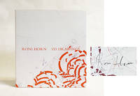
2013rif. 025242Hauser & Wirth and Xavier Hufkens Galleries in association with JRP/Ringier 2013. Book. Fine. Hardcover. Signed by the Artist. 1st Edition. 324 pages with 153 illustrations in color. SIGNED Signed on the illustrated endpaper in graphite by the artist. There are no other internal markings the binding is tight and solid the edges and corners of the boards are sharp and jacket is bright and unblemished. Edited by Michaela Unterdörfer. List of Illustrated Works. Hauser & Wirth and Xavier Hufkens Galleries, in association with JRP/Ringier Hardcover
rif. 16-5006Paris: Galerie Raymond Cordier 1962. 70x45 cm. Folded since 1962. One small hole along a fold. . Rare affiche des expositions et manifestations organisées par Raymond Cordier et Jean-Jacques Lebel du 27 novembre au 12 décembre 1962 " pour conjurer l'esprit de catastrophe. "Vous êtes cordialement inviteÌ à assister ou à participer au Happening auquel prendront part entre autres J. Gab.Printed by Bernard Neyrolles. Paris: Galerie Raymond Cordier, 1962 unknown
rif. SONG0917218868Used: Good unknown
2011rif. x-9401080356Springer 2011. Paperback. New. 644 pages. 9.25x6.10x1.46 inches. Springer paperback
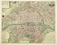
rif. 4582Paris: 1729. No binding. Very Good. 450 x 570 mm. with fine recent wash colour with folds as issued in fine condition. This plan of the modern Paris is from Nicholas Delamare's 'Traite de la Police'. It is a multi-volume work which began in 1707. It was a comprehensive study of the history of regulation and policing in the city of Paris. Accompanying the book were eight plans of Paris from its foundation to the time of publication. This the eighth is the most modern of them and represents the city at the time of publication. 1729 unknown
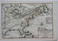
1701rif. 23030Paris: Nicolas De Fer 1701. First Edition. Very Good. Ginville Vincent de. Ginville Vincent de. First Edition. Paper size 42.5 cm x 28.5 cm. Plate mark 34 x 22.5 cm. Marginal paper clip stain inked '109' upper right corner some marginal chipping to the paper and old penciled price lower right. A few unobtrusive spots inside the plate marks. Copperplate engraving by Vincent de Ginville with later awfully bright hand color. This map would frame up nicely. There appears to be several versions of this map. The David Rumsey Collection has an example dated on the cartouch 1705 which he notes as being from Nicolas De Fer's Atlas Curieux published later. The Library of Congress has an example of the map offered here with the 1701 date and a separate page with explanations of the map. We don't know where this 1701 example came from separately issued or another atlas. The map highlights locations of Indian villages found by La Salle during his explorations of the coastal areas of the United States. We see the Gulf of Mexico Cap de la Floride and many inland village names. A nice map showing some early history of the southern United States. It includes parts of modern-day Louisiana Mississippi Alabama and Florida as well as the Bahamas and Cuba. Nicolas De Fer unknown
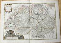
1764rif. M10199Paris c. 1764. Very Good. Notes: An important and decorative map of Switzerland published in mid 18th century. The map originally was drawn by De Fer and later updated and improved by Desnos. Size : 485x670 mm 19.09x26.38 Inches Coloring: Hand Colored Category: Maps Europe Switzerland; unknown
rif. DADAX1569315353New unknown
rif. Z1-C-078-00398Iron & Steel Inst. Used - Good. Ships from UK in 48 hours or less usually same day. Your purchase helps support Sri Lankan Children's Charity 'The Rainbow Centre'. Ex-library so some stamps and wear but in good overall condition. 100% money back guarantee. We are a world class secondhand bookstore based in Hertfordshire United Kingdom and specialize in high quality textbooks across an enormous variety of subjects. We aim to provide a vast range of textbooks rare and collectible books at a great price. Our donations to The Rainbow Centre have helped provide an education and a safe haven to hundreds of children who live in appalling conditions. We provide a 100% money back guarantee and are dedicated to providing our customers with the highest standards of service in the bookselling industry. Iron & Steel Inst unknown
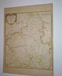
rif. 16-3950Paris: chez l'Auteur dans l'Isle du Palais sur le Quay de l'Orloge a la Sphere Royal avec privilege du Roy 1710. Original handcolored engraved map. 74 x 54 cm. sheet size. On old laid paper with windmill in a necklace watermark.From; Atlas ou Recueil de Cartes Geographiques Dressees Sur les Nouvelles Observations de Mrs. de L'Academie Royale des Sciences Par N. de Fer Geographe de sa Majeste Catolique et de Monseigneur le Dauphin. A Paris chez l'Auteur dans l'Isle du Palais sur le Quay de l'Orloge a la Sphere Royal avec privilege du Roy 1709.Pastoureau describes this large atlas as De Fer's folio atlas. It is described by De Fer in his catalog of 1716 as his highly detailed atlas showing all parts of the world with all the maps available separately. Paris: chez l'Auteur dans l'Isle du Palais sur le Quay de l'Orloge a la Sphere Royal, avec privilege du Roy, 1710 unknown
1706rif. M6655Paris c. 1706. Very Good;. Notes: Cartouche in upper right corner depicts the shield of the Royal coat of arms of the United Kingdom three hunting dogs and a cockfight. The cartouche in the upper left defines the geographical coordinates of London Edinburgh Dublin and Dunkirk. Size : 460x486 mm 18.11x19.13 Inches Coloring: Original Outline Coloring Category: Maps Europe United Kingdom; Maps Europe Ireland; unknown
2008rif. __0415440661Taylor & Francis 2008. Hardcover. New. 1958 pages. 9.75x7.50x4.50 inches. Taylor & Francis hardcover
2002rif. SKU1757369Assn of Iron & Steel Engineers 2002-01-01. hardcover. New. 11x8x1. New Book Ships with Tracking Assn of Iron & Steel Engineers hardcover
2013rif. 2081502111904015Peking University Medical Press 2013. Soft Cover. Fine. The book is in fine condition. Peking University Medical Press paperback
rif. 2091502135300807Not Available N.A. Soft Cover. Fine. Number of books: 1 Not Available paperback
1705rif. M4344Paris 1705. Excellent. Notes: This decorative map focuses on the French possessions in North America. The treatment of French Florida is intriguing. The map shows the United States of America and parts of Southern Canada East of the Mississippi river. "Territorial expansion of New France had reached the Mississipi River with the establishment of the first European settlement at Fort Maurepas by Pierre Le Moyne d'Iberville in 1699 sixteen years after La Salle had reached the mouth of the river. This attractive map from 'L'Atlas Curieux ou le Monde' paris 1705 although containing geographical errors has many interesting historical notes" -The Macdonald Stewart Foundation Size : 232x342 mm 9.125x13.5 Inches Coloring: Hand Colored in Outline Reference: The Macdonald Stewart Foundation "La Decouverte du Monde Cartographes et Cosmographes" Map # 44; McCorkle 702.2 Category: ; Maps North America Great Lakes; Maps Canada; Maps Canada East; Maps United States East; Maps United States South unknown
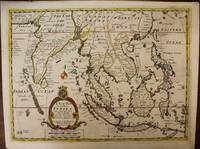
1700rif. M6975London c. 1700. Very Good. Notes: A late 17th Century map of South East Asia by Edward Wells based upon the previous work by De Fer. The cartouche has the dedication in the coat of arms to the Duke of Gloucester. Size : 367x487 mm 14.45x19.17 Inches Coloring: Original Outline Coloring Category: Maps Asia South East; Maps Asia Central India & Sri Lanka / Ceylon; unknown
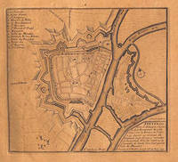
rif. 51-3483Paris: Nicolas de Fer circa 1693. 4to. 23 x 29cm. 18th Century rose cardboard covers. 33 engraved views and plans and 2 hand-drawn plans of Versoi and the col of Grand-Saint-Bernard showing Saint-Rhémy et San Leonardo. Old manuscript table of contents. Most of the plates are 17th Century but 2 are 18th Century. Small losses and browning to most plates.Nicholas de Fer 1646 – 1720 was the son of cartographer Antoine de Fer. Nicholas was established as an engraver cartographer and map publisher in Paris with over 600 maps and atlases to his credit. His work earned a large following because of its considerable decorative appeal. In the late 17th century de Fer’s career culminated in his appointment as Geographer to the King of France. Upon his death in 1720 Nicolas was succeeded by two of his sons-in-law Guillaume Danet and Jacques-François Danet and their heirs who continued the de Fer publishing firm until c. 1760. Recueil de 35 cartes plans et vues de villes fortifiées gravées sur cuivre 33 et manuscrites 2. S.l.n.d. Paris 1693 e.a. In-4 oblong cartonnage rose pièce de titre manuscrite Reliure vers 1800.Le présent ensemble contient :– 27 cartes et plans de villes fortifiées extraites pour la plupart de l'atlas de Nicolas de Fer 1693 montrant Turin Endingen Mont Royal Mayence Ath Pignerol Mont-Melian Landau Casal Verceil Genève Maestricht Huningue Nice Charle-Roy Bonn Calais Coblentz Stetin Juliers Wismar Mons Verüe Berg S. Winox Kamieniec Podolski Donquerque Coni ;– 4 vues gravées de Montmélian Miolans Verue Verrua Savoia et du siège de Genève ;– 2 planches manuscrites : un plan de Versoi et une carte du col du Grand-Saint-Bernard montrant Saint-Rhémy et San Leonardo ;– 2 petites planches gravées postérieures.Exemplaire défraîchi : cartes jaunies présentant parfois des restaurations ; petits manques marginaux à quelques cartes quelques rousseurs et taches d'encre. Paris: Nicolas de Fer, circa 1693. unknown
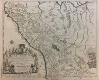
1719rif. 291534Paris 1719. Map. Engraving with original hand outline color. Image measures 19 x 23". Sheet measures 20 x 28". Unusual map of Peru from the early 18th century. Includes part of Ecuador Bolivia and Brazil based on Jesuit activity in the area. Amazon rain forest is visualized with a dynamic design. Cartouche describes the mining industry. Nicolas de Fer 1646-1720 was a prolific cartographer engraver and publisher who took over the family map business from his mother when she retired in 1687. The business flourished and he gained a great reputation in his lifetime and was appointed 'Geographer to the King' in 1690. This map demonstrates his skill and provides a curious yet alluring mixture of history and geography. unknown
1760rif. M5799Paris: Desnos 1760. Very Good. Notes: French map of Poland Lithuania and the surrounding region. 1760 edition of rare Nicolas De Fer's map. Size : 480x590 mm 18.875x23.25 Inches Coloring: Hand Colored in Outline Category: Maps Europe Poland Lithuania Desnos unknown
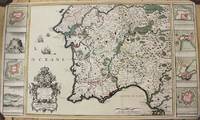
1704rif. M10805Paris: St. Gaspar Baillieu 1704. Very Good backed on acid free tissue paper for long term preservation. Notes: Fine large scale map focused on Southern Portugal and Southern Spain. The map is surrounded by inset maps of Olivenca Castello Ferreire Aronches Badaioz Lisbonne Setubal Chateau St. Iulien Evora. Size : 561x940 mm 22.09x37.01 Inches Coloring: Original Hand Coloring Category: Maps Europe Spain; Maps Europe Portugal; St. Gaspar Baillieu unknown
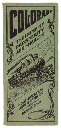
1909rif. 48065N. P. Denver: Privately printed for The Northwestern Land & Iron Company n. d. ca 1909. 1909. COLORADO. First edition. 8vo. 9" x 8" pictorial sheet folds to 9" x 4" 16 pp. illustrated from photographs map town plat. A scarce and attractively illustrated promotional booklet advertising Milliken Colorado a newly developing railroad town in the agricultural country north of Denver. Issued by the Northwestern Land & Iron Company the 16-page pamphlet promotes Milliken as an ideal location for settlement investment farming and business emphasizing the region's fertile soil irrigation sugar-beet and truck-garden production healthful climate transportation facilities and proximity to the Rocky Mountains. Illustrated with photographs of Milliken and its surrounding agricultural country together with a town plat the booklet provides a remarkable visual record of the community at the moment of its creation. Milliken's development was closely tied to the ambitious Denver Laramie & Northwestern Railway which began service to the town in January 1910 and promoted a series of new communities and agricultural settlements along its projected route. The DL&NW was an ambitious but ultimately unsuccessful railroad venture and its associated land companies promoted new town sites and farming lands along the line in hopes of creating prosperous agricultural communities. The railroad entered receivership in 1912 and ceased operations in 1917. There is a space for postage and an address on the rear wrapper as well as an attached perforated sheet for inquiries about the advertised land. First two pages have a tiny clip to the top corners tiny tear to the fore-edge margin of page 5 else a very good copy of an attractive Colorado land promotional booklet. Privately printed for The Northwestern Land & Iron Company, n. d. (ca 1909). unknown
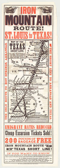
rif. 5718St. Louis: St. Louis Globe-Democrat Job Print; Woodward Tiernan & Hale Map Engr's 1878. Broadsheet with map 20.75" x 6.5" plus margins printed in black and red. Map size 11" x 5". Faded purple stamp of agent Henry H. Hannan. CONDITION: Very good upper-half of right margin rough cut. A scarce and attractive promotional broadsheet with map issued by the St. Louis Iron Mountain & Southern Railway advertising special railway offers to emigrants headed to Texas. This broadsheet announces cheap excursion tickets free baggage up to 200 lbs. and reduced emigrant rates for departures from St. Louis on the Short Line Route which runs through Arkansas into Texas. A table of rates on the verso lists first class and emigrant rates. The Texas Short Line extends from St. Louis Missouri to Galveston and Austin and cuts diagonally across the map with various spurs along the way including intersections the Texas & Pacific R'y and the International & Great Northern R'y. Interested parties seeking assistance information on Texas maps time-tables rates of fare etc. are encouraged to call upon or address the nearest of the railroad's Agents located in Missouri Chicago New York City and Ohio whose names are provided on both recto and verso. The St. Louis Iron Mountain & Southern Railway began selling off land holdings in Arkansas in the mid-1870s and continued to do so into the early twentieth century. OCLC records some twenty maps published by the railroad company promoting land it owned in Arkansas issued during this time period. These lands extended from the northernmost point of the state around Little Rock to the line's southern terminus in Texarkana. The company offered various inducements for settlers deep discounts for putting money down as well as reduced freight should homesteaders wish to transport their belongings via the railway. As demonstrated by the present broadsheet the railroad also capitalized on emigration to Texas. OCLC records only three copies at Yale Princeton and University of Texas at Arlington. St. Louis: St. Louis Globe-Democrat Job Print; Woodward, Tiernan & Hale, Map Engr's, 1878 unknown