2.487 resultados
1936ref. 317043Madrid: Organo Del Batallon De Hierro. Brigada Motorizada De Ametralladoras 1936. First Edition. Softcover. Near fine set in the original stiff-card wrappers; edges very slightly dust-dulled and toned. Issue 15 defective. Remains particularly and surprisingly well-preserved; tight bright clean and especially sharp-cornered. Physical description; two issues. Contents; Número 9 & 15. Notes; Número 15 defective with second and third page having bits cut out. Subjects; Spanish Civil War. 20th century periodicals. Madrid: Organo Del Batallon De Hierro. Brigada Motorizada De Ametralladoras paperback
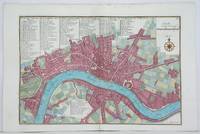
1700ref. 8374Paris 1700. Copper engraving 22.5 x 33.5 cms engraved by C. Inselin black and white slight soiling bottom right blank verso; the key lists 113 places of interest. This is the first version of the map before the date was amended. Howgego Printed Maps of London 44 1 unknown
ref. RGW22847With 4 Share certificates for the Llynvi Coal & Iron Company Ltd dated 1871 to Mary Cavan creased on one corner 1885 correspondence and endorsements about the debentures. The principal sums were repaid in 1885. In 1884 it would appear the debentures were worth £41860. The works were started in 1798. This particular company was formed in 1872. It would appear Mary Cavan held nearly one third of the shares in The Llynvi Coal and Iron Company in 1871. Her husband Colonel Cavan had died in 1870. The Cavan family had a long history of investing in the South Wales iron industry. James Cavan had invested in the Llynvi Iron Works in 1845 and before that in the Cambrian Iron and Spelter Company.In 1886 the companyÕs ironworks at Maesteg ceased to work. Possibly the paying back of the debentures was a contributing factor to the closure. unknown
ref. DADAX0972514619New unknown
1932ref. 2080502106911436Not Available 1932. Soft Cover. Fine. The book is in fine condition. Not Available paperback
ref. SONG1849701814Used: Good unknown
ref. mon0000685296Blurb 6/4/2019 12:00:00 AM. hardcover. Very Good. 1.3386 in x 8.1890 in x 5.2362 in. Crease on cover Blurb hardcover
1916ref. 2210162Roanoke VA: Virginia Bridge & Iron Co. 1916. 1st Edition . Flexible leather. Good. 12mo - over 6¾ - 7¾" tall. See photos for condition details. Original flexible leather handbook produced by theVirginia Bridge & Iron Company. Brown leather exterior with gilt to front and spine. Exterior shows edge and corner chips/wear and chipping is also present at top and bottom of spine. Interior binding is good no hinge issues nothing torn or loose. Previous owners name is written on front pastedown and it was also found two more times on interior pages where it was written along the top edge. The blank pages in the back along with the graph paper pages are all handwriting free. Only handwriting found in book were the three signatures in the number 238 written along the page edge of the copyright page. This is the first edition which shows no copyright or print date other than the serial designation of 9-16 September 1916. This is an extremely rare publication with only a few third editions surviving this one being the first. Virginia Bridge & Iron Co. hardcover
1705ref. M4627Paris 1705. Very Good. Size : 230x340 mm 9x13.375 Inches Coloring: Hand Colored Category: Maps City Maps; Maps Europe United Kingdom England London unknown
1705ref. M4703Paris 1705. Excellent. Size : 250x355 mm 9.875x14 Inches Coloring: Black & White Category: ; Maps Europe Germany unknown
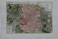
1742ref. M4678Paris 1742. Very Good. Size : 575x430 mm 22.625x16.875 Inches Coloring: Original Outline Coloring Category: ; Maps Europe Spain; Maps Europe Portugal unknown
1705ref. M5230Paris 1705. Excellent. Size : 225x335 mm 8.875x13.125 Inches Coloring: Hand Colored Category: Maps City Maps; Maps Europe Portugal unknown
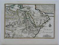
1703ref. M5175Paris 1703. Excellent. Size : 225x325 mm 8.875x12.75 Inches Coloring: Original Outline Coloring Category: Maps Africa North Egypt; Maps Asia Middle East Arabia unknown
1705ref. M6202Paris 1705. Excellent. Notes: An attractive map of the city of Narva besieged by a military encampment. The Battle of Narva was an early battle in the Great Northern War fought in November of 1700. The Swedish army under Charles XII of Sweden defeated a Russian force four times its size commanded by Peter the Great. Narva marked the peak of Swedish power on the continent with Russia eventually gaining decisive victories that were able to end the conflict. Size : 230x325 mm 9x12.75 Inches Coloring: Hand Colored Category: ; Maps Europe Estonia Latvia; Maps City Maps; Maps Military unknown
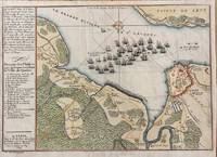
1694ref. M7337Paris: N. de Fer c.1694. Very Good; . Notes: According to Kershaw this map was originally published in "Les Forces De L'Europe" "In August 1690 Sir William Phips left Boston to attack and capture Quebec. Previous military success at Port Royal had given the English an excess of confidence which Phips fully exploited in planning his expedition against Quebec but which quickly evaporated when the under-equipped force discovered the extent of the defenses at Quebec. The operation was disastrous and the English struggled back to Boston losing a number of ships on the way. The battle lines of the English fleet and the details of the French defences were recorded by Villenuve in manuscript form which were subsequently the source of a sequence of printed maps." Kershaw Size : 209x303 mm 8.23x11.93 Inches Coloring: Hand Colored Reference: Kershaw 279 Category: Maps Canada East Quebec Quebec City; Maps City Maps; N. de Fer unknown
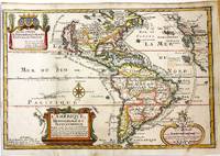
1717ref. M11008Paris: Chez l'autheur dans l'Isle du Palais sur le Quay de l'Orloge a la Sphere Royale 1717. Very Good. Notes: Beautiful example of the map of the Americas by renowned 17th century French cartographer Nicolas De Fer. Size : 225x337 mm 8.86x13.27 Inches Coloring: Hand Colored Category: Maps North America; Maps South America Countries; Chez l'autheur dans l'Isle du Palais sur le Quay de l'Orloge a la Sphere Royale unknown
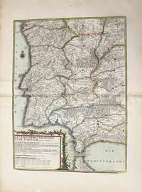
1790ref. M10223Paris: Chez Desnos 1790. Very Good. Notes: Detailed map of Portugal and western Spain showing Gibraltar region. Size : 580x432 mm 22.83x17.01 Inches Coloring: Original Hand Coloring Category: Maps Europe Portugal; Maps Europe Spain; Chez Desnos unknown
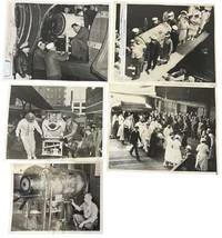
1937ref. 234531937. Iron lung transport press archive documenting the movement of respirator-dependent polio patients through rail terminals ships ramps aircraft hospitals and Coast Guard facilities during the years before the Salk vaccine changed American polio care in 1955. The iron lung developed in 1928 by Philip Drinker and Louis Agassiz Shaw kept patients breathing when polio paralyzed the muscles needed for respiration. Fred B. Snite Jr. appears in several views as the nationally followed Chicago patient who contracted polio in China in 1936 and returned to the United States after a highly publicized 9300-mile medical journey. The group is strongest as a record of medical transport itself: nurses in masks uniformed officers attendants ramps crowds and captioned press slips show how survival could depend on coordinated movement as much as bedside treatment. Photo archive of 5 large silver gelatin press photographs approx 8 x 10 inches Chicago Seattle Port Angeles and related transport locations 1937-1951. Snite's respirator is loaded at a Chicago railroad terminal with his head visible through the front window while men adjust the wheeled carriage; another scene places the iron lung at a ship or dockside ramp surrounded by masked nurses uniformed officers and hospital attendants. A Chicago caption dated February 8 1939 reads "Iron Lung Kid and Bride Entrain for South" identifying Snite and his bride leaving for Miami Florida after their winter vacation. Another verso caption dated June 22 1937 describes his return to Chicago after transport from China where he had been stricken. A January 14 1951 Coast Guard caption identifies an iron lung flown from Seattle to Port Angeles to aid Eldon Tetum a 36-year-old logger stricken with polio. Polio epidemics made the iron lung one of the most visible medical machines of the mid-twentieth century especially before vaccination reduced annual cases after 1955. These scenes connect celebrity medical news to emergency public health logistics showing how mechanical respiration required attendants vehicles terminals aircraft and institutional coordination outside the hospital room. Press stamps pasted captions adhesive staining and surface marks visible on versos; images remain strong and readable. Overall in good condition. unknown
ref. DADAX0849366771New unknown
ref. SONG0152389873Used: Good unknown
ref. SONG0849386764Used: Good unknown
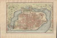
1715ref. 019811Paris. Very Good. 1715. Map. Lovely engraved map depicting Mexico City in the early 18th century. Map is on a 10 ¾" x 15 ¾" sheet that was taken from Nicolas de Fer's "L'Atlas Curieux" of 1715; no content on verso. Date of map was printed in upper margin along with the sheet number "125" and title; content in French. Hand-coloring is still bright. Map has very light toning to edges but is otherwise clean. This detailed map depicts Mexico City when it was surrounded by water and was linked to the mainland by the famous causeways originally designed by the Aztecs. Also pictured are aqueducts and farms and about 50 locations have been numbered on the map but the key is not present likely printed on another page in the Atlas. A beautiful map. . unknown
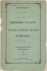
1856ref. 27974Nueva-York: Imprenta de Hallet 1856. Coal Mining in Mexico A Spanish-language prospectus for an American mining and land company on the Pacific coast of Mexico. Original printed wrappers. Rear wrapper detached spine mostly perished library blindstamp on front wrapper and withdrawal stamp on wrapper interior. Foxed. Good overall. SABIN 48572 note. unknown
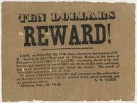
1843ref. BK0115Jackson Michigan 1843. Broadside 7 ¾ x 10 ½ inches. Single sheet printed in black. Old folds with short separations and small losses at several fold intersections and along the edges with general handling wear good overall. An early Jackson Michigan broadside issued by S. T. Carr offering ten dollars for the return of a wallet lost two days earlier on the road between the tavern of W. H. Monroe in Jackson and the Parma House. Carr describes the missing property in some detail: "A CALF-SKIN WALLET containing about sixty dollars in cash mostly in small bills one thirty dollar note and some papers of no value to any one except the owner. The inside of the wallet was marked S. T. Carr." Carr directed that the wallet be returned to him at Monroe's Exchange promising the reward "and no questions asked." Carr and W. H. Munroe appear together again two years later in the early history of Michigan's iron industry. In July 1845 they were among the Jackson men who organized an association to explore the mineral country south of Lake Superior. That fall Carr Munroe Philo M. Everett and E. S. Rockwell traveled north as an exploring party. Michigan mining histories record that Carr and Rockwell working with an Indigenous guide located the iron outcrop that became the Jackson mine; Carr continued the final search for the outcrop alone. The Jackson association subsequently became the Jackson Mining Company one of the earliest enterprises to develop the Marquette Iron Range.1 1 T. B. Brooks "Geological Survey of Michigan. Upper Peninsula 1869-1873 Accompanied by an Atlas of Maps" Legislature of Michigan and Julius Bien 1873 8. . unknown
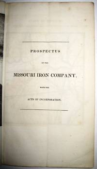
1837ref. 30091St. Louis 1837. 36pp folding plate frontis full-page map. Institutional rubberstamps at base of title page verso. Original printed wrappers light rubberstamp discard stamp on front wrapper. Otherwise Very Good. "Missouri Imprints Inventory No. 197 cites only one copy. This tract is probably the first description of Iron mines west of the Mississippi. The Iron Mountains were located in St. Francis and Madison Counties. A proposal is made to make iron rails for a railroad from the mountains to the Mississippi" Decker. AII MO 197 1. 37 Decker 214. Not in Eberstadt Soliday Graff. OCLC indicates a number of institutional copies. unknown