1,145 results
2001ref. 1335404PN. New. 2001. Soft Cover. Date is original print. This is a reprint edition . PN paperback
1961ref. R240086041PAYOT. 1961. In-8. Broché. Etat d'usage, Couv. légèrement passée, Dos satisfaisant, Intérieur acceptable. 326 pages - ouvrage recouvert d'un plastique transparent - avec 27 figures et 16 photographies en noir et blanc - pages non coupées .. . . . Classification Dewey : 551.46-Océanographie
1961ref. 34147Paris Payot 1961 In-8 cachet de Joseph Gibert quatrième de couverture déchirée sans manque, intérieur frais, bon papier, VIII planches ( 16 photographies ) hors texte et 27 figures
1961ref. ce968Payot Bibliothèque Scientifique Broché 1961 In-8, (22.5x14 cm), broché, couverture illustrée, 326 pages, cartes et schémas en noir et blanc, 16 photographies, préface de M. Fontaine ; pliures sur le dos, plats jaunis, assez bon état. Livraison a domicile (La Poste) ou en Mondial Relay sur simple demande.
1961ref. lr349Payot Bibliothèque scientifique Broché 1961 In-8 (13,6 x 21,7 cm), broché, 326 pages, figures et quelques photos en noir et blanc ; pliures au dos, volume bruni, ex-libris manuscrit au premier plat, quelques traces au quatrième plat, par ailleurs assez bon état. Livraison a domicile (La Poste) ou en Mondial Relay sur simple demande.
1994ref. RO80132881NATHAN. 1994. In-4. Cartonné. Bon état, Couv. convenable, Dos satisfaisant, Intérieur frais. 182 pages. Nombreuses illustrations et photos en couleurs et quelques-unes en noir et blanc, en hors-texte et dans le texte.. . . . Classification Dewey : 551.46-Océanographie
2020ref. RO40050564Editions Gap. Janvier 2020. In-8. Broché. Bon état, Couv. convenable, Dos satisfaisant, Intérieur frais. 336 pages augmentées de quelques illustrations en couleurs dans texte. Couverture contrepliée.. . . A l'italienne. Classification Dewey : 551.46-Océanographie
Novara, Istituto Geografico De Agostini, (1972), in-4, mezza pelle edit., titolo in oro, pp. 128. Con illustrazioni a colori.
Lettura per scuole medie. Un racconto avvincente delle spedizioni compiute da Cousteau.
1990ref. R320170121Hervas. 1990. In-4. Relié. Bon état, Couv. convenable, Dos satisfaisant, Intérieur frais. 185 pages - signet conservé - contre plats jaspés - nombreuses illustrations; cartes en couleurs dans et hors texte - un poster en couleur.. . . . Classification Dewey : 551.46-Océanographie
ref. 107.520Steenbrugge, A.-J. Witteryck, 1913. 17 x 29, 141 pp., nombreuses figures, reliure d'édition pleine percaline polychrôme sur fond bleu (cartonnage), bon état (couverture légèrement défraîchie).
ref. R150080136FRANCE-EMPIRE.. 1974.. In-8. Broché. Bon état, Couv. convenable, Dos satisfaisant, Intérieur frais. 222 pages. 1ère de couverture illustrée en couleurs. Couverture rempliée. Nombreuses photographies et cartes en noir et blanc, hors texte.. . . . Classification Dewey : 551.46-Océanographie
FRANCE-EMPIRE.. 1974.. In-8 Carré. Broché. Bon état. Couv. convenable. Dos satisfaisant. Intérieur frais. 222 pages. 1ère de couverture illustrée en couleurs. Couverture rempliée. Nombreuses photographies et cartes en noir et blanc, hors texte. Collection océans.
28 pages. Black and white illustrations. Unmarked. Moderate wear. Solid copy. Book
225p., illus. Hardcover Very good condition good
95p., illus. Weekly Reader Children's Book Club edition Hardcover Very good condition, paper aging chipped d.j. fair
204pp. (part col.), map, ports. 26 cm. Hardcover Very good condition good
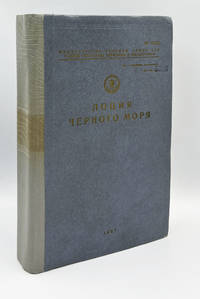
1987ref. 009700Leningrad: Main Directorate of Navigation and Oceanography Ministry of Defence of the USSR 1987 4to 26 cm 584 pp. Publisher's cloth with gilt lettering and Soviet naval anchor-and-star emblem to upper cover number stamped on the front board rebacked binding somewhat skewed with extensive manuscript corrections and annotations in red ink throughout including a densely completed "Лист для учёта корректуры" Correction Record Sheet correction slips inserted for crossed out parts. Publication No. 1244 copy No. 5536 stamped "Для служебного пользования" For Official Use Only. Comprising a general survey navigational-geographical and hydrometeorological overviews and nine chapters of detailed coastal navigation covering the entire Black Sea littoral from the Kiliya mouth of the Danube through the Crimea Caucasian coast Turkish coast and Bulgarian and Romanian shores to the Bosphorus; with a reference section distance tables and alphabetical index; illustrated throughout with coastal profile engravings and navigational diagrams; tracking amendments applied through 1991 the final entries postdating the dissolution of the USSR. A later and substantially expanded edition than the 1968 issue this copy is of exceptional documentary interest as a working navigational instrument actively corrected and used through the final years of the Soviet Black Sea Fleet with the correction record providing a remarkable archival trace of operational naval use up to and beyond the collapse of the Soviet state. Main Directorate of Navigation and Oceanography, Ministry of Defence of the USSR hardcover
Roma, 1957 dicembre 22, copertina illustrata a colori in fascicolo originale completo di pp. 32 de "La Tribuna illustrata" .