|
Mitchell Samuel Augustus Jr
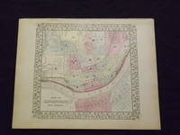
Map of Cincinnati.
<p>Unbound colored engraved map decorative boarder 14" x 11". Slight browning and aging; otherwise bright and clean and in very good shape. Maps are wrapped with acid free board or in rigid sleeves. The Mitchell family started to produce atlases in 1846 and continued into the early 1890s. Around 1860 S. Augustus Mitchell Jr. took over and the atlas would be called Mitchell's New General Atlas. This is an attractive and rather early single page map of Cincinnati from the 1869 installment of this atlas. The map has nice color and good street detail. Part of Covington and Newport are also visible on the other side of the Ohio River. May require extra postage. Ristow 311-313.</p> books
Referentie van de boekhandelaar : 103224
|
|
|
Mitchell Samuel Augustus Jr
Map of Europe
<p>Philadelphia 1861. Unbound colored engraved map decorative border 14"x 11". Slight toning and aging; overall bright and clear and in very good shape. Maps are wrapped with acid free board or in rigid sleeves. The Mitchell family started to produce atlases in 1846 and continued into the early 1890s. Around 1860 S. Augustus Mitchell Jr. took over and the atlas would be called Mitchell's New General Atlas. This is a nice map of Europe from the 1861 installment of that atlas. Despite the large area the map covers there is still a decent amount of detail. Ristow 311-313</p> books
Referentie van de boekhandelaar : 101203
|
|
|
Mitchell Samuel Augustus Jr
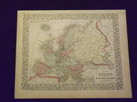
Map of Europe.
<p>Unbound colored engraved map decorative border 14"x 11". Slight toning and aging; overall bright and clear and in very good shape. Maps are wrapped with acid free board or in rigid sleeves. The Mitchell family started to produce atlases in 1846 and continued into the early 1890s. Around 1860 S. Augustus Mitchell Jr. took over and the atlas would be called Mitchell's New General Atlas. This is a nice map of Europe from the 1869 installment of that atlas. Despite the large area the map covers there is still a decent amount of detail. Extra postage may be required. Ristow 311-313. # 103234</p> books
Referentie van de boekhandelaar : 103234
|
|
|
Mitchell Samuel Augustus Jr
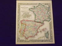
Map of France Spain and Portugal.
<p>Unbound colored engraved map decorative border 14" x 11". Slight toning and aging; overall bright and clean and in very good condition. Maps are wrapped with acid free board or in rigid sleeves. The Mitchell family started to produce atlases in 1846 and continued into the early 1890s. Around 1860 S. Augustus Mitchell Jr. took over and the atlas would be called Mitchell's New General Atlas. This is a very colorful map of France Spain and Portugal from the 1864 installment of that atlas. An inset illustrates Switzerland and the Island of Corsica. Extra postage may be required. Ristow 311-313.</p> books
Referentie van de boekhandelaar : 103237
|
|
|
Mitchell Samuel Augustus Jr
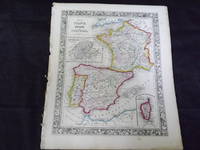
Map of France Spain and Portugal.
<p>Map of France Spain and Portugal. Philadelphia: 1861. Unbound colored engraved map decorative border 14" x 11". Slight browning and aging some chips and nicks at the left edge; overall bright and clean and in very good condition. Maps are wrapped with acid free board or in rigid sleeves. The Mitchell family started to produce atlases in 1846 and continued into the early 1890s. Around 1860 S. Augustus Mitchell Jr. took over and the atlas would be called Mitchell's New General Atlas. This is a very colorful map of France Spain and Portugal from the 1864 installment of that atlas. An inset illustrates Switzerland and the Island of Corsica. Extra postage may be required. Ristow 311-313.</p> books
Referentie van de boekhandelaar : 103243
|
|
|
Mitchell Samuel Augustus Jr
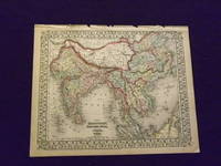
Map of Hindoostan Farther India China and Tibet.
<p>Unbound colored engraved map decorative border 14"x 11". Slight toning and aging a little browning at edges some finger soiling in margins some chips and tears along top edge; otherwise bright and clean. Maps are wrapped with acid free board or in rigid sleeves. The Mitchell family started to produce atlases in 1846 and continued into the early 1890s. Around 1860 S. Augustus Mitchell Jr. took over and the atlas would be called Mitchell's New General Atlas. This is a nice colorful map of India and parts of the far east from the 1870 installment of that atlas. The coloring is more dramatic than other editions of this map. While this is not a large map there is still a considerable amount of detail. Extra postage may be required. Ristow 311-313. # 103247</p> books
Referentie van de boekhandelaar : 103247
|
|
|
Mitchell Samuel Augustus Jr
Map of Hindostan Farther India China and Tibet
<p>Philadelphia 1861. Unbound colored engraved map decorative border 14"x 11". Slight toning and aging a little browning at edges; overall bright and clear and in very good shape. Maps are wrapped with acid free board or in rigid sleeves. The Mitchell family started to produce atlases in 1846 and continued into the early 1890s. Around 1860 S. Augustus Mitchell Jr. took over and the atlas would be called Mitchell's New General Atlas. This is a nice colorful map of India and parts of the far east from the 1861 installment of that atlas. While this is not a large map there is still a considerable amount of detail. Ristow 311-313</p> books
Referentie van de boekhandelaar : 101027
|
|
|
Mitchell Samuel Augustus Jr
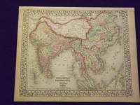
Map of Hindostan Farther India China and Tibet.
<p>Unbound colored engraved map decorative border 14" x 11". Slight browning and aging; otherwise bright and clean. Maps are wrapped with acid free board or in rigid sleeves. The Mitchell family started to produce atlases in 1846 and continued into the early 1890s. Around 1860 S. Augustus Mitchell Jr. took over and the atlas would be called Mitchell's New General Atlas. This is a nice colorful map of India and parts of the Far East from the 1869 installment of that atlas. While this is not a large map there is still a considerable amount of detail. Extra postage may be required. Ristow 311-313.</p> books
Referentie van de boekhandelaar : 103250
|
|
|
Mitchell Samuel Augustus Jr
Map of Kansas Nebraska Colorado and Part of Dacotah
<p>Philadelphia 1969. Unbound colored engraved map decorative border 14"x 11". Slight toning and aging; overall bright and clear and in very good shape. Maps are wrapped with acid free board or in rigid sleeves. The Mitchell family started to produce atlases in 1846 and continued into the early 1890s. Around 1860 S. Augustus Mitchell Jr. took over and the atlas would be called Mitchell's New General Atlas. This is a very colorful and attractive map of Kansas and a couple of western states from the 1869 installment of that atlas. While the map shows mostly Kansas Nebraska and Colorado it also presents a portion of Dakota and Wyoming. Ristow 311-313</p> books
Referentie van de boekhandelaar : 101135
|
|
|
Mitchell Samuel Augustus Jr
Map of Louisiana Mississippi and Arkansas
Philadelphia 1861. Unbound colored engraved map decorative boarder 14"x 11". Slight toning and aging a few small holes in the outer margin; bright and clear and in otherwise very good shape. Maps are wrapped with acid free board or in rigid sleeves. The Mitchell family started to produce atlases in 1846 and continued into the early 1890s. Around 1860 S. Augustus Mitchell Jr. took over and the atlas would be called Mitchell's New General Atlas. This is an attractive colorful map of Louisiana Mississippi and Arkansas from the 1861 installment of that atlas. Good detail and a fairly early map from this series. Ristow 311-313 unknown books
Referentie van de boekhandelaar : 101038
|
|
|
Mitchell Samuel Augustus Jr
Map of Louisiana Mississippi and Arkansas
Philadelphia 1864. Unbound colored engraved map decorative boarder 14"x 11". Slight toning and aging a few small holes in the outer margin; bright and clear and in otherwise very good shape. Maps are wrapped with acid free board or in rigid sleeves. The Mitchell family started to produce atlases in 1846 and continued into the early 1890s. Around 1860 S. Augustus Mitchell Jr. took over and the atlas would be called Mitchell's New General Atlas. This is an attractive colorful map of Louisiana Mississippi and Arkansas from the 1861 installment of that atlas. Good detail and a fairly early map from this series. Ristow 311-313 unknown books
Referentie van de boekhandelaar : 101039
|
|
|
Mitchell Samuel Augustus Jr
Map of Mexico Central America and the West Indies
Philadelphia: Bradley 1882. Unbound colored engraved map 22 1/2"x 14 1/2". Some toning and aging a little darkening at fold; otherwise very good. Maps are wrapped with acid free board or in rigid sleeves. The Mitchell family started to produce atlases in 1846 and continued into the early 1890s. Around 1860 S. Augustus Mitchell Jr. took over and the atlas would be called Mitchell's New General Atlas. This is an attractive double page map of Central America from the 1882 installment of that atlas. Bermuda Jamaica a map of the Panama Railroad and a map of the proposed Panama Canal route are highlighted within insets. Ristow 311-313 Phillips 907 Bradley unknown books
Referentie van de boekhandelaar : 101042
|
|
|
Mitchell Samuel Augustus Jr
Map of Mexico Central America and the West Indies
<p>Philadelphia 1865. Unbound colored engraved map decorative boarder 22 1/2"x 14 1/2". Slight toning and aging; overall bright and clean and in very good condition. Maps are wrapped with acid free board or in rigid sleeves. The Mitchell family started to produce atlases in 1846 and continued into the early 1890s. Around 1860 S. Augustus Mitchell Jr. took over and the atlas would be called Mitchell's New General Atlas. This is an attractive double page map of Central America from the 1865 installment of that atlas. Bermuda Jamaica a map of the Panama Railroad and a map of Cuba are highlighted within insets. May require extra postage.Ristow 311-313 Phillips 907</p> books
Referentie van de boekhandelaar : 101130
|
|
|
Mitchell Samuel Augustus Jr
Map of Mexico Central America and the West Indies
Philadelphia 1870. Unbound colored engraved map decorative border double page 22" x 14". Slight toning and aging; overall bright and clear and in very good shape. Maps are wrapped with acid free board or in rigid sleeves. The Mitchell family started to produce atlases in 1846 and continued into the early 1890s. Around 1860 S. Augustus Mitchell Jr. took over and the atlas would be called Mitchell's New General Atlas. This is an attractive double page map of Central America from the 1870 installment of that atlas. Bermuda Jamaica a map of the Panama Railroad and a map of Cuba are highlighted within insets. Ristow 311-313 Phillips 907 unknown books
Referentie van de boekhandelaar : 101214
|
|
|
Mitchell Samuel Augustus Jr
Map of New Granada Venezuela and Guiana/Peru and Equador/Argentine Confederation.
<p>Unbound colored engraved map decorative boarder 14"x 11". Slight toning and aging a few margin chips on margin edge; overall bright and clear and in very good shape. Maps are wrapped with acid free board or in rigid sleeves. The Mitchell family started to produce atlases in 1846 and continued into the early 1890s. Around 1860 S. Augustus Mitchell Jr. took over and the atlas would be called Mitchell's New General Atlas. This is a colorful map of several South American countries including Peru Venezuela and Argentina from the 1861 installment of that atlas. The map is colorful and has a fair amount of detail. Ristow 311-313.</p> books
Referentie van de boekhandelaar : 106100
|
|
|
Mitchell Samuel Augustus Jr
Map of North America
<p>Philadelphia 1870. Unbound colored engraved map decorative boarder 14"x 11". Slight toning and aging minor staining in margins; overall very bright and clear and in very good shape. Maps are wrapped with acid free board or in rigid sleeves. The Mitchell family started to produce atlases in 1846 and continued into the early 1890s. Around 1860 S. Augustus Mitchell Jr. took over and the atlas would be called Mitchell's New General Atlas. This is a colorful map of North America from the 1870 installment of that atlas. The map is bright and crisp and includes Russian America Alaska Greenland and Central America. May require extra postage.Ristow 311-313</p> books
Referentie van de boekhandelaar : 101212
|
|
|
Mitchell Samuel Augustus Jr
Map of North America
<p>Philadelphia 1861. Unbound colored engraved map decorative boarder 14"x 11". Slight toning and aging; overall very bright and clear and in very good shape. Maps are wrapped with acid free board or in rigid sleeves. The Mitchell family started to produce atlases in 1846 and continued into the early 1890s. Around 1860 S. Augustus Mitchell Jr. took over and the atlas would be called Mitchell's New General Atlas. This is a colorful map of North America from the 1861 installment of that atlas. The map is bright and crisp and includes Russian America Alaska Greenland and Central America. May require extra postage.Ristow 311-313</p> books
Referentie van de boekhandelaar : 101205
|
|
|
Mitchell Samuel Augustus Jr
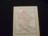
Map of North America.
<p>Unbound colored engraved map decorative boarder 14" x 11". Slight toning browning and aging; overall very bright and clear and in very good shape. Maps are wrapped with acid free board or in rigid sleeves. The Mitchell family started to produce atlases in 1846 and continued into the early 1890s. Around 1860 S. Augustus Mitchell Jr. took over and the atlas would be called Mitchell's New General Atlas. This is a colorful map of North America from the 1869 installment of that atlas. The map is bright and crisp and includes Russian America Alaska Greenland and Central America. Extra postage may be required. Ristow 311-313. </p> books
Referentie van de boekhandelaar : 103215
|
|
|
Mitchell Samuel Augustus Jr
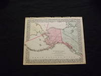
Map of Northwestern America Alaska Showing the Territory Ceded by Russia to the United States.
<p>Unbound colored engraved map decorative boarder 14" x 11". Slight toning browning and aging some chips and tears at top edge bottom margin somewhat narrow; overall very bright and clear and in very good shape. Maps are wrapped with acid free board or in rigid sleeves. The Mitchell family started to produce atlases in 1846 and continued into the early 1890s. Around 1860 S. Augustus Mitchell Jr. took over and the atlas would be called Mitchell's New General Atlas. This is a colorful map of Alaska is from the 1870 installment of that atlas. The map is bright and crisp and shows part of Siberia and the Aleutian Islands and part of Prince Albert Island is also visible. Extra postage may be required. Ristow 311-313.</p> books
Referentie van de boekhandelaar : 103216
|
|
|
Mitchell Samuel Augustus Jr
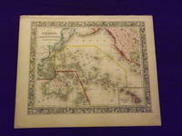
Map of Oceanica Exhibiting its Various Divisions and Island Groups.
<p>Unbound colored engraved map decorative border 14" x 12". Slight toning and aging top edge a little rough some staining or browning in top margin; but still bright and clean. Maps are wrapped with acid free board or in rigid sleeves. The Mitchell family started to produce atlases in 1846 and continued into the early 1890s. Around 1860 S. Augustus Mitchell Jr. took over and the atlas would be called Mitchell's New General Atlas. This is a very attractive colorful single page map of the Pacific islands including Australia Japan and New Zealand. The Sandwich Islands is shown in a small inset. This map is from the 1861 installment of the Mitchell atlas. Some extra postage may be required. Ristow 311-313. </p> books
Referentie van de boekhandelaar : 103166
|
|
|
Mitchell Samuel Augustus Jr
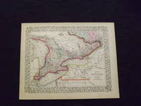
Map of Ontario in Counties.
<p>Unbound colored engraved map decorative border 14" x 11". Slight toning browning and aging; otherwise bright and clean. Maps are wrapped with acid free board or in rigid sleeves. The Mitchell family started to produce atlases in 1846 and continued into the early 1890s. Around 1860 S. Augustus Mitchell Jr. took over and the atlas would be called Mitchell's New General Atlas. This is an attractive colorful map of Ontario from the 1869 installment of that atlas. The map provides good county detail and part of Quebec New York and Pennsylvania are visible. Extra postage may be required. Ristow 311-313. </p> books
Referentie van de boekhandelaar : 103217
|
|
|
Mitchell Samuel Augustus Jr
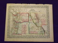
Map of Oregon Washington Idaho and Part of Montana.
<p>Unbound colored engraved map decorative boarder 14" x 11". Slight toning and aging margins show a little darkening some chips in upper margin; otherwise very bright and clear. Maps are wrapped with acid free board or in rigid sleeves. The Mitchell family started to produce atlases in 1846 and continued into the early 1890s. Around 1860 S. Augustus Mitchell Jr. took over and the atlas would be called Mitchell's New General Atlas. This is a very colorful and attractive map of a still relatively early view of Oregon Washington and Idaho from the 1870 installment of that atlas. The map also shows part of British America and Montana. Ristow 311-313. Â # 103161</p><p>$100</p> books
Referentie van de boekhandelaar : 103161
|
|
|
Mitchell Samuel Augustus Jr
Map of Oregon Washington Idaho and Part of Montana
<p>Philadelphia 1865. Unbound colored engraved map decorative boarder 14 1/2"x 11". Slight toning and aging; otherwise very bright and clear. Maps are wrapped with acid free board or in rigid sleeves. The Mitchell family started to produce atlases in 1846 and continued into the early 1890s. Around 1860 S. Augustus Mitchell Jr. took over and the atlas would be called Mitchell's New General Atlas. This is a very colorful and attractive map of a still relatively early view of Oregon Washington and Idaho from the 1865 installment of that atlas. The map also shows part of British America and Montana. Ristow 311-313</p> books
Referentie van de boekhandelaar : 101200
|
|
|
Mitchell Samuel Augustus Jr
Map of Persia Turkey in Asia Afghanistan and Beloochistan
<p>Philadelphia 1882. Unbound colored engraved map decorative boarder 14"x 11". Slight toning and aging; overall bright and clear and in very good shape. Maps are wrapped with acid free board or in rigid sleeves. The Mitchell family started to produce atlases in 1846 and continued into the early 1890s. Around 1860 S. Augustus Mitchell Jr. took over and the atlas would be called Mitchell's New General Atlas. This is a colorful map of part of the Middle East from the 1882 installment of that atlas. Ristow 311-313</p> books
Referentie van de boekhandelaar : 101069
|
|
|
Mitchell Samuel Augustus Jr
Map of Persia Turkey in Asia Afghanistan and Beloochistan
<p>Philadelphia 1861. Unbound colored engraved map decorative boarder 14"x 11". Slight toning and aging and a little staining or soiling along bottom edge; overall bright and clear and in very good shape. Maps are wrapped with acid free board or in rigid sleeves. The Mitchell family started to produce atlases in 1846 and continued into the early 1890s. Around 1860 S. Augustus Mitchell Jr. took over and the atlas would be called Mitchell's New General Atlas. This is a colorful map of part of the Middle East from the 1861 installment of that atlas. The map includes an inset showing Palestine and the Holy Land. May require extra postage. Ristow 311-313</p> books
Referentie van de boekhandelaar : 101068
|
|
|
Mitchell Samuel Augustus Jr
Map of Quebec
<p>Philadelphia 1869. Unbound colored engraved map decorative border 14"x 11". Slight toning and aging; overall bright and clear and in very good shape. Maps are wrapped with acid free board or in rigid sleeves. The Mitchell family started to produce atlases in 1846 and continued into the early 1890s. Around 1860 S. Augustus Mitchell Jr. took over and the atlas would be called Mitchell's New General Atlas. This is an fairly colorful map of Quebec from the 1869 installment of that atlas. The map includes an inset featuring Montreal. Ristow 311-313. Phillips 907</p> books
Referentie van de boekhandelaar : 101074
|
|
|
Mitchell Samuel Augustus Jr
Map of Quebec.
<p>Philadelphia 1882. Unbound colored engraved map decorative border 14"x 11". Slight toning and aging; overall bright and clear and in very good shape. Maps are wrapped with acid free board or in rigid sleeves. The Mitchell family started to produce atlases in 1846 and continued into the early 1890s. Around 1860 S. Augustus Mitchell Jr. took over and the atlas would be called Mitchell's New General Atlas. This is an fairly colorful map of Quebec from the 1882 installment of that atlas. The map includes an inset featuring Montreal. Ristow 311-313 Phillips 907</p> books
Referentie van de boekhandelaar : 101075
|
|
|
Mitchell Samuel Augustus Jr
Map of Russia in Europe Sweden and Norway
<p>Philadelphia 1861. Unbound colored engraved map decorative border 14"x 11". Slight toning and aging; overall bright and clear and in very good shape. Maps are wrapped with acid free board or in rigid sleeves. The Mitchell family started to produce atlases in 1846 and continued into the early 1890s. Around 1860 S. Augustus Mitchell Jr. took over and the atlas would be called Mitchell's New General Atlas. This is a colorful single page map of Russia and some Scandinavian countries from the 1861 installment of that atlas. The map includes insets featuring Denmark and Holland and Belgium. Ristow 311-313</p> books
Referentie van de boekhandelaar : 101076
|
|
|
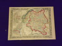
Mitchell Samuel Augustus Jr
Map of Russia in Europe Sweden and Norway.
<p>Unbound colored engraved map decorative border 14"x 11". Slight toning and aging; overall bright and clear and in very good shape. Maps are wrapped with acid free board or in rigid sleeves. The Mitchell family started to produce atlases in 1846 and continued into the early 1890s. Around 1860 S. Augustus Mitchell Jr. took over and the atlas would be called Mitchell's New General Atlas. This is a colorful single page map of Russia and some Scandinavian countries from the 1864 installment of that atlas. The map includes insets featuring Denmark and Holland and Belgium. Ristow 311-313.</p> books
Referentie van de boekhandelaar : 106121
|
|
|
Mitchell Samuel Augustus Jr
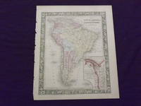
Map of South America
<p>Philadelphia 1865. Unbound colored engraved map decorative border 14"x 11". Slight toning and aging a few small chips at the left edge; overall bright and clear and in very good shape. Maps are wrapped with acid free board or in rigid sleeves. The Mitchell family started to produce atlases in 1846 and continued into the early 1890s. Around 1860 S. Augustus Mitchell Jr. took over and the atlas would be called Mitchell's New General Atlas. This is an attractive colored map of South America from the 1865 installment of that atlas. The map shows a "New Granada" in an inset. Extra postage may be required. Ristow 311-313</p> books
Referentie van de boekhandelaar : 101078
|
|
|
Mitchell Samuel Augustus Jr
Map of South America
<p>Philadelphia 1861. Unbound colored engraved map decorative border 14"x 11". Slight toning and aging a little minor staining in margins; overall bright and clear and in very good shape. Maps are wrapped with acid free board or in rigid sleeves. The Mitchell family started to produce atlases in 1846 and continued into the early 1890s. Around 1860 S. Augustus Mitchell Jr. took over and the atlas would be called Mitchell's New General Atlas. This is an attractive colored map of South America from the 1861 installment of that atlas. The map shows a "New Granada" in an inset. Extra postage may be required. Ristow 311-313</p> books
Referentie van de boekhandelaar : 101077
|
|
|
Mitchell Samuel Augustus Jr
Map of South America
<p>Philadelphia: Bradley 1882. Unbound colored engraved map decorative border 14 1/2"x 11 1/2". Slight toning and aging; overall bright and clear and in very good shape. Maps are wrapped with acid free board or in rigid sleeves. The Mitchell family started to produce atlases in 1846 and continued into the early 1890s. Around 1860 S. Augustus Mitchell Jr. took over and the atlas would be called Mitchell's New General Atlas. This is an attractive colored map of South America from the 1882 installment of that atlas. The map shows a "New Granada" in an inset. Extra postage may be required. Ristow 311-313 Phillips 907</p> Bradley books
Referentie van de boekhandelaar : 101079
|
|
|
Mitchell Samuel Augustus Jr
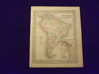
Map of South America.
<p> Unbound colored engraved map decorative border 14" x 11". Slight toning and aging small tear repaired with archival tape in bottom margin; overall bright and clear and in very good condition. Maps are wrapped with acid free board or in rigid sleeves. The Mitchell family started to produce atlases in 1846 and continued into the early 1890s. Around 1860 S. Augustus Mitchell Jr. took over and the atlas would be called Mitchell's New General Atlas. This is an attractive colored map of South America from the 1869 installment of that atlas. The map shows a "New Granada" in an inset. Extra postage may be required. Ristow 311-313.</p> books
Referentie van de boekhandelaar : 103176
|
|
|
Mitchell Samuel Augustus Jr
Map of St Louis
Philadelphia 1869. Unbound colored engraved map decorative border 14 "x 11 ". Slight toning and aging; overall bright and clear and in very good shape. Maps are wrapped with acid free board or in rigid sleeves. The Mitchell family started to produce atlases in 1846 and continued into the early 1890s. Around 1860 S. Augustus Mitchell Jr. took over and the atlas would be called Mitchell's New General Atlas. This is a fairly detailed map of St. Louis from the 1882 installment of that atlas. Ristow 311-313 unknown books
Referentie van de boekhandelaar : 101080
|
|
|
Mitchell Samuel Augustus Jr
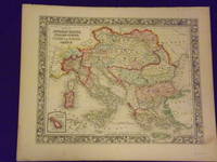
Map of the Austrian Empire Italian States Turkey in Europe and Greece
<p>Philadelphia 1861. Unbound colored engraved map decorative border 14"x 11". Slight toning and aging a little minor staining or soling in rightt margin; overall bright clear and crisp and in very good shape. Maps are wrapped with acid free board or in rigid sleeves. The Mitchell family started to produce atlases in 1846 and continued into the early 1890s. Around 1860 S. Augustus Mitchell Jr. took over and the atlas would be called Mitchell's New General Atlas. This is a very attractive single page colored map of mostly modern day Germany Italy and Turkey from the 1861 installment of that atlas. American maps with a complete picture of Italy are often hard to find. Ristow 311-313</p> books
Referentie van de boekhandelaar : 101210
|
|
|
Mitchell Samuel Augustus Jr
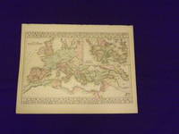
Map of The Roman Empire.
<p>Unbound colored engraved map decorative border 14"x 11". Slight toning and aging; overall bright and clear and in very good shape. Maps are wrapped with acid free board or in rigid sleeves. The Mitchell family started to produce atlases in 1846 and continued into the early 1890s. Around 1860 S. Augustus Mitchell Jr. took over and the atlas would be called Mitchell's New General Atlas. This somewhat unusual map of the Roman Empire is from the 1882 edition of the Mitchell series. In addition to an attractive rendering of the Roman Empire there is a large section of the map that presents Ancient Greece. Ristow 311-313. Phillips 907.</p> books
Referentie van de boekhandelaar : 106130
|
|
|
Mitchell Samuel Augustus Jr
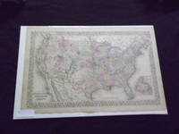
Map of the United States and Territories
<p>Philadelphia: Bradley 1882. Unbound colored engraved map decorative boarder 22 1/2"x 14 1/2". Slight toning and aging; overall bright and clear and in very good shape. Maps are wrapped with acid free board or in rigid sleeves. The Mitchell family started to produce atlases in 1846 and continued into the early 1890s. Around 1860 S. Augustus Mitchell Jr. took over and the atlas would be called Mitchell's New General Atlas. This is an attractive double page map of the United States from the 1882 installment. The Indian Territory is highlighted and the Island of Newfoundland is illustrated in a small inset. May require extra postage. Ristow 311-313 Phillips 907</p> Bradley books
Referentie van de boekhandelaar : 101086
|
|
|
Mitchell Samuel Augustus Jr
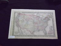
Map of the United States and Territories
<p>Philadelphia 1865. Unbound colored engraved map decorative boarder 22 1/2"x 14 1/2". Slight toning and aging; overall bright and clear and in very good shape. Maps are wrapped with acid free board or in rigid sleeves. The Mitchell family started to produce atlases in 1846 and continued into the early 1890s. Around 1860 S. Augustus Mitchell Jr. took over and the atlas would be called Mitchell's New General Atlas. This is a colorful and attractive double page map of the United States from the 1865 installment. The Indian Territory is highlighted and Pensacola Bay and Norfolk Harbor are illustrated in two small insets. May require extra postage. Ristow 311-313</p> books
Referentie van de boekhandelaar : 101084
|
|
|
Mitchell Samuel Augustus Jr
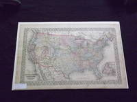
Map of the United States and Territories
<p>Philadelphia 1870. Unbound colored engraved map decorative boarder 22 1/2"x 14 1/2". Slight toning and aging just a little staining in margins; overall bright and clear and in very good shape. Maps are wrapped with acid free board or in rigid sleeves. The Mitchell family started to produce atlases in 1846 and continued into the early 1890s. Around 1860 S. Augustus Mitchell Jr. took over and the atlas would be called Mitchell's New General Atlas. This is an attractive double page map of the United States from the 1870 installment. The Indian Territory is highlighted and the Island of Newfoundland is illustrated in a small inset. May Require extra postage. Ristow 311-313</p> books
Referentie van de boekhandelaar : 101085
|
|
|
Mitchell Samuel Augustus Jr
Map of the World
Philadelphia: Bradley 1882. Unbound colored engraved map decorative boarder 22 1/2"x 14 1/2". Some toning and aging a couple of small chips in margins no impact on image or boarder; otherwise very good. Maps are wrapped with acid free board or in rigid sleeves. The Mitchell family started to produce atlases in 1846 and continued into the early 1890s. Around 1860 S. Augustus Mitchell Jr. took over and the atlas would be called Mitchell's New General Atlas. This is an attractive double page map of the world from the 1882 installment that atlas. Ristow 311-313 Phillips 907 Bradley unknown books
Referentie van de boekhandelaar : 101092
|
|
|
Mitchell Samuel Augustus Jr
Map of the World
Philadelphia 1870. Unbound colored engraved map decorative boarder 22 1/2"x 14 1/2". Some toning and aging a little staining in margins; otherwise very good. Maps are wrapped with acid free board or in rigid sleeves. The Mitchell family started to produce atlases in 1846 and continued into the early 1890s. Around 1860 S. Augustus Mitchell Jr. took over and the atlas would be called Mitchell's New General Atlas. This is an attractive double page map of the world from the 1870 installment that atlas. Ristow 311-313 Phillips 907 unknown books
Referentie van de boekhandelaar : 101131
|
|
|
Mitchell Samuel Augustus Jr
Map of the World
Philadelphia 1865. Unbound colored engraved map decorative boarder 22 1/2"x 14 1/2". Some toning and aging; otherwise very good. Maps are wrapped with acid free board or in rigid sleeves. The Mitchell family started to produce atlases in 1846 and continued into the early 1890s. Around 1860 S. Augustus Mitchell Jr. took over and the atlas would be called Mitchell's New General Atlas. This is an attractive double page map of the world from the 1865 installment that atlas. Ristow 311-313 Phillips 907 unknown books
Referentie van de boekhandelaar : 101176
|
|
|
Mitchell Samuel Augustus Jr
Map of the World
Philadelphia 1861. Unbound colored engraved map decorative boarder 22 1/2"x 14 1/2". Some toning and aging; otherwise very good. Maps are wrapped with acid free board or in rigid sleeves. The Mitchell family started to produce atlases in 1846 and continued into the early 1890s. Around 1860 S. Augustus Mitchell Jr. took over and the atlas would be called Mitchell's New General Atlas. This is an attractive double page map of the world from the 1861 installment that atlas. Ristow 311-313 Phillips 907 unknown books
Referentie van de boekhandelaar : 101177
|
|
|
Mitchell Samuel Augustus Jr
Map of the World in Hemispheres.
<p>Unbound colored engraved map decorative boarder 14" x 11". Slight toning darkening and aging bottom margin narrow upper margin with a few edge chips and a little rough; still fairly bright and clean and in very good condition. Maps are wrapped with acid free board or in rigid sleeves. The Mitchell family started to produce atlases in 1846 and continued into the early 1890s. Around 1860 S. Augustus Mitchell Jr. took over and the atlas would be called Mitchell's New General Atlas. This is an attractive hemispheric map of the world from the 1869 installment of that atlas. Ristow 311-313.</p> books
Referentie van de boekhandelaar : 106105
|
|
|
Mitchell Samuel Augustus Jr
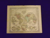
Map of the World in Hemispheres.
<p>Unbound colored engraved map decorative boarder 14" x 11". Slight toning darkening and aging top and bottom margina little narrow but still ample; otherwise fairly bright and clean and in very good condition. Maps are wrapped with acid free board or in rigid sleeves. The Mitchell family started to produce atlases in 1846 and continued into the early 1890s. Around 1860 S. Augustus Mitchell Jr. took over and the atlas would be called Mitchell's New General Atlas. This is an attractive hemispheric map of the world from the 1870 installment of that atlas. Ristow 311-313.</p> books
Referentie van de boekhandelaar : 106106
|
|
|
Mitchell Samuel Augustus Jr
Map of Turkey in Europe
<p>Philadelphia: Bradley 1882. Unbound colored engraved map decorative boarder 22 1/2"x 14 1/2". Some toning and aging a little foxing in margins; otherwise very good. Maps are wrapped with acid free board or in rigid sleeves. The Mitchell family started to produce atlases in 1846 and continued into the early 1890s. Around 1860 S. Augustus Mitchell Jr. took over and the atlas would be called Mitchell's New General Atlas. This is an very interesting double page map of Turkey from the 1882 installment of that atlas. The map shows parts of Austria Russia and Armenia and illustrates the Berlin Congress Treaty of 1878. Map shows some territory annexed by Russia near the Black Sea. Extra postage may be required. Ristow 311-313 Phillips 907</p> Bradley books
Referentie van de boekhandelaar : 101083
|
|
|
Mitchell Samuel Augustus Jr
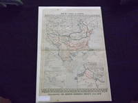
Minnesota and Dacotah
Philadelphia 1861. Unbound colored engraved map decorative boarder 14"x 11". Some toning and aging a small margin stain; otherwise bright and clean. Maps are wrapped with acid free board or in rigid sleeves. The Mitchell family started to produce atlases in 1846 and continued into the early 1890s. Around 1860 S. Augustus Mitchell Jr. took over and the atlas would be called Mitchell's New General Atlas. This is a colorful map of Minnesota and Dakota from the 1861 installment of that atlas. Lands of the Cree and Dakota Indians are included on the map. Ristow 311-313 unknown books
Referentie van de boekhandelaar : 101045
|
|
|
Mitchell Samuel Augustus Jr
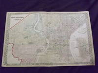
Philadelphia and Camden.
<p>Unbound colored engraved map lined boarder 23"x 15". Some toning darkening and aging a couple of small margin tears three with archival tape repairs slight corner crease; overall a nice impression about very good. Maps are wrapped with acid free board or in rigid sleeves. The Mitchell family started to produce atlases in 1846 and continued into the early 1890s. Around 1860 S. Augustus Mitchell Jr. took over and the atlas would be called Mitchell's New General Atlas. This is a fairly colorful double page map of the city of Philadelphia from the 1872 installment. W.H. Gamble is credited for this map. Unlike previous Mitchell maps this one does not have the traditional decorative boarder. The Camden portion of the map is to the side and almost set up as an inset. Ristow 311-313. Phillips 907.</p> books
Referentie van de boekhandelaar : 105050
|
|
|
Mitchell Samuel Augustus Jr
Plan of Baltimore
Philadelphia 1864. Unbound colored engraved map decorative border 13" x 10 1/2". Slight toning and aging; otherwise very good. Maps are wrapped with acid free board or in rigid sleeves. The Mitchell family started to produce atlases in 1846 and continued into the early 1890s. Around 1860 S. Augustus Mitchell Jr. took over and the atlas would be called Mitchell's New General Atlas. This is a detailed single page map of Boston from the 1864 installment of this atlas. The map ishows a lot of street detail. Ristow 311-313 unknown books
Referentie van de boekhandelaar : 101008
|
|
|
Mitchell Samuel Augustus Jr
Plan of Boston
Philadelphia: Bradley 1882. Unbound colored engraved map decorative border 23"x 15". Some toning and aging small tape repair in margin; otherwise very good. Maps are wrapped with acid free board or in rigid sleeves. The Mitchell family started to produce atlases in 1846 and continued into the early 1890s. Around 1860 S. Augustus Mitchell Jr. took over and the atlas would be called Mitchell's New General Atlas. This is a detailed double page map of Boston from the 1882 installment of this atlas. The map includes a small inset illustrating Boston Harbor & Islands. Ristow 311-313 Phillips 907 Bradley unknown books
Referentie van de boekhandelaar : 101009
|
|

 De zoekresultaten per email ontvangen
 Zoekresultaten downloaden als PDF
 RSS feed
 Permanente link


