|
Mitchell Samuel Augustus Jr
Plan of Milwaukee
Philadelphia: Bradley 1882. Unbound colored engraved map decorative boarder 14"x 11 1/2". Some toning and aging a couple of minor nicks at left edge; otherwise very good and bright and clean. Maps are wrapped with acid free board or in rigid sleeves. The Mitchell family started to produce atlases in 1846 and continued into the early 1890s. Around 1860 S. Augustus Mitchell Jr. took over and the atlas would be called Mitchell's New General Atlas. This is an attractive single page map ofthe city of Milwaukee from the 1882 installment of that atlas.Map has some decent color and good detail on city streets. Ristow 311-313 Phillips 907 Bradley unknown books
Referentie van de boekhandelaar : 101044
|
|
|
Mitchell Samuel Augustus Jr
Plan of Philadelphia
Philadelphia 1864. Unbound colored engraved map decorative boarder 14"x 11". Slight toning and aging; overall bright and clear and in very good shape. Maps are wrapped with acid free board or in rigid sleeves. The Mitchell family started to produce atlases in 1846 and continued into the early 1890s. Around 1860 S. Augustus Mitchell Jr. took over and the atlas would be called Mitchell's New General Atlas. This is a colorful map of the city of Philadelphia from the 1864 installment of that atlas. Ristow 311-313 unknown books
Referentie van de boekhandelaar : 101071
|
|
|
Mitchell Samuel Augustus Jr
Plan of Philadelphia
Philadelphia 1861. Unbound colored engraved map decorative boarder 14"x 11". Slight toning and aging a few small chips at the top edge; overall bright and clear and in very good shape. Maps are wrapped with acid free board or in rigid sleeves. The Mitchell family started to produce atlases in 1846 and continued into the early 1890s. Around 1860 S. Augustus Mitchell Jr. took over and the atlas would be called Mitchell's New General Atlas. This is a colorful map of the city of Philadelphia from the 1861 installment of that atlas. Ristow 311-313 unknown books
Referentie van de boekhandelaar : 101070
|
|
|
Mitchell Samuel Augustus Jr
Plan of Philadelphia
Philadelphia 1870. Unbound colored engraved map decorative boarder 14"x 11". Slight toning and aging; overall bright and clear and in very good shape. Maps are wrapped with acid free board or in rigid sleeves. The Mitchell family started to produce atlases in 1846 and continued into the early 1890s. Around 1860 S. Augustus Mitchell Jr. took over and the atlas would be called Mitchell's New General Atlas. This is a colorful map of the city of Philadelphia from the 1870 installment of that atlas. Ristow 311-313 unknown books
Referentie van de boekhandelaar : 101072
|
|
|
Mitchell Samuel Augustus Jr
Plan of the City of Philadelphia and Camden
Philadelphia: Bradley 1882. Unbound colored engraved map decorative boarder 22 1/2"x 14 1/2". Slight toning and aging; overall bright and clear and in very good shape. Maps are wrapped with acid free board or in rigid sleeves. The Mitchell family started to produce atlases in 1846 and continued into the early 1890s. Around 1860 S. Augustus Mitchell Jr. took over and the atlas would be called Mitchell's New General Atlas. This is a fairly colorful double page map of the city of Philadelphia from the 1882 installment. The Camden portion of the map is to the side and almost set up as an inset. Ristow 311-313 Phillips 907 Bradley unknown books
Referentie van de boekhandelaar : 101073
|
|
|
Mitchell Samuel Augustus Jr
Plan of the City of Washington
Philadelphia 1870. Unbound colored engraved map decorative boarder 14 1/2"x 11". Slight toning and aging overall bright and clear and in very good shape. Maps are wrapped with acid free board or in rigid sleeves. The Mitchell family started to produce atlases in 1846 and continued into the early 1890s. Around 1860 S. Augustus Mitchell Jr. took over and the atlas would be called Mitchell's New General Atlas. This is an attractive single page map of Washington from the 1870 installment of that atlas. Ristow 311-313 unknown books
Referentie van de boekhandelaar : 101091
|
|
|
Mitchell Samuel Augustus Jr.
A New Map of Palestine or the Holy Land.
<p>Unbound colored engraved map decorative boarder 14" x 11". Slight toning and aging a couple of nicks or chips in left margin; otherwise bright and clear. Maps are wrapped with acid free board or in rigid sleeves. The Mitchell family started to produce atlases in 1846 and continued into the early 1890s. Around 1860 S. Augustus Mitchell Jr. took over and the atlas would be called Mitchell's New General Atlas. This is a very attractive single page map of Palestine and the Holy Land from the 1865 installment of that atlas. This map is probably one of the more attractive versions of this map from the Mitchell series. Modern Jerusalem is shown in an inset. Extra postage may be required. Ristow 311-313. </p> books
Referentie van de boekhandelaar : 103232
|
|
|
MITCHELL Samuel Augustus Jr.
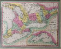
Canada West Formerly Upper Canada
Philadelphia: Samuel Augustus Mitchell Jr. 1847. unbound. Map. Lithograph with original hand coloring. Image measures 14" x 17".<br/><br/> This lovely 1847 map of Ontario Canada depicts the province in its entirety. The map includes part of New York State as well. "Canada West" previously known as "Upper Canada" is color coded at the district level and notes railroads cities rivers mountains and other important topographic elements. An inset in the lower right features Lake Superior of the Great Lakes. The map is in good condition. Dated and copyrighted to 1846 this map appeared in the 1847 edition of Mitchell's "New General Atlas".<br><br>Samuel Augustus Mitchell Sr. 1792-1868 was one of the leaders in American cartography of the 19th century and pioneered the conversion of engraved map plates to more affordable lithographic plates. His son Samuel Augustus Mitchell Jr. continued his father's successful mapmaking and publishing business and was one of the most prolific and renowned 19th century American publishers.<br/><br/> Samuel Augustus Mitchell Jr. unknown books
Referentie van de boekhandelaar : 287994
|
|
|
MITCHELL Samuel Augustus Jr.
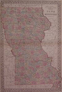
County & Township Map of the States of Iowa and Missouri
Philadelphia: Mitchell Samuel Augustus Jr. 1882. unbound. very good. Gamble W.H. Map. Engraving with original hand coloring. Image measures 21.5" x 14.5".<br/><br/> Great double page map of Iowa and Missouri divided into counties. Showing townships towns major routes waterways and railroads. Plan of St. Louis on verso. In excellent condition with only very slight crease along centerfold edges. S. Augustus Mitchell Jr. continued his father's successful mapmaking and publishing business and was one of the most prolific and renowned 19th century American publishers.<br/><br/> Mitchell, Samuel Augustus Jr. unknown books
Referentie van de boekhandelaar : 202998
|
|
|
Mitchell Samuel Augustus Jr.
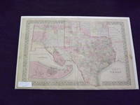
County and Township Map of Texas.
<p>Unbound colored engraved map decorative boarder 22 1/2" x 14 1/2". Normal aging and toning crease at center fold some staining in margins; otherwise very good and bright and clean. Maps are wrapped with acid free board or in rigid sleeves. The Mitchell family started to produce atlases in 1846 and continued into the early 1890s. Around 1860 S. Augustus Mitchell Jr. took over and the atlas would be called Mitchell's New General Atlas. This is an attractive map of Texas is from the 1882 installment. The city of Galveston is shown in an inset. The map has good detail and nice coloring. Extra postage will be required. Ristow 311-313. </p> books
Referentie van de boekhandelaar : 103261
|
|
|
MITCHELL Samuel Augustus Jr.
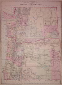
County and Township of Oregon and Washington
Philadelphia: Mitchell Samuel Augustus Jr. 1881. unbound. very good. Map. Engraving with original hand coloring. Image measures 20" x 14.5".<br/><br/> Great double page map of Washington and Oregon divided into counties and some townships. Shows towns waterways railroads topographical details and Indian reservations. In excellent condition. Also available in 1882 edition. S. Augustus Mitchell Jr. continued his father's successful mapmaking and publishing business and was one of the most prolific and renowned 19th century American publishers.<br/><br/> Mitchell, Samuel Augustus Jr. unknown books
Referentie van de boekhandelaar : 203536
|
|
|
Mitchell Samuel Augustus Jr.
County Map 0f Massachusetts Connecticut and Rhode Island.
Unbound colored engraved map decorative boarder 14"x 11". Slight toning and aging margins narrow; still bright and clear and in otherwise good condition. Maps are wrapped with acid free board or in rigid sleeves. The Mitchell family started to produce atlases in 1846 and continued into the early 1890s. Around 1860 S. Augustus Mitchell Jr. took over and the atlas would be called Mitchell's New General Atlas. This is an attractive colorful single page map of the states of Massachusetts Connecticut and Rhode Island from the 1870 installment of that atlas. Good detail and Portland is featured in an inset. Ristow 311-313. books
Referentie van de boekhandelaar : 106170
|
|
|
Mitchell Samuel Augustus Jr.
County Map 0f Massachusetts Connecticut and Rhode Island.
Unbound colored engraved map decorative boarder 14"x 11". Slight toning and aging some margin chips top margin narrow and with a coup;e of chips touching the neat line; still bright and clear and in otherwise good condition. Maps are wrapped with acid free board or in rigid sleeves. The Mitchell family started to produce atlases in 1846 and continued into the early 1890s. Around 1860 S. Augustus Mitchell Jr. took over and the atlas would be called Mitchell's New General Atlas. This is an attractive colorful single page map of the states of Massachusetts Connecticut and Rhode Island from the 1869 installment of that atlas. Good detail and Portland is featured in an inset. Ristow 311-313. books
Referentie van de boekhandelaar : 106168
|
|
|
MITCHELL Samuel Augustus Jr.
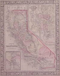
County Map of California
Philadelphia: Mitchell Samuel Augustus Jr. 1866. unbound. very good. Map. Steel engraving with original hand coloring. Image measures 13.25" x 10.5".<br/><br/> Classic map of California divided into counties showing all major towns and cities geographical features and waterways. Includes insets of San Francisco Bay and the Great Salt Lake Country. S. Augustus Mitchell Jr. continued his father's successful mapmaking and publishing business and was one of the most prolific and renowned 19th century American publishers. In very good condition.<br/><br/> Mitchell, Samuel Augustus Jr. unknown books
Referentie van de boekhandelaar : 202852
|
|
|
Mitchell Samuel Augustus Jr.
County Map of England and Wales.
<p>Unbound colored engraved map decorative border 14" x 11". Slight browning and aging; overall bright and clear and in very good shape. Maps are wrapped with acid free board or in rigid sleeves. The Mitchell family started to produce atlases in 1846 and continued into the early 1890s. Around 1860 S. Augustus Mitchell Jr. took over and the atlas would be called Mitchell's New General Atlas. This is an attractive colored map of England and Wales from the 1864 installment of that atlas. Extra postage may be required. Ristow 311-313. </p> books
Referentie van de boekhandelaar : 104501
|
|
|
Mitchell Samuel Augustus Jr.
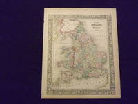
County Map of England and Wales.
<p>Unbound colored engraved map decorative border 14" x 11". Slight browning and aging a couple of nicks at the left edge; overall bright and clear and in very good shape. Maps are wrapped with acid free board or in rigid sleeves. The Mitchell family started to produce atlases in 1846 and continued into the early 1890s. Around 1860 S. Augustus Mitchell Jr. took over and the atlas would be called Mitchell's New General Atlas. This is an attractive colored map of England and Wales from the 1864 installment of that atlas. Extra postage may be required. Ristow 311-313. </p> books
Referentie van de boekhandelaar : 103235
|
|
|
MITCHELL Samuel Augustus Jr.
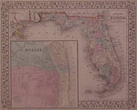
County Map of Florida
Philadelphia: Mitchell Samuel Augustus Jr. 1867. unbound. very good. Map. Steel engraving with original hand coloring. Image measures 11" x 13.25".<br/><br/> Nicely detailed map of Florida divided into counties showing towns major routes and geographical features. Includes a large inset town plan of Mobile Alabama. Minor chipping to corners. S. Augustus Mitchell Jr. continued his father's successful mapmaking and publishing business and was one of the most prolific and renowned 19th century American publishers.<br/><br/> Mitchell, Samuel Augustus Jr. unknown books
Referentie van de boekhandelaar : 202924
|
|
|
Mitchell Samuel Augustus Jr.
County Map of Kentucky and Tennessee.
Unbound colored engraved map decorative boarder 14" x 11". Slight toning and aging a couple of small chips at upper margin edge; otherwise bright and clean and in very good condition. Maps are wrapped with acid free board or in rigid sleeves. The Mitchell family started to produce atlases in 1846 and continued into the early 1890s. Around 1860 S. Augustus Mitchell Jr. took over and the atlas would be called Mitchell's New General Atlas. This is an attractive and colorful map of Kentucky and Tennessee from the 1861 installment of that atlas. Ristow 311-313. books
Referentie van de boekhandelaar : 106159
|
|
|
MITCHELL Samuel Augustus Jr.
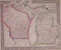
County Map of Michigan and Wisconsin
Philadelphia: Mitchell Samuel Augustus Jr. 1864. unbound. very good. Map. Engraving with original hand coloring. Image measures 11.75" x 13.75".<br/><br/> Nice map of Michigan and Wisconsin divided into counties. Shows cities major routes and waterways. Light scattered foxing. S. Augustus Mitchell Jr. continued his father's successful mapmaking and publishing business and was one of the most prolific and renowned 19th century American publishers.<br/><br/> Mitchell, Samuel Augustus Jr. unknown books
Referentie van de boekhandelaar : 203205
|
|
|
MITCHELL Samuel Augustus Jr.
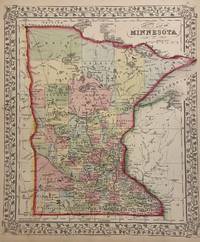
County Map of Minnesota
Philadelphia: Mitchell Samuel Augustus Jr. 1866. unbound. Map. Engraving with original hand coloring. Image measures 13.75" x 11.5".<br/><br/> Nice map of Minnesota divided into counties. Towns capitols roads rivers lakes railroads and proposed railroads are labeled. A wagon road from Fort Ridgely westward toward the Missouri River is indicated. <br><br> S. Augustus Mitchell Jr. continued his father's successful mapmaking and publishing business and was one of the most prolific and renowned 19th century American publishers.<br/><br/> Mitchell, Samuel Augustus Jr. unknown books
Referentie van de boekhandelaar : 300140
|
|
|
Mitchell Samuel Augustus Jr.
County Map of New Jersey Maryland and Delaware.
Unbound colored engraved map decorative boarder 12 1/2"x 15". Somewhat narrow margins slight toning and aging; overall bright and clear and in very good shape. Maps are wrapped with acid free board or in rigid sleeves. The Mitchell family started to produce atlases in 1846 and continued into the early 1890s. Around 1860 S. Augustus Mitchell Jr. took over and the atlas would be called Mitchell's New General Atlas. This is a colorful map of New Jersey and Maryland and Delaware from the 1872 installment of that atlas. The map includes is divided into two panels with New Jersey in one and Maryland and Delaware in the other. books
Referentie van de boekhandelaar : 102233
|
|
|
MITCHELL Samuel Augustus Jr.
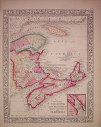
County Map of Nova Scotia New Brunswick Cape Breton Id. and Pr. Edward's Id
Philadelphia: Mitchell Samuel Augustus Jr. 1863. unbound. very good. Map. Engraving with original hand coloring. Image measures 13" x 10.5".<br/><br/> Includes inset of Halifax Harbor and city. S. Augustus Mitchell Jr. continued his father's successful mapmaking and publishing business and was one of the most prolific and renowned 19th century American publishers.<br/><br/> Mitchell, Samuel Augustus Jr. unknown books
Referentie van de boekhandelaar : 204026
|
|
|
MITCHELL Samuel Augustus Jr.
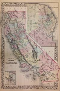
County Map of the State of California
Philadelphia: Mitchell Samuel Augustus Jr. 1872. unbound. Map. Steel engraving with original hand coloring. Image measures 21" x 15".<br/><br/> Beautifully detailed double page map of California divided into counties showing major towns and cities routes railroads and waterways. Includes two insets of San Francisco-one the bay and its vicinity and the other a city plan. Centerfold shows wear. Minor foxing and edge wear and foxing below center right.<br><br> Samuel Augustus Mitchell Sr. 1792-1868 was one of the leaders in American cartography of the 19th century and pioneered the conversion of engraved map plates to more affordable lithographic plates. His son Samuel Augustus Mitchell Jr. continued his father's successful mapmaking and publishing business and was one of the most prolific and renowned 19th century American publishers.<br/><br/> Mitchell, Samuel Augustus Jr. unknown books
Referentie van de boekhandelaar : 271717
|
|
|
MITCHELL Samuel Augustus Jr.
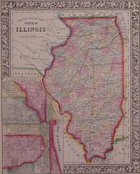
County Map of the State of Illinois
Philadelphia: Mitchell Samuel Augustus Jr. 1864. unbound. very good. Map. Engraving with original hand coloring. Image measures 13.5" x 10.75".<br/><br/> Great map of Illinois divided into counties showing towns major routes railroads and waterways. Includes a detailed town plan inset Chicago. Available in 1865 and 1866 editions. In excellent condition with a few very small chips to left edge and a narrow stain along right edge. S. Augustus Mitchell Jr. continued his father's successful mapmaking and publishing business and was one of the most prolific and renowned 19th century American publishers.<br/><br/> Mitchell, Samuel Augustus Jr. unknown books
Referentie van de boekhandelaar : 202985
|
|
|
MITCHELL Samuel Augustus Jr.
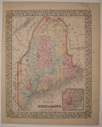
County Map of the State of Maine
Philadelphia: Mitchell Samuel Augustus Jr. 1869. unbound. very good. Map. Steel engraving with original hand coloring. Image measures 13 3/8" x 10 5/8".<br/><br/> Classic map of Maine divided into counties. Shows major towns and cities routes railroads and waterways. Features an inset of Portland Harbor. In excellent condition with minor overall aging. Light crease to lower left corner. S. Augustus Mitchell Jr. continued his father's successful mapmaking and publishing business and was one of the most prolific and renowned 19th century American publishers.<br/><br/> Mitchell, Samuel Augustus Jr. unknown books
Referentie van de boekhandelaar : 226734
|
|
|
MITCHELL Samuel Augustus Jr.
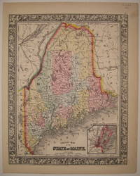
County Map of the State of Maine
Philadelphia: Mitchell Samuel Augustus Jr. 1864. unbound. very good. Map. Steel engraving with original hand coloring. Image measures 13 3/8" x 10 5/8".<br/><br/> Beautifully printed map of Maine divided into counties. Shows major towns and cities routes railroads and waterways. Features an inset of Portland Harbor. In excellent condition with one very small dot of foxing to lower left margin. S. Augustus Mitchell Jr. continued his father's successful mapmaking and publishing business and was one of the most prolific and renowned 19th century American publishers.<br/><br/> Mitchell, Samuel Augustus Jr. unknown books
Referentie van de boekhandelaar : 226732
|
|
|
Mitchell Samuel Augustus Jr.
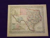
County Map of the State of Texas.
<p> Unbound colored engraved map decorative boarder 15" x 12". Slight toning in margins normal aging ample margins; overall bright and clear and in very good shape. Maps are wrapped with acid free board or in rigid sleeves. The Mitchell family started to produce atlases in 1846 and continued into the early 1890s. Around 1860 S. Augustus Mitchell Jr. took over and the atlas would be called Mitchell's New General Atlas. This is an attractive map of Texas from the 1869 installment. The city of Galveston is highlighted in an inset. Ristow 311-313. Phillips 907. </p> books
Referentie van de boekhandelaar : 103160
|
|
|
MITCHELL Samuel Augustus Jr.
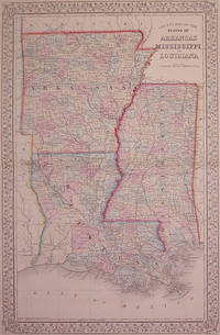
County Map of the States of Arkansas Mississippi and Louisiana
Philadelphia: Mitchell Samuel Augustus Jr. 1867. unbound. very good. Gamble W.H. Map. Engraving with original hand coloring. Image measures 21.25" x 13.5".<br/><br/> Classic double page map of Louisiana Arkansas and Mississippi divided into counties. Shows towns major routes waterways and geographical features. In excellent condition. S. Augustus Mitchell Jr. continued his father's successful mapmaking and publishing business and was one of the most prolific and renowned 19th century American publishers.<br/><br/> Mitchell, Samuel Augustus Jr. unknown books
Referentie van de boekhandelaar : 203103
|
|
|
Mitchell Samuel Augustus Jr.
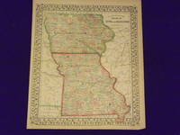
County Map of the States of Iowa and Missouri.
Unbound colored engraved map decorative border 14"x 11 1/2". Slight toning and aging margins a litle narrow; otherwise very good and overall bright and clear. Maps are wrapped with acid free board or in rigid sleeves. The Mitchell family started to produce atlases in 1846 and continued into the early 1890s. Around 1860 S. Augustus Mitchell Jr. took over and the atlas would be called Mitchell's New General Atlas. This is very colorful version of the Iowa and Missouri map from the 1869 installment of this atlas. Ristow 311-313. books
Referentie van de boekhandelaar : 106177
|
|
|
MITCHELL Samuel Augustus Jr.
County Map of Utah and Nevada
Philadelphia: Mitchell Samuel Augustus Jr. 1866. unbound. very good. Map. Engraving with original hand coloring. Image measures 11.5" x 13.75".<br/><br/> Classic map of Utah and Nevada divided into counties. Shows towns waterways major routes topographical details and Indian reservations. Light scattered foxing. S. Augustus Mitchell Jr. continued his father's successful mapmaking and publishing business and was one of the most prolific and renowned 19th century American publishers.<br/><br/> Mitchell, Samuel Augustus Jr. unknown books
Referentie van de boekhandelaar : 203707
|
|
|
MITCHELL Samuel Augustus Jr.
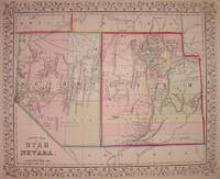
County Map of Utah and Nevada
Philadelphia: Mitchell Samuel Augustus Jr. 1867. unbound. very good. Map. Engraving with original hand coloring. Image measures 11.5" x 13.75".<br/><br/> Classic map of Utah and Nevada divided into counties. Shows towns waterways major routes topographical details and Indian reservations. Small spot of foxing in northeast Nevada. S. Augustus Mitchell Jr. continued his father's successful mapmaking and publishing business and was one of the most prolific and renowned 19th century American publishers.<br/><br/> Mitchell, Samuel Augustus Jr. unknown books
Referentie van de boekhandelaar : 203706
|
|
|
Mitchell Samuel Augustus Jr.
County Map of Virginia and West Virginia.
Unbound colored engraved map decorative boarder 14" x 11". Slight toning darkening and aging margins somewhat narrow slight tear in lower margin; overall bright and clean and in very good condition. Maps are wrapped with acid free board or in rigid sleeves. The Mitchell family started to produce atlases in 1846 and continued into the early 1890s. Around 1860 S. Augustus Mitchell Jr. took over and the atlas would be called Mitchell's New General Atlas. This is an attractive single page map of Virginia and West Virginia from the 1869 installment of that atlas. Extra postage may be required. Ristow 311-313. books
Referentie van de boekhandelaar : 106162
|
|
|
mitchell Samuel Augustus Jr.
County Map of Virginia and West Virginia.
Unbound colored engraved map decorative boarder 14" x 11". Slight toning darkening and aging margins somewhat narrow slight tear in lower margin; overall bright and clean and in very good condition. Maps are wrapped with acid free board or in rigid sleeves. The Mitchell family started to produce atlases in 1846 and continued into the early 1890s. Around 1860 S. Augustus Mitchell Jr. took over and the atlas would be called Mitchell's New General Atlas. This is an attractive single page map of Virginia and West Virginia from the 1870 installment of that atlas. Extra postage may be required. Ristow 311-313. books
Referentie van de boekhandelaar : 106163
|
|
|
Mitchell Samuel Augustus Jr.
Map of Asia.
<p>Philadelphia 1861. Unbound colored engraved map decorative border 14"x 11". Slight toning and aging; overall bright and clear and in very good shape. Maps are wrapped with acid free board or in rigid sleeves. The Mitchell family started to produce atlases in 1846 and continued into the early 1890s. Around 1860 S. Augustus Mitchell Jr. took over and the atlas would be called Mitchell's New General Atlas. This is a very attractive single page colored map of Asia from the 1861 installment of that atlas. A very brightly colored version of this map. The map features China Hindostan Turkestan Persia and Siberia. Extra postage may be required. Ristow 311-313</p> books
Referentie van de boekhandelaar : 101199
|
|
|
Mitchell Samuel Augustus Jr.
Map of Cincinnati.
<p>Unbound colored engraved map decorative boarder 14" x 11". Slight browning and aging; otherwise bright and clean and in very good shape. Maps are wrapped with acid free board or in rigid sleeves. The Mitchell family started to produce atlases in 1846 and continued into the early 1890s. Around 1860 S. Augustus Mitchell Jr. took over and the atlas would be called Mitchell's New General Atlas. This is an attractive and rather early single page map of Cincinnati from the 1870 installment of this atlas. The map has nice color and good street detail. Part of Covington and Newport are also visible on the other side of the Ohio River. May require extra postage. Ristow 311-313. # 103227</p> books
Referentie van de boekhandelaar : 103227
|
|
|
Mitchell Samuel Augustus Jr.
Map of Europe.
<p>Unbound colored engraved map decorative border 14"x 11". Slight browning and aging a little foxing in margins; still overall bright and clear and in very good shape. Maps are wrapped with acid free board or in rigid sleeves. The Mitchell family started to produce atlases in 1846 and continued into the early 1890s. Around 1860 S. Augustus Mitchell Jr. took over and the atlas would be called Mitchell's New General Atlas. This is a nice map of Europe from the 1882 installment of that atlas. Despite the large area the map covers there is still a decent amount of detail. Extra postage may be required. Ristow 311-313. # 103242</p> books
Referentie van de boekhandelaar : 103242
|
|
|
Mitchell Samuel Augustus Jr.
Map of France Spain and Portugal.
<p>Philadelphia 1882. Unbound colored engraved map decorative border 14"x 11". Slight toning and aging; overall bright and clear and in very good shape. Maps are wrapped with acid free board or in rigid sleeves. The Mitchell family started to produce atlases in 1846 and continued into the early 1890s. Around 1860 S. Augustus Mitchell Jr. took over and the atlas would be called Mitchell's New General Atlas. This is a colorful map of France Spain and Portugal from the 1882 installment of that atlas. An inset illustrates Switzerland and the Island of Corsica. Extra postage may be required. Ristow 311-313</p> books
Referentie van de boekhandelaar : 101026
|
|
|
Mitchell Samuel Augustus Jr.
Map of Ireland and Scotland.
Unbound colored engraved map decorative border 14" x 11". Slight toning and aging. A few margin creases and chips; overall generally bright and clean and in very good shape. Maps are wrapped with acid free board or in rigid sleeves. The Mitchell family started to produce atlases in 1846 and continued into the early 1890s. Around 1860 S. Augustus Mitchell Jr. took over and the atlas would be called Mitchell's New General Atlas. This is an attractive two panel map of Ireland and Scotland from the 1870 installment of that atlas.  While the map presents two countries it does provide a fair amount of county level detail. This is a very sharp and colorful impression. Extra psotage may be required. Ristow 311-313. books
Referentie van de boekhandelaar : 106133
|
|
|
Mitchell Samuel Augustus Jr.
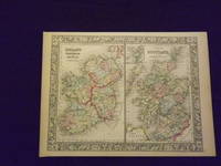
Map of Ireland and Scotland.
<p>Unbound colored engraved map decorative border 14" x 11". Slight toning and aging; overall generally bright and clean and in very good shape. Maps are wrapped with acid free board or in rigid sleeves. The Mitchell family started to produce atlases in 1846 and continued into the early 1890s. Around 1860 S. Augustus Mitchell Jr. took over and the atlas would be called Mitchell's New General Atlas. This is an attractive two panel map of Ireland and Scotland from the 1864 installment of that atlas. While the map presents two countries it does provide a fair amount of county level detail. Extra postage may be required. Ristow 311-313. </p> books
Referentie van de boekhandelaar : 103236
|
|
|
MITCHELL Samuel Augustus Jr.
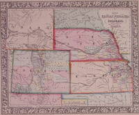
Map of Kansas Nebraska and Colorado. Showing also the Eastern Portion of Idaho
Philadelphia: Mitchell Samuel Augustus Jr. 1861. unbound. very good. Map. Steel engraving with original hand coloring. Image measures 11.5" x 14".<br/><br/> Classic map of the west with Kansas Nebraska Colorado and part of Idaho divided into counties showing major towns and cities routes railroads and geographic features. S. Augustus Mitchell Jr. continued his father's successful mapmaking and publishing business and was one of the most prolific and renowned 19th century American publishers. In excellent condition.<br/><br/> Mitchell, Samuel Augustus Jr. unknown books
Referentie van de boekhandelaar : 202865
|
|
|
Mitchell Samuel Augustus Jr.
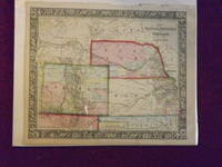
Map of Kansas Nebraska Colorado and Part of Dacotah.
<p>Unbound colored engraved map decorative border 14"x 11". Slight toning and aging; a few chips and tears on top margin overall bright and clear and in very good shape. Maps are wrapped with acid free board or in rigid sleeves. The Mitchell family started to produce atlases in 1846 and continued into the early 1890s. Around 1860 S. Augustus Mitchell Jr. took over and the atlas would be called Mitchell's New General Atlas. This is a very colorful and attractive map of Kansas and a couple of western states from the 1865 installment of that atlas. While the map shows mostly Kansas Nebraska and Colorado it also presents a portion of Dakota and Wyoming. For some of these territories this is an early representation. Ristow 311-313. </p> books
Referentie van de boekhandelaar : 106068
|
|
|
MITCHELL Samuel Augustus Jr.
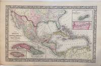
Map of Mexico Central America and the West Indies
Philadelphia: Mitchell Samuel Augustus Jr. 1866. unbound. W. Williams. Map. Engraving with original hand coloring. Image measures 13.25" x 21".<br/><br/> Beautiful map of Mexico published in 1866. centered on the Gulf of Mexico. Includes four inset maps; Jamaica Cuba Bermuda and Panama. Samuel Augustus Mitchell Sr. 1792-1868 is one of the leaders in American cartography of the 19th century and pioneered the conversion of engraved map plates to more affordable lithographic plates.<br/><br/> Mitchell, Samuel Augustus Jr. unknown books
Referentie van de boekhandelaar : 297675
|
|
|
Mitchell Samuel Augustus Jr.
Map of North and South Carolina.
Unbound colored engraved map decorative boarder 14" X 11". Slight toning and agin some writing in right margin; overall bright and clear and in very good shape. Maps are wrapped with acid free board or in rigid sleeves. The Mitchell family started to produce atlases in 1846 and continued into the early 1890s. Around 1860 S. Augustus Mitchell Jr. took over and the atlas would be called Mitchell's New General Atlas. This is an attractive and colorful map of North and South Carolina from the 1882 installment. The map has a fair amount of detail and an inset of Charleston Harbor and another of Charleston. Ristow 311-313. books
Referentie van de boekhandelaar : 106158
|
|
|
Mitchell Samuel Augustus Jr.
Map of North and South Carolina.
Unbound colored engraved map decorative boarder 14" X 11". Slight darkening and aging some some chipping in top margin edge; overall bright and clear and in very good shape. Maps are wrapped with acid free board or in rigid sleeves. The Mitchell family started to produce atlases in 1846 and continued into the early 1890s. Around 1860 S. Augustus Mitchell Jr. took over and the atlas would be called Mitchell's New General Atlas. This is an attractive and colorful map of North and South Carolina from the 1870 installment. The map has a fair amount of detail and an inset of Charleston Harbor and another of Charleston. Ristow 311-313. books
Referentie van de boekhandelaar : 106161
|
|
|
Mitchell Samuel Augustus Jr.
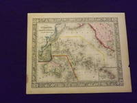
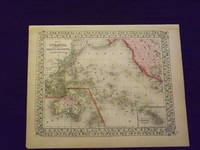
Map of Oceanica Exhibiting its Various Divisions and Island Groups.
<p>Unbound colored engraved map decorative boarder 14" x 11". Slight browning and aging a little staining in margins a couple of edge chips; overall bright and clean and in very good condition. Maps are wrapped with acid free board or in rigid sleeves. The Mitchell family started to produce atlases in 1846 and continued into the early 1890s. Around 1860 S. Augustus Mitchell Jr. took over and the atlas would be called Mitchell's New General Atlas. This is a very colorful map of Oceanica South Pacific from the 1864 installment of that atlas. The map includes the Polynesian Islands Australia part of the Chinese coast; part of the western portion of North America and the Sandwich Islands is shown in a small inset. Extra postage may be required. Ristow 311-313. </p> books
Referentie van de boekhandelaar : 103248
|
|
|
Mitchell Samuel Augustus Jr.
Map of Oceanica Exhibiting its Various Divisions and Island Groups.
<p>Unbound colored engraved map decorative boarder 14" x 11". Slight browning and aging; overall generally bright and clean and in very good condition. Maps are wrapped with acid free board or in rigid sleeves. The Mitchell family started to produce atlases in 1846 and continued into the early 1890s. Around 1860 S. Augustus Mitchell Jr. took over and the atlas would be called Mitchell's New General Atlas. This is a very colorful map of Oceanica South Pacific from the 1864 installment of that atlas. The map includes the Polynesian Islands Australia part of the Chinese coast; part of the western portion of North America and the Sandwich Islands is shown in a small inset. Extra postage may be required. Â Ristow 311-313. </p> books
Referentie van de boekhandelaar : 103249
|
|
|
MITCHELL Samuel Augustus Jr.
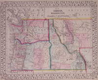
Map of Oregon Washington Idaho and part of Montana
Philadelphia: Mitchell Samuel Augustus Jr. 1871. unbound. very good. Map. Engraving with original hand coloring. Image measures 10.75" x 13.25".<br/><br/> S. Augustus Mitchell Jr. continued his father's successful mapmaking and publishing business and was one of the most prolific and renowned 19th century American publishers.<br/><br/> Mitchell, Samuel Augustus Jr. unknown books
Referentie van de boekhandelaar : 203192
|
|
|
Mitchell Samuel Augustus Jr.
Map of Persia Turkey in Asia Afghanistan and Beloochistan.
<p>Unbound colored engraved map decorative boarder 14"x 11". Slight browning and aging; overall bright and clean and in very good shape. Maps are wrapped with acid free board or in rigid sleeves. The Mitchell family started to produce atlases in 1846 and continued into the early 1890s. Around 1860 S. Augustus Mitchell Jr. took over and the atlas would be called Mitchell's New General Atlas. This is a very colorful map of part of the Middle East from the 1864 installment of that atlas. The map includes an inset showing Palestine and the Holy Land. Extra postage may be required. Ristow 311-313. </p> books
Referentie van de boekhandelaar : 103231
|
|
|
Mitchell Samuel Augustus Jr.
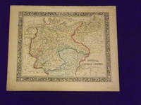
Map of Prussia and the German States.
Unbound colored engraved map decorative boarder 14"x 11". Slight toning and aging top margin a little rough at the edge but not significant; overall bright and clear and in very good shape. Maps are wrapped with acid free board or in rigid sleeves. The Mitchell family started to produce atlases in 1846 and continued into the early 1890s. Around 1860 S. Augustus Mitchell Jr. took over and the atlas would be called Mitchell's New General Atlas. This is an attractive fairly colorful map of Prussia from the 1861 Mitchell atlas. The map shows part of Poland and Switzerland and has a very sharp and attractive boarder. Ristow 311-313. books
Referentie van de boekhandelaar : 106135
|
|
|
Mitchell Samuel Augustus Jr.
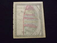
Map of St. Louis.
<p>Unbound colored engraved map decorative border 14 "x 11 ". Some browning and aging bottom margin narrow left margin has rough edge with some nicks and chips; still bright and clean and in very good shape. Maps are wrapped with acid free board or in rigid sleeves. The Mitchell family started to produce atlases in 1846 and continued into the early 1890s. Around 1860 S. Augustus Mitchell Jr. took over and the atlas would be called Mitchell's New General Atlas. This is a fairly detailed map of St. Louis from the 1870 installment of that atlas. Colorful and contains considerable street detail. May require extra postage. Ristow 311-313. </p> books
Referentie van de boekhandelaar : 103221
|
|

 De zoekresultaten per email ontvangen
 Zoekresultaten downloaden als PDF
 RSS feed
 Permanente link


