|
ORTELIUS (Abraham);
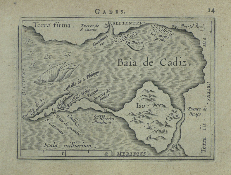
[CADIX] Gades.
Anvers 1598 81 x 104 mm.
书商的参考编号 : LBW-1499
|
|
|
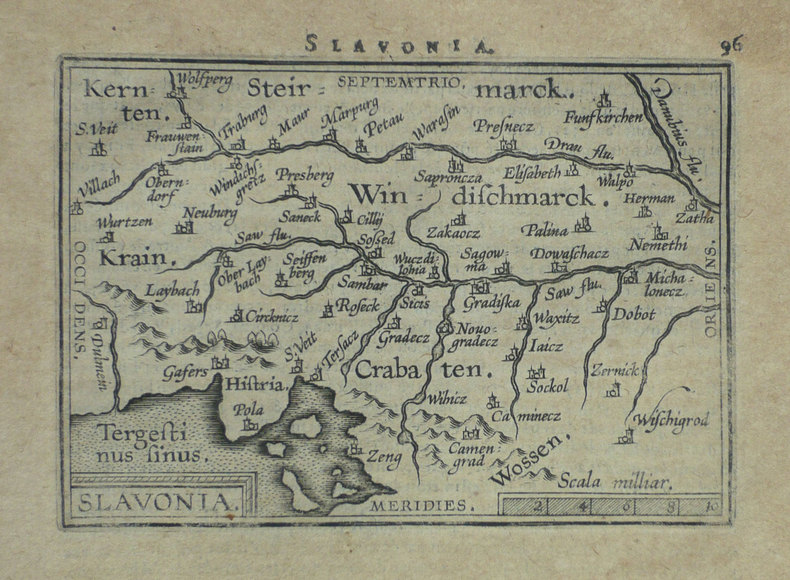
ORTELIUS (Abraham);
[CROATIE] Slavonia.
Anvers 1598 80 x 110 mm.
书商的参考编号 : LBW-1399
|
|
|
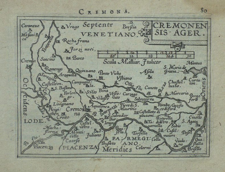
ORTELIUS (Abraham);
[CREMONE] Cremonensis ager.
Anvers 1598 80 x 105 mm.
书商的参考编号 : LBW-1418
|
|
|
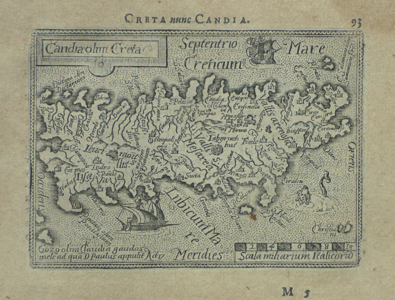
ORTELIUS (Abraham);
[CRETE] Candia olim Creta.
Anvers 1598 82 x 106 mm.
书商的参考编号 : LBW-1432
|
|
|
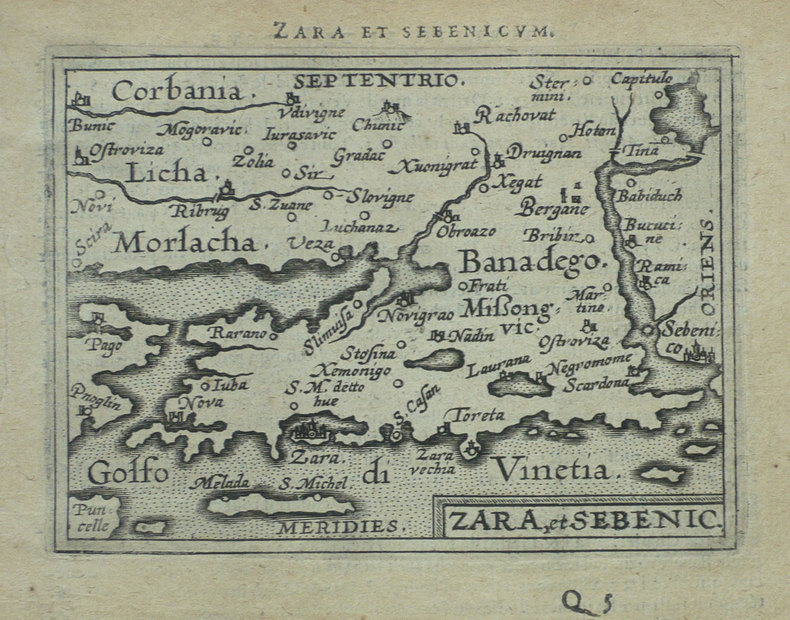
ORTELIUS (Abraham);
[CROATIE] Zara et Sebenico.
Anvers 1598 81 x 105 mm.
书商的参考编号 : LBW-1430
|
|
|
ORTELIUS (Abraham);
[CROATIE] Histria.
Anvers 1598 82 x 105 mm.
书商的参考编号 : LBW-1389

|
|
|
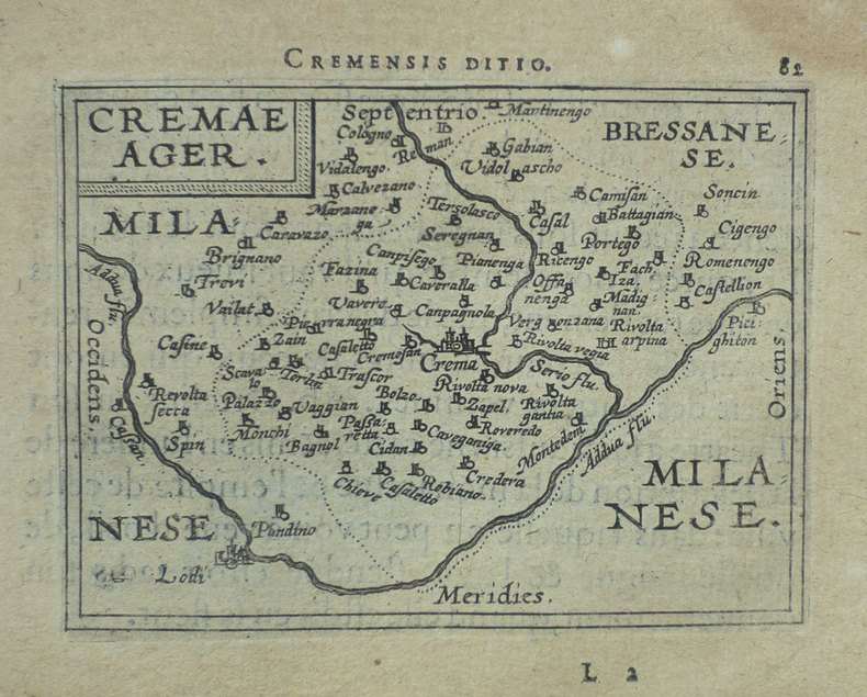
ORTELIUS (Abraham);
[CREMA] Cremae ager.
Anvers 1598 82 x 105 mm.
书商的参考编号 : LBW-1421
|
|
|
ORTELIUS (Abraham);
[FLORENCE] Florentinum dominium.
Anvers 1598 81 x 105 mm.
书商的参考编号 : LBW-1410

|
|
|
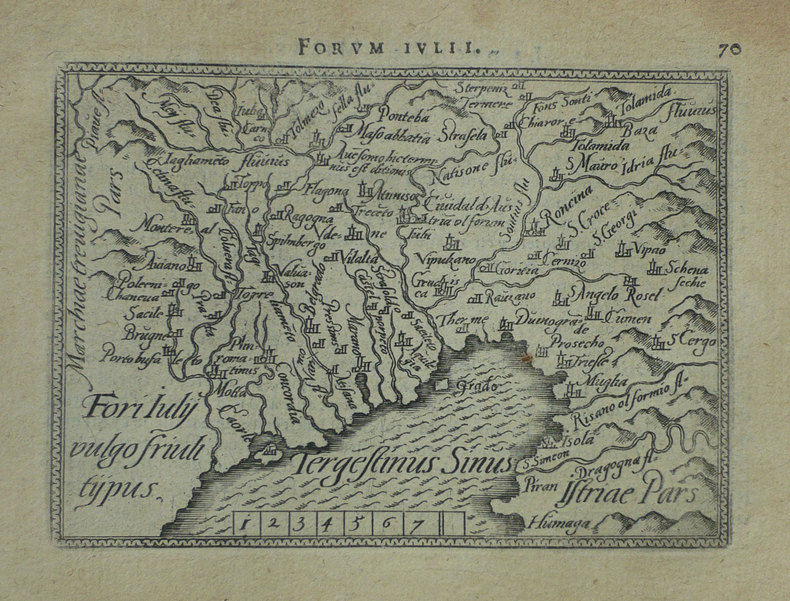
ORTELIUS (Abraham);
[FRIOUL] Fori Iuly vulgo Friuli typus.
Anvers 1598 82 x 105 mm.
书商的参考编号 : LBW-1422
|
|
|
ORTELIUS (Abraham).
[LUXEMBOURG] Lutzeburg.
[Anvers, 1598]. 90 x 103 mm.
书商的参考编号 : LBW-1380

|
|
|
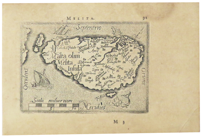
ORTELIUS (Abraham).
[MALTE] Melita.
[Anvers, 1598]. 80 x 107 mm.
书商的参考编号 : LBW-5386
|
|
|
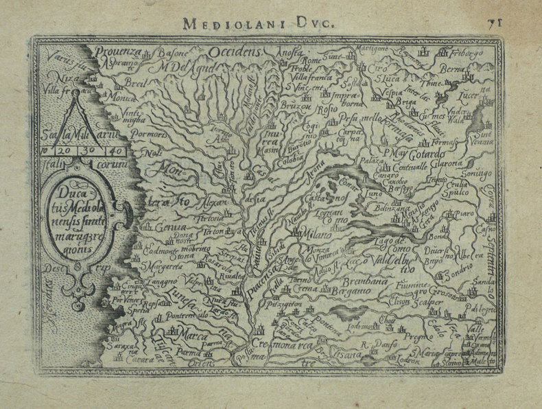
ORTELIUS (Abraham);
[MILANAIS] Ducatus Mediolanensis finitimarumq regionis.
Anvers 1598 83 x 110 mm.
书商的参考编号 : LBW-1412
|
|
|
ORTELIUS (Abraham);
[ORVIETO] Oropitum.
Anvers 1598 81 x 105 mm.
书商的参考编号 : LBW-1415

|
|
|
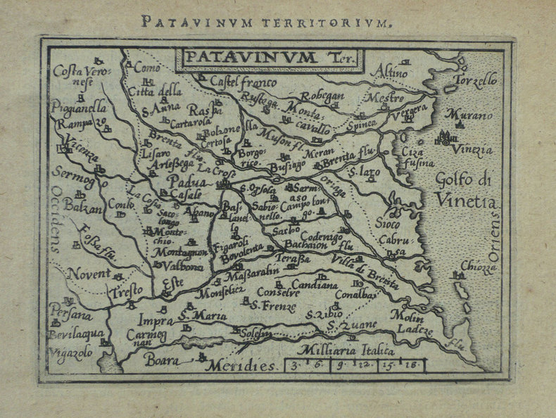
ORTELIUS (Abraham);
[PADOUE] Patavinum.
Anvers 1598 82 x 105 mm.
书商的参考编号 : LBW-1423
|
|
|
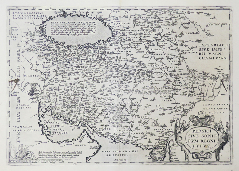
ORTELIUS (Abraham).
[PERSE] Persici sive Sophorum regni typus.
[Anvers, 1592]. 349 x 496 mm.
书商的参考编号 : LBW0251e
|
|
|
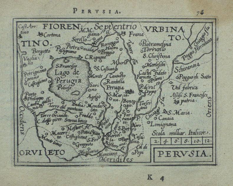
ORTELIUS (Abraham);
[PEROUSE] Perusia.
Anvers 1598 82 x 107 mm.
书商的参考编号 : LBW-1416
|
|
|
ORTELIUS (Abraham);
[PIEMONT] Pedemontanae vicinorumque regionum auctore Iacobo Castaldo descrip.
Anvers 1595-1609 369 x 494 mm.
书商的参考编号 : LBW04178

|
|
|
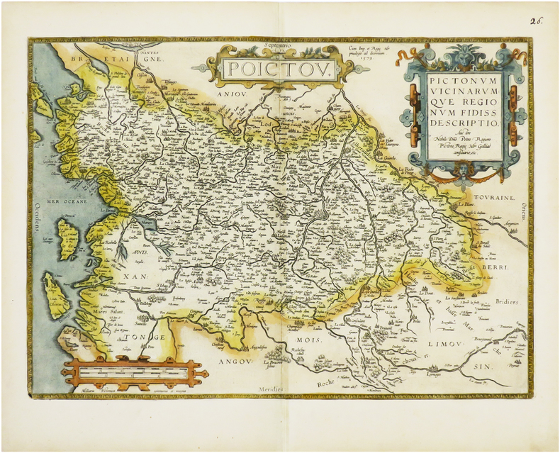
ORTELIUS (Abraham).
[POITOU] Poictou. Pictonum vicinarumque regionum fidiss descriptio.
Anvers, 1579 [1612]. 360 x 504 mm.
书商的参考编号 : LBW-6675
|
|
|
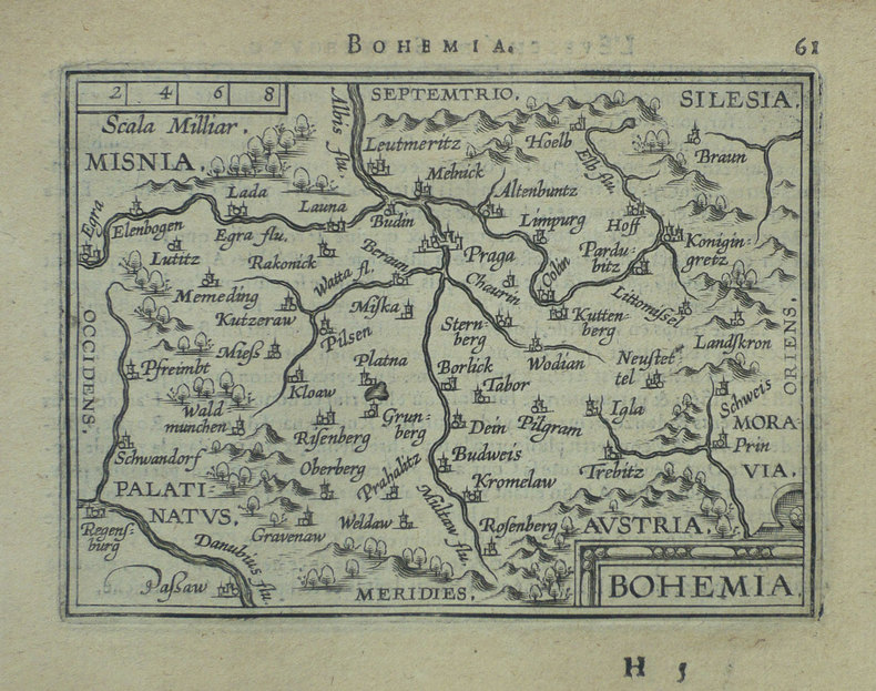
ORTELIUS (Abraham);
[REPUBLIQUE TCHEQUE] Bohemia.
Anvers 1598 81 x 105 mm.
书商的参考编号 : LBW-1401
|
|
|
ORTELIUS (Abraham);
[ROME] Romanum territorium.
Anvers 1598 81 x 106 mm.
书商的参考编号 : LBW-1409

|
|
|
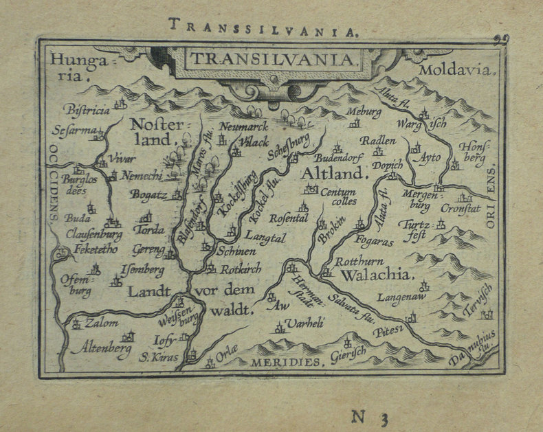
ORTELIUS (Abraham);
[ROUMANIE] Transilvania.
Anvers 1598 80 x 105 mm.
书商的参考编号 : LBW-1395
|
|
|
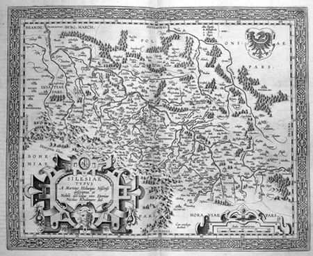
ORTELIUS (Abraham).
[SILESIE] Silesiae typus.
[Anvers, 1603]. 344 x 420 mm.
书商的参考编号 : LBW02528
|
|
|
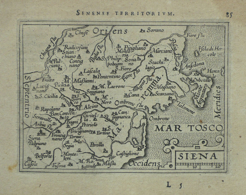
ORTELIUS (Abraham);
[SIENNE] Siena.
Anvers 1598 83 x 106 mm.
书商的参考编号 : LBW-1420
|
|
|
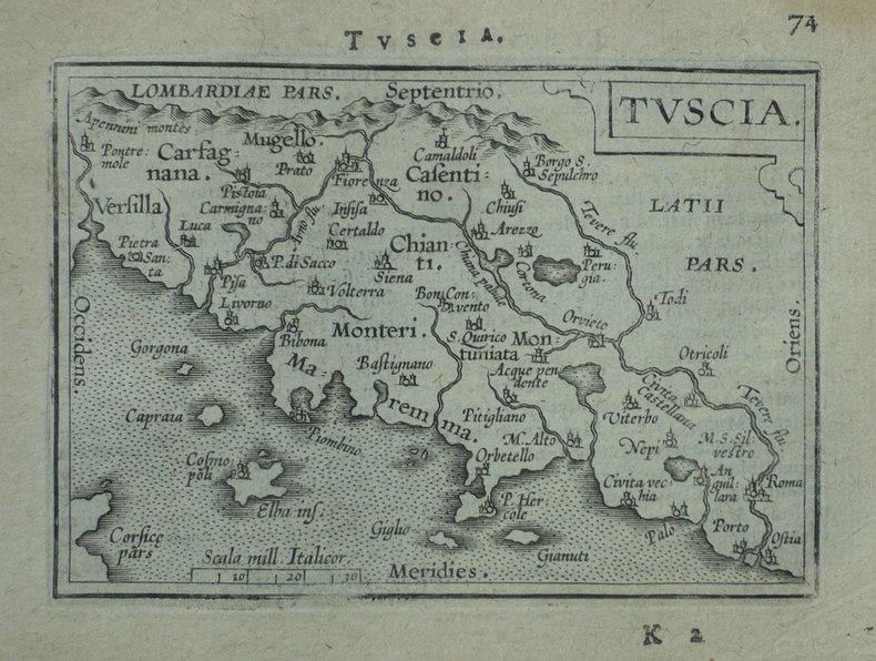
ORTELIUS (Abraham);
[TOSCANE] Tuscia.
Anvers 1598 80 x 109 mm.
书商的参考编号 : LBW-1411
|
|
|
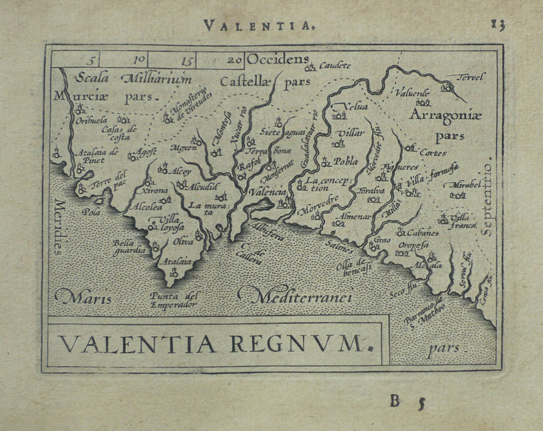
ORTELIUS (Abraham);
[VALENCE] Valentia regnum.
Anvers 1598 81 x 107 mm.
书商的参考编号 : LBW-1403
|
|
|
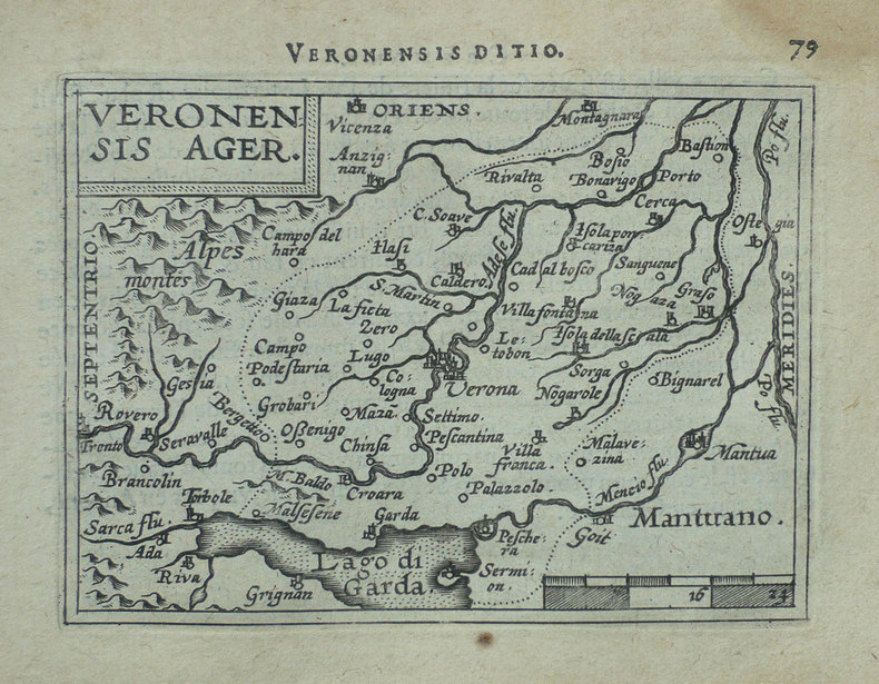
ORTELIUS (Abraham).
[VERONE] Veronensis ager.
[Anvers, 1598]. 82 x 107 mm.
书商的参考编号 : LBW-1417
|
|
|
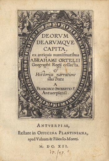
ORTELIUS Abraham.-
Abrahami Ortelii, Cosmographi et Geographi Regii. Deorum Dearumque Capita, Ex Antiquis Numismatibus Collecta: Historica Narratione illustrata à Francisco Swertio antvepiensis.-
Extant Bruxellis. Apud Francisum Foppens. 1683. Petit in-4 (158 x 197 mm) pleine basane brune, dos à 5 nerfs, sans ornement ni pièce de titre, 8ff. n.ch. (Titre, épître au lecteur, index des dieux et déesses, tête de chapitre), 170, (1) pages. Petite vignette de titre sur v*bois et 59 belles figures hors texte gravées d'après des pièces et médailles antiques par Pierre François Sweert. Reliure assez épidermée, coiffes un peu arasées, qq. courtes écritures à l'encre en début d'ouvrage, planche de la page 102 réparée sans perte, papier bruni essentiellement sur les marges, gravures en très bon état. Tel.
书商的参考编号 : ORD-18670
|
|
|
ORTELIUS (Abraham).
Africae propriae tabula.
[Anvers, 1608]. 335 x 486 mm.
书商的参考编号 : LBW01b3a

|
|
|
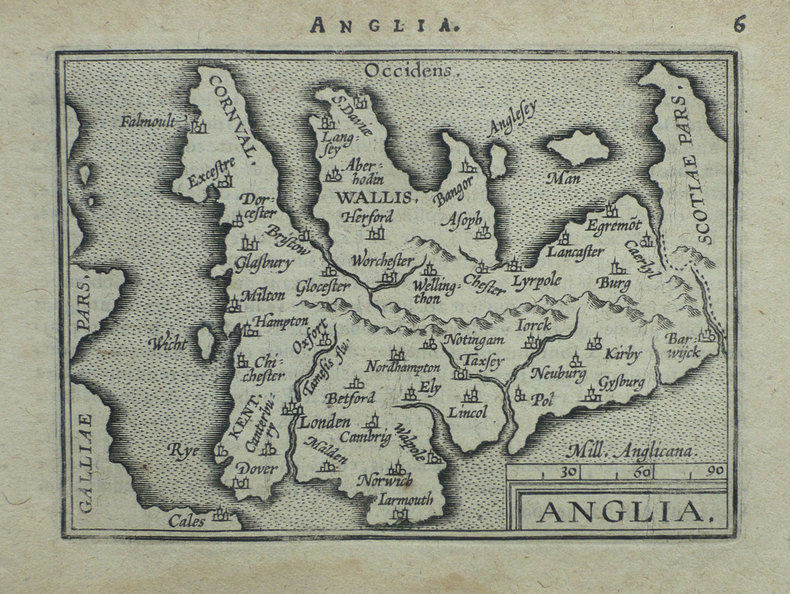
ORTELIUS (Abraham);
Anglia.
Anvers 1598 80 x 104 mm.
书商的参考编号 : LBW-1375
|
|
|
ORTELIUS, Abraham & MÜNSTER, Sebastian:
Basiliensis Territorii Descriptio Nova.
Anvers / Antwerpen, s.d. (1559), 32 x 25 cm (feuille 45 x 28 cm), exemplaire non colorié. Petite déchirure marginale en haut de la feuille (3 cm) qui n’atteint pas la carte.
书商的参考编号 : 99723aaf
|
|
|
ORTELIUS (Abraham);
Cyprus insula - Candia olim Creta.
Anvers 1574-1575 363 x 434 mm.
书商的参考编号 : LBW-589
|
|
|
Ortelius (Abraham) :
Deorum dearumque capita, ex antiquis numismatibus Abrahami Ortelii Geographi Regii collecta, et Historica narratione illustrata A Francisco Sweertio F. Antuerpiensi.
Anvers, Plantin, les fils de Joannes Moretus (Typis Roberti Bruneau), 1612 ; petit in-4 ; vélin, titre manuscrit, plats décorés, à froid, à la Duseuil, avec un double fleuron en coins (reliure de l’époque) ; (136) pp. non chiffrées, titre et 59 planches gravés sur cuivre : portraits ou profils des dieux et déesses chacun dans un riche décor à l’ancienne (*, A-Q 4).
书商的参考编号 : 16230
|
|
|
ORTELIUS Abraham:
Epitome Theatri Orteliani. Præcipuarum Orbis Regionum delineationes, minoribus tabulis expressas, brevioribúsque declarationibus illustratas, continens.
Antverpiæ, Philippo Gallæo execudebat Arnoldus Coninx, 1595. In-8 oblong de [8]-109-[2] feuillets, plein maroquin brun, dos à nerfs orné de double D entrelacés, plats décorés d'un cartouche ovale doré, orné d'une composition allégorique, double filet doré encadrant les plats, tranches dorées. Reliure début XVIIème siècle. Ex-libris Jacques Teutsch.
书商的参考编号 : 16728

|
|
|
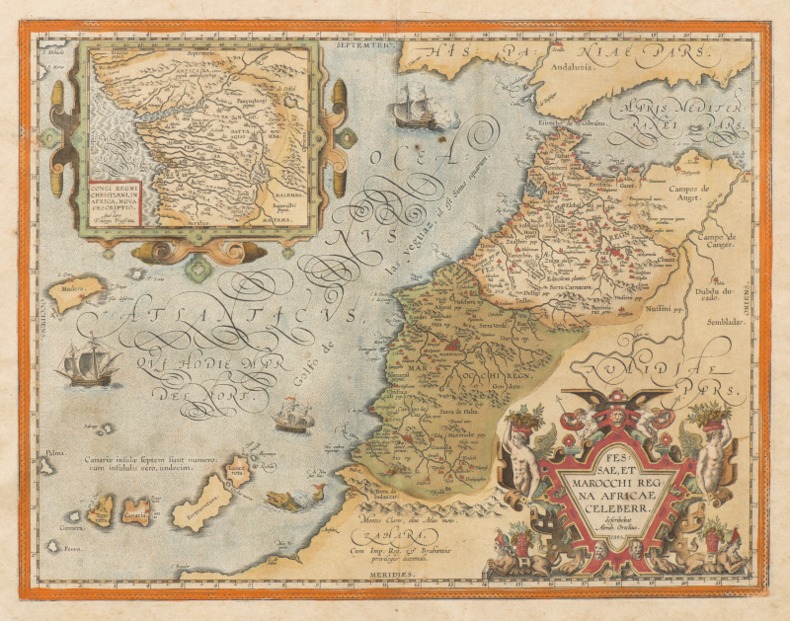
ORTELIUS (Abraham).
FESSAE, ET MAROCCHI REGNA AFRICAE CELEBERR. [Et] BARBARIAE ET BILEDULGERID, nova descriptio. [2 cartes XVIe du MAROC].
1595 [Anvers], Ortelius, 1595. Deux cartes (51 X 39 cm) et (50 X 33 cm) sous cadres en pichepin.
书商的参考编号 : 004429
|
|
|
ORTELIUS Abraham (1527 - 1598).-
Gallia Vetus Ad Juliy Caesaris commentaria ex conatibus geographicis Abrah. Ortely. 1590.-
Grande carte en coloris ancien de la Gaule selon les Commentaires de Jules César. Elle donne les noms des villes, des cours d'eau, des principaux peuples (dont la liste détaillée est dressée dans les 2 colonnes qui bordent la carte). Les grandes régions sont écrites en grosses lettres rouges, les forêts indiquées en vert, les montagnes en brun. Elle est agrémentée de deux cartouches colorés et 3 vaisseaux, 2 dans l'Atlantique, un dans la Méditerranée. Ortelius. 1590. Dimensions totales 435 x 540 mm, dimensions de la carte elle-même 465 x 358 mm. Texte en latin au dos. Pli central d'origine. Excellent état.
书商的参考编号 : ORD-7945
|
|
|
ORTELIUS (Abraham);
Graeciae universae secundum hodiernum situm neoterica descriptio.
Anvers 1603 365 x 515 mm.
书商的参考编号 : LBW0394b
|
|
|
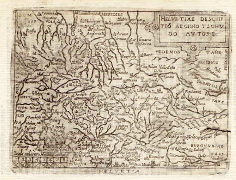
ORTELIUS, Abraham (1527-1598):
Helvetiae descriptio. Carte gravée de la Suisse.
1608, 7.5 x 10.5 cm, carte gravée légèrement tachée + 1 feuille avec le début de la description de la Suisse en italien, 2 feuilles (13 x 9 cm).
书商的参考编号 : 100865aaf
|
|
|
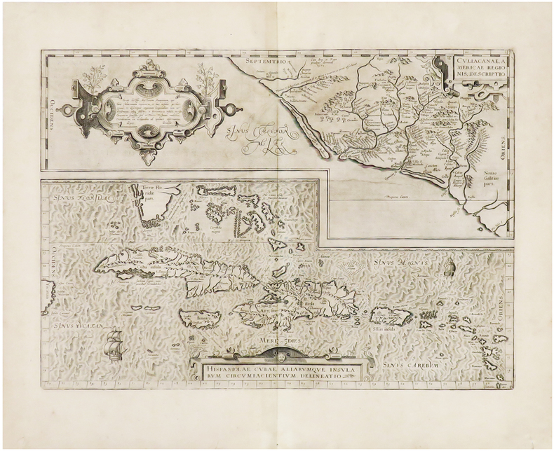
ORTELIUS (Abraham).
Hispaniolae, Cubae, aliarumque insularum circumiacientium, delineatio - Culiacanae, Americae regionis, descriptio.
[Anvers, 1608]. 355 x 498 mm.
书商的参考编号 : LBW-943
|
|
|
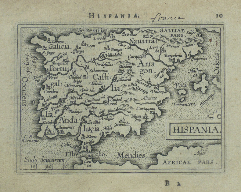
ORTELIUS (Abraham);
Hispania.
Anvers 1598 82 x 107 mm.
书商的参考编号 : LBW-1404
|
|
|
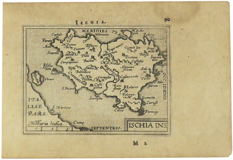
ORTELIUS (Abraham).
Ischia ins.
[Anvers, 1598]. 82 x 106 mm.
书商的参考编号 : LBW-1405
|
|
|
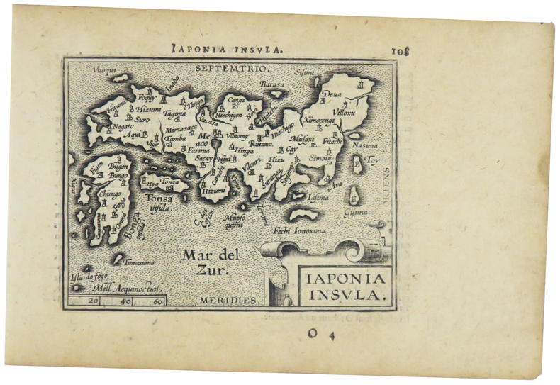
ORTELIUS (Abraham).
Japonia insula.
[Anvers, 1598]. 82 x 102 mm.
书商的参考编号 : LBW-1424
|
|
|
ORTELIUS (Abraham)
Le Berry et la Limagne d'Auvergne. "Regionis Biturigum exactis: descriptio per Joanum Calamaeum". "Limaniae topographia, Gabrielle Symoneo auctor."
Anvers Deux cartes sur une feuille 39,5 x 52,5 cm. Gravure en noir rehaussée en couleurs (bleu, rouge, ocre et vert). Description en latin au dos. Impression fin XVIème ou début XVIIème siècle.
书商的参考编号 : 3144

|
|
|
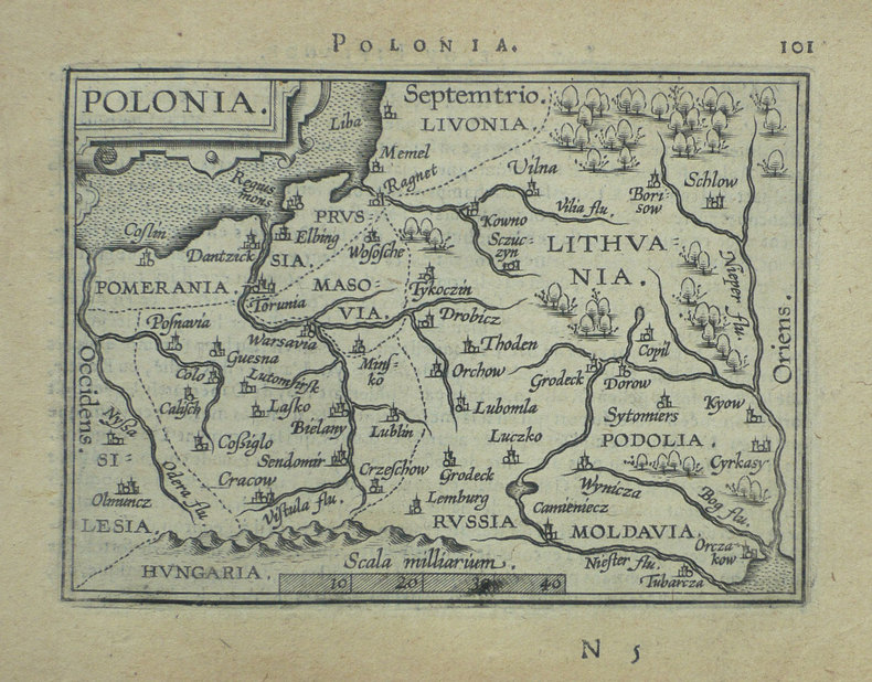
ORTELIUS (Abraham);
Polonia.
Anvers 1598 82 x 108 mm.
书商的参考编号 : LBW-1390
|
|
|
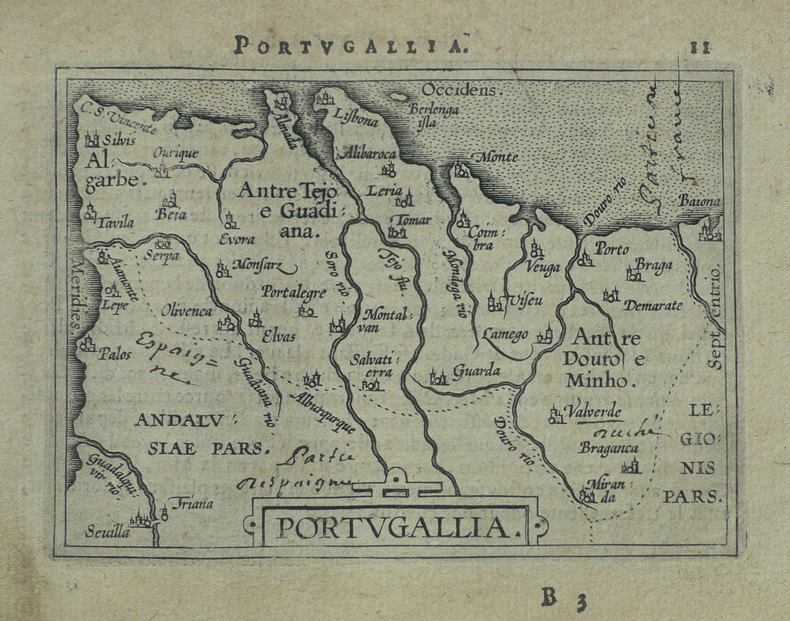
ORTELIUS (Abraham);
Portugallia.
Anvers 1598 81 x 106 mm.
书商的参考编号 : LBW-1384
|
|
|
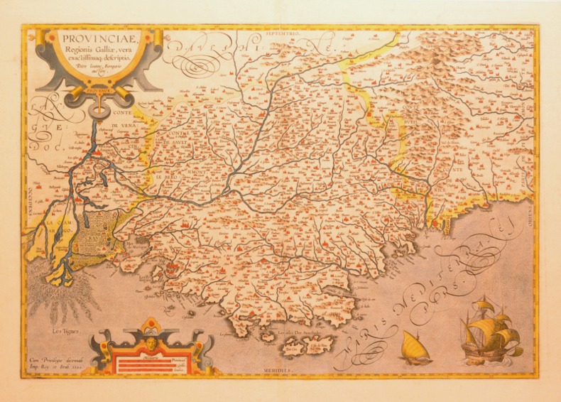
ORTELIUS (Abraham).
PROVINCIAE, REGIONIS GALLIAE, VERA EXACTISSIMAQ DESCRIPTIO. Petro Ioanne Bompario auctore. PROVENCE.
1595 [Anvers], Ortelius, 1594. Carte (557 X 405 mm, marges comprises) sous cadre en bois noirci moderne.
书商的参考编号 : 004430
|
|
|
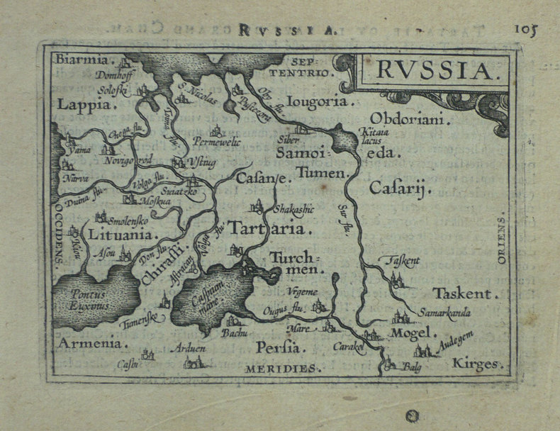
ORTELIUS (Abraham).
Russia.
[Anvers, 1598]. 80 x 106 mm.
书商的参考编号 : LBW-1431
|
|
|
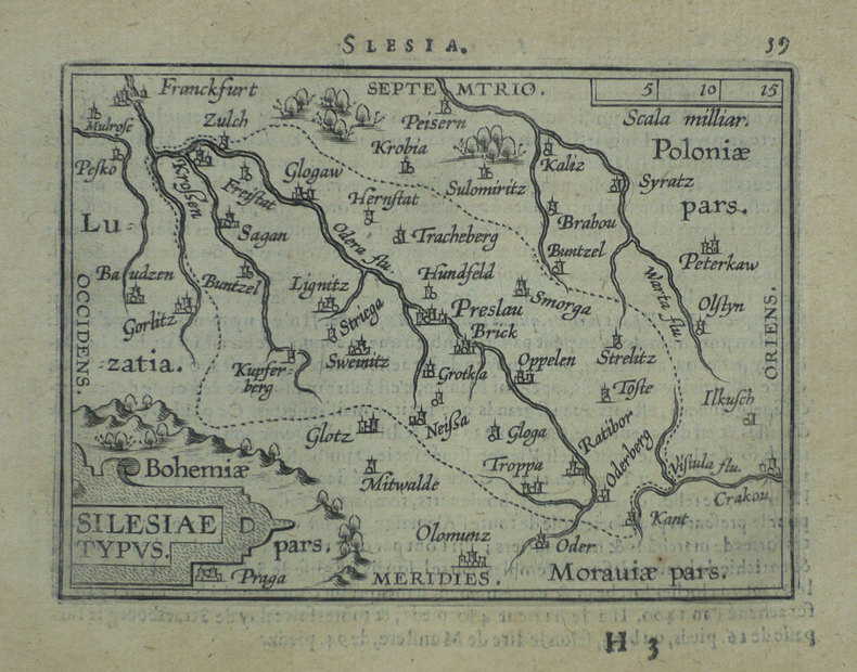
ORTELIUS (Abraham);
Silesiae typus.
Anvers 1598 81 x 106 mm.
书商的参考编号 : LBW-1391
|
|
|
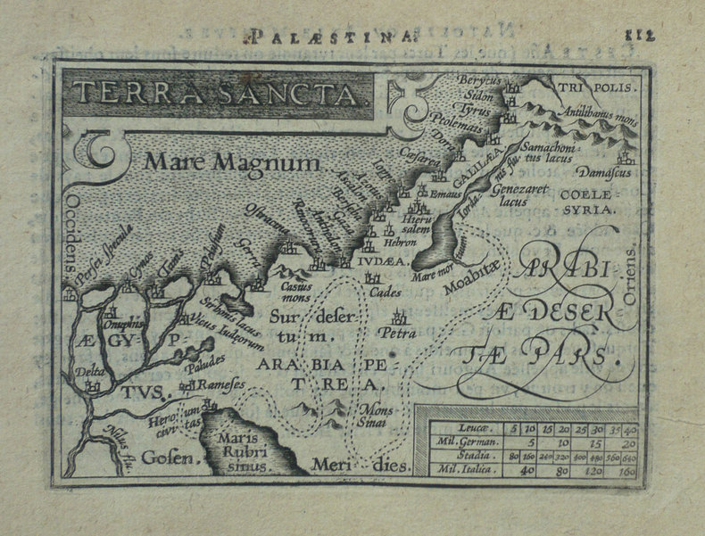
ORTELIUS (Abraham);
Terra sancta.
Anvers 1598 80 x 105 mm.
书商的参考编号 : LBW-1425
|
|
|
ORTELIUS, Abraham
Theatro del mondo. L'atlas de poche d'Ortelius
L’Atlas de poche d’Ortelius en italien, complet de ses 108 cartes à pleine page, conservé dans sa reliure de l’époque. Venetia, Per Scipion Banca, 1667. In-16 de (4) ff., 232 pp., (8) ff. 108 cartes gravées à pleine page. Relié en vélin rigide de l’époque. Ex libris manuscrit sur le faux titre : « Bibliotheca Neorelli ». 133 x 93 mm.
书商的参考编号 : LCS-1863

|
|
|
ORTELIUS (Abraham);
Turcicum Imperium.
Anvers 1598 81 x 105 mm.
书商的参考编号 : LBW-1428

|
|
 ?????????
 ?????PDF???
 RSS feed


