No date. Ca. 1960s. Vintage poster two color brown and yellow photo litho 36 x 24 inches. Very light creasing from rolling at lower left soft crease to upper right corner; very good condition. Printed in U.S.A. PS-102. Originally Southwest Airways founded in 1941; in 1958 became Pacific Air Lines; in 1968 merged as Hughes Air West. . unknown
England: Canadian Pacific. Paperback. Approximately 5.5" x 4.5" four-panel folded card with illustration of 1786 chariot upon front cover. Appears to have been printed at sea on or about July 30th 1962. Documents dates locations distances weather remarks etc. of the first half of the trip which departed Liverpool on July 24th. Ink-stamped signature of Captain C.L. de H. Bell upon second panel plus details of other crew officers. Light wear. Clean and unmarked. A quality copy of this nice memento. . Good. 1962. First Edition. Canadian Pacific paperback
England: Canadian Pacific. Paperback. This approx. 10" x 7" four-panel menu describes a magnificent selection of offerings. The front and back panels feature famous Jackfish Curve along the northern edge of Lake Superior in Ontario. Unmarked. Moderate wear. A nice memento of this voyage. . Good. 1952. First Edition. Canadian Pacific paperback
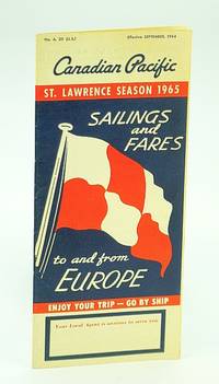
Canada: Canadian Pacific. Paperback. Folds out to a very informative illustrated 9" x 8" booklet of 12 pages printed in blue and red. Unmarked with light wear. A nice vintage copy. . Very Good. 1964. First Edition. Canadian Pacific paperback
Canada: Canadian Pacific. Paperback. 12 pages. Illustration of the "Empress of Scotland" on front cover. A very detailed fare guide which describes various classes of sailings from Montreal and Quebec to Southampton Cherbourg Hamburg Liverpool Belfast-Glasgow and Antwerp. Average external wear and fading soiling. A quality copy of this wonderful vintage item. . Good. 1924. First Edition. Canadian Pacific paperback
Seattle:: Sasquatch Books 2001. . A Fine tight copy in a Fine price-clipped dust jacket. Derek Hayes author of Historical Atlas of the Pacific Northwest delivers another stunning atlas filled with stories of explorations and exquisite historical maps. Over five hundred years of maps depicting the North Pacific Ocean and the lands that border it�the United States Canada Alaska Russia Japan Korea and China�have been collected into this new atlas. From antique maps of the sixteenth century to modern satellite images this volume covers all the major explorations such as Magellan Bering Cook and Vancouver; Perry�s opening of Japan; and the U.S. North Pacific Exploring Expedition. It also includes modern maps that use the latest technology to show ocean currents fault lines and the seabed in astounding detail. Sasquatch Books, unknown
Mountain View California: Press Publishing Association 1933. 324pp.incl.index; HB green w/gilt; corners&edges rubbed; foredge trimmed in green marble; green marble endpapers w/cleantight pgs. loose hinges. Rough trans: "The Road to Health" -- Treatise on anatomy physiology & hygiene with scientific descriptions of diseases causes & treatment from the writings of numerous medical experts. illus. Spanish lang. Hard Cover. Very Good/No Jacket. 8vo - over 7�" - 9�" tall. Press Publishing Association Hardcover
Balboa Press. Hardcover. 1452537240 BRAND NEW GIFT QUALITY! NOT OVERSTOCKS OR MARKED UP REMAINDERS! DIRECT FROM THE PUBLISHER!VCF . New. Balboa Press hardcover
Bookseller reference : OTF-Y-9781452537245 ISBN : 1452537240 9781452537245
Balboa Press. PAPERBACK. 1452537232 BRAND NEW GIFT QUALITY! NOT OVERSTOCKS OR MARKED UP REMAINDERS! DIRECT FROM THE PUBLISHER!VCF . New. Balboa Press paperback
Bookseller reference : OTF-Y-9781452537238 ISBN : 1452537232 9781452537238
Toronto: The Gardiner Museum of Ceramic Art 2002. Soft cover. Near Fine. Catalogue from a 2002 community art installation whereby more than 400 participants including children seniors artists and amateurs made ceramic wheels expressing individual themes The resulting artifacts formed their own miniature city alive with multiple identities. Essays by Pacific curator / artist Sanjit Sethi & exhibit designer Philip Beasley. White illustrated wraps. 130 pages with colour and B&W illustrations / photos. Square 16mo 6 1/4" x 6 1/4". Very slight edgewear & smudging to covers. <br/> <br/> The Gardiner Museum of Ceramic Art paperback
Bookseller reference : 004884 ISBN : 0969938659 9780969938651
2018. Hardcover. New. Lang: - eng Pages 48. Reprinted in 2018 with the help of original edition published long back 1962. This book is Printed in black & white Hardcover sewing binding for longer life with Matt laminated multi-Colour Dust Cover Printed on high quality Paper re-sized as per Current standards professionally processed without changing its contents. As these are old books we processed each page manually and make them readable but in some cases some pages which are blur or missing or black spots. If it is multi volume set then it is only single volume. We expect that you will understand our compulsion in these books. We found this book important for the readers who want to know more about our old treasure so we brought it back to the shelves. Any type of Customisation is possible. Hope you will like it and give your comments and suggestions. hardcover
2018. Softcover. New. Lang: - eng Pages 48. Reprinted in 2018 with the help of original edition published long back 1962. This book is Printed in black & white sewing binding for longer life with Matt laminated multi-Colour Soft Cover HARDCOVER EDITION IS ALSO AVAILABLE Printed on high quality Paper re-sized as per Current standards professionally processed without changing its contents. As these are old books we processed each page manually and make them readable but in some cases some pages which are blur or missing or black spots. If it is multi volume set then it is only single volume. We expect that you will understand our compulsion in these books. We found this book important for the readers who want to know more about our old treasure so we brought it back to the shelves. Any type of Customisation is possible. Hope you will like it and give your comments and suggestions. paperback
Adam and Charles Black London 1908. Reprint. hardcover. Fair Condition. Illustrator: maps & frontispiece. handled worn rubbed rear panel marked the colour illustration facing page 243 has a tear and immediately following page 272 is the remains of a table of signalling flags. the memorandum has been filled out in pencil and would appear that a plate from between pages 96 and 97 is missing. The maps appear all to be present including the foldout map showing the railways of the United States with lines of the P & O and that connecting routes on the verso Size: 8vo - over 7�" - 9�" tall. 272 pages. Please refer to accompanying picture s. Illustrator: maps & frontispiece. Quantity Available: 1. Category: Travel & Places; England; Ships & the Sea. Inventory No: 0256631. . Adam and Charles Black hardcover
R. R. Donnelley & Sons 1956. Hardcover. Good. Disclaimer:A copy that has been read but remains in clean condition. All pages are intact and the cover is intact. The spine may show signs of wear. Pages can include limited notes and highlighting and the copy can include previous owner inscriptions. At ThriftBooks our motto is: Read More Spend Less.Shelf and handling wear to cover and binding with general signs of previous use. Bowed boards. Employee business card stapled to front free endpaper note in pen at top edge. Company flyer stapled to reverse side of front free endpaper one address circled. Light soiling of covers. Secure packaging for safe delivery.Dust jacket quality is not guaranteed. R. R. Donnelley & Sons hardcover
San Francisco: PASA 1929. Book. Very Good. Hardcover. Signed Association. 12mo brown cloth. 24pp. The service booklet of one Arne Monssen who was born in Norway in 1900. This seaman served on the following vessels out of Seattle according to the folded signed Certificate in the back pocket: Queen Dorothy Alexander 4 times Curacao 3 Admiral Farragut Victoria 2 & Admiral Moser. It gives the dates of service & various capacities. Seven pages of the booklet are fully filled out. Signature of the General Manager on appropriate line on the printed front paste down. Vg. Soiling to covers & also Monssen's printed name at top. PASA Hardcover
San Francisco: Pacific American Company 1894. Vol VI. ; No. 4. Paperback. Covers lightly soiled else Very Good. Large format 4to 12 1/2 by 9 1/4 inches in stapled illustrated white wrappers; 30pp b/w illus and adverts. VERY RARE. World Cat locates no holdings for this serial title ; RLIN lists one which is only for vol.7 no.3 Sept. 1894. // Western Americana California Military history; Military biography; Periodicals. California--Biography. <br/><br/> Pacific American Company paperback
San Francisco: Pacific American Company 1894. Vol VI. ; No. 4. Paperback. Very clean. Near Fine -. Large format 4to 12 1/2 by 9 1/4 inches in stapled illustrated wrappers; 30pp b/w illus and adverts. VERY RARE. World Cat locates no holdings for this title ; RLIN lists one which is only for vol.7 no.3 Sept. 1894. // Western Americana California Military history; Military biography; Periodicals. California--Biography. <br/><br/> Pacific American Company paperback
San Francisco: Pacific American Company 1896. Vol IX Nos 13 & 19. Paperback. Very Good- to Very Good with crease fold down center of No 13. Large Octavo 11 1/2 by 8 1/2 inches and 12 by 8 1/2 respectively in stapled illustrated wrappers; 10 numbered pages adverts; numerous b/w illus. VERY RARE. Both World Cat & RLIN locate no copies Western Americana California Military history; Military biography; Periodicals. California--Biography. <br/><br/> Pacific American Company paperback
Berkeley: Pacific and Asian American Center for Theology and Strategies PACTS 1979. 31p. staplebound wraps 5.5x8.5 inches. Laid in is a brochure introducing the group and its work. Pacific and Asian American Center for Theology and Strategies (PACTS) unknown
Various places 1872. Twelve cards each 17 x 13 inches a.e.g. with manuscript captions in lower margins. Images are 9 x 6 1/2 inches except the two oval images of San Francisco. Some minor soiling on cards some images slightly faded. Very good. Archivally matted protected with a mylar sheet. An excellent collection of views quite early for Hawaii and New Zealand. The four views of Honolulu include one wide view of the town a view of a side street with a church steeple in the background the Pali mountain pass and the harbor with several large vessels at anchor. In New Zealand the Supreme Court building in Christchurch and the city of Littleton are displayed. The San Francisco images include the Palace Hotel and the famous Cliff House. Of particular interest are the three views of the Central Pacific Railway. The sections of the track include Capestown the Palisade and Summit Station each with fresh evidence of the line's recent completion. Also in the collection is one image of a railroad along the banks of Salt Lake and three wide views of Salt Lake City one with the Mormon tabernacle completed in 1871 prominently featured. An attractive collection of views each quite displayable. unknown
Berkeley: Pacific and Asian American Center for Theology and Strategies PACTS 1979. 18p. staplebound wraps 8.5x11 inches. Pacific and Asian American Center for Theology and Strategies (PACTS) unknown
2020. Paperback. New. Lang: - English Pages 46. Reprinted in 2020 with the help of original edition published long back 1851. This book is Printed in black & white sewing binding for longer life with Matt laminated multi-Colour Soft Cover HARDCOVER EDITION IS ALSO AVAILABLE Printed on high quality Paper re-sized as per Current standards professionally processed without changing its contents. As these are old books we processed each page manually and make them readable but in some cases some pages which are blur or missing or black spots. If it is multi volume set then it is only single volume if you wish to order a specific or all the volumes you may contact us. We expect that you will understand our compulsion in these books. We found this book important for the readers who want to know more about our old treasure so we brought it back to the shelves. Any type of Customisation is possible with extra charges. Hope you will like it and give your comments and suggestions. paperback
2020. Hardcover. New. Lang: - English Pages 46. Reprinted in 2020 with the help of original edition published long back 1851. This book is Printed in black & white Hardcover sewing binding for longer life with Matt laminated multi-Colour Dust Cover Printed on high quality Paper re-sized as per Current standards professionally processed without changing its contents. As these are old books we processed each page manually and make them readable but in some cases some pages which are blur or missing or black spots. If it is multi volume set then it is only single volume if you wish to order a specific or all the volumes you may contact us. We expect that you will understand our compulsion in these books. We found this book important for the readers who want to know more about our old treasure so we brought it back to the shelves. Any type of Customisation is possible with extra charges. Hope you will like it and give your comments and suggestions. hardcover
Berkeley: Pacific and Asian American Center for Theology and Strategies PACTS 1979. 31p. staplebound wraps 5.5x8.5 inches. Laid in is a brochure introducing the group and its work. Pacific and Asian American Center for Theology and Strategies (PACTS) unknown books
Berkeley: Pacific and Asian American Center for Theology and Strategies PACTS 1979. 18p. staplebound wraps 8.5x11 inches. Pacific and Asian American Center for Theology and Strategies (PACTS) unknown books
Various places 1872. Twelve cards each 17 x 13 inches a.e.g. with manuscript captions in lower margins. Images are 9 x 6 1/2 inches except the two oval images of San Francisco. Some minor soiling on cards some images slightly faded. Very good. Archivally matted protected with a mylar sheet. An excellent collection of views quite early for Hawaii and New Zealand. The four views of Honolulu include one wide view of the town a view of a side street with a church steeple in the background the Pali mountain pass and the harbor with several large vessels at anchor. In New Zealand the Supreme Court building in Christchurch and the city of Littleton are displayed. The San Francisco images include the Palace Hotel and the famous Cliff House. Of particular interest are the three views of the Central Pacific Railway. The sections of the track include Capestown the Palisade and Summit Station each with fresh evidence of the line's recent completion. Also in the collection is one image of a railroad along the banks of Salt Lake and three wide views of Salt Lake City one with the Mormon tabernacle completed in 1871 prominently featured. An attractive collection of views each quite displayable. unknown books
Honolulu: Bishop Museum Press 1978. First Edition. Paperback. Near Fine. First edition in tall decorated bound wrappers. 293 pp. Profusely illustrated with several hundred photographs of relics discovered on Cook's journeys. <br/><br/> Bishop Museum Press paperback
2019. Leather Bound. New. Leather Binding on Spine and Corners with Golden Leaf Printing on round Spine. Reprinted in 2019 with the help of original edition published long back 1877. This book is printed in black & white sewing binding for longer life Printed on high quality Paper re-sized as per Current standards professionally processed without changing its contents. As these are old books we processed each page manually and make them readable but in some cases some pages which are blur or missing or black spots. If it is multi volume set then it is only single volume if you wish to order a specific or all the volumes you may contact us. We expect that you will understand our compulsion in these books. We found this book important for the readers who want to know more about our old treasure so we brought it back to the shelves. Hope you will like it and give your comments and suggestions. Lang: - eng Pages 48. EXTRA 10 DAYS APART FROM THE NORMAL SHIPPING PERIOD WILL BE REQUIRED FOR LEATHER BOUND BOOKS. FOLIO EDITION IS ALSO AVAILABLE. hardcover
2020. Paperback. New. Lang: - eng Pages 44. Reprinted in 2020 with the help of original edition published long back 1877. This book is Printed in black & white sewing binding for longer life with Matt laminated multi-Colour Soft Cover HARDCOVER EDITION IS ALSO AVAILABLE Printed on high quality Paper re-sized as per Current standards professionally processed without changing its contents. As these are old books we processed each page manually and make them readable but in some cases some pages which are blur or missing or black spots. If it is multi volume set then it is only single volume if you wish to order a specific or all the volumes you may contact us. We expect that you will understand our compulsion in these books. We found this book important for the readers who want to know more about our old treasure so we brought it back to the shelves. Any type of Customisation is possible with extra charges. Hope you will like it and give your comments and suggestions. paperback
2020. Hardcover. New. Lang: - eng Pages 44. Reprinted in 2020 with the help of original edition published long back 1877. This book is Printed in black & white Hardcover sewing binding for longer life with Matt laminated multi-Colour Dust Cover Printed on high quality Paper re-sized as per Current standards professionally processed without changing its contents. As these are old books we processed each page manually and make them readable but in some cases some pages which are blur or missing or black spots. If it is multi volume set then it is only single volume if you wish to order a specific or all the volumes you may contact us. We expect that you will understand our compulsion in these books. We found this book important for the readers who want to know more about our old treasure so we brought it back to the shelves. Any type of Customisation is possible with extra charges. Hope you will like it and give your comments and suggestions. hardcover
2020. Paperback. New. Lang: - eng Pages 48. Reprinted in 2020 with the help of original edition published long back 1877. This book is Printed in black & white sewing binding for longer life with Matt laminated multi-Colour Soft Cover HARDCOVER EDITION IS ALSO AVAILABLE Printed on high quality Paper re-sized as per Current standards professionally processed without changing its contents. As these are old books we processed each page manually and make them readable but in some cases some pages which are blur or missing or black spots. If it is multi volume set then it is only single volume if you wish to order a specific or all the volumes you may contact us. We expect that you will understand our compulsion in these books. We found this book important for the readers who want to know more about our old treasure so we brought it back to the shelves. Any type of Customisation is possible with extra charges. Hope you will like it and give your comments and suggestions. paperback
2020. Hardcover. New. Lang: - eng Pages 48. Reprinted in 2020 with the help of original edition published long back 1877. This book is Printed in black & white Hardcover sewing binding for longer life with Matt laminated multi-Colour Dust Cover Printed on high quality Paper re-sized as per Current standards professionally processed without changing its contents. As these are old books we processed each page manually and make them readable but in some cases some pages which are blur or missing or black spots. If it is multi volume set then it is only single volume if you wish to order a specific or all the volumes you may contact us. We expect that you will understand our compulsion in these books. We found this book important for the readers who want to know more about our old treasure so we brought it back to the shelves. Any type of Customisation is possible with extra charges. Hope you will like it and give your comments and suggestions. hardcover
San Francisco: Pacific Art Company 1903. Large Octavo. 634p. Portraits and biographies of each of the major businessmen of the Pacific West Coast. Of course it has all sorts of professional men such as doctors and lawyers or furniture salesman but there is also a photograph of Jack London who had just published "The Son of the Wolf" Ambrose Bierce; Hubert Howe Bancroft Charles Lummis Joaquin Miller and on one page the Big Four Stanford Huntington Hopkins and Crocker the McClatchys of Sacramento Bound in full dark brown leather lettered and decorated in gilt spine lettring gilt spine has changed to lighter shade of brown top edge gilt gilt turn-ins marbled endpapers a very nice clean copy. <br/><br/> Pacific Art Company hardcover
Inglewood CA: Pacific Arts and Crafts 1958. First Edition. Paperback. Very Good. Size=11"x8.5". B/W Photos and Drawings. full book description Pacific Arts and Crafts Inglewood CA 1958. 1st PB Edition VG Paperback Size=11"x8.5" 501-518B. B/W Photos and Drawings. Spine cover rubbed & nicked covers have 3 fore-edge creases o.w. clean tight and bright. No ink names tears chips etc. Contents in Fine condition. Mosaics; Decorative Arts; Interior Decoration; Tesserae; Colored Glass; Colored Stones SELLING WORLDWIDE SINCE 1987. WE ALWAYS PACK WITH GREAT CARE! Pacific Arts and Crafts paperback
Pacific Arts & Crafts. Good with no dust jacket. 1958. Softcover. B001569; 50 pages; 50 pp Oversized booklet good contents & wraps A473 . Pacific Arts & Crafts paperback
TEMPE AZ.: PACIFIC ARTS ASSOCIATION. VG- IN WRAPS. STAPLED BOOKLET. CREASE AT UPPER CENTER EDGE. Pages: 28. . 1959. TRADE PAPERBACK. PACIFIC ARTS ASSOCIATION paperback
 Receive by email
 Download as PDF document
 RSS feed