|
Otero Jose Pacifico
La Revolucion De Mayo y Su Influencia En America
Buenos Aires: Acadameia National De Historia y De Geografia De Mejico 1938. very good hardcover with no dust jacket. Some wear. 1938. Text in Spanish. Hard Cover. Very Good/No Dust Cover. Acadameia National De Historia y De Geografia De Mejico Hardcover
Bookseller reference : 160602-MG18
|
|
|
Otero Jose Pacifico
La révolution argentine 1810-1816 : thèse présentée pour le doctorat d'Université devant la Faculté des lettres de l'Université de Paris / par José P. Otero 1917 Leather Bound
2019. Leather Bound. New. Leather Binding on Spine and Corners with Golden Leaf Printing on round Spine. Reprinted in 2019 with the help of original edition published long back 1917. This book is printed in black & white sewing binding for longer life Printed on high quality Paper re-sized as per Current standards professionally processed without changing its contents. As these are old books we processed each page manually and make them readable but in some cases some pages which are blur or missing or black spots. If it is multi volume set then it is only single volume if you wish to order a specific or all the volumes you may contact us. We expect that you will understand our compulsion in these books. We found this book important for the readers who want to know more about our old treasure so we brought it back to the shelves. Hope you will like it and give your comments and suggestions. Lang: - French Pages 335. EXTRA 10 DAYS APART FROM THE NORMAL SHIPPING PERIOD WILL BE REQUIRED FOR LEATHER BOUND BOOKS. FOLIO EDITION IS ALSO AVAILABLE. hardcover
Bookseller reference : LB1111004039306
|
|
|
Otero Jose Pacifico
La r�volution argentine 1810-1816 : th�se pr�sent�e pour le doctorat d'Universit� devant la Facult� des lettres de l'Universit� de Paris / par Jos� P. Otero 1917 Hardcover
2020. Hardcover. New. Lang: - French Pages 335. Reprinted in 2020 with the help of original edition published long back 1917. This book is Printed in black & white Hardcover sewing binding for longer life with Matt laminated multi-Colour Dust Cover Printed on high quality Paper re-sized as per Current standards professionally processed without changing its contents. As these are old books we processed each page manually and make them readable but in some cases some pages which are blur or missing or black spots. If it is multi volume set then it is only single volume if you wish to order a specific or all the volumes you may contact us. We expect that you will understand our compulsion in these books. We found this book important for the readers who want to know more about our old treasure so we brought it back to the shelves. Any type of Customisation is possible with extra charges. Hope you will like it and give your comments and suggestions. hardcover
Bookseller reference : 1111004039306
|
|
|
Otero Jose Pacifico
La r�volution argentine 1810-1816 : th�se pr�sent�e pour le doctorat d'Universit� devant la Facult� des lettres de l'Universit� de Paris / par Jos� P. Otero 1917
2020. Paperback. New. Lang: - French Pages 335. Reprinted in 2020 with the help of original edition published long back 1917. This book is Printed in black & white sewing binding for longer life with Matt laminated multi-Colour Soft Cover HARDCOVER EDITION IS ALSO AVAILABLE Printed on high quality Paper re-sized as per Current standards professionally processed without changing its contents. As these are old books we processed each page manually and make them readable but in some cases some pages which are blur or missing or black spots. If it is multi volume set then it is only single volume if you wish to order a specific or all the volumes you may contact us. We expect that you will understand our compulsion in these books. We found this book important for the readers who want to know more about our old treasure so we brought it back to the shelves. Any type of Customisation is possible with extra charges. Hope you will like it and give your comments and suggestions. paperback
Bookseller reference : PB1111004039306
|
|
|
Otero Pacifico
Fray Caetano 1908 Leather Bound
2019. Leather Bound. New. Leather Binding on Spine and Corners with Golden Leaf Printing on round Spine. Reprinted in 2019 with the help of original edition published long back 1908. This book is printed in black & white sewing binding for longer life Printed on high quality Paper re-sized as per Current standards professionally processed without changing its contents. As these are old books we processed each page manually and make them readable but in some cases some pages which are blur or missing or black spots. If it is multi volume set then it is only single volume if you wish to order a specific or all the volumes you may contact us. We expect that you will understand our compulsion in these books. We found this book important for the readers who want to know more about our old treasure so we brought it back to the shelves. Hope you will like it and give your comments and suggestions. Lang: - spa Pages 172. EXTRA 10 DAYS APART FROM THE NORMAL SHIPPING PERIOD WILL BE REQUIRED FOR LEATHER BOUND BOOKS. FOLIO EDITION IS ALSO AVAILABLE. hardcover
Bookseller reference : LB1111000758421
|
|
|
Otero Pacifico
Fray Caetano 1908
2020. Paperback. New. Lang: - spa Pages 172. Reprinted in 2020 with the help of original edition published long back 1908. This book is Printed in black & white sewing binding for longer life with Matt laminated multi-Colour Soft Cover HARDCOVER EDITION IS ALSO AVAILABLE Printed on high quality Paper re-sized as per Current standards professionally processed without changing its contents. As these are old books we processed each page manually and make them readable but in some cases some pages which are blur or missing or black spots. If it is multi volume set then it is only single volume if you wish to order a specific or all the volumes you may contact us. We expect that you will understand our compulsion in these books. We found this book important for the readers who want to know more about our old treasure so we brought it back to the shelves. Any type of Customisation is possible with extra charges. Hope you will like it and give your comments and suggestions. paperback
Bookseller reference : PB1111000758421
|
|
|
Otero Pacifico
Fray Caetano 1908 Hardcover
2020. Hardcover. New. Lang: - spa Pages 172. Reprinted in 2020 with the help of original edition published long back 1908. This book is Printed in black & white Hardcover sewing binding for longer life with Matt laminated multi-Colour Dust Cover Printed on high quality Paper re-sized as per Current standards professionally processed without changing its contents. As these are old books we processed each page manually and make them readable but in some cases some pages which are blur or missing or black spots. If it is multi volume set then it is only single volume if you wish to order a specific or all the volumes you may contact us. We expect that you will understand our compulsion in these books. We found this book important for the readers who want to know more about our old treasure so we brought it back to the shelves. Any type of Customisation is possible with extra charges. Hope you will like it and give your comments and suggestions. hardcover
Bookseller reference : 1111000758421
|
|
|
Otero Jose Pacifico
El padre Casta�eda : su obra ante la posteridad y en la historia / por Pac�fico Otero. 1907 Hardcover
2020. Hardcover. New. Lang: - spa Pages 172. Reprinted in 2020 with the help of original edition published long back 1907. This book is Printed in black & white Hardcover sewing binding for longer life with Matt laminated multi-Colour Dust Cover Printed on high quality Paper re-sized as per Current standards professionally processed without changing its contents. As these are old books we processed each page manually and make them readable but in some cases some pages which are blur or missing or black spots. If it is multi volume set then it is only single volume if you wish to order a specific or all the volumes you may contact us. We expect that you will understand our compulsion in these books. We found this book important for the readers who want to know more about our old treasure so we brought it back to the shelves. Any type of Customisation is possible with extra charges. Hope you will like it and give your comments and suggestions. hardcover
Bookseller reference : 1111014866019
|
|
|
Otero Jose Pacifico .
El padre Casta�eda : su obra ante la posteridad y en la historia / por Pac�fico Otero. 1907
2020. Paperback. New. Lang: - spa Pages 172. Reprinted in 2020 with the help of original edition published long back 1907. This book is Printed in black & white sewing binding for longer life with Matt laminated multi-Colour Soft Cover HARDCOVER EDITION IS ALSO AVAILABLE Printed on high quality Paper re-sized as per Current standards professionally processed without changing its contents. As these are old books we processed each page manually and make them readable but in some cases some pages which are blur or missing or black spots. If it is multi volume set then it is only single volume if you wish to order a specific or all the volumes you may contact us. We expect that you will understand our compulsion in these books. We found this book important for the readers who want to know more about our old treasure so we brought it back to the shelves. Any type of Customisation is possible with extra charges. Hope you will like it and give your comments and suggestions. paperback
Bookseller reference : PB1111014866020
|
|
|
Otero Jose Pacifico .
Estudio biogr�fico sobre fray Cayetano Jos� Rodriguez y recopilacion de sus producciones literarias por fray Pac�fico Otero . precedido de un juicio cr�tico de Don Alberto del Solar. 1899 Hardcover
2020. Hardcover. New. Pages 268. Reprinted in 2020 with the help of original edition published long back 1899. This book is Printed in black & white Hardcover sewing binding for longer life with Matt laminated multi-Colour Dust Cover Printed on high quality Paper re-sized as per Current standards professionally processed without changing its contents. As these are old books we processed each page manually and make them readable but in some cases some pages which are blur or missing or black spots. If it is multi volume set then it is only single volume if you wish to order a specific or all the volumes you may contact us. We expect that you will understand our compulsion in these books. We found this book important for the readers who want to know more about our old treasure so we brought it back to the shelves. Any type of Customisation is possible with extra charges. Hope you will like it and give your comments and suggestions. hardcover
Bookseller reference : 1111013753451
|
|
|
Otero Jose Pacifico .
Estudio biogr�fico sobre fray Cayetano Jos� Rodriguez y recopilacion de sus producciones literarias por fray Pac�fico Otero . precedido de un juicio cr�tico de Don Alberto del Solar. 1899 Hardcover
2020. Hardcover. New. Pages 270. Reprinted in 2020 with the help of original edition published long back 1899. This book is Printed in black & white Hardcover sewing binding for longer life with Matt laminated multi-Colour Dust Cover Printed on high quality Paper re-sized as per Current standards professionally processed without changing its contents. As these are old books we processed each page manually and make them readable but in some cases some pages which are blur or missing or black spots. If it is multi volume set then it is only single volume if you wish to order a specific or all the volumes you may contact us. We expect that you will understand our compulsion in these books. We found this book important for the readers who want to know more about our old treasure so we brought it back to the shelves. Any type of Customisation is possible with extra charges. Hope you will like it and give your comments and suggestions. hardcover
Bookseller reference : 1111013753452
|
|
|
Otero Jose Pacifico
Fray Cayetano Spanish Edition
Nabu Press 2010-10-15. Paperback. Good. Nabu Press paperback
Bookseller reference : SONG1172271941 ISBN : 1172271941 9781172271948

|
|
|
Otero Pacifico Jose
Estudio Biografico Sobre Fray Cayetano Jose Rodriguez
Cordoba. 1899. First Edition. Very good bound without title page or frontis wear to extrems; 236 pp & indexes; leather bound marbled endpapers t.e.g. . hardcover
Bookseller reference : 27224
|
|
|
Otero Pacifico
Fray Caetano Spanish Edition
Nabu Press 2010-09-28. Paperback. Good. Nabu Press paperback
Bookseller reference : SONG1173118624 ISBN : 1173118624 9781173118624

|
|
|
Other Contributor Asia and South Pacific Design Automation
Proceedings of the ASP-Dac 2005: Asia and South Pacific Design Automation Conference 2005: January 18-21 2005 Hotel Equatorial Shanghai China Volumes 1 & 2
Institute of Electrical & Electronics Enginee 2005-01-29. Paperback. Good. Institute of Electrical & Electronics Enginee paperback
Bookseller reference : SONG0780387368 ISBN : 0780387368 9780780387362
|
|
|
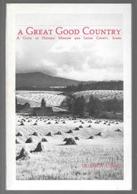
Otness Lilllian W.
A Great Good Country : A Guide to Historic Moscow and Latah County Idaho
Moscow ID: Latah County Historical Society. Very Good with no dust jacket. 1983. First Edition. Paperback. 0914429108 . Author's signature in ink on title page. Gift inscription in ink on first page. No other marking or writing noted in book. Binding is tight and pages are clean. Text block and gutters are firm. 186 pages.; 8vo 8" - 9" tall; 186 pages; Signed by Author . Latah County Historical Society paperback
Bookseller reference : 21006 ISBN : 0914429108 9780914429104
|
|
|
OVIDIO PUBLIO NASONE
LE METAMORFOSI SCELTA ( PROVASI PACIFICO ) TESTO A FRONTE
|
|
|
Owen, R.D.
On Hypsiprymnodon, Ramsey, a Genus indicative of a distinct Family (pleopodidae) in the Diprotodont Section of the Marsupialia.
1878 10 p., 3 figs, 2 (1 col.) lithographed pls, 4to, modern wrappers. The coloured plate by J. Wolf. Published in: Transactions Linnaean Society. Zoology.
Bookseller reference : VZ00836
|
|
|
Owen, R.D.
On the Osteology of the Marsupialia. Part III. Modifications of the Skeleton in the Species of Phascolomys.
1873 16 p., 8 lithographed pls, roy. 4to, disbound. Published in: Transactions of the Zoological Society of London.
Bookseller reference : VZ01553
|
|
|
Owen, R.D.
On Hypsiprymnodon, Ramsey, a Genus indicative of a distinct Family (pleopodidae) in the Diprotodont Section of the Marsupialia.
1878 10 p., 3 figs, 2 (1 col.) lithographed pls, 4to, plain wrappers. The coloured plate by J. Wolf. Published in: Transactions Linnaean Society. Zoology.
Bookseller reference : VZ09530
|
|
|
Owen G. K Pacific Press Oakland Calif. bkp CU BANC
Perils and possibilities : a voice of warning and an appeal to the citizen and to the nation 1896 Leather Bound
2019. Leather Bound. New. Leather Binding on Spine and Corners with Golden Leaf Printing on round Spine. Reprinted in 2019 with the help of original edition published long back 1896. This book is printed in black & white sewing binding for longer life Printed on high quality Paper re-sized as per Current standards professionally processed without changing its contents. As these are old books we processed each page manually and make them readable but in some cases some pages which are blur or missing or black spots. If it is multi volume set then it is only single volume if you wish to order a specific or all the volumes you may contact us. We expect that you will understand our compulsion in these books. We found this book important for the readers who want to know more about our old treasure so we brought it back to the shelves. Hope you will like it and give your comments and suggestions. Lang: - eng Pages 208. EXTRA 10 DAYS APART FROM THE NORMAL SHIPPING PERIOD WILL BE REQUIRED FOR LEATHER BOUND BOOKS. FOLIO EDITION IS ALSO AVAILABLE. hardcover
Bookseller reference : LB1111005182506
|
|
|
Owen G. K Pacific Press Oakland Calif. bkp CU BANC
Perils and possibilities : a voice of warning and an appeal to the citizen and to the nation 1896
2020. Paperback. New. Lang: - eng Pages 208. Reprinted in 2020 with the help of original edition published long back 1896. This book is Printed in black & white sewing binding for longer life with Matt laminated multi-Colour Soft Cover HARDCOVER EDITION IS ALSO AVAILABLE Printed on high quality Paper re-sized as per Current standards professionally processed without changing its contents. As these are old books we processed each page manually and make them readable but in some cases some pages which are blur or missing or black spots. If it is multi volume set then it is only single volume if you wish to order a specific or all the volumes you may contact us. We expect that you will understand our compulsion in these books. We found this book important for the readers who want to know more about our old treasure so we brought it back to the shelves. Any type of Customisation is possible with extra charges. Hope you will like it and give your comments and suggestions. paperback
Bookseller reference : PB1111005182506
|
|
|
Owen G. K Pacific Press Oakland Calif. bkp CU BANC
Perils and possibilities : a voice of warning and an appeal to the citizen and to the nation 1896 Hardcover
2020. Hardcover. New. Lang: - eng Pages 208. Reprinted in 2020 with the help of original edition published long back 1896. This book is Printed in black & white Hardcover sewing binding for longer life with Matt laminated multi-Colour Dust Cover Printed on high quality Paper re-sized as per Current standards professionally processed without changing its contents. As these are old books we processed each page manually and make them readable but in some cases some pages which are blur or missing or black spots. If it is multi volume set then it is only single volume if you wish to order a specific or all the volumes you may contact us. We expect that you will understand our compulsion in these books. We found this book important for the readers who want to know more about our old treasure so we brought it back to the shelves. Any type of Customisation is possible with extra charges. Hope you will like it and give your comments and suggestions. hardcover
Bookseller reference : 1111005182506
|
|
|
Owen Lorrie K. editor
Dictionary Of California Historic Places - Volume One Alameda County - Nevada County
New York: Somerset. Very Good with No dust jacket as issued. 1997. Hardcover. Text is clean. Institutional stamp on front pastedown. Cover is bright cloth is clean. Some soiling to side text edges. . Somerset hardcover
Bookseller reference : 23754

|
|
|
Owens Adair B. A. Bethenia Angelina M. D.
DR. OWEN-ADAIR Some of Her Life Experiences
Portland: Privately Printed 1906. Book. Very Good. Hardcover. First Edition. 1st printing. Cloth. 537pp. Illus. Wiki says that the author "was an American social reformer and one of the first female physicians in Oregon." Minor wear to extremities; tear along gutter of one leaf archivally repaired. Scarce in 1st edit. Smith 20. Privately Printed Hardcover
Bookseller reference : 1412100
|
|
|
OZBURN, Charlton.
Guerilla en Birmanie, 1944 - 1945.
Paris, Presses de la Cité,. 1959. in-8. Relié. Bon état, Couv. convenable, Dos satisfaisant, Intérieur frais. 1959, in 8, reliure éditeur, photos, 314 pp.. . . . Classification Dewey : 996-Autres régions du pacifique
Bookseller reference : R300266768
|
|
|
P. O'REILLY
DOSSIER N°22. LA DANSE A TAHITI.
NOUVELLES EDITIONS LATINES. NON DATE. In-8. Broché. Bon état, Couv. convenable, Dos satisfaisant, Intérieur frais. 30 pages. Premier plat illustré en couleurs. Nombreuses photos et illustrations en noir et blanc, dans et hors texte.. . . . Classification Dewey : 996-Autres régions du pacifique
Bookseller reference : R260151109
|
|
|
P. A. DE SALINIS
Marins et Missionnaires - Conquête de la Nouvelle-Calédonie - 1843 - 1853 -
1892 Paris - Retaux et fils - 1892 - 1 volume in8 de 340 - couvertures conservées - Reliure demi maroquin brun à coins - mors frottés - Trés bon état intérieur -
Bookseller reference : GF35820
|
|
|
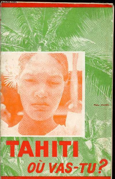
P. Mouly
Tahiti, ou vas tu?
Lectures missionnaires. 1965. In-8. Broché. Etat d'usage, Couv. défraîchie, Dos frotté, Intérieur acceptable. 162 pages. Nombreuses planches d'illustrations en noir et blanc dans et hors texte. Partiellement désolidarisé. . . . Classification Dewey : 996-Autres régions du pacifique
Bookseller reference : RO80208470
|
|
|
P. Hilarion Lucas
HISTOIRE DE LA MISSION DES ILES SANDWICH OU HAWAII 1825-1838
Un volume di317 pagine. Ritratto in antiporta, Testo in francese. Brossura editoriale. Resoconto della prima missione di conversione al cattolicesimo degli abitanti delle Hawaii condotta dal padre Hilarion Lucas (1782-1865) - Notevole fonte di informazioni sulla storia e i costumi della civiltà delle isola Sandwich all'inizio dell'Ottocento.
|
|
|
P. Pacifico Passionista
Onore al crocifisso!
PALERMO: Editore Lo Monaco 1965. Brossura. BUONO. 125 17. CIV0477 Saggio 016 USATO Editore Lo Monaco unknown
Bookseller reference : CIV0477-49C ISBN : 2560846463722 2560846463

|
|
|
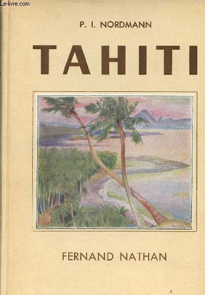
P.I.Nordmann
Tahiti.
Fernand Nathan. 1938. In-8. Relié. Etat d'usage, Coins frottés, Coiffe en pied abîmée, Intérieur frais. 160 pages - nombreuses photos en noir et blanc dans et hors texte - quelques illustrations en couleurs hors texte.. . . . Classification Dewey : 996-Autres régions du pacifique
Bookseller reference : R320142245
|
|
|
P.R.C.& R.A.S.
Prince Rupert: An Illustrated History
184 pages. "A captivating collection of 600 photographs that document over 100 years of the history of Prince Rupert, British Columbia and surrounding area." - dust jacket. Front free endpaper removed, otherwise clean, bright and unmarked with very light wear. Dust jacket now preserved in archival-grade Brodart. A quality copy of this attractively presented local history. Oblong 32 x 24cm. Book

|
|
|
PACIFIQUE DE VALIGNY, R.P. (1863-1943)
Chroniques des plus anciennes églises de l'Acadie : Bathurst, Pabos et Ristigouche, Rivière Saint-Jean, Memramcook
Montréal L'Echo de Saint-François 1944
Bookseller reference : 18976
|
|
|
PACIFIC SERENADERS
DISQUE VINYLE 33T : LES PLUS CELEBRES AIRS HAWAIIENS - Beyond the reef, Hawaiian wedding song, Mapuana, My little grass shack, Moon of manakoora, Now is the hour, Sweet lelani, Little brown girl, Hukilau, Mahala Pua, Beach at Waikiki, Aloha Oe
STEREO GOLD AWARD. NON DATE. In-12. Broché. Bon état, Couv. convenable, Dos satisfaisant, Intérieur frais. Pochette en couleurs.. . . . Classification : 410-33 Tours
Bookseller reference : R130011729
|
|
|
PACIFIQUE (Propagande américaine).
Evolution de la Guerre dans le Pacifique. L'Amérique riposte.
. 1945. in-4. Broché. Etat d'usage, Couv. défraîchie, Dos très frotté, Intérieur frais. Office d'Informations de Guerre des Etat-Unis, (1945), in 4, broché, nb. photos, (84 pp.). . . . Classification Dewey : 996-Autres régions du pacifique
Bookseller reference : R300266771
|
|
|
PACIFICO FRANCESCO
HISTOIRE DE MON INNOCENCE.
ROBERT LAFFONT. 2013. In-8. Broché. Bon état, Couv. convenable, Dos satisfaisant, Intérieur frais. 317 pages - illustration en couleurs sur le 1er plat.. . . . Classification Dewey : 850-Littératures italienne, roumaine, rhéto-romane
Bookseller reference : R240080360
|
|
|
PACIFIQUE ROUSSELET Augustin.
Histoire et description de l'église royale de Brou.
Elevée à Bourg en Bresse, sous les ordres de Marguerite d'Autriche entre les années 1511 et 1536. Bourg en Bresse. Comte, 1768. In-12 (17/10cm), VII-131 pages. Broché, sous couvertures muettes (le dos manque).
Bookseller reference : 4566
|
|
|
PACIFICO (Francesco)
Histoire de mon innocence
2013 Paris, Robert Laffont, 2013 13,5 x 21,5 cm, 318 pp, broché, couverture souple à rabats illustrée, état neuf,
Bookseller reference : 57990
|
|
|
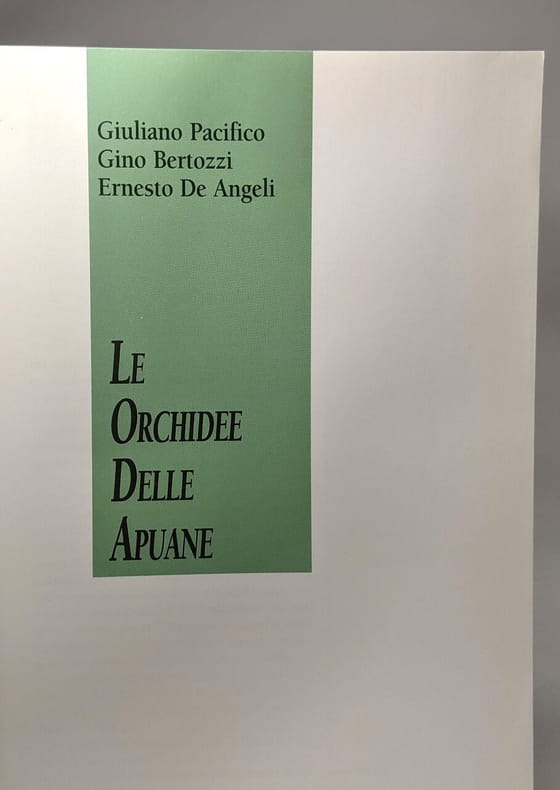
Pacifico Giuliano Bertozzi Gino De Angeli Ernesto
Le orchidee spontanee delle Apuane
Baroni 2000 208 pages in8. 2000. Broché. 208 pages. iconographie en couleurs et en noir et blanc
Bookseller reference : 100091460
|
|
|
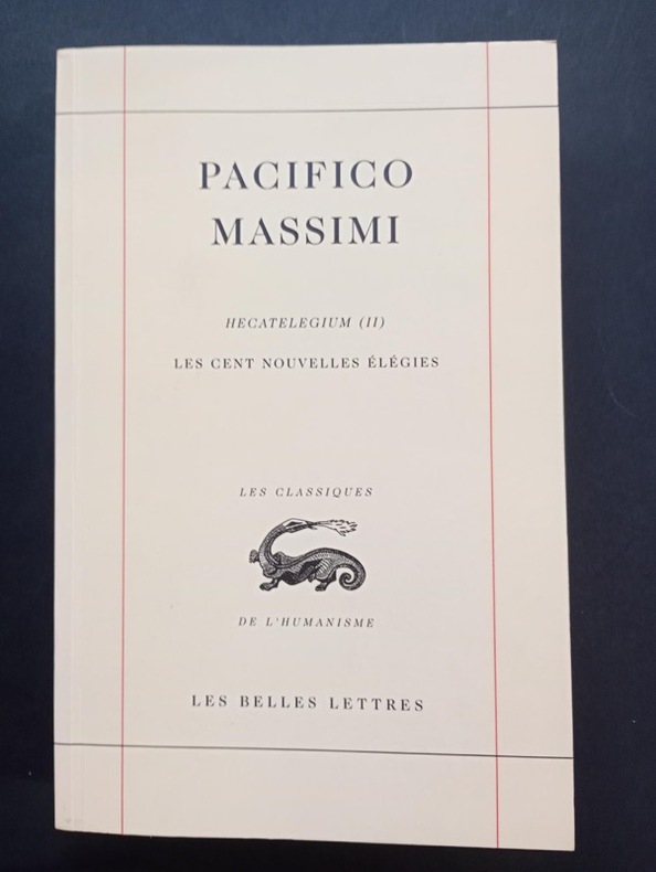
Pacifico Massimi
Les Cent nouvelles élégies - deuxième Hecatelegium. Tome II. Texte inédit, publié, traduit et présenté par Juliette Desjardins Daude
Les Belles Lettres, coll. « Les Classiques de l’Humanisme » 2008 In-8 broché 22,5 cm sur 14,6. 494 pages. Bon état d’occasion.
Bookseller reference : 133704
|
|
|
PACIFIQUE DE CALAIS (P.)
Traité du sacrifice de louanges établi par David sous la Loi par ses cantiques, sanctifié et continué par Jésus-Christ sous l'Evangile.
1740 rel. époque (mq. coiffe sup,; 1 mors fendu sur qq. cms). in-12, (10ff.), 409pp., (5ff.), Avignon Labaye 1740
Bookseller reference : 2168
|
|
|
Pace Iva ed.; Children of Tamalpais Valley School
Coast Miwok of Marin
San Rafael: Unicorn Printing 1980. Clean and well bound text; mild wear with slight wrinkle at binding margin a little rust to staples. In original green pictorial wraps 36 pages illustrated; a general introduction with bibliography. Edition Unstated. Soft Cover Staplebound. Good. Octavo. Unicorn Printing Paperback
Bookseller reference : 9075
|
|
|
Pacific
Captain Victory and the Galactic Rangers Edition# 4
Pacific. Used - Very Good. Very Good condition. Pacific unknown
Bookseller reference : H21Y-01315
|
|
|
Pacific
Corben Special a Edition# 1 Edgar Allen Poe
Pacific 1984. First edition. Wraps. New. Includes illustrations. Pacific paperback
Bookseller reference : Alibris.0076612
|
|
|
Pacific
Groo the Wanderer Sergio Aragonés'… #7
Pacific. Used - Good. Good condition. Slightly dampstained. Pacific unknown
Bookseller reference : C01I-00336
|
|
|
Pacific
Ravens and Rainbows Edition# 1
Pacific. Used - Very Good. Very Good condition. Pacific unknown
Bookseller reference : S00D-03259
|
|
|
PACIFIC
Redwoods. Pacific Wonderland U.S.A. Pacific Air Lines - we fly the nicest places.
No date. Ca. 1960s. Vintage poster two color brown and yellow photo litho 36 x 24 inches. Very light creasing from rolling at lower left soft crease to upper right corner; very good condition. Printed in U.S.A. PS-102. Originally Southwest Airways founded in 1941; in 1958 became Pacific Air Lines; in 1968 merged as Hughes Air West. . unknown
Bookseller reference : 34725

|
|
|
Pacific
Starslayer Edition# 6
Pacific. Used - Very Good. Very Good condition. Pacific unknown
Bookseller reference : F06H-05488
|
|
|
Pacific
Starslayer Edition# 30
Pacific. Used - Very Good. Very Good condition. Pacific unknown
Bookseller reference : F06H-03147
|
|
 Receive by email
 Download as PDF document
 RSS feed


