Onafhankelijke website van professionele boekhandelaars

‎Cartes‎

Main

Aantal treffers : 18.456 (370 pagina's)

Eerste pagina Vorige pagina 1 ... 58 59 60 [61] 62 63 64 ... 107 150 193 236 279 322 365 ... 370 Volgende pagina Laatste pagina

‎BARBIER (Claude) & SCHWARZ (Pierre-François)‎

‎Atlas Historique du Pays de Genève – Des Celtes au Grand Genève.‎

‎Ouvrage orné de cartes en dont 17 cartes hors-texte. La Salévienne, 2014. Petit in-4 (27,5x21,5cm) cartonnage souple illustré et plastifié. 134pp.‎

‎Bon état‎

Referentie van de boekhandelaar : WOC-687

Livre Rare Book

Librairie Hermès
Annemasse France Francia França France
[Books from Librairie Hermès]

€ 20,00 Kopen

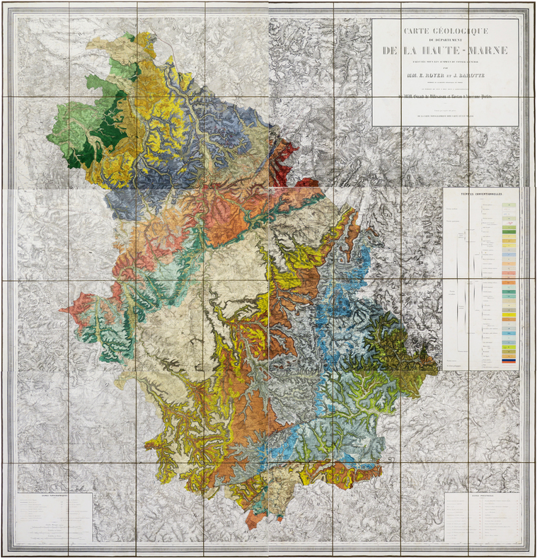
‎BAROTTE (Jules) & ROYER (Ernest).‎

‎Carte géologique du département de la Haute-Marne, exécutée sous les auspices du Conseil Général par MM. E. Royer et J. Barotte, membres de la Société Géologique de France, et publiée de 1859 à 1863 sous l'administration de MM. Girard de Villesaison et Rostan d'Ancezune, Préfets.‎

‎Nancy, Wiener Aîné Fils, 1859-1863. En six feuilles coupées en sections et montées sur toile brune, pouvant être jointes pour former une carte d'environ 1,72 x 1,63 m ; étiquette de l'éditeur Wiener Aîné Fils, papetier à Nancy, au dos de chaque carte ; sous emboîtage in-4 de papier marbré de l'époque.‎

‎Très rare carte monumentale lithographiée en couleurs, figurant la géologie du département de la Haute-Marne. Elle a été dressée par Ernest Royer et Jules Barotte, membres de la Société Géologique de France, fondée en 1830. Les formations sont identifiées à l'aide d'un système de couleurs : terrain moderne, terrain quaternaire, terrain secondaire, terrain ancien et accidents géologiques. Un encadré intitulé Signes industriels permet de repérer les souces minérales, les mines de fer, les exploitations de sable siliceux, les carrières de calcaire, les tuileries ou encore les usines travaillant le fer et l'acier. La cartographie géologique en France connut une impulsion décisive en 1841, lorsque Dufrénoy et de Beaumont réalisèrent la toute première carte géologique de la France. Cette carte servira de canevas au levé des cartes géologiques départementales. La carte géologique de la Haute-Marne fut réalisée grâce à la collection de minéraux et de fossiles que Jules Barotte rassembla lors de ses travaux dans le département. À notre connaissance, la carte de Barotte et Royer est la seconde carte géologique du département de la Haute-Marne à avoir été publiée. Elle est basée sur la première, réalisée par A. Duhamel, et publiée dès 1856. Cartes en très bonne condition, coloris très frais. Salissures et rousseurs légères au niveau du titre et des encadrés. Emboîtage usagé.‎

Referentie van de boekhandelaar : LBW-6191
Livre Rare Book

Librairie Le Bail
Paris France Francia França France
[Books from Librairie Le Bail]

€ 800,00 Kopen

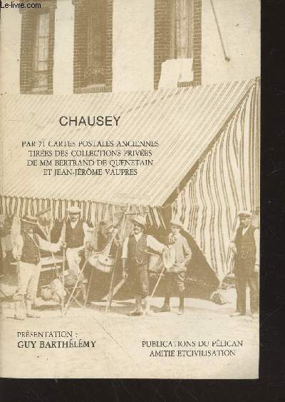
‎Barthélémy Guy‎

‎Chausey par 71 cartes postales anciennes tirées des collections privées de MM Bertrand de Quenetain et Jean-Jérôme Vaupres‎

‎Pélican Amitié et Civilisation. Non daté. In-8. Broché. Bon état, Couv. convenable, Dos satisfaisant, Intérieur frais. 54 pages augmentées de nombreuses photos de cartes postales en noir et blanc hors texte.. . . . Classification Dewey : 741.68-Illustrations des cartes postales‎

‎Classification Dewey : 741.68-Illustrations des cartes postales‎

Referentie van de boekhandelaar : RO20213371
Livre Rare Book

Le-livre.fr / Le Village du Livre
Sablons France Francia França France
[Books from Le-livre.fr / Le Village du Livre]

€ 39,80 Kopen

‎BARRERE, Henry ; ANDRIVEAU-GOUJON‎

‎Empire Ottoman [ Carte de l'Asie Mineure - 1904 ]‎

‎Carte entoilée en couleur au format 94 x 68 cm, échelle 1 : 3500000, Maison Andriveau-Goujon, Henry Barrère, Paris, 1904 (mention rev. 1904), carte n° 15, atlas usuel n° 21 ; atlas universel n° 34, gravé : le trait par Smith, la topographie par Gérin, les Ecritures par Rousset, les Eaux par Mme Fontaine‎

‎Belle grande carte entoilée de l'Empire ottoman (petites usures aux pliures, une petite annotation marginale).‎

Referentie van de boekhandelaar : 26332
Livre Rare Book

SARL Librairie du Cardinal
Gradignan France Francia França France
[Books from SARL Librairie du Cardinal]

€ 195,00 Kopen

‎Barrigue:‎

‎Etiquette Dôle de Sierre 1982.‎

‎Etiquette et bandeau pour une Dôle de Sierre Tavelli.‎

‎Illustrés par Barrigue, à l'occasion de la sortie de son album "Les refusés", 1er festival international de bande dessinés, Sierre 1982. L'étiquette est dédicacée et signée par Barrigue‎

Referentie van de boekhandelaar : 1899

Livre Rare Book

La Bergerie
Carouge Switzerland Suiza Suíça Suisse
[Books from La Bergerie]

€ 18,39 Kopen

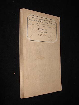
‎Barrère Henry‎

‎France 1 : 100.000. Brest‎

‎Maison Andriveau-Goujon Carte 1913 In-8 (12.5x23.5 cm), carte pliée, carte du Finistère reproduite en couleurs ; traces sur les plats, assez bon état. Livraison a domicile (La Poste) ou en Mondial Relay sur simple demande.‎

Referentie van de boekhandelaar : jj5340
Livre Rare Book

Abraxas-Libris
Bécherel France Francia França France
[Books from Abraxas-Libris]

€ 21,00 Kopen

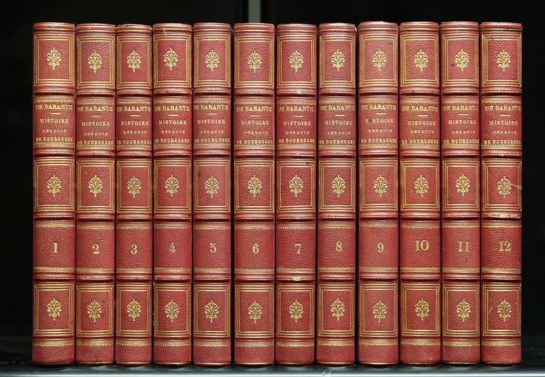
‎BARANTE M. de:‎

‎Histoire des ducs de Bourgogne de la maison de Valois 1364-1477.‎

‎Paris, Librairie Le Normand / Librairie Garnier Frères, 1854. 12 volumes in-8 de [2]-VIII-420-[2] / [8]430-[4] / [6]-418-[4] / [8]-434-[2] / [6]-431-[2] / [6]-439-[2] / [8]-415-[2] / [8]-418-[4] / [8]-448-[2] / [8]-448-[2] / [8]-446-[4] et [8]-465-[2] pages, demi-maroquin rouge, dos à 4 nerfs ornés de fleurons, roulettes, filets, encadrement, tomaison et titre dorés. Coins légèrement frottés, rousseurs dans certains volumes, quelques minuscules épidermures. Belle condition générale malgré les défauts mentionnés.‎

‎Illustré de 12 frontispices, 15 cartes (dont 9 à double page et 3 dépliantes) et 91 hors-textes en noir.‎

Referentie van de boekhandelaar : 8375
Livre Rare Book

ILLIBRAIRIE | Bombadil SA
Genève Switzerland Suiza Suíça Suisse
[Books from ILLIBRAIRIE | Bombadil SA]

€ 643,58 Kopen

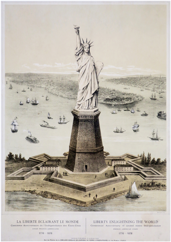
‎BARTHOLDI (Frédéric Auguste) & CHÉRET (Jules).‎

‎La Liberté éclairant le Monde. Centième anniversaire de l'Indépendance des États-Unis. Union Franco-Américaine. 1776-1876. - Liberty enlightning the World. Centennial anniversary of United States Independance. French-American Union. 1776-1876. Bartholdi scup.t. Imprimé par JULES CHÉRET, 18, rue Brunel, PARIS, Sur les Pierres de la COMPAGNIE GÉNÉRALE DES CARRIÈRES DE PIERRES LITHOGRAPHIQUES, 3, rue Rossini, PARIS.‎

‎[entre 1875 et 1876]. 685 x 478 mm.‎

‎Exceptionnelle estampe, de toute rareté, figurant La Liberté éclairant le Monde, plus connue sous le nom de Statue de la Liberté, à l'entrée du port de New York. Elle a été lithographiée en deux tons et imprimée par Jules Chéret à Paris, sur les pierres de la Compagnie Générale des Carrières de Pierres Lithographiques, située à Paris. En bas à droite de l'estampe figure la mention Bartholdi scup.t, pour Bartholdi, sculpteur du monument. Cette estampe, lithographiée et imprimée entre 1875 et 1876, est l'une des toutes premières vues projetées de la Statue de la Liberté, quelques années avant qu'elle ne soit construite, érigée et inaugurée en 1886 sur Bedloe's Island (renommée Liberty Island en 1956), face à Long Island, là où débuta la Guerre d'Indépendance le 27 août 1776. Autour du piédestal de la statue, construit par les Américains sur les fondations du Fort Wood, ancien fort reconnaissable à son plan en étoile à 11 branches, construit entre 1806 et 1811, on aperçoit quelques promeneurs et des pêcheurs. Cette vue plongeante nous offre au second plan un large panorama de la ville, avec Manhattan, le fleuve Hudson, l'East River et le quartier de Brooklyn. Le pont de Brooklyn n'est pas visible puisqu'il sera inauguré en 1883. Le port de New York est animé de voiliers et de bateaux à vapeur. Sur la droite, on aperçoit également la pointe de l'île de Governors Island, avec la fortification de Castle Williams. Né le 2 août 1834 dans une famille de notables de Colmar (Haut-Rhin), Frédéric Auguste Bartholdi présenta très tôt des aptitudes certaines pour les arts. Après avoir essayé la peinture et la photographie, c'est vers la sculpture qu'il se tourne, essentiellement monumentale. Après un voyage initiatique en Orient, il travaille sur sa première commande, une statue du Général Rapp, haut personnage de l'Alsace ; inaugurée en 1856 à Colmar, elle contribuera grandement à le faire connaître. Patriote et républicain, Bartholdi est profondément révolté par l'annexion de l'Alsace et de la Lorraine par la Prusse en 1870, suite à la défaite de Sedan. Pour rendre hommage aux belfortains qui ont bravement affronté un terrible siège au cours du conflit, il sculpte le monumental Lion de Belfort en 1879, dont une réplique trône aujourd'hui place Denfert-Rochereau à Paris (Bartholdi, les Bâtisseurs de la Liberté. Exposition de photographies (1876-1886). Musée des Arts et Métiers, 2004-2005). En 1871, Édouard Lefebvre de Laboulaye, président du Comité de l'Union Franco-Américaine, souhaite sceller l'amitié entre la France et les États-Unis, et demande à Bartholdi de réaliser un monument commémoratif de l'Indépendance des États-Unis (1776-1876) qui sera offert par la France aux États-Unis. La construction de la statue débute en 1875 dans les ateliers Monduit et Bechet, situés à Paris. Le sculpteur élabore un premier modèle de son œuvre, d'une taille de 2,11 mètres, à partir duquel les ouvriers opèrent un découpage méthodique des différentes parties de la statue. L'architecte Eugène Viollet-Le-Duc, puis l'ingénieur Gustave Eiffel, participeront au projet. L'installation de la structure métallique et l'assemblage de l'enveloppe de la statue ont lieu en 1886 à New York. À leur arrivée le 25 octobre 1886, les membres de la délégation française entourant Auguste Bartholdi, découvrent, du pont du paquebot Bretagne, une œuvre monumentale de 93 mètres. La statue sera inaugurée le 28 octobre. La Liberté éclairant le monde connut d'emblée un immense succès. Elle restera l'oeuvre majeure du sculpteur Bartholdi, à laquelle il aura consacré quinze années de sa vie. Jules Chéret (1836-1932) est l'affichiste majeur de la Belle Époque. En 1866, il ouvre à Paris une imprimerie qui est la première à proposer des affiches illustrées lithographiées en couleurs. Il répond à la forte demande publicitaire liée à l'apparition de nouveaux produits, à l'évolution des modes de vente et au développement intense de l'industrie du spectacle. Il a ainsi joué un rôle décisif dans l'avènement de la publicité commerciale et culturelle. Inventeur de l’affiche en couleurs et de l'affiche illustrée publicitaire en France, surnommé par ses contemporains « le roi de l’affiche», sa production d’affiches pour les spectacles et la publicité entre le Second Empire et 1900 est considérable. Il a réalisé plus de 1 400 affiches qui ont accompagné l'entrée de la France dans la vie moderne. Parallèlement à sa carrière d'affichiste, il consacra la seconde partie de sa vie à la peinture décorative, et réalisa des œuvres pour ses mécènes mais aussi pour l'Hôtel de Ville de Paris, le musée Grévin, ou encore la préfecture de Nice (Bargiel & Le Men, La Belle Époque de Jules Chéret. De l’affiche au décor. Les Arts Décoratifs, Paris, 2010). Cette estampe, d'une extrême rareté, est absente des collections publiques, françaises comme américaines. Elle manque également à toutes les bibliographies consacrées à Jules Chéret : Maindron, Les Affiches Illustrées (1886-1895), Paris, 1896 ; Beraldi, Les graveurs du XIXe siècle. Guide de l'amateur d'estampes modernes, 1886, Tome IV ; Broido, The Posters of Jules Chéret, Toronto, 1980 ; et enfin la plus récente, Bargiel & Le Men, La Belle Époque de Jules Chéret. De l’affiche au décor. Les Arts Décoratifs, Paris, 2010. Cette dernière bibliographie est la plus complète de toutes. Elle recense les 1430 affiches de Jules Chéret, avec une illustration pour chaque affiche. Elle mentionne une planche intitulée La Liberté éclairant le Monde. Centième anniversaire de l'Indépendance des États-Unis. Union Franco-Américaine. 1776-1876, mais celle-ci est plus petite que notre affiche (59 x 46 cm). C'est l'une des rares à ne pas être illustrée, car l'auteur de la bibliographie n'a pas été en mesure de la localiser. Notre vue est l'une des toutes premières vues projetées de la Statue de la Liberté. On retrouve cette illustration sur l'affiche publicitaire de Jules Chéret annonçant le diorama représentant le monument commémoratif de l'Indépendance des États-Unis d'Amérique, présenté au Palais de l'Industrie sur les Champs-Élysées. Ce diorama avait été réalisé dans le cadre d'une campagne de promotion lancée, dès 1875, par le Comité de l'Union Franco-Américaine, afin de lever des fonds. Le diorama fut présenté une première fois en août 1877 au Palais de l'Industrie (journal quotidien Le Rappel du 28 août 1877), puis une seconde fois aux Tuileries en 1878 (journal quotidien Le Rappel du 3 avril 1878). Un exemplaire de cette affiche publicitaire se trouve au Musée Bartholdi à Colmar ; le musée lui attribue la date de 1874 ; mais si l'on s'en tient à l'article du quotidien Le Rappel, cette date est erronée. Un autre exemplaire de cette affiche annonçant le diorama se trouve à la Bibliothèque Nationale de France, qui la date de 1876, mais la date est ici également erronée. On peut donc penser que notre affiche a été réalisée avant celle annonçant le diorama, plus précisément entre 1875, date de lancement de la campagne pour la levée des fonds, et 1876, date du centenaire. Exemplaire en très bonne condition. Deux petites restaurations anciennes dans les marges gauche et droite, très légères cassures dans la partie haute de l'estampe, petites taches claires au bas du titre anglais. BARTHOLDI (Frédéric Auguste). La Liberté éclairant le Monde. Centième anniversaire de l'Indépendance des États-Unis. Union Franco-Américaine. 1776-1876. - Liberty enlightning the World. Centennial anniversary of United States Independance. French-American Union. 1776-1876. Bartholdi scup.t. Imprimé par JULES CHÉRET, 18, rue Brunel, PARIS, Sur les Pierres de la COMPAGNIE GÉNÉRALE DES CARRIÈRES DE PIERRES LITHOGRAPHIQUES, 3, rue Rossini, PARIS. [between 1875 and 1876]. 685 x 478 mm. 10 000 € Exceptional print, of an extreme rarity, depicting Liberty Enlightening the World, better known as the Statue of Liberty, at the entrance to the port of New York. It was lithographed in two tones and printed by Jules Chéret in Paris, on the stones of the Compagnie Générale des Carrières de Pierres Lithographiques, located in Paris. At the bottom right of the print appears the mention Bartholdi scup.t, for Bartholdi, sculptor of the monument. This print, lithographed and printed between 1875 and 1876, is one of the very first projected views of the Statue of Liberty, a few years before it was built, erected and inaugurated in 1886 on Bedloe's Island (renamed Liberty Island in 1956), facing Long Island, where the War of Independence began on August 27, 1776. Around the pedestal of the statue, built by the Americans on the foundations of Fort Wood, an old fort recognizable by its 11-pointed star plan, built between 1806 and 1811, we can see some walkers and fishermen. This bird's eye view offers us in the background a wide panorama of the city, with Manhattan, the Hudson River, the East River and the district of Brooklyn. The Brooklyn Bridge is not visible since it will be inaugurated in 1883. New York Harbor is bustling with sailboats and steamboats. On the right, we can also see the tip of Governors Island, with the fortification of Castle Williams. Born on August 2, 1834 in a family of notables from Colmar (Haut-Rhin), Frédéric Auguste Bartholdi showed very early some aptitudes for the arts. After trying painting and photography, he turned towards sculpture, essentially monumental. After an initiatory trip to the East, he worked on his first order, a statue of General Rapp, a high figure in Alsace; inaugurated in 1856 in Colmar, it will greatly contribute to making him known. A patriot and republican, Bartholdi was deeply revolted by the annexation of Alsace and Lorraine by Prussia in 1870, following the defeat of Sedan. To pay tribute to the people of Belfort who bravely faced a terrible siege during the conflict, he sculpted the monumental Lion of Belfort in 1879, a smaller replica of which now stands on Place Denfert-Rochereau in Paris (Bartholdi, les bâtisseurs de la Liberté. Exposition de photographies (1876-1886). Musée des Arts et Métiers, 2004-2005). In 1871, Édouard Lefebvre de Laboulaye, president of the Committee of the Franco-American Union, willing to seal the friendship between France and the United States, asked Bartholdi to work on a monument commemorating the Independence of the United States ( 1776-1876) which will be offered by France to the United States. Construction of the statue began in 1875 in the Monduit and Bechet workshops, located in Paris. The sculptor developed a first model of his work, measuring 2.11 meters, from which the workers carried out a methodical cutting of the different parts of the statue. The architect Eugène Viollet-Le-Duc, then the engineer Gustave Eiffel, will take part in the project. The installation of the metal structure and the assembly of the shell of the statue took place in 1886 in New York. Upon their arrival on October 25, 1886, the members of the French delegation surrounding Auguste Bartholdi, discovered, from the deck of the liner Bretagne, a monumental work of 93 meters. The statue will be unveiled on October 28. Liberty Enlightening the World was immediately a huge success. It will remain the major work of the sculptor Bartholdi, to which he devoted fifteen years of his life. Jules Chéret (1836-1932) was the major poster artist of the Belle Époque. In 1866, he opened a printing press in Paris which was the first to offer lithographed illustrated posters in color. He met the strong advertising demand linked to the appearance of new products, the evolution of sales methods and the intense development of the entertainment industry. He thus played a decisive role in the advent of commercial and cultural advertising. Inventor of the color poster and the illustrated advertising poster in France, nicknamed by his contemporaries "the king of the poster", his production of posters for shows and advertising between the Second Empire and 1900 was considerable. He produced more than 1,400 posters which accompanied France's entry into modern life. At the same time as his career as a poster artist, he devoted the second part of his life to decorative painting, and produced works for his patrons but also for the Hôtel de Ville in Paris, the Musée Grévin, or the prefecture of Nice (Bargiel & Le Men, La Belle Époque de Jules Cheìret. De l’affiche au deìcor. Les Arts Décoratifs, Paris, 2010). This extremely rare print is absent from public collections, both French and American. It is also missing from all the bibliographies devoted to Jules Chéret: Maindron, Les Affiches Illustrées (1886-1895), Paris, 1896 ; Beraldi, Les graveurs du XIXe siècle. Guide de l'amateur d'estampes modernes, 1886, Tome IV ; Broido, The Posters of Jules Chéret, Toronto, 1980 ; and the most recent, Bargiel & Le Men, La Belle Époque de Jules Chéret. De l’affiche au décor. Les Arts Décoratifs, Paris, 2010. This last bibliography is the most complete of all. It lists the 1,430 posters of Jules Chéret, with an illustration for each poster. It mentions a print entitled La Liberté éclairant le Monde. Centième anniversaire de l'Indépendance des États-Unis. Union Franco-Américaine. 1776-1876, with no other mention. But this one is smaller than our print (59 x 46 cm). It is one of the few not to be illustrated, as the author of the bibliography was unable to locate it (pp. 224-225, n°631, "Affiche non localisée"). This is one of the very first projected views of the Statue of Liberty. This illustration can be found on Jules Chéret's advertising poster announcing the diorama representing the monument commemorating the Independence of the United States of America, presented at the Palais de l'Industrie on the Champs-Élysées. This diorama had been made as part of a promotional campaign launched in 1875 by the Committee of the Franco-American Union, in order to raise funds. The diorama was presented for the first time in August 1877 at the Palais de l'Industrie (article in the daily newspaper Le Rappel of August 28, 1877), then a second time at the Tuileries in 1878 (article in the daily newspaper Le Rappel of April 3, 1878). The Bartholdi Museum in Colmar owns a copy of this advertising poster, and dates it from 1874, but from the article in the newspaper Le Rappel, this date is erroneous. The National Library of France also owns a copy of this poster announcing the diorama, and dates it from 1876, but again the date is erroneous. We can therefore assume that our poster was produced before the poster announcing the exhibition of the diorama, and more precisely between 1875, date of the launching of the campaign, and 1876, date of the centennial anniversary. Copy in very good condition. Two small old restorations in the left and right margins, very slight cracks in the upper part of the print, small light stains at the English title.‎

Referentie van de boekhandelaar : LBW-6827
Livre Rare Book

Librairie Le Bail
Paris France Francia França France
[Books from Librairie Le Bail]

€ 7.000,00 Kopen

‎BARATIERI Oreste:‎

‎Memorie d'Africa (1892-1896).‎

‎Torino, Fratelli Bocca, 1898. In-8 de VIII-487 pages, pleine percaline brun caramel.‎

‎Orné de 8 cartes hors-texte, dont 3 dépliantes et une en couleurs. L'auteur, fut nommé gouverneur de la colonie italienne d'Érythrée en 1892 (et promu au grade de major-général), et l'histoire se terminera mal pour lui (et pour l'Italie). L'empereur Ménélik II et ses 100 000 Abyssins lui firent subire une défaite magistrale, qui eut des secousses jusqu'en Italie: le gouvernement tomba. Le traité de signé à Addis-Abeba le 26 octobre 1896 consacra la victoire et l'indépendance de l'Éthiopie.Quelques rares rousseurs, la grande cartes dépliante en couleurs a été renforcée par du Filmoplast P.‎

Referentie van de boekhandelaar : 19735

Livre Rare Book

ILLIBRAIRIE | Bombadil SA
Genève Switzerland Suiza Suíça Suisse
[Books from ILLIBRAIRIE | Bombadil SA]

€ 73,55 Kopen

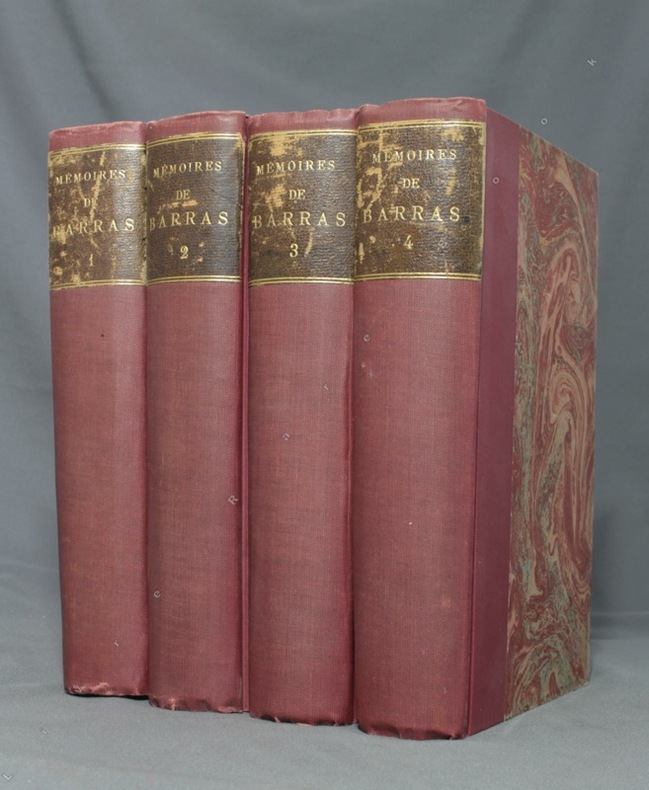
‎BARRAS Paul; DURUY George (intro):‎

‎Mémoires de Barras, membre du directoire.‎

‎Paris, Lib. Hachette, 1895-1896. 4 volumes in-8 de LXXXIII-372 / XVI-543 / XXXVI-526 et XXXII-548 pages, demi-percaline bordeaux, dos lisses, étiquettes de titre brunes, un brin frottées, couvertures conservées.‎

‎Illustré de 7 portraits, 3 fac-simile, 2 cartes. Edition originale.‎

Referentie van de boekhandelaar : 1723
Livre Rare Book

ILLIBRAIRIE | Bombadil SA
Genève Switzerland Suiza Suíça Suisse
[Books from ILLIBRAIRIE | Bombadil SA]

€ 275,82 Kopen

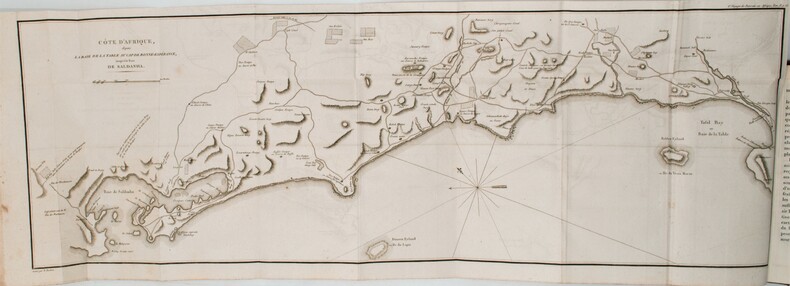
‎BARROW, John.‎

‎Nouveau voyage dans la partie méridionale de l'Afrique....‎

‎Dentu, Imprimeur - Libraire, Paris, 1806, 2 volumes in-8 , x-310pp. ,2ffnch.-312pp. ,illustré de 8 cartes dépliantes , relié plein cuir époque , dos lisse avec pièce de titre rouge et tomaison noire , tranches mouchetées bleues , coupes et coins usés , début de fentes , rares rousseurs , frottements.‎

‎John Barrow , accompagne lord Macartney , en 1797, comme secrétaire personnel, dans une importante et délicate mission : établir un gouvernement pour la nouvelle colonie du Cap. Barrow à la charge de réconcilier les Boers et les "Cafres" et de décrire l'intérieur du pays. Après avoir visité toutes les parties de la colonie, il est nommé vérificateur général des comptes publics et décide de s'installer en Afrique du Sud. «Où l'on examine quelle est l'importance du Cap de Bonne-Espérance pour les différentes puissances de l'Europe, considéré comme station militaire et navale; comme boulevard du commerce et de la domination des Anglais dans l'Inde; comme centre des établissements pour la pêche de la baleine dans les mers Australes; comme acquisition territoriale, et comme entrepôt commerciale en tems de paix. Accompagné d'une description statistique de la colonie, rédigée sur les documens les plus hautentiques; enrichi de huit belles cartes, contenant celle de la côte d'Afrique depuis la baie de la Table jusqu'à la baie de Saldanba; des cartes de la baie de Pletenberg, d'Algos, de Mossel ou de False bay; du plan militaire de la pénisnule du Cap, et de ceux de la baie de la Table et du Knisna.» titre .‎

Referentie van de boekhandelaar : PHO-1285
Livre Rare Book

Librairie Voyage et Exploration
Cerny France Francia França France
[Books from Librairie Voyage et Exploration]

€ 360,00 Kopen

‎BARKER Ronnie‎

‎Pennyworth of Art : the Green album -- his own collection of picture Postcards.‎

‎The Herbert press, 1986. Grand in-8 carré relié, avec jaquette imprimée en couleurs, 96 pages, richement illustré en couleurs, très bon état. /// the Herbert Press, London, 1986. Hardcover. État : Very Good. Etat de la jaquette : Very Good. Photographic (illustrateur). 1st Edition. 550 g; 96 pages of postcards with an introduction and attendant commentary on each card. Colour illustrated dust wrapper is very slightly faded on the spine section, and the Green papered boards are slightly rubbed on the bottom edge.‎

Referentie van de boekhandelaar : 18587

Livre Rare Book

Déjà Jadis
Fréjus France Francia França France
[Books from Déjà Jadis]

€ 19,00 Kopen

‎BARTHÉLEMY (J.E.).‎

‎Plan géométrique (en deux feuilles) des bois dépendants du domaine de Tigery appartenants à Madame de Clermont-Tonnerre. Dressé par J.E. Barthélemy, géomètre à Corbeil, d'après les réarpentages successifs faits depuis 1843 inclusivement (à l'exception de l'année 1851).‎

‎1864. In-folio ; demi-percaline noire, dos lisse muet, pièce de titre de maroquin rouge sur le premier plat (reliure de l'époque).‎

‎Atlas manuscrit comprenant 1 titre, 2 cartes sur double page et un tableau récapitulatif. Les deux cartes, encre noire et aquarelle, montrent le bois de Tigery, au nord de la commune du même nom, dans l'Essonne, avec la date des mises en vente des bois. Cartes en très bonne condition. Coiffes, coins et coupes usagés, étiquette de titre frottée.‎

Referentie van de boekhandelaar : LBW-6635

Livre Rare Book

Librairie Le Bail
Paris France Francia França France
[Books from Librairie Le Bail]

€ 800,00 Kopen

‎BARBIÉ du BOCAGE, J.D.:‎

‎Plan de L’ Hellespont, de la Chersonèse de Thrace et d une grande partie de la Troade. Pour le Voyage du Jeune Anacharsis. Gravé par P.F. Tardieu / L. Aubert scripsit (les textes).‎

‎1782 - Germinal An VI, 34x23 cm, carte sous passepartout.‎

‎Karte der Dardanellen und Umgebung. Marmarameer. Gallipolli. Kleinasiien. Türkei. Kupferstich von Giraldon Bovinet, um 1800, 16x11 cm.‎

Referentie van de boekhandelaar : 130920aaf

Livre Rare Book

Harteveld Rare Books Ltd.
Fribourg Switzerland Suiza Suíça Suisse
[Books from Harteveld Rare Books Ltd.]

€ 137,91 Kopen

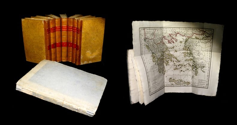
‎BARTHELEMY (Jean-Jacques).‎

‎Voyage du jeune Anacharsis en Grèce & Recueil de cartes géographiques, plans, vues, médailles de l'ancienne Grèce.‎

‎A Paris, chez E. A. Lequien / de l'Imprimerie de P. Didot l'Aîné, 1822 - A Paris, chez de Bure, 1839 (pour le volume d'Atlas). 7 vol. de texte au format in-8 (225 x 141 mm) de 1 f. bl., 2 ff. n.fol., 1 frontispice gravé n.fol., 451 pp. et 1 f. bl. ; 1 f. bl., 2 ff. n.fol., 488 pp. et 1 f. bl. ; 1 f. bl., 2 ff. n.fol., 462 pp., 1 f. n.fol. et 1 f. bl. ; 1 f. bl., 2 ff. n.fol., 474 pp., 1 f. n.fol. et 1 f. bl. ; 1 f. bl., 2 ff. n.fol., 466 pp., 1 f. n.fol. et 1 f. bl. ; 1 f. bl., 2 ff. n.fol., 423 pp., 1 f. n.fol. et 1 f. bl. ; 1 f. bl., 2 ff. n.fol., 438 pp., 1 f. n.fol. et 1 f. bl. 1 vol. d'Atlas au format pt in-4 (282 x 223 mm) de xlii pp et 31 planches gravées, sous couverture d'attente de l'époque de plein cartonnage gris-perle.‎

‎Ensemble complet de ses 7 volumes de texte - le premier s'ouvre sur un frontispice gravé figurant l'auteur - ainsi que de son Atlas. Le Voyage du jeune Anacharsis en Grèce constitue un récit de voyage détaillé et érudit décrivant les sites et la géographie de la Grèce classique (une version française de la Description de la Grèce de Pausanias). D'après Michaud, cet Atlas est sans conteste la meilleure production de Barbier du Bocage. Il renferme 31 plans et vues (dont un dépliant et certaines cartes en couleurs) et s'avère précieux du fait des éléments qu'il recèle relatif à la Grèce antique. Leur auteur a été l'élève de Jean-Baptiste Bourguignon d'Anville. Il fut attaché au Cabinet des médailles de la Bibliothèque du roi, géographe du ministère des Relations extérieures et est reconnu comme un spécialiste de la cartographie de l'Antiquité. Il a à ce titre d'ailleurs apporté sa contribution à presque toutes les entreprises géographiques de quelque importance faites en son temps. Quérard I, La France littéraire, p. 200. Petit défaut affectant la coiffe supérieure d'un des volumes. Quelques frottements affectant les plats. Quelques claires rousseurs dans le texte ; quoique davantage marquées aux trois derniers volumes. Petite déchirure en marge d'un feuillet. Discrète cerne angulaire affectant les premières planches de l'atlas. Petite déchirure affectant une planche. Une autre présente un léger manque angulaire. Du reste, ensemble en bonne condition.‎

Referentie van de boekhandelaar : 19077
Livre Rare Book

Babel Librairie
Périgueux France Francia França France
[Books from Babel Librairie]

€ 250,00 Kopen

‎Baranov Aleksandr A Chevigny Hector and Maps on End Papers‎

‎Lord of Alaska: The Story of Baranov and The Russian Adventure‎

‎Hardcover. Good. Viking 1943 4th printing hardcover. Different dust jacket than that shown in image. Not EX-LIB. Cover shows minimal wear. Text is clean and binding is tight. Moderate general wear to dust jacket. hardcover‎

Referentie van de boekhandelaar : 00-TRF8-GQL2

Biblio.com

Blue Leaf Books
United States Estados Unidos Estados Unidos États-Unis
[Books from Blue Leaf Books]

€ 10,58 Kopen

‎Barbara Abbs Author; Susan Rowland Maps by‎

‎French Gardens: A Guide‎

‎Sagaponack NY: Sagapress Inc. 1995. Trade Paperback. Like New. 8vo or 8� Medium Octavo: 7�" x 9�" tall. Deidre Hall Photographs by; Susan Rowland Maps by. 173 pp. Very clean book with minor creasing on spine. Solid and tight binding. Two small stains on top edge. <br/> <br/> Sagapress, Inc. paperback‎

Referentie van de boekhandelaar : 1ivEc0017 ISBN : 0898310415 9780898310412

Biblio.com

gearbooks
United States Estados Unidos Estados Unidos États-Unis
[Books from gearbooks]

€ 8,11 Kopen

‎Barbara Anthony & Marcillene Barnes Illustrated By Kreigh Collins in B/W Maps Drawn By Harold Vander Werf Inner Flap DJ Pric‎

‎Explorers All Story of Adventures & Achievements for Boys & Girls & Adults Includes Norsemen Marco Polo Christopher Columbus Vasco Da Gama Hernando De Soto Henry Hudson Robert Cavelier De La Salle David Livingstone Robert Edwin Peary‎

‎Fideler MICH 1942 HBDJ 1942. 1st EditionGoldenyellow cloth hardback cvr duplicates DJ Illustration. size= 8 1/4 x 9 1/2 in. 112 pgs Oblong illustrated cloth Light handling soil on back cover of book and back cover of dustjacket light corner and spine ends wear on dustjacket. NOT x-lib. Very Good in Very Good Dustjacket. DJ light rub wear tiny chips tears extremities. First Edition. Hard Cover. Fideler MICH hardcover‎

Referentie van de boekhandelaar : 26040

Biblio.com

BLUFF PARK RARE BOOKS
United States Estados Unidos Estados Unidos États-Unis
[Books from BLUFF PARK RARE BOOKS]

€ 41,46 Kopen

‎Barbara Kingsolver Rebeca Cartes‎

‎Another America/Otra America English and Spanish Edition‎

‎Good. No Hassle 30 Day Returns Ships Daily Underlining/Highlighting: NONE Writing: None unknown‎

Referentie van de boekhandelaar : 5741183 ISBN : 1878067575 9781878067579

Biblio.com

BookHolders
United States Estados Unidos Estados Unidos États-Unis
[Books from BookHolders]

€ 0,85 Kopen

‎Barbara Kingsolver Rebecca Cartes‎

‎Another America / Otra Amrica‎

‎Seal Press. Used - Good. Ships from Reno NV. Shows some signs of wear and may have some markings on the inside. 100% Money Back Guarantee. Shipped to over one million happy customers. Your purchase benefits world literacy! Seal Press unknown‎

Referentie van de boekhandelaar : GRP85766188 ISBN : 1580050042 9781580050043

Biblio.com

Better World Books
United States Estados Unidos Estados Unidos États-Unis
[Books from Better World Books]

€ 5,47 Kopen

‎Barbara Kingsolver Reader Rebecca Cartes Translator‎

‎Another America / Otra América‎

‎Seal Press 1998-07-24. Audio Cassette. Used:Good. Seal Press unknown‎

Referentie van de boekhandelaar : DADAX1580050093 ISBN : 1580050093 9781580050098

Biblio.com

Ergodebooks
United States Estados Unidos Estados Unidos États-Unis
[Books from Ergodebooks]

€ 34,37 Kopen

‎Barbara Kingsolver Rebeca Cartes Translator‎

‎Another America/Otra America English and Spanish Edition‎

‎Seal Press 1994-08-01. Paperback. Used:Good. Seal Press paperback‎

Referentie van de boekhandelaar : DADAX1878067575 ISBN : 1878067575 9781878067579

Biblio.com

Ergodebooks
United States Estados Unidos Estados Unidos États-Unis
[Books from Ergodebooks]

€ 85,37 Kopen

‎Barbara Kingsolver; Rebeca Cartes‎

‎Another America/Otra America‎

‎Seattle: Seal Press 1992. Fine in near fine dust jacket with light rubbing. First Edition. Hardcover. Fine/Near Fine. Seal Press Hardcover‎

Referentie van de boekhandelaar : b17993 ISBN : 1878067141 9781878067142

Biblio.com

Clayton Fine Books
United States Estados Unidos Estados Unidos États-Unis
[Books from Clayton Fine Books]

€ 33,84 Kopen

‎Barbara Kingsolver Rebecca Cartes‎

‎Another America / Otra Amrica‎

‎Seal Press. Used - Good. Former Library book. Shows some signs of wear and may have some markings on the inside. Seal Press unknown‎

Referentie van de boekhandelaar : GRP2663539 ISBN : 1580050042 9781580050043

Biblio.com

Better World Books
United States Estados Unidos Estados Unidos États-Unis
[Books from Better World Books]

€ 5,47 Kopen

‎Barber, Peter (Commentary)‎

‎King Henry's Map of the British Isles‎

‎A book on the early map of Great Britain and Ireland forming part of the collection assembled by the antiquary and administrator Sir Robert Cotton. 158 pages. With Notes. In slip-case. Slipcase has some light wear.‎

‎BARBEY Antonio (attivo tra il 1690 ed il 1714 circa)‎

‎Nuova Pianta della Citta di Roma coll'Indice de Tempij Palazzi et Altre Fabriche Antiche e Moderne...‎

‎Mappa di Roma del XVII secolo, incisa a Roma da Antonio Barbey e pubblicata da Domenico de Rossi.Si basa sulla grande pianta murale di Giovan Battista Falda, ma mostra con particolare cura gli interventi urbani sotto il pontificato di papa Innocenzo XII, tra i quali la dogana di mare a Ripa Grande (1694). Sono inoltre contenute nella pianta una serie di interessanti note e i nomi delle ville e vigne entro le mura della città.Comprende un elegante cartiglio con titolo e stemma in alto, e un secondo cartiglio con un lungo elenco che individua 464 luoghi di interesse nella Città Eterna.La mappa è orientata a nord-est in alto e comprende siti antichi e moderni. "I lotti edificati sono campiti con puntinato e vengono indicati i nomi di molte strade. L'impostazione generale e vari dettagli denotano la derivazione di questa pianta dalla grande del Falda cui il Barbey apportò però numerosi aggiornamenti. Sono infatti riportati i nuovi interventi di Innocenzo XII tra i quali la dogana di mare a Ripa Grande (1694). Sono inoltre contenute nella pianta una serie di interessanti note e i nomi delle ville e vigne entro le mura della città. In basso a sinistra è scritto Ant. Barbey Sculp. ed a destra Domenico de Rossi [...] l'anno 1697 il di 25 maggio. Sotto il titolo in alto è riportata la dedica a Mons. Ranuccio Pallavicino Governatore di quest'alma Città e vice Camerlengo [...] Innocenzo XII felicemente regnante. Sui due lati legenda con 464 numeri di rimando ed elenco dei XIV rioni, e, in basso a destra, l'indice delle chiese di Roma" (cfr. Marigliani p. 253). Incisione in rame con bellissima coloritura a mano, alcune pieghe di carta perfettamente restaurate, per il resto in buono stato di conservazione. Rara. Bibliografia Frutaz n. 162, Scaccia Scarafoni n. 206, Huelsen n. 135; Marigliani n. 159. Map of Rome from the 17th century, engraved in Rome by Antonio Barbey and published by Domenico de Rossi. It is based on the large wall map by Giovan Battista Falda, but shows with particular care the urban interventions under the pontificate of Pope Innocenzo XII, including the sea customs house at Ripa Grande (1694). The map also contains a number of interesting notes and the names of the villas and vineyards within the city walls.  It includes an elegant cartouche with title and coat of arms at the top, and a second cartouche with a long list identifying 464 places of interest in the Eternal City. The map is oriented north-east at the top and includes ancient and modern sites. Built-up lots are dotted and the names of many streets are indicated. The general layout and various details indicate that this map derives from Falda's great map, to which Barbey however made numerous updates. In fact, the new interventions of Innocent XII are shown, including the sea customs house at Ripa Grande (1694). The map also contains a series of interesting notes and the names of the villas and vineyards within the city walls. At lower left is written Ant. Barbey Sculp. and on the right Domenico de Rossi [...] the year 1697 the 25th of May. Under the title at the top there is the dedication to Monsignor Ranuccio Pallavicino Governor of this great City and Vice Camerlengo. On both sides a legend with 464 reference numbers and a list of the XIV districts, and, at the bottom right, the index of the churches of Rome (cf. Marigliani p. 253). Copper engraving with fine later hand colour, few repaired paper folds, otherwise in good condition. Rare. Bibliografia Frutaz n. 162, Scaccia Scarafoni n. 206, Huelsen n. 135; Marigliani n. 159.‎

‎Barbra Crossette; Cover Design Krystyna Skalski Illustrator; Cover Illustrations Steven Guarnaccia Illustrator; Maps by Donald P‎

‎America's Wonderful Little Hotels and Inns 1984 Eastern Region including Puerto Rico and Eastern Canada‎

‎Congdon & Weed 1984-01-01. Fourth Edition. Paperback. Very Good. Softcover showing minor scuffing. Spine is mostly uncreased. Edges and corners showing minor wear. Pages are unmarked or folded. Congdon & Weed paperback‎

Referentie van de boekhandelaar : 200220-c6-rw-0020

Biblio.com

Must Love Books
United States Estados Unidos Estados Unidos États-Unis
[Books from Must Love Books]

€ 8,42 Kopen

‎Barclay Maps‎

‎1973-74 Map and Street Guide Riverside California MAP‎

‎Barclay Maps 1973. Map - VG - Map is clean with only light wear. Map. Very Good. Barclay Maps Hardcover‎

Referentie van de boekhandelaar : 228110

Biblio.com

gigabooks
United States Estados Unidos Estados Unidos États-Unis
[Books from gigabooks]

€ 8,04 Kopen

‎Barker A. J. & 58 B/W Photos 33 Maps‎

‎The Bastard War The Mesopotamian Compaign of 1914-1918‎

‎New York: Dial Press. Near Fine in Very Good dust jacket. 1967. Hardcover. A bit of edge soil jakcet faded with some wear & chips on extremities; 9.10 X 6.50 X 1.60 inches . Dial Press hardcover‎

Referentie van de boekhandelaar : 42619

Biblio.com

T. A. Borden Books
United States Estados Unidos Estados Unidos États-Unis
[Books from T. A. Borden Books]

€ 25,38 Kopen

‎Barker, Felix‎

‎London from the Air‎

‎No marks or inscriptions. A very clean crisp very tight copy with bright unmarked boards and no bumping to corners. Dust jacket not price clipped or marked or torn or creased with light traces of storage. 144pp.‎

MareMagnum

Godley Books
Hyde, GB
[Books from Godley Books]

€ 8,81 Kopen

‎Barnes, Jeremy‎

‎The Pictorial History of the American Civil War‎

‎208 pages including index. From the first firing of guns at Fort Sumter to the ultimate surrender of the South, richly illustrated with many contemporary engravings and rare photographs as well as many colour illustrations and maps. A must for every Civil War Buff. Clean and unmarked. Very light wear. Gorgeous copy of this handsome work. Book‎

‎Barnett A. Doak; End Paper Maps Illustrator‎

‎COMMUNIST CHINA AND ASIA CHallenge to American Policy. Council on Foreign Affairs Study‎

‎Harper & Brothers 1960-01-01. Hardcover. Very Good. Hardcover. Very Good in Very Good dust jacket. Clean tight. Name inside. Harper & Brothers hardcover‎

Referentie van de boekhandelaar : UT1513415

Biblio.com

GuthrieBooks
United States Estados Unidos Estados Unidos États-Unis
[Books from GuthrieBooks]

€ 10,99 Kopen

‎Barnett's Maps‎

‎Bedford Street Plan with Index with Road Map of Bedfordshire and Plan of Car Parks & One-Way Streets‎

‎Barking: G.I. Barnett & Son. No date 1970s folded map with some red ink hi -liting. . Good. Paperback. G.I. Barnett & Son paperback‎

Referentie van de boekhandelaar : 153011

Biblio.com

Philip Emery
United Kingdom Reino Unido Reino Unido Royaume-Uni
[Books from Philip Emery]

€ 1,12 Kopen

‎BARNEVILLE‎

‎Carte couleurs au 1/100 000?. Feuille VIII-11. Mise ? jour 1923.‎

‎Une feuille 57x45 cm.‎

‎Baron, Stanley‎

‎The Road to Rome‎

‎No marks or inscriptions. A very clean very tight copy with bright unmarked boards and no bumping to corners. Dust jacket not price clipped or marked, torn or creased with a little rubbing to bottom of spine. 307pp. The author follows a route from Boulogne by way of Reims, Colmar, Lucerne, the St Gotthard Pass, Milan, Lake Maggiore, Cremona, Ravenna, Florence and finally Rome where he continues his tour.‎

MareMagnum

Godley Books
Hyde, GB
[Books from Godley Books]

€ 9,95 Kopen

‎BARRERE, Henry ; ANDRIVEAU-GOUJON‎

‎Empire Ottoman [ Carte de l'Asie Mineure - 1904 ]‎

‎Carte entoilée en couleur au format 94 x 68 cm, échelle 1 : 3500000, Maison Andriveau-Goujon, Henry Barrère, Paris, 1904 (mention rev. 1904), carte n° 15, atlas usuel n° 21 ; atlas universel n° 34, gravé : le trait par Smith, la topographie par Gérin, les Ecritures par Rousset, les Eaux par Mme Fontaine Belle grande carte entoilée de l'Empire ottoman (petites usures aux pliures, une petite annotation marginale). Français‎

‎Barrett, Betty and Power, Frances‎

‎The Golden Book of Dublin‎

‎No inscriptions or marks. No creasing to covers or to spine. A very clean crisp tight copy with bright unmarked boards, very slight traces of handling and no bumping to corners. 64pp. A brief history of Dublin, a guide and map to the city.‎

MareMagnum

Godley Books
Hyde, GB
[Books from Godley Books]

€ 5,40 Kopen

‎Barron Roderick‎

‎Decorative Maps‎

‎<p>Folio 28X38cm 8p. 40 color plates ill covers</p> Bracken Books, poster art series paperback‎

Referentie van de boekhandelaar : biblio638 ISBN : 1851702989 9781851702985

Biblio.com

Librairie In Folio
Canada Canadá Canadá Canada
[Books from Librairie In Folio]

€ 30,56 Kopen

‎Barron, Roderick M‎

‎The World Displayed - Rare, fine & decorative Antique Maps & Globes of the World & its regions (Summer 2003)‎

‎Sevenoaks, Kent, Roderick M.Barron, Antique Map Specialist, 2003. 190 S.mit zahlreichen überwiegend farbigen Abbildungen, Tafeln (Karten); Original-Karton; 8°. Sehr gutes Exemplar. Verzeichnet 215 Nummern.‎

Referentie van de boekhandelaar : D12840

Antiquariat.de

Antiquariat Andreas Schwarz
Germany Alemania Alemanha Allemagne
[Books from Antiquariat Andreas Schwarz]

€ 16,00 Kopen

‎Bartholemew Maps‎

‎'Bartholemew''s Contoured Road Map of the British Isles'‎

‎Edinburgh: John Bartholemew & Sons 1961. Folding color map scale 1: 1000000. Good Plus unmarked bright w a few small tears at the fold points one clean 7-inch corner tear some tape scars at top. All tears easily repairable. A vintage color-contoured view of Britain. 35 x 40. Scarce. <br/><br/> John Bartholemew & Sons unknown‎

Referentie van de boekhandelaar : 4556

Biblio.com

edburynbooks
United States Estados Unidos Estados Unidos États-Unis
[Books from edburynbooks]

€ 8,46 Kopen

‎Bartholomew J. G. & Herbertson A. J. & Buchan Editor‎

‎ATLAS OF METEOROLOGY‎

‎Edinburgh: The Royal Geography Society 1899. "A Series of Over Four Hundred Maps - prepared by J. G. Bartholomew and A. J. Herbertson and edited by Alex Buchan . Under the Patronage of the Royal Geographical Society Prepared by the Edinburgh Geographical Institute" Bartholomew's Physical Atlas - Volume III. Fine colour maps throughout. A very good copy of this impressive atlas. Original blue cloth binding with glazed blue-black pebbled cloth to the spine and corners gilt lettering. Binding very good with a little general wear only and slight rubbing to extremities and joints. Top edge gilt. Contents clean and tight no inscriptions no foxing. A very good to fine copy. First Edition. Hardcover. Very Good. Folio. The Royal Geography Society Hardcover‎

Referentie van de boekhandelaar : 007362

Biblio.com

Loe Books
United Kingdom Reino Unido Reino Unido Royaume-Uni
[Books from Loe Books]

€ 336,83 Kopen

‎Bartholomew Maps‎

‎Bartholomew's Half-Inch Contoured Maps Sheet 8 Salisbury Plain by Bartholomew Maps‎

‎Bartholomew Maps. Paperback. Acceptable. Binding: Paperback ---Publisher: Bartholomew Maps---Date: 1962 ---Edition: ---Pages: ---Condition: Fair ---DJ Condition: ---Description: All of the pages are tightly bound no stamps or inscriptions the only flaws are some scuffs and light creases to the covers. and a couple of short routes have been marked on the map in blue biro. MOST OF OUR BOOKS ARE SHIPPED WITHIN 1 WORKING DAY OF PURCHASE. . BUY WITH CONFIDENCE - WE UPLOAD A SELECTION OF HIGH QUALITY PHOTOGRAPHS WITH EACH LISTING HOWEVER IF NOT ALREADY PRESENT PHOTOGRAPHS OF ANY OF OUR TITLES CAN BE PROVIDED BY REQUEST VIA E-MAIL. Bartholomew Maps paperback‎

Referentie van de boekhandelaar : SKU1011441

Biblio.com

Barmas Books
United Kingdom Reino Unido Reino Unido Royaume-Uni
[Books from Barmas Books]

€ 2,45 Kopen

‎Bartholomew's Maps‎

‎Bartholomew's Revised "Half-Inch" Contoured Maps - Sheet 15 - Herts and Bucks‎

‎Bartholomew's Maps 1930-01-01. Paperback. Good. Binding: Paperback ---Publisher: Bartholomew's Maps ---Date: None Stated ---Edition: ---Pages: ---Condition: Good ---DJ Condition: --- Description: All of the pages are unmarked no stamps or inscriptions the only flaws are a couple of small rips to the outer edges of the map and a couple of small creases to the covers. . MOST OF OUR BOOKS ARE SHIPPED WITHIN 1 WORKING DAY OF PURCHASE. If not already present high quality photographs of any of our titles can be provided by request via e-mail. Bartholomew's Maps paperback‎

Referentie van de boekhandelaar : SKU1003773

Biblio.com

Barmas Books
United Kingdom Reino Unido Reino Unido Royaume-Uni
[Books from Barmas Books]

€ 3,55 Kopen

‎Bartholomew‎

‎Bartholomew's Revised ''half -Inch'' Contoured Maps Cambridge Great Britain Sheet 20 Paper‎

‎Edinburgh: John Bartholomew 1948. Revised. Paperback. Very Good. Clean colour fold out map mounted on paper. Sheet 20 in the Bartholomew's series. Blue cover. Minor wear . Some inked rourtes on inside cover. Good for its age <br/><br/> John Bartholomew paperback‎

Referentie van de boekhandelaar : 2269

Biblio.com

Will Cook Books
United Kingdom Reino Unido Reino Unido Royaume-Uni
[Books from Will Cook Books]

€ 6,13 Kopen

‎Bartholomew‎

‎Bartholomew's Revised ''half -Inch'' Contoured Maps Warwickshire Great Britain Sheet 19‎

‎Edinburgh: John Bartholomew 1948. Revised. Paperback. Very Good. Clean colour fold out map mounted on paper. Sheet 29 in the Bartholomew's series. Blue cover. Minor wear . Some inked rourtes on inside cover. Good for its age <br/><br/> John Bartholomew paperback‎

Referentie van de boekhandelaar : 2270

Biblio.com

Will Cook Books
United Kingdom Reino Unido Reino Unido Royaume-Uni
[Books from Will Cook Books]

€ 6,13 Kopen

‎Bartholomew‎

‎Bartholomew's Revised Half Inch Contoured Map Of Great Britain - Sheet 21 - Suffolk‎

‎Edinburgh: John Bartholomew 1948. Revised. Paperback. Very Good. Clean colour fold out map mounted on paper. Sheet 21 in the Bartholomew's series. Blue cover. Minor wear and tears including a couple slightly larger ones which are repairable if wished Good for its age <br/><br/> John Bartholomew paperback‎

Referentie van de boekhandelaar : 2268

Biblio.com

Will Cook Books
United Kingdom Reino Unido Reino Unido Royaume-Uni
[Books from Will Cook Books]

€ 6,13 Kopen

‎Bartholomew Maps‎

‎London Westminster to the City Map - 9 Inches to the Mile by Bartholomew Maps‎

‎Bartholomew Maps. Paperback. Good. Binding: Paperback ---Publisher: Bartholomew Maps ---Date: 1963 ---Edition: ---Pages: ---Condition: Good ---DJ Condition: --- Description: The map is unmarked no stamps or inscriptions the only flaws are a couple of minor scuffs to the covers. . MOST OF OUR BOOKS ARE SHIPPED WITHIN 1 WORKING DAY OF PURCHASE. If not already present high quality photographs of any of our titles can be provided by request via e-mail. Bartholomew Maps paperback‎

Referentie van de boekhandelaar : SKU1005991

Biblio.com

Barmas Books
United Kingdom Reino Unido Reino Unido Royaume-Uni
[Books from Barmas Books]

€ 17,73 Kopen

‎Bartholomew John G maps‎

‎The Times Comprehensive Atlas of the World. 12th Edition. 2008‎

‎London: The Times Book Group. VG: in very good condition with slipcase. 2008. 12th Edition reprint. Illustrated hardback laminated board cover. 460mm x 320mm 18" x 13". 67pp 224pp plates. Colour maps. . The Times Book Group hardcover‎

Referentie van de boekhandelaar : ta-008 ISBN : 0007801505 9780007801503

Biblio.com

Barter Books Ltd
United Kingdom Reino Unido Reino Unido Royaume-Uni
[Books from Barter Books Ltd]

€ 63,94 Kopen

‎Bartholomew John G maps‎

‎The Times Comprehensive Atlas of the World. 10th Edition. 2001‎

‎London: The Times Book Group. VG: in very good condition with dust jacket and silver/black slipcase. Jacket and slip case lightly rubbed. 2001. 10th Edition reprint. Black hardback cloth cover. 460mm x 320mm 18" x 13". 124 plates; 220pp. 320 colour plates. . The Times Book Group hardcover‎

Referentie van de boekhandelaar : ta-001 ISBN : 0723007926 9780723007920

Biblio.com

Barter Books Ltd
United Kingdom Reino Unido Reino Unido Royaume-Uni
[Books from Barter Books Ltd]

€ 63,94 Kopen

‎Bartholomew‎

‎Bartholomew's Quarter Inch Map of Ireland : Sheet 4 - Cork and Killarney‎

‎No marks or inscriptions. Two secitions slightly sunned. A little tearing along most exposed vertical fold. Some exposure of the linen but still intact along some other folds. 1pp. Folded linen-backed vintage map of Cork and Killarney opens up to 23 x 33 inches. Undated ca 1950s. Compass north bearing date 1948.‎

MareMagnum

Godley Books
Hyde, GB
[Books from Godley Books]

€ 8,53 Kopen

Aantal treffers : 18.456 (370 pagina's)

Eerste pagina Vorige pagina 1 ... 58 59 60 [61] 62 63 64 ... 107 150 193 236 279 322 365 ... 370 Volgende pagina Laatste pagina