|
Beddow Dominic/ Collins Maps
Discovering London Illustrated Map Maps
Collins 2018. Map. New. new edition edition. 8.27x5.91x0.87 inches. Collins unknown
Bookseller reference : __0008214166 ISBN : 0008214166 9780008214166

|
|
|
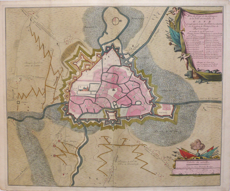
BEECK (Anna);
[GAND] Plan du siège et des attaques de la ville et citadelle de Gand.
La Haye Anna Beek circa 1710 488 x 586 mm.
Bookseller reference : LBW06229
|
|
|
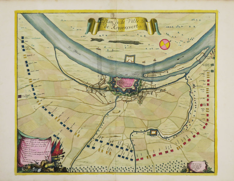
BEECK (Anna).
[KAISERSWERTH] Plan de la ville de Keyserswert.
La Haye, Anna Beek, [1702]. 383 x 470 mm.
Bookseller reference : LBW-3491
|
|
|
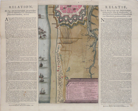
BEECK (Anna);
[OSTENDE] Fortificatie en attaque van Oostende.
La Haye Anna Beeck 1706 En 3 feuilles collées ensemble de 370 x 467 mm.
Bookseller reference : LBW0622a
|
|
|
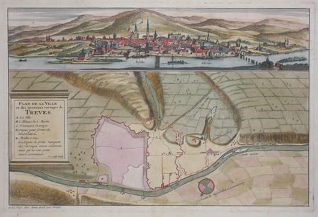
BEECK (Anna);
[TREVES] Plan de la ville et des nouveaux ouvrages de Treves.
La Haye Anna Beek circa 1710 244 x 370 mm.
Bookseller reference : LBW0622b
|
|
|
Beer, Gerard de
Beveren-Waas in oude prentkaaarten deel 2
Zaltbommel, Europese Bibliotheek, 1996 Hardcover, 80 pagina's, 15 x 21 cm. ISBN 9789028863170.
Bookseller reference : 64995
|
|
|
Beer, Gerard de
Beveren-Waas in oude prentkaaarten deel 1
Zaltbommel, Europese Bibliotheek, 1996 Hardcover, 80 pagina's, 15 x 21 cm.
Bookseller reference : 64996
|
|
|
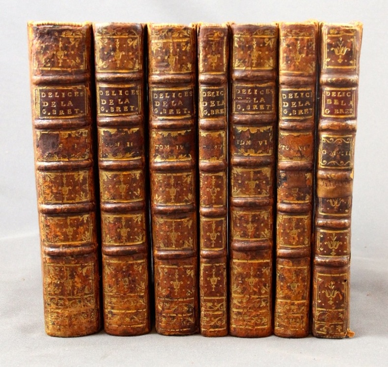
BEEVERELL James:
Les délices de la Grand’ Bretagne, & de l’Irlande; Où sont exactement décrites les Antiquitez, les Provinces, les Villes, les Bourgs, les Montagnes, les Rivières, les Ports de mer, les Bains, les Forteresse, Abbaies,...
A Leide, Chez Pierre Vander, 1727. 7 vol. (sur 8) in-8 de 1506-[2] (Pagination continue : [17 ff.], [278] + [299] + [164] + [128] + [198] + [177] + [131] pp.), plein veau havane moucheté, dos à nerfs ornés de fleurons dorés, étiquettes de titre bordeaux, tranches rouges. Dos et coins frottés, coiffes sup. des vol. 1, 4, 5 et 8 manquantes, coiffes inf. du vol. 8 manquante, accroc à la coiffe sup. vol. 6 et à la coiffe inf. vol. 4, mors 1er plat légèrement fendu aux vol. 1, 2, 4 et 5 (env. 1 cm.), quelques rousseurs sur les cartes et pl.
Bookseller reference : 2311
|
|
|
Bee Jay
Scotland's Shangri-La
No marks or inscriptions. A very clean very tight copy with bright unmarked pale green boards, slight bumping to lower page corners and no bumping to board corners. Dust jacket not price clipped or torn with slight marking and very minor creasing to edges. 359pp. The far north-west of Scotland in Wester Ross and Sutherland.

|
|
|
Beebe Lucius AUTOGRAPHED/Clegg Charles AUTOGRAPHED/Hammack ES. decorations/Shaw Fredric maps/lettering E. S.
Virginia & Truckee: A Story of Virginia City and Comstock Times
Oakland: Grahame H. Hardy 1949. 3rd edition. VG/VG dust jacket 1/4 inch tears to edges of dust jacket. SIGNED BY BOTH AUTHORS special Bucket of Blood edition 72 p. photos illus maps illus endpapers 8vo; Grahame H. Hardy hardcover
Bookseller reference : 67522

|
|
|
Behrman S. N. & line drawings/photos/maps
Portrait of Max
Random House. Very Good in Good dust jacket. 1960. Hardcover. used but still very attractive. Dustjacket is good though rippled at the top from moisture; 9 X 6.60 X 1.60 inches . Random House hardcover
Bookseller reference : 112237

|
|
|
BELLIN (Jacques-Nicolas).
[AFRIQUE DU SUD] Carte de la baye de Saldana ou Saldane.
[circa 1760]. 200 x 278 mm.
Bookseller reference : LBW024b7
|
|
|
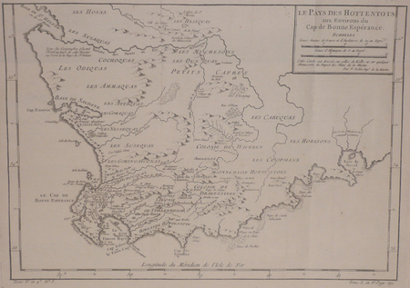
BELLIN (Jacques-Nicolas).
[AFRIQUE DU SUD] Le pays des Hottentots aux environs du Cap de Bonne Espérance.
[circa 1760]. 245 x 348 mm.
Bookseller reference : LBW024b8
|
|
|
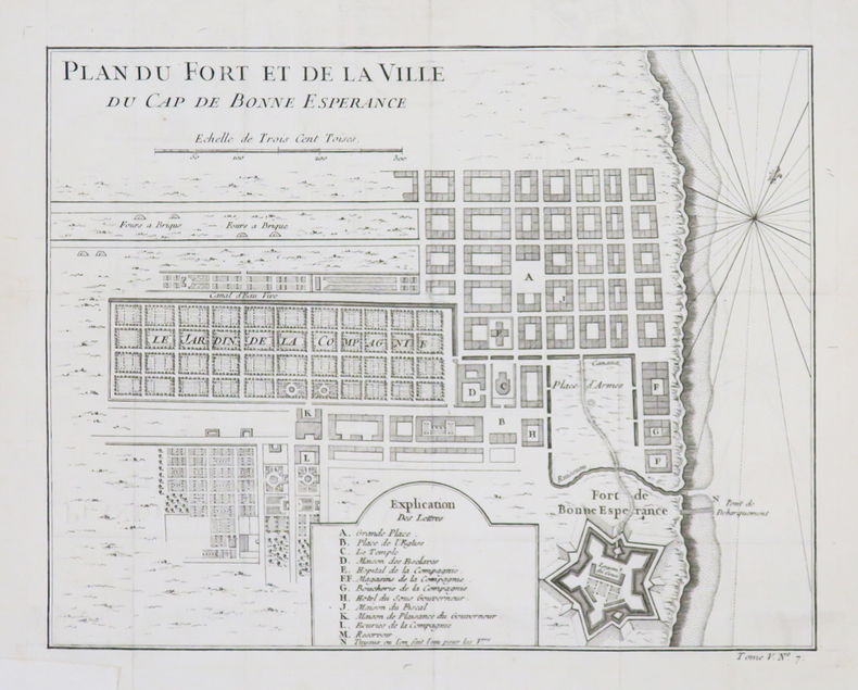
BELLIN (Jacques-Nicolas).
[AFRIQUE du SUD/LE CAP] Plan du fort et de la ville du Cap de Bonne Espérance.
[circa 1760]. 209 x 265 mm.
Bookseller reference : LBW-4532
|
|
|
BELLIN (Jacques-Nicolas).
[ALGERIE] Plan de la ville forts et port d'Alger.
[1764]. 211 x 169 mm.
Bookseller reference : LBW01b58
|
|
|
BELMAS (Jacques-Vital) & TARDIEU (Ambroise).
[ALMEIDA] Plan du siège d'Almeida par l'armée française de Portugal en 1810.
[1836]. 596 x 878 mm.
Bookseller reference : LBW-5980

|
|
|
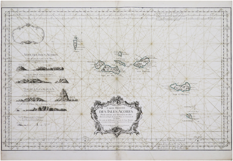
BELLIN (Jacques-Nicolas).
[AÇORES] Carte réduite des Isles Açores.
Paris, M. Bellin, 1755. 557 x 897 mm.
Bookseller reference : LBW-8147
|
|
|
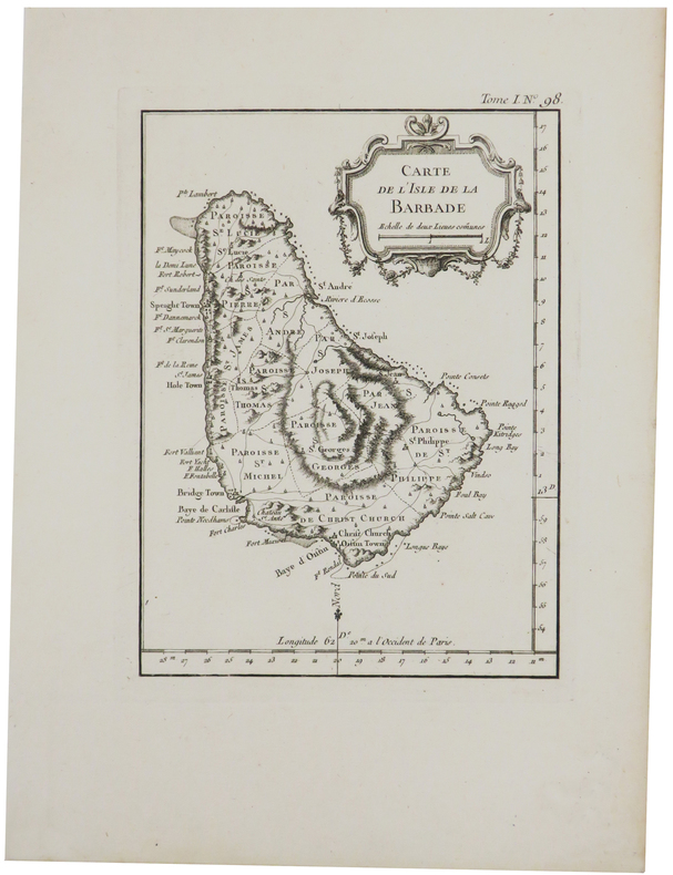
BELLIN (Jacques-Nicolas).
[BARBADE] Carte de l'isle de la Barbade.
1764. 200 x 147 mm.
Bookseller reference : LBW-2370
|
|
|
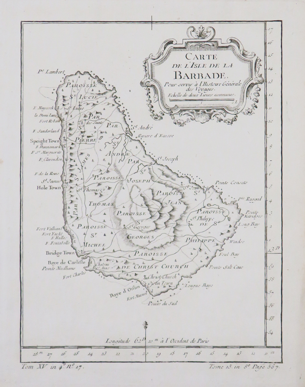
BELLIN (Jacques-Nicolas).
[BARBADE] Carte de l'isle de la Barbade.
[circa 1770]. 199 x 149 mm.
Bookseller reference : LBW-4879
|
|
|
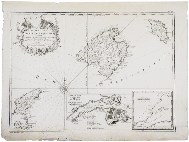
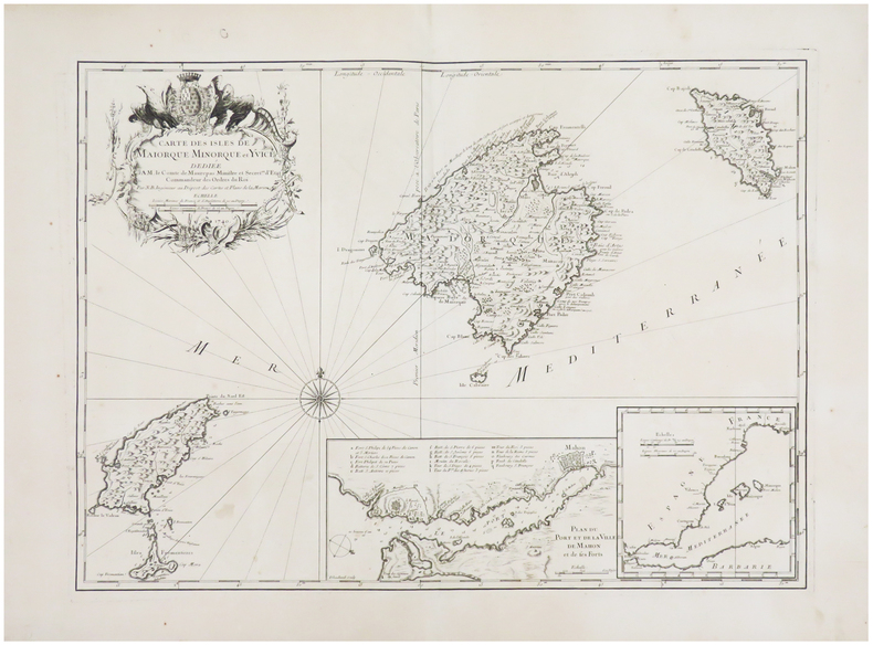
BELLIN (Jacques-Nicolas).
[BALÉARES] Carte des isles de Maiorque Minorque et Yvice.
[Paris], 1740-1756. 410 x 576 mm.
Bookseller reference : LBW-5915
|
|
|
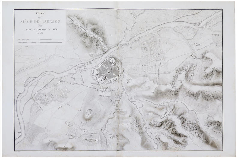
BELMAS (Jacques-Vital) & TARDIEU (Ambroise).
[BADAJOZ] Plan du siège de Badajoz par l'armée française du Midi en 1811.
[1836]. 611 x 898 mm.
Bookseller reference : LBW-5982
|
|
|
BELLIN (Jacques-Nicolas).
[BALÉARES/MINORQUE] Carte des isles de Maiorque Minorque et Yvice.
Paris, 1740. 408 x 563 mm.
Bookseller reference : LBW-6526
|
|
|
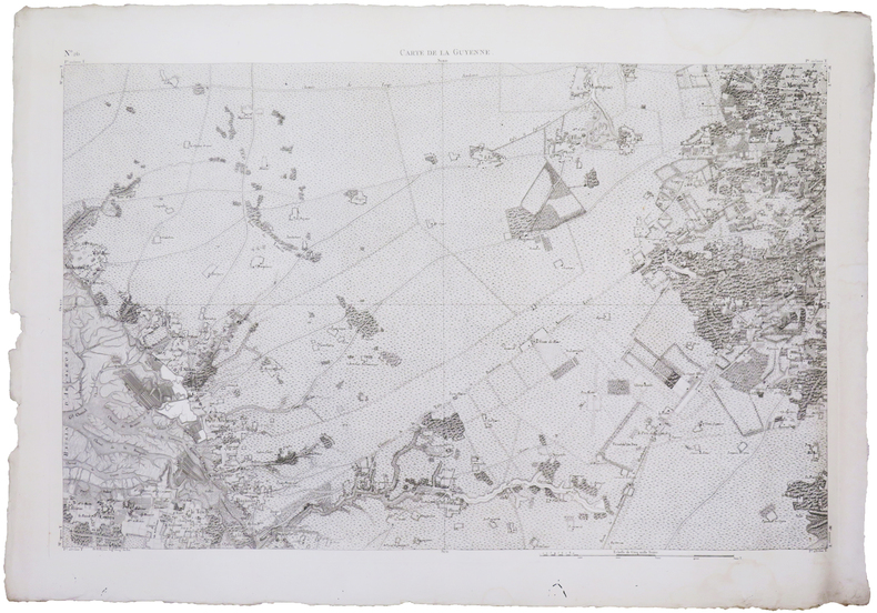
BELLEYME (Pierre de).
[BASSIN d'ARCACHON] Carte de la Guyenne [dite Carte de Belleyme]. Feuille n°26 (Le Teich).
[1785]. 585 x 895 mm.
Bookseller reference : LBW-7565
|
|
|
BELLIN (Jacques-Nicolas).
[BELLE-ÎLE-en-MER] Carte de l'isle de Belle Isle.
[Paris], 1764. 215 x 355 mm.
Bookseller reference : LBW-8294

|
|
|
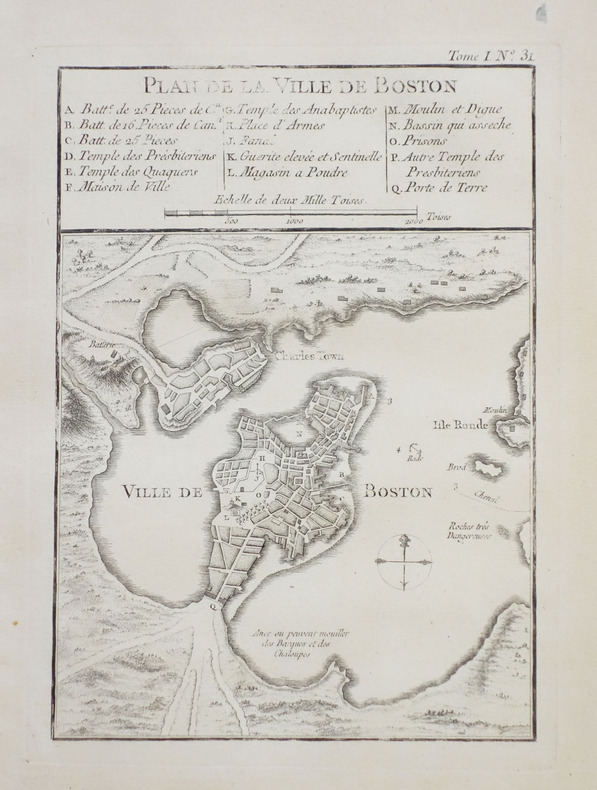
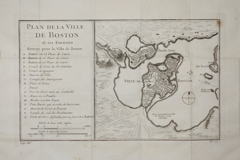
BELLIN (Jacques-Nicolas).
[BOSTON] Plan de la ville de Boston et ses environs.
1764. 212 x 152 mm.
Bookseller reference : LBW-2398
|
|
|
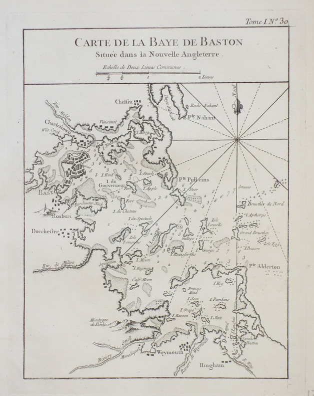
BELLIN (Jacques-Nicolas).
[BOSTON] Carte de la baye de Baston située dans la Nouvelle Angleterre.
1764. 211 x 161 mm.
Bookseller reference : LBW-2386
|
|
|
BELLIN (Jacques-Nicolas);
[BOSTON] Plan de la ville de Boston et ses environs.
vers 1760 164 x 271 mm.
Bookseller reference : LBW-2281
|
|
|
BELLIN (Jacques-Nicolas).
[BRESIL] Plan de la ville de St. Salvador capitale du Brésil.
[circa 1760]. 191 x 300 mm.
Bookseller reference : LBW-2341

|
|
|
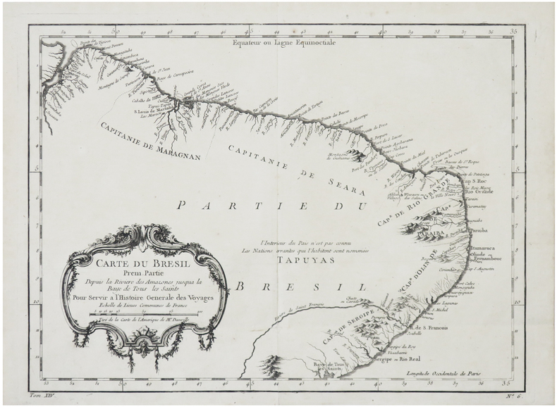
BELLIN (Jacques-Nicolas).
[BRÉSIL] Carte du Brésil, prem. partie. Depuis la rivière des Amazones jusqu'à la Baye de Tous les Saints.
[circa 1750]. 238 x 323 mm.
Bookseller reference : LBW-6382
|
|
|
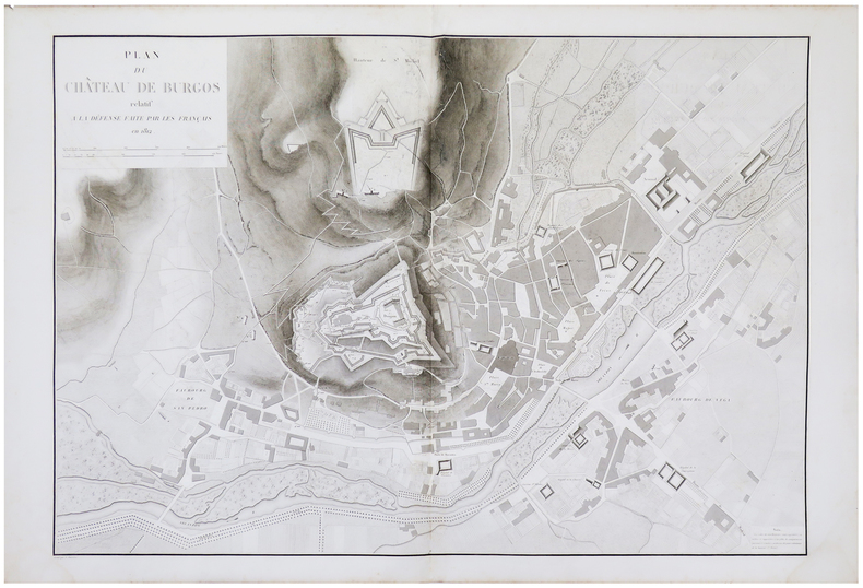
BELMAS (Jacques-Vital) & TARDIEU (Ambroise).
[BURGOS] Plan du château de Burgos relatif à la défense faite par les Français en 1812.
[1836]. 603 x 884 mm.
Bookseller reference : LBW-5985
|
|
|
BELLIN (Jacques-Nicolas);
[CANARIES] Carte des isles Canaries.
1746 204 x 282 mm.
Bookseller reference : LBW02500

|
|
|
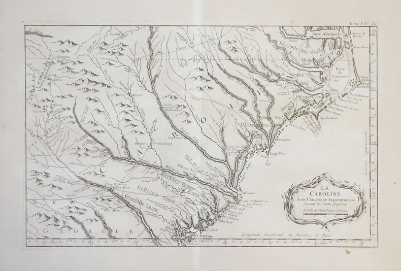
BELLIN (Jacques-Nicolas).
[CAROLINE du NORD et du SUD] La Caroline dans l'Amérique septentrionale suivant les cartes angloises.
1764. 224 x 355 mm.
Bookseller reference : LBW-2394
|
|
|
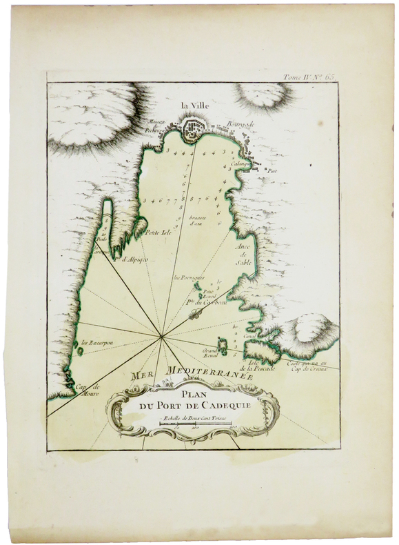
BELLIN (Jacques-Nicolas).
[CADAQUÉS] Plan du port de Cadequie.
[1764]. 220 x 175 mm.
Bookseller reference : LBW-5420
|
|
|
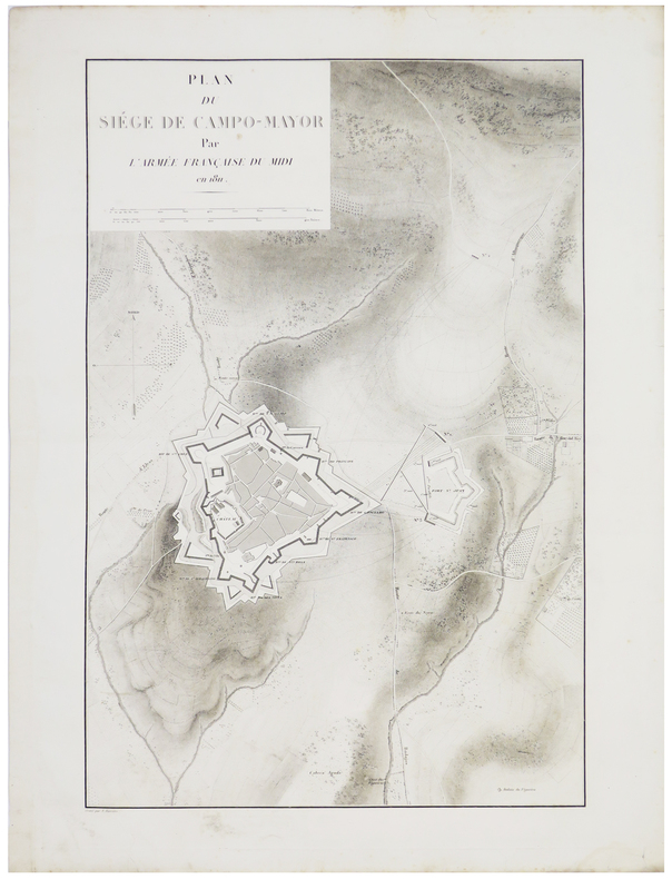
BELMAS (Jacques-Vital) & TARDIEU (Ambroise).
[CAMPO MAIOR] Plan du siège de Campo-Mayor par l'armée française du Midi en 1811.
[1836]. 578 x 380 mm.
Bookseller reference : LBW-5897
|
|
|
BELMAS (Jacques-Vital) & TARDIEU (Ambroise).
[CASTRO-URDIALES] Plan du siège de Castro-Urdiales par l'armée française du Nord en 1813.
[1836]. 597 x 397 mm.
Bookseller reference : LBW-5976

|
|
|
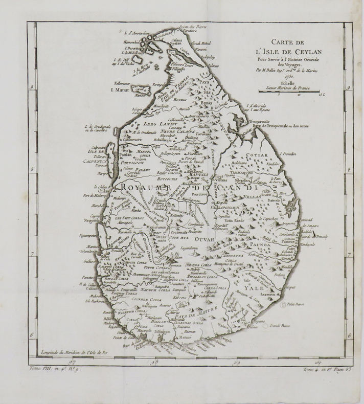
BELLIN (Jacques-Nicolas).
[CEYLAN/SRI LANKA] Carte de l'isle de Ceylan.
1750. 258 x 246 mm.
Bookseller reference : LBW-4786
|
|
|
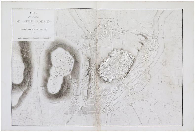
BELMAS (Jacques-Vital) & TARDIEU (Ambroise).
[CIUDAD RODRIGO] Plan du siège de Ciudad Rodrigo par l'armée française de Portugal en 1810.
[1836]. 602 x 890 mm.
Bookseller reference : LBW-5983
|
|
|
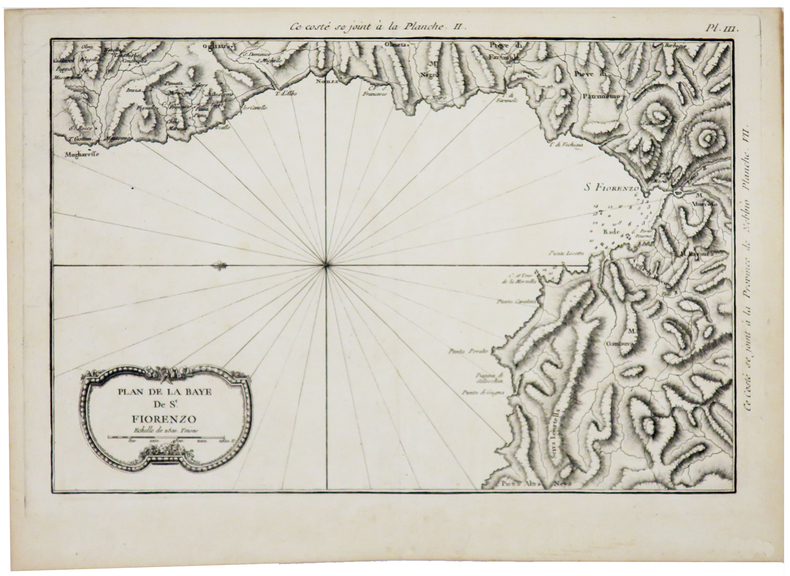
BELLIN (Jacques-Nicolas).
[CORSE] Plan de la baye de St. Fiorenzo.
[1769]. 216 x 322 mm.
Bookseller reference : LBW002cd
|
|
|
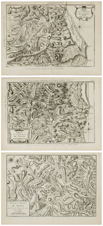
BELLIN (Jacques-Nicolas).
[CORSE] Partie de la province de Bastia. En trois feuilles.
[1769]. En trois feuilles d'environ 220 x 320 mm.
Bookseller reference : LBW002cf
|
|
|
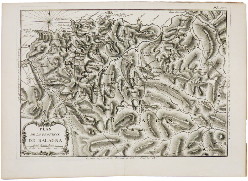
BELLIN (Jacques-Nicolas).
[CORSE] Plan de la province de Balagna.
[1769]. 222 x 310 mm.
Bookseller reference : LBW002d1
|
|
|
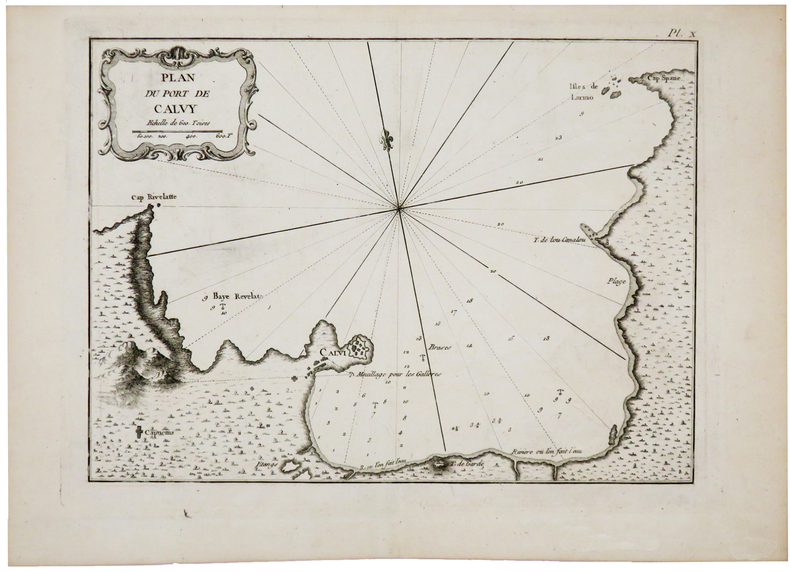
BELLIN (Jacques-Nicolas).
[CORSE] Plan du port de Calvy.
[1769]. 212 x 286 mm.
Bookseller reference : LBW002d2
|
|
|
BELLIN (Jacques-Nicolas).
[CORSE] Carte de la province d'Ajaccio et fief d'Istria en quatre feuilles.
[1769]. En quatre feuilles d'environ 230-240 x 275-300 mm.
Bookseller reference : LBW002d4

|
|
|
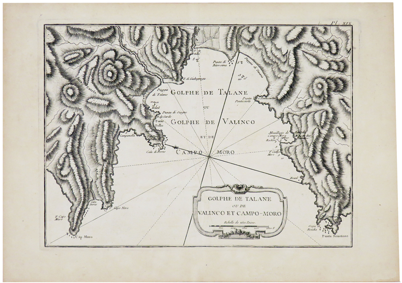
BELLIN (Jacques-Nicolas).
[CORSE] Golphe de Talane ou de Valinco et Campo-Moro.
[1769]. 210 x 288 mm.
Bookseller reference : LBW002d5
|
|
|
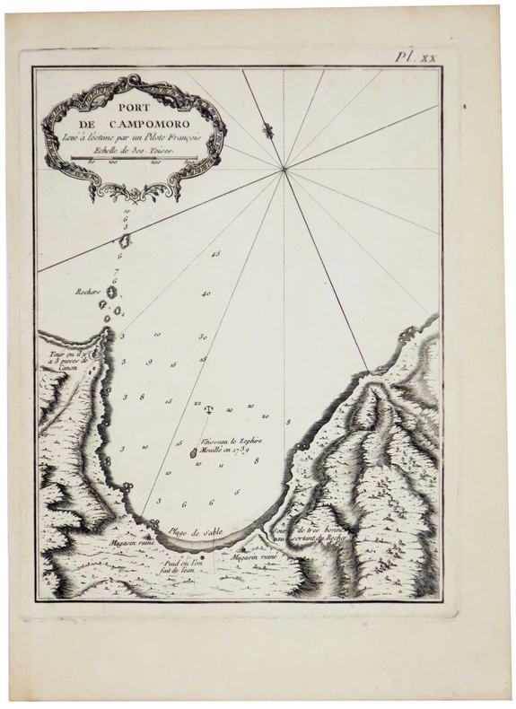
BELLIN (Jacques-Nicolas);
[CORSE] Port de Campomoro.
[1769]. 207 x 158 mm.
Bookseller reference : LBW002d6
|
|
|
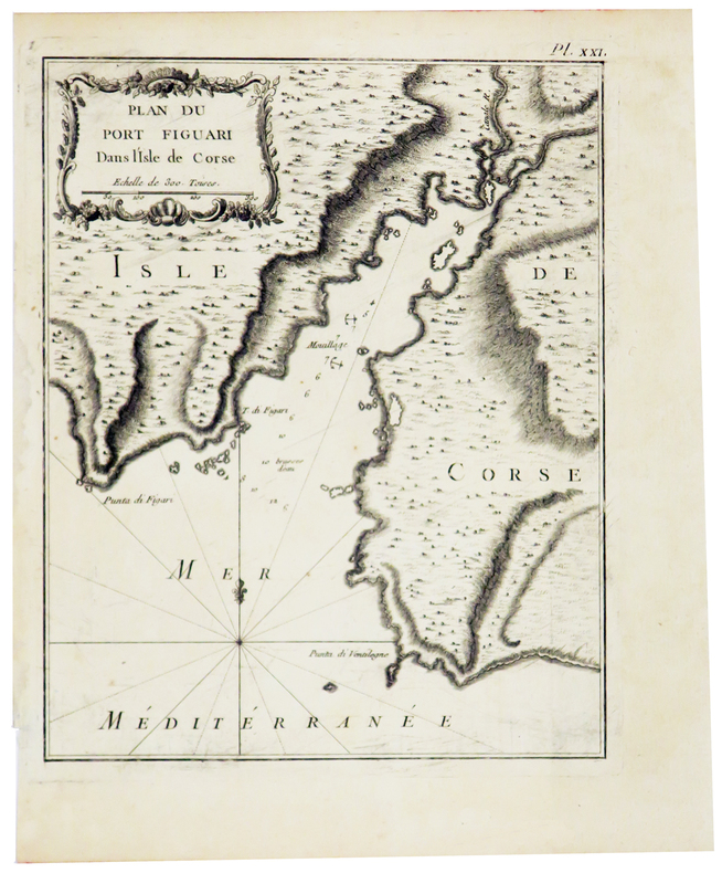
BELLIN (Jacques-Nicolas).
[CORSE] Plan du port Figuari dans l'isle de Corse.
[1769]. 218 x 177 mm.
Bookseller reference : LBW002d7
|
|
|
BELLIN (Jacques-Nicolas).
[CORSE] Plan du golfe de Ventilegne et partie de la coste jusqu'à Bonifacio.
[1769]. 222 x 310 mm.
Bookseller reference : LBW002d9

|
|
|
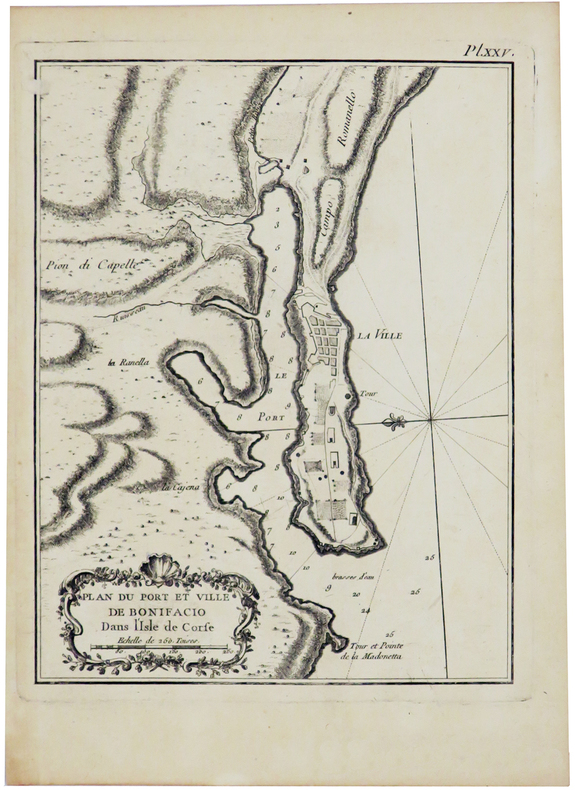
BELLIN (Jacques-Nicolas).
[CORSE] Plan du port et ville de Bonifacio dans l'isle de Corse.
[1769]. 212 x 163 mm.
Bookseller reference : LBW002da
|
|
|
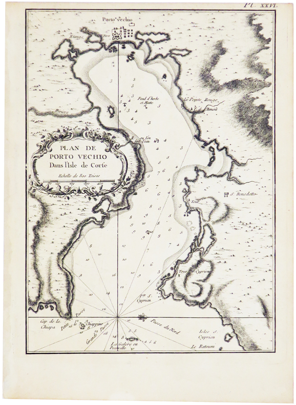
BELLIN (Jacques-Nicolas).
[CORSE] Plan de Porto Vechio dans l'isle de Corse.
[1769]. 229 x 167 mm.
Bookseller reference : LBW002db
|
|
|
BELLIN (Jacques-Nicolas).
[CORSE] Plan des bouches de Bonifacio et partie de la coste, depuis Porto Vecchio jusqu'à Bonifacio.
[1769]. 210 x 288 mm.
Bookseller reference : LBW002dc

|
|
|
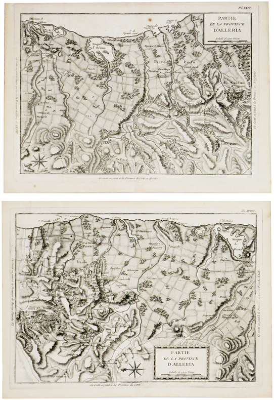
BELLIN (Jacques-Nicolas).
[CORSE] Partie de la province d'Alleria.
[1769]. En deux feuilles d'environ 225 x 325 mm.
Bookseller reference : LBW002dd
|
|
 Receive by email
 Download as PDF document
 RSS feed


