|
boisseranc ( claudine ) bayle ( georges )
les hautes-alpes d'antan
les provinciales curendera 1989 in 4 broché (30cmX21cm) 143 pages tres nombreuses illustrations par la carte postale
Bookseller reference : 1804

|
|
|
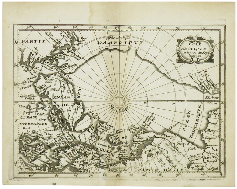
BOISSEVIN (Louis).
[PÔLE NORD] Pôle Arctique ou terres du septentrion.
[Paris, Louis Boissevin, 1653]. 142 x 198 mm.
Bookseller reference : LBW-6174
|
|
|
BOITE CARTES LECTURE
CARTES A LIRE 1RE ANNEE ANAPHORES
PASSE-TEMPS EDITIONS
Bookseller reference : SVBLIVCN-9830096008199
|
|
|
BOITE CARTES LECTURE
CARTES A LIRE 1RE ANNEE IDEE PRINCIPALE
PASSE-TEMPS EDITIONS
Bookseller reference : SVBLIVCN-9830096008151
|
|
|
BOITE CARTES LECTURE
CARTES A LIRE 1RE ANNEE INFERENCES
PASSE-TEMPS EDITIONS
Bookseller reference : SVBLIVCN-9830096008175
|
|
|
BOITE CARTES LECTURE
CARTES A LIRE 1RE ANNEE PREDICTIONS
PASSE-TEMPS EDITIONS
Bookseller reference : SVBLIVCN-9830096008182
|
|
|
BOITE CARTES LECTURE
CARTES A LIRE 1RE ANNEE REPERAGE
PASSE-TEMPS EDITIONS
Bookseller reference : SVBLIVCN-9830096008168
|
|
|
BOITE CARTES LECTURE
CARTES A LIRE 1RE ANNEE VOCABULAIRE
PASSE-TEMPS EDITIONS
Bookseller reference : SVBLIVCN-9830096008205
|
|
|
BOITE CARTES LECTURE
CARTES A LIRE 2E ANNEE ANAPHORES
PASSE-TEMPS EDITIONS
Bookseller reference : SVBLIVCN-9830096008267
|
|
|
BOITE CARTES LECTURE
CARTES A LIRE 2E ANNEE IDEE PRINCIPALE
PASSE-TEMPS EDITIONS
Bookseller reference : SVBLIVCN-9830096008229
|
|
|
BOITE CARTES LECTURE
CARTES A LIRE 2E ANNEE INFERENCES
PASSE-TEMPS EDITIONS
Bookseller reference : SVBLIVCN-9830096008243
|
|
|
BOITE CARTES LECTURE
CARTES A LIRE 2E ANNEE PREDICTIONS
PASSE-TEMPS EDITIONS
Bookseller reference : SVBLIVCN-9830096008250
|
|
|
BOITE CARTES LECTURE
CARTES A LIRE 2E ANNEE REPERAGE
PASSE-TEMPS EDITIONS
Bookseller reference : SVBLIVCN-9830096008236
|
|
|
BOITE CARTES LECTURE
CARTES A LIRE 2E ANNEE VOCABULAIRE
PASSE-TEMPS EDITIONS
Bookseller reference : SVBLIVCN-9830096008274
|
|
|
BOITE CARTES LECTURE
CARTES A LIRE 3E ANNEE ANAPHORES
PASSE-TEMPS EDITIONS
Bookseller reference : SVBLIVCN-9830096008335
|
|
|
BOITE CARTES LECTURE
CARTES A LIRE 3E ANNEE INFERENCES
PASSE-TEMPS EDITIONS
Bookseller reference : SVBLIVCN-9830096008311
|
|
|
BOITE CARTES LECTURE
CARTES A LIRE 3E ANNEE PREDICTIONS
PASSE-TEMPS EDITIONS
Bookseller reference : SVBLIVCN-9830096008328
|
|
|
BOITE CARTES LECTURE
CARTES A LIRE 3E ANNEE VOCABULAIRE
PASSE-TEMPS EDITIONS
Bookseller reference : SVBLIVCN-9830096008342
|
|
|
BOITE CARTES LECTUREE
CARTES A LIRE 3E ANNEE REPERAGE
PASSE-TEMPS EDITIONS
Bookseller reference : SVBLIVCN-9830096008304
|
|
|
BOITE JEUX DE CARTES -ENSEMBLE 1-
ORTHOGRAPHE SANS PAPIER NI CRAYON 6-8 ANS
CHENELIERE EDUCATION (CA)
Bookseller reference : SVBLIVCN-9782765051541
|
|
|
BOITE JEUX DE CARTES -ENSEMBLE 2-
ORTHOGRAPHE SANS PAPIER NI CRAYON 8-10 ANS
CHENELIERE EDUCATION (CA)
Bookseller reference : SVBLIVCN-9782765051558
|
|
|
BOITE JEUX DE CARTES -ENSEMBLE 3-
ORTHOGRAPHE SANS PAPIER NI CRAYON 10-12 ANS
CHENELIERE EDUCATION (CA)
Bookseller reference : SVBLIVCN-9782765051565
|
|
|
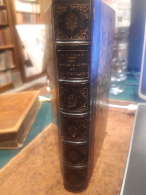
Boiteau d'Ambly,P.
Les cartes à jouer et la cartomancie
Paris, Librairie de L.Hachette 1854 1 in -8 Demi chagrin 386[p.p]
Bookseller reference : LCI-4056
|
|
|
BOITES 80 CARTES JEU
COMPREHENSION EN LECTURE 5E ANNEE
L'ENVOLEE (CA)
Bookseller reference : SVBLIVCN-9782894885741
|
|
|
BOITES 80 CARTES JEU
COMPREHENSION EN LECTURE 6E ANNEE
L'ENVOLEE (CA)
Bookseller reference : SVBLIVCN-9782894885765
|
|
|
BOITES CARTES LECTURE
CARTES A LIRE 3E ANNEE IDEE PRINCIPALE
PASSE-TEMPS EDITIONS
Bookseller reference : SVBLIVCN-9830096008298
|
|
|
BOIVIN (Mariette).
[QUÉBEC] Le Vieux Québec.
Québec, Librairie Garneau Limitée, 1976. 682 x 937 mm.
Bookseller reference : LBW-7722

|
|
|
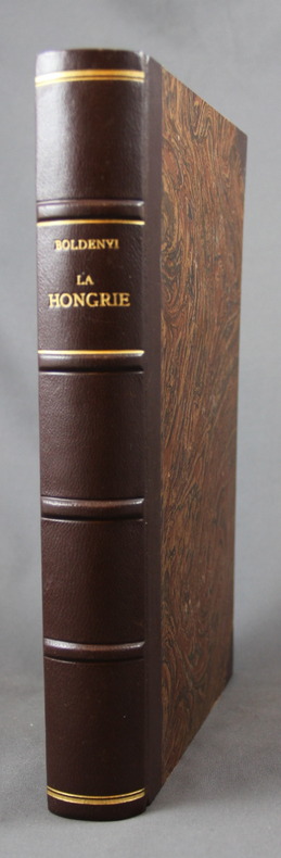
BOLDENYI M. J. (dir.):
La Hongrie ancienne et moderne. Histoire, arts, littératures, monuments. Par une société de littérateurs.
Paris, H. Lebrun, 1851. 2 tomes en 1 volume in-4 de 239, 159 pages, demi-chagrin marron à coins, dos à nerfs orné. Quelques rousseurs.
Bookseller reference : 2049
|
|
|
Bolivar Simon Trend JB. and Maps on End Papers J. B.
Bolivar and the Independence of Spanish America Teach Yourself History Series
Hardcover. Good. hardcover
Bookseller reference : 715896
|
|
|
BOLL (Marcel).-
La chance et les jeux de hasard. Loterie - Boule - Roulettes - Baccar - 30 et 40 - Dés - Bridge - Poker - Belote - Ecarté - Piquet - Manille.
P., Librairie Larousse, 1936, fort in 8° broché, 382 pages ; couverture illustrée en couleurs, fanée avec petites déchirures avec manques ; 20 premières pages "rongées" à un angle.
Bookseller reference : 51488
|
|
|
BONACKER, Wilhelm / MEINE, Karl-Heinz:
Kartengeschichte und Kartenbearbeitung. Festschrift zum 80. Geburtstag von Wilhelm Bonacker, Geograph u. Wissenschaftlicher Kartograph in Berlin, am 17.März 1968.
Bad Godesberg, Kirschbaum Verlag, 1968, in-4to, 261 S. (+ 1 weiss) + 5 Bl. Werbung. Mit 30 Kartentafeln, 61 Textabb. u. 12 Tab. Bibl.-Stempel (Getilgt) auf Vorsatz, Original-Leinenband. Schönes Exemplar.
Bookseller reference : 129528aaf
|
|
|
BONACKER, Wilhelm:
Bibliographie der Strassenkarte. Annlasslich des 85 : Geburtstages des Autors am 17 : Marz 1973 aus dem Nachlass herausgegebene Zusammenstellung von weit mehr als 4600 Kartenobjekten, mit einer Einfuhrung versehen von Rudolf Kinauer.
Bonn : Kirschbaum Verlag, 1973, gr. in-8vo, XXV + 242 S. + 2 Bl. (Werbung), hs. Widmung Ueberreicht v.d. Töchter G. Ledewa - Bonacker Berlin 1973, Original-Leinenband. Mit Orig.- Rhodoidumschlag.
Bookseller reference : 135369aaf
|
|
|
BONAFOUS ; DELAGE ; [Ministère des Travaux publics-Ponts et Chaussées. Etudes et Travaux].
Chemin de fer de Felletin à Ussel. Rapport sur l'exécution des travaux. [REGIONALISME CORREZE]
Sans lieu [Paris], sans nom, sans date [1905]. Grand In-8 -21 x 31 cm. Reliure de l'éditeur à la bradel en pleine percaline bordeaux, dos lisse, titrage à l'or sur le premier plat. 1 pl, 47 pp., 32 pl. Ouvrage de toute rareté (un seul exemplaire trouvé en bibliothèque). Un plan et profil en long généraux indiquent en préambule la localisation des ouvrages d'art (ponts, essentiellement), suit un rapport sur l'exécution des travaux et les tableaux des dépenses effectuées organisé ainsi : historique, personnel, tracé, longueur de la ligne, alignements et courbes, déclivités, altitudes principales, acquisitions de terrains ; Infrastructure ; Renseignements généraux sur les principaux travaux d'infrastructure ; Superstructure. Chaque ouvrage d'art est ensuite représenté au moyen d'une ou plusieurs planches (plans et coupes), en noir et en couleurs, certaines dépliantes : pont de Felletin sur la Creuse, 6 ponts voûtés (2 sur la Creuse, 2 sur la Liège, un sur le ruisseau de Mirambel, 1 sur le Gourbillon), 2 ponceaux voûtés sur la Creuse, un type d'aqueduc, un passage supérieur voûté, un passage inférieur voûté, le souterrain de Gaudeix, murs de soutènement et de revêtement entre les ponts, travaux de défense des dérivations de la Liège , consolidation et assainissement de tranchées et remblais. In-fine, les planches 27 à 32 illustrent les stations de la nouvelle ligne de chemin de fer (plans généraux, bâtiments, divers équipements).
Bookseller reference : 2460
|
|
|
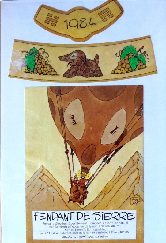
Bondroit:
Etiquette Fendant de Sierre.
Etiquette de vin 12 x 9 cm. et 2 bandeaux pour un Fendant de Sierre (Bernard Rouvinez).
Bookseller reference : 1897
|
|
|
Bonet, Juan
Mallorca
No marks or inscriptions. No creasing to covers or to spine. A very clean very tight copy with bright unmarked boards and no bumping to corners. 212pp. Guide to Mallorca (Majorca), very well illustrated with text throughout the pictorial section (160pp) in English. Practical information at end in English, Spanish, French and German. Very scarce in the UK.
|
|
|
BONIFAS (Aimé).
Le Bouschet-de-Pranles (Ardèche): Maison de Marie Durand.
s.l., s.d., 1 carte postale de 13 x 9 cm, dessin de Aimé Bonifas ;
Bookseller reference : 4212
|
|
|
BONNAMOUR Jacques
Le canton de Matour en 1900... à travers les cartes postales.
Editions de Saint-Seine-l'Abbaye, 1984, 83 p., broché, bon état.
Bookseller reference : 87057
|
|
|
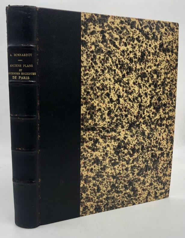
BONNARDOT (Alfred).
Études archéologiques sur les anciens plans de Paris. des XVIe, XVIIe et XVIIIe siècles
Paris, Librairie ancienne de Deflorenne [Imprimerie de Hennuyer], 1851 in-4, [2] ff. n. ch., 248 pp., [4] ff. n. ch., avec une planche hors texte, demi-chagrin noir, dos à nerfs, tranches mouchetées, couvertures bleues imprimées conservées (reliure de la fin du XIXe siècle). Petits frottements au dos.
Bookseller reference : 228886
|
|
|
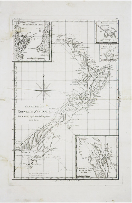
BONNE (Rigobert & COOK (James).
[NOUVELLE-ZÉLANDE] Carte de la Nouvelle Zéelande.
[1788]. 346 x 237 mm.
Bookseller reference : LBW-7242
|
|
|
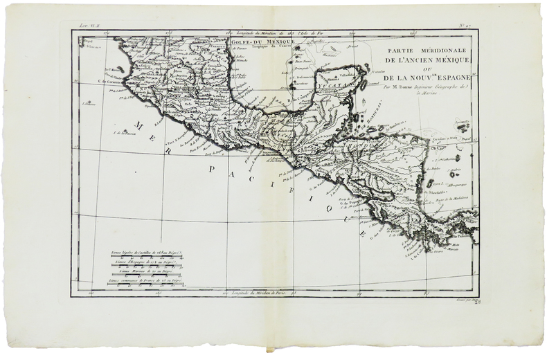
BONNE (Rigobert).
[AMÉRIQUE CENTRALE] Partie méridionale de l'ancien Méxique ou de la Nouv.le Espagne.
[1780]. 211 x 318 mm.
Bookseller reference : LBW-5900
|
|
|
BONNE (Rigobert).
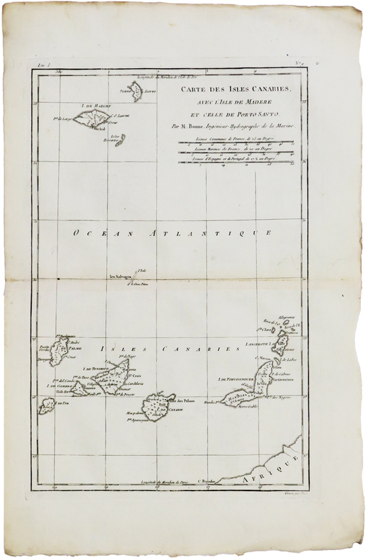
[CANARIES & MADÈRE] Carte des isles Canaries, avec l'isle de Madère et celle de Porto Santo.
[1780]. 320 x 211 mm.
Bookseller reference : LBW-5941
|
|
|
BONNE (Rigobert).
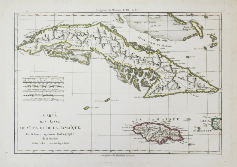
[CUBA/JAMAÏQUE] Carte des isles de Cuba et de la Jamaïque.
1782. 223 x 320 mm.
Bookseller reference : LBW-3727
|
|
|
BONNE (Rigobert).
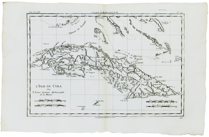
[CUBA] L'isle de Cuba.
[1780]. 214 x 316 mm.
Bookseller reference : LBW-5930
|
|
|
BONNE (Rigobert).
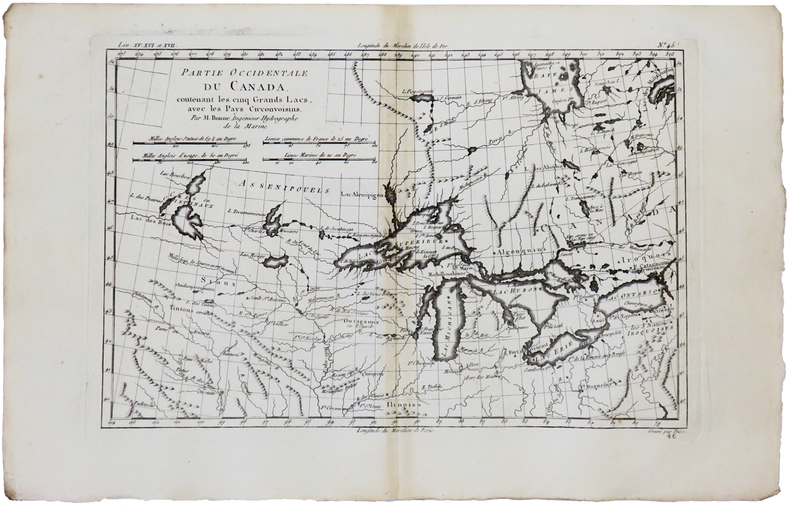
[GRANDS LACS] Partie occidentale du Canada, contenant les cinq Grands Lacs, avec les pays circonvoisins.
[1780]. 212 x 314 mm.
Bookseller reference : LBW-5929
|
|
|
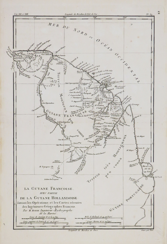
BONNE (Rigobert).
[GUYANE] La Guyane Françoise, avec partie de la Guyane Hollandoise.
[circa 1770]. 322 x 230 mm.
Bookseller reference : LBW-4789
|
|
|
BONNE (Rigobert).
[LOUISIANE & FLORIDE] Carte de la Louisiane, et de la Floride.
[1780]. 321 x 205 mm.
Bookseller reference : LBW-5894

|
|
|
BONNE (Rigobert).
[NOUVEAU-MEXIQUE] Le Nouveau Mexique avec la partie septentrionale de l'ancien, ou de la Nouvelle Espagne.
[1780]. 208 x 315 mm.
Bookseller reference : LBW-5928

|
|
|
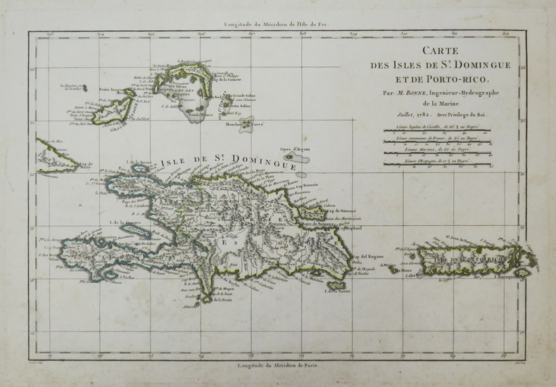
BONNE (Rigobert).
[PORTO-RICO/SAINT-DOMINGUE] Carte des isles de St. Domingue et de Porto-Rico.
1782. 225 x 332 mm.
Bookseller reference : LBW-3728
|
|
|
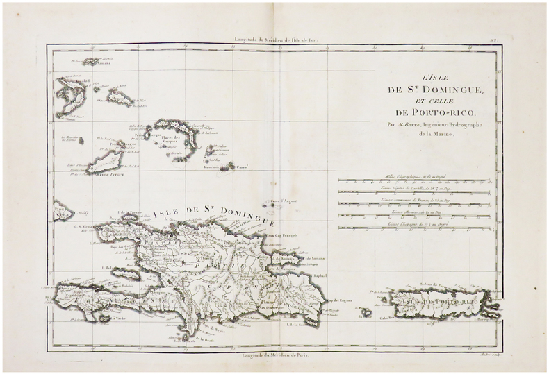
BONNE (Rigobert).
[PORTO-RICO/SAINT-DOMINGUE] L'Isle de St. Domingue et celle de Porto-Rico.
[1788]. 236 x 347 mm.
Bookseller reference : LBW02492
|
|
|
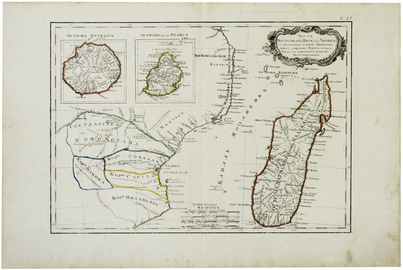
BONNE (Rigobert).
[REUNION-MAURICE-MADAGASCAR] [Partie de la côte orientale d'Afrique avec l'île de Madagascar et les îles de France et de Bourbon].
[circa 1780]. 285 x 405 mm.
Bookseller reference : LBW-3427
|
|

 Receive by email
 Download as PDF document
 RSS feed
 Permanent link


