|
DÉPÔT GÉNÉRAL DE LA MARINE.
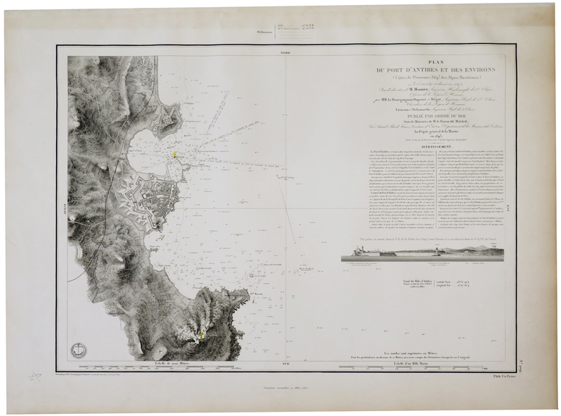
[ANTIBES] Plan du port d'Antibes et des environs (Côtes de Provence, Dép.t des Alpes Maritimes).
Dépôt Général de la Marine, 1843-1873. 470 x 591 mm.
Bookseller reference : LBW-5702
|
|
|
DÉPÔT GÉNÉRAL DE LA MARINE.
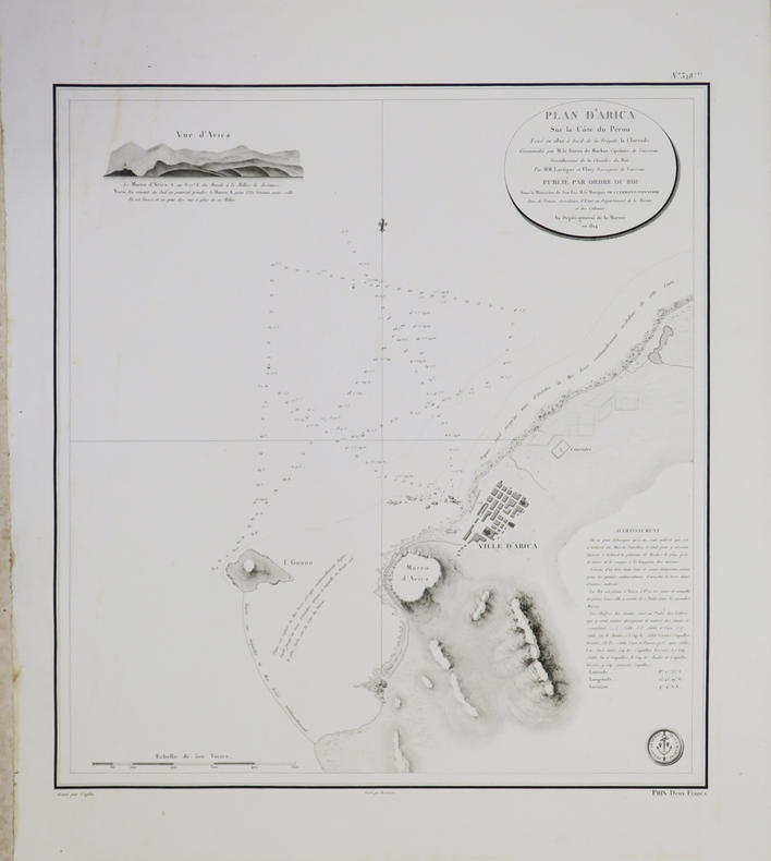
[CHILI] Plan d'Arica sur la côte du Pérou.
1824. 460 x 426 mm.
Bookseller reference : LBW-3712
|
|
|
DÉPÔT GÉNÉRAL DE LA MARINE.
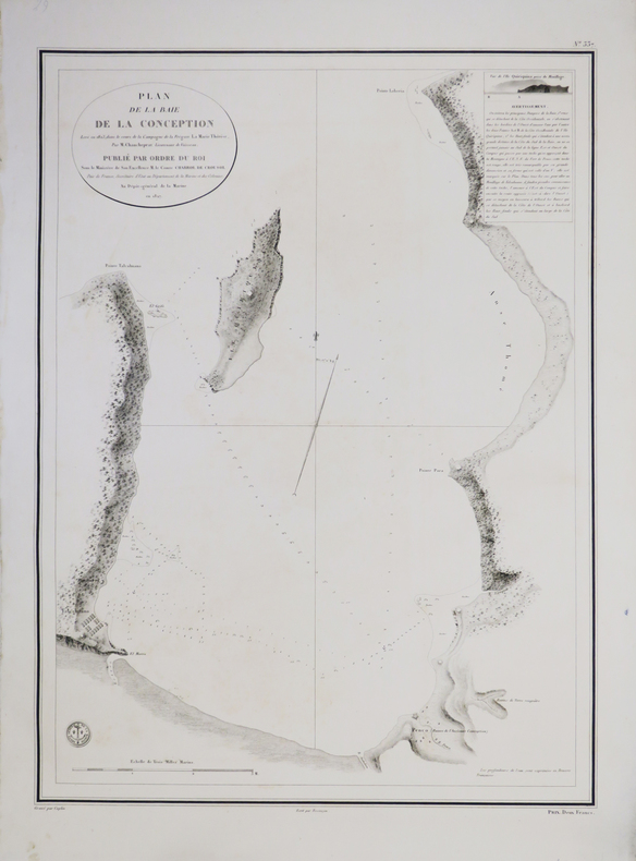
[CHILI] Plan de la baie de la Conception.
1827. 593 x 438 mm.
Bookseller reference : LBW-3704
|
|
|
DÉPÔT GÉNÉRAL DE LA MARINE.
[CHILI] Plan de Valdivia sur la côte du Chili.
1825. 614 x 932 mm.
Bookseller reference : LBW-3710

|
|
|
DÉPÔT GÉNÉRAL DE LA MARINE.
[CHILI] Plan du port de Baldivia à la côte occidentale de l'Amérique méridionale - Plan de la rade de S.n Juan Bautista à la pointe N.E. de l'île de Juan Fernandez.
1821. 562 x 409 mm.
Bookseller reference : LBW-3706

|
|
|
DÉPÔT GÉNÉRAL DE LA MARINE.
[CHILI] Plan du port de S.n Carlos situé à la partie du nord de l'île de Chiloé.
1821. 558 x 410 mm.
Bookseller reference : LBW-3705

|
|
|
DÉPÔT GÉNÉRAL DE LA MARINE.
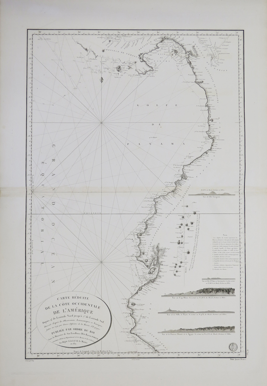
[COSTA RICA/PANAMA/PÉROU] Carte réduite de la côte occidentale de l'Amérique depuis 9.° de latitude nord jusqu'à 7.° de latitude sud.
1821. 846 x 562 mm.
Bookseller reference : LBW-3714
|
|
|
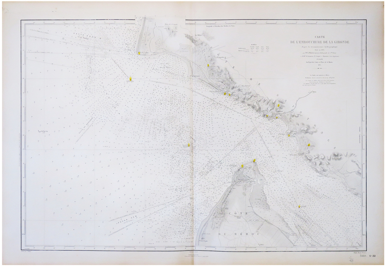
DÉPÔT GÉNÉRAL DE LA MARINE.
[GIRONDE] Carte de l'embouchure de la Gironde d'après la reconnaissance hydrographique faite en 1874.
Paris, Dépôt des Cartes et Plans de la Marine, 1875-1888. 638 x 929 mm.
Bookseller reference : LBW-6805
|
|
|
DÉPÔT GÉNÉRAL DE LA MARINE.
[MEXIQUE] Carte réduite de la côte du Mexique sur la mer du Sud depuis le golfe Dulce jusqu'au cap Corrientes.
1823. 571 x 891 mm.
Bookseller reference : LBW-3711

|
|
|
DÉPÔT GÉNÉRAL DE LA MARINE.
[PÉROU/CHILI] Plan du Callao de Lima ou port de Lima, la capitale du Pérou - Plan de l'anse et port de Valparaiso.
[circa 1820]. 592 x 426 mm.
Bookseller reference : LBW-3709

|
|
|
DÉPÔT GÉNÉRAL DE LA MARINE.
[PÉROU] Plan de Mollendo sur la côte du Pérou - Plan d'Ilo sur la côte du Pérou.
1824. 440 x 589 mm.
Bookseller reference : LBW-3708

|
|
|
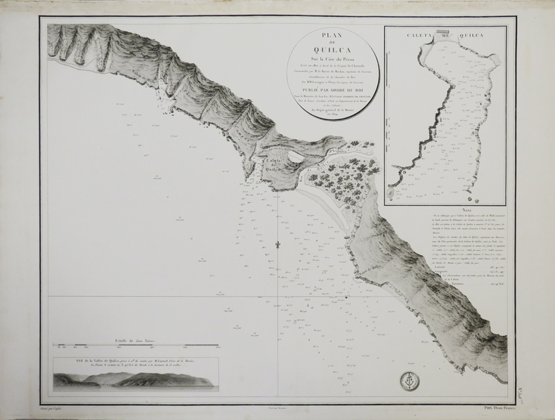
DÉPÔT GÉNÉRAL DE LA MARINE.
[PÉROU] Plan de Quilca sur la côte du Pérou.
1824. 471 x 578 mm.
Bookseller reference : LBW-3707
|
|
|
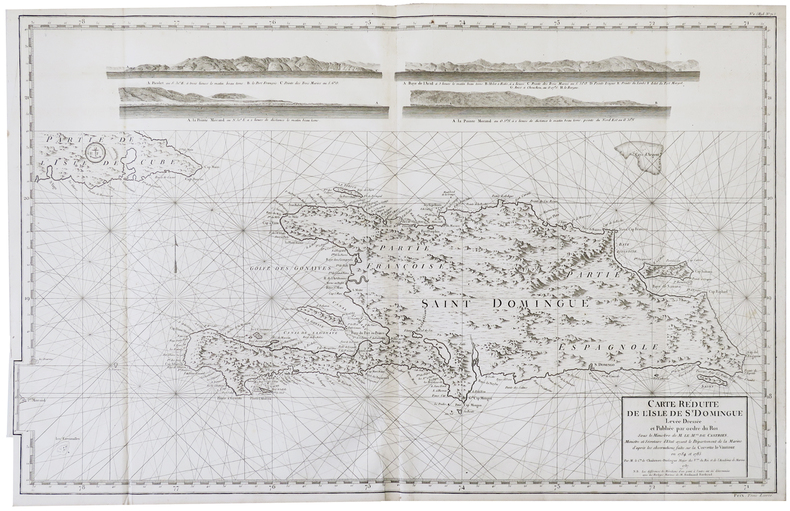
DÉPÔT GÉNÉRAL DE LA MARINE.
[SAINT-DOMINGUE] Carte réduite de l'isle de S.t Domingue.
Dépôt Général de la Marine, 1787 [circa 1795]. 595 x 945 mm.
Bookseller reference : LBW-6293
|
|
|
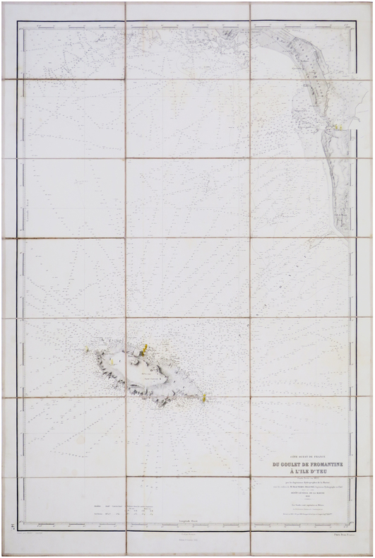
DÉPÔT GÉNÉRAL de la MARINE.
[VENDÉE/L'ÎLE d'YEU] Côte ouest de France. Du Goulet de Fromantine à l'Île d'Yeu.
Dépôt Général de la Marine, 1828-1901. En 21 sections montées sur toile et repliées, formant une carte de 975 x 650 mm ; étiquette au dos de l'éditeur parisien Forest, portant le titre en manuscrit."
Bookseller reference : LBW-7878
|
|
|
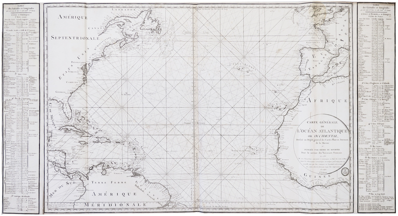
DÉPÔT GÉNÉRAL des CARTES PLANS et JOURNAUX de la MARINE.
[ATLANTIQUE] Carte générale de l'océan Atlantique ou Occidental.
1786-1792. 0,61 x 1,15 m.
Bookseller reference : LBW-6295
|
|
|
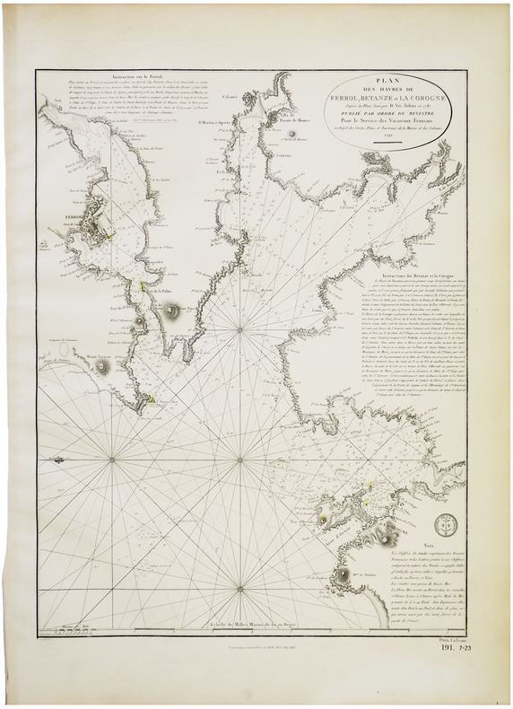
DÉPÔT GÉNÉRAL des CARTES PLANS et JOURNAUX de la MARINE et des COLONIES.
[LA COROGNE] Plan des havres de Ferrol, Betanze et La Corogne.
Dépôt des Cartes, Plans et Journaux de la Marine et des Colonies, 1792-1883. 585 x 436 mm.
Bookseller reference : LBW-5709
|
|
|
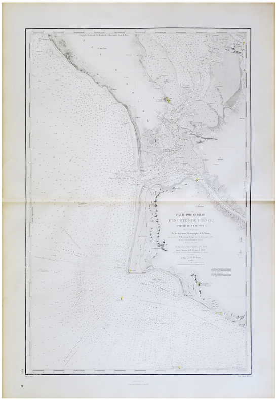
DÉPÔT-GÉNÉRAL DE LA MARINE & BEAUTEMPS-BEAUPRÉ (Charles-François).
[GARONNE/DORDOGNE] Carte particulière des côtes de France (cours de la Garonne depuis Bordeaux jusqu'au Bec d'Ambès et cours de la Dordogne depuis Libourne jusqu'à la même pointe).
Dépôt-Général de la Marine, 1831. 585 x 890 mm.
Bookseller reference : LBW-5745

|
|
|
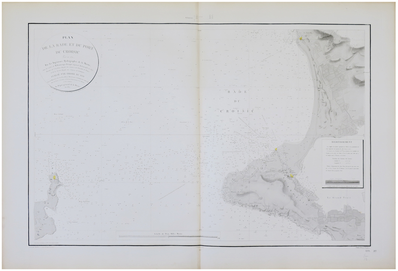
DÉPÔT-GÉNÉRAL DE LA MARINE & BEAUTEMPS-BEAUPRÉ (Charles-François).
[LE CROISIC] Plan de la rade et du port du Croisic.
Dépôt-Général de la Marine, 1827-1867. 618 x 890 mm.
Bookseller reference : LBW-5759
|
|
|
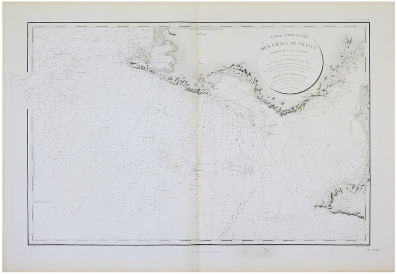
DÉPÔT-GÉNÉRAL DE LA MARINE & BEAUTEMPS-BEAUPRÉ (Charles-François).
[LE CROISIC]. Carte particulière des côtes de France (Embouchure de la Loire).
Dépôt-Général de la Marine, 1828-1888. 595 x 935 mm.
Bookseller reference : LBW-5758
|
|
|
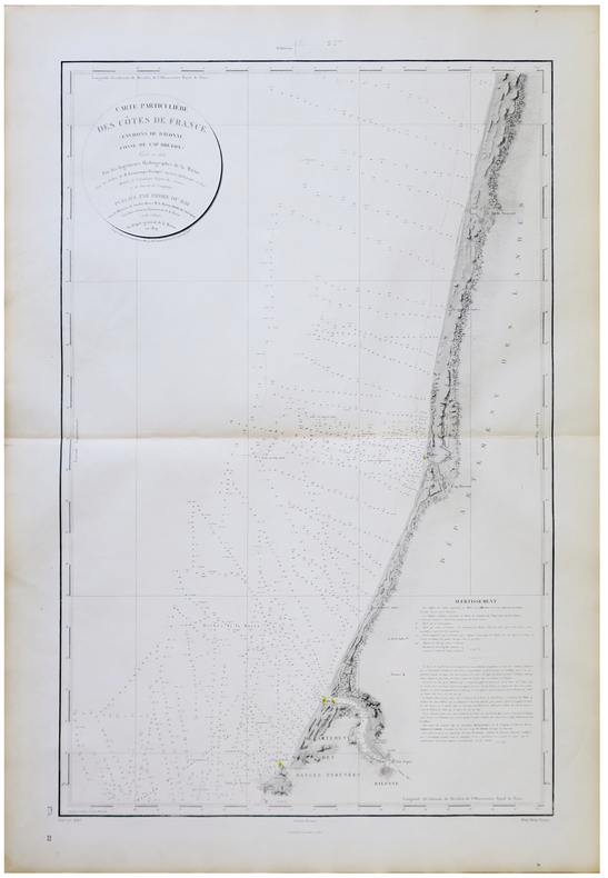
DÉPÔT-GÉNÉRAL DE LA MARINE & BEAUTEMPS-BEAUPRÉ (Charles-François).
[PAYS BASQUE/LANDES] Carte particulière des côtes de France (Environs de Bayonne, Fosse de Cap Breton).
Dépôt-Général de la Marine, 1829-1870. 935 x 580 mm.
Bookseller reference : LBW-5744
|
|
|
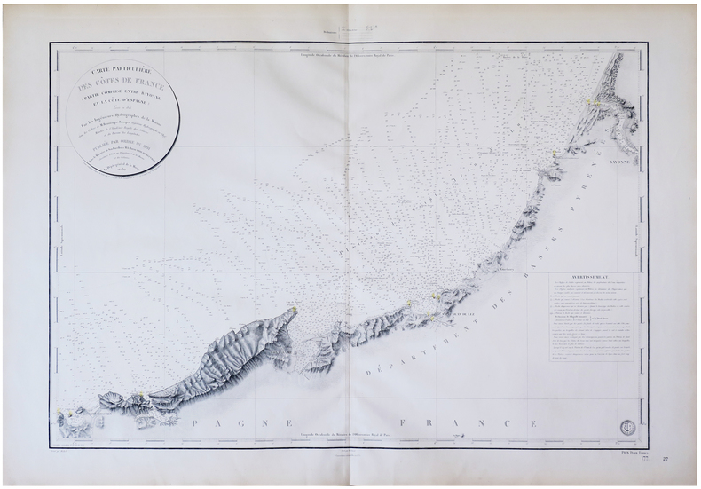
DÉPÔT-GÉNÉRAL DE LA MARINE & BEAUTEMPS-BEAUPRÉ (Charles-François).
[PAYS BASQUE] Carte particulière des côtes de France (Partie comprise entre Bayonne et la côte d'Espagne).
Dépôt-Général de la Marine, 1829-1879. 630 x 883 mm.
Bookseller reference : LBW-5743
|
|
|
DÉPÔT-GÉNÉRAL DE LA MARINE & BEAUTEMPS-BEAUPRÉ (Charles-François).
[SABLES d'OLONNE] Carte particulière des côtes de France (Environs des Sables d'Olonne et entrée du Pertuis breton).
Dépôt-Général de la Marine, 1830-1870. 912 x 578 mm.
Bookseller reference : LBW-5754

|
|
|
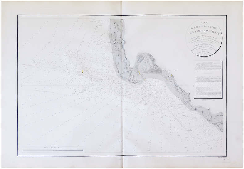
DÉPÔT-GÉNÉRAL DE LA MARINE & BEAUTEMPS-BEAUPRÉ (Charles-François).
[SABLES d'OLONNE] Plan du port et de la rade des Sables d'Olonne.
Dépôt-Général de la Marine, 1828-1870. 610 x 884 mm.
Bookseller reference : LBW-5753
|
|
|
DÉPÔT-GÉNÉRAL DE LA MARINE & BEAUTEMPS-BEAUPRÉ (Charles-François).
[ÎLE d'OLÉRON] Carte particulière des côtes de France (Pertuis de Maumusson).
Dépôt-Général de la Marine, 1832-1888. 918 x 580 mm.
Bookseller reference : LBW-5747
|
|
|
DÉPÔT-GÉNÉRAL DE LA MARINE & BEAUTEMPS-BEAUPRÉ (Charles-François).
[ÎLE d'YEU] Carte particulière des côtes de France (Île d'Yeu, Pont d'Yeu et Goulet de Fromantine).
Dépôt-Général de la Marine, 1828-1887. 925 x 583 mm.
Bookseller reference : LBW-5749
|
|
|
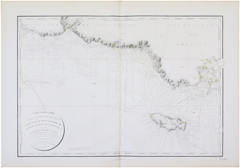
DÉPÔT-GÉNÉRAL DE LA MARINE & BEAUTEMPS-BEAUPRÉ (Charles-François).
[ÎLE de GROIX] Carte particulière des côtes de France (entrée du port de Lorient, île de Groix, anse du Pouldu, entrée de l'Aven et Basse Jaune).
Dépôt-Général de la Marine, 1824-1887. 610 x 885 mm.
Bookseller reference : LBW-5763
|
|
|
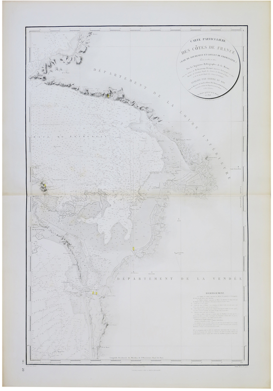
DÉPÔT-GÉNÉRAL DE LA MARINE & BEAUTEMPS-BEAUPRÉ (Charles-François).
[ÎLE de NOIRMOUTIER] Carte particulière des côtes de France (Baie de Bourgneuf et Goulet de Fromantine).
Dépôt-Général de la Marine, 1828-1887. 905 x 579 mm.
Bookseller reference : LBW-5756
|
|
|
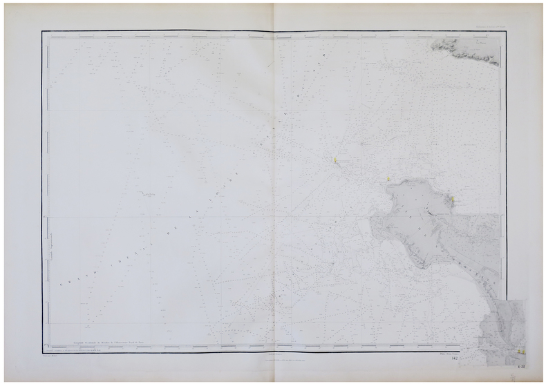
DÉPÔT-GÉNÉRAL DE LA MARINE & BEAUTEMPS-BEAUPRÉ (Charles-François).
[ÎLE de NOIRMOUTIER].
Dépôt-Général de la Marine, 1828-1888. 610 x 910 mm.
Bookseller reference : LBW-5757
|
|
|
DÉPÔT-GÉNÉRAL DE LA MARINE & BEAUTEMPS-BEAUPRÉ (Charles-François).
[ÎLE de RÉ] Carte particulière des côtes de France (Partie occidentale de l'île de Ré, entrée du Pertuis breton, entrée du Pertuis d'Antioche).
Dépôt-Général de la Marine, 1831-1872. 955 x 580 mm.
Bookseller reference : LBW-5752
|
|
|
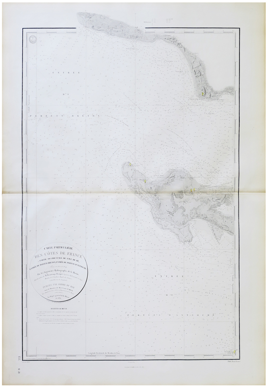
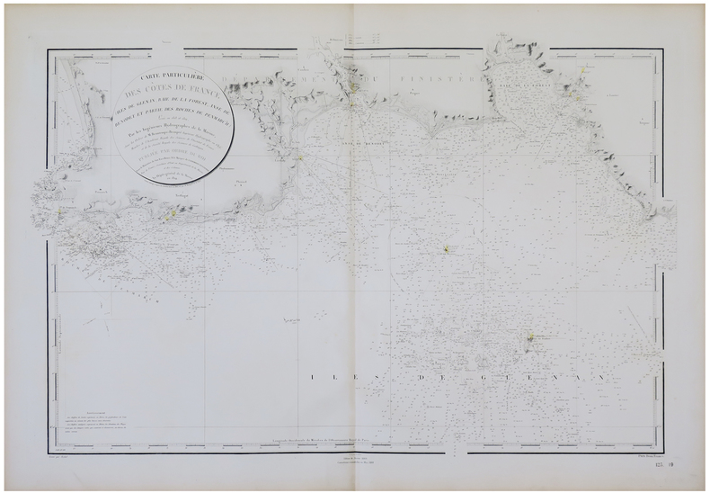
DÉPÔT-GÉNÉRAL DE LA MARINE & BEAUTEMPS-BEAUPRÉ (Charles-François).
[ÎLES des GLÉNAN] Carte particulière des côtes de France (îles de Glénan, Baie de la Forest, Anse de Bénodet et partie des roches de Penmarc'h).
Dépôt-Général de la Marine, 1824-1888. 620 x 935 mm.
Bookseller reference : LBW-5764
|
|
|
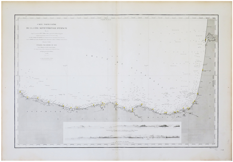
DÉPÔT-GÉNÉRAL DE LA MARINE.
[ASTURIES/PAYS BASQUE] Carte particulière de la côte septentrionale d'Espagne.
Paris, Dépôt-Général de la Marine, 1833-1890. 598 x 895 mm.
Bookseller reference : LBW-5637
|
|
|
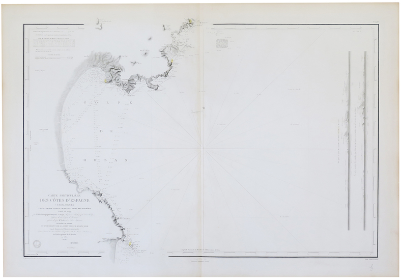
DÉPÔT-GÉNÉRAL DE LA MARINE.
[CATALOGNE] Carte particulière des côtes d'Espagne (Catalogne). Partie comprise entre le Cap de Creux et les îles des Mèdes.
Dépôt-Général de la Marine, 1850-1869. 640 x 915 mm.
Bookseller reference : LBW-5677
|
|
|
DÉPÔT-GÉNÉRAL DE LA MARINE.
[GALICE/ASTURIES] Carte particulière de la côte septentrionale d'Espagne.
Dépôt-Général de la Marine, 1833-1890. 600 x 895 mm.
Bookseller reference : LBW-5663

|
|
|
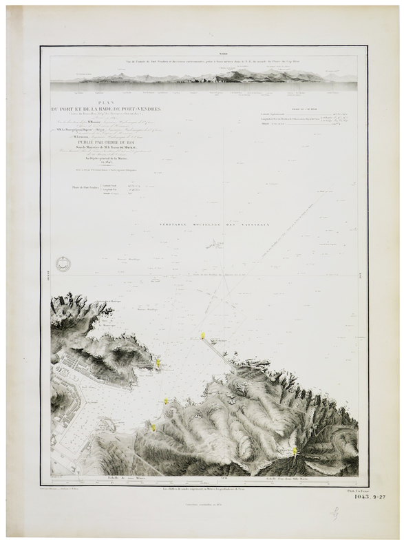
DÉPÔT-GÉNÉRAL DE LA MARINE.
[PORT-VENDRES] Plan du port et de la rade de Port-Vendres (Côtes du Roussillon, Dép.t des Pyrénées-Orientales).
Dépôt-Général de la Marine, 1845-1874. 610 x 436 mm.
Bookseller reference : LBW-5645
|
|
|
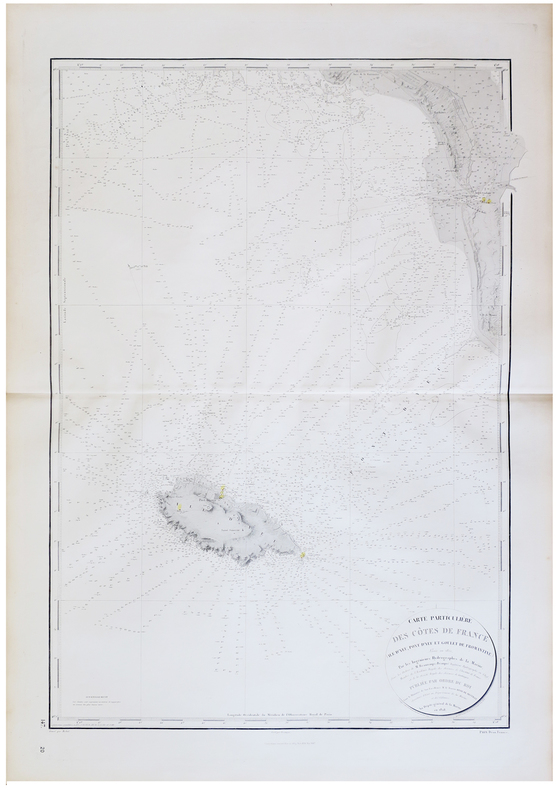
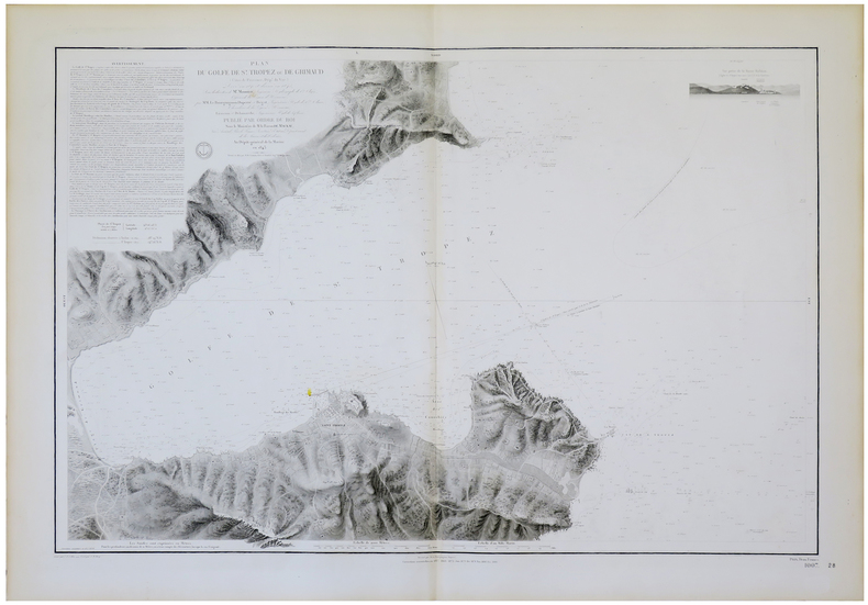
DÉPÔT-GÉNÉRAL DE LA MARINE.
[SAINT-TROPEZ] Plan du golfe de S.t Tropez ou de Grimaud (Côtes de Provence, Dép.t du Var).
Dépôt-Général de la Marine, 1843-1886. 610 x 914 mm.
Bookseller reference : LBW-5653
|
|
|
DÉSIRY (Joseph).
[ÎLE d'YEU] Canton de l'île d'Yeu.
Paris, Erhard, [1887]. 528 x 341 mm.
Bookseller reference : LBW-8310

|
|
|
DÍAZ ALEJO, Raimundo y GIL, Joaquín [Editores].
América y el Viejo Mundo.
Buenos Aires, Joaquín Gil Editor, 1942. 4to.; 4 hs., 558 pp., 1 h. Con 343 ilustraciones en láminas fuera de texto y 9 mapas plegados. Encuadernación moderna en media tela con tejuelo. Contiene el facsímil de la edición principe de la versión latina de la Carta de Cristobal Colón a Gabriel Sánchez. El libro se completa con un impresionante aparato iconográfico, preparado por Joaquín Gil, que reproduce numerosos mapas de los Siglos XV al XVIII, grabados relativos a la "idea europea" de América y sus habitantes, portadas de libros, etc.

|
|
|
DÜRRENMATT (Guy) - DUGUA (Roger).
FOIRES ET MARCHES EN ARDECHE ET HAUTE-LOIRE.Histoire et anecdotes.
Le Cheylard, Dolmazon, 2005, 1 broché, couverture illustrée. in-4 de 217-(3) pages, nombreuses photos (reproductions de cartes postales anciennes) ;
Bookseller reference : 19339
|
|
|
Düwel, Robert
Hamburg und seine schöne Umgebung. [Stadtplan]. Text v.Robert Duüwel.
(Hamburg, Fremdenverkehrs- u. Kongress-Zentrale Hamburg, 1966). Mehrfach gefalt. farbige Ktn.-Skizze, gezeichnet von Heinz Schultchen. Blattnmaß 42 x 60 cm. Gefalzt zu21 cm.
Bookseller reference : 51687

|
|
|
D’ORLEANS Père
Histoire des Révolutions d’Angleterre
depuis le commencement de la monarchie. Nouvelle édition, corrigée, ornée de cartes. Tomes 1-2 rt 3. (Tome 4 et dernier manquant) In 12 plein cuir fauve raciné à nerfs, pièce de titre et tomaison cuir rouge, caissons, filets, roulette dorés. Roulette dorée sur coupes. Tranches marbrées, filet à froid encadrant les plats. Tome I : faux-titre, XII avertissement, Carte dépliante de l’Angleterre suivant les dernières relations de SANSON, 480 pages. Tome II : faux-titre, titre, carte dépliante de l’Ecosse suivant les dernières relations de SANSON. 451 pages. Tome LLL : faux-titre, XI, carte dépliante de l’Irlande suivant les dernières relations par SANSON. 434 pages. A Paris chez François MUSIER Quai des Augustins 1767. Quelques coins légèrement émoussés, sinon bon ensemble, complet des 3 cartes
Bookseller reference : 12058

|
|
|
E. Benjsmin Andrews; 650 Illustrations and Maps Illustrator
History of the United States Volume 2 From the Earliest Discovery of America to the Present Time Hardcover Jan 01 1914 E. Benjsmin Andrews and 650 Illustrations and Maps
Charles Scribner's Sons 1914-01-01. Hardcover. Good. Edition: reprint; Used: Good/Missing; tight edge wear on blue boards minor join crack inside front board no jacket pages unmarked no tears 1984 reprinted 1914 Charles Scribner's Sons hardcover
Bookseller reference : B7075HP
|
|
|
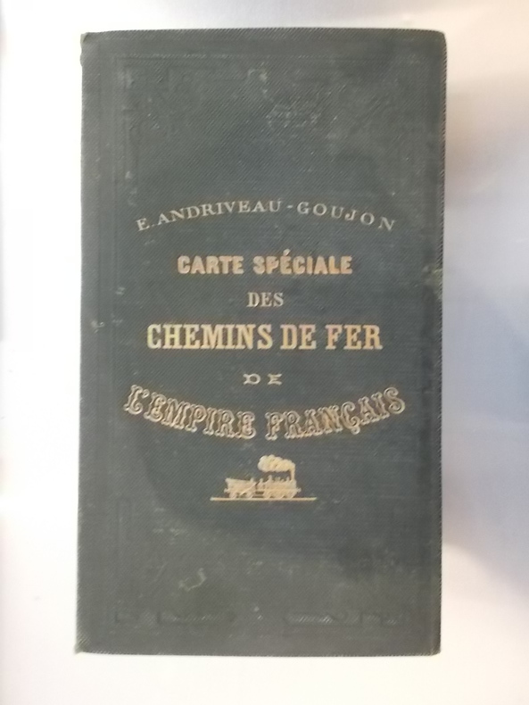
E/ Andriveau - Goujon
CARTE SPECIALE des CHEMINS DE FER de L'EMPIRE FRANCAIS. 1870.
Taille : 96 x 83 cm. Editions E. Andriveau-Goujon.
Bookseller reference : CHF150M
|
|
|
Eagleton, Terry
The Truth About the Irish
No marks or inscriptions. No creasing to covers or to spine. A very clean very tight copy with bright unmarked boards and no bumping to corners. 181pp. The book which 'separates the myths about the Irish from the reality with a blend of caustic commentary, jokes that will make you laugh out loud and answers to questions you were too polite to ask'.

|
|
|
EARLY 20TH CENTURY JAPANESE MAPS OF TAIWAN AND HOKKAIDO.
台湾全図、北海道. Taiwan Zenzu Hokkaido. Whole Map of Taiwan and Hokkaido.
Japan.: No publication details. circa1910. Double sided folded sheet with colour printed maps of Taiwan and Hokkaido on either side 27.5 x 38.7 cm small holes at folds and several small closed tears now neatly repaired with archival quality paper a little browned at edges and folds. The double sided map features Taiwan and Hokkaido. The Taiwan map 1/1210000 scale records place names in Japanese characters; while the Hokkaido map 1/1950000 scale includes inset maps of Sakhalin and Kuril Islands. The map shows rail road and shipping routes and the border between the Russian half of Sakhalin and the Japanese colony of Karafuto in the south of the same island which had been drawn after Japan acquired Karafuto as part of the spoils of victory in the Russo-Japanese War of 1904-05. . No publication details. unknown
Bookseller reference : 169327

|
|
|
EAST ASIA MAPS. KAGAMI Kenkichi President.
To Japan China and around the World. To the colorful Orient! Why not NYK Line.
Tokyo & Chicago: Nippon Yusen Kaisha Poole Brothers 1926. 8vo. 4 x 9 in. 32 pp unpaginated. printed in columns which folds out into large 18 x 31 in. colour map w/ borders on verso text photo illustrations and text illustrations on recto printed in green & orange minor dutsoiling edgewear couple closed tears still VG- copy. First edition thus of this nicely illustrated map showing all of the Nippon Yusen Kaisha Ocean Liner Fleet in the 1920s with the routes carefully marked in orange and such ocean liners as the Shinyo Maru Taiyo Maru Tenyo Maru and others. Worldcat locates 1 copy Nat. Lib. of Australia. Nippon Yusen Kaisha, [Poole Brothers], unknown
Bookseller reference : 56140
|
|
|
Easterbrook, Don J.
Landforms of Washington: The Geologic Environment
Book shows light shelf wear to covers Binding is solid and square, covers have sharp corners, exterior shows no blemishes, text/interior is clean and free of marking of any kind. Written as an illustrated account of the nature and effects of geology and the topography of Washington State, the effects of glaciation, flooding, and material composition. Includes two maps of the geology of Washington State with a pamphlet "6 times in 3,500 years," about the Kautz Creek Mudflow Nature Trail (1975) regarding the eruption of Mt. Rainier. Contents include: Cascade mountains, Puget lowland, Coast ranges, Columbia basin , Northern rocky mountains. 156 pages
|
|
|
Easyfind Series of Maps
Map and Street Directory of Durham
Worcester: Littlebury & Company Limited .please e-mail for further details. Not Signed or Inscribed. This is a First Edition. Red Card. Very Good AVERAGE/No Jacket. Illus. by Ilustrated with Large Fold Out Map. 12mo - over 6�" - 7�". PAPERBACK. Littlebury & Company Limited Paperback
Bookseller reference : 008272
|
|
|
EBERLIN Philippe:
Rapport de mer. Navires et marins au service de la Suisse et de la Croix-Rouge pendant la guerre de 1939-1945.
Berne, Office central fédéraldes imprimés et du matériel, 1970. In-8 broché de 285 pages, couverture illustrée.
Bookseller reference : 19980

|
|
|
EBUL'ULA MARDIN, (Turkish jurist, academician and politician), (1881-1957).
Huzur dersleri. 2 volumes set.
Very Good Turkish In decorative contemporary clothes. Roy. 8vo. (24 x 17 cm). In Turkish. 2 volumes set: (614 p.;1154 p.). Mardin was a Turkish jurist, academician and politician. He was one of the ends of the Ottoman Empire and the firsts of Turkish Republic lawyers. He worked as a lecturer at Istanbul University during his whole life, where he graduated, and became a professor of the Civil Law. He ws born in Shkodra. Scarce. First Edition.
|
|
|
ECOMMOY
Carte couleurs topographique au 1/25 000e d'Ecommoy. Partie ouest.
Une feuille 77x90 cm.
|
|
 Receive by email
 Download as PDF document
 RSS feed


