|
Frank J. Mackey; Illustrator drawings maps Illustrated by Photos
Forward-March! Volume 1 and Forward-March Volume 2- the Photographic Record of America in the World War and the Post War 2 vol set
Disabled America Veterans 1937-12-01. Hardcover. Acceptable. Large 2 vol set Blue boards. Fair 2 of 10. Wear and rub-through to the edges of cover. Spine has been taped together. large chip top spine vol 2. minor dampstain to corners. Former owner's name inked on fly. FREE Media Mail Shipping! Images available for any item just ask. Any images shown next to the listing that have our www.aCastleofBooks.com watermark on them are the exact item you will receive all other images are for reference only. Free delivery confirmation for domestic orders. Books with Author signatures are guaranteed authentic. We understand collectors needs in terms of accurate grading and proper packaging. We stand behind our descriptions 100%. All items will be shipped securely to insure that they arrive in exactly the same condition in which they left. May have small easily erasable pencil markings on first page. Our Packing Slips do not contain any pricing information so you may order items as Gifts or for Dropship without concern. We ship every Monday Wednesday & Friday morning. All items subject to prior sale. Why the odd prices We run a percent discount for our Biblio listings which insures Biblio has our lowest prices online but does give odd change. Disabled America Veterans hardcover
Bookseller reference : 019592

|
|
|
Franklin Benjamin Randall Willard; B/W ; maps on End Papers Illustrator
A Little Revenge : Benjamin Franklin and His Son
Little Brown & Co 1987-01-01. Paperback. Acceptable. Little, Brown & Co paperback
Bookseller reference : 0316733652-4-18107197 ISBN : 0316733652 9780316733656
|
|
|
Franklin Benjamin Randall Willard; B/W ; maps on End Papers Illustrator
A Little Revenge : Benjamin Franklin and His Son
Little Brown & Co 1987-01-01. Paperback. Acceptable. Student Edition. No apparent missing pages. Light wrinkling from liquid damage. Light wear fading or curling of cover or spine. May have used stickers or residue. Good binding with NO apparent loose or torn pages. Light writing highlighting and marker. Supplemental materials are not guaranteed with used books. Little, Brown & Co paperback
Bookseller reference : 0316733652-4 ISBN : 0316733652 9780316733656
|
|
|
Franklin Benjamin Randall Willard; B/W ; maps on End Papers Illustrator
A Little Revenge : Benjamin Franklin and His Son
Good. Used book in good condition. Has wear to the cover and pages. Contains some markings such as highlighting and writing. Ex-library with the usual stamps. 100% guaranteed. 062720 unknown
Bookseller reference : 0316733652[go] ISBN : 0316733652 9780316733656
|
|
|
FRANKLIN (Alfred).
Les Anciens plans de Paris.. Notices historiques et topographiques. I. Plans de Munster, de Braun, De Tapisserie, de Truschet et Hoyau, de Du Cerceau, de Belleforest, de Quesnel, de Vassalieu, de Merian et de Gomboust. - II. Plans de Berey, de Jouvin de Rochefort, de Bullet et Blondel, de Bernard Jaillot, de Jean de La Caille, de Louis Bretez, de Deharme et de Verniquet
Paris, Léon Willem [Imprimerie Deurbergue], 1878 - 1880 2 vol. in-4, VIII pp., 164 pp., [2] ff. n. ch. ; [2] ff. n. ch., 264 pp., [2] ff. n. ch., avec un plan hors texte à double page, brochés. Dos du vol. I cassé, dos du vol. II défraîchi.
Bookseller reference : 227770

|
|
|
Franklin Maps Firm
Metro street atlas of Bucks & Montgomery counties in Pennsylvania
Franklin Maps. Unknown Binding. POOR. Noticeably used book. Heavy wear to cover. Pages contain marginal notes underlining and or highlighting. Possible ex library copy with all the markings/stickers of that library. Accessories such as CD codes toys and dust jackets may not be included. Franklin Maps unknown
Bookseller reference : 3202181131 ISBN : 1928955096 9781928955092
|
|
|
Franklin Maps
Metro Street Atlas of Dauphin County Harrisburg Vincinity Carlisle Hershey & Mechanicburg Pennsylvania
Franklin Maps 2000. Paperback. Near Fine. Near Fine with very light wear around the extremities. <br/><br/>CTH Franklin Maps paperback
Bookseller reference : 53751 ISBN : 1928955193 9781928955191
|
|
|
Franklin Maps
Metro Street Atlas of Lebanon Co. PA
King of Prussia PA: Franklin Maps 1999. Paperback. As New. A fine copy! <br/><br/>CTH Franklin Maps paperback
Bookseller reference : 53749
|
|
|
Franklin Maps
Metro Street Atlas of Lancaster County In Pennsylvania
Franklin Maps. Used - Very Good. Very Good condition. 4th edition. Franklin Maps unknown
Bookseller reference : P02K-00359 ISBN : 1600480527 9781600480522
|
|
|
Franklin Maps Editor
Metro Street Atlas of Philadelphia PA including Main Line Delaware County & Eastern Montgomery County
Franklin Maps 2001-01-01. Unknown Binding. Good. NA39 MAY20T9AL overall creasing edge/point wear no underlining or highlighting within Franklin Maps unknown
Bookseller reference : 1928955363 ISBN : 1928955363 9781928955368
|
|
|
Franklin Maps
Metro Street Atlas of Dauphin County and Harrisburg Vicinity PA: Including Carlisle Hershey & Mechanicsburg Metro Street Atlas Series
Rand McNally & Company 2001-12-01. Paperback. Good. Rand McNally & Company paperback
Bookseller reference : SONG1928955401 ISBN : 1928955401 9781928955405
|
|
|
Franklin Maps Firm
Metro street atlas of Burlington County in New Jersey
Franklin Maps. Used - Good. Shows some signs of wear and may have some markings on the inside. Franklin Maps unknown
Bookseller reference : GRP66162752 ISBN : 1877911178 9781877911170
|
|
|
Franko Maps Ltd.
Alaska Inside Passage Map Guide Waterproof Card
2017-06-01. New. Ships with Tracking Number! INTERNATIONAL WORLDWIDE Shipping available. May be re-issue. Buy with confidence excellent customer service! unknown
Bookseller reference : 1601905394n ISBN : 1601905394 9781601905390

|
|
|
Franko Maps Ltd.
Ambergris Caye Belize Dive Map & Reef Creatures Guide Franko Maps Laminated Fish Card
2011-03-09. New. Ships with Tracking Number! INTERNATIONAL WORLDWIDE Shipping available. May be re-issue. Buy with confidence excellent customer service! unknown
Bookseller reference : 1601903375n ISBN : 1601903375 9781601903372

|
|
|
Franko Maps Ltd.
Ambergris Caye Belize Dive Map & Reef Creatures Guide Franko Maps Laminated Fish Card
2011-03-09. Good. Ships with Tracking Number! INTERNATIONAL WORLDWIDE Shipping available. May not contain Access Codes or Supplements. May be re-issue. May be ex-library. Shipping & Handling by region. Buy with confidence excellent customer service! unknown
Bookseller reference : 1601903375 ISBN : 1601903375 9781601903372

|
|
|
Franko Maps Ltd
Andros Island Bahamas Dive Map & Reef Creatures Guide Franko Maps Laminated Fish Card
Franko Maps Ltd 2011-01-01. Map. Used:Good. Franko Maps Ltd unknown
Bookseller reference : DADAX1601903413 ISBN : 1601903413 9781601903419
|
|
|
Franko Maps Ltd.
Andros Island Bahamas Dive Map & Reef Creatures Guide Franko Maps Laminated Fish Card
2011-09-04. New. Ships with Tracking Number! INTERNATIONAL WORLDWIDE Shipping available. May be re-issue. Buy with confidence excellent customer service! unknown
Bookseller reference : 1601903413n ISBN : 1601903413 9781601903419

|
|
|
Franko Maps Ltd.
Antigua Dive Map & Coral Reef Creatures Guide Franko Maps Laminated Fish Card
2016-11-01. New. Ships with Tracking Number! INTERNATIONAL WORLDWIDE Shipping available. May be re-issue. Buy with confidence excellent customer service! unknown
Bookseller reference : 160190519Xn ISBN : 160190519x 9781601905192

|
|
|
Franko Maps Ltd
Aruba Dive Map & Reef Creatures Guide Franko Maps Laminated Fish Card
Franko Maps Ltd 2010-08-31. Map. Used:Good. Franko Maps Ltd unknown
Bookseller reference : DADAX1601901763 ISBN : 1601901763 9781601901767
|
|
|
Franko Maps Ltd.
Aruba Dive Map & Reef Creatures Guide Franko Maps Laminated Fish Card
2010-09-03. New. Ships with Tracking Number! INTERNATIONAL WORLDWIDE Shipping available. May be re-issue. Buy with confidence excellent customer service! unknown
Bookseller reference : 1601901763n ISBN : 1601901763 9781601901767

|
|
|
Franko Maps Ltd
Aruba Reef Creatures Guide Franko Maps Laminated Fish Card 4" x 6
Franko Maps Ltd 2014-11-10. Map. Used:Good. Franko Maps Ltd unknown
Bookseller reference : DADAX1601904525 ISBN : 1601904525 9781601904522
|
|
|
Franko Maps Ltd.
Aruba Reef Creatures Guide Franko Maps Laminated Fish Card 4" x 6"
2014-02-04. New. Ships with Tracking Number! INTERNATIONAL WORLDWIDE Shipping available. May be re-issue. Buy with confidence excellent customer service! unknown
Bookseller reference : 1601904525n ISBN : 1601904525 9781601904522

|
|
|
Franko Maps Ltd.
Aruba Reef Creatures Guide Franko Maps Laminated Fish Card 4" x 6"
2014-02-04. Good. Ships with Tracking Number! INTERNATIONAL WORLDWIDE Shipping available. May not contain Access Codes or Supplements. May be re-issue. May be ex-library. Shipping & Handling by region. Buy with confidence excellent customer service! unknown
Bookseller reference : 1601904525 ISBN : 1601904525 9781601904522

|
|
|
Franko Maps Ltd
Bahamas Map & Reef Creatures Guide Franko Maps Laminated Fish Card
Franko Maps Ltd 2010-07-01. Map. Used:Good. Franko Maps Ltd unknown
Bookseller reference : DADAX1601902077 ISBN : 1601902077 9781601902078
|
|
|
Franko Maps Ltd.
Bahamas Map & Reef Creatures Guide Franko Maps Laminated Fish Card
2010-09-02. New. Ships with Tracking Number! INTERNATIONAL WORLDWIDE Shipping available. May be re-issue. Buy with confidence excellent customer service! unknown
Bookseller reference : 1601902077n ISBN : 1601902077 9781601902078

|
|
|
Franko Maps Ltd
Bahamas Reef Creatures Identification Guide Franko Maps Laminated Fish Card 4"x6
Franko Maps Ltd 2011-06-01. Map. Used:Good. Franko Maps Ltd unknown
Bookseller reference : DADAX1601903723 ISBN : 1601903723 9781601903723
|
|
|
Franko Maps Ltd.
Bahamas Reef Creatures Identification Guide Franko Maps Laminated Fish Card 4"x6"
2011-02-03. New. Ships with Tracking Number! INTERNATIONAL WORLDWIDE Shipping available. May be re-issue. Buy with confidence excellent customer service! unknown
Bookseller reference : 1601903723n ISBN : 1601903723 9781601903723

|
|
|
Franko Maps Ltd.
Baja & Sea of Cortez Mexico Dive Map & Fish Identification Guide Franko Maps Laminated Fish Card
2017-01-13. New. Ships with Tracking Number! INTERNATIONAL WORLDWIDE Shipping available. May be re-issue. Buy with confidence excellent customer service! unknown
Bookseller reference : 1601905327n ISBN : 1601905327 9781601905321

|
|
|
Franko Maps Ltd.
Baja & Sea of Cortez Mexico Dive Map & Fish Identification Guide Franko Maps Laminated Fish Card
2017-01-13. Good. Ships with Tracking Number! INTERNATIONAL WORLDWIDE Shipping available. May not contain Access Codes or Supplements. May be re-issue. May be ex-library. Shipping & Handling by region. Buy with confidence excellent customer service! unknown
Bookseller reference : 1601905327 ISBN : 1601905327 9781601905321

|
|
|
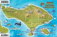
Franko Maps Ltd
Bali Indonesia Dive Map & Coral Reef Creatures Guide Franko Maps Laminated Fish Card
Franko Maps Ltd 2015-08-01. Map. Used:Good. Franko Maps Ltd unknown
Bookseller reference : DADAX1601904568 ISBN : 1601904568 9781601904560
|
|
|
Franko Maps Ltd.
Bali Indonesia Dive Map & Coral Reef Creatures Guide Franko Maps Laminated Fish Card
2015-01-05. New. Ships with Tracking Number! INTERNATIONAL WORLDWIDE Shipping available. May be re-issue. Buy with confidence excellent customer service! unknown
Bookseller reference : 1601904568n ISBN : 1601904568 9781601904560
|
|
|
Franko Maps Ltd.
Bali Indonesia Dive Map & Coral Reef Creatures Guide Franko Maps Laminated Fish Card
2015-01-05. Good. Ships with Tracking Number! INTERNATIONAL WORLDWIDE Shipping available. May not contain Access Codes or Supplements. May be re-issue. May be ex-library. Shipping & Handling by region. Buy with confidence excellent customer service! unknown
Bookseller reference : 1601904568 ISBN : 1601904568 9781601904560

|
|
|
Franko Maps Ltd
Barbados Dive Map & Reef Creatures Guide Franko Maps Laminated Fish Card
Franko Maps Ltd 2013-06-01. Map. Used:Good. Franko Maps Ltd unknown
Bookseller reference : DADAX1601903987 ISBN : 1601903987 9781601903983
|
|
|
Franko Maps Ltd.
Barbados Dive Map & Reef Creatures Guide Franko Maps Laminated Fish Card
2013-08-08. New. Ships with Tracking Number! INTERNATIONAL WORLDWIDE Shipping available. May be re-issue. Buy with confidence excellent customer service! unknown
Bookseller reference : 1601903987n ISBN : 1601903987 9781601903983

|
|
|
Franko Maps Ltd
Barbados Reef Creatures Guide Franko Maps Laminated Fish Card 4" x 6
Franko Maps Ltd 2013-06-01. Map. Used:Good. Franko Maps Ltd unknown
Bookseller reference : DADAX1601904096 ISBN : 1601904096 9781601904096
|
|
|
Franko Maps Ltd.
Barbados Reef Creatures Guide Franko Maps Laminated Fish Card 4" x 6"
2013-07-09. New. Ships with Tracking Number! INTERNATIONAL WORLDWIDE Shipping available. May be re-issue. Buy with confidence excellent customer service! unknown
Bookseller reference : 1601904096n ISBN : 1601904096 9781601904096

|
|
|
Franko Maps Ltd.
Belize Atolls Dive Map & Reef Creatures Guide Franko Maps Laminated Fish Card
2013-09-05. New. Ships with Tracking Number! INTERNATIONAL WORLDWIDE Shipping available. May be re-issue. Buy with confidence excellent customer service! unknown
Bookseller reference : 1601904169n ISBN : 1601904169 9781601904164

|
|
|
Franko Maps Ltd.
Belize Atolls Dive Map & Reef Creatures Guide Franko Maps Laminated Fish Card
2013-09-05. Good. Ships with Tracking Number! INTERNATIONAL WORLDWIDE Shipping available. May not contain Access Codes or Supplements. May be re-issue. May be ex-library. Shipping & Handling by region. Buy with confidence excellent customer service! unknown
Bookseller reference : 1601904169 ISBN : 1601904169 9781601904164

|
|
|
Franko Maps Ltd.
Belize Dive Map & Reef Creatures Guide Franko Maps Laminated Fish Card
2011-09-08. New. Ships with Tracking Number! INTERNATIONAL WORLDWIDE Shipping available. May be re-issue. Buy with confidence excellent customer service! unknown
Bookseller reference : 1601903383n ISBN : 1601903383 9781601903389

|
|
|
Franko Maps Ltd.
Belize Dive Guide Franko Maps Waterproof Map
2014-10-06. New. Ships with Tracking Number! INTERNATIONAL WORLDWIDE Shipping available. May be re-issue. Buy with confidence excellent customer service! unknown
Bookseller reference : 1601904509n ISBN : 1601904509 9781601904508

|
|
|
Franko Maps Ltd.
Belize Dive Map & Reef Creatures Guide Franko Maps Laminated Fish Card
2011-09-08. Good. Ships with Tracking Number! INTERNATIONAL WORLDWIDE Shipping available. May not contain Access Codes or Supplements. May be re-issue. May be ex-library. Shipping & Handling by region. Buy with confidence excellent customer service! unknown
Bookseller reference : 1601903383 ISBN : 1601903383 9781601903389

|
|
|
Franko Maps Ltd.
Belize Dive Guide Franko Maps Waterproof Map
2014-10-06. Good. Ships with Tracking Number! INTERNATIONAL WORLDWIDE Shipping available. May not contain Access Codes or Supplements. May be re-issue. May be ex-library. Shipping & Handling by region. Buy with confidence excellent customer service! unknown
Bookseller reference : 1601904509 ISBN : 1601904509 9781601904508

|
|
|
Franko Maps Ltd.
Belize Reef Creatures Guide Franko Maps Laminated Fish Card 4" x 6"
2013-08-07. Good. Ships with Tracking Number! INTERNATIONAL WORLDWIDE Shipping available. May not contain Access Codes or Supplements. May be re-issue. May be ex-library. Shipping & Handling by region. Buy with confidence excellent customer service! unknown
Bookseller reference : 1601904207 ISBN : 1601904207 9781601904201

|
|
|
Franko Maps Ltd.
Berlin Ichthyosaur State Park Nevada Hiking & Adventure Guide Franko Maps Waterproof Map
2016-05-23. New. Ships with Tracking Number! INTERNATIONAL WORLDWIDE Shipping available. May be re-issue. Buy with confidence excellent customer service! unknown
Bookseller reference : 1601904878n ISBN : 1601904878 9781601904874

|
|
|
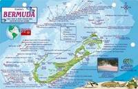
Franko Maps Ltd.
Bermuda Dive Map & Reef Creatures Guide Franko Maps Laminated Fish Card
2011-06-06. New. Ships with Tracking Number! INTERNATIONAL WORLDWIDE Shipping available. May be re-issue. Buy with confidence excellent customer service! unknown
Bookseller reference : 1601909861n ISBN : 1601909861 9781601909862
|
|
|
Franko Maps Ltd.
Bermuda Dive Map & Reef Creatures Guide Franko Maps Laminated Fish Card
2011-06-06. Good. Ships with Tracking Number! INTERNATIONAL WORLDWIDE Shipping available. May not contain Access Codes or Supplements. May be re-issue. May be ex-library. Shipping & Handling by region. Buy with confidence excellent customer service! unknown
Bookseller reference : 1601909861 ISBN : 1601909861 9781601909862

|
|
|
Franko Maps Ltd.
Bermuda Reef Creatures Guide Franko Maps Laminated Fish Card 4" x 6"
2013-01-07. Good. Ships with Tracking Number! INTERNATIONAL WORLDWIDE Shipping available. May not contain Access Codes or Supplements. May be re-issue. May be ex-library. Shipping & Handling by region. Buy with confidence excellent customer service! unknown
Bookseller reference : 1601904061 ISBN : 1601904061 9781601904065

|
|
|
Franko Maps Ltd.
Berry Islands Bahamas Map & Reef Creatures Guide Franko Maps Laminated Fish Card
2015-09-06. Good. Ships with Tracking Number! INTERNATIONAL WORLDWIDE Shipping available. May not contain Access Codes or Supplements. May be re-issue. May be ex-library. Shipping & Handling by region. Buy with confidence excellent customer service! unknown
Bookseller reference : 1601903421 ISBN : 1601903421 9781601903426

|
|
|
Franko Maps Ltd.
Berry Islands Bahamas Map & Reef Creatures Guide Franko Maps Laminated Fish Card
2015-09-06. New. Ships with Tracking Number! INTERNATIONAL WORLDWIDE Shipping available. May be re-issue. Buy with confidence excellent customer service! unknown
Bookseller reference : 1601903421n ISBN : 1601903421 9781601903426

|
|
|
Franko Maps Ltd.
Big Bear Lake Guide to Fishing Boating & Recreation Franko Maps Waterproof Map
2007-06-01. New. Ships with Tracking Number! INTERNATIONAL WORLDWIDE Shipping available. May be re-issue. Buy with confidence excellent customer service! unknown
Bookseller reference : 1601901356n ISBN : 1601901356 9781601901354

|
|
 Receive by email
 Download as PDF document
 RSS feed


