|
|
|
GASTALDI Giacomo (1500 circa – 1565 circa)
Sardinia insula inter Africu[m], et Tyrrenu[m]…
Rarissima carta dell’isola che attribuiamo a Giacomo Gastaldi e che consideriamo il prototipo di questa tipologia di carte del ‘500. L’opera, in passato anonima e conosciuta solo attraverso l’esemplare conservato nell’atlante Doria, la troviamo stampata in un singolo foglio di atlante insieme alla carta della Corsica firmata da Gastaldi, nell’esemplare venduto in asta a Londra (Sotheby’s, 2000). Le due carte sono assolutamente simili in tutto, anche nella inusuale modo di rappresentare l’orientazione, attraverso una sorta di croce che attraversa tutta l’isola. Ulteriore conferma dell’attribuzione al Gastaldi deriva dalla presenza della carta nel suddetto Atlante Doria, insieme ad un gruppo di carte delle isole del cartografo piemontese, quali Malta, Elba e la Corsica. Dal confronto con tutte le altre carte dell’isola, si notano le seguenti differenze: orografia e idrografia meno accentuate; in alto a nord del fiume Temo viene indicato Fresan anziché S.reparata (nelle altre carte Fresan è a sud del fiume); sempre a nord, sotto l’isola denominata Tolata, non vi è piu disegnata un’isoletta priva dell’indicazione toponomastica, che si trova invece nelle altre carte. Il primo stato della carta è una prova di stampa, parzialmente incompleta. Ad oggi è noto un solo esemplare, venduto in asta a Parigi nel 2006 ed ora nella collezione di chi scrive. Al centro dell’isola, l’iscrizione SARDEGNA. In alto, in una targa incorniciata da fregi, una breve descrizione del territorio Sardinia insula inter Africu[m], et Tyrrenu[m] pelagus sita: magnitudine 562 mil. pas. fertilis admodu[m] animaliu[m]que varij generis abundans metallis argentarijs, stagnis, fontibus, salubris prestantissima. Orientazione nei quattro lati al centro, il nord in alto. Carta priva di graduazione ai margini e di scala grafica.Acquaforte e bulino, ampi margini, perfetto stato di conservazione.Esemplare di secondo stato, del tutto simile al precedente, ma viene arricchito il disegno orografico con l’aggiunta di diversi monticelli nella parte centro-settentrionale dell’isola. Aggiunti anche degli alberelli di forma diversa da quelli già presenti. Meraviglioso esemplare di questa influente mappa della Sardegna, conosciuto in pochissimi esemplari. Erroneamente attribuita al Duchetti in Bifolco-Ronca (2014). Extremely rare map of the Sardinia, which we attribue to Camocio, and we consider as prototype of this kind of sixteenth century's map.Just one example of this map, formerly attribued to an anonimous mapmaker-engraver, is known, kept in the Doria's atlas, and printed on a single sheet with the map of Corsica, signed by Gastaldi, in the copy sold at auction by Sotheby's London (2000).The two cards are very similar, even for the unusual orientation, through a sort of cross that runs through the island.To confirm the attribution to Gastaldi is also the presence, in the aforementioned Atlas Doria, of other islands' map realized by Piedmontese cartographer, such as Malta, Elba and Corsica.Comparing all other maps of the island, it's possible notice the following differences: topography and hydrography are less marked; at the top, on northern river Temo is indicated Fresan instead of S.Reparata (in other maps Fresan is at south of the river); at north, under the island called Tolata, there isn't the small island without any indication place names, which is located on the other maps.The first state of this map is a proof, partially incomplete.To date only one example of the first state is known, sold at auction in Paris in 2006 and now in the collection of the writer.At the island's center, lettered SARDINIA. At top, in a cartouche framed by friezes, a brief Latin description of the territory "Sardinia insula inter Africu [m], et Tyrrenu [m] pelagus located: magnitude 562 mil. pas. fertilis admodu [m] animaliu [m] que varij generis abundans metallis argentarijs, stagnis, fontibus, Salubris prestantissima"Map oriented with Nord at the top; without graduation at the edge and the bar scale. Etching and engraving, in perfect condition.Example of second state, very similar to the first one, but the orography is enriched by enriched by numerous mountains in the north-central part. Added also some tree of different shapeMagnificient example of this iauthoritative map of Sardinia, known in very few examples.Erroneously attributed to Duchetti in Bifolco-Ronca (2014). Bifolco-Ronca (2014): n. 151; Christie’s Pa (2006): n. 266; Christie’s (2012): n. 31; Dzikowski (1940): n. 49; Sotheby’s (2000): n. 257; Sotheby’s (2005): n. 77; b) Lago (2002): p. 490, tav. 488.

|
|
|
GASTALDI, J-ORTELIUS, A. Iacobo.
Italia novissima descriptio avctore Iacobo Castaldo Pedemontamo.
Incisione in rame (cm.36x51 e margini), testo latino al verso. Carta geografica tratta dal "Theatrum Orbis Terrarum", edizione latina. Prima versione della carta d'Italia dell'Ortelio ripresa da quella realizzata da Giacomo Gastaldi. Due sono le varianti della carta dell'Italia inserite nel "Theatrum..". Nella prima le due figure allegoriche poste al centro in basso sono raffigurate abbracciate, mentre nella seconda inserita a partire dal 1584, queste due figure sono rappresentate solamente affiancate. Il Theatrum Orbis Terrarum è considerato il primo atlante moderno, comprendente carte di tutte le zone del mondo. Ortelius riunì in un unico corpus la produzione cartografica eterogenea del periodo, costituendo la base per un'impresa editoriale di enorme successo, pubblicata dal 1570 al 1612. Bell'esemplare di questa rara carta d'Italia.. .

|
|
|
GASTALDI, J-ORTELIUS, A. Iacobo.
Italia novissima descriptio avctore Iacobo Castaldo Pedemontamo.
Incisione in rame (cm.36x51 e margini), testo latino al verso. Carta geografica tratta dal "Theatrum Orbis Terrarum", edizione latina. Prima versione della carta d'Italia dell'Ortelio ripresa da quella realizzata da Giacomo Gastaldi. Due sono le varianti della carta dell'Italia inserite nel "Theatrum..". Nella prima le due figure allegoriche poste al centro in basso sono raffigurate abbracciate, mentre nella seconda inserita a partire dal 1584, queste due figure sono rappresentate solamente affiancate. Il Theatrum Orbis Terrarum è considerato il primo atlante moderno, comprendente carte di tutte le zone del mondo. Ortelius riunì in un unico corpus la produzione cartografica eterogenea del periodo, costituendo la base per un'impresa editoriale di enorme successo, pubblicata dal 1570 al 1612. Bell'esemplare di questa rara carta d'Italia.. .
|
|
|
GAUDILLAT (Claude)
Cartes anciennes de la Bretagne. 1582-1800. Préface de Jean-Pierre Pinot.
Kerangwenn, Coop Breizh, 1999. In-4 à l'italienne, cart. éd. ill. en coul. sous étui, XXXVIII pp., nb. fig. en n/b. et en coul. int., 86 pl. de cartes en n/b et en coul., bibliographie. Epuisé chez l'éditeur.
書籍販売業者の参照番号
: 596957

|
|
|
GAULTIER , L.
Atlas de Géographie, contenant six cartes.. plus une feuille d'étiquettes...
1817 A Paris, Au dépôt des ouvrages de l' auteur, sans date ( 1817); atlas infolio broché, sans couverture ; titre et 7 planches à double page.Atlas composé de 6 cartes coloriées à l'époque : carte de l' Europe, avec la lettre , Idem sans la lettre; partie centrale de l" Europe" , avec la lettre, Idem sans la lettre; Planisphère emblématique non écrite, Idem avec la lettre et d'une feuille de 300 Etiquettes rondes en noir, à découper et coller sur de petites cartes ou sur des boules de Loto, pour servir au jeu de Géographie.
書籍販売業者の参照番号
: c5565
|
|
|
Gaultier Louis.
GEOGRAPHIE DE L'ABBE' GAULTIER entièrement refondue par ses élèves ... ET AUGMENTEE DE PLUSIEURS NOTIONS SUR LES ETAT DU ROI DE SARDAIGNE revue par le compteLuis Capello de Sanfranco.
(Codice LM/0199) In 24° (13,5 cm) 376 pp. Edizione torinese, estremamente rara. Legatura mezza pelle dell'epoca, titolo oro, piatti con abrasioni, angoli usurati. Antica firma, ingialliture e macchiette. Testo in ottimo stato. ~~~ SPEDIZIONE IN ITALIA SEMPRE TRACCIATA

|
|
|
Gavish, Dov
Land and Map: The Survay of Palestine, 1920 - 1948 [IN HEBREW]
IN HEBREW. Contains color plates. 23.5X16 cm. 297 pages. Hardcover with dust jacket. Spine edges slightly bumped. Else in good condition.
|
|
|
GD. Mitchell with BA. Reid and W. Simcock ; cartography William R. Constable ; editing Joseph G. Goski. G. D. B. A.
RCHA - right of the line : an anecdotal history of the Royal Canadian Horse Artillery from 1871
Ottawa: RCHA History Committee 1987. red cloth gilt spine . 2nd Printing. Hard Cover. Very Good/No Dust Jacket. Oblong 4 to. Military History. RCHA History Committee Hardcover
書籍販売業者の参照番号
: 112557120 ISBN : 0969088116 9780969088110

|
|
|
GEBAUER, J. J. (da).
Carta topografica de’ contorni di Genova e delle due valli di Polcevera e Bisagno con sue adiacente.
Gebauer, 1785 circa. Incisione in rame, b/n, cm 38,5 x 44,5 ca. (alla lastra). Stemma con titolo entro cartiglio nella parte superiore, “Scala di miglia due italiane” in piccolo riquadro in bs. a s., due navi e una rosa dei venti nel mare. Buon esemplare su carta fine, unico difetto un ritaglio della carta al margine laterale sinistro, fuori dal margine.

|
|
|
Geelan,P.J.M. Twitchett,D.C.(Ed.s).
The Times Atlas of China.
<br/> TITOLO: The Times Atlas of China. <br/> AUTORE: Geelan,P.J.M. Twitchett,D.C.(Ed.s).<br/> EDITORE: Times Newspapers Limited<br/> DATA ED.: 1974,<br/>
|
|
|
GEERZ, F
Geschichte d. geographischen Vermessungen und der Landkarten Nordalbingiens. vom Ende des 15. Jahrhunderts bis zum Jahre 1859.
Berlin, Jansen, 1859. 14, 277, (1) S. Etwas späterer Hpgtbd (innen durchgehend braunfl.).
書籍販売業者の参照番号
: 1011244
|
|
|
GELCICH Eugenio
CARTOGRAFIA.
Manuale teorico pratico con un sunto sulla storia della cartografia. Hoepli, Milano, 1894. In-24 gr., tela editoriale (lievi aloni), pp. VI,257,28,(4), con 27 incisioni nel t. Prima edizione. Timbro H al frontespizio. Testo ben conservato.
書籍販売業者の参照番号
: 12980
|
|
|
GELCICH Eugenio
CARTOGRAFIA. Manuale teorico pratico con un sunto sulla storia della cartografia.
In-24 gr., tela editoriale (lievi aloni), pp. VI,257,28,(4), con 27 incisioni nel t. Prima edizione. Timbro “H” al frontespizio. Testo ben conservato.
|
|
|
GENNARI Enrico - BIAGIOTTI Federico - SAVELLI Daniele - DOTTORI Francesco - MENGARELLI Donato - PACITTI Patrizio -
Dinamiche fluviali, collinari e costiere: dalle riprese satellitari alla difesa del suolo. L'esperienza di “ANCONAPACO” , Progetto Interreg. IIIA, Regione Marche - Regione Durazzo (Albania) .
Sant'Arcangelo di Romagna, 2007, 8vo stralcio con copertina posticcia muta, pp. 305/332 con 6 illustrazioni fotografiche e 16 carte. - !! ATTENZIONE !!: Con il termine estratto (o stralcio) intendiamo riferirci ad un fascicolo contenente un articolo, completo in se, sia che esso sia stato stampato a parte utilizzando la stessa composizione sia che provenga direttamente da una rivista. Le pagine sono indicate come "da/a", ad esempio: 229/231 significa che il testo è composto da tre pagine. Quando la rivista di provenienza non viene indicata é perché ci è sconosciuta. - !! ATTENTION !!: : NOT A BOOK : “extract” or “excerpt” means simply a few pages, original nonetheless, printed in a magazine. Pages are indicated as in "from” “to", for example: 229/231 means the text comprises three pages (229, 230 and 231). If the magazine that contained the pages is not mentioned, it is because it is unknown to us.

|
|
|
GENOVIE' Lina -
Opere geografiche del XVI-XVIII secolo recentemente annesse alla biblioteca dell'I.G.M. .
Firenze, 1935, 8vo stralcio con copertina posticcia muta, pp. 405/413. - !! ATTENZIONE !!: Con il termine estratto (o stralcio) intendiamo riferirci ad un fascicolo contenente un articolo, completo in se, sia che esso sia stato stampato a parte utilizzando la stessa composizione sia che provenga direttamente da una rivista. Le pagine sono indicate come "da/a", ad esempio: 229/231 significa che il testo è composto da tre pagine. Quando la rivista di provenienza non viene indicata é perché ci è sconosciuta. - !! ATTENTION !!: : NOT A BOOK : “extract” or “excerpt” means simply a few pages, original nonetheless, printed in a magazine. Pages are indicated as in "from” “to", for example: 229/231 means the text comprises three pages (229, 230 and 231). If the magazine that contained the pages is not mentioned, it is because it is unknown to us.

|
|
|
Gentilcore, R. Louis; Head, C. Grant; Winearls, Joan
Ontario's History in Maps (The Ontario Historical Studies Series)
xvii, [1], 285 pages. List of sources. "The authors have selected nearly three hundred maps, half in colour, which, combined with ample explanatory text and informative captions, present a unique graphic history of Ontario from its discovery by European explorers to the present. An outstanding example of contemporary methods of map reproduction, and a work which combines effectively the insights of historical geography and cartography." - from dust jacket. Book clean, bright and unmarked with light wear. Binding sound. Multiple closed openings and patches to dust jacket, now preserved in archival-grade Brodart. 42cm x 32cm. 4kg. A must for the library of any serious student of Ontario's cartographic history. Book

|
|
|
Gentry R.C., Simpson R.H.
HURRICANES.
(Codice OS/0150) In 8° 12 pages with 1 plate and 11 figures. Excerpt with paper covers. ~~~ SPEDIZIONE IN ITALIA SEMPRE TRACCIATA

|
|
|
Genzo Carlo - Zele Walter
Il racconto del Carso
illustrazioni

|
|
|
Geographer: TH[UONOT] DUVOTENAY, (1796-1875).
[MAP of ANTILLES and CARRIBEAN SEA, CUBA, HAITI] Carte des Antilles, 1844.
Very Good French Original b/w map. Folded. Oblong 4to. (23 x 29 cm). In French. This map was published in 1875 but it may depict an earlier representation of the area shown dated 1844 and the mapmaker may have drawn on an earlier original work. It shows The Antilles is an archipelago bordered by the Caribbean Sea to the south and west, the Gulf of Mexico to the northwest, and the Atlantic Ocean to the north and east, Cuba, Haiti Porto Rioc et alli. [MAP of ANTILLES and CARRIBEAN SEA, CUBA, HAITI] Carte des Antilles, 1844.
|
|
|
Geographer: TH[UONOT] DUVOTENAY, (1796-1875).
[MAP of FRENCH COLOMBIA AND GUYANA] Colombie et Guyanes; par Th. Duvotenay.
Very Good French Original b/w map. Folded. Oblong 4to. (23 x 29 cm). In French. It shows Antilles Sea, Atlantic and Grand Oceans, Portugal Guyana, Colombia, North of South America. [MAP of FRENCH COLOMBIA AND GUYANA] Colombie et Guyanes; par Th. Duvotenay.
|
|
|
Geographer: TH[UONOT] DUVOTENAY, (1796-1875).
[MAP of PERU and BOLIVIA] Perou et Bolivie par Jenotte, 1841.
Very Good French Original b/w map. Folded. Oblong 4to. (23 x 29 cm). In French. It shows Peru, Bolivia, Grand Ocean shores. [MAP of PERU and BOLIVIA] Perou et Bolivie par Jenotte, 1841.
|
|
|
Geographer: TH[UONOT] DUVOTENAY, (1796-1875).
[MAP of UNITED STATES of AMERICA] Etats-Unis; par Th. Duvotenay.
Very Good French Original b/w map. Folded. Oblong 4to. (23 x 29 cm). In French. It shows United States with Mexican Golf, and Atlantic Ocean. [MAP of UNITED STATES of AMERICA] Etats-Unis; par Th. Duvotenay.
|
|
|
Geographia Ltd
Geographia Vest Pocket Atlas of Central London.
Geographia Ltd., London (1951). 96 p. with 45 col. and 6 b/w maps and plans. 16° (9x14 cm). Laminated cloth. Slight traces of use. In all good copy.
書籍販売業者の参照番号
: 16226

|
|
|
George Pierre
Le regioni polari
tavole in bianco e nero fuori testo

|
|
|
George Pierre.
L'ORGANIZZAZIONE SOCIALE ED ECONOMICA DEGLI SPAZI TERRESTRI. A cura di Teresa Isenburg.
(Codice EC/2693) In 8º (22 cm) 224 pp. Con alcune figure. Sottolineature a matita. Brossura editoriale, buono stato. ~~~ SPEDIZIONE IN ITALIA SEMPRE TRACCIATA

|
|
|
GEORGE TOLIAS.
Challenged territories: Cartographies of Greece and the Levant during the Ottoman Era.
New English Paperback. Roy. 8vo. (24 x 17 cm). In English. 256 p. 1. Challenged Territories: Competing Cartographic Approaches to Greece, Fifteenth-Nineteenth Centuries. 2. The Politics of the Isolario: Maritime Cosmography and Overseas Expansion during the Renaissance. 3. Il Tramonto degli Isolari: Informazione e celebrazione (1572-1696) B. Occidental Cartographic Fictions. 4. Mourning Greece: Cartographic Allegories of Melancholy in the Late Renaissance. 5. 'Sweet Land of Cyprus': The Heritage of Cyprus and Early Modern Cartography. 6. À la recherche d'Homère: Les aventures de la géographie homérique au XVIIIe siècle C. The Ambitions of Greek Cartography. 7. Totius Graeciae: Nicolaos Sophianos' Map of Greece and the Transformations of 'Hellenism'. 8. Maps printed in Greek During the Age of Enlightennent, 1665-1820. 9. Antiquarianism, Patriotism and Empire: Transfers of the Cartography of The Travels of Anacharsis the Younger in Greece (1788-1811) Supplement. 10. La Grèce restaurée: Une république insulaire savante. 11. Images de la Turquie dans la Presse littéraire parisienne sous le Directoire, le Consulat et l'Empire, 1794-1816. Index.
|
|
|
George, Pierre.
Geografia economica dell'Unione Sovietica.
cm.10,5x18, pp.254, 3 cartine in bn.ripieg. in append., br., cop.fig. Coll.P.B.E.,4.

|
|
|
George,Pierre.
Geografia delle città.
<br/> STATO: USATO, BUONO.<br/> TITOLO: Geografia delle città. <br/> AUTORE: George,Pierre.<br/> CURATORE: Trad.di E,Mazzetti.<br/> EDITORE: ESI<br/> DATA ED.: 1964,<br/> COLLANA: Coll. L'Acropoli,3.<br/>

|
|
|
George,Pierre.
Geografia e sociologia.
<br/> TITOLO: Geografia e sociologia. <br/> AUTORE: George,Pierre.<br/> CURATORE: Traduz.di Riccardo Scacchi.<br/> EDITORE: Il Saggiatore<br/> DATA ED.: 1994,<br/> COLLANA: Coll.Economici,24.<br/> EAN: 9788842801443

|
|
|
George,Pierre.
Geografia economica dell'Unione Sovietica.
<br/> TITOLO: Geografia economica dell'Unione Sovietica. <br/> AUTORE: George,Pierre.<br/> CURATORE: Prima edizione. Traduz.di Eugenia Martinet.<br/> EDITORE: Einaudi Ed.<br/> DATA ED.: 1960,<br/> COLLANA: Coll.P.B.E.,4.<br/>
|
|
|
George,Pierre.
Gli uomini sulla terra. La geografia del Duemila.
<br/> STATO: NUOVO.<br/> TITOLO: Gli uomini sulla terra. La geografia del Duemila. <br/> AUTORE: George,Pierre.<br/> CURATORE: Traduz.di Christine Leverd.<br/> EDITORE: La Nuova Italia Scientifica<br/> DATA ED.: 1994,<br/> COLLANA: Coll.Studi Superiori NIS,96. Geografia.<br/> EAN: 9788843002641
|
|
|
GEORGES BLOND
Histoire de la flibuste.
1975 Editions Famot, 1975, 398 pages, in 8 reliure éditeur cartonnée skaivertex noir, rouge et or, dos et mors skaivertex marron, titres or, bon état.
書籍販売業者の参照番号
: 18613
|
|
|
GEORGES DUHAMEL
Géographie cordiale de l'Europe.
1930 Les Amateurs du Livre Choisi, 1930, 279 pages, in 12 broché, état correct, quelques usures et frottements.
書籍販売業者の参照番号
: 13299
|
|
|
GEORGES FRÊCHE
Montpellier la longue marche 1970-2020.
2005 Montpellier Agglomération, Empreinte, 2005, 139 pages, in 4 broché, très bon état.
書籍販売業者の参照番号
: 14093
|
|
|
GEORGES G.TOUDOUZE
Le costume français.
Larousse, Arts Styles et Techniques, collection dirigée par Norbert Dufourcq, 1947, 174 pages + 48 planches, in 12 reliure cartonnée et toilée verte, exemplaire de bibliothéque, bon état général, légèrement insolé.
書籍販売業者の参照番号
: 10486
|
|
|
GEORGES LAMY
Voyage du novice Jean-Paul à travers la France d'Amérique.
Librairie Armand Colin, 1918, portant le tampon du C.A.R.D (comité américain pour les regions dévastées de la France), in 12 reliure bibliothèque cartonnée percaline bleue, quelques usures et frottements, 273 pages papier jauni (rousseurs), coins cornés, état d'usage (correct).
書籍販売業者の参照番号
: 6628
|
|
|
GEORGES MARIE-HAAROT, LOUIS AUDOIN-DUBREUIL INTODUCTION DE ANDRE CITROEN
Le raid Citroen: la première traversée du Sahara en automobile, de Touggourt à Tombouctou par l'Atlantide.
Plon, 1923, état moyen, 307 pages, in 12, couverture defraichie et jaunie, illustrations de Bernard Boutet de Monvel.
書籍販売業者の参照番号
: 3638
|
|
|
GEORGES PIALLOUX
Connaitre le Pays Basque.
Sud-Ouest Editions, 1989, 64 pages, format magazine, bon état général.
書籍販売業者の参照番号
: 10072
|
|
|
GEORGES PILLEMENT
Beautés cachées de la France (Centre et Sud).
Henri Veyrier, 1966, 71 planches hors texte, 181 pages, in 8 broché, bon état.
書籍販売業者の参照番号
: 10367
|
|
|
GEORGES PLANES-BURGADE
Bordeaux historique et artistique.
Librairie Picquot Bordeaux, 1940, 95 pages + illustrations, in 8 broché, état moyen, dos abimé et scotché, coins cornés, quelques usures et frottements, intérieur frais.
書籍販売業者の参照番号
: 9997
|
|
|
GEORGES SAINT GEORGES, LEVUSTINOV
Déserts et montagnes de Russie .
Collection les les grandes étendues sauvages ,éditions time life 1980 très bon état 184 pages in 4.photographies Levustinov novosti .
書籍販売業者の参照番号
: 3650
|
|
|
Geraghty, James J. ; Miller, David William ; Water Information Center, inc.
Water atlas of the United States
Oblong folio in maroon cloth, stamped boards; (unpaged) 122 col. maps. 24 x 36 cm. Over 120 plates, mainly in color, with facing pages of textual descriptions. A fascinating work. || Water-supply -- United States -- Maps. Text on verso of maps.
|
|
|
GERARD CHOLVY
Le Languedoc et le Roussillon, civilisations populaires et régionales.
Editions Horvath, 1982, exemplaire de bibliothèque, 531 pages, in 8 reliure éditeur cartonnée, état d'usage, usures et frottements sur les mors et les bords des plats.
書籍販売業者の参照番号
: 12712
|
|
|
GERARDO MERCATORE
UDRONE IRLANDIAE in Cartelag Baronia
dimensioni lastra cm 28x 34,5- dimensione foglio cm 50.4x47.5- colorazione a mano coeva - piccoli rinforzi ai marg. sup.in corrispondenza della piega centrale

|
|
|
GERARDUS MERCATOR, (1512-1594).
[MAP of ASIA MINOR] Asia Minor.
Very Good Latin Original map. Oblong 4to. (25 x 34,5 cm). In Latin. From 'Mercator Atlas'. A very good copy. A detailed and decorative engraved map. B/w. Including Europae Pars (Thrace) and Black Sea, Aegean and Mediterranean, and with all ancient toponyms and names of regions including Cyprus and Syriae (Syria). Could not be find map-maker and being from which book. An early and decorative map of Asia Minor.
|
|
|
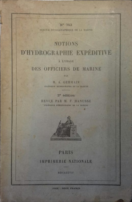
GERMAIN A. - HANUSSE F.
Notions d'hydrographie expéditive à l'usage des officiers de marine.
Couverture rigide. Cartonnage de l'éditeur. 16 x 23 cm. Petits manques au dos.
書籍販売業者の参照番号
: 42370
|
|
|
GERMAIN, A.:
Traité d'hydrographie. Levé et construction des cartes marines. (Dépôt des cartes et plans de la Marine N° 641).
Paris, Imprimerie nationale, M. DCCC. LXXII, 1882, in-4°, VIII + 506 p., avec des schémas, ex libris ´Maurice Ed. Perret´, reliure en demi-cuir rouge à coins, dos orné à caissons, coin lég. touché, bel exemplaire.
書籍販売業者の参照番号
: 33327aaf
|
|
|
Gerosa Gian Piero
Quel borgo che s'incammina. Giro umoristico di Lecco
8°, pp. 109, alcuni disegni nel testo. Brossura editoriale illustrata con mancanza, titolo al piatto e dorso. Giro umoristico di Lecco in 13 rioni e diverse puntate sul centro, con stampe originali dell'epoca su disegno dell'architetto Ugo Sacchi. Presentazione di A. Pedrone. Buono

|
|
|
Gerrit Verhoeven
ON THE ROAD WITH PLANTIN Travel in the 16th Century
Antwerp, BAI, 2021 HB, 215 x 165 mm, 128 pages, English edition. ISBN 9789085868095.
書籍販売業者の参照番号
: 55941
|
|
|
Gerrit Verhoeven
OP REIS MET PLANTIJN Onderweg in de 16de eeuw
Antwerpen , BAI, 2021 HB, 215 x 165 mm, 128 pagina's NL edition. ISBN 9789085868088.
書籍販売業者の参照番号
: 55940
|
|
|
 検索結果のメールを受信する
 PDFファイルの検索結果をダウンロード
 RSSフィード


