|
JAMIER Henri, Collectif -
Chemin De Saint-Jacques Par Saint-Antoine-L'Abbaye (à Partir De Gillonnay), Chemins De Compostelle En Rhône-Alpes, Association des Amis de Saint-Jacques, Lyon, 2003
14,5x21 cm, broché, 60 pages, très bon état, supplément (N°2) au bulletin périodique de l'association, ce guide est partiellement traduit en allemand, format A5 (quinze feuilles A4 pliées en deux), parcours, cartes et croquis cartographiques en N&B, liste d'adresses utiles -
书商的参考编号 : 4011
|
|
|
JAMIER Henri, Collectif -
Chemin De Saint-Jacques Par Saint-Antoine-L'Abbaye (à Partir De Gillonnay), Chemins De Compostelle En Rhône-Alpes, Association des Amis de Saint-Jacques, Lyon, 2003
14,5x21 cm, broché, 60 pages, très bon état, supplément (N°2) au bulletin périodique de l'association, ce guide est partiellement traduit en allemand, format A5 (quinze feuilles A4 pliées en deux), parcours, cartes et croquis cartographiques en N&B, liste d'adresses utiles -
书商的参考编号 : 4089
|
|
|
JAMAIN Paul; BELLAIR Georges; MOREAU Claude; HAUSERMANN R. (atlas):
La vigne et le vin. La vigne dans les vignobles, les jardins et les serres. Le vin, sa préparation, sa distillation, ses maladies. [avec] Atlas vinicole de la France et de ses colonies.
Paris, Octave Doin, Librairie Agricole, 1901. 2 volumes in-4, l'un broché de [4]-XLIII-[1]-956 pages, couvertures rempliées et l'autre relié en demi percaline de [4]-III-19 cartes en couleurs et 16 planches en chromolithographies.
书商的参考编号 : 20341
|
|
|
James Atlas
Battle of the books: The curriculum debate in america
Norton. Hardcover. GOOD. Spine creases wear to binding and pages from reading. May contain limited notes underlining or highlighting that does affect the text. Possible ex library copy that’ll have the markings and stickers associated from the library. Accessories such as CD codes toys may not be included. Norton hardcover
书商的参考编号 : 3187449354 ???????? : 0393034135 9780393034134

|
|
|
James Atlas
Battle of the Books : What It Takes to Be Educated in America
Norton & Company Incorporated W. W. 1992. Hardcover. Good. Disclaimer:A copy that has been read but remains in clean condition. All pages are intact and the cover is intact. The spine may show signs of wear. Pages can include limited notes and highlighting and the copy can include previous owner inscriptions. An ex-library book and may have standard library stamps and/or stickers. At ThriftBooks our motto is: Read More Spend Less.Dust jacket quality is not guaranteed. Norton & Company, Incorporated, W. W. hardcover
书商的参考编号 : G0393034135I3N10 ???????? : 0393034135 9780393034134
|
|
|
James Atlas
Battle of the Books : What It Takes to be Educated in America
Norton & Company Incorporated W. W. 1993. Paperback. Very Good. Disclaimer:A copy that has been read but remains in excellent condition. Pages are intact and are not marred by notes or highlighting but may contain a neat previous owner name. The spine remains undamaged. At ThriftBooks our motto is: Read More Spend Less.Dust jacket quality is not guaranteed. Norton & Company, Incorporated, W. W. paperback
书商的参考编号 : G0393310701I4N00 ???????? : 0393310701 9780393310702

|
|
|
James Atlas
Battle of the Books: Curriculum Debate in America
1993-01-08. New. Ships with Tracking Number! INTERNATIONAL WORLDWIDE Shipping available. May be re-issue. Buy with confidence excellent customer service! unknown
书商的参考编号 : 0393034135n ???????? : 0393034135 9780393034134

|
|
|
James Atlas
Battle of the Books: Curriculum Debate in America
WW Norton & Co 1993. Book. Fine. Hardcover. 1st Edition. 8vo - over 7� - 9�" tall. Near-new condition hardback with jacket. No remainder marks or price clippings. Price inside jacket $17.95. Number line: 1 2 3 4 5 6 7 8 9 0. No writing or tears. Tight spine clean pages. . WW Norton & Co Hardcover
书商的参考编号 : 061800 ???????? : 0393034135 9780393034134
|
|
|
James Atlas
Battle of the Books: Curriculum Debate in America
WW Norton & Co 1993-01-08. 1st Norton ed. Hardcover. Used:Good. WW Norton & Co hardcover
书商的参考编号 : DADAX0393034135 ???????? : 0393034135 9780393034134
|
|
|
James Atlas
Battle of the Books: The Curriculum Debate in America
W W Norton & Co Inc 1993-10-01. Reprint. Paperback. Used:Good. W W Norton & Co Inc paperback
书商的参考编号 : DADAX0393310701 ???????? : 0393310701 9780393310702

|
|
|
James Atlas
Battle of the Books
W W Norton & Co Ltd 1993-01-08. Hardcover. New/New. Excellent condition. 1993 edition book reflects age other wise in new condition. Free Tracking information available. W W Norton & Co Ltd hardcover
书商的参考编号 : S28F080513008 ???????? : 0393034135 9780393034134
|
|
|
James Atlas
Battle Of The Books -
W.W. Norton Publishing - 1992. PB/pub.1992/Gd. condition/157 pages - Discusses the curriculum debate in America. AI228902. Soft Cover. Good. W.W. Norton Publishing - Paperback
书商的参考编号 : 28902
|
|
|
James Atlas
Bellow
Softcover. Very Good. Used book with good condition there is no highlighting or markings on the book paperback
书商的参考编号 : BK 0037816 JB DB ???????? : 0375759581 9780375759581

|
|
|
James Atlas
Bellow
Faber and Faber 11/05/2001. Paperback. Used; Good. WE SHIP WITHIN 24 HRS FROM LONDON UK 98% OF OUR ORDERS ARE RECEIVED WITHIN 7-10 DAYS. We believe you will be completely satisfied with our quick and reliable service. All orders are dispatched as swiftly as possible! Buy with confidence! Faber and Faber paperback
书商的参考编号 : mon0000560019 ???????? : 0571209688 9780571209682

|
|
|
James Atlas
Bellow - A Biography
Random House. Used - Very Good. 2000. Hardcover. Very Good. Random House hardcover
书商的参考编号 : Z0228701 ???????? : 0394585011 9780394585017

|
|
|
James Atlas
Bellow - A Biography
Random House October 2000. Hardcover. Acceptable. marking Random House hardcover
书商的参考编号 : 141298 ???????? : 0394585011 9780394585017
|
|
|
James Atlas
Bellow - A Biography
Random House 2000-10-17. Hardcover. Used:Good. Random House hardcover
书商的参考编号 : DADAX0394585011 ???????? : 0394585011 9780394585017
|
|
|
James Atlas
Bellow - A Biography
Random House. Used - Good. Former Library book. Shows some signs of wear and may have some markings on the inside. Random House unknown
书商的参考编号 : GRP2448690 ???????? : 0394585011 9780394585017
|
|
|
James Atlas
Bellow : A Biography
Random House Publishing Group 2000. Hardcover. Good. Disclaimer:A copy that has been read but remains in clean condition. All pages are intact and the cover is intact. The spine may show signs of wear. Pages can include limited notes and highlighting and the copy can include previous owner inscriptions. At ThriftBooks our motto is: Read More Spend Less.Dust jacket quality is not guaranteed. Random House Publishing Group hardcover
书商的参考编号 : G0394585011I3N00 ???????? : 0394585011 9780394585017

|
|
|
James Atlas
Bellow : A Biography
Random House Publishing Group 2002. Paperback. Acceptable. Disclaimer:A readable copy. All pages are intact and the cover is intact. Pages can include considerable notes-in pen or highlighter-but the notes cannot obscure the text. At ThriftBooks our motto is: Read More Spend Less.Dust jacket quality is not guaranteed. Random House Publishing Group paperback
书商的参考编号 : G0375759581I5N00 ???????? : 0375759581 9780375759581

|
|
|
James Atlas
Bellow: A Biography
Random House. Hardcover. GOOD. Spine creases wear to binding and pages from reading. May contain limited notes underlining or highlighting that does affect the text. Possible ex library copy that’ll have the markings and stickers associated from the library. Accessories such as CD codes toys may not be included. Random House hardcover
书商的参考编号 : 3187469876 ???????? : 0394585011 9780394585017
|
|
|
James Atlas
Bellow: A Biography
Random House 2000. Hardcover. Fine/Near Fine. Shelf wear on dust jacket. Clipped DJ. Not inscribed. <br/> <br/> Random House hardcover
书商的参考编号 : 000525 ???????? : 0394585011 9780394585017
|
|
|
James Atlas
Bellow: A Biography
2000-09-08. New. Ships with Tracking Number! INTERNATIONAL WORLDWIDE Shipping available. May be re-issue. Buy with confidence excellent customer service! unknown
书商的参考编号 : 0394585011n ???????? : 0394585011 9780394585017

|
|
|
James Atlas
Bellow: A Biography Modern Library Paperbacks
2002-06-01. New. Ships with Tracking Number! INTERNATIONAL WORLDWIDE Shipping available. May be re-issue. Buy with confidence excellent customer service! unknown
书商的参考编号 : 0375759581n ???????? : 0375759581 9780375759581

|
|
|
JAMES ATLAS
BELLOW: A BIOGRAPHY
RANDOM HOUSE. GOOD Condition. HC w/DJ. RANDOM HOUSE hardcover
书商的参考编号 : IM123403 ???????? : 0394585011 9780394585017
|
|
|
James Atlas
Bellow: A Biography Modern Library Paperbacks
Modern Library. Used - Like New. 2002. Paperback. Small publishers mark to text block. Otherwise Fine. Modern Library paperback
书商的参考编号 : A39889 ???????? : 0375759581 9780375759581
|
|
|
James Atlas
Bellow: A Biography
U.S.A.: Random House pp. 686 b/w photographs ""Masterly original Bellow: A Biography is an extraordinary achievement the brilliant and long-awaited biography of the Nobel Prize-winning author of Herzog The Adventures of Augie March and other bestsellers. National Book Award nominee James Atlas here gives the first definitive account of Bellow's turbulent personal and professional life as it unfolded… 2000. 2nd Printing. Hardcover. Verg Good/Very Good. 8vo. Random House hardcover
书商的参考编号 : 164814
|
|
|
James Atlas
Bellow: A Biography Modern Library Paperbacks
Modern Library 2002-02-05. Paperback. Used:Good. Modern Library paperback
书商的参考编号 : DADAX0375759581 ???????? : 0375759581 9780375759581
|
|
|
James Atlas
Bellow: A Biography Modern Library Paperbacks
Modern Library. Used - Good. Shows some signs of wear and may have some markings on the inside. Modern Library unknown
书商的参考编号 : GRP8494250 ???????? : 0375759581 9780375759581
|
|
|
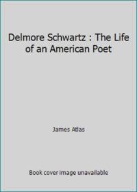
James Atlas
Delmore Schwartz : The Life of an American Poet
Farrar Straus & Giroux 1977. Hardcover. Acceptable. Disclaimer:A readable copy. All pages are intact and the cover is intact. Pages can include considerable notes-in pen or highlighter-but the notes cannot obscure the text. At ThriftBooks our motto is: Read More Spend Less.Dust jacket quality is not guaranteed. Farrar, Straus & Giroux hardcover
书商的参考编号 : G0374137617I5N00 ???????? : 0374137617 9780374137618

|
|
|
James Atlas
Delmore Schwartz : The Life of an American Poet
Farrar Straus & Giroux 1977. Hardcover. Very Good. Disclaimer:A copy that has been read but remains in excellent condition. Pages are intact and are not marred by notes or highlighting but may contain a neat previous owner name. The spine remains undamaged. At ThriftBooks our motto is: Read More Spend Less.Dust jacket quality is not guaranteed. Farrar, Straus & Giroux hardcover
书商的参考编号 : G0374137617I4N00 ???????? : 0374137617 9780374137618
|
|
|
James Atlas
Delmore Schwartz: The Life of An American Poet
Farrar Straus & Giroux . .Gift inscription on the front free end paper. . Good. Hardcover. 1st Edition. 1977. Farrar, Straus & Giroux hardcover
书商的参考编号 : 107038
|
|
|
James Atlas
DELMORE SCHWARTZ The Life of an American Poet
Farrar Sraus and Giroux. 1977. First Edition; First Printing. Hardcover. Near Fine in a Near Fine dust jacket. Jacket lightly scuffed lightly wrinkled at bottom. Boards are bumped with light stress creases to heel. Foreword by Robert F. Kennedy Jr. Presumed first. No publisher or publication date. ; 418 pages; Original unclipped dust jacket protected by archival Brodart cover. All domestic orders shipped protected in a Box. . Farrar, Sraus and Giroux hardcover
书商的参考编号 : 132878

|
|
|
James Atlas
Delmore Schwartz: The Life of an American Poet
1985-06-08. New. Ships with Tracking Number! INTERNATIONAL WORLDWIDE Shipping available. May be re-issue. Buy with confidence excellent customer service! unknown
书商的参考编号 : 0156252724n ???????? : 0156252724 9780156252720

|
|
|
James Atlas
Delmore Schwartz : The Life of an American Poet
1977-02-09. New. Ships with Tracking Number! INTERNATIONAL WORLDWIDE Shipping available. May be re-issue. Buy with confidence excellent customer service! unknown
书商的参考编号 : 0374137617n ???????? : 0374137617 9780374137618

|
|
|
James Atlas
Delmore Schwartz: The Life of an American Poet
1985-06-08. Good. Ships with Tracking Number! INTERNATIONAL WORLDWIDE Shipping available. May not contain Access Codes or Supplements. May be re-issue. May be ex-library. Shipping & Handling by region. Buy with confidence excellent customer service! unknown
书商的参考编号 : 0156252724 ???????? : 0156252724 9780156252720

|
|
|
James Atlas
Delmore Schwartz: The Life of an American Poet
1978-06-01. Good. Ships with Tracking Number! INTERNATIONAL WORLDWIDE Shipping available. May not contain Access Codes or Supplements. May be re-issue. May be ex-library. Shipping & Handling by region. Buy with confidence excellent customer service! unknown
书商的参考编号 : 0380410389 ???????? : 0380410389 9780380410385

|
|
|
James Atlas
Delmore Schwartz: The Life of an American Poet
2000-05-01. Good. Ships with Tracking Number! INTERNATIONAL WORLDWIDE Shipping available. May not contain Access Codes or Supplements. May be re-issue. May be ex-library. Shipping & Handling by region. Buy with confidence excellent customer service! unknown
书商的参考编号 : 1566491207 ???????? : 1566491207 9781566491204

|
|
|
James Atlas
Delmore Schwartz
Avon Books 1978. Mass Market Paperback. Very Good. Some jacket wear from storage. Make me an offer Avon Books paperback
书商的参考编号 : 7973635
|
|
|
James Atlas Delmore Schwartz
DELMORE SCHWARTZ The Life of an American Poet
New York: Farrar Straus and Giroux. 1977. First Edition; First Printing. Hardcover. 0374137617 . Very Good in a Good dust jacket. Closed tear to front panel's upper edge. Opened tear to rear panel's upper edge. ; 9.10 X 6 X 1.60 inches; 417 pages; Original unclipped dust jacket protected by archival Brodart cover. All domestic orders shipped protected in a Box. . Farrar, Straus and Giroux hardcover
书商的参考编号 : 99178 ???????? : 0374137617 9780374137618

|
|
|
James Atlas
Delmore Schwartz: The Life of an American Poet
Harcourt 1985-10-01. Paperback. Used:Good. Harcourt paperback
书商的参考编号 : DADAX0156252724 ???????? : 0156252724 9780156252720
|
|
|
James Atlas
Delmore Schwartz: The life of an American poet
Farrar Straus and Giroux 1977-01-01. Hardcover. Used:Good. Farrar, Straus and Giroux hardcover
书商的参考编号 : DADAX0374137617 ???????? : 0374137617 9780374137618

|
|
|
James Atlas
Delmore Schwartz: The Life of an American Poet
Welcome Rain Publishers 2000-05. Paperback. Good. Welcome Rain Publishers paperback
书商的参考编号 : SONG1566491207 ???????? : 1566491207 9781566491204

|
|
|
James Atlas
Delmore Schwartz: The Life of an American Poet
Harcourt 1985-10. Paperback. Good. Harcourt paperback
书商的参考编号 : SONG0156252724 ???????? : 0156252724 9780156252720
|
|
|
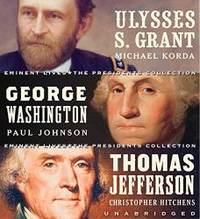
James Atlas
Eminent Lives: The Presidents Collection CD Set: George Washington Thomas Jefferson and Ulysses S. Grant
2006-02-07. New. Ships with Tracking Number! INTERNATIONAL WORLDWIDE Shipping available. May be re-issue. Buy with confidence excellent customer service! unknown
书商的参考编号 : 0060878754n ???????? : 0060878754 9780060878757

|
|
|
James Atlas
Eminent Lives: The Presidents Collection CD Set: George Washington Thomas Jefferson and Ulysses S. Grant
2006-02-07. Good. Ships with Tracking Number! INTERNATIONAL WORLDWIDE Shipping available. May not contain Access Codes or Supplements. May be re-issue. May be ex-library. Shipping & Handling by region. Buy with confidence excellent customer service! unknown
书商的参考编号 : 0060878754 ???????? : 0060878754 9780060878757
|
|
|
JAMES ATLAS
GREAT PRETENDER
SIMON & SCHUSTER. GOOD Condition. PB Trade. SIMON & SCHUSTER paperback
书商的参考编号 : IM217875 ???????? : 0689118007 9780689118005

|
|
|
James Atlas
How They See Us
ATLAS & CO 10/02/2009. Paperback. Used; Good. WE SHIP WITHIN 24 HRS FROM LONDON UK 98% OF OUR ORDERS ARE RECEIVED WITHIN 7-10 DAYS. We believe you will be completely satisfied with our quick and reliable service. All orders are dispatched as swiftly as possible! Buy with confidence! ATLAS & CO paperback
书商的参考编号 : 3688528 ???????? : 1934633100 9781934633106

|
|
|
James Atlas Editor
How They See Us: Meditations on America
Atlas 2009-12-29. Original. Paperback. Used:Good. Atlas paperback
书商的参考编号 : DADAX1934633100 ???????? : 1934633100 9781934633106
|
|
|
James Atlas
My Life in the Middle Ages: A Survivor's Tale
Harper. Hardcover. GOOD. Spine creases wear to binding and pages from reading. May contain limited notes underlining or highlighting that does affect the text. Possible ex library copy that’ll have the markings and stickers associated from the library. Accessories such as CD codes toys may not be included. Harper hardcover
书商的参考编号 : 3190099740 ???????? : 0060196297 9780060196295

|
|
 ?????????
 ?????PDF???
 RSS feed


