|
KEELY S DIRECTORIES.
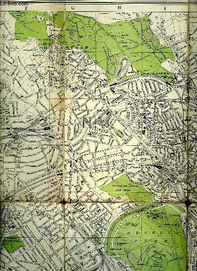
PLAN DE LONDRES DRAWN AND ENGRAVED EXPRESSLY.
CHEZ L AUTEUR.. 1907. In-8. Broché. Etat d'usage, Couv. convenable, Dos satisfaisant, Pliures. 75 cm / 108 cm. Carte entoilé en couleurs. Déchirures au niveau des pliures. Renforcé avec du scotch sur le dos.. . . . Classification Dewey : 912-Atlas, cartes et plans
书商的参考编号 : R150148702
|
|
|
KEELY S DIRECTORIES.
PLAN DE LONDRES DRAWN AND ENGRAVED EXPRESSLY.
CHEZ L AUTEUR.. 1907. In-8 Carré. Broché. Etat d'usage. Couv. convenable. Dos satisfaisant. Pliures. 75 cm / 108 cm. Carte entoilé en couleurs. Déchirures au niveau des pliures. Renforcé avec du scotch sur le dos.

|
|
|
Keller Heinrich
Première carte routière de la Suisse - Edition Originale de 1850
Chez l'auteur. 1850. In-Plano. En feuillets. Bon état, Couv. convenable, Dos satisfaisant, Intérieur frais. Carte dépliante de la Suisse en couleurs collée sur une toile (65 x 48 cm environ). Au verso, 12 petites cartes en couleurs (Plan des Rigibergs, Zürich bei H. Keller, La Suisse avec les distances, Charte des Gefichtskreises vom Rigi-Kulm, Basel, Bâme, Bern, Fribourg, Genève, Schaffhause, Lausanne...) + 2 encadrés de texte en allemand. Explication en allemand et en français. Le tout sous-emboîtage abîmé.. . Sous Emboitage. . Classification Dewey : 912-Atlas, cartes et plans
书商的参考编号 : R240164533
|
|
|
KEMP Richard, Illustré par BRIAN DELF
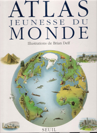
Atlas Jeunesse du Monde.
SEUIL. Oct. 1991. In-Folio. Cartonné. Bon état, Couv. fraîche, Dos satisfaisant, Intérieur frais. 80 pages. Nombreuses cartes et illustrations en couleurs, dans le texte.. . . . Classification Dewey : 912-Atlas, cartes et plans
书商的参考编号 : RO80117828 ???????? : 202012257
|
|
|
KEMP Richard
Atlas Jeunesse Du Monde ( the Children's Picture Atlas )
Paris Seuil 1991 In Plano Un regard neuf sur le monde : trouver où poussent les cactus candélabres , la longueur de la muraille de Chine , les différences entre l'Arctique et l'Antarctique , la structure de la terre et comment elle s'est formée , étudier un continent , un pays , une région , ses peuples , ses coutumes , ses industries et son agriculture etc...Cartes toutes en couleurs .- 80 p., 1 kg. 200
书商的参考编号 : 003952
|
|
|
KEMAL ÖZDEMIR.
Osmanli deniz haritalari ve Ali Macar Reis atlasi.
New New Turkish Original bdg. Dust wrapper. 4to. (33 x 23 cm). Edition in Turkish. 159, [1] p., color ills. Turkish Edition of the Ottoman nautical charts and the Atlas of Ali Macar Reis. 16th century Ottoman nautical charts figure significantly in the history of cartography. Dating from the time when the Ottoman Empire was approaching its zenith of wealth and power, these charts are a valuable source of information about the history of the period. The work of the Ottoman privateers who then held sway over most of the Mediterranean, these charts cover a geographical area far beyond the bounds of the Ottoman Empire. as rulers of an expanding empire, the Ottoman sultans took a close interest in mapmaking and may well have commissioned their sea captains to draw the charts. When Piri Reis presented his first world map to Sultan Selim I, conqueror of Egypt, in 1517, the sultan is said to have declared, "How small is the world for a conqueror.".
|
|
|
KEMAL ÖZDEMIR.
Ottoman nautical charts and the atlas of Ali Macar Reis.
Fine Fine English Original bdg. Dust wrapper. Folio. (33 x 23 cm). In English. 159, [1] p., color ills. Ottoman nautical charts and the Atlas of Ali Macar Reis. 16th century Ottoman nautical charts figure significantly in the history of cartography. Dating from the time when the Ottoman Empire was approaching its zenith of wealth and power, these charts are a valuable source of information about the history of the period. The work of the Ottoman privateers who then held sway over most of the Mediterranean, these charts cover a geographical area far beyond the bounds of the Ottoman Empire. as rulers of an expanding empire, the Ottoman sultans took a close interest in mapmaking and may well have commissioned their sea captains to draw the charts. When Piri Reis presented his first world map to Sultan Selim I, conqueror of Egypt, in 1517, the sultan is said to have declared, "How small is the world for a conqueror.". A very heavy volume.
|
|
|
KEMP Richard
Atlas Jeunesse Du Monde ( the Children's Picture Atlas )
Un regard neuf sur le monde : trouver où poussent les cactus candélabres , la longueur de la muraille de Chine , les différences entre l'Arctique et l'Antarctique , la structure de la terre et comment elle s'est formée , étudier un continent , un pays , une région , ses peuples , ses coutumes , ses industries et son agriculture etc...Cartes toutes en couleurs .- 80 p., 1 kg. 200
|
|
|
KENDALL Lt
1 CARTE MARITIME EN NOIR ET BLANC - AMERIQUE MERIDIONALE - copie du plan levé en 1828 - CARTE N°2043
***. 1943. In-Plano. En feuillets. Bon état, Couv. convenable, Dos satisfaisant, Intérieur frais. 1 carte en noir et blanc de 76 x 51 cm. Echelle 1/120000. Port Cook 1/36000.. . . . Classification Dewey : 912-Atlas, cartes et plans
书商的参考编号 : RO30092603
|
|
|
KENDALL (Richard) / DEGAS
DEGAS par lui meme
1987 Paris, Editions Atlas, 1987. In-folio cartonné noir, jaquette ill. 328 p. Très nombreuses illustrations en couleurs. Parfait état. Tableaux, dessins, extraits de la correspondance et des carnets de notes de Degas ainsi que des écrits des contemporains du peintre rassemblés par Richard Kendall.
书商的参考编号 : 5462

|
|
|
Kenneth W. Dobra; Lionas Miller; Alfred E. Browm; Ronald M. Atlas
Experimental Microbiology : Fundamentals and Applications
Benjamin-Cummings Publishing Company 1988. Paperback. Good. Disclaimer:A copy that has been read but remains in clean condition. All pages are intact and the cover is intact. The spine may show signs of wear. Pages can include limited notes and highlighting and the copy can include previous owner inscriptions. At ThriftBooks our motto is: Read More Spend Less.Dust jacket quality is not guaranteed. Benjamin-Cummings Publishing Company paperback
书商的参考编号 : G002304280XI3N00 ???????? : 002304280X 9780023042805

|
|
|
Keppel, Karl
Karl Keppels Geschichtsl-Atlas in 27 Karten.
München, Oldenbourg, (1904). 4° quer., Original-Broschur. 18. Auflage. (Umschlag eingerissen, eselsohrig).
书商的参考编号 : 305121AB
|
|
|
KERMABON Adh. JACQUEZ.-
Atlas des Lignes Télégraphiques Aériennes Construites en France de 1793 à 1852.-
Etabli d'après les ordres de Mr le Directeur Général des Postes et des Télégraphes Sous la direction de Mr Jacquez, Bibliothécaire de l'Administration Par Adh. Kermabon, Commis principal des Postes et des Télégraphes. Paris. 1892. In-plano (360 x 502 mm) cartonnage rouge d'éditeur imprimé et orné en noir, gardes bleues, 3ff., 48 cartes planimétriques en couleurs, montées sur onglets et très grande carte (ca 428 x 770 mm) des lignes télégraphiques aériennes de France 1793-1852. Mors du 1er plat fendu sur 21 cm, planche 33 (Gironde entièrement et uniformément brunie, sinon bel exemplaire malgré de tout petits défauts. De toute rareté.
书商的参考编号 : ORD-12168
|
|
|
KERGUELEN DE TREMAREC, Yves-Joseph Marie de.
Relation de deux voyages Dans les mers Australes & des Indes, faits en 1771, 1772, 1773 & 1774. Par M. De Kerguelen. Commandant les Vaisseaux du Roi le Berrier, la Fortune, le Gros-Ventre, le Rolland, l’Oiseau & la Dauphine. Ou Extrait du Journal de sa Navigation pour la découverte des terres Australes, & pour la vérification d’une nouvelle route proposée pour abréger d’environ huit cents lieues la traversée d’Europe à la Chine. Rare édition originale de ce voyage de découverte visant à prouver l’existence d’un continent austral, dont la plupart des exemplaires furent aussitôt mis au pilori.
Provenant de la Bibliothèque du Duc d’Aiguillon. A Paris, chez Knapen & Fils, Lib.-Imp. de la Cour des Aides, 1782. In-8 de viii pp., 244 pp., 1 carte dépliante hors-texte in-fine (Terres Australes ou Partie Septentrionale de l’Isle de Kerguelen), (2) ff. Plein veau glacé moucheté, filet à froid d’encadrement sur les plats, dos lisse orné de fleurons dorés, pièce de titre de maroquin vert, tranches rouges. Reliure de l’époque. 199 x 126 mm.
书商的参考编号 : LCS-18462

|
|
|
Kerrod, Robin
Das Kosmos-Buch vom Weltall / aus d. Engl. übers. von Hermann-Michael Hahn.
Stuttgart : Franckh-Kosmos, 1992. 95 S. : überw. Ill., Kt. Gr. 4°. Ill. OPpbd.
书商的参考编号 : 5331
|
|
|
Keskin Naci
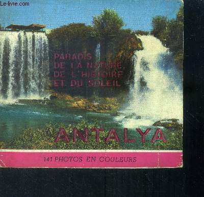
Paradis de la nature, de l'histoire et du soleil Antalya
Keskin Color. Non daté. In-12. Broché. Etat passable, Couv. légèrement passée, Dos frotté, Déchirures. Environ 100 pages augmentées de nombreuses photos en couleurs dans et hors texte.. . . . Classification Dewey : 912-Atlas, cartes et plans
书商的参考编号 : RO40010133
|
|
|
Kettermann, Günter
Atlas zur Geschichte des Islam [von Günter Kettermann], Mit einer Einleitung von Adel Theodor Khoury,
Darmstadt: Wissenschaftliche Buchgesellschaft (WBG) 2001. VI, 186 Seiten. Mit zahlreichen Abbildungen. Gr. 4° (33,5 x 25 cm). lllustrierter Orig.-Pappband. [Hardcover / fest gebunden].
书商的参考编号 : 5133200

|
|
|
Kettermann, Günter
Atlas zur Geschichte des Islam [von Günter Kettermann], Mit einer Einleitung von Adel Theodor Khoury,
Darmstadt: Wissenschaftliche Buchgesellschaft (WBG) 2001. VI, 186 Seiten. Mit zahlreichen Abbildungen. Gr. 4° (33,5 x 25 cm). lllustrierter Orig.-Pappband. [Hardcover / fest gebunden].
书商的参考编号 : 5136404

|
|
|
Kettermann, Günter
Atlas zur Geschichte des Islam.
Darmstadt: Wissenschaftliche Buchgesellschaft, 2001. VI + 186 S., Ill., graph. Darst., zahlr. Kt., 33 cm. Opp., gebundene Ausgabe.
书商的参考编号 : 225531

|
|
|
Kettermann, Günter
Atlas zur Geschichte des Islam.
Darmstadt: Wissenschaftliche Buchgesellschaft, 2001. VI + 186 S., Ill., graph. Darst., zahlr. Kt., 33 cm. Opp., gebundene Ausgabe.
书商的参考编号 : 215714

|
|
|
Kettermann, Günter
Atlas zur Geschichte des Islam. Mit einer Einl. von Adel Theodor Khoury
[Darmstadt] : Primus-Verl., 2001. VI, 186 S. : Ill., graph. Darst., zahlr. Kt. ; 33 cm Pp.
书商的参考编号 : 26975
|
|
|
Kettermann, Günter
Atlas zur Geschichte des Islam. Mit einer Einl. von Adel Theodor Khoury
Darmstadt : WBG / , WBG / Wissenschaftliche Buchgesellschaft 2001. VI, 186 S. :132 farb. Ktn ; 33 cm gebundene Ausgabe, Hardcover/Pappeinband, Exemplar in sehr gutem Erhaltungszustand
书商的参考编号 : 45025

|
|
|
Kettermann, Günter
Atlas zur Geschichte des Islam. Mit einer Einleitung von Adel Theodor Khoury.
Darmstadt: Primus Verlag, 2001. VI, 186 S. : Ill., graph. Darst., zahlr. Kt. Leinen mit Schutzumschlag.
书商的参考编号 : 1202389

|
|
|
Kettermann, Günter
Atlas zur Geschichte des Islam. Mit einer Einleitung von Adel Theodor Khoury.
(Darmstadt, Wissenschaftliche Buchgesellschaft WBG, 2001). VI, 186 S. Mit sehr zahlr. farb. Abb. und Ktn. (= Die besondere wissenschaftliche Reihe). 4to. 32,5 cm. OPp.
书商的参考编号 : 90738

|
|
|
Kettermann, Günter:
Atlas zur Geschichte des Islam. Mit einer Einleitung von Adel Theodor Khoury.
Leicht berieben und vergilbt, sonst sehr guter Zustand. - Mit dem Islam entsteht im 7. Jahrhundert eine Weltreligion, die für den gläubigen Muslim das gesamte öffentliche und private Leben bestimmt. Die Andersartigkeit und Fremdheit der Islamischen Welt und ihre räumlichen Bezüge sind erst vor dem Hintergrund ihrer historischen Bedingungen und Ursachen zu verstehen. Der »Atlas zur Geschichte des Islam« präsentiert diese facettenreiche Geschichte aus einer völlig neuen Perspektive. Mit 134 speziell für diesen Band gestalteten Karten, zahlreichen Farbfotos sowie ausführlichen Erläuterungen und Hintergrundinformationen macht Günter Kettermann die Ursprünge des Islam und die Differenzierung der von dieser Religion geprägten Welt transparent. ISBN 9783896781949
|
|
|
KIDRON MICHAEL ET SMITH DAN.
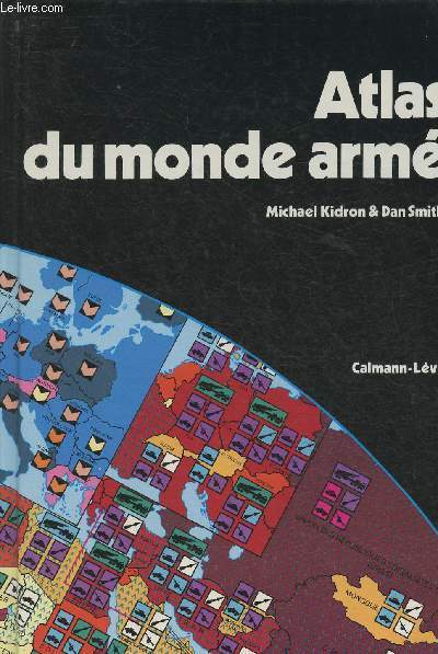
ATLAS DU MONDE ARME.
CALMANN LEVY.. 1983.. In-8. Relié. Bon état, Couv. convenable, Dos satisfaisant, Intérieur frais. Environ 150 pages. 1ère et 4 ème de couverture illustrées en couleurs. Nombreuses cartes et illustrations en couleurs, dans le texte et hors texte.. . . . Classification Dewey : 912-Atlas, cartes et plans
书商的参考编号 : R150019844

|
|
|
Kidron Michael, Smith Dan
Atlas du monde armé
Calmann-Lévy. 1983. In-8. Relié. Bon état, Couv. convenable, Dos satisfaisant, Intérieur frais. 80 pages environ, illustrées de cartes en couleurs, hors texte.. . . . Classification Dewey : 912-Atlas, cartes et plans
书商的参考编号 : RO30327187
|
|
|
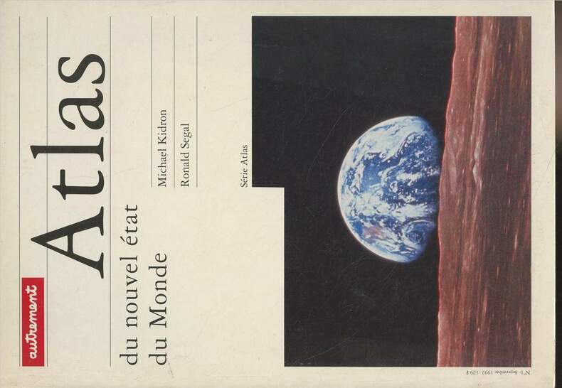
Kidron Michael/Segal Ronald
Atlas du nouvel état du Monde - Série Atlas
Autrement. 1992. In-12. Broché. Bon état, Couv. convenable, Dos satisfaisant, Intérieur frais. 168 pages - nombreuses cartes en couleurs hors texte.. . . . Classification Dewey : 912-Atlas, cartes et plans
书商的参考编号 : R300280385
|
|
|
KIDRON MICHAEL - SEGAL RONALD
NOUVEL ATLAS ENCYCLOPEDIQUE DU MONDE.
FRANCE LOISIRS / CALMANN-LEVY. 1984. In-8. Relié. Bon état, Couv. convenable, Dos satisfaisant, Intérieur frais. 57 pages.. . . . Classification Dewey : 912-Atlas, cartes et plans
书商的参考编号 : R240038141
|
|
|
KIDRON MICHAEL ET SMITH DAN.
ATLAS DU MONDE ARME.
CALMANN LEVY.. 1983.. In-8 Carré. Relié. Bon état. Couv. convenable. Dos satisfaisant. Intérieur frais. Environ 150 pages. 1ère et 4 ème de couverture illustrées en couleurs. Nombreuses cartes et illustrations en couleurs, dans le texte et hors texte. L'arsenal, Dans le monde entier, La rupture, Le jeu du marché, Les ressources.

|
|
|
Kidron, Michael & Smith, Dan
Die Aufrüstung der Welt. Ein politischer Atlas. Kriege und Waffen seit 1945.
Reinbek bei Hamburg, Rowohlt Taschenbuch Verlag, 1983. 25 cm, unpaginiert, ca. 128 Seiten, mit zahlreichen Karten, graphischen Darstellungen und Tabellen, kartoniert. Deutsche Erstausgabe kaum gebraucht, sehr gute Erhaltung. rororo aktuell 5237.
书商的参考编号 : 12774AB
|
|
|
KIDRON- SEGAL
NOUVEL ATLAS ENCYCLOPEDIQUE DU MONDE
ISBN : 2702113230. CALMANN LEVY. 1984. In-4 Carré. Relié. Bon état. Couv. convenable. Dos satisfaisant. Intérieur frais. 150 pages environ augmentées de nombreuses cartes en couleurs hors texte, avec légendes
|
|
|
KIENAST - BERTRAND
Atlas Kienast - Bertrand
DELAGRAVE. 1984. In-Folio. Cartonné. Etat d'usage, Couv. légèrement passée, Dos satisfaisant, Intérieur acceptable. 80 pages de cartes en couleurs, hors-texte. Une carte dépliante en couleurs. Coiffes frottées. Quelques traces d'humidité éparses.. . . . Classification Dewey : 912-Atlas, cartes et plans
书商的参考编号 : RO80050860
|
|
|
KIEPERT HEINRICH
KARTEN ZUR ALTEN GESCHICHTE, VII, ITALIEN
Dietrich Reimer. Non daté. In-12. Broché. Etat d'usage, Couv. légèrement passée, Dos satisfaisant, Intérieur bon état. Une carte dépliable en couleur, d'env. 40/50 cm. Ouvrage de bibliothèque avec étiquette annotée, tampons et annotation.. . . . Classification Dewey : 912-Atlas, cartes et plans
书商的参考编号 : RO40087485

|
|
|
KIEPERT, Heinrich:
Kiepert's Atlas Antiquus. 12 Karten zur alten Geschichte. Entworfen und bearbeitet von Heinrich Kiepert. 6., neu bearb. Aufl.
Berlin, Dietrich Reimer, O.J., um 1870, gr. in-4°, 1 Bl. + 12 doppelbl. Karten, farb. lithogr. v J. Sulzer, Original-Leinenband, verblasst, Rücken leicht beschädigt.
书商的参考编号 : 42439aaf
|
|
|
KIEPERT H.
Topographisch-historischer Atlas von Hellas und den hellenischen Colonien, unter Mitwirkung des Professors Carl Ritter bearbeitet von...
Berlin, Nicolaische Buchhandlung, 1846. 265 X 425 mm. relié toile bleue. 10 pp. suvies de 23 (sur 24) cartes sur double page colorisées, montées sur onglets.Mit Vorwort und Vorbericht. La carte 24 manque. Quelques rousseurs et mouillures, principalements sur les feuillets liminaires, reliure légèrement frottée.
书商的参考编号 : 25999
|
|
|
Kienast et bertrand
ATLAS Classique.
français Grand in-4 de 80-XXVIII pp., (1) ff.; album de l'éditeur. Seconde édition revue et mise à jour. Cartes et hémisphères en couleurs suivi d'un index alphabétique.
|
|
|
Kiepert
Kieperts Grosser Hand-Atlas
Berlin, Reimer, Dietrich, 1896. gr.Folio(50x33cm), Titel mit alten Bibliotheksstempeln (2), 2 Bll. (Verzeichnis), zusammen 37 Karten (es fehlen die Karten: 4,5,10,12,20,27,42, teilw. auch im Text), Halbledereinband
书商的参考编号 : 7-0-642

|
|
|
Kiepert (Heinrich), Dr.
Neuer Hand Atlas über alle Theile der Erde.
français Grand in-folio (60 x 32 cm) de Titre et 17 pages de texte + 40 cartes à double-pages montées sur onglet ; demi-cuir à coins bordé d'un filet doré (reliure de l'époque). Bel exemplaire.
|
|
|
Kiepert + Wolf
Historischer Schul-Atlas zur alten, mittleren und neueren Geschichte in sechsunddreissig 36 Karten 2.Auflage
Berlin, Reimer, 1882. Hln, 36S, Block aus Bindung gelöst, sonst gutes Exemplar
书商的参考编号 : 03926

|
|
|
KIEPERT HEINRICH
KARTEN ZUR ALTEN GESCHICHTE, VII, ITALIEN
Dietrich Reimer. Non daté. In-12 Carré. Broché. Etat d'usage. Couv. légèrement passée. Dos satisfaisant. Intérieur bon état. Une carte dépliable en couleur, d'env. 40/50 cm. Ouvrage de bibliothèque avec étiquette annotée, tampons et annotation.

|
|
|
Kiepert Henrico Berolinensi
Undecim Regiones ab Augusto Imp. Institutae Italia
1 46x36 cm., circa su carta dorte con buoni margini, in passepartout, a colori, in latino, buone condizioni.
|
|
|
Kiepert, H
Historisch-geographischer Atlas der alten Welt. Sechzehnte verbesserte Auflage in 16 Karten
Weimar Geographisches Institut der Justus-Liebig-Universität Gießen, 1868. 22 S. + XI Tafn. 4° Quart (Quer) Hln.
书商的参考编号 : 17707

|
|
|
Kiepert, H. und Carl Wolf
Historischer Schul-Atlas zur mittleren und neueren Geschichte in 36 Karten.
Berlin, Dietrich Reimer, 1882. 4° quer., Original-Halbleinen. 2. berichtigte Auflage. (Einband berieben u. bestoßen, sonst gut).
书商的参考编号 : 305120AB
|
|
|
Kiepert, H.; Weiland, C.F
Grosser Hand-Atlas des Himmels und der Erde
Weimar, Geographisches Institut, 1873. gr.Folio(57x36cm), 71 Bll.(Karte 32 fehlt) in Kupferstich mit Farbendruck und Clororit, Halbleineneinband
书商的参考编号 : 7-0-654

|
|
|
Kiepert, Heinrich
Atlas Antiques - Zwölf Karten zur alten Geschichte - 6.Auflage
Berlin, Reimer, 1878. PP, Rücken fehlt, Karten gelöst, Karten aber in gutem Zustand
书商的参考编号 : 09661
|
|
|
Kiepert, Heinrich
Atlas antiquus. Karten zur Geschichte der alten Welt. Zwölf Karten zur Alten Geschichte entworfen und bearbeitet von Heinrich Kiepert. Limitierte Exlusivausgabe. Reprint der Originalausgabe Berlin 1898 bei Reimer.
Holzminden: Volker Hennig (Reprint-Verlag in Leipzig) (2007). (31), 27 Seiten. Mit 12 doppelseitigen farbigen Karten. 2° (37,5 x 27 cm). Hübscher Orig.-Halbleinenband mit Samtbezug und goldgeprägtem Titel. [Hardcover / fest gebunden].
书商的参考编号 : 2121518

|
|
|
Kiepert, Heinrich
Atlas Antiquus. Zwölf Karten zur Alten Geschichte. Entworfen und bearbeitet von Heinrich Kiepert. Kiepert's Atlas Antiquus.
Berlin; Verlag von Dietrich Reimer, o.J. (1881?). Ca. 60 Seiten; großformatige, farb. illustr. Karten; 36,5 cm. Originalleinenband.
书商的参考编号 : 1197114

|
|
|
Kinder, Hermann (Herausgeber)
Realienbuch zur Weltgeschichte : histor. Atlas; chronolog. Abriss; Dokumente in Bildern; von d. Vor- u. Frühgeschichte bis z. Gegenwart. Hermann Kinder; Werner Hilgemann. [Graph. Gestaltung d. Kt.: Harald u. Ruth Bukor]
Frankfurt (a. M.), Wien, Zürich : Büchergilde Gutenberg, 1972. 700 S. : 268 Ill. u. graph. Darst., 473 Kt.; ; 25 cm Leinen
书商的参考编号 : 28914
|
|
|
Kinder, Hermann und Werner Hilgemann
dtv-Atlas Weltgeschichte. Von den Anfängen bis zur Gegenwart. Mit 249 Abbildungsseiten in Farbe. Graphische Gestaltung der Abbildungen Harald und Ruth Bukor.
München: Deutscher Taschenbuch-Verlag, 2000. Originalausgabe; Sonderausgabe des im dtv in zwei Bänden 1964 und 1966 erstmals erschienen dtv-Atlas Weltgeschichte; 631 S. mit zahlreichen Abbildungen; 24 cm; OKart. (Taschenbuch);
书商的参考编号 : 106500

|
|
 ?????????
 ?????PDF???
 RSS feed


