|
|
|
[Colton's Condensed Octavo Atlas of the Union]
TRAVEL MAPS MAP OF NEVADA UTAH AND ARIZONA
New York: J. H. Colton 1865. Second Edition. Colored engraved map with a bit of creasing at the fold. 11 3/4 x 9 1/2â€. From the second edition of Colton’s Condensed Octavo Atlas of the Union. J. H. Colton unknown
Bookseller reference : 291848

|
|
|
[CREVIER] - D'ANVILLE
Atlas de Géographie ancienne pour servir à l'intelligence de l'Histoire des Empereurs par Crevier gravé d'après les cartes originales de d'Anville -
Paris - Ledoux et Tenré - Didot le jeune - 1819 - 1 volume in-folio broché comprenant 5 cartes, toutes marges, format 35 x 53 cm chacune - Quelques mouillures anciennes - Couverture poussièreuse, un peu salie avec petits manques aux angles-
Bookseller reference : GF25634
|
|
|
[Dartein, Fernand de]
M. Léonce Reynaud. Sa vie et ses oeuvres par l’un de ses élèves.
Paris, Dunod, 1885 ; in-8, broché ; (1) f. blanc, (6), 266 pp., (1) f. blanc, portrait par Jules Lefebvre gravé à l’eau-forte par Léon Gaucherel en frontispice, couverture verte imprimée.
Bookseller reference : 10632
|
|
|
[DESNOS] - [REGLEY (Abbé)].-
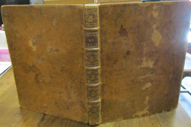
Atlas chorographique, historique et portatif des Elections du Royaume. GENERALITE de PARIS, divisée en ses vingt-deux Elections et représentée dans toutes ses parties par autant de Cartes particulières, d'une manière Chorographique et complette [sic], avec le nombre des Paroisses et des Feux, la position des Villes, des Bourgs, des Villages, des hameaux, des Abbayes, des Bois, des Prairies, des Montagnes, des Etangs, des Marais, des Rivières, des Routes, de tous les Lieux enfin qui la composent, levées sur le Terrain [sic]. Par une Société d'Ingénieurs. Dirigées et données au Public par le S. DESNOS. Accompagnées d'une Description dans laquelle on explique l'histoire particulière de chaque Ville, sa situation, ses Embellissemens [sic], ses principaux Edifices, ses Evènemens [sic] remarquables, son Terroir, ses foires, son Commerce, ses Manufactures, ses Curiosités naturelles, enfin toutes les Productions de la Nature et de l'Art qui s'y trouvent. Par M. l'Abbé REGLEY. Ouvrage utile à l'Etranger comme au Citoyen qui veut avoir une connoissance détaillée de la France, et particulièrement à ceux qui sont intéressés dans l'administration de la Justice, le Commerce et les Finances, aux Voiageurs [sic], et aux jeunes gens qui veulent apprendre notre Histoire.
1763 P., Savoye, Despilly, Duchesne, Dessaint et Saillant, Guillyn, Grange et Dufour, et l'Auteur, 1763, in 4° relié plein veau de l'époque, dos à cinq nerfs orné, étiquette rouge, tranches marbrées, VIII [Discours préliminaire] - XXXIV [Description de la Généralité de Paris] - 122 pages - 1 feuillet [carton du feuillet XXXIII/XXXIV, avec errata] et XII pages [Table générale des Matières / Fautes à corriger] ; titre gravé, une planche à double page [Statue Equestre de Louis le bien Aimé] et 25 cartes aquarellées, à double-page ; quelques très rares rousseurs éparses ; coiffes usées, coins émoussés, un mors fendu sur 5 cm, et petits frottis.
Bookseller reference : 61701
|
|
|
[Deutschland, Österreich]
?Generalkarte von Deutschland [...] von C. Glaser?. Grenzkolor. lithogr. Karte. (Aus: Glaser, C. Vollständiger Atlas).
(Mainz, um 1840). 39,5 x 48 cm. Mittig gefaltet (wie erschienen).
Bookseller reference : 40832
|
|
|
[Dänemark, Island, Faröer, Kopenhagen, Skandinavien]
?Daenemark mit Holstein & Lauenburg [...] von C. Glaser?. Grenzkolor. lithogr. Karte. (Aus: Glaser, C. Vollständiger Atlas).
(Mainz, um 1840). 39,5 x 48 cm. Mittig gefaltet (wie erschienen).
Bookseller reference : 40834

|
|
|
[ENCYCLOPÉDIE. ATLAS].-
Complément de l'Encyclopédie moderne. Dictionnaire abrégé des sciences, des lettres, des arts, de l'industrie, de l'agriculture et du commerce. Atlas seuls.-
Tome 1er: Agriculture (11 pl.). Antiquités (18pl.) Architecture (17pl.). Armures romaines (4pl.). Chimie (1pl.). Costumes français (55 pl.). Économie domestique (1pl.). Géographie (21 cartes rempliées). Tome 2: Géographie (35 cartes rempliées), Art héraldique (4pl.). Histoire Naturelle (5pl.). Arts mécaniques (10 pl.). Art militaire (12 pl.). Musique (6 pl.). Navigation (4pl.). Paléographie (9 pl.). Pavillons (4pl.). Physique (2pl.). Religions (15 pl.). Sceaux (2pl.). Vénerie (1pl.). Paris. Firmin Didot. 1863. 2 volumes in-8 (172 x 238mm) dos basane violette virés au brun clair, plats mouchetés, gardes marbrées, 2ff., 3 pages, 108 planches et 21 cartes rempliées; 2ff., 3 pages, 35 cartes rempliées et 74 planches. Toutes montées sur onglet. Les planches 14 à 16 de l'architecture déplacées dans l'agriculture, la pl. 2 de l'histoire naturelle placée après la physique, mais exemplaire absolument complet des planches. Cachets et étiquettes de bibliothèques. Première feuille de table du tome 2 en partie détachée, couverture un peu râpée, sinon bon exemplaire.
Bookseller reference : ORD-3602
|
|
|
[environs de Paris. Atlas]
Les environs de Paris. Atlas de poche
Paris, Haar & Steinert, coll. « Diamant » 1908 In-16 16,5 x 9,5 cm. Cartonnage éditeur pleine percaline bleu-marine, dos muet, titre doré sur le premier plat, 12 pp., 20 cartes en couleus avec texte-guide alphabétique,prface, liste des curiosités aux environs de Paris, excursions aux environs de Paris. Exemplaire en bon état.
Bookseller reference : 117344
|
|
|
[Förster, Ch. F. Ludwig (Hg.)]
[Allgemeine Bauzeitung]. 13 Tafeln aus Atlasband.
Alle Tafeln mit Bezeichnung Allg. Bauzeitung 1851. Halbledereinband der Zeit. 13 z. T. gefaltete und z. T. doppelbl.gr. Tafeln mit Grund- und Aufrißen bzw. Ansichten, alle die Architektur-Denkmäler "Die Otto´s Universität" und "Das Erechtheion" in Athen betr. 2°. Stellenweise vereinzelt gering fl. Gut erhalten.
Bookseller reference : 25168
|
|
|
[F.I.C.].-
Atlas de géographie, physique, politique et historique.
P., Procure Générale, 1900, in 4° cartonnage de percaline verte de l'éditeur (très légèrement fané).
Bookseller reference : 64954
|
|
|
[FEYDEL, Gabriel]
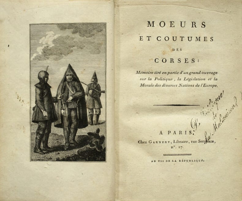
Mœurs et coutumes des Corses : Mémoire tiré en partie d’un grand ouvrage sur la Politique, la Législation et la Morale des diverses Nations de l’Europe. Remarquable exemplaire à la provenance particulièrement croustillante : de la Bibliothèque de la Malmaison.
Edition originale de cet intéressant traité sur les Corses en France. Paris, Garnery, An VII (1798-99). Grand in-8 de (4) ff., 1 frontispice, 112 pp. Relié en pleine basane fauve, roulette dorée encadrant les plats, dos lisse orné de fleurons dorés, chiffre P B frappé or en pied du dos, pièce de titre en maroquin rouge, roulette dorée sur les coupes, tranches dorées sur marbrures. Dos légèrement frotté. Reliure de l’époque. 198 x 122 mm.
Bookseller reference : LCS-17457
|
|
|
[Fermanel de Favery, Luc].
Relation des missions et des voyages des evesques vicaires apostoliques, et de leurs ecclesiastiques és Années 1676. & 1677. Edition originale « très rare » de cette relation des missions à la Cochinchine, au Tonkin, à la Chine, au Cambodge, à Ciampa, aux Indes et au Royaume de Siam.
Précieuse édition originale de ce récit des « missions de la Cochinchine, du Tonkin, Siam et Cambodge. Très rare » (Chadenat, II, 4391). Paris, Charles Angot, 1680. In-8 de (8) ff., 242 pp., (1) f. de privilège. Plein veau brun granité, dos à nerfs orné, roulette dorée sur les coupes. Reliure de l’époque. 187 x 116 mm.
Bookseller reference : LCS-18085

|
|
|
[FOREZ].-
Atlas des cartes cantonales [Atlas Cantonal] du département de la Loire. A l'échelle de 1/40 000ème. Dressé par le Service Vicinal.
1887 Saint-Etienne, Archives de la Préfecture, 1887, grand in folio (64x47cm) relié pleine percaline noire de l'éditeur, 28 cartes en couleurs, sur double-page, montées sur onglets ; défauts d'usage à la reliure ; ex-dono de 7 lignes (daté 1987) sur la page de titre.
Bookseller reference : 3385
|
|
|
[France] LA BRUGèRE, F. de
Dictionnaire général, en une seule série alphabétique, des communes de France et des colonies...
Paris, Arthème Fayard 1877 In-4 32 x 24 cm. Reliure de l’époque demi-chagrin noir, dos à nerfs encadrés de fers dorés, 814-10 pp., ,95 cartes géographiques ou plans des principales villes de France, le plan replié de l’Exposition universelle de 1878 un fine.
Bookseller reference : 123799

|
|
|
[FRENCH ATLAS]
Methode Abregee Et Facile Pour Apprendre La Geographie
Lyon: Chez Bernuset 1780. Hardcover. Very Good. Nouvelle Edition revue corrigee & augmentee. Contemporary calf. 515 pp. 17 maps. <br/><br/> Chez Bernuset hardcover
Bookseller reference : D19540
|
|
|
[Ghega, Carl Ritter von]
Atlas pittoresque du chemin de fer du Semmering [...].
Wien, Carl Gerold & Sohn, 1854. Qu.-Gr.-4°. Mit einer lithogr. Karte, einem lithogr. Längenprofil, 5 getönt. lithogr. Ansichten sowie einem mehrf. gefalt. Leporello-Panorama in Tonlithographie. 2 Bll., 19 S., (Text; in mod. Umschlag m. bedrucktem Deckeltitel) u. die 8 Tafeln, lose in mod. HLdr.-Kassette m. goldgepr. Ldr.-Deckelschild.
Bookseller reference : 61648

|
|
|
[GUEUDEVILLE, Nicolas et Henri Abraham CHATELAIN].
Atlas historique, ou nouvelle introduction à l’histoire, à la chronologie, et à la géographie ancienne et moderne ; représentée dans de nouvelles cartes, où l’on remarque l’établissement des Etats et Empires du monde, leur durée, leur chûte et leurs différents gouvernements ; la chronologie des Consuls romains, des Papes, des Empereurs, des Rois et des Princes, etc. qui ont été depuis le commencement du Monde, jusqu’à présent : et la généalogie des maisons souveraines de l’Europe. Par Mr. C. [Chatelain]. Avec des dissertaions sur l’histoire de chaque Etat, par Mr. Gueudeville. Seconde édition revue, corrigée et augmentée.
Amsterdam, les Frères Chatelain, 1708-1714, 4 vol. in-folio, (18)-8-(4)82, (16)-(10)-162 (pagination continue) et (12)-98 pp, lettrines, culs-de-lampes, reliures plein veau raciné, dos à 6 nerfs guillochés et caissons très ornés, pièces de titre et de tomaison basane naturelle, coupes guillochées, tranches rouges (rel. de l'époque), pet. travail de ver au tome 1 sans perte de texte, coiffes abîmées, qqs épidermures, 1 mors fendu sur 8 cm au tome 3, intérieurs propres, bon état
Bookseller reference : 116863
|
|
|
[GUEULLETTE (Simon)]
Méthode facile pour apprendre l'histoire de France, avec une idée générale des Sciences. Nouvelle édition augmentée de plus d'un tiers (…). [Belle carte dépliante gravée de l'Europe].
In-12, pleine basane de l'époque, dos à nerfs (rel. frottée, manque de cuir en pied), (10) f., 530 p., (13) f., grande carte historique de l'Europe dépliante, portrait des rois de France dans des médaillons sur bois. Nouvelle édition considérablement augmentée. La grande carte d'Europe est gravée par P. Ganière. Portraits des rois de France dans des médaillons sur bois en tête de chaque notice. (G. Kaucher, ‘Les Jombert’, n°403). Ex-libris anciens manuscrits.
|
|
|
[GÉOGRAPHIE: ENFANTINA]:
Atlas des enfans, ou méthode nouvelle, courte, facile et démonstrative, pour apprendre la géographie en XXII carte enluminée. Avec un nouveau traité de la sphère, ou l'on explique le mouvement des astres, [...].
A Amstredam, chez J. H. Schneider, 1766. In-12 de [4]-VI-213-[1] et 40 pages, plein veau brun , dos à nerfs orné de filets et fleurons dorés.
Bookseller reference : 21301

|
|
|
[HARITA UMUM MÜDÜRLÜGÜ = MAP GENERAL DIRECTORY].
Ottoman map of Kayseri [Caesaria] and its around.
Very Good Turkish, Ottoman (1500-1928) Original color map on cloth. A little foxing on cloth. Very good. Folded. Oblong atlas folio. (50 x 67 cm). In Ottoman script. Scale: 1/300.000. Map of Ottoman Kayseri printed in its period. No publisher and map-maker. Physical geography of Kayseri city and its around. It shows Kayseri, Sultan Sazligi, mountains and hills, Malatya borders, etc.
|
|
|
[HARITA UMUM MÜDÜRLÜGÜ SHEET].
[MAP of BALKANS] Filibe [Plovdiv].
Very Good Turkish, Ottoman (1500-1928) Original color map on cloth. Oblong eephant folio. (64 x 573 cm). Toponyms in Ottoman script. [MAP of BALKANS] Filibe [Plovdiv]. A very detailed map. Shows Plovdiv and mountains, rivers around it. Extremely rare.
|
|
|
[HARITA UMUM MÜDÜRLÜGÜ].
[MAP] Büyükada, Maltepe ve Adalar. [Feuille of Sedef Island and South of Prinkipo, Marmara Sea].
Very Good French Original color map on cloth. Oblong folio. (42 x 53 cm). In Ottoman script. [MAP] Büyükada, Maltepe ve Adalar. [Feuille of Sedef Island and South of Prinkipo, Marmara Sea]. 6th sheet of set.
|
|
|
[HARITA UMUM MÜDÜRLÜGÜ].
[MAP] Kocaeli-Izmit Körfezi. Gökbüze, Derince, Dilburnu, Hersek Gölü. [Izmit Bay, Dilburnu, Gökbüke, Derince, Marmara Sea].
Very Good French Original color map on cloth. Oblong large folio. (49 x 58 cm). In Ottoman script. [MAP] Kocaeli-Izmit Körfezi. Gökbüze, Derince, Dilburnu, Hersek Gölü. [Izmit Bay, Dilburnu, Gökbüke, Derince, Marmara Sea]. Scale: 1/50.000.
|
|
|
[Heckel, Johann Christoph (Hg.)]
Atlas für die Jugend, und alle Liebhaber der Geographie, nach D. Büschings Lehrart eingerichtet. Nebst einer Abhandlung von der Erd- und Himmelskugel, mit XXIV. illuminirten kleinen Landkarten nach [Guillaume] Delisle [recte nach Christiaan Andreas Sepp].
Augsburg, Conrad Heinrich Stage 1776. 8°. Tit., 7 Bll. (Widm., Vorrede, Inh.), 442 S., 8 [v. 9] Bll. (Reg.). Mit 22 (v. 24) grenzkol., gef. Karten in Kupferst. (dav. 2 nur zur Hälfte erh.). Frontispiz fehlt. Lederbd. d. Zeit am Rücken mit Streicheisenlinien u. mont. Titelschild sowie verblasstem rotem Sprengschnitt. Durch Wurmfraß größere Fehlstellen an beiden Kapitalen, Einband berieben, Sign. v. alter Hd. auf Vorderdeckel, Reste von geklebten Papierumschlag auf beiden Spiegeln, hs. Sign. auf Vorderdeckel, im Text durchgeh. abgegriffen, mehrere Ss. fleckig u. angeschmutzt, Kritzelei v. Kinderhand auf hint. Spiegel. Vgl. Holzmann-B. I, 3227 (hier die Ausg. 1780); LKJL I, 74. - Früher Schulatlas in erster deutscher Ausgabe. Mit geographischen Mitteilungen in Gesprächsform (Frage und Antwort) und reizenden Karten im Miniaturformat (Erdteilkarten sowie Karten der europäischen Länder). Die Karten mit aus dem Text herausgehobenen Buchstaben, römischen und arabischen Ziffern, aber ohne Namen. Mit separatem Anhang 'Neue Abhandlung von der Sphäre oder Himmelskugel etc.", dazu 2 Tafeln mit Armillarsphäre u. Planetenbahnen. Nach der erstmals 1758 in Amsterdam erschienenen Ausgabe die viele Nachahmungen, Übersetzungen und Auflagen erfuhr. - Es fehlen die Karten 1 u. 3, die Karten 8 u. 11 sind unvollständig vorhanden.
Bookseller reference : ALDR0162
|
|
|
[HISTOIRE] - DEFFONTAINES ET DELAMARRE (Pierre et Mariel-Jean-Brunhes)
Atlas aérien – Tome I. Alpes, Vallée du Rhône, Provence, Corse – Tome II. Bretagne, Val de Loire, Sologne et Berry, Pays atlantiques entre Loire et Gironde – Tome III. Pyrénées, Languedoc, Aquitaine, Massif Central – Tome IV. Paris & la vallée de la Seine, Ile de France, Beauce et Brie, Normandie, de la Picardie à la Flandre – Tome V. Alsace, Vosges, Lorraine, Ardennes, Champagne, Morvan, Bourgogne, Jura.
Paris, Éditions Gallimard, 1955 ; in-4 (220 x 278 mm), 192 + 192 + 192 + 192 + 192 pp., relié pleine percaline d'éditeur, coloris ocre pâle, sous jaquette (quelques déchirures [traces d'adhésif] et usures d'usage). Les 5 volumes. Cartes de Jacques Bertin et nombreuses photographies en noir et blanc. Très bon état.
Bookseller reference : D5484
|
|
|
[HISTOIRE] - CHADWICK - EVANS (Henry - G. R.)
Atlas du christianisme.
S.l., Brepols, s.d. ; in-folio, 232 pp., cartonnage d'éditeur, dos lisse, sous jaquette imprimée. Traduction de l'anglais par Chr. Cannuyer et R. F. Poswick. Cet atlas est autant historique que géographique ou même artistique et culturel. Très fouillé, il permet selon les époques étudiées de centrer les préoccupations et les éléments essentiels. Ouvrage intelligent et documenté. Nombreuses illustrations (documents photographies et dessins). Très bon état.
Bookseller reference : F1251
|
|
|
[HISTOIRE ATLAS] - MEER (Frederic van der ) -
Atlas de la civilisation occidentale.
, Elsevier, 1952 ; in-folio, 228 pp., cartonnage de l'éditeur. Avec jaquette.
Bookseller reference : 201115514
|
|
|
[HISTOIRE] - DUBOIS - SIEURIN
Cartes d'étude pour servir à l'enseignement de la géographie. Géographie générale: Asie, Océanie, Afrique, Amérique.
Paris, Masson & Cie, 1904 ; in-folio, atlas de 55 cartes, cartonnage d'éditeur, sans jaquette. Très bon état.
Bookseller reference : E2194
|
|
|
[HISTOIRE] - COLLECTIF
Délices de la France.
Strasbourg, Éditions Willy Fischer, 1970 ; in-8 oblong, 200 pp. environ, reliure d'éditeur plein Skivertex, coloris noir, dos lisse. Fac-similé d'un ouvrage divisé en trois parties. Les 3 petits volumes in-16 dont les illustrations sont reproduites ici, ont été édités à Leyde, chez Théodore Haak, en 1728, sont en taille-douce (73 gravures) non signées, qui représentent, en vue cavalière, les principales villes décrites. Très bon état.
Bookseller reference : _201600196
|
|
|
[HISTOIRE] - COLLECTIF
Délices de la France.
Strasbourg, Éditions Willy Fischer, 1970; in-8 oblong, 200 pp. environ, reliure d'éditeur plein Skivertex, coloris noir, dos lisse. Fac-similé d'un ouvrage divisé en trois parties. Les 3 petits volumes in-16 dont les illustrations sont reproduites ici, ont été édités à Leyde, chez Théodore Haak, en 1728, sont en taille-douce (73 gravures) non signées, qui représentent, en vue cavalière, les principales villes décrites. Très bon état.
|
|
|
[HISTOIRE] - DEFFONTAINES ET DELAMARRE (Pierre et Mariel-Jean-Brunhes)
Atlas aérien – Tome I. Alpes, Vallée du Rhône, Provence, Corse – Tome II. Bretagne, Val de Loire, Sologne et Berry, Pays atlantiques entre Loire et Gironde – Tome III. Pyrénées, Languedoc, Aquitaine, Massif Central – Tome IV. Paris & la vallée de la Seine, Ile de France, Beauce et Brie, Normandie, de la Picardie à la Flandre – Tome V. Alsace, Vosges, Lorraine, Ardennes, Champagne, Morvan, Bourgogne, Jura.
Paris, Éditions Gallimard, 1955; in-4 (220 x 278 mm), 192 pp. + 192 pp. + 192 pp. + 192 pp. + 192 pp., relié pleine percaline d'éditeur, coloris ocre pâle, sous jaquette (quelques déchirures [traces d'adhésif] et usures d'usage). Cartes de Jacques Bertin et nombreuses photographies en noir et blanc. Très bon état.
|
|
|
[HISTOIRE] - DUBOIS - SIEURIN
Cartes d'étude pour servir à l'enseignement de la géographie. Géographie générale : Asie, Océanie, Afrique, Amérique.
Paris, Masson & Cie, 1904; in-folio, atlas de 55 cartes, cartonnage d'éditeur, sans jaquette. Très bon état.
|
|
|
[HÜSEYIN] FEVZI KURTOGLU, (1890-1945).
Türk süel alaninda harita ve krokilere verilen deger ve Ali Macar Reis atlasi.
Very Good Turkish Modern cloth bdg. Roy. 8vo. (24 x 17 cm). In Turkish. 50, [2] p., 9 unnumbered folded maps. Türk süel alaninda harita ve krokilere verilen deger ve Ali Macar Reis atlasi. First Edition. Extremely rare.
|
|
|
[ILLINOIS -- ATLAS] WARNER, [Charles & Augustus] & BEERS, [Frederick, Silas, James & Daniel].
Atlas of the State of Illinois to which is added an atlas of the United States maps of the hemispheres. . . combined town county state national and general atlas.
Chicago IL: Warner & Beers 62 & 64 Lake Street 1873. Atlas folio. 16 x 18.7 in. 3 3 5-91 1 pp. Woodcut-engraved title page 42 hand-coloured steel-engraved maps all w/ nicely executed engraved borders couple double-page additional steel-engraved “Family Records†page filled-out in manuscript inserted. Original front panel stamped in decorative gilt lettering mounted on recent black cloth binding occasional edgewear minor soiling to fore-edges of textblock couple very minor closed tears still VG copy from the library of John Inkster 1828-1908 Scottish-American farmer who immigrated in 1860 to Pilot Township Kankakee IL to farm with his brother James and then continued West to farm in Coast Fork Lane Co. Oregon and finally the Washington Territory in 1881 where he homesteaded near Davenport WT assisted in building Fort Spokane and served as County Commissioner from 1886-1892. First edition of this exceedingly scarce Illinois Atlas published just after the great Chicago Fire of 1871 featuring an unrecorded platt map of Pilot Township in Kankakee County Illinois showing all the properties and property owners in 1872. This atlas also features the Railway map of Illinois City Map of Chicago maps of all the Illinois Counties and large map of the United States. Of special interest are the excellent early western maps of Texas; Minnesota Nebraska and the Dakota Territory; Wyoming Montana and Idaho Territories; Nevada and California along with map of Oregon and Washington and Alaska Territories. The Beers and Warners were successful map publishers in Chicago IL from about 1850 to 1886 and often publishing as Warner & Beers the cartographers produced a series of early state and county atlases and regional maps which were considered the most detailed maps produced at the time of the respective regions. As their Township and County maps often detailed individual homes and landowners they provide invaluable reference tools to researchers historians and genealogists. No copies located of this specific Warner & Beers Atlas in Worldcat; No individual copies located of the Pilot Township Map; See: Portrait & Biographical Record of Kankakee County Illinois 1893 pp. 390-391; An Illustrated History of the Big Bend Country embracing Lincoln Douglas Adams & Franklin Counties 1904 pp. 421-425. Warner & Beers, 62 & 64 Lake Street, hardcover
Bookseller reference : 54200
|
|
|
[INDOCHINE] - [ATLAS]
Atlas de l'Indochine dressé et publié par le Service Géographique de l'Indochine en 1920.
Hanoï, Service Géographique de l'Indochine, 1920. 1 volume in plano (31*41 cm) contenant 46 cartes en couleurs sur doubles pages montées sur onglets. Reliure demi-toile, dos usagé, plats cartonnés marbrés, intérieur en bon état. Atlas à l'échelle 1/1.000.000e.
Bookseller reference : 11400
|
|
|
[INDOCHINE]
L'Illustration Economique et Financière - Numéro Spécial: L'Indochine
Paris, Imprimerie de l'Illustration Economique et Financière, 1926 . 1 volume in-4, 109 pp., très nombreuses illustrations in texte, 1 grande carte de l'Indochine, 7 pages de publicités pour des sociétés Indochinoises in fine, reliure moderne plein cuir brun, couvertures illustrées conservées. Très bon état (malgré une petite découpure de texte page 5 et 6).
Bookseller reference : 5251
|
|
|
[INDOCHINE] [REVUE]
L'Illustration Economique et Financière - Numéro Spécial: L'Indochine
Paris, Imprimerie de l'Illustration Economique et Financière, 1926 . 1 volume in-4, 109 pp., très nombreuses illustrations in texte, 1 grande carte de l'Indochine, 7 pages de publicités pour des sociétés Indochinoises in fine, reliure moderne plein cuir brun, couvertures illustrées conservées. Très bon état (malgré une petite découpure de texte page 5 et 6).
Bookseller reference : 9205
|
|
|
[INDOCHINE] [GEOGRAPHIE] - AGARD (A.)
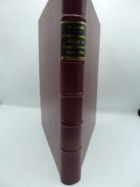
l'Union Indochinoise ou Indochine Orientale - Régions Naturelles et Géographie Economique
Hanoï, Imprimerie d'Extrême-Orient, 1935. 1 volume in-4, 370 pp., reliure moderne plein cuir. Richement illustré de XIV cartes en couleurs hors texte, de 48 cartes, plans et figures in texte et de 30 planches hors texte représentant plusieurs centaines de clichés photographiques. Avec un bel envoi de l'auteur à Monsieur Charton, Inspecteur Conseil de l'Instruction Publique, Lycée Albert Sarraut, Hanoi, 12 novembre 1938.
Bookseller reference : 7569
|
|
|
[INDOCHINE] [MISSION PAVIE] [ATLAS]
Mission Pavie - Indo-Chine - Atlas - Notices et Cartes
Paris, Augustin Challamel, Editeur, 1903. 1 volume in-4, 54 pp., reliure ancienne demi-basane, plats cartonnés, enrichi de 9 planches de cartes en couleurs, très bon état.
Bookseller reference : 12299
|
|
|
[Indien, Ostindien]
?Ostindien [...] von C. Glaser?. Grenzkolor. lithogr. Karte. (Aus: Glaser, C. Vollständiger Atlas).
(Mainz, um 1840). 39,5 x 48 cm. Mittig gefaltet (wie erschienen).
Bookseller reference : 40828

|
|
|
[Indien, Ostindien]
?Ostindische Inseln [...] von C. Glaser?. Grenzkolor. lithogr. Karte. (Aus: Glaser, C. Vollständiger Atlas).
(Mainz, um 1840). 39,5 x 48 cm. Mittig gefaltet (wie erschienen).
Bookseller reference : 40827

|
|
|
[ISÈRE - CRÉMIEUX] - CHASTILLON (Claude).
Crémieulx petite ville en Lionnois. Estampe originale
[Paris, Boisseau, vers 1640], 11,5 X 17,5 cm. sur une feuille de 14 x 20 cm., monté dans un passe-partout. Vue de la ville de Crémieux tirée de Topographie françoise parue chez Boisseau.
Bookseller reference : 46405253

|
|
|
[ISMAIL CEMAL KAMBAY [GALATALI], (Cartographer and Colonel), (1886-1950?)].
[MAP of EAST ANATOLIA] Malatya - Divrigi, Mancinik, Adiyaman, Harput.
Very Good Turkish, Ottoman (1500-1928) Original color map. Folded. Oblong atlas folio. (50 x 60 cm). In Ottoman script. [MAP of EAST ANATOLIA] Malatya - Divrigi, Mancinik, Adiyaman, Harput. Shows Malatya, Adiyaman and Kharpout region; Firat River (Euphrates), Yazi Düzü, Erguvan etc. Scale: 1/200.000. This is one the serie of the Bonn projection maps which are the first map series in modern techniques in Turkey and the Ottoman Empire. In order to produce these maps covering Turkish territory, Reconnaissance Branch was incorporated into The Mapping Commission. The maps were produced in the datum based on the latitude and longitude of Ayasofya Mosque in equal area Bonn Projection. The field works for the 123 sheets covering the country were conducted by 76 staff. The production was completed in 18 years starting from east west. Field works continued without stopping except in years 1914 and 1920. This map series called also reconnaissance maps contributed a lot to producing 1:25.000 scale maps. Hegira: 1332 = Gregorian: 1916. Not description on map-maker. According to Türkezer & Çobanoglu: History of Mapping in Turkey-1:200.000 Scale Maps, cartographer of this map is Kambay, Cemal.
|
|
|
[Italien, Süditalien, Rom, Sardinien]
?Südliches Italien nebst der Umgebung von Rom [...] von C. Glaser?. Grenzkolor. lithogr. Karte. (Aus: Glaser, C. Vollständiger Atlas).
(Mainz, um 1840). 39,5 x 48 cm. Mittig gefaltet (wie erschienen).
Bookseller reference : 40833

|
|
|
[Italien]
?Generalkarte von Italien [...] von C. Glaser?. Grenzkolor. lithogr. Karte. (Aus: Glaser, C. Vollständiger Atlas).
(Mainz, um 1840). 39,5 x 48 cm. Mittig gefaltet (wie erschienen).
Bookseller reference : 40836

|
|
|
[JANSSON, Johann]:
Österreich-Ungarn und Böhmen auf alten Landkarten aus dem Novus Atlas Absolutissimus. 15 farbige, faksimilierte Karten, davon 1 (Donau) gefaltet (48,8 x 106 cm), sonst 48,8 x 60 cm.
Faksimilierte Auswahl aus dem 92 Karten umfassenden Deutschland-Band von Janssons monumentalem Atlas, dessen deutsche Ausgabe in 10 Bänden im Jahr 1658 in Amsterdam erschienen war. Beigelegt ist ein grossformatiges Textheft mit einer Einführung zum „historischen und kulturellen Hintergrund” von Traudl Seifert (damalige Leiterin der Kartensammlung der Bayr. Staatsbibliiothek, deren Exemplar als Vorlage für den Nachdruck verwendet wurde) und den faksimilierten Texten aus Janssons Atlas zu den entsprechenden Karten. - Klappen mit leichten Knickspuren, sonst sehr sauberes, dekoratives Exemplar.
|
|
|
[JAPAN -- REAL ESTATE ATLAS].
In Japanese. Maps of Yamada Village in Keta District Tajima Province present day northern Hyogo Prefecture.
Yamada Village Japan: n.p. ca. 1890. 4to. 7.5 x 11 in. 354 pp index maps & sections separately paginated. entirely in original manuscript with over 250 plat and section maps many double-page some folding many w/ additions tipped-in or laid-in as supplemental overlays and many w/ additional manuscript annotations most hand-coloured throughout. Original beige limp boards punch-sewn at gutter margin title in manuscript on front cover some scuffing wear occasional internal worming mildly affecting some maps still a VG- exemplar. An extraordinary Meiji-era manuscript real estate plat map atlas for the Yamada Village and environs of the Keta District in present-day northern Hyogo Prefecture. Traditionally ruled over by descendants of the Miwabe-no-Atai clan this real estate atlas volume encompasses hundreds of plat maps tied to outline maps with the plats all numbered and many colour-coded with colour coding to the opening index. The creator of this map atlas appears to have been commissioned by local land agents following the economic expansion after the opening of the Hyogo Harbor in 1867 for foreign trade while quickly became one of the largest trading ports in Japan. The Tajima province is perhaps best known as the birthplace of Kobe Beef or Tajima Wagyu traditionally compact working cattle with a calm nature but which quickly came into high demand as Kobe Beef in the late 1880s as the large foreign trading and tourist community desired beef and the Tajima cattle were especially desired. This also contributed to a rising demand for land in which to raise the Tajima Wagyu cattle and land prices. At the same time the nearby coast also began slowly developing a small tourist trade and coastal resorts. The map sections include No. 5 -- Kitakami no machi; No. 11 -- Sampo no matsu; No. 12 - Shita takimiya; No. 13 - Okawahara; No. 14 - Takimiya; No. 30 - Kita shitaya as well as No. 36 - Kawahara. In April 1896 the Keta District was dissolved and merged into the Kinosaki District along with the Mikumi District and became the Hyogo Prefecture anchored by the city of Kobe. The additional supplemental pieces tipped-in others laid-in and the many add-ons to the folding map with many bearing annotations indicate that this was a meticulously maintained working document for Meiji land agents. We have been unable to locate any similar manuscript or printed real estate atlases for this era and geographical location. See: Mochizuki Kotaro Japan To-Day: A Souvenir of the Anglo-Japanese Exhibition Held in London 1910 Special Number of the “Japan Financial and Economic Monthly;†Mike Buchanan Hyogo Prefecture Tajima Wagyu History Australian Wagyu Forum 2018; Masanobu Suzuki Development and Dispersal Process of Ancient Japanese Clans 2003. [n.p.], hardcover
Bookseller reference : 56329

|
|
|
[JAPANESE ATLAS] Ichikawa To^kei
KOKUGUN ZENZU 2 volumes
1837. JAPANESE ATLAS Ichikawa Tokei. KOKUGUN ZENZU 2 volumes. Nagoya Edo Osaka Kyoto. Eirakuya Toshiro et al. Preface dated 1837. String-bound Japanese-style fukuro-toji printed paper title labels. Original yellow covers. Covers are a bit soiled with ownership labels. Internal occasional marginal worming. Printed in color woodblock throughout an interesting atlas of the traditional governing divisions of Edo-era Japan. unknown
Bookseller reference : 89193

|
|
|
[KAISERLICH UND KÖNIGLISCHES MILITAR-GEOGRAPHISCHES INSTITUT].
[GERMAN MAP OF ROMANIA] N.9. Hermannstadt (Sibiu).
Very Good German Original color map on cloth. A little foxing on cloth. Very good. Folded. Oblong folio. (45 x 51 cm). In German. Shows N. Enyed, Zalathna, Mediasch, Hermannstadt, Hatszeg, Petroseni, Ôzt River, etc. Scale: 1/300,000. Sibiu (Sibiiu - Hermannstadt - Nagyszeben) is a city in Romanian Transylvania. The city straddles the Cibin River, a tributary of the river Olt. The first official record referring to the Sibiu area comes from 1191 when Pope Celestine III confirmed the existence of the free prepositure of the German settlers in Transylvania, the prepositure having its headquarters in Sibiu, named Cibinium at that time. In the 14th century, it was already an important trade center. As of the year 1376, the craftsmen were divided into 19 guilds. Sibiu became the most important ethnic German city among the seven cities that gave Transylvania its German name Siebenbürgen (literally "Seven Citadels"). It was home to the Universitas Saxorum (Community of the Saxons), a network of pedagogues, ministers, intellectuals, city officials, and councilmen of the German community forging an ordered legal corpus and political system in Transylvania since the 1400s. During the 18th and 19th centuries, the city became the second -and then the first most important center of Transylvanian Romanian ethnics. The first Romanian-owned bank had its headquarters here (The Albina Bank), as did the ASTRA (Transylvanian Association for Romanian Literature and Romanian's People Culture). After the Romanian Orthodox Church was granted status in the Habsburg Empire from the 1860s onwards, Sibiu became the Metropolitan seat, and the city is still regarded as the third-most important center of the Romanian Orthodox Church. Between the Hungarian Revolution of 1848 and 1867 (the year of the Ausgleich), Sibiu was the meeting-place of the Transylvanian Diet, which had taken its most representative form after the Empire agreed to extend voting rights in the region (Source: Wikipedia). A sheet of the collection of 'The general map of Central Europe'. appeared in the years between 1873-1876 with the work of Joseph Ritter von Scheda, (1815-1888) who was a general, geographer, and cartographer.
|
|
|
[KANSAS -- ATLAS]. CRAM, George F[ranklin].
Cram’s superior reference atlas of Kansas and the World. . . .
Chicago & New York: George F. Cram 55-61 Market Street 1907. Folio. 12.25 x 15 in. 160 pp. Illustrated title in blue. Over 100 photo illustrations maps colour maps many double-page with Cram’s Kansas 51.5 x 31.5 inch map in full colour laid-in minor soiling faint markings from glue offsetting where previously attached to rear pastedown. Dark forest-green coloured publisher’s cloth silver lettering & decoration embossed on front cover minor soiling minor wear to corners slight bumping head & foot of spine light restoration back cover still a VG- copy. First edition of this rare Cram’s reference atlas replete with colour World maps and maps of the individual states and many different local cities including Omaha Minneapolis St. Paul St. Louis Chicago and others. The section on Kansas includes two colour maps depicting manufacturing and mechanical industries by counties as well as statistical map showing live stock and dairy products. The photos depict the Kansas oil fields brick yards in Pittsburg KS; oil tank farms in Neodesha Strawboard Factory in Coffeyville streets in Atchison and other areas across the state. The atlas is also unusually complete with the very scarce giant oversize colour Kansas map typically missing from these Cram’s local history reference atlases. George F. Cram, 55-61 Market Street, hardcover
Bookseller reference : 63122
|
|
|

 Receive by email
 Download as PDF document
 RSS feed
 Permanent link


