|
Euro Atlas
France Euro-Atlas
American Map. Used - Good. Shows some signs of wear and may have some markings on the inside. American Map unknown
Ссылка продавца : GRP66506846 ISBN : 0841606056 9780841606050
|
|
|
EWAG: Essex Writers' & Artists' Guild Kelly Gunter Atlas Editor
NOBODY: an anthology of Dark Fiction
DarkHart Press 2006-12-05. Paperback. Used:Good. DarkHart Press paperback
Ссылка продавца : DADAX0978731824 ISBN : 0978731824 9780978731823

|
|
|
EWAG: Essex Writers' & Artists' Guild; Editor Kelly Gunter Atlas
NOBODY: an anthology of Dark Fiction
DarkHart Press 2006-12-05. Paperback. Good. DarkHart Press paperback
Ссылка продавца : SONG0978731824 ISBN : 0978731824 9780978731823
|
|
|
Ewart WD. Editor of Sea and Shipping HFullard Editor of World Atlas W. D. H. Fu
WORLD ATLAS OF SHIPPING
St. Martins Press 1973. Very Good/Very Good. Hardcover: Front board bumped along top edge. Rust cloth binding with title in white on frontboard and on spine. Colored endpapers are spotless. Title and text pages printed on coated stock. This is an excellent atlas and authoritative guide to shipping. The Atlas section of the book has 128 pages of full-colored maps and is integrated with almost 150 illustrations and diagrams and is an invaluable reference guide. Nice tight binding. Jacket: Slightly oxidized front and back. Very attractive copy in protective mylar . St. Martins Press hardcover
Ссылка продавца : INVENT021643I
|
|
|
EXPANDET
Europa Touring Atlas. .
HALLWAG, Bern. Non daté. In-8. Broché. Bon état, Couv. convenable, Dos satisfaisant, Intérieur frais. Environ 125 pages. Nombreuses cartes en couleurs, hors-texte. Texte en anglais, français et allemand.. . . . Classification Dewey : 912-Atlas, cartes et plans
Ссылка продавца : RO80022771
|
|
|
EYSSERIC J.
NOUVELLE GEOGRAPHIE GENERALE.
Paris, Ch. Delagrave, 1901. In-8, cartonnage toilée, 82 cartes, 130 figures et 12 plans.
Ссылка продавца : 5427
|
|
|
F. MIOTTO, M.-S. PUTFIN et R. BELZACQ
ATLAS GISSEROT de FRANCE
Une plaquette de 32 pages, format 190 x 260 mm, illustrée, brochée couverture couleurs, publiée en 2011, Editions J.-P. Gisserot, bon état
Ссылка продавца : LFA-126713823
|
|
|
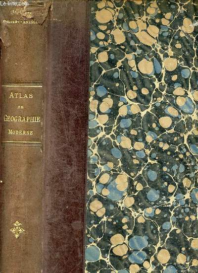
F. SCHRADER, F. PRUDENT, E. ANTHOINE
ATLAS DE GEOGRAPHIE MODERNE
HACHETTE. 1891. In-Folio. Cartonnage d'éditeurs. Etat d'usage, Couv. défraîchie, Dos abîmé, Intérieur acceptable. Coins et dos de cuir marron, papier roge sur les plats. 64 cartes en couleurs sur doubles pages, 2 pages de texte illustré en noir et blanc pour chaque carte. Lexique de 35 pages (pages abîmées en bordures avec quelques manques). Manque sur le revêtement des plats frottés et manques au dos. Ouvrage déboîté. Double page détachée.. . . . Classification Dewey : 912-Atlas, cartes et plans
Ссылка продавца : R240027869
|
|
|
F. T. P.
ATLAS-GEOGRAHIE OU NOUVEAU MANUEL DE GEOGRAPHIE GENERALE / COURS MOYEN / ENSEIGNEMENT PRIMAIRE ET SECONDAIRE
EMMANUEL VITTE. 1898. In-8. Cartonné. Etat d'usage, Couv. défraîchie, Dos abîmé, Intérieur frais. 64 pages - nombreuses gravures et cartes en noir et blanc et en couleurs dans et hors texte.. . . . Classification Dewey : 912-Atlas, cartes et plans
Ссылка продавца : RO20161760
|
|
|
F. T. D.
ATLAS-GEOGRAPHIE COMPRENANT 30 CARTES POLYCHROMES, 64 PAGES DE TEXTE, 50 GRAVURES OU CARTONS ET DE NOMBREUX DE VOIRS / ENSEIGNEMENT PRIMAIRE ET MODERNE - COURS MOYENS CONFORME AUX DIVERS PROGRAMMES DE L'ENSEIGNEMENT ET REDIGE D'APRES LES DOCUMENTS...
EMMANUEL VITTE. 1894. In-4. Cartonné. Etat d'usage, Coins frottés, Dos abîmé, Intérieur acceptable. 64 pages. Nombreuses illustrations en couleurs et en noir et blanc dans et hors texte. Texte sur 3 colonnes. Quelques pages désolidarisées.. . . . Classification Dewey : 912-Atlas, cartes et plans
Ссылка продавца : ROD0112866
|
|
|
F. SCHRADER, F. PRUDENT et E. ANTHOINE
ATLAS de GEOGRAPHIE MODERNE
Un fort ouvrage non paginé, format 240 x 380 mm, illustré de 600 cartes de détail, figures, diagrammes, relié cartonnage dos cuir, publié en 1892, Librairie Hachette et Cie (les 64 cartes en couleurs sont absentes de l'ouvrage)
Ссылка продавца : LFA-126738677
|
|
|
F. De La Brugere
Dictionnaire général en une seule série alphabétique des communes de France et des colonies, comprenant la nomenclature complète des communes, donnant en plus les principaux villages, bourgs, hameaux, châteaux, écarts, lieux-dits, etc. + 1 volume de 95 cartes.
Avec : Le chiffre de la Population d'après le dernier recensement / Pour chaque commune, l'indication du département et du canton dont elle fait partie / Pour les principaux village, hameaux, lieux dits, etc., le nom de la commune, du département et du canton auxquels ils appartiennent / Tous les bureaux de poste et de télégraphie électrique / Pour les communes, la distance kilométrique au chef-lieu d'arrondissement et au chef-lieu du département / pour les chefs lieux d'arrondissement et de département, la distance de Paris / Les foires et marchés / Toutes les stations des chemins de fer / Les opérations commerciales, les richesses minéralogiques, les productions du sol, les manufactures / les curiosités naturelles ou artistiques. Contenant en plus 95 cartes géographiques ou plans des principales villes de France.
Ссылка продавца : GEO030M
|
|
|
F. A-M
Exercices cartographiques, cahier N°2.
Mame et fils, Librairie générale, De Gigord. début 20è. In-4. Broché. Bon état, Couv. convenable, Dos satisfaisant, Intérieur frais. 27 pages de cartes géographiques avec exercices.. . . . Classification Dewey : 912-Atlas, cartes et plans
Ссылка продавца : ROD0049737
|
|
|
F. F.
GEOGRAPHIE-ATLAS DU COURS SUPERIEUR, TEXTE ET CARTES
Alfred Mame & Fils - Ch. Poussièlgue. 1901. In-4. Relié. Etat passable, Plats abîmés, Dos abîmé, Intérieur bon état. 160 pages. Illustré de nombreuses cartes en couleur et gravures en noir et blanc dans le texte. Moitié du dos manquante. Petit manque en surface du 2e plat. Plats tachés et annotés. Couverture détachée.. . . . Classification Dewey : 912-Atlas, cartes et plans
Ссылка продавца : RO40103589

|
|
|
F. T. D.
GEOGRAPHIE-ATLAS COMPRENANT LA DESCRIPTION PHYSIQUE, ETNOGRAPHIQUE, POLITIQUE ET ECONOMIQUE DES CINQ PARTIES DU MONDE - ENSEIGNEMENT CONFORME AUX PROGRAMMES OFFICIELS / COURS SUPERIEUR CONTENANT 70 CARTES OU CARTONS POLYCHROMES, 62 CARTES OU CARTONS EN...
EMMANUEL VITTE. 1891. In-4. Cartonné. Etat d'usage, Tâchée, Dos abîmé, Intérieur acceptable. 191 pages. Nombreuses illustrations en couleurs et en noir et blanc dans et hors texte. Texte sur 3 colonnes. Plats désolidarisés. Coins abimés.. . . . Classification Dewey : 912-Atlas, cartes et plans
Ссылка продавца : ROD0112867
|
|
|
F. SCHRADER
L'ANNEE CARTOGRAPHIQUE, SUPPLEMENT ANNUEL A TOUTES LES PUBLICATIONS DE GEOGRAPHIE ET DE CARTOGRAPHIE. PREMIER SUPPLEMENT. OCTOBRE 1891. ASIE 1890/ AFRIQUE 1890. AMERIQUE 1890.
HACHETTE. 1891. In-Folio. En feuillets. Etat d'usage, Couv. partiel. décollorée, Dos satisfaisant, Intérieur frais. 3 doubles pages, texte à l'extérieur, cartes en couleurs au centre, contenus dans une chemise.. . . . Classification Dewey : 912-Atlas, cartes et plans
Ссылка продавца : R260129792
|
|
|
F. MANE et G. LEMOINE
La FRANCE et ses COLONIES
Un ouvrage de 94 pages, format 215 x 260 mm, illustré, relié cartonnage, publié en 1932, Librairie Ferran & Cie, bon état, peu courant
Ссылка продавца : LFA-126716733
|
|
|
F. PINARDEL
LE MONE, MOINS LE MONDE ET L'ASIE RUSSE.
LES EDITIONS DE L'ECOLE. NON DATE. In-4. Broché. Etat d'usage, Couv. légèrement passée, Dos satisfaisant, Intérieur frais. 32 pages de cartes en couleurs. Premier plat illustré en couleurs.. . . A l'italienne. Classification Dewey : 912-Atlas, cartes et plans
Ссылка продавца : R260115669

|
|
|
F. LECOY - Géographe
Méthode simple et facile pour lever les Plans, suivie d'un Traité du Nivellement et d'un abrégé des Régles du Lavis - Avec douze planches dont neuf enluminées -
Paris - Duponcet - 1805 - 1 volume in12 de XXXII - 119 + 12 pages - Reliure pleine basane d'époque - triples filets dorés sur les plats - dos plat orné de fleurons et de filets - mors frottés - coins émoussés -
Ссылка продавца : 35565
|
|
|
F. F.
GEOGRAPHIE-ATLAS DU COURS SUPERIEUR, TEXTE ET CARTES
Alfred Mame & Fils - Ch. Poussièlgue. 1901. In-4 Carré. Relié. Etat passable. Plats abîmés. Dos abîmé. Intérieur bon état. 160 pages. Illustré de nombreuses cartes en couleur et gravures en noir et blanc dans le texte. Moitié du dos manquante. Petit manque en surface du 2e plat. Plats tachés et annotés. Couverture détachée. N° 133. Série de Géographies-Atlas (Texte et cartes). La Terre. La France.

|
|
|
F. I. C.
La Terre illustrée.
français In-12 de XVI-656 pp.; cartonnage de percaline rouge décoré de l'éditeur, tranches dorées. Cours spécial de Géographie universelle pour l'enseignement primaire supérieur à l'usage des écoles chrétiennes. Illustré de cartes et gravures.
|
|
|
F. MUHTAR KATIRCIOGLU COLLECTION.
Images of the earth. F. Muhtar Katircioglu Map Collection.= Yeryüzü suretleri. F. Muhtar Katircioglu Harita Koleksiyonu. [Exhibition catalogue]. Edited by Selahattin Özpalabiyiklar.
New English Paperback. 4to. (29 x 21 cm). In English and Turkish. 227 p., color ills. Images of the earth. F. Muhtar Katircioglu Map Collection.= Yeryüzü suretleri. F. Muhtar Katircioglu Harita Koleksiyonu. [Exhibition catalogue]. Edited by Selahattin Özpalabiyiklar. Colour reproductions of collected maps with explanations, 34 pgs. of introductory texts with colour photos and drawings. Catalogue: Ptolemaic Maps, Maps of Istanbul, Maps of Anatolia, Maps of Canakkale (Hellespont), Maps of Ottoman Empire, Nautical Charts. Includes a special section dedicated to the instruments for cartography and navigation from the collection of the Naval Museum. ISBN: 9789750802072. MAP Atlas Geography Asia Minor Archeology Ottomania Collection The Hellespont The Bosphorus Ottoman Empire.
|
|
|
F.I.C.
Atlas de Géographie à l'usage des Ecoles Chrétiennes.
IMP. HERMET. Non daté. In-4. Broché. Bon état, Couv. légèrement passée, Dos satisfaisant, Intérieur frais. Environ 40 planches ou doubles-planches de cartes en couleurs et en noir et blanc et de quelques illustrations en noir et blanc, hors-texte. Dos toilé vert. . . . Classification Dewey : 912-Atlas, cartes et plans
Ссылка продавца : RO80031066
|
|
|
F.I.C.
Atlas de géographie physique politique & historique atlas E de 50 (60) cartes à l'usage de l'enseignement secondaire
Procure générale, Poussielgue frères et Alfred Mame et Fils. 1885. In-4. Relié. Bon état, Couv. convenable, Dos satisfaisant, Intérieur frais. 50 cartes géographiques en noir et blanc et en couleurs hors texte.. . . . Classification Dewey : 912-Atlas, cartes et plans
Ссылка продавца : RO30351819

|
|
|
F.I.C (Frères des écoles chrétiennes)
Atlas de géographie physique et politique. Atlas C de 14 cartes. A l'usage des écoles chrétiennes des frères.
Couverture rigide. Cartonnage de l'éditeur. 28 pages imprimées recto seul.
Ссылка продавца : 103394

|
|
|
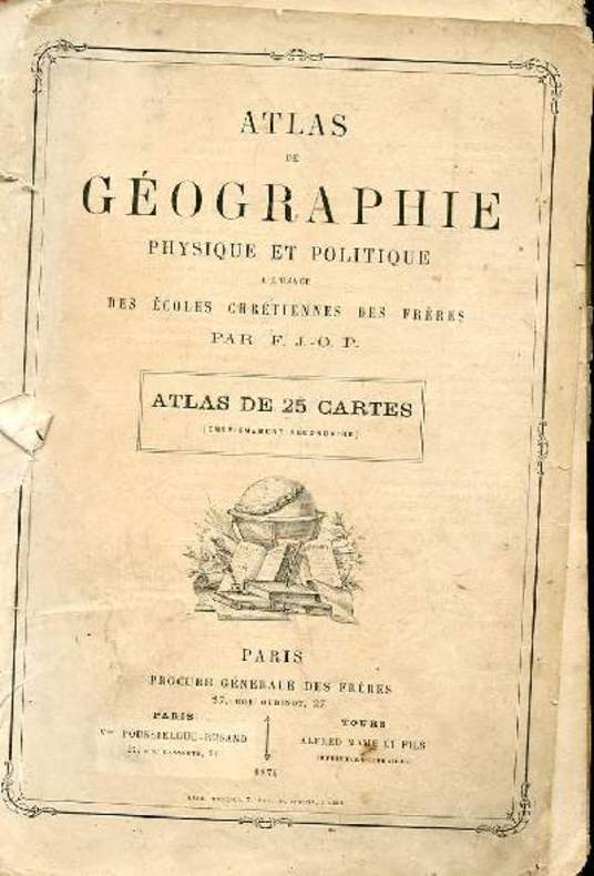
F.J.-O.P.
ATLAS DE GEOGRAPHIE. PHYSIQUE ET POLITIQUE A L'USAGE DES ECOLES CHRETIENNES DES FRERES. 20 CARTES SUR 25
PROCURE GENERALE DES FRERES. 1874. In-4. Broché. A relier, Couv. défraîchie, Dos abîmé, Intérieur acceptable. Atlas incomplet de 20 cartes sur 25. 20 doubles planches de cartes en couleur. Ouvrage débroché. Quelques déchirures et manques sur les plats de couverture. Quelques traces de crayons de couleur en marge. . . . Classification Dewey : 912-Atlas, cartes et plans
Ссылка продавца : R160112425
|
|
|
F.Maurette
Petit atlas de la guerre et de la paix - Les Pays où nous nous battons et pour lesquels nous nous battons.
Hachette et cie. 1918. In-8. Broché. Etat d'usage, Couv. convenable, Agraffes rouillées, Papier jauni. 20 pages agrafées - quelques cartes en couleurs dans et hors texte.. . . . Classification Dewey : 912-Atlas, cartes et plans
Ссылка продавца : R320136754

|
|
|
F.P.B.
ATLAS DE GEOGRAPHIE ELEMENTAIRE A L'USAGE DES ECOLES CHRETIENNES DES FRERES - ATLAS B - 14 CARTES.
POUSSIELGUE ROUSANT - ALFRED MAME ET CIE. NON DATE. In-4. Cartonné. Etat d'usage, Tâchée, Dos satisfaisant, Intérieur acceptable. 14 cartes en couleurs hors texte - coins et tranches frottés - manque déchirure sur la page de titre - manque sur la page d'introduction ayant des conséquences sur la lecture - annotations sur le 1er contre plat - 2 photos disponibles.. . . . Classification Dewey : 912-Atlas, cartes et plans
Ссылка продавца : R240092751
|
|
|
F.Pinardel
Le Monde moins l'Europe et l'Asie Russe.
Les éditions de l'école. 1957. In-4. Broché. Etat d'usage, Couv. légèrement passée, Agraffes rouillées, Intérieur acceptable. 32 pages de cartes en couleurs - tampon sur le 1er plat.. . . A l'italienne. Classification Dewey : 912-Atlas, cartes et plans
Ссылка продавца : R320125899

|
|
|
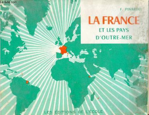
F.Pinardel
Petit atlas de la France et des pays d'Outre-Mer - 9e édition.
Les éditions de l'école. non daté. In-4. Broché. Etat d'usage, Couv. légèrement passée, Dos satisfaisant, Intérieur acceptable. 32 pages de cartes en couleurs.. . . A l'italienne. Classification Dewey : 912-Atlas, cartes et plans
Ссылка продавца : R320123801
|
|
|
F.Pinardel
Petit atlas de la France et l'Union française.
Les éditions de l'école. non daté. In-4. Broché. Etat d'usage, Tâchée, Agrafes rouillées, Quelques rousseurs. 32 pages agrafées de cartes en couleurs - tâches d'encre bleu sur les pages 3-4-5-6 - papier jauni.. . . A l'italienne. Classification Dewey : 912-Atlas, cartes et plans
Ссылка продавца : R160226425

|
|
|
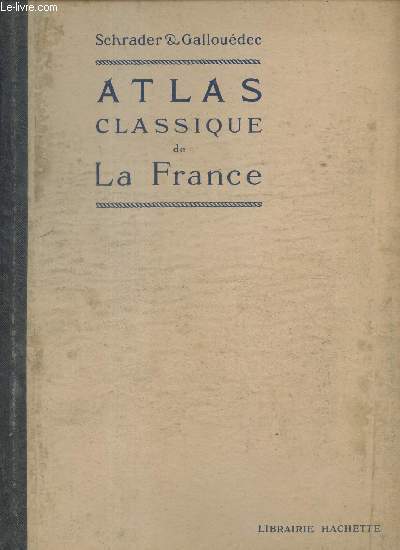
F.Schrader & L.Gallouedec
Atlas classique de la France.
Hachette. non daté. In-4. Cartonné. Etat d'usage, Couv. légèrement passée, Dos satisfaisant, Intérieur frais. 24 pages de cartes en couleurs - 2 photos disponibles.. . . . Classification Dewey : 912-Atlas, cartes et plans
Ссылка продавца : R320116941
|
|
|
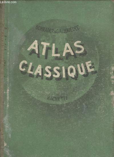
F.Schrader & L.Gallouedec
Atlas classique de Géographien ancienne et moderne - Conforme aux programmes officiels de l'enseignement du second degré.
Hachette. 1956. In-4. Cartonné. Etat d'usage, Plats abîmés, Dos satisfaisant, Intérieur acceptable. 96 pages cartes en couleurs + 18 pages (index alphabétique) - coins, tranches et plats frottés.. . . . Classification Dewey : 912-Atlas, cartes et plans
Ссылка продавца : R320123813
|
|
|
F.Schrader & F.Prudent & E.Anthoine
Atlas de géographie moderne - Nouvelle édition corrigée et mise à jour.
Hachette et Cie. 1911. In-Folio. Relié cuir dos-coins. Etat d'usage, Coins frottés, Coiffe en tête abîmée, Intérieur acceptable. Contenant 64 cartes doubles imprimées en couleurs accompagnées au verso d'un texte géographique, statistique et ethnographique avec 600 cartes de détail et d'un index alphabétique d'environ 50000 noms + 42 pages - coins et tranches frottés - coiffes abîmées - auteur, titre, fleuron, éditeur et filets dorés sur le dos - déchirure sur le second plat.. . . . Classification Dewey : 912-Atlas, cartes et plans
Ссылка продавца : R320157949
|
|
|
F.SCHRADER
PETIT ATLAS DE LA GUERRE
HACHETTE ET CIE. NON DATE. In-12. Cartonné. Etat d'usage, Couv. légèrement passée, Dos satisfaisant, Intérieur acceptable. 56 pages - nombreuses cartes en 7 couleurs des divers fronts de france belgique allemagne russie balkans caucase arabie perse euphrate cameroun etc - coins frottés.. . . . Classification Dewey : 912-Atlas, cartes et plans
Ссылка продавца : R240067133
|
|
|
F.T.D.
Atlas-Géographie ou nouveau manuel de géographie générale. Cours spécial à l'usage des aspirants aux baccalauréats…
Couverture rigide. Cartonnage de l'éditeur. 205 pages. Légèrement défraîchi. La toile du dos manque.
Ссылка продавца : 103395

|
|
|
Fackel-Weltatlas
Taschenausgabe. Mit 35 Karten, vielen Statistiken und einem umfangreichen Namenregister für sämtliche Karten.
Olten/Stuttgart/Salzburg, Fackel, 1964. Kl.8°. 156 Seiten. Originalhalblederband mit goldgeprägter Deckelvignette und goldgeprägtem Rückentitel. - Wohlerhalten und frisch.
Ссылка продавца : 19980AB
|
|
|
Fahrrad Atlas
Die schönsten Radwanderungen in Deutschland. Touren - Technik - Fitness. Überaus reich illustriert mit Kartenausschnitten, Übersichtskarten, Photos und Zeichnungen.
Ostfildern, Mairs Geographischer Verlag, 1989-1991. 8°. 350 Seiten. Mit einem "Fahrrad-am-Bahnhof-Service". Farbig illustrierter Originalpappband mit 2 Lesebändchen. - Sehr gut erhaltenes, frisches Exemplar. = Offizieller Fahrrad Atlas Bund Deutscher Radfahrer e.V.
Ссылка продавца : 27716AB
|
|
|
FAIK SABRI [DURAN], (Turkish geographer, educator, cartographer, journey writer), (1882-1943).
[RARE TURKISH SCHOOL MAP OF AFRICA] Afrika: Müderris Fayik Sabri Beyin talebe haritalari. No: 3. 25 kurus. Kanaat Kütüphanesi. [i.e. Africa: From the corpus of schol maps by Mr. Faik Sabri].
Very Good Turkish, Ottoman (1500-1928) Original pictorial wrappers. Chromo-lithographed photo-montage collage cover with seven b/w photos of African buildings and natives, and a red map of Africa. Complete in wrappers and folded huge Africa map (size: 57 x 82 cm). Cover size: 28.5 x 20.5 cm. In Turkish. Scale: 1/20,000,000. A very rare chromo-lithographed Africa map, prepared for the geography lessons about foreign countries in Turkey in 1930. The map shows the territories of the African continent, which was still politically under European colonialism as of the 1930s. It includes Rio de Oro (Spanish territory), Fas [i.e. Morocco], Algeria, Sahara, Cameroon (French territories), Trabulus [i.e. Libya] as Italian territory; and Liberia, Egypt, East Sudan, Eritre [i.e. Eritrea], Habesistan [i.e. Ethiopia], Somali, Kenya, Belgian Kongo, Angola, Mozambique and South African land including Rhodesia (equivalent in the territory to modern Zimbabwe), Transvaal, The Orange Free State [Oranje-Vrystaat], Natal and Kap [Cape] with Madagascar. An extra panel for the same scale map showing the Suez Canal, Nile Delta, and North Egypt in the lower-left corner. Duran studied in Istanbul and Paris. He worked as a geography teacher in various high schools and afterward he undertook the positions of lecturer and administrator in Ankara Gazi Education Institute for a time. He was known for his writings on various topics and particularly for his works on geography. Born in the imperial period, Duran conducted the first cartographic studies of the Republic of Turkey after the transition to the Republican administration. Sealed. Slight foxing. Otherwise a fine copy. Not in OCLC.
|
|
|
FAIK SABRI [DURAN], (Turkish geographer, journey writer), (1882-1943).
[SCARCE TURKISH ATLAS PRINTED IN LONDON] Ilk atlas. Ilk mekteblere mahsus. [i.e. First atlas for the primary schools].
Very Good Turkish, Ottoman (1500-1928) Original bdg. Large roy. 8vo. (24 x 20 cm). In Ottoman script. (Old Turkish with Arabic letters). 16 p., 15 chromo-lithographed maps. Some markings on the two maps. Otherwise a very good copy. First edition of this scarce atlas for Turkish primary schools drawn and published by Turkish geographical educators and cartographers in the early Republican period of Turkey. This fine atlas was printed in London, in a period after the proclamation of the Republic, before the Letter Revolution in 1928. Duran studied in Istanbul and Paris. He worked as a geography teacher in various high schools then he became a lecturer and a manager at Ankara Gazi Education Institute for a while. He was known for his writings on various topics and especially for his works on geography. Born in the imperial period, Duran signed the first cartographic studies of the Republic of Turkey with the transition to the Republican administration. Özege 8764.
|
|
|
Faksimile.- Grosjean, Georges (Hrsg.):
Der Seeatlas des Vesconte Maggiolo vom Jahre 1512. Vesconte Maggiolo atlante nautico del 1512.
2 Bde. Dietikon-Zürich, Urs Graf Verlag, 1979. 4°. 80 S.; (1) S. Mit 4 doppelblattgr. faksimil. Karten auf dicker Pappe. Orig.-Lederbde. in Orig.-Pappschuber (fleckig, Schuber angestaubt).
Ссылка продавца : 2287DB

|
|
|
FALK André
DANEMARK.
reliure éditeur - 17,5x27 - 1912pp - 1966 - éditions RENCONTRE, Lausanne.Collection " ATLAS DES VOYAGES, RENCONTRE" dirigée par Charles-Henri FAVROD.Nombreuses illustrations dans et hors texte.
Ссылка продавца : 4975
|
|
|
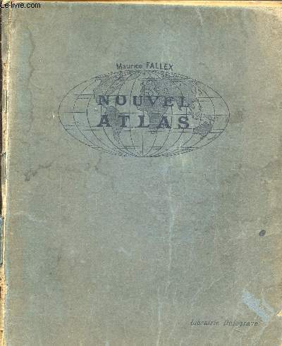
FALLEX MAURICE
NOUVEL ATLAS CLASSIQUE - 2ème EDITION MISE A JOUR.
DELAGRAVE. 1922. In-8. Relié. Bon état, Couv. convenable, Dos satisfaisant, Intérieur frais. 79 pages de cartes en couleurs - 1 carte en couleurs en frontispice.. . . . Classification Dewey : 912-Atlas, cartes et plans
Ссылка продавца : RO20182187
|
|
|
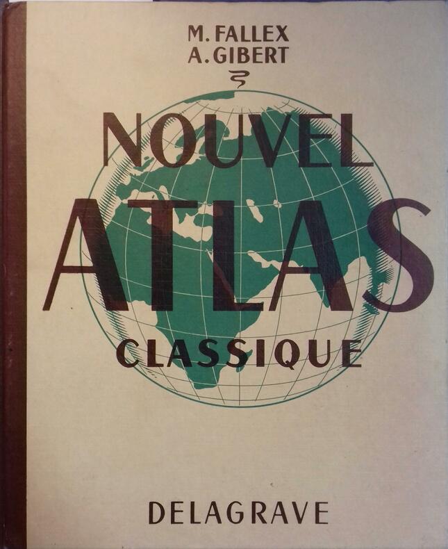
FALLEX M. / GIBERT A.
NOUVEL ATLAS CLASSIQUE / NOUVELLE EDITION
DELAGRAVE. 1949. In-12. Broché. Etat d'usage, Couv. convenable, Dos abîmé, Intérieur frais. 79 pages de cartes en couleurs -. . . . Classification Dewey : 912-Atlas, cartes et plans
Ссылка продавца : R320074694
|
|
|
FALLEX M. / GIBET A.
NOUVEAU ATLAS CLASSIQUE / NOUVELLE EDITION ENTIEREMENT REFONDUE.
DELAGRAVE. 1949. In-4. Relié. Etat d'usage, Coins frottés, Dos abîmé, Intérieur frais. 79 pages de cartes couleurs + 20 pages - Coins émoussés.. . . . Classification Dewey : 912-Atlas, cartes et plans
Ссылка продавца : R320085348
|
|
|
Fallex M.
Nouvel atlas classique
Librairie delagrave. Non daté. In-4. Cartonné. Etat d'usage, Tâchée, Dos abîmé, Papier jauni. Non paginé, environ 60 pages de cartes en couleurs et en noir et blanc . Annotations sur la page de faux-titre au craton à papier et ex-libris au crayon à papier en page de garde. Frontispice en couleurs.Dos manquant. Agraffes rouillées.Quelques rousseurs.. . . . Classification Dewey : 912-Atlas, cartes et plans
Ссылка продавца : RO80216597
|
|
|
FALLEX M. - GIBERT A.
Nouvel atlas classique.
Couverture rigide. Reliure de l'éditeur. 79 pages de cartes + 16 pages d'index. 22 x 27, 5 cm.
Ссылка продавца : 98651
|
|
|
FALLEX M.
NOUVEL ATLAS CLASSIQUE
Librairie Delagrave. 1922. In-4 Carré. Relié. Etat d'usage. Couv. légèrement pliée. Mors fendus. Intérieur acceptable. 79 pages. Cartes en couleur en frontispice. Illustré de nombreuses cartes en couleur et en noir et blanc, dans et hors texte. Dos muet. 1er plat légèrement taché. 1re page de garde pliée. 2e édition mise à jour.

|
|
|
FALLEX M. / GIBET A.
NOUVEAU ATLAS CLASSIQUE / NOUVELLE EDITION ENTIEREMENT REFONDUE.
DELAGRAVE. 1949. In-4 Carré. Relié. Etat d'usage. Coins frottés. Dos abîmé. Intérieur frais. 79 pages de cartes couleurs + 20 pages - Coins émoussés. 111 CARTES ET CARTONS.
|
|
|
FALLEX M. / GIBET A.
NOUVEL ATLAS CLASSIQUE
DELAGRAVE. 1955. In-4 Carré. Cartonné. Bon état. Couv. convenable. Dos frotté. Intérieur frais. 81 pages de cartes en couleur et noir et blanc horsd texte + 21 pages - 125 cartes et cartons.
|
|
 Получить результаты поиска по электронной почте
 Загрузить результаты в формате PDF
  RSS-канал


