|
FW. BEERS ATLAS OF MONMOUTH COUNTY F. W.
SPRING LAKE: REIDS VILLA PARK/ REV. WILLITS
1877. F.W. BEERS ATLAS OF MONMOUTH COUNTY. SPRING LAKE 1878: REIDS VILLA PARK. Upper picture frontal view of Reids Villa Park lower picture frontal view of the residence of Rev. A.A. Willits Spring Lake. $60.00. <br/><br/> unknown
书商的参考编号 : 26200

|
|
|
FW. BEERS ATLAS OF MONMOUTH COUNTY F. W.
EATONTOWN NEW JERSEY: 1873 MAP
1873. F.W. BEERS ATLAS OF MONMOUTH COUNTY. EATONTOWN MAP 1873. A 13-inch by 24-inch hand-colored map of Eatontown showing Shrewsbury and Ocean Township. $75.00. <br/><br/> unknown books
书商的参考编号 : 26083

|
|
|
FW. BEERS ATLAS OF MONMOUTH COUNTY F. W.
LONG BRANCH: 1873 MAP
1873. F.W. BEERS ATLAS OF MONMOUTH COUNTY. LONG BRANCH 1873 MAP. A 13-inch by 24-inch hand-colored map of a portion of Long Branch. $85.00. <br/><br/> unknown books
书商的参考编号 : 26084

|
|
|
FW. BEERS ATLAS OF MONMOUTH COUNTY F. W.
MILLSTONE TOWNSHIP MAP 1873
1873. F.W. BEERS ATLAS OF MONMOUTH COUNTY. MILLSTONE TOWNSHIP MAP 1873. A 16-inch by 13-inch hand-colored map of Millstone. $75.00. <br/><br/> unknown books
书商的参考编号 : 26040

|
|
|
FW. BEERS ATLAS OF MONMOUTH COUNTY F. W.
SPRING LAKE: REIDS VILLA PARK/ REV. WILLITS
1877. F.W. BEERS ATLAS OF MONMOUTH COUNTY. SPRING LAKE 1878: REIDS VILLA PARK. Upper picture frontal view of Reids Villa Park lower picture frontal view of the residence of Rev. A.A. Willits Spring Lake. $60.00. <br/><br/> unknown books
书商的参考编号 : 26200
|
|
|
FW. BEERS ATLAS OF MONMOUTH COUNTY F. W.
SPRING LAKE: REIDS VILLA PARK/ REV. WILLITS
1877. F.W. BEERS ATLAS OF MONMOUTH COUNTY. SPRING LAKE 1877: REIDS VILLA PARK. Upper picture frontal view of Reids Villa Park lower picture frontal view of the residence of Rev. A.A. Willits Spring Lake. Hand-colored. $125.00. <br/><br/> unknown books
书商的参考编号 : 26075

|
|
|
Fénelon (Paul)
Les Pays de la Loire.
Paris Flammarion 1978 Atlas et géographie de la France moderne. Un volume in-4 relié plein simili brun de l'éditeur sous jaquette illustrée, 501 pages. Bel état.
书商的参考编号 : 1956
|
|
|
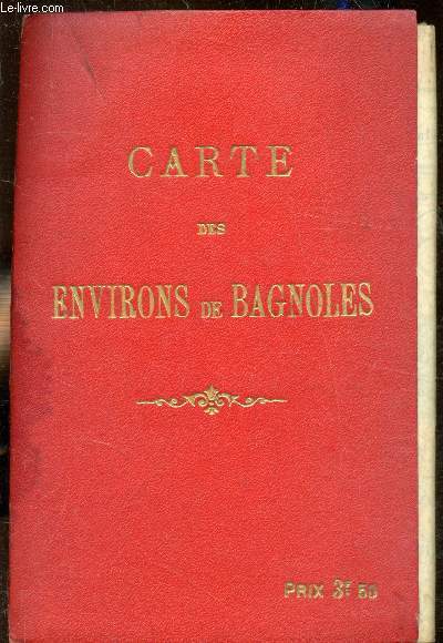
G. Devaux
Carte des environs de Bayonne - 1:50000 + 1 plan de bagnoles.
Devaux. Non daté. In-Plano. Broché. Etat d'usage, Couv. défraîchie, Dos frotté, Intérieur acceptable. Carte des environs de Bayonne - 1:50000 + 1 plan de Bayonne en couleurs. Légère tâche sur le 1er plat. Plan de Bayonne avec légères déchirures.. . . . Classification Dewey : 912-Atlas, cartes et plans
书商的参考编号 : RO80209343
|
|
|
G.PELTIER
CARTE DE L'YSERE à L'AISNE
. NON DATE. In-Folio. En feuillets. Etat d'usage, Couv. convenable, Dos satisfaisant, Intérieur frais. Carte en couleur, mesurant 40cmx59cm, à l'échelle 1:420 000 . Quelques déchirures (altérant un peu la lecture), carte consolidé avec du scotch sur le dos, rousseurs.. . . . Classification Dewey : 912-Atlas, cartes et plans
书商的参考编号 : R240004669
|
|
|
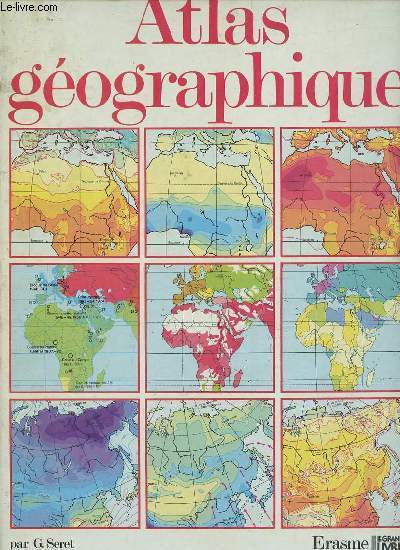
G.Seret & L.Swysen
Atlas géographique.
Erasme / le grand livre du mois. 1986. In-4. Relié. Etat d'usage, Tâchée, Dos satisfaisant, Intérieur frais. 120 pages - nombreuses cartes en couleurs hors texte.. . . . Classification Dewey : 912-Atlas, cartes et plans
书商的参考编号 : R320149429 ???????? : 287127049
|
|
|
Gabriel, Kathryn
Roads to center place. A cultural atlas of Chaco Canyon and the Anasazi. [By Kathryn Gabriel].
Boulder: Johnson Books 1991. 300 Seiten. Mit einigen Abbildungen im Text. Gr. 8° (22,5-25 cm). Orig.-Broschur. [Softcover / Paperback].
书商的参考编号 : 158746

|
|
|
Gaebler (Hrsg.), Eduard
Gaeblers kleiner Hand-Atlas über alle Teile der Erde.
Leipzig, Georg Dollheimer Verlag, 1933. 287 S. + 80 Tafn. + LXXXIV S. Gr.-8° Groß-Oktav, Leinen
书商的参考编号 : 101833

|
|
|
Gaebler Eudard
Neuester Hand-Atlas über alle Teile der Erde mit besonderer Berücksichtigung des gesamten Weltverkehrs
Leipzig (F.A.Berger) 1901 (= 4.Auflage). 4°, illustriertes Originalleinen (Hardcover), 40 S., farbige Karten 4
书商的参考编号 : Khe01233
|
|
|
Gaebler, Eduard
Gaeblers kleiner Hand-Atlas über alle Teile der Erde.
Leipzig, Ed. Gaebler Geographisches Institut, 1935. 304 S. + 88 Tafn. LXXXIV S. Gr.-8° Groß-Oktav, Halbleder
书商的参考编号 : 81977

|
|
|
Gail Atlas
Expecting Jesus : A Book of Daily Readings for the Advent Season
CreateSpace Independent Publishing Platform 2013. Paperback. Good. Disclaimer:A copy that has been read but remains in clean condition. All pages are intact and the cover is intact. The spine may show signs of wear. Pages can include limited notes and highlighting and the copy can include previous owner inscriptions. At ThriftBooks our motto is: Read More Spend Less.Dust jacket quality is not guaranteed. CreateSpace Independent Publishing Platform paperback
书商的参考编号 : G1493553755I3N00 ???????? : 1493553755 9781493553754

|
|
|
Gail Atlas
Harvest of the Holy One
CreateSpace Independent Publishing Platform 2016. Paperback. As New. Disclaimer:An apparently unread copy in perfect condition. Dust cover is intact; pages are clean and are not marred by notes or folds of any kind. At ThriftBooks our motto is: Read More Spend Less.Dust jacket quality is not guaranteed. CreateSpace Independent Publishing Platform paperback
书商的参考编号 : G1537536001I2N00 ???????? : 1537536001 9781537536002

|
|
|
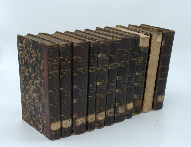
GAIMARD (Paul) ,LOTTIN (V.),MARMIER (X.) ,BRAVAIS (A.),ROBERT (E.), ANGLÉS (R.) , MARTINS (Ch.) , BIARD (Fr.) ,VAHL (J) , LAESTADIUS (L.L.) ,DUROCHER (J.) ,SILJERSTRÖM (P.)(sv) , BOECK (Chr.) ,etc ...
Voyages en Scandinavie, en Laponie, au Spitzberg, et aux Iles Féroé pendant les années 1838-1840 sur la Corvette La Recherche.
Paris, Arthus Bertrand, s.d. (1842-1845). 11 volumes grand in-8 (18, 13 volumes de texte et 5 atlas), relié demi veau aubergine, dos lisse avec titre et tomaison, étiquette au dos, supra libri effacés aux plats, coins usés, dos avec manque (géologie, minéralogie), dos manquant (histoire de la Scandinavie), - Relation du voyage par X. Marmier, 2 vol. (374 pp., 1 pl. ; 458 pp.) - Magnétisme terrestre par V. Lottin, A. Bravais : 3 vol. (563 pp. plus errata ; 448 pp. ; 297 pp. plus table générale détaillée des planches.) - Aurores boréales par V. Lottin, A. Bravais 1 vol. (566 pp., avec 42 figures in texte.) - Géologie, par E. Robert, 2 vol. en 1, (4), 210 pp. ; (4), 308 pp.) - Géologie, Minéralogie par J. Durocher, 1 vol. (482 pp.) - Astronomie et Hydrographie, par V. Lottin, A. Bravais… 1 vol. (531 pp.) - Littérature scandinave, par X. Marmier : 1 vol. (557 pp.) - Histoire de la Scandinavie, par X. Marmier, 1 volume (515 pp.)
书商的参考编号 : PHO-1524
|
|
|
Galit Atlas
Dramatic Dialogue: Contemporary Clinical Practice Relational Perspectives Book Series
2017-12-24. New. Ships with Tracking Number! INTERNATIONAL WORLDWIDE Shipping available. May be re-issue. Buy with confidence excellent customer service! unknown
书商的参考编号 : 1138555487n ???????? : 1138555487 9781138555488

|
|
|
Galit Atlas
Dramatic Dialogue: Contemporary Clinical Practice Relational Perspectives Book Series
2017-12-24. Good. Ships with Tracking Number! INTERNATIONAL WORLDWIDE Shipping available. May not contain Access Codes or Supplements. May be re-issue. May be ex-library. Shipping & Handling by region. Buy with confidence excellent customer service! unknown
书商的参考编号 : 1138555487 ???????? : 1138555487 9781138555488

|
|
|
Galit Atlas
The Enigma of Desire: Sex Longing and Belonging in Psychoanalysis Relational Perspectives Book Series
2015-08-09. Good. Ships with Tracking Number! INTERNATIONAL WORLDWIDE Shipping available. May not contain Access Codes or Supplements. May be re-issue. May be ex-library. Shipping & Handling by region. Buy with confidence excellent customer service! unknown
书商的参考编号 : 1138789607q ???????? : 1138789607 9781138789609

|
|
|
Galit Atlas
The Enigma of Desire: Sex Longing and Belonging in Psychoanalysis Relational Perspectives Book Series
2015-08-09. New. Ships with Tracking Number! INTERNATIONAL WORLDWIDE Shipping available. May be re-issue. Buy with confidence excellent customer service! unknown
书商的参考编号 : 1138789607n ???????? : 1138789607 9781138789609

|
|
|
GALLETTI, Johann Georg August
Allgemeine Weltkunde oder geographisch-statistisch-historische Übersicht aller Länder, in Rücksicht ihrer Lage, Grösse, Bevölkerung, Cultur, vorzüglichsten Städte, Verfassung und Nationalkraft... Fünfte Auflage, umgearb. u. vermehrt von C. Reichard.
Pesth und Wien, C. A. Hartleben 1822. 27 x 21 cm. 3 Bll., 339 S. Mit 25 (24 gefalt., 1 doppelblattgr.) grenzkol. Kupferkarten (Blattgr.: 26 x 34). Pappband d. Zt., bestoßen u. berieben, Deckelbezug mit kleinen Fehlstellen. Die altkolorierten Karten - großteils gest. von J. N. Champion - auf kräftigem Papier gedruckt ADB VIII, 333. Vgl. Engelmann 1, 47 (Erste Aufl.): "Vgl. Engelmann I,41. "Ein Hülfsmittel beim Studium der Tagsgeschichte für denkende und gebildete Leser"; Espenhorst PP 45.1.1.- Erstmalig 1807 erschienenes Werk des Gothaer Gymnasialprofessors Galletti (1750-1828). "Seine Schriften sind sehr zahlreich, seine Lehrbücher der Geschichte und Geographie die besten ihrer Zeit..." (ADB).
书商的参考编号 : KART0194
|
|
|
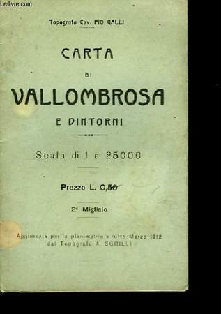
GALLI Pio
Carta di Vallombrosa e Dintorni
SGRILLI A.. 1912. In-12. Broché. Bon état, Couv. légèrement passée, Dos satisfaisant, Intérieur frais. Carte dépliante en couleurs, de 43/30 cm. Légendes en italien.. . . . Classification Dewey : 912-Atlas, cartes et plans
书商的参考编号 : RO80038153
|
|
|
Gambarelli, J.; G. Guerinel, L. Chevrot, M. Mattei, J.P. Jacomy (Illustrator), D. Amy (Photographer), M. Soler (Photographer), R. Galliano (Assistant), S. Nazarian (Assistant)
Computerized Axial Tomography: An Anatomic Atlas of Serial Sections of the Human Body. Anatomy, Radiology, Scanner
A clean, unmarked book with a tight binding. 286 pages. Full black cloth boards: 9 5/8"w x 12 1/2"h.

|
|
|
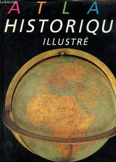
Gamberini Marie-Christine
Atlas historique illustré.
Nathan. 1986. In-4. Relié. Bon état, Couv. convenable, Dos satisfaisant, Intérieur frais. 159 pages. Nombreuses photos et cartes en couleurs dans le texte. Jaquette en bon état.. Avec Jaquette. . . Classification Dewey : 912-Atlas, cartes et plans
书商的参考编号 : RO80259004 ???????? : 209290034
|
|
|
GAMBESSEDES OLIVIER
ATLASECO DE POCHE - EDITION 1990 - ATLAS ECONOMIQUE MONDIAL.
DU SERAIL. 1989-90. In-12. Relié. Bon état, Couv. convenable, Dos satisfaisant, Intérieur frais. 758 pages - TExte sur 2 colonnes - Nombreux graphiques en noir et blanc.. . . . Classification Dewey : 912-Atlas, cartes et plans
书商的参考编号 : R320076328
|
|
|
GANCEL
CARTES DES DEAPRTEMENTS DE LA FRANCE.
NON PRECISE. 1879-1880. In-8. Relié. Etat d'usage, Tâchée, Dos satisfaisant, Intérieur acceptable. Environ 80 pages de nombreuses cartes en noir et blanc contre collées sur page blanc - tranches viollettes - 3 photos disponibles .. . . . Classification Dewey : 912-Atlas, cartes et plans
书商的参考编号 : R240088939
|
|
|
GANNE Gilbert
LONDRES.
reliure éditeur - 17,5x27 - 192 pp - 1968 - éditions RENCONTRE, Lausanne.Collection " ATLAS DES VOYAGES, RENCONTRE" dirigée par Charles-Henri FAVROD.Nombreuses illustrations dans et hors texte.
书商的参考编号 : 4960
|
|
|
GARDETTE Pierre / DURDILLY Paulette
Atlas linguistique et ethnographique du Lyonnais, V : commentaires et index.
Centre national de la Recherche Scientifique, 1976, 848 p., cartonnage éditeur, bon état.
书商的参考编号 : 92246
|
|
|
Gardner Faxton E. Faxton Eugene b. Bockenheimer Ph. Philipp b. . Atlas der Chirurgischen Hautkrankheiten
Iconograms ; a collection of colored plates illustrating interesting surgical conditions 1913 Leather Bound
2019. Leather Bound. New. Leather Binding on Spine and Corners with Golden Leaf Printing on round Spine. Reprinted in 2019 with the help of original edition published long back 1913. This book is printed in black & white sewing binding for longer life Printed on high quality Paper re-sized as per Current standards professionally processed without changing its contents. As these are old books we processed each page manually and make them readable but in some cases some pages which are blur or missing or black spots. If it is multi volume set then it is only single volume if you wish to order a specific or all the volumes you may contact us. We expect that you will understand our compulsion in these books. We found this book important for the readers who want to know more about our old treasure so we brought it back to the shelves. Hope you will like it and give your comments and suggestions. Lang: - eng Pages 552. EXTRA 10 DAYS APART FROM THE NORMAL SHIPPING PERIOD WILL BE REQUIRED FOR LEATHER BOUND BOOKS. FOLIO EDITION IS ALSO AVAILABLE. hardcover
书商的参考编号 : LB1111006953641
|
|
|
Gardner Faxton E. Faxton Eugene b. Bockenheimer Ph. Philipp b. . Atlas der Chirurgischen Hautkrankheiten
Iconograms ; a collection of colored plates illustrating interesting surgical conditions 1913 Hardcover
2020. Hardcover. New. Lang: - eng Pages 552. Reprinted in 2020 with the help of original edition published long back 1913. This book is Printed in black & white Hardcover sewing binding for longer life with Matt laminated multi-Colour Dust Cover Printed on high quality Paper re-sized as per Current standards professionally processed without changing its contents. As these are old books we processed each page manually and make them readable but in some cases some pages which are blur or missing or black spots. If it is multi volume set then it is only single volume if you wish to order a specific or all the volumes you may contact us. We expect that you will understand our compulsion in these books. We found this book important for the readers who want to know more about our old treasure so we brought it back to the shelves. Any type of Customisation is possible with extra charges. Hope you will like it and give your comments and suggestions. hardcover
书商的参考编号 : 1111006953641
|
|
|
GARLAND F SMITH MORRIS ATLAS DAVID G HALL
Guadalupe Jimenez et al. Appellants v. Hidalgo County Water Improvement District No. 2 et al. U.S. Supreme Court Transcript of Record with Supporting Pleadings
Gale U.S. Supreme Court Records 2011-10-30. Paperback. Good. Gale, U.S. Supreme Court Records paperback
书商的参考编号 : SONG1270654004 ???????? : 1270654004 9781270654001
|
|
|
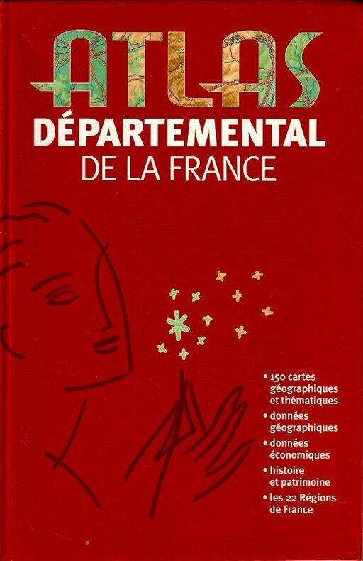
Garnier (Yves) - Boissieu (Charles-Henri de) - Lacrouts (Philippe).
Atlas Départemental de La France
Le Club 2004. Broché au format 15 X 23.5, excellent état, 286 pp. onglets de couleurs, 150 cartes géographiques, données économiques et géographiques, histoire et patrimoine. Les 22 régions de France.
书商的参考编号 : 19793
|
|
|
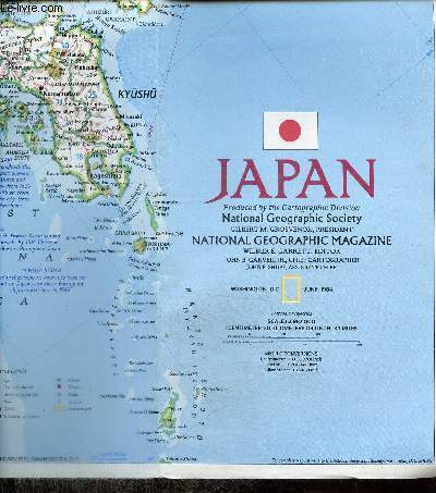
Garrett Wilbur E.
Carte : Japan / Historical Japan
National Geographic. 1984. In-Plano. En feuillets. Bon état, Couv. convenable, Dos satisfaisant, Intérieur frais. Une carte dépliante en couleurs, recto-verso. Nombreuses illustrations en couleurs au verso. 96 x 28,5 cm. Echelle : 1/2982000. Texte en anglais.. . . . Classification Dewey : 912-Atlas, cartes et plans
书商的参考编号 : RO80250502
|
|
|
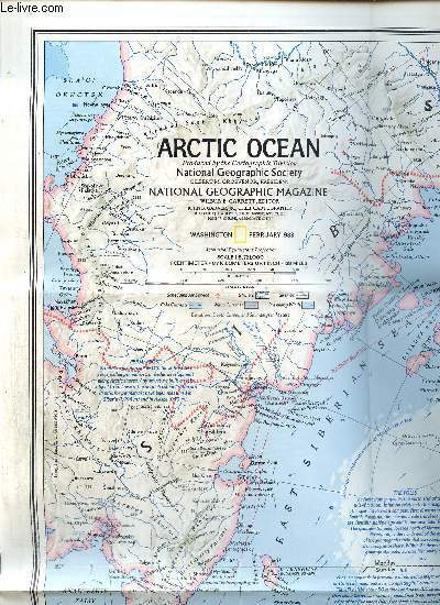
Garrett Wilbur E.
Carte : Peoples of the Arctic / Arctic Ocean
National Geographic. 1983. In-Plano. En feuillets. Bon état, Couv. convenable, Dos satisfaisant, Intérieur frais. Une carte dépliante en couleurs, recto-verso. Nombreuses illustrations en couleurs au verso. 60 x 76 cm environ. Echelle : 1/8721000.. . . . Classification Dewey : 912-Atlas, cartes et plans
书商的参考编号 : RO80250452
|
|
|
Garrett Wilbur E.
Carte : The World / World Ocean Floor
National Geographic. Non daté. In-Plano. En feuillets. Bon état, Couv. convenable, Dos satisfaisant, Intérieur frais. Une carte dépliante en couleurs, recto-verso. Texte en anglais. 75 x 107 cm environ. Echelle : 1/39370000 et 1/42440000.. . . . Classification Dewey : 912-Atlas, cartes et plans
书商的参考编号 : RO80250448

|
|
|
Garver John B. & Collectif
Carte : The Historic Mediterranean / The Mediterranean Seafloor
National Geographic Society. 1982. In-Plano. En feuillets. Bon état, Livré sans Couverture, Dos satisfaisant, Intérieur frais. Une carte dépliante en couleurs recto-verso. Texte en anglais. Echelles : 1/4730000 et 1/4371000. 56 x 92 cm environ.. . . . Classification Dewey : 912-Atlas, cartes et plans
书商的参考编号 : RO80251217

|
|
|
GASPARD Armand
JUGOSLAWIEN.
reliure éditeur - 17,5x27 - 216 pp - 1963 - éditions RENCONTRE, Lausanne.Collection " ATLAS DES VOYAGES, RENCONTRE" dirigée par Charles-Henri FAVROD.Nombreuses illustrations dans et hors texte. ATTENTION : livre écrit en allemand.
书商的参考编号 : 6526
|
|
|
Gassert, Michael
Kulturtransfer durch Fernhandelskaufleute
Peter Lang 15 x 21 Frankfurt am Main 2001 Broché, 377 p. Nombreux graphiques et cartes. Stadt, Region und Fernhandel in der europäischen Geschichte Eine wirtschaftshistorische Untersuchung der Beziehungen zwischen wirtschaftlichen Vorgängen und kulturellen Entwicklungen anhand von Karten 12. bis 16. Jahrhundert. Ouvrage de référence. Exemplaire en parfait état. Livre 363138582X
书商的参考编号 : 3047 ???????? : 363138582
|
|
|
Gastmann, Dennis
Atlas der unentdeckten Länder. [Von Dennis Gastmann].
Berlin: Rowohlt 2016. 267 Seiten. 8° (17,5-22,5 cm). Orig.-Pappband mit illustriertem Orig.-Schutzumschlag. [Hardcover / fest gebunden].
书商的参考编号 : 3116070

|
|
|
GASTON DODU
ATLAS PORTATIF. OCEANIE, AMERIQUE, AFRIQUE, ASIE, EUROPE, FRANCE.
FERNAND NATHAN. NON DATE. In-8. Cartonnage d'éditeurs. Etat d'usage, Couv. légèrement passée, Dos satisfaisant, Intérieur frais. Environ 40 pages de cartes illustrées en couleurs dont une est dépliante. Toilé marron, titres blancs. Ecriture au stylo sur le premier plat.. . . . Classification Dewey : 912-Atlas, cartes et plans
书商的参考编号 : R260134383
|
|
|
Gatz, Erwin (Hg.)
Atlas zur Kirche in Geschichte und Gegenwart. Heiliges Römisches Reich - deutschsprachige Länder. In Zusammenarbeit mit Rainald Becker, Clemens Brodkorb und Helmut Flachenecker. Kartogr.: Karsten Bremer. 1. Aufl.
Regensburg : Schnell + Steiner, 2009. 376 S. Originalleinen mit Schutzumschlag.
书商的参考编号 : 1041262

|
|
|
Gatz, Erwin (Hrsg. ) und Karsten Bremer
Atlas zur Kirche in Geschichte und Gegenwart : Heiliges Römisches Reich - deutschsprachige Länder. Hrsg. von Erwin Gatz in Zus. mit Rainald Becker, Clemens Brodkorb, Helmut Flachenecker. Kartogr.: Karsten Bremer.
Regensburg : Schnell + Steiner, 2009. 1. Aufl.; 376 S. : Mit 197 Karten ; 35 cm; blauer Org.-Leinen mit Org.-Umschlag
书商的参考编号 : 28121

|
|
|
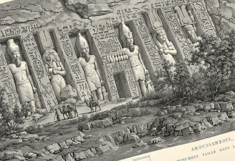
GAU, Francisque-Christian.
Antiquités de la Nubie, ou Monumens inédits des bords du Nil, situés entre la première et la seconde cataracte. Dessinés et mesurés en 1819, par F.C. Gau, architecte. Ouvrage faisant suite au grand ouvrage de la commission d’Egypte dédié au roi. Première et unique édition de cet impressionnant « ouvrage de référence sur l’art, la culture et l’architecture antiques de la vallée du Nil ».
Précieux exemplaire sur papier vélin, très grand de marges car non rogné, conservé dans son cartonnage d’origine. Stuttgart, Paris, imprimerie et librairie de Firmin Didot, 1822-1827. In-plano de viii pp., 20 pp., 13 ff. d’explication des planches, 64 planches numérotées à pleine page dont 5 en couleurs, 29 pp. de texte, 14 planches à pleine page. Cartonnage vert d’éditeur, dos lisse avec une pièce de titre en maroquin rouge, non rogné. Reliure de l’époque. 710 x 517 mm.
书商的参考编号 : LCS-17637
|
|
|
GAUCHE / HACQ / LESTOQUEY
Carte de Beaupreau, N°118.
DEPOT DE LA GUERRE. 1860. In-Plano. En feuillets. Bon état, Livré sans Couverture, Dos satisfaisant, Intérieur acceptable. Carte dépliante en noir et blanc, entoilée, d'environ 88 / 60cm.. . . . Classification Dewey : 912-Atlas, cartes et plans
书商的参考编号 : RO80055168
|
|
|
GAUCHE / HACQ / ORGIARRI
Carte de Chartres N°64
DEPOT DE GUERRE. 1913. In-Plano. En feuillets. Bon état, Couv. convenable, Dos satisfaisant, Intérieur frais. Carte dépliante en noir et blanc, de 85/59cm. Pas de plats de couverture.. . . . Classification Dewey : 912-Atlas, cartes et plans
书商的参考编号 : RO80006329
|
|
|
GAUCHE, HACQ et GEORGE
Carte de Laon . N°22
DEPOT DE LA GUERRE. 1912. In-Plano. En feuillets. Bon état, Livré sans Couverture, Dos satisfaisant, Intérieur frais. Carte dépliante en noir et blanc de 59 / 84 cm. . . A l'italienne. Classification Dewey : 912-Atlas, cartes et plans
书商的参考编号 : RO80072074
|
|
|
GAUCHE, HAS
Carte de Laon N°22
DEPOT DE LA GUERRE. 1912. In-12. En feuillets. Etat d'usage, Livré sans Couverture, Dos satisfaisant, Intérieur acceptable. Carte dépliante en noir et blanc, de 84 x 59 cm.. . . . Classification Dewey : 912-Atlas, cartes et plans
书商的参考编号 : RO80084378
|
|
|
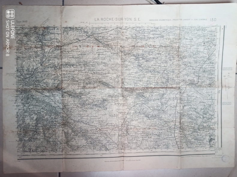
Gauché, Hacq, Gombault
Carte d'Etat-Major de La Roche-sur-Yon S.E. - Carroyage kilométrique, projection Lambert II, zone centrale
Institut National Géographique. Non daté. In-Plano. En feuillets. Bon état, Couv. convenable, Dos satisfaisant, Intérieur acceptable. Une carte en noir et blanc. Environ 54 x 74 cm. Tampon du Secrétariat d'Etat aux communications.. . . . Classification Dewey : 912-Atlas, cartes et plans
书商的参考编号 : RO80240274
|
|
 ?????????
 ?????PDF???
 RSS feed


