|
LATE 19TH CENTURY TOKYO AND YOKOHAMA MAPS
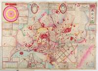
横濵市圖附市郡村名改正實測改正東京全図. Yokohamashizu tsuketari shigunsonmei kaisei jissoku kaisei Tōkyō zenzu. Map of Whole Tokyo with Yokohama City Map. Post Changes of City County and Village Names with Actual Survey.
東京. Tokyo.: 山嵜暁三郎. Yamazaki Akizaburo. Meiji 25 1892. Colour woodblock map 50 x 71cm folds into card covers with plain cloth spine. 18 x 12cm. Occasional small holes at folds some colour offsetting in places a little marking and staining along upper margin upper left section of upper cover stained with a little subsequent staining to map. A bright and attractive map which looks better than this sounds. This 1892 map of Tokyo shows a growing metropolitan city which attracts many tourists from outside. Portraits of the Emperor and the Empress are featured prominently at the top. There are 11 inset illustrations of major buildings and sites surrounding the main map with a round chart which shows directions and distances to them. Another chart lists place names in wards and counties in Tokyo. The Royal Palace is featured in the center and the palace and major buildings are coloured in red. An inset map of Yokohama sits on the lower left. . 山嵜暁三郎. [Yamazaki Akizaburo]. hardcover
Referentie van de boekhandelaar : 214181
|
|
|
Latif, Major General (Retired) M. A. (Editor).
BANGLADESH DISTRICT GAZETTEERS TANGAIL.
pp. xiii, 310 + Plus 25 photographs and a large folding map. Map slightly foxed. Endpapers foxed. Small 4to. Original full green paper binding, some wear. Hardbound. Very scarce. **PRICE JUST REDUCED! INDIA BOX 1
|
|
|
LATRICHE J.
Carte de Visite de J. Latriche, Expéditions Directes des Vignobles.
CHEZ L'AUTEUR. 1924. In-12. Broché. Bon état, Couv. convenable, Dos satisfaisant, Intérieur frais. Carte de 13.5 x 9 cm; imprimée recto / verso.. . . . Classification : 1000-Images Divers
Referentie van de boekhandelaar : RO80088295
|
|
|
LATTRÉ (Jean).
[ROUEN] Plan de la ville et des faubourgs de Rouen levé par MM. les Ingénieurs des Ponts et Chaussées, et dédié par eux à M. Thiroux de Crosne, Maître des Requêtes honoraire, et intendant de la Généralité de Rouen.
Paris, Lattré, 1782. En deux feuilles jointes formant un plan de 785 x 900 mm ; replié et monté dans une reliure de papier rose.
Referentie van de boekhandelaar : LBW-8237

|
|
|
Lattré Jean
Plan de la Ville de Rome d'après celui publié par J. B. Nolli...
Rarissima pianta di Roma a proiezione verticale, orientata con il nord in alto.Prima edizione dell'opera, pubblicata a Parigi da Jean Lattré sulla base della pianta di Giovan Battista Nolli del 1748."Prima sconosciuta edizione della pianta incisa dal Lattré usando come modello quella del Nolli. La Pianta si presenta raccolta in una cornice campata a mano in giallo. Il titolo scritto in francese si trova sulla destra dell'incisione ed in fondo, dopo la dedica al monsignor Antoine Eleonor Leon, si legge la data 1788. La colorazione aggiunta manualmente consente di distinguere le antichità e le emergenze architettoniche campite in rosso, le chiese campite in azzurro e raffigurate in pianta con le uniche eccezioni di San Pietro e Castel Sant'Angelo campite in giallo. I lotti edificati sono delineati con una sottile linea perimetrale rosa. In basso a destra è presente una descrizione in lingua francese ed a destra una legenda di 170 numeri. La presente pianta venne ristampata nel 1801 dall'editore Jean (vedi Scaccia Scarafoni n. 247)" [cfr. Marigliani p. 296].Il solo esemplare noto nelle raccolte pubbliche è quello alla Biblioteca Apostolica Vaticana, mentre della ristampa del 1801 esiste quello della collezione della Biblioteca Nazionale di Roma.Acquaforte, finemente colorata a mano in epoca, piccoli restauri nei margini laterali, per il resto in ottimo stato di conservazione. Very rare map of Rome with vertical projection, oriented with the north at the top.First edition of the work, published in Paris by Jean Lattré and based on the map by Giovan Battista Nolli (1748).The title written in French is on the right of the engraving and at the bottom, after the dedication to Monsignor Antoine Eleonor Leon, the date 1788. The coloring added manually allows to distinguish the antiquities and architectural emergencies campite in red, the churches campite in blue and represented in plan with the only exceptions of St. Peter and Castel Sant'Angelo campite in yellow. The lots built are outlined with a thin pink perimeter line. At the bottom right there is a description in French and on the right a legend of 170 numbers. The present map was reprinted in 1801 by the publisher Jean (see Scaccia Scarafoni n. 247 and Marigliani p. 296).The only known exemplar in the public collections is that of the Vatican Library, while the reprint of 1801 is that of the collection of the Biblioteca Nazionale of Rome.Etching, fine original colouring, small restorations in the lateral margins, otherwise excellent condition. C. Marigliani, "Le Piante di Roma delle collezioni private", n. 218; Scaccia Scarafoni, "Le Piante di Roma", n. 247.

|
|
|
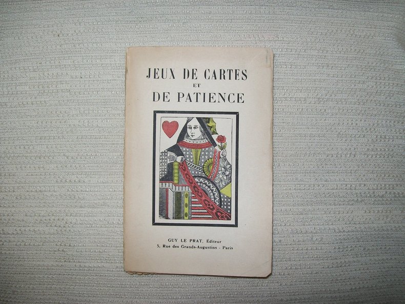
LAUN
PETITS jeux de salon et patiences.
Paris Guy Le Prat sd v 1930. In-16 broché couverture illustrée 150pp. Orné d'un frontispice. Non coupé.
Referentie van de boekhandelaar : GITb922
|
|
|
LAUN
TRAITE DE L'ECARTE
1950 broché (paperback) in-octavo, dos muet marron (spine - no title) - petit manque de papier sur le dos (small lack of paper on the spine), couverture imprimée (cover printed), tranches lisses (smooth edges), illustrations : orné d'un (illuminated of) front-de-chapitre (headpiece) de lettrines (dropped initials) et de culs-de-lampe (tailpieces), naissances de rousseurs (beginning of the redness marks) et cicatrices de mouillures en lisière de queue (scars of waterstains in bottom of the pages), 59 pages, sans date (no date) les années 1930 environ - à Paris Delarue Libraire-Editeur,
Referentie van de boekhandelaar : 11378
|
|
|
LAUN (Dr.)
Petits jeux de salons et patiences. Recueil de jeux de cartes à banque et sans banque que l'on peut jouer en famille et nouvelles patiences
Paris, Delarue, s.d. (c.1900), in-12, 150, 8pp, broché, Quelques figures dans le texte. Belle couverture illustrée. Bon exemplaire. 150, 8pp.
Referentie van de boekhandelaar : 27145
|
|
|
LAUN (Dr.)
Petits jeux de salons et patiences. Recueil de jeux de cartes à banque et sans banque que l'on peut jouer en famille et nouvelles patiences
Paris, Delarue, s.d. (c.1909), in-12, 150, 32pp, toile grise, couverture illustrée collé sur le premier plat, Quelques figures dans le texte 150, 32pp.
Referentie van de boekhandelaar : 27146
|
|
|
LAURENT Claude-Marcel
Tous les jeux de dés. Tous les jeux et leurs règles.
Paris, Bornemann, 1967. 13 x 18, 40 pp., broché, très bon état.
Referentie van de boekhandelaar : 26584
|
|
|
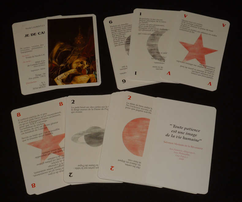
Laurent-Catrice Nicole
Je de cartes
N. Laurent Jeu de cartes 1992 Jeu de 56 cartes (8,3 x 12,8 cm) vernies des deux côtés, sous boîtier plastique rigide transparent, avec au recto les textes de Nicole Laurent-Catrice et au verso le détail d'une vanité de Cornelis Gysbrechts (17e siècle) ; quelques marques de frottement sur la boîte, par ailleurs cartes en très bel état. Livraison a domicile (La Poste) ou en Mondial Relay sur simple demande.
Referentie van de boekhandelaar : gm3833
|
|
|
LAURENT.
[BERRY] Carte de la province du Berry et de la Généralité de Bourges, divisée par élection où se trouve le Nivernois, partie de la Touraine, du Blaisois et autres pays circonvoisins.
Paris, Mondhare, 1770. 500 x 633 mm ; repliée sous couverture cartonnée recouverte de papier bleu de l'époque (200 x 127 mm) ; étiquette sur le premier plat portant le titre manuscrit à l'encre.
Referentie van de boekhandelaar : LBW-8457

|
|
|
LAURIE, (ROBERT) & (JAMES) WHITTLE.
New Travelling Map of Sweden Proper, Gothland, &c. Exhibiting the Admeasured Distances, On all the Principal and Cross Roads, In Quarters of a Swedish Mile.
London, Rob. Laurie and Ja. Whittle, 1807. 62x49,5 cm. Kobberstukket kort over Sverige med Sundet og til Gävle og Fahlun i nord, Gotland og den Botniske Bugt i øst. I smuk original helkolorering. Rent frisk eksemplar trykt på kraftigt papir.
|
|
|
LAURIE, (ROBERT) & (JAMES) WHITTLE.
New Travelling Map of Sweden Proper, Gothland, &c. Exhibiting the Admeasured Distances, On all the Principal and Cross Roads, In Quarters of a Swedish Mile.
London, Rob. Laurie and Ja. Whittle, 1807. 62x49,5 cm. Kobberstukket kort over Sverige med Sundet og til Gävle og Fahlun i nord, Gotland og den Botniske Bugt i øst. I smuk original helkolorering. Rent frisk eksemplar trykt på kraftigt papir.
Referentie van de boekhandelaar : 31273
|
|
|
LAURO Giacomo (1561-1645/50)
Roma Antiqua Triumphatrix
Pianta archeologica di Roma incisa da Giacomo Lauro e pubblicata dalla tipografia de Rossi.In alto al centro il titolo e l’imprint editoriale ROMA ANTIQUA TRIUMPHATRIX AB ANTIQUIS MONUMENTIS ET RERUM GESTARUM MEMORIIS ERUTA HICA IACOBO LAURO ROMANO AUCTORE ET SCULPTORE GRAPHICE EXPRESSA. Io. Iacobus de Rubeis formis Romae ad Templu[m] Pacis cu[m] Priv. S. Pont. In basso al centro Romae Cum Privilegio Summi Pontificis. A destra e sinistra della carta una lunga legenda numerica di 279 rimandi a luoghi e monumenti notabili e due piccole mappe. La carta è circondata da un testo inciso e da venti vignette che simboleggiano momenti significativi nella storia antica della città. Carta priva di orientazione. Acquaforte e bulino, mm 482x736.La carta è circondata da un testo inciso e da venti vignette che simboleggiano momenti significativi nella storia antica della città, mentre due piccole mappe raffigurano i sette colli sui quali sorge Roma. Incerta è la datazione della stessa, che il Frutaz colloca tra il 1612 e prima del 1650. Cartograficamente ispirata a quella realizzata da Etienne Duperac nel 1574, la pianta venne pubblicata da Giacomo de Rossi tra il 1649 e il 1677, anno in cui viene elencata nel celebre Indice della stamperia De Rossi.Acquaforte e bulino, impressa su carta vergata coeva, con margini, colori coevi, lieve restauro con parziale perdita di testo in basso al centro, nel complesso in eccellente stato di conservazione.BibliografiaArrigoni-Bertarelli (1930): p. 10, n. 77; Christie’s (1998): n. 1034; Frutaz (1962): p. 72, n. XXVII, Tavv. 59-61; Hülsen (1915): XXIII, p. 86, n. 107; Iusco. Indice delle stampe de' Rossi, p. 379 (p.16 c.2); Scaccia Scarafoni (1939): pp. 32-33, n. 32. The bird's-eye view of ancient Rome by Giacomo Lauro was derived from Etienne du Pérac's large view of Rome.Printed from two separate plates on two sheets subsequently joined at vertical edges. List of buildings and sites numbered 1-279, keyed to view. At outer margin is a band of 16 engraved scenes from Roman history interspersed with 20 numbered explanatory texts. Heads of the 7 kings of Rome appear at upper left, heads of the 12 Caesars at upper right. Title and imprint at top center. Oriented with east at top.In marginal text, Lauro refers to his Antiquae urbis splendor (published 1612), so the view must have been engraved between that date and his death in 1650. This span is narrowed by the probability that the present view is that signed by Lauro in 1635. It must have been published by Giovanni Giacomo de Rossi between the beginning of his publishing activity in 1649 and the 1677 index of his publications whichincludes this view.Etching with engraving, printed on contemporary laid paper, with margins, contemporary colour, light repair with the loss of part of the text on lower part, otherwise in excellent condition.LiteratureArrigoni-Bertarelli (1930): p. 10, n. 77; Christie’s (1998): n. 1034; Frutaz (1962): p. 72, n. XXVII, Tavv. 59-61; Hülsen (1915): XXIII, p. 86, n. 107; Iusco. Indice delle stampe de' Rossi, p. 379 (p.16 c.2); Scaccia Scarafoni (1939): pp. 32-33, n. 32.

|
|
|
LAURO Giacomo (1561-1645/50)
Urbis Romae Novissima Delineatio
Piccola pianta di Roma proiezione obliqua, orientata col nord a sinistra. "E' evidente la derivazione di questa pianta da quella più grande del Florimi, come giustamente rilevato dalla Jatta nel catalogo Roma Veduta. In basso a sinistra si legge Romae Anno 1618 cum privilegio Summi POntifici ed a destra: Jacobus Laurus f. Sul margine inferiore una legenda di 95 numeri che prosegue nel cartiglio in alto a destra fino al n. 121" (cfr. Marigliani, p. 185). Tuttavia, ci sembra improbabile che sia derivazione del Florimi - che, tra l'altro, comprende una legenda di soli 86 numeri di legenda. Sembra più probabile la derivazione con le piante incise da Ambrogio Brambilla per il Franzini prima e per Nicola van Aelst poi (1590). Pianta tratta dall'Antiquae Urbis Splendor di Giacomo Lauro, opera per la prima volta pubblicata nel 1612, importante e ricercata raccolta di vedute e antichità romane, rappresenta il più importante lavoro del Lauro e godette di una incredibile fortuna. L'opera interamente illustrata con sintetici testi didascalici sulle bellezze e gli splendori di Roma antica e Roma moderna venne ristampata ed accresciuta. Le edizioni posteriori fanno sempre riferimento alla data di pubblicazione del 1612. La data e lo stampatore sono però dedotti dalla dedica di Giovanni Alto (jan Alten) da Lucerna, curatore del volume, ai lettori. Acquaforte e bulino, stampata su carta vergata coeva, in ottimo stato di conservazione. Bibliografia Frutaz n. 26; Scaccia Scarafoni n. 180; Huelsen 49; Roma Veduta n. 22; Marigliani p. 185, n. 90. Small map of Rome with an oblique projection, oriented with the north on the left. It is evident the derivation of this map from the larger one of Florimi, as rightly noted by Jatta in the catalog Roma Veduta. In the lower left corner it reads Romae Anno 1618 cum privilegio Summi POntifici and on the right: Jacobus Laurus f. On the lower margin a legend of 95 numbers that continues in the cartouche in the upper right up to n. 121" (cf. Marigliani, p. 185). However, it seems unlikely to us that it is a derivation of the Florimi - which, by the way, includes a legend of only 86 numbers. It seems more likely to be derived from the maps engraved by Ambrogio Brambilla for Franzini first and then for Nicola van Aelst (1590). The map is taken from Antiquae Urbis Splendor by Giacomo Lauro, a work published for the first time in 1612, an important and sought-after collection of Roman views and antiquities, it represents Lauro's most important work and enjoyed an incredible fortune. The work, entirely illustrated with concise didactic texts on the beauties and splendors of ancient and modern Rome, was reprinted and enlarged. Later editions always refer to the date of publication of 1612. The date and the printer are however deduced from the dedication of Giovanni Alto (jan Alten) from Lucerne, editor of the volume, to the readers. Etching and engraving, printed on contemporary laid paper, in excellent condition. Literature Frutaz n. 26; Scaccia Scarafoni n. 180; Huelsen 49; Roma Veduta n. 22; Marigliani p. 185, n. 90.

|
|
|
LAVALLEEE Jospeh; GUÉROULT Adolphe:
Espagne [et] Espagne depuis l'expulsion des Maures jusqu'à l'année 1847. Îles baléares et pithyuses par M. Frédéric Lacroix. Sardaigne, par M. le président de Grégory. Corse par M. Friess de Colonna.
Paris, Firmin Didot frères, 1844 et 1847. 2 volumes in-8 de [4]-507-[1] et [4]-412-[1]; 27-[1]; 49-[1]; 144 pages,demi-chagrin rouge, dos lisse orné de filets dorés.
Referentie van de boekhandelaar : 21053

|
|
|
LAVALLÉE (Joseph) & BRION de la TOUR (Louis).
[SARTHE] Département de la Sarte, ci-devant partie du Maine et de l'Anjou.
[Paris, Brion, 1793]. 170 x 212 mm.
Referentie van de boekhandelaar : LBW-8056

|
|
|
LAVERRIERE (C. L.).
Pensionnat de N.-D. de Bellegarde.
Neuville-sur-Saône, 1876. 470 x 750 mm ; monté sur carton.
Referentie van de boekhandelaar : LBW-8946

|
|
|
Lavoisne (CV.). C. V.
LAVOISNE'S COMPLETE GENEALOGICAL HISTORICAL CHRONOLOGICAL AND GEOGRAPHICAL ATLAS
London: Printed and Published By J. Barfield 1840. Book. Very Good. Hardcover. Fourth Edition. Folio 30 x 46cm. "Revised Collated and Considerably Enlarged by John Satchell Esq." Seventy-four double-page engraved genealogical tables and geographical maps all with original hand colouring contemporary . half black morocco gilt with green cloth boards. Binding good with some general wear and rubbing leather chipped with loss to the base of the spine joints rubbed but still strong corners worn. All edges gilt./ Contents clean and tight contemporary ink stain effecting the fore-edges of the first few pages but not affecting text or maps most noticeable to the front end papers with also have a pencil inscription dated 30 November 1935. All maps and charts in very good condition. Notwitstanding wear to the binding a very good copy. Printed and Published By J. Barfield Hardcover
Referentie van de boekhandelaar : 018232
|
|
|
Lawrence, Chester H; Ramsey, Ray (Maps)
New World Horizons
Duell Sloan and Pearce. Hardcover. B000IV2UPE 1942 Duell Sloan and Pearce pictorial hardcover. Very Good. Some limited edgewear one corner bumped clean unmarked and tight. No dust jacket. Color maps by Ray Ramsey. . Very Good. Duell, Sloan and Pearce hardcover
Referentie van de boekhandelaar : 34504
|
|
|
Lawrence, T. E.; 54 b/w Illustrations, 4 b/w Maps / Plates [Illustrator]
Seven Pillars of Wisdom
Doubleday Doran & Company. hardcover. Good. 0x0x0. states "first publication for general circulation 1935" yet title page states 1936 - Doubleday Doran hard cover - red cloth cover - no dust jacket - 1 1/2 inch cut at binding - some staining to cover and closed page edge - gift inscription inside front cover - owner's label inside front cover - a number of illustrations throughout - dingins trong contents clean - enjoy Doubleday, Doran & Company hardcover
Referentie van de boekhandelaar : 2308220004
|
|
|
Lawrence, Hal
A Bloody War - One Man's Memories of The Canadian Navy 1939-45
183 pages. From a tug in Halifax Harbour to a destroyer in Norwegian fiords, from the balmy Caribbean to the frozen reaches of Murmansk, Hal Lawrence spins an engaging personal account of a young man growing up at sea. Author commemorates with genuine affection the dedicated men with whom he served and the fighting navy which shaped them. Includes numerous interesting black and white photographic plates. Endpapers decorated with maps. Book clean and unmarked with light wear. Average wear to dust jacket. Very nice copy. Book
|
|
|
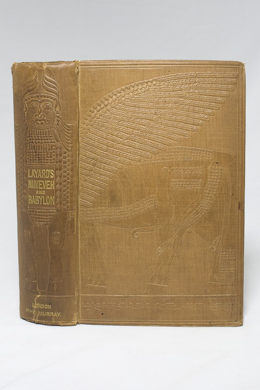
LAYARD AUSTEN H:
Discoveries in the Ruins of Nineveh and Babylon; with Travels in Armenia, Kurdistan and the Desert: Being the Result of a Second Expedition undertaken for the Trustees of the British Museum.
London, John Murray, 1853. In-8 deXXIII-[1]-686-[2] pages, pleine percaline chocolat estampée d'un beau motif babylonien. Menues rousseurs. Etiquette des relieurs Remnants & Edmonds.
Referentie van de boekhandelaar : 14311
|
|
|
LAZARE (Louis) & LEFEBVRE.
[BOIS de BOULOGNE] Service municipal des promenades et plantations de Paris. Plan du bois de Boulogne et de ses dépendances. Janvier 1856.
Paris, Kaeppelin, 1856. En 21 sections montées sur toile et repliées, formant un plan de 371 x 552 mm ; sous chemise et étui de papier moiré vert de l'époque (132 x 85 mm), avec étiquette de titre sur le premier plat.
Referentie van de boekhandelaar : LBW-8956

|
|
|
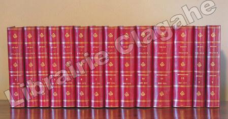
Le Bas, Philippe :
France. Dictionnaire encyclopédique.
Paris, Firmin Didot, 1840 - 1845, 12 volumes in-8 ; suivi de Annales de France, 1840 - 1843, deux volumes ; soit en tout 14 volumes in-8 en reliure uniforme ; demi-chagrin rouge-cerise, dos à faux-nerfs dorés, fleurons, titre et tomaison dorés, tranches mouchetées (reliure de l'époque) ; 560, (2), 18, 15, (1 bl.), 22 pp. ; 576 ; 576 ; 576 ; 588 ; 851 ; 802, (2) ; 844 ; 880 ; 892 ; 908 ; IV, 1015 pp. et 496 ; 744 pp. et 33 cartes coloriées et en tout 616 gravures hors-texte (exemplaire collationné, bien complet des 616 gravures et non 620 comme annoncé). Texte imprimé sur deux colonnes.
Referentie van de boekhandelaar : 6355
|
|
|
LE BOURGUIGNON-DUPERRÉ (Cyprien-Gabriel).
[ARGENTINE/BUENOS-AIRES] Plan de la rade de Buenos-Ayres, dans le Río de la Plata.
[Paris], Dépôt-Général de la Marine, 1833. 598 x 887 mm.
Referentie van de boekhandelaar : LBW-8751

|
|
|
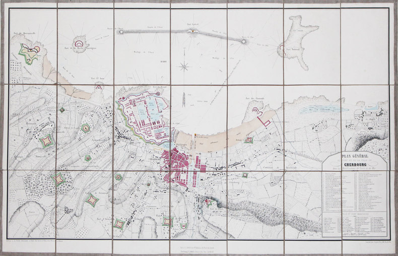
LE BRETON (Louis).
[CHERBOURG] Plan général du port et de la ville de Cherbourg avec les fortifications de terre et de mer.
Cherbourg, F. Simon, [circa 1850]. En 21 sections montées sur toile et pliées, formant un plan de 498 x 785 mm.
Referentie van de boekhandelaar : LBW-3160
|
|
|
LE BRETON (Louis).
[EQUATEUR] Guayaquil.
Paris, [circa 1860]. 122 x 172 mm.
Referentie van de boekhandelaar : LBW-1188
|
|
|
LE BRETON (Louis).
[LIVOURNE] Guerre d'Italie. Livourne. Débarquement d'une armée française commandée par le Prince Napoléon. Mai 1859.
Paris, Gosselin, et Lyon, Gadola, [1859]. 237 x 298 mm.
Referentie van de boekhandelaar : LBW-8840

|
|
|
LE BRETON (Louis).
[PORTO] Oporto (Portugal).
Paris, Gosselin, et Lyon, Gadola, [circa 1860]. 228 x 299 mm.
Referentie van de boekhandelaar : LBW-8849

|
|
|
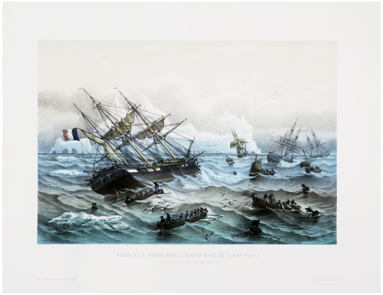
LE BRETON (Louis).
[TERRE-NEUVE] Pêche à la morue sur le Grand Banc de Terre-Neuve. Les embarcations élongeant les lignes.
Paris, F. Sinnett, [circa 1845]. 370 x 501 mm.
Referentie van de boekhandelaar : LBW-8047
|
|
|
LE BRETON (Louis).
La Gloire. Frégate cuirassée à hélice.
Paris, F. Sinnett, [1861]. 407 x 502 mm.
Referentie van de boekhandelaar : LBW-8920

|
|
|
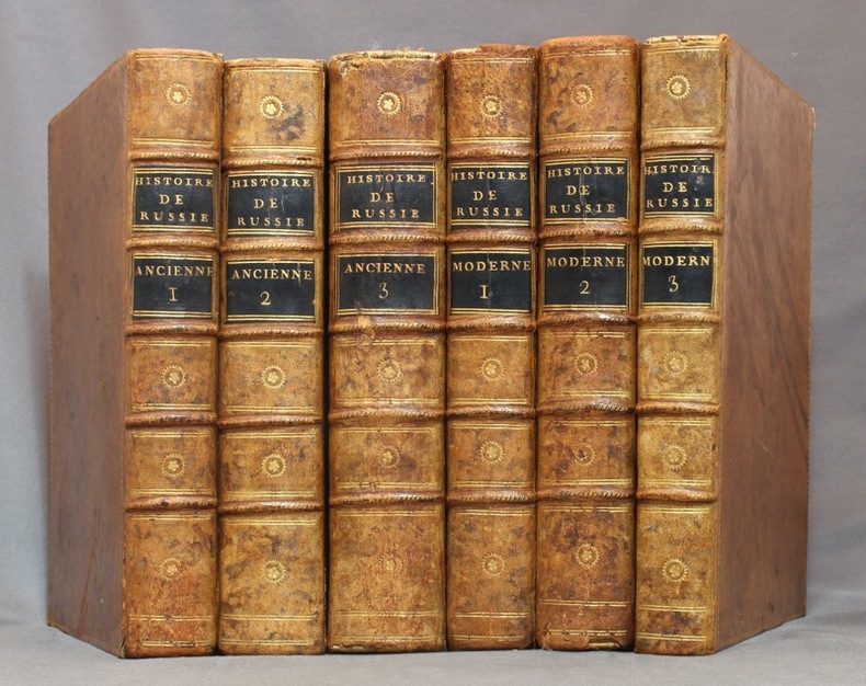
LE CLERC Nicolas-Gabriel:
Histoire physique, morale, civile et politique de la Russie ancienne [-moderne].
A Paris et à Versailles, Chez Froullé, Maradan et Chez Blaizot, 1783-1794. 6 volumes in-4 de [4]-VII-[1]-XX-510-[2]; [4]-XXIV-560-[2]; [4]-VI-[2]-748; [4]-536-VIII; [4]-619; VIII-424 pages. Pleine basane racinée du temps, dos à nerfs ornés de filets et petits fleurons dorés, roulette dorée sur les plats, tranches marbrées. Coins tapés et accrocs à quelques coiffes.
Referentie van de boekhandelaar : 15434
|
|
|
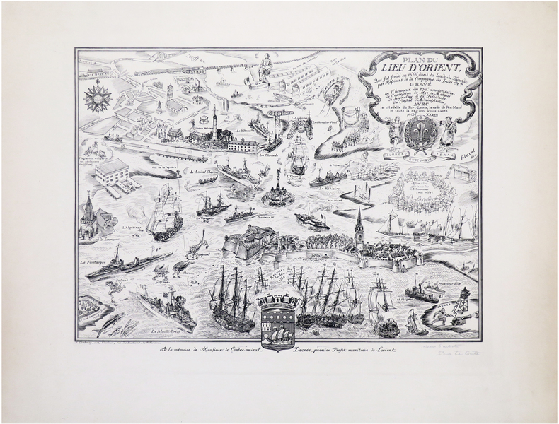
LE CONTE (Pierre).
[LORIENT] Plan du lieu d'Orient qui fut fondé en 1666 dans la lande du Faouédic par Messieurs de la Compagnie des Indes Or.les. Gravé en l'honneur du 250e anniversaire de l'accession de Mgr le Marquis de Seignelay à la Présidence du Conseil d'Administration, avec la citadelle de Port-Louis, la rade de Pen-Mané et toute la région avoisinante.
Cherbourg, chez l'auteur, 1933. 335 x 446 mm.
Referentie van de boekhandelaar : LBW-8026
|
|
|
LE DENTU José
Bridge : 100 questions, 100 réponses. Collection : Marabout service, MS 345.
Verviers, Les Nouvelles Editions Marabout, 1979. 11 x 18, 185 pp., broché, très bon état.
Referentie van de boekhandelaar : 85092
|
|
|
LE DENTU José
Bridge facile. Les enchères naturelles et le jeu de la carte.
Paris, Fayard, 1973 14 x 20, 446 pp., cartonnage + jaquette, très bon état
Referentie van de boekhandelaar : 3451
|
|
|
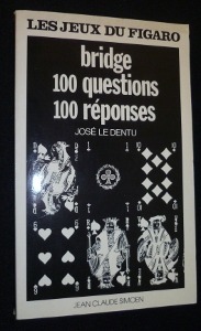
Le Dentu José
Bridge, 100 questions 100 réponses
Simoën Jean Claude Les jeux du Figaro Broché 1977 In-8, (21x13 cm), broché, couverture illustrée, 181 pages, livre qui s'adresse à ceux qui savent déjà jouer et veulent progresser ; plats légèrement jaunis, assez bon état. Livraison a domicile (La Poste) ou en Mondial Relay sur simple demande.
Referentie van de boekhandelaar : nf182
|
|
|
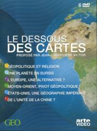
LE DESSOUS DES CARTES
Le dessous des cartes. Coffret de 6 DVD. Géopolitique et religion - Une planète en sursis - L'Europe une alternative - Moyen-Orient pivot géopolitique - Etats-Unis une géographie impériale -De l'unité de la Chine. 1996-2006.
Géo et Arte Vidéo 2006. Paperback. <b>Livre en français</b>. Couverture souple. Recueil d'émissions de Jean-Christophe Victor. Avec un livret. Ajouté: le livre de Jean-Christophe Victor Virginie Raisson et Frank Tétard : Le dessous des cartes 2006. Coffret de 6 DVD. <i>ref. 146357</i> Géo et Arte Vidéo paperback
Referentie van de boekhandelaar : 146357
|
|
|
LE DESSOUS DES CARTES
Le dessous des cartes. Coffret de 6 DVD. Géopolitique et religion - Une planète en sursis - L'Europe, une alternative? - Moyen-Orient pivot géopolitique - Etats-Unis, une géographie impériale -De l'unité de la Chine.
Couverture souple. Coffret de 6 DVD.
Referentie van de boekhandelaar : 146357
|
|
|
LE FAURE Amédée
Histoire de la guerre Franco allemande 1870-1871
illustrée de 19 cartes et plans, de portraits, vues épisodes de batailles etc. 2 tomes en 2 volumes in 4 demi-chagrin foncé, titre tomaison, roulette, filets dorés. Tome 1 : faux-titre, titre, 442 pages, 1 page de table des cartes Tome 2 : page de titre absente, 458 pages. Garnier frères libraires éditeurs 1875
Referentie van de boekhandelaar : 11448

|
|
|
LE FOLL (Alain).
Menu illustré d'une gravure originale signée.
Paris Société des Francs-Bibliophiles 1982 1 vol. Broché Menu dépliant sur Arches illustré d'une lithographie (28 x 30 cm) signée par Alain Le Foll. En parfait état.
Referentie van de boekhandelaar : 109139
|
|
|
LE FOLL (Alain).
Menu illustré d'une gravure originale signée.
Paris Société des Francs-Bibliophiles 1982 1 vol. Broché Menu dépliant sur Arches illustré d'une lithographie (28 x 30 cm) signée par Alain Le Foll. En parfait état.
Referentie van de boekhandelaar : 109139
|
|
|
LE FRANCOIS (Abbé)
Méthode abrégée et facile pour apprendre la géographie, où l'on décrit la forme du Gouvernement de chaque Pays, ses qualités, les moeurs de ses Habitans, & ce qu'il y a de plus remarquable.
...Avec un Abrégé de la Sphère et une Table des Longitudes et Latitudes des principales Villes du Monde, conforme aux dernières Observations des Meilleurs de l'Académie des Sciences, de RR.PP.Jésuite, et autre astronomes. Nouvelles édition revue, corrigée et augmentée.Paris, Belin, 1781. In-12 relié pleine basane fauve, dos à 5 nerfs aux caissons ornés de fleurs dorées, pièce de titre rouge. XVI - (5) - 614 p.L'ouvrage contient une mappemonde et 15 cartes dépliables de Sr Robert de Vangondy.Le dos comporte quelques trous de ver, le coin supérieur du premier plat est abimé, les autres coins sont émoussés. La coiffe supérieure est cornée et en état d'usage (c'est un livre scolaire), petites griffures sur les plats et les mors. L'état extérieur reste cependant correct. L'intérieur comporte d'infimes rousseurs et quelques petits défauts qui restent très discrets. Bel exemplaire bien complet.
Referentie van de boekhandelaar : 17308
|
|
|
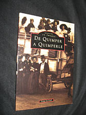
Le Gall Serge
De Quimper à Quimperlé
Editions Alan Sutton Mémoire en Images Broché 1996 In-8, (23,5x16,5 cm), broché, couverture illustrée sepia, 128 pages, riche iconographie en noir et blanc (cartes postales et photographies) ; plats à peine défraîchis, bon état. Livraison a domicile (La Poste) ou en Mondial Relay sur simple demande.
Referentie van de boekhandelaar : ql660
|
|
|
LE GENTIL Georges
Découverte Du Monde
Paris Presses Universitaires De France - PUF 1954 In-8 289 pp
Referentie van de boekhandelaar : 28749
|
|
|
LE HAVRE. MANUSCRIT.
Bombardement du Havre le 4 juillet 1759.
[circa 1780]. 300 x 450 mm, sur papier calque.
Referentie van de boekhandelaar : LBW-4171

|
|
|
LE HAVRE. MANUSCRIT.
Plan de l’agrandissement de la ville du Havre et de l’amélioration de son port. Ces ouvrages ont été commencés le 3 mai 1787.
[circa 1787]. 305 x 437 mm.
Referentie van de boekhandelaar : LBW-512

|
|
|
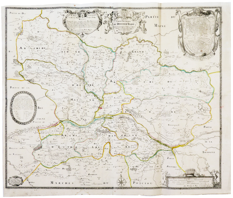
LE LOYER (Jean).
[ANJOU] Carte générale du diocèse d'Anjou.
1652. En quatre feuilles jointes formant une carte de 633 x 757 mm.
Referentie van de boekhandelaar : LBW-3691
|
|
|
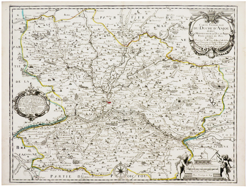
LE LOYER (Jean).
[ANJOU] Carte générale du duché d'Anjou.
1654. 412 x 532 mm.
Referentie van de boekhandelaar : LBW-2680
|
|
 De zoekresultaten per email ontvangen
 Zoekresultaten downloaden als PDF
 RSS feed


