|
TARN
Carte d?partementale couleurs au 1/200 000?me. Sans date.
Une feuille. 56x76 cm.
|
|
|
TARN ET GARONNE
Carte d?partementale couleurs au 1/200 000?me. Sans date.
Une feuille. 56x76 cm.
|
|
|
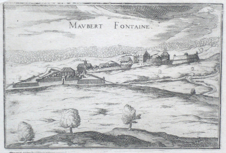
TASSIN (Christophe);
[ARDENNES] Maubert Fontaine.
Paris 1634 104 x 153 mm.
Riferimento per il libraio : LBW061ed
|
|
|
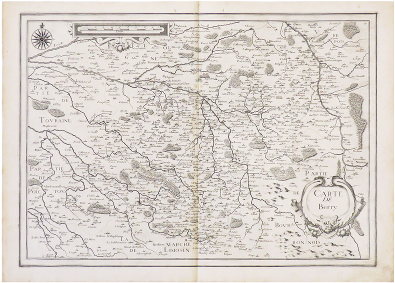
TASSIN (Christophe).
[BERRY] Carte de Berry.
[1634]. 364 x 511 mm.
Riferimento per il libraio : LBW-6831
|
|
|
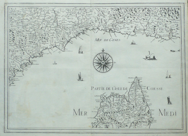
TASSIN (Christophe);
[Carte des côtes de la Provence et de la Ligurie].
Paris circa 1640 367 x 516 mm.
Riferimento per il libraio : LBW-1382
|
|
|
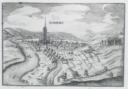
TASSIN (Christophe);
[CHAMPAGNE] Dormans.
Paris 1634 105 x 151 mm.
Riferimento per il libraio : LBW061ef
|
|
|
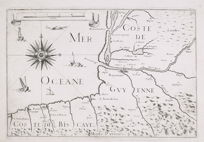
TASSIN (Christophe);
[Coste de Guyenne et coste de Biscaye].
Paris 1634 222 x 330 mm.
Riferimento per il libraio : LBW-651
|
|
|
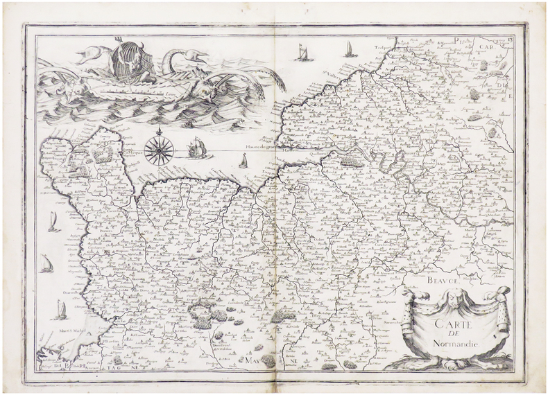
TASSIN (Christophe).
[NORMANDIE] Carte de Normandie.
[Paris, 1634]. 368 x 520 mm.
Riferimento per il libraio : LBW-6839
|
|
|
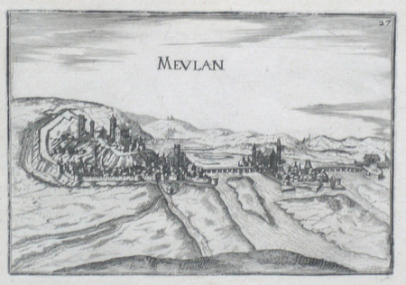
TASSIN (Christophe).
[YVELINES] Meulan.
[Paris, 1634]. 105 x 153 mm.
Riferimento per il libraio : LBW061ee
|
|
|
TASSIN (Christophe).
[ÉTANG de BERRE & MARSEILLE] [Carte particulière des costes de Provence].
[Paris, 1634]. 523 x 372 mm.
Riferimento per il libraio : LBW-6820

|
|
|
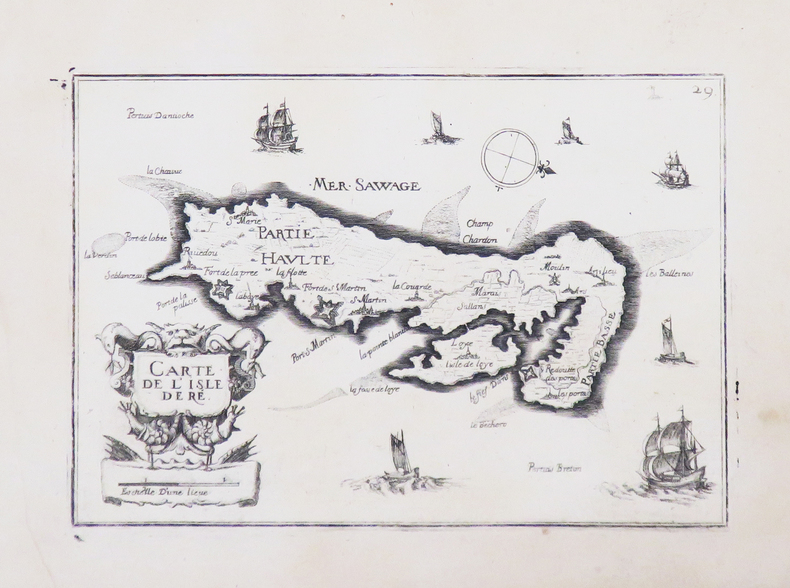
TASSIN (Christophe).
[ÎLE de RÉ] Carte de l'isle de Ré.
[Paris, 1634]. 104 x 152 mm.
Riferimento per il libraio : LBW-4640
|
|
|
TASSIN (Christophe).
[ÎLES de LÉRINS] Description du Cap de la Croix, isles Ste Marguerite et St Honorat.
[Paris, 1634]. 525 x 373 mm.
Riferimento per il libraio : LBW-6859

|
|
|
TASSIN (Nicolas).
Dieppe.
Sans nom ni date (circa 1631). Gravure en noir, 240 x 165 mm, très bon état.
Riferimento per il libraio : 21652

|
|
|
TASSIN ou DE FER.
PARTIE DE LA COSTE DE PICARDIE. PARTIE DE LA COSTE DE NORMANDIE.
Slnd, (Tassin 1636 ou milieu XVIIe). Gravure de 33 x25 cm. Rose des vents accompagnée d'un monstre marin et d'un bateau, échelle verticale en lieues. Pâle mouillure dans le haut de la carte.
Riferimento per il libraio : 11600
|
|
|
Tatjana LIPSKA
TIRER les CARTES : Prédire l'avenir
Un ouvrage de 50 pages, format 170 x 235 mm, illustré, broché couverture couleurs, s.d., Presses Parisiennes de Publications, bon état
Riferimento per il libraio : LFA-126713406
|
|
|
TAVERNIER (Melchior).
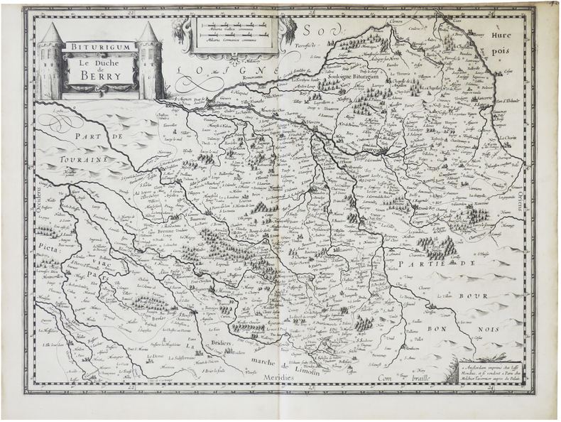
[BERRY] Biturigum. Le Duché de Berry.
Paris, Melchior Tavernier, [1632]. 370 x 488 mm.
Riferimento per il libraio : LBW-8708
|
|
|
TAVERNIER (Melchior).
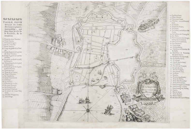
[LA ROCHELLE] Inographie de la ville de La Rochelle. 1621.
Paris, Melchior Tavernier, [1621]. 384 x 575 mm.
Riferimento per il libraio : LBW-6514
|
|
|
TAVERNIER (Melchior).
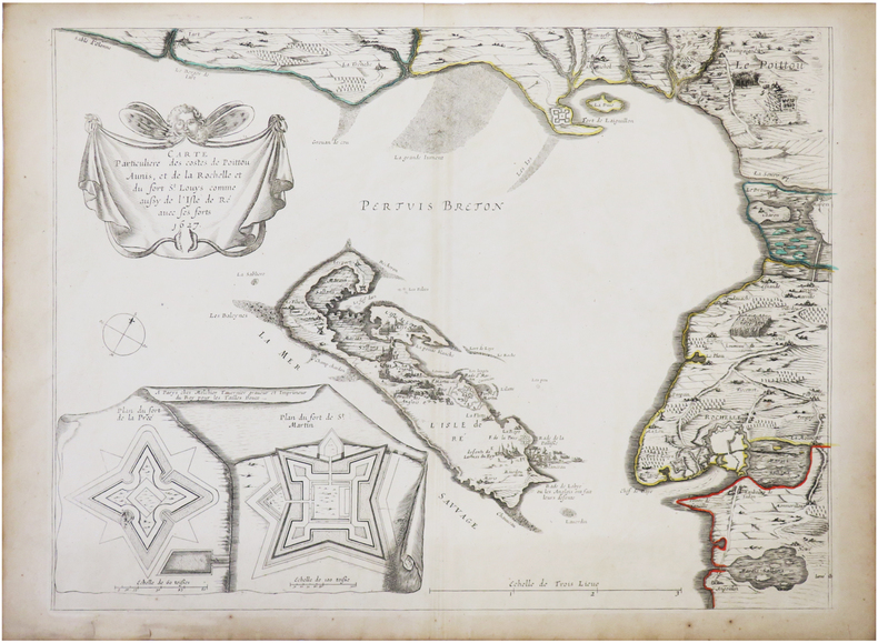
[ÎLE de RÉ] Carte particulière des costes de Poittou Aunis, et de La Rochelle et du fort S.t Louys comme aussy de l'isle de Ré avec ses forts 1627.
[Paris, Melchior Tavernier], 1627 [1632]. 385 x 514 mm.
Riferimento per il libraio : LBW-7282
|
|
|
TAVERNIER (Melchior) & [ANONYME].
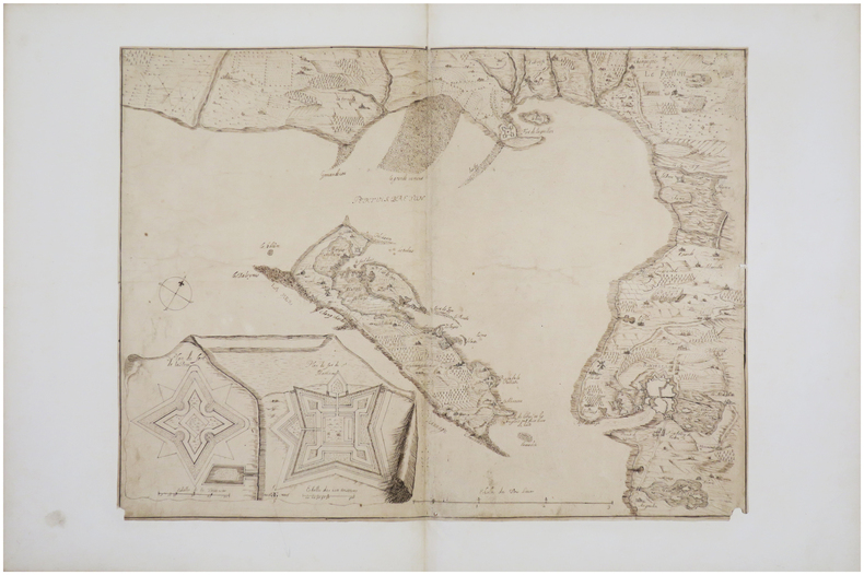
[ÎLE de RÉ] [Carte particulière des costes de Poittou, Aunis, et de La Rochelle et du fort St Louys comme aussy de l'Isle de Ré avec ses forts].
[milieu du XVIIe siècle]. 39 x 53,5 cm, sur papier mince, et monté sur papier vergé postérieur.
Riferimento per il libraio : LBW-7437
|
|
|
TAVENER (Robert).
A literary map of Britain.
Londres, British Travel Association, [circa 1950]. 101,2 x 63,7 cm.
Riferimento per il libraio : LBW-8425

|
|
|
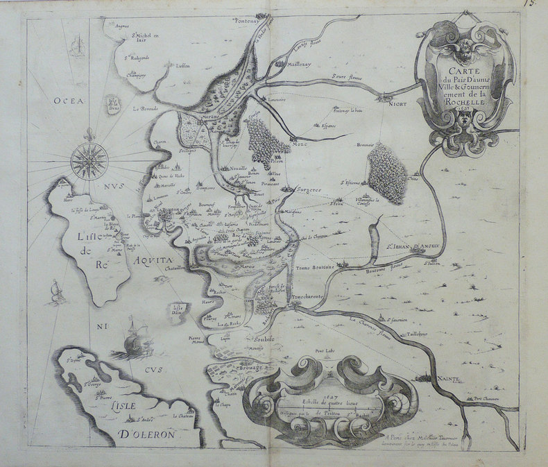
TAVERNIER (Melchior);
Carte du pais d'Aunis ville & gouvernement de La Rochelle.
Paris Melchior Tavernier 1627 [1632] 375 x 427 mm.
Riferimento per il libraio : LBW-964
|
|
|
TAYYAR AKKESKIN, SAIM ALTIOK, I. CELAL ANTEL, ISMAIL HAKKI ALPAN, CEVAT TAHSIN PEKSUN, BAHTIYE MUSLUOGLU (?) et alli.
[FIRST TURKISH SKIING EXPEDITIONS] [Album of photograph: One of early Turkish skiing expeditions in Uludag Mt., Bursa].
Very Good Turkish Original 53 gelatin silver albumen photographs in a cloth photograph album. Oblong: 14x23 cm. Photos' sizes: 7x8,5 cm. No description and script. [FIRST TURKISH SKIING EXPEDITIONS] [Album of photograph: One of early Turkish skiing expeditions in Uludag Mt., Bursa]. Too many skiers seen in photographs. They are early and most important names for Turkish skiing. "In the same year in the course of Erzurum Kerim Hitli Fort set under the leadership of Albert Bilstein who came from Austria, the army engaged in skiing and the first skiers such as Arif Hikmet Koyunoglu Cemal Dursunoglu, Kemal Hasip had been brought up. A ski battalion composed of four companies was founded in Erzincan in 1917. In the same period the first ski school was set up in Susehri (Buldur Village) by Hikmet Koyunoglu. A Teacher of Galatasaray High School skiing in Uludag in 1933 boosted activity to the sport and afterwards the ski activities organised by Bursa Community Centre in Uludag in 1933-1934, Ankara Community Centre in Elmadag and Erzurum Community Centre in Palandöken had been important movements...". (Source: Skiingturkey - History).
|
|
|
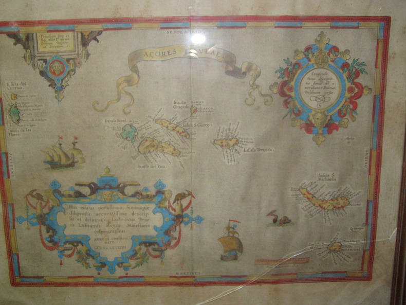
Teixeira, Luis - Ortelius Abraham,
Published by Antwerpen, dat. 1584., Ortelius Abraham, 1584. Acores Insulae. Altkolorierte Kupfer-Karte aus Abraham Ortelius "Theatrum Orbis Terrarum". carte coloriée d’époque
1584 Orig. copper-engraving. Published by A. Ortelius after to L. Teixeira's map of the Açores. Dated 1584. Coloured. With title in decorative border, 3 ornamental cartouches, 2 ships, sea-monster and "Scala Leucarum". 32,5:46,5 cm (12 3/4 x 18 1/4 inch.) 2,5 x 46,5 cm Van der Krogt, Koeman's Atlantes Neerlandici, Vol. III B, 6350:31; Van den Broecke, Ortelius Atlas Maps, Nr. 24. - Stammt aus einer von fünf lateinischen Ausgaben, die in den Jahren 1595 - 1612 erschienen. Alle tragen das Datum 1584 in der großen Kartusche.A splendid sea chart of the Azores with three scrollwork cartouches; the ocean is decorated with sailing vessels. A fresh example of this scarce sea chart, based on Teixeira's single sheet map of Terceira from 1582, and a later manuscript atlas of the Azores islands. The Azores played a significant role in international sea trade as a victualling stop and shelter for ships sailing into the South Atlantic. In very good condition. The map was first issued in an edition of 100 examples in the Additamentum to the 1583 edition of Ortelius' Theatrum Orbis Terrarum, which is widely referred to as the first modern atlas and a landmark in the history of Western map making. Beginning in 1570, Abraham Ortelius and his successors published (and continuously added to) this monumental work for a period of over 40 years (not including the very rare edition of 1641), with text on the verso in Latin, Italian, German, Dutch, French, Spanish and English.References: Van Den Broecke 24. Meurs p 253-254.
Riferimento per il libraio : 22425
|
|
|
Temple, Philip
About New Zealand
No marks or inscriptions. No creasing to covers. A very clean very tight copy with bright unmarked boards, minor traces of storage and no bumping to corners. 64pp. Government tourist publication describing the country's history, politics, culture, industry, sport and the rest.

|
|
|
Tennant, Hal; Rockett, Paul and Beverley; Wiseman, Adele; Johnstone, Ken; Bodsworth, Fred; Adams, Jjack; Gray, Grattan; Porter, M.; Metcalfe, R.; Russell, F.; Gardner, R.; Et al
Maclean's - Canada's National Magazine, January (Jan.) 7, 1961: Whistler's Ski Potential / The Richardsons are World Curling Champs (cover photo)
88 pages. Features: Fantastic fold-out two-panel colour cover photo of the four Richardsons of Regina who are world curling champions; Brief article on how Nanaimo Realty paid its realtors to lose weight - and sales increased!; Nice one-page black and white Volkswagen photo ad entitled "Who backs up the Volkswagen?"; Nice one-page colour photo ad for Florida orange juice shows smiling girl wearing white ear muffs; What Winter Does to Canada - and vice versa; What to wear to a Fashion Opening - photo-illustrated article; Duel in the Kitchen (fiction); The Return of the Winter Carnivals; The Simple Joys of Camping in a Snowdrift; Hockey Isn't As Rough as it Used to Be - Part 1 of Jack Adams' "My 43 Years in Hockey" - photo-illustrated article (with large photo of Howie Meeker pounding a limp Canadien); The Second Splendid Discovery of Spices; How to Gain Entree to the Social Pages; Canada's world champions of Curling - Ernie Richardson and the Richardsons of Regina; Population Explosion on the Ski Slopes; Skier's Dream - two-page colour-photo-illustrated brief article with two maps describe how Franz Wilhelmsen and the Garibaldi Olympic Committee seek to have the massive potential of Whistler Mountain developed for the Winter Olympics of 1968; Best and Worst Movies of 1960; Escape to the Sun - Robert Thomas Allen's road trip from California to Florida; Seagrams ad features colour painting of winter carnival by Henry Simpkins; Large colour ad for Apollo Beach waterfront real estate development near Tampa; Canadian Club colour-photo one-page ad features Walter Gonnason falling into an ice crevasse on Mount Victoria Glacier in Alberta; Why color TV isn't here yet - and when it may be; Colour-photo Coke ad on back cover features skating couple; and more. Discrete six-inch clear archival tape repair to bottom left corner of front cover, otherwise unmmarked with average wear. A quality copy of this great vintage issue. Magazine

|
|
|
TERMIER (Pierre) & BOULE (Marcellin).
[LE PUY-en-VELAY] Carte topographique de l'État-Major. Carte géologique détaillée. Le Puy. Feuille n°186.
Paris, Ch. Béranger, 1861-1893. En 27 sections montées sur toile et repliées, formant une carte de 0,62 x 1,16 m ; étiquette au dos de l'éditeur Charles Béranger.
Riferimento per il libraio : LBW-8953

|
|
|
TERRE, EXPLORATEURS et CONQUÉRANTS par Ch. de LA RONCIÈRE et collaborateurs.
Histoire de la découverte de la terre. Richement documenté (8 planches en couleurs, 586 gravures et cartes).
Paris, Larousse 1938. Bel exemplaire relié, dos orné avec titres dorés, in-4 (32 x 25), 304 pages avec illustrations, table + planches.
Riferimento per il libraio : AUB-6937
|
|
|
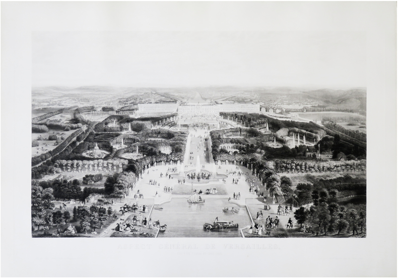
TESTARD (Jacques Alphonse).
Aspect général de Versailles, pris à vol d'oiseau du Grand Canal.
Paris, Fatout, [1856]. 570 x 817 mm.
Riferimento per il libraio : LBW-8701
|
|
|
Texas Maps: Lapie M.
CARTE DE L'AMERIQUE SEPTENTRIONALE
Paris 1842. Partially colored map 27 x 20 inches. Center fold some foxing else very nice. Archival matting and protected with Mylar sheet. Shows all of North America with Russian British U.S. and Mexican possessions. Texas is shown as part of the United States with the Nueces as the boundary line with Mexico. unknown books
Riferimento per il libraio : WRCAM9643

|
|
|
THE AMERICAS - MATTHAEUS MERIAN.
America noviter delineata (in the cartouche). Septentrionalissimas Americae partes Groenlandiam puta, Islandiam at adjacentes, quod Americae tabulae commodé comprehendi non potuerit, peculariari hac tabella Spectatoribus exhibendas duximus. (At upper ...
Without place, (Basel ca. 1650). 30x36 cm. Fine engraved map of North and South America from Terra del Fuego, Terra Australis Incognita and the Magellan Strait in the south to the unmapped regions in the north. A small map of the known parts og Greenland in inset. Outer left shows the coasts regions of Spain and Africa. Ships and whales in the see. Signed M. Merian fecit (lower right). Clean and fine, broad margins, uncoloured.
Riferimento per il libraio : 44316
|
|
|
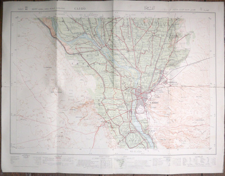
The Survey of Egypt
Cairo. Egypt (normal series), scale 1:100.000, sheet 80/60. [Carte du Caire de 1934]
1934 The Survey of Egypt (25/690), 1934 (33/885). Carte en couleurs de 53 x 69,5 cm montée sur toile par l'éditeur et pliée en 8.
Riferimento per il libraio : 573
|
|
|
THE HOLY LAND - SANSON, NICHOLAS.
Iudaea seu Terra Sancta quæ Hebraraeorum sive Israelitarum in suas duodecim Tribus divisa Regnis Iuda et Israel.... Gulielmi Sanson....Hubertus Iallot.
Amsterdam, Huguetan & Mortier, 1691. 56x85 cm. Large engraved map of Terra Sancta with original colours in outline. With two large engraved cartouches. Small repairs to lower part of centerfold.
Riferimento per il libraio : 43500
|
|
|
THEVENOT (Melchisédech).
Relation de divers voyages curieux qui n'ont point esté publiées, et qu’on a traduit ou tiré des originaux des voyageurs François, Espagnols, Allemands, Portugais, Anglois, Hollandois, Persans, Arabes & autres... occidentaux. ….Nouvelle édition.
Paris, Thomas Moette, 1696 ; 5 parties en 2 vol. in-folio (37x23,5cm), veau marbré, dos à nerfs richement orné de motifs dorés avec tomaison et pièce de titre grenat, quelques frottements, charnières fendillées, manque au dos, coins usés, coiffes absentes, 8 feuillets détachés, rousseurs, qlqs feuillets brunis. L’illustration comporte de nombreuses gravures et illustrations dans et hors texte, 6 cartes dont la carte de l’Indostan, de la Colchide, du Japon (qui regarde l’Amérique), carte de la route du voyage de Canton à Péking, carte de l’Éthiopie, carte de l'Éthiopie ["Entrée de quelques ports…"]. Il manque la Carte de Bassorah, les 2 planches de caractères Chaldéens, la carte de l’Australie, la carte des côtes d’Arabie et d’Asie, la carte des Costes de Sierlionne, la carte des Philippines et Chine, la carte de Chine
Riferimento per il libraio : PHO-1981

|
|
|
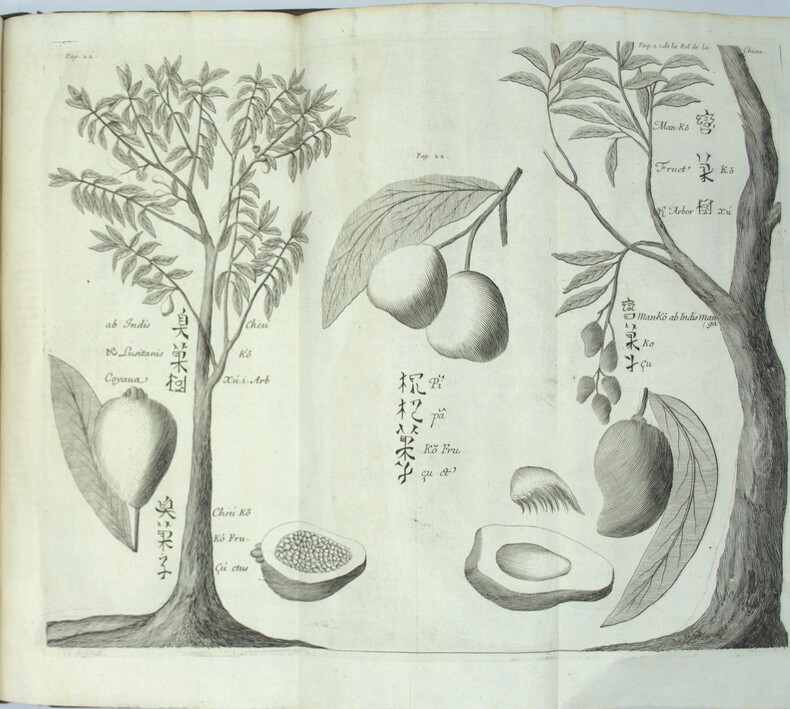
THEVENOT (Melchisédech).
Relations de divers voyages curieux qui n'ont pas été publiées ou qui ont été traduites d'Hacluyt, de Purchas et d'autres voyageurs.
A Paris, chez Jacques Langlois, 1663-1666 3 parties en 1 volumes in-folio (38x25cm). Veau tacheté époque, dos à nerfs ornés avec pièce de titre en maroquin et tomaison, tranches jaspées rouges. Réparations au dos et coins, mouillure, quelques rousseurs, réparation au titre, renforcement à la carte. Complet de ses relations de voyage selon Brunet & Camus
Riferimento per il libraio : PHO-2278
|
|
|
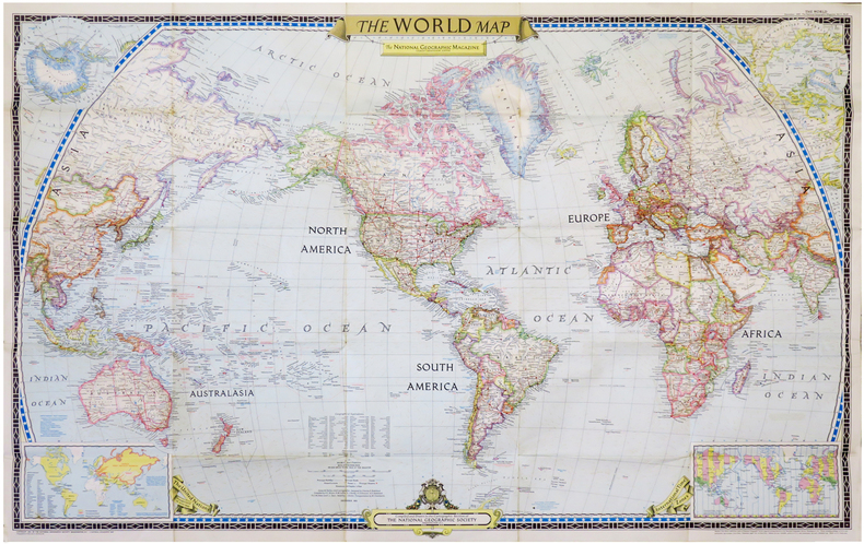
THE NATIONAL GEOGRAPHIC MAGAZINE.
The World map.
Washington, D.C., The National Geographic Magazine, 1951. 0,65 x 1,02 m.
Riferimento per il libraio : LBW-6834
|
|
|
The [British] War Office
Coast Artillery Training Vol. [Volume] I [1 / One]
Originally printed in 1938 in Britain, this copy reprinted with permission in Canada in 1940 with amendments Nos. 1 and 2. Quite a detailed treatise with chapters entitled: Organization of a Coast Fortress in Peace; Responsibility for Training; Annual Training; Charts and Maps; Range-Finders and Other Instruments; Misc. Instruments; Laying; Ballistics; Gunnery Calculations; Gunnery Calculations - Automatic Sights; Range Tables and Initial Corrections; Calibration; Battery Drill and Fire Discipline; Instructions for Training and Examination in Range-Finding; Instructions for Training Examination in x, 224 pages. Plotting Room Duties; Instructions for Training and Examination in Laying; Instructions for Training and Examination in Telephony; Instructions for the Examination for Skill-At-Arms Badges for Gunnery; plus appendices on probability and the slide rule. Several fold-outs. Black and white diagrams. Unmarked with average wear. Binding tight. A sound copy of this vintage WWII reference. Book

|
|
|
THE AMERICAS - MATTHAEUS MERIAN.
America noviter delineata (in the cartouche). Septentrionalissimas Americae partes Groenlandiam puta, Islandiam at adjacentes, quod Americae tabulae commodé comprehendi non potuerit, peculariari hac tabella Spectatoribus exhibendas duximus. (At upper ...
Without place, (Basel ca. 1650). 30x36 cm. Fine engraved map of North and South America from Terra del Fuego, Terra Australis Incognita and the Magellan Strait in the south to the unmapped regions in the north. A small map of the known parts og Greenland in inset. Outer left shows the coasts regions of Spain and Africa. Ships and whales in the see. Signed M. Merian fecit (lower right). Clean and fine, broad margins, uncoloured.
|
|
|
The Automobile Association
AA Members Handbook 1982/83
No marks or inscriptions to contents. No creasing to covers or to spine. A lovely clean tight copy with bright unmarked boards and no bumping to corners. Maps plus 224pp.

|
|
|
The Development Committee of Hull City Council
The City and County of Kingston Upon Hull
No marks or inscriptions and no creasing to covers. A lovely clean very tight copy with bright unmarked boards, minor rubbing to spine ends and no bumping to corners. 168pp. Comprehensive concise review of the Hull, its industry, sport, shops, suburbs, transport, shipping etc. Undated but Lord Mayors listed up to 1960.

|
|
|
The Editor
AA Camping Caravanning Guide : Bulgaria, Greece, Italy and Yogoslavia
No marks or inscriptions to contents. Minor creasing to covers. A clean copy with very slightly marked covers. 49pp. A nostalgic look at the campsites available in the 1960s in parts of Europe. Very large fold-out map of the four countries at rear in excellent condition. Scarce.

|
|
|
The Editor
Black's Guide to the Channel Islands
No marks or inscriptions to contents. No creasing to covers or to spine. A very clean very tight copy with gilt embossed dark green cloth boards, dusty page edges, extremely faint damp effect to edge of front and very tiny bump to lower front corner. Fold-out map of Jersey opposite title page in very good condition. Internal map of Guernsey foxed and with damp effect from edge. 115 pages of adverts plus 190pp. A guide to Jersey, Guernsey, Alderney, Sark and adjacent islets. Map of Channel Islands on front end papers. .

|
|
|
The Editor
British Airways London Eye : The Essential Guide
No marks or inscriptions. No creasing to covers or to spine. A lovely clean very tight copy with bright unmarked boards and no bumping to corners. 48pp. Guide to the London Eye.

|
|
|
The Editor
Camposanto Di Genova (40 vedute)
No marks or inscriptions. No creasing to covers, light crease to soft spine. A very clean very tight brochure with bright unmarked very slightly sunned boards, minor bump to top od spine and no bumping to rounded corners. 40pp. A series of forty sculptures and panoramas of Genoa in Italy in one long folded strip with captions on the reverse side in Italian, French, English and German. Map of the city on end papers. Undated, ca 1930s.

|
|
|
The Editor
Carte De France - Map of Nancy (1962)
Very good condition with a little creasing to corners. Unmarked, not torn map. 1pp. Folded map 1:100.000 of French City of Nancy based on 1958 with partial update 1962. Opens up to 22 x 28 inches.
|
|
|
The Editor
Cirencester : Capital of the Cotswolds
No marks or inscriptions. No creasing to covers or to spine. A lovely clean very tight copy with bright unmarked boards and no bumping to corners. 116pp. Official guide to the town of Cirencester in Gloucestershire. Undated ca 1987.

|
|
|
The Editor
Complete Guide to Scotland
No marks or inscriptions. No creasing to covers or to spine. A very clean very tight copy with bright unmarked boards and no bumping to corners. Attached red silk bookmark. All fold-out maps in excellent condition. Dust jacket not price clipped or marked or torn with a little creasing/rubbing to edges and corners. 448pp. Detailed tourist guide to the whole of Scotland. Seventh Edition revised., Undated ca. early 1960s.

|
|
|
The Editor
Croatia : Small Country for a Great Holiday
No marks or inscriptions. Small crease to upper corner of rear cover. A very clean very tight copy with bright unmarked boards and no bumping to corners. Unpaginated. ca. 60pp. Travel guide to Croatia - the thousand islands of the Croatian Adriatic.

|
|
|
The Editor
Derbyshire Guide 1979
No marks or inscriptions. No creasing to covers or to spine. A very clean very tight copy with bright unmarked boards and no bumping to corners. Large fold-out coloured Bartholemew map at the rear in excellent condition. 240pp. Tourism and more guide to the delights of Derbyshire.

|
|
|
The Editor
Edinburgh Castle
No marks or inscriptions. No creasing to covers. A very clean very tight booklet with bright unmarked boards and no bumping to corners. 31pp. An illustrated guide with the story of Edinburgh Castle through the centuries.
|
|
|
The Editor
England from the Air
No marks or inscriptions. Creasing to front cover, none to rear or to spine. A very clean very tight copy with bright unmarked boards and no bumping to corners. 64pp. Full-page photographs with a little explanatory text showing England from an aerial perspective in its variety of forms. More city and town shots than countryside.

|
|

 Ricevere i risultati per e-mail
 Scaricare i risultati in PDF
 RSS feed
 Link
Link


