|
The Editors
Inns of Character in the West Riding
Small mark at top edge of two pages. No other inscriptions or marks. Light creasing to covers. A very clean tight copy with bright front boards and dusty rear and no bumping to corners. 72pp. Details and photographs of around seventy inns and public houses in the old West Riding of Yorkshire plus a map. Not dated but around early 1970s.

|
|
|
The Editors
Manchester
No marks or inscriptions. Slight creasing to covers. A very clean very tight copy with lettering and a coloured coat of arms on matt black covers and no bumping to corners. Scarce. 48pp. Comprehensive concise review of the City of Manchester, its industry, sport, shops, suburbs, transport etc. Includes a table giving bus and rail fares between the city and other places, eg. bus to Sheffield was 6s 9d and the train cost 22s 4d to Windermere. Undated but latest aircraft movements given for first half of 1950.

|
|
|
The Editors
New Forest : Ordnance Survey Explorer Guide
No marks or inscriptions. Light creasing to covers, none to spine. A very clean very tight copy with bright unmarked boards and no bumping to corners. ca 100pp. The secrets of Britain's best-loved woodland illustrated including OS 1:25,000 maps.
|
|
|
The Editors
Newly Discovered White Scar Caverns Ingleton
No inscriptions or marks. No creasing to covers or to spine. A very clean crisp tight copy with bright unmarked covers and no bumping to corners. 20pp. The story of the Cavern's discovery is told along with its history and details of what visitors can see. Not dated but the Cavern was discovered in 1923 and special mention is made of it being 'Illuminated by Electric Light'.

|
|
|
The Editors
Southport Official Guide 1956
No marks or inscriptions. No creasing to covers or to spine. A lovely clean very tight copy with bright unmarked boards, slight rubbing to top of spine and no bumping to corners. 132pp.

|
|
|
The Editors
The British Heritage
Slight foxing to top of page edges. No other marks or inscriptions. A very clean very tight copy with bright unmarked boards and minor bumping/rubbing to corners. Dust jacket not price clipped or marked with some loss to top of spine, tear to spine foot and nicks/creases to upper edge. 320pp. Includes 19 coloured plates by British artists

|
|
|
The Editors
The English Lakes
No marks or inscriptions. No creasing to covers. A very clean tight copy with bright boards, traces of handling and no bumping to corners. 32pp. Coloured photographs and descriptions of the English Lake District.

|
|
|
The Editors
Time Off in the Lake District and the Yorkshire Dales
No inscriptions or marks. No creasing to covers or to spine. A lovely clean crisp very tight copy with bright unmarked covers and no bumping to corners. Browning to page edges. 127pp. The Observer Guide to hotels and restaurants.

|
|
|
The Editors
Wales : Walking
No marks or inscriptions. No creasing to covers or to spine. A very clean very tight copy with bright unmarked boards and no bumping to corners. 107pp. Very concise details of six-hundred and twenty-five walks in Wales, including grid references and OS map numbers.

|
|
|
The Editors
White Nancy : The Official Guide to Bollington
No marks or inscriptions. Creasing to lower corner. A very clean very tight copy with bright unmarked boards and no bumping to corners. 32pp. Guide to Bollington, near Macclesfield, Cheshire. White Nancy is the structure on the hill overlooking the Village. Tucked in is a used Christmas card of a snow scene featuring White Nancy.

|
|
|
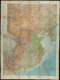
THE GEOGRAPHICAL INSTITUTE
China Mongolia and Korea: With Boundaries Roads and Railways.
Edinburgh.: John Bartholomew & Son Ltd. 1953. Colour folding map laid down on linen. Scale 1:450000. 97 x 72 cm. Small holes and tears at some folds a little light browning. Cloth tape repair at fold adjoining upper card cover. Frederick Warne label upper cover a little creased and torn key includes glossary of Chinese geographical terms translated into English. Contour-coloured world map series. Published in the period immediately following the Korean War this map shows the 38th Parallel. . John Bartholomew & Son Ltd. hardcover
Riferimento per il libraio : 161304
|
|
|
THE HOLY LAND - SANSON, NICHOLAS.
Iudaea seu Terra Sancta quæ Hebraraeorum sive Israelitarum in suas duodecim Tribus divisa Regnis Iuda et Israel.... Gulielmi Sanson....Hubertus Iallot.
Amsterdam, Huguetan & Mortier, 1691. 56x85 cm. Large engraved map of Terra Sancta with original colours in outline. With two large engraved cartouches. Small repairs to lower part of centerfold.
|
|
|
The Scarborough Co.
THE SCARBOROUGH COMPANY FOLDING MAP OF PENNSYLVANIA. 1908.
This 1908 Scarborough Company folding map of Pennsylvania shows all counties, townships, cities, boroughs, villages, Post Offices, and railway stations. Rail lines, suburban electric lines, and a few highways are also shown. This large map is made of linen or cotton backed paper. The verso contains population for 1900 and a gazetteer keyed to a grid around the map edge. Includes an inset of Philadelphia, plus a mileage table. Scale: 1 inch = 6 miles. Size: 36 x 51 inches. In the original cloth folder. Map split at some folds. MAP CASE SE
|
|
|
Theodoro Tscherning; maps by Martin Stier
Das von den Türcken lang-gequälte nun durch die Christen neu-bescelte Königreich Hungarn
<p>Das von den Türcken lang-gequälte nun durch die Christen neu-bescelte Königreich Hungarn Theodoro Tscherning; maps by Martin Stier. Published by Martin Endter Nuremberg 1687. First Edition. 16mo up to 6½" tall. 464pp. fold out dedication to the Holy Roman Emperor Leopold I dated 1687 with detailed engraving of a double-headed eagle holding a scepter and orb; 12 folding maps as called for; index 12pp. Individual maps removed and placed together form one large map. Half leather over marbled boards banded spine red edges. Browning to title page and light toning thereafter. Maps are in very good to fine condition. Partial split to leather at outer upper hinge and partial crack to inner hinge. In very good condition.</p><p>The Kingdom of Hungary long tormented by the Turks now blessed by the Christians. According to the attached XII most accurate maps clearly handled and provided with the newest most remarkable events extending up to the present time. A brief presentation and description of the Hungarian cities fortresses and castles including the neighboring lands of Austria Moravia Carinthia Carniola Styria Bosnia Dalmatia Croatia Slavonia Bulgaria Transylvania etc.</p><p>Published during a pivotal era for the Habsburgs shortly after the 1683 Battle of Vienna and the same year 1687 as the Battle of Mohács which helped solidify Habsburg control over Hungary.</p> Martin Endter hardcover
Riferimento per il libraio : 6047
|
|
|
THERAPY? (Andy Cairns, Michael McKeagan, Neil Cooper), (1989-).
[RARE AUTOGRAPHED POSTER] Therapy? Never Apologise Never Explain Tour 2005 + Kukla. Tekel Birasi ve Host Productions sunar. 13 Mayis 2005, Cuma, 20:00 / Bornova, Izmir.; 14 Mayis 2005, Cumartesi, 20:00 / Maslak / Istanbul. [SIGNED BY ALL MEMBERS of THERAPY]
Very Good Turkish Original printed poster in a standard black frame. Folio. (50 x 35 cm). In Turkish. Izmir and Istanbul live of Therapy in their "Never Apologise Never Explain Tour 2005". An extremely rare and fine graphic-designed Turkish poster. Signed by all three members of the band: Andy Cairns, Michael McKeagan, and Neil Cooper. Only dedication by Michael as 'Love from'. Sponsors of those concerts are Yüxexes (a modern rock music periodical published in Turkey), Eksen 96.2 (Turkish radio channel), Tekel birasi (National Turkish brand of beer), and Host Productions. A fine, very collectible, and extremely rare poster with its signatures and inscriptions.
|
|
|
Thevet Andrè (Angoulême 1516 ca. - Parigi 1592)
Carte dei quattro continenti
Suite completa delle carte raffiguranti i 4 continenti. Xilografie, 1575, finemente colorate a mano in epoca, impresse su carta vergata coeva, complete della linea marginale, in eccellente stato di conservazione. Le carte sono tratte dalla prima edizione de La Cosmographie universelle d'Andre Thevet, cosmographe du roy : illustree de diverses figures des choses plus remarquables veues par l'auteur, & incogneues de noz anciens & modernes, curata da Pierre l’Huilier, che precede di uno o due anni la ristampa di Guillaume Chaudiere. Nato a Angoulême intorno al 1516, Thevet divenne frate francescano e intorno al 1550 compì la sua prima spedizione, quando accompagnò il cardinale Jean de Lorraine in Italia e nel bacino del Mediterraneo. Poco dopo, Thevet pubblicò la Cosmographie de Levant, un compendio circa fatti, persone, luoghi, flora e fauna della zona visitata. L’esperienza di Thevet come un viaggiatore attirò l'attenzione di Nicolas Durand, Cavaliere di Villegagnon, che si apprestava a fondare una colonia in quello che è oggi il Brasile. Durant chiese a Thevet di accompagnarlo nella spedizione come suo confessore. Durante il viaggio, Thevet si ammalò e fu costretto a tornare in Francia dopo aver trascorso sole dieci settimane in Brasile. Tuttavia, combinando le sue osservazioni con le informazioni acquisite da altri viaggiatori, Thevet realizzò il suo Singularitez de la France Antarctique, pubblicato a Parigi nel 1557, che gli valse il riconoscimento reale e la nomina a cosmografo della corte dei Valois. Si dedicò poi alla sua opera più ambiziosa, La Cosmographie universelle, una sorta di descrizione di ogni parte del mondo conosciuto. Il suo collaboratore François de Belleforest, probabilmente a seguito di un litigio, lo abbandonò pubblicando una propria cosmografia nel 1572. Al di là delle accuse di furto del materiale mosse da Thevet, senza dubbio la pubblicazione di Belleforest, tolse successo all’opera di Thevet che, con oltre 2.000 pagine, apparve a 3 anni di distanza, nel 1575. Thevet continuò a scrivere di viaggi reali e immaginari fino alla morte, nel 1592, lasciando due opere manoscritte: la Gran Insulaire, un almanacco di isole di tutto il mondo, e le Histoire de deux voyages, un resoconto, probabilmente amplificato, dei suoi viaggi nel Nuovo Mondo. EuropeEsemplare nell’unico stato conosciuto. La carta deriva dalla rappresentazione murale del mondo di Gerard Mercator del 1569. La mappa è riccamente ornata con mostri marini e numerosi vascelli, e riporta anche le mitiche isole di Frislandia, Ibira e Enoem. La Groenlandia e l’Islanda sono in forma molto allungata, mentre la Scandinavia non si discosta, nella forma, dalla carta di Olaus Magnus.AsieEsemplare nel primo stato di due, avanti la firma dell’editore Chaudiere e la data 1581. La carta dell’Asia è basata sul modello di Mercator del 1569. La Nuova Guinea stranamente non compare nella mappa, mentre il Giappone assume una curiosa forma a tartaruga. La più importante novità cartografica della mappa è rappresentata dalla corretta rappresentazione delle stretto di Anania, oggi Bering.Table d’AfriqueEsemplare nel primo stato di due, avanti la firma dell’editore Chaudiere e la data 1581. Betz sottolinea come questa mappa dell’Africa costituisca un importante tassello nella storia della cartografia del continente, trattandosi della prima mappa di formato in-folio a descrivere l’area basandosi sul modello mercatoriano del 1569, fondendolo con le informazioni desunte dalle carte di Gastaldi e Ortelius. Il risultato è una mappa che fornisce un enorme numero di informazioni cartografiche, talvolta difficili da leggere.Quarte Partie du Monde Esemplare nel primo stato di tre, con il marchio tipografico sotto la descrizione nel cartiglio in basso a sinistra, edito nella prima edizione de La Comosgraphie Universelle del 1575. Burden ebidenzia che il secondo stato della carta non presenta questo marchio tipografico, mentre i... Set of the 4 continents. Woodcuts, 1575, finely hand colored at the time, printed on contemporary laid paper, complete the marginal line, in excellent condition. The maps are from the first edition of The Cosmographie universelle d'Andre Thevet, Cosmographe du roy: ILLUSTREE de diverses figures des choses plus remarquables veues par l'auteur, & incogneues de noz anciens & modernes, curated by Pierre the Huilier, which of one or two years before the reissue of Guillaume Chaudiere. Born around 1516 in Angoulême, Thevet became a Franciscan friar about 1550 and made his first expedition, when he accompanied the Cardinal Jean de Lorraine in Italy and in the Mediterranean basin. Soon after, he published the Cosmographie de Levant, a compendium of facts about people, places, flora and fauna of the area visited. The experience of Thevet as a traveler came to the attention of Nicolas Durand, Knight Villegagnon, who was preparing to establish a colony in what is today Brazil. Durant asked Thevet to accompany the expedition as his confessor. During the trip, Thevet became ill and was forced to return to France after having spent only ten weeks in Brazil. However, by combining his observations with information obtained from other travelers, Thevet realized his Singularitez Antarctique de la France, published in Paris in 1557, which earned him recognition and real cosmographer the appointment of the Valois court. He then devoted himself to his most ambitious work, The Cosmographie universelle, a kind of description of each of the known world. His collaborator François de Belleforest, probably as a result of a quarrel, left him by publishing its own cosmography in 1572. Thevet’s work, of over 2,000 pages, appeared 3 years later, in 1575. Thevet continued to write real and imaginary travel until his death in 1592, leaving two manuscripts: Great Insulaire, an almanac of islands around the world, and the Histoire de deux voyages, a quick, probably amplified, of his travels in the New World. EuropeExample in the only known state. The map comes from the wall map of the world by Gerard Mercator of 1569. The map is richly ornamented with numerous sea monsters and ships, and also reports the mythical islands of Frislandia, Ibira and Enoem. Greenland and Iceland are very elongated, while Scandinavia does not differ in form from the map of Olaus Magnus.AsieExample in the first state of two, before the address of Chaudiere and the date 1581. The map of Asia is based on the model by Mercator wall map of the world. 1569. The New Guinea strangely does not appear in the map, while Japan takes a curious form a turtle. The most important novelty of the cartographic map is represented by the correct representation of the Strait of Ananias, Bering today.Table d'AfriqueExample in the first state of two, before the address of Chaudiere and the date 1581. Betz points out this map of Africa is an important step in the history of cartography of the continent, this is the first map of folio format to describe the area based on the Mercator’s model of 1569, by fusing the information obtained from the maps by Gastaldi and Ortelius. The result is a map that provides a huge number of cartographic information, sometimes difficult to read.Fourth Partie du MondeExample in the first state of three, with the typographical mark under the description in the title, published in the first edition of The Comosgraphie Universelle of 1575. Burden notes that the second state of the map does not present this mark, while the third state is with the address of Chaudiere and the date 1581. From the cartographic point of view, the map is derived from the map of the world of Gerard Mercator of 1569, while the nomenclature and morphology of the northern part seem to be the assembly of several cartographic sources. New Guinea, and a large mass southern called "Cercle Antartique" are richly decorated with scenes of native life. Excellent examples of these rare maps, among... Betz, The Mapping of Africa, pp. 133/34, 17 I/II; Norwich 12; Burden, The Mapping of North America, pp.59/60, 46 I/III; Sweet, Mapping the continent of Asia, 6, I/II.

|
|
|
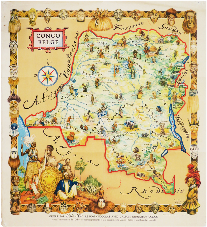
THIRIAR (James).
[CONGO] Congo Belge.
Courtrai, Ets Léon Beyaert-Sioen, [1951]. Lithographie en couleurs de 521 x 470 mm.
Riferimento per il libraio : LBW-6547
|
|
|
Thiers, Adolphe (1797-1877, Directeur de publication) - Plans & cartes par Auguste-Henri Dufour et Thunot Duvotenay
Atlas de l'Histoire du Consulat et de l'Empire dressé et dessiné sous la direction de M. Thiers, par MM. A Dufour et Duvotenay, gravé sur acier par Dyonnet
1859 Paris, Paulin, Lheureux et Cie, Libraires-éditeurs, 1859 - Edition originale -In-folio - Reliure 1/2 basane frottée - faux-titre avec la liste des 66 cartes au verso, titre, 66 cartes gravées - Bel exemplaire
Riferimento per il libraio : 46234
|
|
|
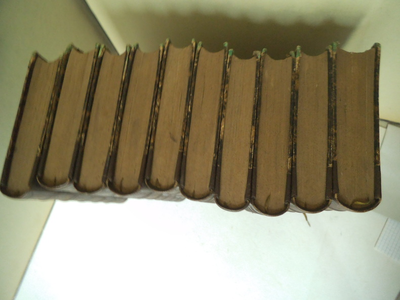
THIERS A.
Histoire de la Révolution Française
10 tomes en 10 volumes in 8 demi- cuir marron à nerfs, titre, fers, tomaison dorés. Caissons, filets à froid. Furne & Cie libraire éditeur 1865. Faux-titre, frontispice gravé sous serpente titre, à chaque volume. Tome 1 : XXIII-319 pages-469-389-405-411-395-391-437-427-538-pages. Gravures sur acier, hors-texte, sous serpentes. D’après RAFFET, A et T. JOHANNOT, Ary SCHEFFER… Rousseurs plus ou moins concentrées
Riferimento per il libraio : 11801
|
|
|
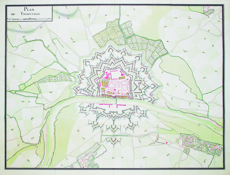
THIONVILLE. MANUSCRIT.
Plan de Thionville.
[circa 1740]. 380 x 500 mm.
Riferimento per il libraio : LBW-4176
|
|
|
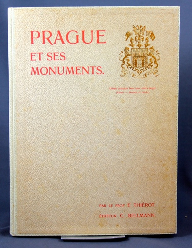
THIEROT E.; BELLMANN C:
Prague et ses monuments.
Prague, Impr. de Ch. Bellmann, 1900. 1 vol. in-4 de 43 pages, pleine percaline blanche d’éditeur, dos lisse muet, 1er plat orné aux armes. Bel état.
Riferimento per il libraio : 2244
|
|
|
Thierry DEPAULIS
*"Les cartes de la Révolution". Cartes à jouer et propagande
82 p., 13 pl. coul. + ill. n/b. Catalogue d'exposition, Ville d'Issy-les-Moulineaux, 17 nov. 1989-12 févr. 1990. Inv. 41382
|
|
|
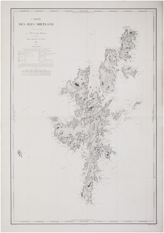
THOMAS (George).
[ÉCOSSE/ÎLES SHETLAND] Carte des îles Shetland.
[Paris], Dépôt-Général de la Marine, 1847. 902 x 610 mm.
Riferimento per il libraio : LBW-7593
|
|
|
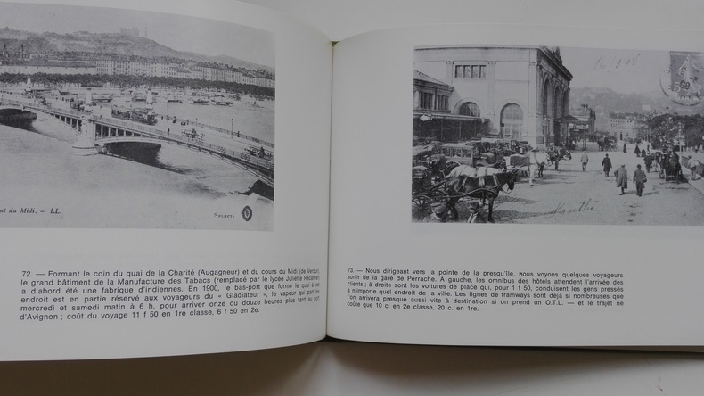
THORNE Noël
Lyon à la belle époque
Bruxelles, Editions Libro-Sciences, 1973. In-12, format à l'italenne. Cartonnage éditeur toie verte avec une llustration en noir et blanc contre-collée sur le 1er plat. 137 pages de reproductions NB de cartes postales anciennes légendées. Une petite tache sur la couverture sans gravité. Bon état de l'ensemble.
Riferimento per il libraio : 5248
|
|
|
Thomas Brothers Maps
1988 San Diego County Including Imperial County Thomas Guide
paperback. Good. Access codes and supplements are not guaranteed with used items. May be an ex-library book. paperback
Riferimento per il libraio : 0881302554.G ISBN : 0881302554 9780881302554
|
|
|
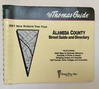
Thomas Bros Maps
Alameda County Street Guide and Directory
Irvine CA: Thomas Bros. Maps 1994. 1995 ed. Paperback. Very good to near fine-. 1 atlas 1 volume various pagings: color maps; 21 x 26 cm; color folding map attached to rear wrap verso; metal comb binding. Surprisingly scarce. Thomas Bros. Maps paperback
Riferimento per il libraio : 102220
|
|
|
Thomas Bros Maps
Alameda County street atlas and directory
paperback. Good. Access codes and supplements are not guaranteed with used items. May be an ex-library book. paperback
Riferimento per il libraio : 0881301124.G ISBN : 0881301124 9780881301120
|
|
|
Thomas Bros Maps
Alameda/Contra Costa Counties Street Guide and Directory
spiral_bound. Good. Access codes and supplements are not guaranteed with used items. May be an ex-library book. unknown
Riferimento per il libraio : 0881308587.G ISBN : 0881308587 9780881308587
|
|
|
Thomas Brothers Maps
California Road Atlas and Driver's Guide
New. spiral_bound. New. Satisfaction Guaranteed or your money back. unknown
Riferimento per il libraio : 0881305715 ISBN : 0881305715 9780881305715
|
|
|
Thomas Brothers Maps
California Road Atlas and Driver's Guide: 1995 Edition Thomas Guide California Road Atlas & Driver's Guide
New. paperback. New. Satisfaction Guaranteed or your money back. paperback
Riferimento per il libraio : 0881306886 ISBN : 0881306886 9780881306880
|
|
|
Thomas Brothers Maps
California Road Atlas and Driver's Guide
spiral_bound. Good. Access codes and supplements are not guaranteed with used items. May be an ex-library book. unknown
Riferimento per il libraio : 0881305715.G ISBN : 0881305715 9780881305715
|
|
|
Thomas Bros Maps
California Road Atlas & Driver's Guide Annual
Thomas Brothers Maps 1998-03-01. Paperback. New. In shrink wrap. Looks like an interesting title! Thomas Brothers Maps paperback
Riferimento per il libraio : Q-0881309206 ISBN : 0881309206 9780881309201

|
|
|
Thomas Brothers Maps
California Road Atlas and Driver's Guide
paperback. Good. Access codes and supplements are not guaranteed with used items. May be an ex-library book. paperback
Riferimento per il libraio : 0881304913.G ISBN : 0881304913 9780881304916
|
|
|
Thomas Brothers Maps
California road atlas: The complete driver's guide from state roads to city streets
spiral_bound. Good. Access codes and supplements are not guaranteed with used items. May be an ex-library book. unknown
Riferimento per il libraio : 0881303399.G ISBN : 0881303399 9780881303391
|
|
|
Thomas Bros Maps
California Road Atlas & Driver's Guide Annual
Thomas Brothers Maps 1998-03-01. Paperback. Like New. Like New Inside and Outside. Clean and crisp pages w/no markings! You will be pleased. Excellent book! Metal spiral. z1s220B Some very minor shelf wear on cover. Fast Shipping Thomas Brothers Maps paperback
Riferimento per il libraio : SKU1027443 ISBN : 0881309206 9780881309201
|
|
|
Thomas Bros Maps
Central Valley cities California street guide and directory Thomas Guides Maps
spiral_bound. Good. Access codes and supplements are not guaranteed with used items. May be an ex-library book. unknown
Riferimento per il libraio : 0881308633.G ISBN : 0881308633 9780881308631
|
|
|
Thomas Brothers Maps
Clark County Street Guide and Directory: 2000
spiral_bound. Good. Access codes and supplements are not guaranteed with used items. May be an ex-library book. unknown
Riferimento per il libraio : 1581740700.G ISBN : 1581740700 9781581740707

|
|
|
Thomas Bros Maps
Clark County Thomas Guide Las Vegas Street Guide
spiral_bound. Good. Access codes and supplements are not guaranteed with used items. May be an ex-library book. unknown
Riferimento per il libraio : 1581743793.G ISBN : 1581743793 9781581743791
|
|
|
Thomas Brothers Maps
Golden Gate: Marin San Francisco San Mateo & Santa Clara Counties Street Guide & Directory 1987
paperback. Good. Access codes and supplements are not guaranteed with used items. May be an ex-library book. paperback
Riferimento per il libraio : 0881302058.G ISBN : 0881302058 9780881302059
|
|
|
Thomas Bros Maps
King County street guide & directory
hardcover. Good. Access codes and supplements are not guaranteed with used items. May be an ex-library book. hardcover
Riferimento per il libraio : 0881302457.G ISBN : 0881302457 9780881302455
|
|
|
Thomas Brothers Maps
King Pierce & Snohomish Counties Street Guide & Directory
paperback. Good. Access codes and supplements are not guaranteed with used items. May be an ex-library book. paperback
Riferimento per il libraio : 0881303658.G ISBN : 0881303658 9780881303650
|
|
|
Thomas Brothers Maps
King Snohomish 1995
paperback. Good. Access codes and supplements are not guaranteed with used items. May be an ex-library book. paperback
Riferimento per il libraio : 0881306975.G ISBN : 0881306975 9780881306972
|
|
|
Thomas Brothers Maps
King-Pierce-Snohomish Counties Street Guide and Directory: 1995 Zip Code Edition
paperback. Good. Access codes and supplements are not guaranteed with used items. May be an ex-library book. paperback
Riferimento per il libraio : 0881306959.G ISBN : 0881306959 9780881306958
|
|
|
Thomas Brothers Maps
La Orange 1994-Map
Thomas Brothers Maps. paperback. Good. 0x0x0. Buy with confidence. Excellent Customer Service & Return policy. Thomas Brothers Maps paperback
Riferimento per il libraio : ANAIS-0881306355 ISBN : 0881306355 9780881306354
|
|
|
Thomas Brothers Maps
La Orange 1994-Map
paperback. Good. Access codes and supplements are not guaranteed with used items. May be an ex-library book. paperback
Riferimento per il libraio : 0881306355.G ISBN : 0881306355 9780881306354
|
|
|
Thomas Brothers Maps
Los Angeles Orange Zip 1996-Map
paperback. Good. Access codes and supplements are not guaranteed with used items. May be an ex-library book. paperback
Riferimento per il libraio : 0881307661.G ISBN : 0881307661 9780881307665
|
|
|
Thomas Brothers Maps
Map-Alameda Contra Costa-90
Good. Access codes and supplements are not guaranteed with used items. May be an ex-library book. unknown
Riferimento per il libraio : 0881303887.G ISBN : 0881303887 9780881303889
|
|
|
Thomas Brothers Maps
Map-Golden Gate Counties
paperback. Good. Access codes and supplements are not guaranteed with used items. May be an ex-library book. paperback
Riferimento per il libraio : 0881301531.G ISBN : 0881301531 9780881301533
|
|
|
Thomas Brothers Maps
Map-Orange/La Co
paperback. Good. Access codes and supplements are not guaranteed with used items. May be an ex-library book. paperback
Riferimento per il libraio : 0881301639.G ISBN : 0881301639 9780881301632
|
|
|
Thomas Brothers Maps
Map-San Bernardino-Riverside-91
hardcover. Good. Access codes and supplements are not guaranteed with used items. May be an ex-library book. hardcover
Riferimento per il libraio : 0881304433.G ISBN : 0881304433 9780881304435
|
|

 Ricevere i risultati per e-mail
 Scaricare i risultati in PDF
 RSS feed
 Link
Link


