|
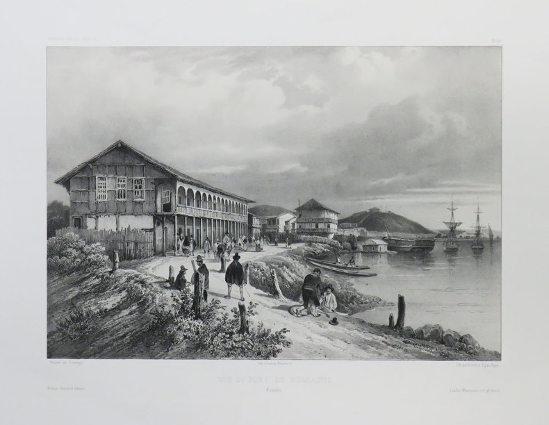
VAILLANT (Auguste-Nicolas).
[EQUATEUR] Vue du port de Guayaquil. Colombie.
[1840]. 222 x 294 mm.
Référence libraire : LBW-3676
|
|
|
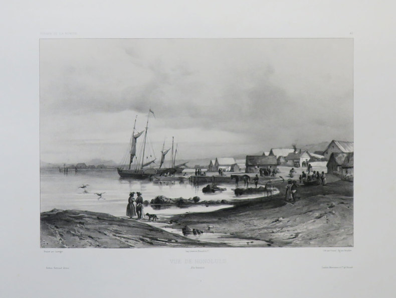
VAILLANT (Auguste-Nicolas).
[HAWAII] Vue de Honolulu. Îles Sandwich.
[1840]. 220 x 291 mm.
Référence libraire : LBW-3642
|
|
|
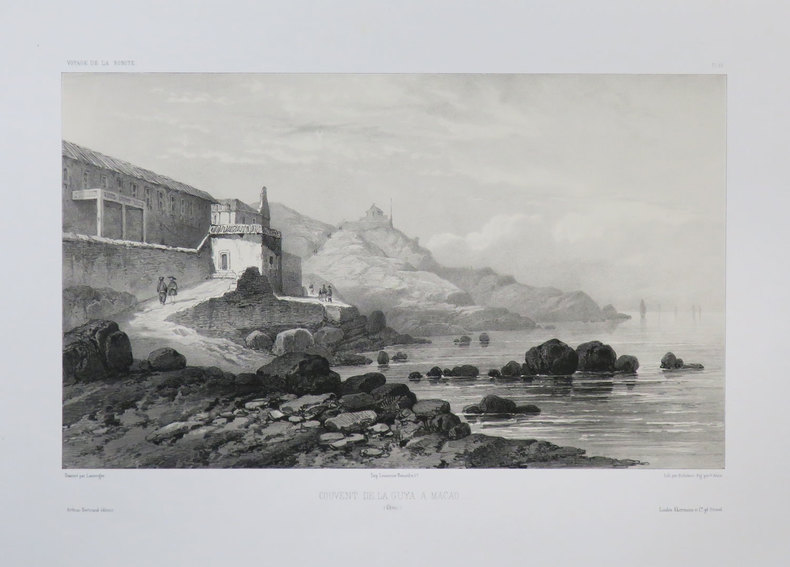
VAILLANT (Auguste-Nicolas).
[MACAO] Couvent de la Guya a Macao. (Chine).
[1840]. 219 x 322 mm.
Référence libraire : LBW-3678
|
|
|
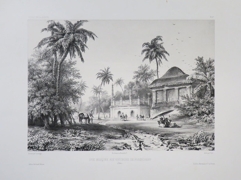
VAILLANT (Auguste-Nicolas).
[PONDICHERY] Une mosquée aux environs de Pondichéry. (Inde).
[1840]. 230 x 287 mm.
Référence libraire : LBW-3683
|
|
|
Valck, Gerard
Tabula Ducatuum Livoniae et Curlandiae recentior: incisa editaque per Gerardum Valck. Kupferstichkarte von Gerard Valk [Valck] (1650/51-1720) in altem Kolorit.
Amsterdam, [ca. 1680]. Plattenmaß: 59,5 x 48 cm [Blattmaß: 62,5 x 52,5 cm]. Mit kolorierter barocker Titelkartusche (oben links) u. zweifachem Maßstab.
Référence libraire : 52698

|
|
|
VALENCIENNES. . .
Carte au 1/200 000e. Sans date.
Une feuille 32x50 cm.
|
|
|
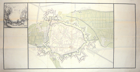
VALENCIENNES. MANUSCRIT.
[Valenciennes].
circa 1760 498 x 1070 mm.
Référence libraire : LBW00283
|
|
|
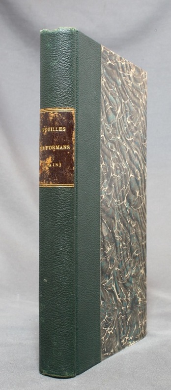
VALENTIN-SMITH J.-E.:
Fouilles dans la vallée du Formans (Ain) en 1862. Documents pour servir à l'histoire de la campagne de Jules César contre les Helvètes [relié avec] Les fouilles dans la vallée du Formans d'après un compte-rendu allemand.
Lyon, Librairie ancienne d'Auguste Brun / Imprimerie Mougin-Rusand, 1888. Grand in-8 de VII-153-[3]; [2]-4-[2] pages, demi-percaline verte, pièce de titre marron au dos, toutes les couvertures conservées.
Référence libraire : 14664
|
|
|
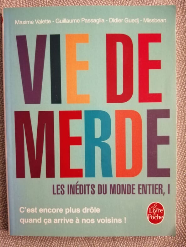
Valette Maxime Passaglia Guillaume Guedj Didier Missbean
Vie de Merde : les inédits du monde entier tome 1
LGF 2012 96 pages 14x1 8x18 4cm. 2012. pocket_book. 96 pages.
Référence libraire : 500196306
|
|
|
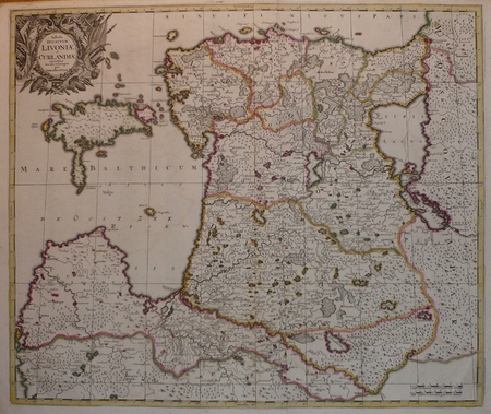
VALK (Gerard).
[LETTONIE/ESTONIE] Tabula ducatuum Livoniae et Curlandiae.
Amsterdam, [circa 1700]. 487 x 578 mm.
Référence libraire : LBW04172
|
|
|
VALLAUD Pierre
La Seconde Guerre Mondiale. Collection : Témoins de l'histoire.
Paris, France Loisirs, 2002. 18 x 25, 703 pp., très nombreuses illustrations en N/B et en couleurs, cartonnage d'édition + jaquette, état neuf.
Référence libraire : 30590
|
|
|
VALLET
Carte couleurs au 1/50 000?.
Une feuille 70x60 cm.
|
|
|
VALLOT (Henri) & VALLOT (Joseph).
[HAUTE-SAVOIE/CHAMONIX-MONT-BLANC] Environs de Chamonix extraits de la carte du massif du Mont Blanc (Édition touristique).
Paris, Girard et Barrère, 1934. 481 x 428 mm.
Référence libraire : LBW-8226

|
|
|
VALLOT Ch.:
Autour du Mont-Blanc. Choix d'excursions.
Paris, Girard, Barrère et Thomas, 1947. In-12 broché de 115-[15] pages, dos de toile bleue avec étiquette de titre (incomplète).
Référence libraire : 14347

|
|
|
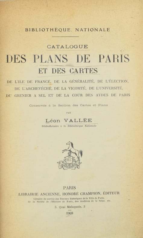
Vallée (Léon).
Catalogue des plans de Paris et des cartes de l'Île-de-France de la généralité, de l'élection, de l'archevêché, de la vicomté, de l'Université, du grenier à sel et de la Cour des aydes de Paris, conservés à la Section des cartes et plans.
Paris, Honoré Champion, 1908. In-8 de II-576 pp., index, demi-maroquin prune, dos à nerfs, tête dorée, couverture et dos conservés (Honnelaître).
Référence libraire : 42603
|
|
|
VALLÉE, Léon.
Catalogue des Plans de Paris et des Cartes de l'île de France, de la généralité, de l'élection, de l'Archevêché, de la Vicomté, de l'Université, du grenier à sel et de la Cour des Aydes de Paris conservés à la Section des Cartes et Plans.
Paris, Librairie Ancienne, Honoré Champion, éditeur, 1908. In-8 - 25,5 x 17 cm. Reliure en demi-toile noire, dos lisse, pièce de titre en chagrin vert souligné de doubles filets dorés, tête mouchetée, couvertures conservées et montées sur onglets. II, 576 pages paginées, 2 feuillets. Précieux exemplaire avec envoi autographe signé de l'auteur sur la page de titre à Léon Bourgeois : « à Monsieur Léon Bourgeois / Respectueux hommage de son reconnaissant et tout dévoué L. Vallée ». L'ouvrage ayant paru peu avant la mort de Vallée, survenue en 1908, cet envoi compte parmi les derniers témoignages autographes du bibliographe. Le destinataire, Léon Bourgeois (1851–1925), homme d'État républicain, président du Conseil en 1895–1896, président du Sénat de 1920 à 1923 et lauréat du prix Nobel de la paix en 1920, était l'une des figures les plus éminentes de la Troisième République.
Référence libraire : 2877

|
|
|
VALVERDE Y ÁLVAREZ, Emilio (1848-1894).
Atlas de la Península Ibérica, islas adyacentes y posesiones de ultramar. Provincia de Madrid.
Madrid, Litografía A. Foruny, s.a. (1880). Un mapa de 56 x 39 cm., Escala 1:750000, plegado y contenido en carpeta de cartón.

|
|
|
VAN CHI-BONNARDELLE R?gine
Grand atlas du continent africain, sous la direction de R. Van-Chi-Bonnardelle.
Reliure toile de l'?diteur. 335 pages. 30x40 cm.
|
|
|
VAN DEN HAUTE, Robert.
Woluwe en cartes postales anciennes.- Woluwe in oude prentkaarten.
Petit in-8 oblong, 76 cartes en n&b., reliure cartonnage editeur illustrée.- RARE Tres bon état. [BU-11]
|
|
|
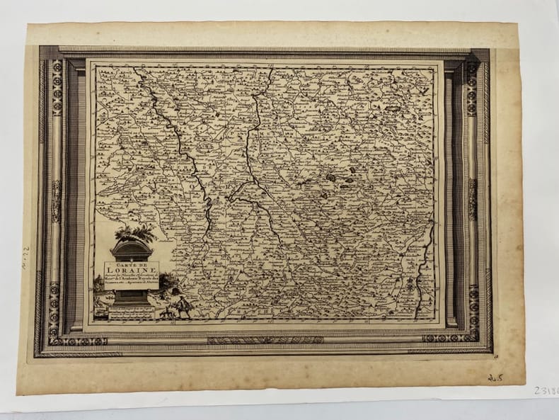
VAN DER AA.
Carte de Lorraine. suivant les Nouvelles Observations de Messieurs de l'Académie Royale des Sciences, etc. Augmentées de Nouveau.
(c.1729), 26.5 x 39.5 cm - feuille : 31 x 42 cm , contrecollée sous passe-partout volant Marge supérieure découpée et restaurée.
Référence libraire : 231860
|
|
|
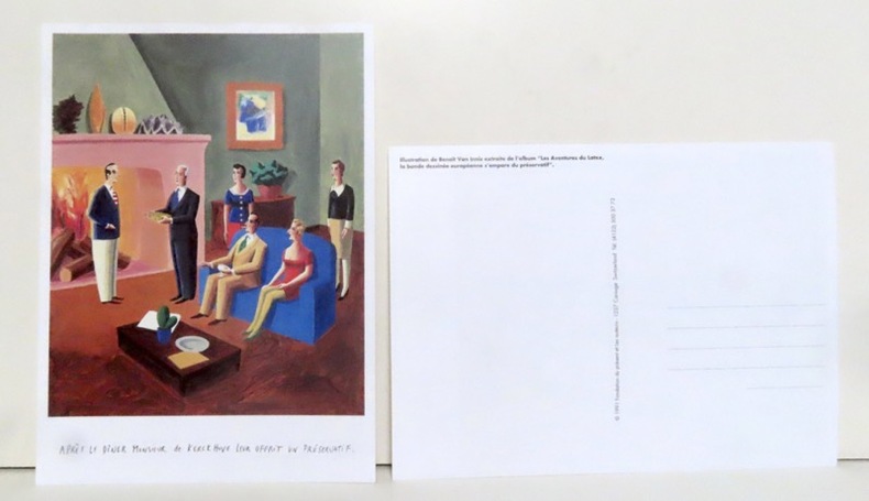
Van Innis Benoît:
Après le dîner Monsieur de Kerckhuve leur offrit un préservatif.
Carouge, Fondation du présent et les auteurs, 1991. Grande carte postale (16x22), représentant une illustration extraite de l'album "Les aventures du latex, la bande dessinée européenne s'empare du préservatif".
Référence libraire : 14343
|
|
|
VAN VALKENBURGH, Richard F ADAMS, Lucy Wilcox and MCPHEE, John C (editors); Charles Keetsie Shirley (maps)
Diné Bikéyah The Navajo's Country
Window Rock AZ: United States Department of the Interior Office of Indian Affairs Navajo Service 1941. First Edition. Small quarto 26.25cm; mimeographed sheets printed recto and verso and side-stapled into illustrated wrappers; vi 180pp 20; illus. Former owner's name in ink to front wrapper with chipping thin splits and short tears to same; thin vertical paint streak to rear wrapper; text remains fresh and clean; Very Good.<br /> <br /> Guide book and gazeteer of the Navajo country and adjacent regions compiled by Richard Fowler Van Valkenburgh a former Bureau of Indian Affairs worker and long-time archeological assistant with the L.A. County Museum of History Art and Science. Contains a 4pp key to the Navajo alphabet palatalization and labialization an extensive list of Navajo place names providing detailed information regarding their origins history and significance. Illustrated throughout with maps drawn by Charles Keetsie Shirley. Scarce in commerce. United States Department of the Interior, Office of Indian Affairs, Navajo Service unknown
Référence libraire : 21072

|
|
|
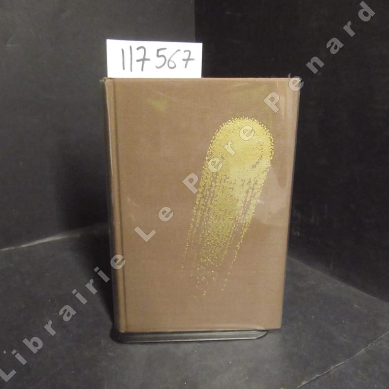
VANCE, Jack - Illustrations de Caza - Traduit par Michel Deutsch - Introduction par Jacques Chambon et Jean-Pierre Fontana
Tschaï 2
1971 Editions Opta, collection "Club du Livre d'Anticipation" (CLA) N° 34 - 1971 - In-8, reliures toilée marron avec titre doré au dos et décor (comète) doré sur le premier plat, sous rhodoïd - VII + 337 pages - Avec sa carte dépliante - Illustré de dessins originaux de Caza - Exemplaire numéroté N° 5486 / 6000
Référence libraire : 117567
|
|
|
VANCOUVER George.
Voyage de découvertes, à l’océan Pacifique nord, et autour du monde, entrepris par ordre de sa majesté Britannique, exécuté, pendant les années 1790, 1791, 1792, 1793, 1794 et 1795, par le capitaine George Vancouver. Traduit de l’Anglais par P.F. Henry. ATLAS Seul.
Paris, Didot jeune, an X (1802), ATLAS in-8(190x130mm), basane époque, dos lisse orné, manque au dos, brunissures en début et fin d’ouvrage, mouillure claire, légères rousseurs. ATLAS seul de l’édition in-8. Complet de ses 18 planches et 8 cartes dépliantes, De la bibliothèque de Joseph de Lazerme avec son ex-libris et timbre sec
Référence libraire : PHO-2092

|
|
|
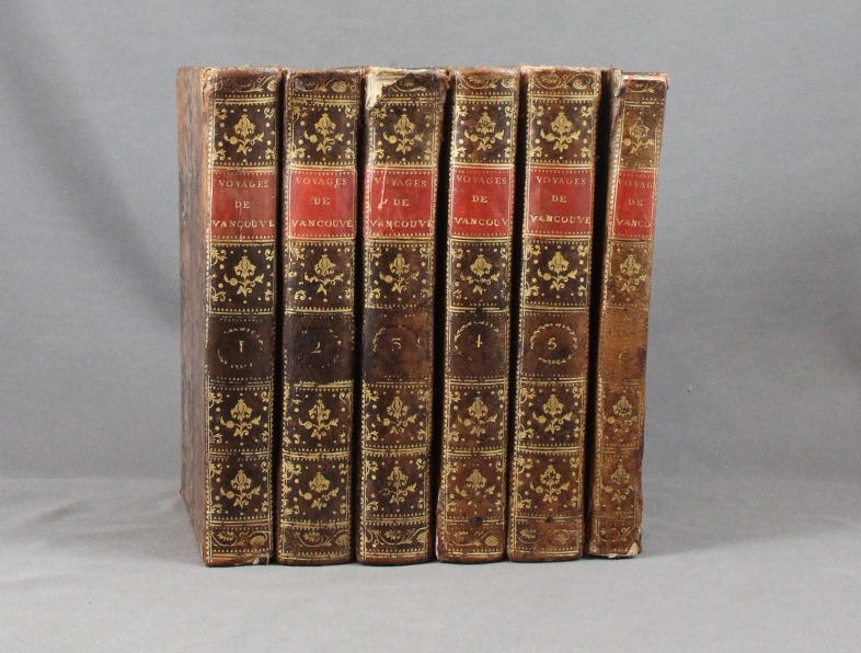
VANCOUVER George:
Voyage de découvertes, à l'océan Pacifique du nord, et autour du monde, entrepris par ordre de sa Majesté Britannique, exécuté, pendant les années 1790, 1791, 1792, 93, 1794 et 1795, par le capitaine George Vancouver. Traduits de l'anglais par P. F. Henry.
Paris, Didot jeune, an X. 6 volumes in-8 de [4]-VIII-341p., [4]-384p., [4]-381p., [4]-368p., [4]-438p., et un atlas de [4]p., 17 vues et 9 cartes, plein veau moucheté, dos lisses ornés de filets et fleurons dorés, pièces de titre rouge. Reliures un peu malmenées, coiffes frottées, mors un peu fendus, épidermures, auréoles pales à trois volumes, plus présentes dans l'atlas. Chaque première page est frappée d'un large tampon non identifié par votre serviteur.
Référence libraire : 6293
|
|
|
VAR
Carte d?partementale couleurs au 1/200 000?me. Sans date.
Une feuille. 78x60 cm.
|
|
|
VAR
Carte d?partementale couleurs au 1/200 000e. Sans date.
Une feuille 60x80 cm.
|
|
|
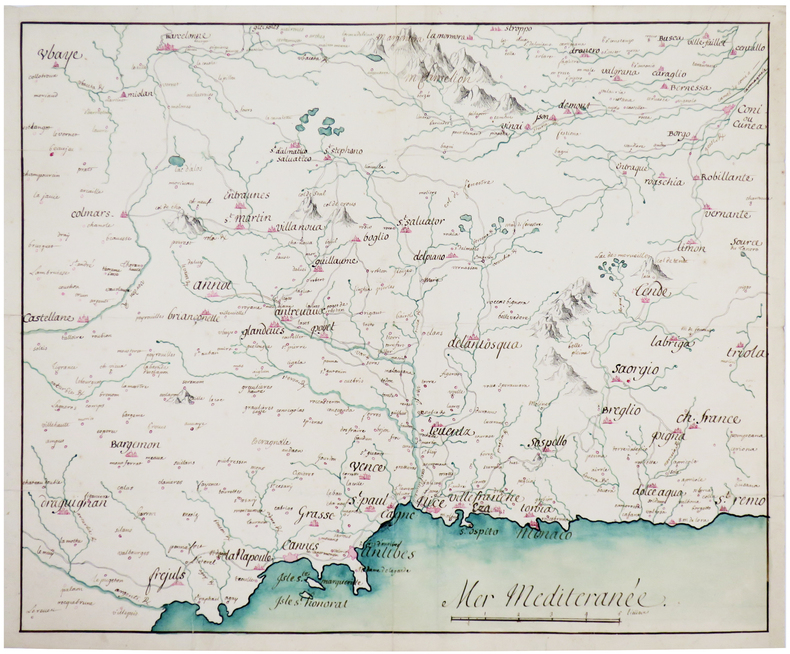
VAR. MANUSCRIT.
Costes de Provence. Fréjus, Antibes, Nice, Monaco.
[circa 1750]. 366 x 444 mm.
Référence libraire : LBW-4141
|
|
|
Varganov, Alexei
Suzdal / Souzdal / Susdal
No marks or inscriptions. A very clean very tight copy with bright unmarked boards, bump to spine foot and no bumping to corners. Dust jacket not price clipped or marked with small nicks/tears to edges and crease to front dust flap. 175pp. The history, buildings, archtecture and people of the ancient Russian town of Suzdal. Mostly captioned colour and black & white photographs. Text in Russian, English, French and German. Very scarce in the UK.

|
|
|
VARIGNY C(de)
Nouvelle géographie moderne des cinq parties du Monde. Premier volume ASIE
in 4 pleine toile rouge éditeur,titre doré,au dos et sur le premier plat.Faux-titre, frontispice,titre avec vignette, 322 pages,tranches dorées,illustrations hors-texte certaines par FRAIPONT dont une en couleurs,cartes en couleurs,A la librairie illustrée sans date Asie Mahométane:La Turquie d'Asie,Arménie et la Mésopotamie La Syrie et Palestine,Sinaï,Arabie,Perse,Asie Anglaise : L'Afghanistan,le Baloutchistan,L'Empire des Indes,Asie Russe:La Caucasie,Turkestan Le),Sibérie(la),L'Asie Bouddhiste:Empire de Chine,Tibet(Le),Turkestan Chinois, Mongolie,La Corée,L'empire du Japon,Indo-Chine,L'Annam,Le Tonkin,La Cochinchine,La Birmanie.
Référence libraire : 5179
|
|
|
Various Contributors
The Illustrated London News, 12 August 1944
Cover: Our Royal Field-Marshal (King George VI) Viewing the Fighting in Italy. Features include: Our Notebook; Book Review: "Excellenz X: The Leader of To-Morrow's Germans" by R.G. Waldeck; The Great World War: What Next on the Eastern Front? (inc maps); Books of the Day; and The World of Science: Summer's Emptying Nests. Pictorial Journals include: The King (George VI) in Italy: His Majesty Awards Honours and Decorations; Obstacles in the Path of Our Normandy Advance: German Defensive Methods in a Compact Countryside (illustrated by Captain Bryan de Grineau); Britain's 17-Pounder: More than a Match for German Tanks (illustrated by G.H. Davis); The Armour Against Us: Some Details of Germany's Modern Armoured Vehicles in Use in Normandy To-Day (illustrated by G.H. Davis); Blazing the Trail: Bulldozers Carving Roads Through Debris in Normandy; The Allied Offensive in Normandy: Montgomery's Great Drive; Scenes of Action at Caumont and Other Sites; Advance in Normandy: The Type of Landscape Our Forces Experience; The Devastation of Modern War: St. Lo Cathedral and Other Ruined Sites; Three Famous Places in Brittany - Now in the War News; The Scene of an Invasion Rehearsal - The Invasion Staged in Reality; The 14th Army's Success in Burma Amid Arduous Conditions; Warsaw Yesterday: Poland's Capital Under Nazi Domination; The War From Varied Angles: Topicalities Recorded by the Camera; Flying Our Wounded Home From the Battlefields of Normandy (Illus. by Flight Lieut. H.W. Hailstone); Dover-Photographed by the Enemy for His Cross-Channel Guns; and A Puzzle Posed by High-Speed Photographs of a Bullet in Flight. Prior owners ink stamp with some writing centre front cover. Some ink smudges to back cover. Contents clean and unmarked. Moderate wear. Book

|
|
|
Various Contributors
The Illustrated London News, 22 July 1944
Cover: The First Entry of Canadians into Caen. Features include: Our Notebook; Book Review: "The Bank of England: 1694 - 1944" by Reginald Saw; The Great World War: Moving on in Italy (inc maps); Books of the Day; and The World of Science: Wood Comes of Age. Pictorial Journals include: In Liberated Caen: The Mayor Hoisting the Tricolour; Caen After the Battle: The Key City of Lower Normandy, whose Capture Marked a Valorous British Victory; Two Aerial Photos: German Atlantic Wall, Eastern Section of the Cherbourg Peninsula; On the Western Front (Battle of Normandy): War and Its Aftermath; On the Western Front: Scenes From the Battle Zones of British and American Armies in Normandy; The Red Army Surges On: Important Cities in the Path of Battle; A Lancashire Fusilier's V.C.: Fusilier (Francis Arthur) Jefferson, Single-Handed, Breaking Up an Enemy Tank Attack (illustrated by Captain Bryan de Grineau); The Onward Advance of Gen. Alexander's Armies: War Scenes at Castiglione, Lake Trasimeno, The French Entry into Siena; Mediaeval San Gimignano and Its Towers; The War in Burma: The Clearing of the Kohima-Imphal Road; The Japanese Main Fleet Caught Napping - Another U.S. Sea Victory (Battle of Philippine Sea); New Additions to our Fighting Power: Flying Bombs from Start to Finish; A Threatened View - Durham Cathedral from River and Railway (illustrated by Sir Muirhead Bone); and War's Trail of Devastation in Normandy: Historic Buildings Wrecked in Fierce Armoured Battles on the Allied Front. Binding sound. Clean and unmarked with minimal wear. A quality copy. Book

|
|
|
Various Contributors
The Illustrated London News, 23 September 1944: The Invasion of Holland
Cover: Le Touquet, France Canadian Soldiers Walking Along Promenade. Features include: Our Notebook; Book Review: "Norfolk Portraits" by R.W. Ketton-Cremer; The Great World War: Is This the Final Round? (inc maps); Books of the Day; and The World of Science: The Problem of Migrating Birds. Pictorial Journals include: Stubborn Resistance - American Troops in Moving Up for the Final Assault; The Greatest of Airborne Operations - The Invasion of Holland; Canals and Rivers of the Netherlands, Scene of a Vital Battle (inc map); Le Havre: The British Capture of the Important Enemy-Held Port; Infantry and Flame-Throwers in Action: Some of the Prisoners; The Triumphant Advance of the Allies: Scenes of Liberated France and Belgium; The Dutch Landscape Covered with Grounded and Falling Allied Parachutes; The First Penetration By U.S. Troops of the Siegfried Line; The A.V.R.E.: A British Mortar Tank Designed for Breaching Fortifications; The Battle of Britain Commemoration Service in Westminster Abbey on Sunday, September17, 1944; Secrets of the Flying Bomb: Constructional Details Revealed; The Mystery Structure Near St. Omer - Believed a Long-Range V-2 Base; The Quebec Conference, 1944; War Items of Interest; Pencil Studies of Gandhi and Jinnah, Who Recently Met in Bombay (illus. by Feliks Topolski); and Norman Wilkinson's Exhibition of "War at Sea" Paintings in London. Advertising cover: moderate to excessive wear, with prior owners ink stamp with some writing centre front cover. Page 339/340 missing. Page 361/362 loose but present. Covers loose and taped at fold. Contents clean and unmarked. A worthy reading copy. Book

|
|
|
Various Contributors
The Illustrated London News, 3 March 1945
Cover: A Triumph of Road-making: The First Allied Convoy to China to Break the Japanese Blockade. Features include: Our Notebook; Book Review: "Persons and Places" by George Santayana; The Great World War: The American Passage of the Roer (inc maps); Books of the Day; and The World of Science: The Locust's Year of Decision. Pictorial Journals include: The Rocket That Would Not Go Up! - Photos of an ill-fated rocked experiement by Herr Johannes Winkler in 1932; U-Boat Warfare - 1939 - 1945: A Survey of Changing German Submarines and Tactics in a Never-Ceasing Battle (Illus. by G.H. Davis); War Scraps: Incidents at the Front and Behind the Lines; On the Western Front: The American Advance into Germany; Battle Incidents with the Third and Seventh U.S. Armies; The Battle for Goch: British Troops in the Wrecked German Fortress Town; General Crerar's Offensive: The Storming of Cleve (Illus. by Capt. Bryan de Grineau); General Crerar's Offensive: British Troops in Mortal Combat With the Germans in the Reichswald (Illus. by Capt. Bryan de Grineau); The Zeitz Synthetic Oil Plant: Before the R.A.F. Attack - And After; War in the Pacific: Luzon Island and Iwo Jima; With the Red Army: Scenes From Liberated Poznan; Bombed Bath: Proposals for Replanning; and Masterpieces of Painting From the Cook Collection. 8" opening to page 241/242. Remaining contents clean and unmarked with minimal wear. A worthy copy. Book

|
|
|
Various Contributors
The Illustrated London News, Saturday, June 17, 1939 - Cover Photos of the King and Queen with President And Mrs. Roosevelt
36 pages. Features: Photos of the memorial services for the "Thetis" victims; Photos of Axis Activities - "Volunteers" return from Spain - Italy's Navy Day - Kondor Legion goose-steps past Hitler; Maps of the strenuous Royal Tour; Cross-section illustration and photos of their Majesties' "Royal Yacht" for their return to England in the "Empress of Britain"; Great photos of unusulally-placed bird nests; Amazing illustrations of the feet of various Australian animals; Colour photos of pageantry at the Aldershot Tattoo; Photos of the Royal Tour through the Rockies from Banff to the Pacific; Five photos of the Royals in British Columbia; Photos of the Royals returning eastward across Canada to Niagara; The King and Queen in Washington - photos; The Royals in New York City; Classy two-color ad for Wills's Gold Flake cigarettes; and more. Average wear. Unmarked. First three pages loose but present. Pages 1127-28 and 1131-32 and any pages after 1134 are not included. Despite its deficiencies, still a worthy copy. Magazine

|
|
|
VAUBAN par Adrien MELLION.
Vauban, l'homme de guerre, l'homme d'état, l'homme privé. Portrait gravé, cartes.
Paris, Librairie Générale des Publications Populaires 1886. Bel exemplaire relié, rel. demi toile avec coins, gd in-8, 143 pages.
Référence libraire : AUB-3781
|
|
|
VAUCLUSE.
Nouvelle carte départementale. Vaucluse.
1910 carte en coul., rempl. de 60X80 cms, couverture imprimée. Paris André Lesot (ca.1910),
Référence libraire : 6936
|
|
|
VAUGONDY, ROBERT DE
L'Empire de La Chine dressé d'après les cartes de l'Atlas Chinois
Paris. 1751. Engraved map 48 x 52.2 cm; 51 x 67.6 cm sheet provinces highlighted with outline hand-colour elaborate title cartouche central fold small tear at the foot affecting the border old paper repair on the verso affecting the margin only pin-holes to the four marginal corners margins a little browned and dusty a handsome map in good condition. Fine large format map showing China Korea Taiwan and parts of Central Asia prepared for De Vaugondy's "Atlas Universel". The beautifully foliated cartouche features a duo of joyful Chinese musicians one dancing and a diminutive figure holding a parasol. <br> <br>From the Estate of the late collector and scholar Arthur Hacker. . unknown
Référence libraire : 177606
|
|
|
Vaugondy, Robert de
Karte von Rußland: Partie Occidentale de l´Empire de Russie, ou se trouve distinguee la Russie Europeenne.
O. O. [um 1750]. Grenzkolorierte Kupferstich-Karte mit Kartusche links oben. Blattgröße: 49,5 x 65,5 cm. Am Kopf bis in den Plattenrand beschnitten und etwas wasserrandig. An den Rändern stellenweise etwas bestoßen und mittig am Fuß mit kleinem Darstellungsverlust.
Référence libraire : 35070

|
|
|
VAUGONDY, ROBERT de - RUSSIA.
Partie Occidentale de L'Empire de Russie, ou se trouve distinguée La Russie Européenne...(Paris), 1750.
A large engraved cont. handcoloured map of the Northern part of Russia from Novaja Semlja in the north to the Caspian Meer in the South, from Finland to Jakusskkáy, measuring 48,5 x 62 cm. Folded in center. A few tears in margins.
|
|
|
VAUGONDY, ROBERT de - RUSSIA.
Partie Occidentale de L'Empire de Russie, ou se trouve distinguée La Russie Européenne...(Paris), 1750.
A large engraved cont. handcoloured map of the Northern part of Russia from Novaja Semlja in the north to the Caspian Meer in the South, from Finland to Jakusskkáy, measuring 48,5 x 62 cm. Folded in center. A few tears in margins.
Référence libraire : 16523
|
|
|
Vaugondy, Robert de.
Antiquor[um] Imperiorum Tabula [...]. [Paris], Robert de Vaugondy, 1757.
Engraved map (73 x 52 cm), hand-coloured in outline. This finely engraved map, published in Vaugondy’s “Atlas Universel”, extends to the Caspian Sea in the north, in the west to show Greece, east to the Indus River, and south to include the Red Sea and the Nile River valley. Almost the whole of Arabia is blank and unexplored, but parts of Oman and the cities and places along the Arabian Gulf are indicated. In good condition. National Maritime Museum Cat. I, 317. Al Ankary 185.
|
|
|
VAUTHEY, P, Docteur (Pour la notice médicale) -Cartes & Plans de E. FONNE
Guide pratique de VICHY et environs - La Saison, La cure, Les Eaux, Notice médicale, Les Fêtes, Promenades, Excursions
LYON, guides Pol - In-16 - 7 Edition, vers 1914 - Brochée - 7 plans, 4 cartes dont 1 HT dépliante, 2 profils de route, Gravures en texte - 92 pages + environ 60 pages de publicités régionales, certaines illustrées - Propre
Référence libraire : 13093
|
|
|
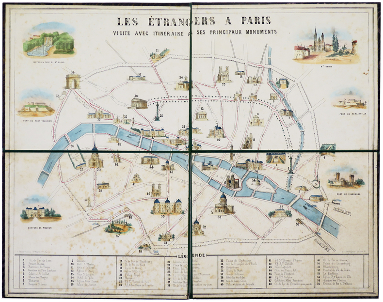
VAYRON (François Benjamin).
Les étrangers à Paris. Visite avec itinéraire à ses principaux monuments.
Paris, G. Gautier, 1855. En 4 feuilles montées sur carton fort doublé de percaline moirée et repliées, de 495 x 630 mm.
Référence libraire : LBW-5731
|
|
|
VE Et al (John T Lonsdale Director) Barnes, Illustrations and Maps B/W Photos V E
Stratigraphy of the Pre-Simpson Paleozoic Subsurface Rocks of Texas and Southeast New Mexico
University of Texas 1959. Price HAS BEEN REDUCED by 10% until Monday June 29 SALE item 836 pp. two volumes maps paperbacks ex library else text and binding clean and tight. - If you are reading this this item is actually physically in our stock and ready for shipment once ordered. We are not bookjackers. Buyer is responsible for any additional duties taxes or fees required by recipient's country. University of Texas paperback
Référence libraire : ZB1332156
|
|
|
Veiatlas Norge: Veikart = road maps = Strassenkarten 1:300 000 : bykart = city maps = Stadtplane 1:20 000 (Norwegian Edition) [U
Veiatlas Norge: Veikart = road maps = Strassenkarten 1:300 000 : bykart = city maps = Stadtplane 1:20 000 Norwegian Edition Unknown Binding Veiatlas Norge: Veikart = road maps = Strassenkarten 1:300 000 : bykart = city maps = Stadtplane 1:20 000 Norwegian Edition Unknown Binding
Veiatlas Norge: Veikart = road maps = Strassenkarten 1:300 000 : bykart = city maps = Stadtplane 1:20 000 Norwegian Edition Unknown Binding <br/><br/>Veiatlas Norge: Veikart = road maps = Strassenkarten 1:300 000 : bykart = city maps = Stadtplane 1:20 000 Norwegian Edition Unknown Binding Veiatlas Norge: Veikart = road maps = Strassenkarten 1:300 000 : bykart = city maps = Stadtplane 1:20 000 Norwegian Edition Unknown Binding unknown
Référence libraire : BN92838 ISBN : 8279450025 9788279450023
|
|
|
VELICKOVIC (Vladimir).
Menu illustré d'une gravure originale signée.
Paris Société Les Amis du livre contemporain 2003 1 vol. Broché Menu dépliant sur Arches illustré d'une lithographie (35 x 25 cm) signée par Vladimir Velickovic. En parfait état.
Référence libraire : 109143
|
|
|
VELICKOVIC (Vladimir).
Menu illustré d'une gravure originale signée.
Paris Société Les Amis du livre contemporain 2003 1 vol. Broché Menu dépliant sur Arches illustré d'une lithographie (35 x 25 cm) signée par Vladimir Velickovic. En parfait état.
Référence libraire : 109143
|
|
|
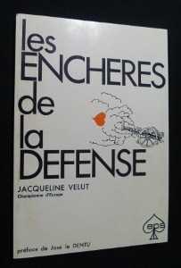
Velut Jacqueline
Les Enchères de la Défense
Les Editions de la presse spécialisée Broché 1971 In-8, (18x12.5 cm), broché, 90 pages, préface de José le Dentu ; plats légèrement défraîchis, bon état. Livraison a domicile (La Poste) ou en Mondial Relay sur simple demande.
Référence libraire : nf185
|
|
|
VENDEE
Nouvelle carte d?partementale. Sans date.
1 feuille repli?e 80x60 cm.
|
|

 Recevoir par e-mail
 Télécharger en PDF
 Flux RSS
 Lien permanent


