|
TSCHUDI, Iwan von:
Der Turist in der Schweiz und den Grenzrayons. Reisetaschenbuch. 33., neu bearb. Auflage.
Zürich, Orell Füssli, 1895, kl. in-8°, 6 gelbe Blätter (Werbung & Index) + XXXIV + 534 S. + 9 gefalt. Panoramas + 6 gefalt. Stadtplänen + 11 Karten, und als Vorsatz hinten 1 Doppelblattgrosses Routekärtchen der Schweiz + 1 gef. Touristenkarte der Schweiz am Schlusse des Buches, roter Original-Leinenband, Schönes Exemplar.
Référence libraire : 137129aaf
|
|
|
TT Maps & Publications Ltd
Himachal Pradesh: With trekking routes TTK discover India series
paperback. Good. Access codes and supplements are not guaranteed with used items. May be an ex-library book. paperback
Référence libraire : 8170530660.G ISBN : 8170530660 9788170530664

|
|
|
Tt Maps & Publications Ltd
Kerala Discover India Series
paperback. Good. Access codes and supplements are not guaranteed with used items. May be an ex-library book. paperback
Référence libraire : 8170530164.G ISBN : 8170530164 9788170530169
|
|
|
TT Maps & Publications Ltd
Odisha Road Guide
paperback. Good. Access codes and supplements are not guaranteed with used items. May be an ex-library book. paperback
Référence libraire : 8170530857.G ISBN : 8170530857 9788170530855
|
|
|
TT Maps & Publications Ltd
Sikkim Discover India series / TT. Maps
paperback. Good. Access codes and supplements are not guaranteed with used items. May be an ex-library book. paperback
Référence libraire : 8170530962.G ISBN : 8170530962 9788170530961
|
|
|
Tucazinsky, Nissan Aharon
The Borders of the Holy Land: Jerusalem in Pictures [IN HEBREW] Supplement to the Book "The Holy City & Temple"
In Hebrew. 180X250 mm. 43+4+12 + 55 Plates. Gilt Hard cover with dust jacket. Dust Jacket slightly torn on the upper edge. Cover and spine slightly worn. Yellow pages. Name of previous owner written on the first white page and on title page. Else in good condition. Includes Maps, Photos and Illustrations.
|
|
|
Tucker Glenn; maps by Dorothy Thomas Tucker
Dawn Like Thunder: The Barbary Wars and the Birth of the U.S. Navy
Indianapolis: Bobbs-Merrill 1963. 1st. Hardcover. Book fine Dust jacket fine. The dust jacket is price clipped and has minor chips and closed tears to the extremities. <br/><br/> Bobbs-Merrill hardcover books
Référence libraire : 9010503
|
|
|
Tucker Glenn; Tucker Maps WT. W. T.
Poltroons and Patriots: A Popular Account of the War of 1812 Two volumes
Bobbs-Merrill 1954. Very Good. Tucker Glenn. Poltroons and Patriots: A Popular Account of the War of 1812 Two volumes. Tucker Maps W.T. Indianapolis: Bobbs-Merrill 1954. 812pp. Indexed. Illustrated. 8vo. Cloth with gilt lettering. Book condition: Very good with lightly bumped and yellowed spines. Slipcase is very good with light rubbing and yellowing. Includes monthly bulletin of American History Publication Society. Bobbs-Merrill hardcover books
Référence libraire : UTUCPOL00JMJ
|
|
|
Tufte, Edward R.
Envisioning Information
A clean, unmarked book with a tight binding. 126 pages. Slight edge wear and marks to dust jacket. "Revealed here are design strategies for enhancing the dimensionality and density of portrayals of information -- techniques exemplified in maps, the manuscripts of Galileo, timetables, notation describing dance movements, aerial photographs, the Vietnam Veterans Memorial, electrocardiograms, drawings of Caler and Klee, computer visualizations, and a textbook of Euclid's geometry." Later printing.

|
|
|
TUNBRIDGE WELLS.
Barnett's Official Street Plan of Tunbridge Wells. With Road Map of Kent, Plans of Tonbridge, London Boroughs & Postale Districts. Also Map of the M2 Motorway. BRIGHT, CLEAN COPY
Folding street plan in red and black on paper, measuring 25.0 x 20.0 ins (approx. 63.5 x 51.0 cms) folding in 16 panels to 9.0 x 5.5 ins (approx. 23.0 x 14.0 cms); original printed wrappers in orange and black, yapped edges, covers very lightly age-soiled else a very good, bright, clean copy. With numerous trade advertisements.

|
|
|
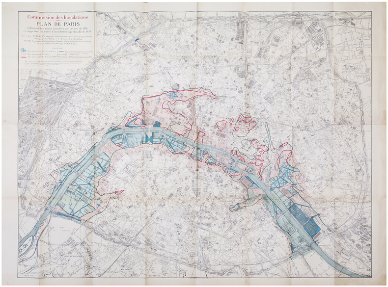
TUR (Paul Henri) & BOREUX (Léon Claude).
[INONDATIONS de 1910] Commission des Inondations. Plan de Paris indiquant les zones inondées par la crue de 1910 et rappelant les zones d'inondation superficielle de 1658.
Paris, Librairie Chaix, 1910. 0,93 x 1,18 m.
Référence libraire : LBW-6846
|
|
|
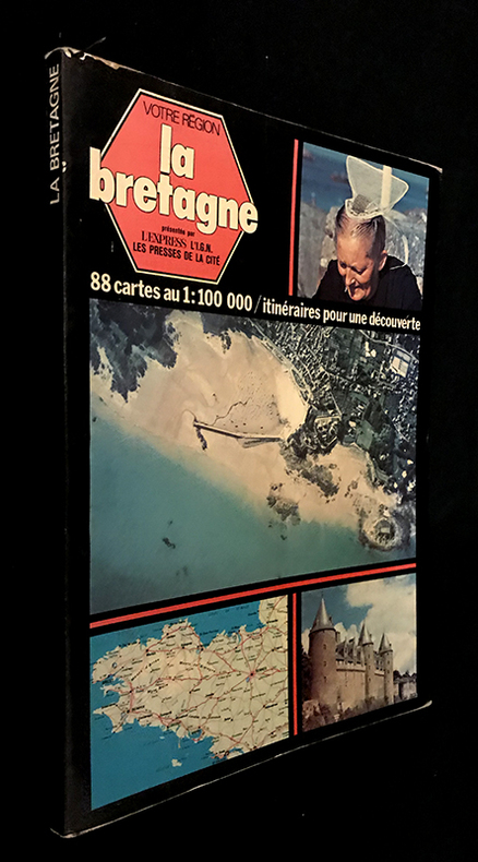
Turin Jeanne
Votre région : La Bretagne (avec 88 cartes au 1:100 000 / itinéraires pour une découverte)
L'express, Les Presses de la cité, l'I.G.N Votre région Broché 1977 In-4 (20.5 x 28 cm), broché avec rabats, couverture illustrée en couleurs, 126 pages, préface d'Olivier Philip, présentation d'Henri Queffélec, textes de Jeanne Turin, avec 88 cartes en couleurs au 1:100 000 / itinéraires pour une découverte et photographies en couleurs in et hors-texte ; coiffes et bords frottés, pliures et marques d'usage à la couverture, notes manuscrites à la dernière garde, assez bon état. Livraison a domicile (La Poste) ou en Mondial Relay sur simple demande.
Référence libraire : fm651
|
|
|
Turner, Colonel A. G. (editor)
Trans-African Highways
No marks or inscriptions to contents. No creasing to covers or to spine. A clean very tight copy with very slightly marked boards, dusty page edges and bumping to some corners. A small piece of a fair number of the lower edges of adjacent pages has been clipped away/pierced - with no effect on any of the maps or text. 548pp. A fascinating trip around Africa with great detail giving mile-by-mile information and all the place names for all of the major road routes.

|
|
|
Turner, Reverend Mr
A VIEW OF THE EARTH: Being a Short But Comprehensive System of Modern Geography
London: Printed for S. Crowder 1766. Book. Very Good. Hardcover. The Second Edition. Folio 21 x 32cm. The second edition with additions and improvements; pp. iv 45 iii publisher's adverts; engraved frontispiece map of the world five further engraved plates of maps and one engraved plate of globes ten engraved figures and diagrams within the text. Contemporary half textured calf binding with marbled paper boards expertly restored with a new spine in matching style re-corned. contents clean and tight a few small marks/reading wear; frontispiece plate with a couple of short edge-tears expertly and inconspicuously repaired a few corners re-tipped. A very good well-presented copy. Scarce. Printed for S. Crowder Hardcover
Référence libraire : 016077

|
|
|
Turner, Robert D.
Pacific Empresses: An Illustrated History of Canadian Pacific Railways Empress Liners on the Pacific Ocean
290 pages. "The dramatic story of the Canadian Pacific's Empresses on the trans-Pacific service, from record-breaking runs and multi-million-dollar silk cargoes to typhoons and war service." - from dust jacket. Contains over 400 illustrations, photographs, maps, timetables and scale drawings, together with detailed text, fleet lists, bibliography and index. Map endpapers. Colour frontis. Book clean, bright and unmarked with minimal wear. Light wear to dust jacket which bears closed two-inch tear at bottom of back panel and is now preserved in a glossy new archival-grade Brodart cover. Very nice copy of this handsome reference. Book

|
|
|
Tutte, W. T
Graph Theory.
Cambridge, Cambridge University Press (Cambridge Mathematical Library), 2001. Foreword by Crispin St. J. A. Nash-Williams) XXI, 333 S. (24 cm) Broschierte Ausgabe
Référence libraire : 74064
|
|
|
TWYFORD
Road Map of Twyford and District. Presented with the Compliments of Pike & Smith of Twyford. BRIGHT, CLEAN COPY
Large folding road map printed in green on paper measuring 16.0 x 19.0 ins (approx. 40.5 x 48.0 cms) folding in 12 panels to 8.5 x 3.5 ins (approx. 21.5 x 9.0 cms); original printed wrappers, folded as issued, yapped edges, covers very lightly dust-soiled else a very good, bright, clean copy.

|
|
|
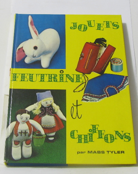
Tyler Maps
Jouets feutrine et chiffons
La farandole 1975 130 pages in8. 1975. Relié. 130 pages.
Référence libraire : 278005
|
|
|
TYROL
Carte du Tyrol et du Trento N° 5.
1800 18 sections montées sur toile et pliées formant une carte de 600 x 890 située à l'angle inférieur gauche d'une carte non déterminée. s.n. ca 1800
Référence libraire : 16327
|
|
|
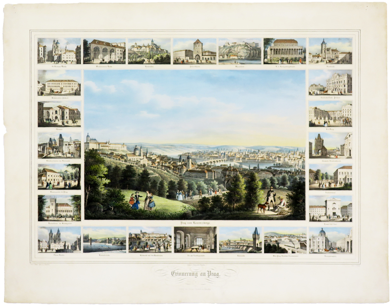
TÄUBERT (Gustave).
[RÉPUBLIQUE TCHÈQUE] Erinnerung an Prag.
Dresden, J. Braunsdorf, [circa 1850]. 420 x 535 mm.
Référence libraire : LBW0247d
|
|
|
TÅSINGE, LANGELAND, ALS, ÆRØ - H. SKANKE.
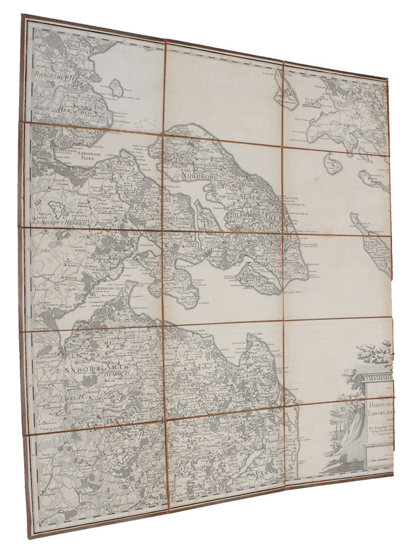
Kort over den Sydlige Deel af Fyen tilligemed det tilgrænsende Stykke af hertugdømmet Schleswig saavel øerne Langeland, Taasinge, Ærøe, Als og mellemliggende smaae Øer under det Kongl: Videnskabernes Societets Direction ved rigtig Landmaaling optaget,...
(København), 1783. Kobberstukket kort over Øerne etc. 53x88 cm. Med stor kobberstukket kartouche. Tegnet for Videnskabernes Selskab af H. Skanke 1783. Kortet er her originalt opdelt i 21 felter, opklæbet på lærred og foldet som rejsekort. Indlagt i marmoreret foderal.
|
|
|
TÅSINGE, LANGELAND, ALS, ÆRØ - H. SKANKE.
Kort over den Sydlige Deel af Fyen tilligemed det tilgrænsende Stykke af hertugdømmet Schleswig saavel øerne Langeland, Taasinge, Ærøe, Als og mellemliggende smaae Øer under det Kongl: Videnskabernes Societets Direction ved rigtig Landmaaling optaget,...
(København), 1783. Kobberstukket kort over Øerne etc. 53x88 cm. Med stor kobberstukket kartouche. Tegnet for Videnskabernes Selskab af H. Skanke 1783. Kortet er her originalt opdelt i 21 felter, opklæbet på lærred og foldet som rejsekort. Indlagt i marmoreret foderal.
Référence libraire : 51528
|
|
|
Töpffer Rodolphe:
Carnet de timbres Rodolphe Töpffer "Les Amours de M. Vieux Bois".
La Poste suisse, 1999. Carnet complet de 10 timbres, valeur faciale 90 centimes, 2 sans valeur servant de titre, publiés par la Poste suisse. Tout beau tout neuf.
Référence libraire : 15645

|
|
|
U.S. Executive Messages - Maps and Views.
MAPS AND VIEWS TO ACCOMPANY MESSAGES AND DOCUMENTS. 1854-5. Message from the President of the United States to the Two Houses of Congress, at the Commencement of the Second Session of the Thirty-third Congress. Part III, Illustrations Belonging to Reports
(2) pp. [Title-page with list of contents on the verso] + 45 maps and plans, of various sizes (some quite large), most folding. Some damp stain and foxing, but nothing too substantial, except to the endpapers. Original full black cloth binding, stamped in blind, and lettered in gold gilt. Lightly worn. 4to. 300mm. These maps and plans illustrate the Reports of: the Commissioner of the General Land Office (8): Commissioner of Public Buildings (1-4); National Hospital for the Insane (1); Colonel of Topographical Engineers (31); and the Report of the Chief of Ordnance and Hydrography (1) [Officers Quarters at Annapolis]. Significant regions covered include parts of: Kansas; Nebraska; Arkansas; Florida; Michigan; Iowa; California; Minnesota; Wisconsin; Ohio; District of Columbia; New York; as well as a Topographical Map of a portion of the Isthmus of Darien, in site of proposed inter-oceanic navigation (canal). These reports were apparently an adjunct to the MAPS AND CHARTS OF THE UNITED STATES COAST SURVEY. A wonderful addition to any collection of U.S. Maps. . **PRICE JUST REDUCED! W155 CTR
|
|
|
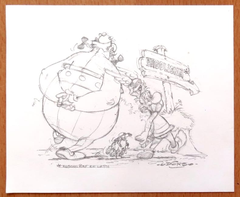
Uderzo:
Carte de voeux pour l'année 1998 - Astérix et Obélix.
Centre National de la Bande Dessinée et de l'Image. Carte de voeux au format 17 x 14.
Référence libraire : 26562
|
|
|
Ulinger, Johann Caspar (1703?1768)
Prospect des Schlosses Lauenberg zu Hohen Trimms in Pünten.
o.J. Radierung. Plattengrösse: 17 x 25 cm. Papiergrösse: 21,3 x 34,6 cm. + Wichtig: Für unsere Kunden in der EU erfolgt der Versand alle 14 Tage verzollt ab Deutschland / Postbank-Konto in Deutschland vorhanden +, A
Référence libraire : 1007CG

|
|
|
Ulinger, Johann Caspar (1703?1768)
Prospect von Reichenau in der Pfarr Thamyns in Pünten, bey dem Zusammenfluss des Vorder- und Hinter-Rhyns.
o.J. Radierung. Plattengrösse: 17 x 25 cm. Papiergrösse: 22 x 34,5 cm. + Wichtig: Für unsere Kunden in der EU erfolgt der Versand alle 14 Tage verzollt ab Deutschland / Postbank-Konto in Deutschland vorhanden +, A
Référence libraire : 1008CG

|
|
|
Ulinger, Johann Caspar (1703?1768)
Situation des zerstörten Schlosses Mannegg und der Passage der Syl zu Leimbach, samt Vorstellung des lustigen Prospects von danen, über die Gegne des Zürich-Sees.
o.J. Radierung. Plattengrösse: 17,3 x 25 cm. Papiergrösse: 22 x 34,3 cm. + Wichtig: Für unsere Kunden in der EU erfolgt der Versand alle 14 Tage verzollt ab Deutschland / Postbank-Konto in Deutschland vorhanden +, A
Référence libraire : 1006CG

|
|
|
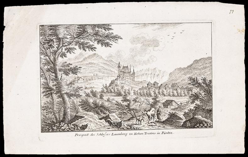
Ulinger, Johann Caspar (1703–1768):
Prospect des Schlosses Lauenberg zu Hohen Trimms in Pünten.
Radierung. Plattengrösse: 17 x 25 cm. Papiergrösse: 21,3 x 34,6 cm.
Référence libraire : 1007CG
|
|
|
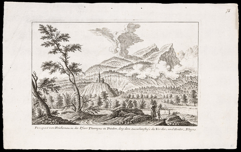
Ulinger, Johann Caspar (1703–1768):
Prospect von Reichenau in der Pfarr Thamyns in Pünten, bey dem Zusammenfluss des Vorder- und Hinter-Rhyns.
Radierung. Plattengrösse: 17 x 25 cm. Papiergrösse: 22 x 34,5 cm.
Référence libraire : 1008CG
|
|
|
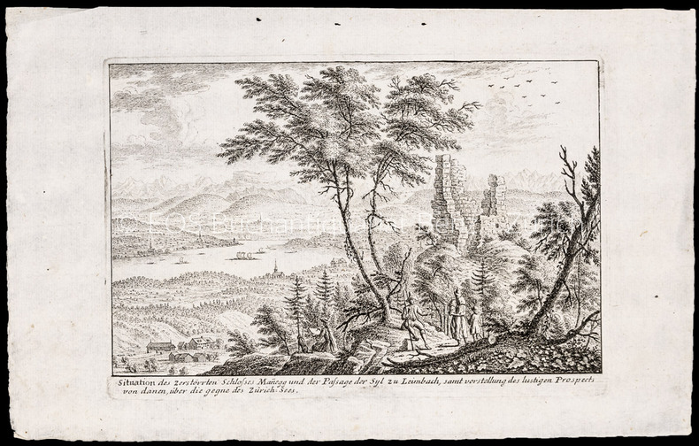
Ulinger, Johann Caspar (1703–1768):
Situation des zerstörten Schlosses Mannegg und der Passage der Syl zu Leimbach, samt Vorstellung des lustigen Prospects von danen, über die Gegne des Zürich-Sees.
Radierung. Plattengrösse: 17,3 x 25 cm. Papiergrösse: 22 x 34,3 cm.
Référence libraire : 1006CG
|
|
|
Ulrich Bonnell Phillips; Photos & Maps [Illustrator]
Life and Labor in the Old South
Little Brown & Company 1929-01-01. Hardcover. New. In shrink wrap. Looks like an interesting title! Little Brown & Company hardcover
Référence libraire : Q-0316706078 ISBN : 0316706078 9780316706070
|
|
|
UMA Engineering Ltd.
North Nanaimo Planning Study - City of Nanaimo, March 1991
35 pages plus appendix and numerous maps, some with colour. Occasional markings by former owner. Recent rapid growth has raised concerns about the quality of development, impacts on the environment and the adequacy of support services. This study assesses alternative development scenarios for the large tracts of remaining lands, and develops a more detailed conceptual plan for North Nanaimo than currently provided by the Official Community Plan. Book
|
|
|
Unger, Merrill F.
Unger's Bible Dictionary - Third Edition
1192 pages plus 16 pages of maps. Includes over 500 photos, maps and drawings. No marks noted. A little above average wear to green cloth covered boards. Binding intact. Light soiling. Prior owner's small address label atop preface. Solid working copy of this excellent reference. Book

|
|
|
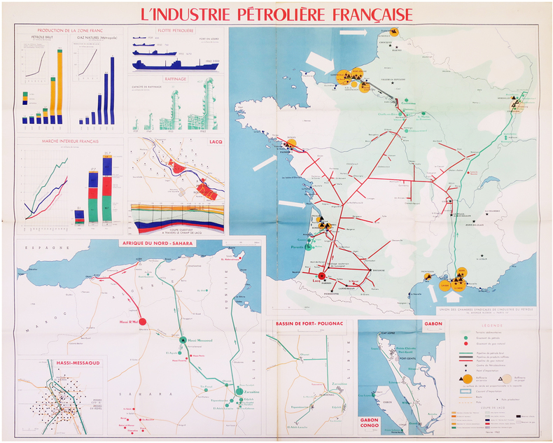
UNION des CHAMBRES SYNDICALES de l'INDUSTRIE du PÉTROLE.
[PÉTROLE] L'Industrie pétrolière française.
Paris, Union des Chambres Syndicales de l'Industrie du Pétrole, Février 1962. 0,97 x 1,14 m.
Référence libraire : LBW-7972
|
|
|
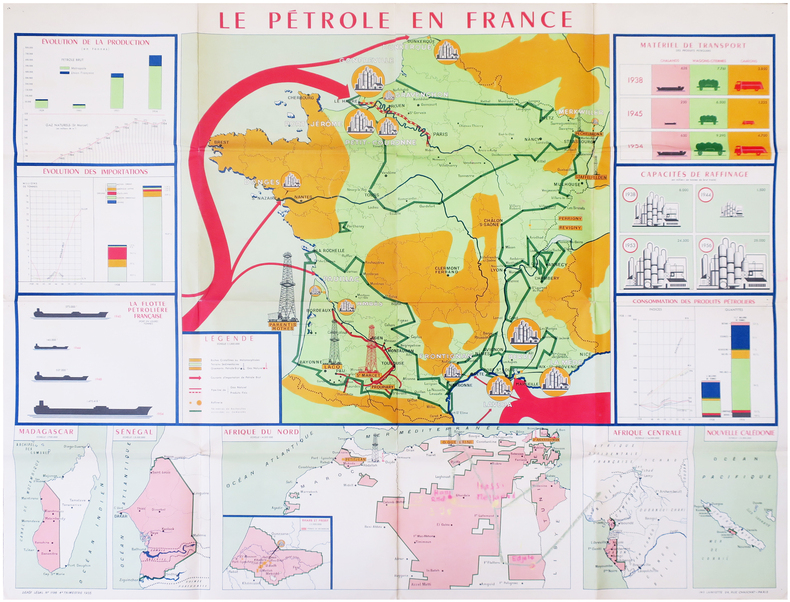
UNION des CHAMBRES SYNDICALES de l'INDUSTRIE du PÉTROLE.
[PÉTROLE] Le pétrole en France.
Paris, Union des Chambres Syndicales de l'Industrie du Pétrole, 1955. 0,97 x 1,22 m.
Référence libraire : LBW-7973
|
|
|
Unstated
British Columbia Official Centennial Record: 1858-1958 - A Century of Progress
176 pages. Endpapers decorated with colour maps. Designed to tell the story of what British Columbia was and is. Tells stories of romance and adventure; of exploration and settlement; of the search for riches in furs, in gold, in fisheries, farming and forestry. Tells the story of development; of the building of a character and a homogeneous province; of a God-fearing pioneering people dedicated to progress, strengthened by their contest with a great land at first reluctant to yield its full resources. Contents: agriculture; historical background; committees; education; energy and power; fisheries; forestry and logging; government; mining; programme; recreation. Illustrated with a multitude of interesting old black and white photographs as well as some modern colour photos. Attractive colour-illustrated boards. Book
|
|
|
Urban, Sylvanus [Henry, David] [ed]; Gibson, John; Bowen, Thomas [maps]
The Gentleman's Magazine and Historical Chronicle. Volume XLIV 44 January to December 1774
London: David Henry; Elizabeth Newbery. G: in good condition without dust jacket. 20th century binding with new eps. Inner hinge cracking. Sporadic foxing browning marking and off-setting from illustrations. Occasional pencil annotations. Loss to lower edge of prelims slightly impinging on content. 1774. First Edition. Buff hardback cloth cover. 220mm x 140mm 9" x 6". iv 628pp xvi plates. 20 b/w plates 3 fold-out plans 18 fold-out John Gibson and Thomas Bowen road maps. . David Henry; Elizabeth Newbery hardcover
Référence libraire : gnt774

|
|
|
URTEAGA, Luis.
Vigilia Colonial. Cartógrafos militares españoles en Marruecos (1882-1912).
Barcelona, 2006. Folio; 262 pp. Con 55 reproducciones de planos y mapas en color. Encuadernación original en tela. Sobrecubiertas.

|
|
|
US Executive Messages - Maps and Views U S
MAPS AND VIEWS TO ACCOMPANY MESSAGES AND DOCUMENTS. 1854-5. Message from the President of the United States to the Two Houses of Congress at the Commencement of the Second Session of the Thirty-third Congress. Part III Illustrations Belonging to Reports
A.O.P. Nicholson Printer Washington D.C.: . 1854 2 pp. Title-page with list of contents on the verso 45 maps and plans of various sizes some quite large most folding. Some damp stain and foxing but nothing too substantial except to the endpapers. Original full black cloth binding stamped in blind and lettered in gold gilt. Lightly worn. 4to. 300mm. These maps and plans illustrate the Reports of: the Commissioner of the General Land Office 8: Commissioner of Public Buildings 1-4; National Hospital for the Insane 1; Colonel of Topographical Engineers 31; and the Report of the Chief of Ordnance and Hydrography 1 Officers Quarters at Annapolis. Significant regions covered include parts of: Kansas; Nebraska; Arkansas; Florida; Michigan; Iowa; California; Minnesota; Wisconsin; Ohio; District of Columbia; New York; as well as a Topographical Map of a portion of the Isthmus of Darien in site of proposed inter-oceanic navigation canal. These reports were apparently an adjunct to the MAPS AND CHARTS OF THE UNITED STATES COAST SURVEY. A wonderful addition to any collection of U.S. Maps. . PRICE JUST REDUCED! W155 CTR Language: eng. Full Cloth. Hardcover. Very Good. A.O.P. Nicholson, Printer, Washington [D.C.]: . hardcover
Référence libraire : 182A61
|
|
|
USSR Soviet Union Communist Era Economics Maps
1959 - 1965 Map of the Soviet Union Giving the Results of Economic Planning Over 7 Years with Map Showing the Economic Districts of the USSR
USSR 1965. The 7 year plan economic map with good lithographic color key gives interpretation and on back various charts show growth over time. The district map in black and white with numbers keyed to the list of districts on the back; text entirely in Cyrillic. Approx. 9 3/4" x 13" size; a little edge-wear one short 1/4" closed edge-tear; in very good condition. First Edition. Not Bound. Very Good. paperback books
Référence libraire : 25042

|
|
|
Ustinov, Peter
Ustinov in Russia
No marks or inscriptions. A lovely clean crisp tight copy with bright boards and no bumping to corners. Dust jacket not price clipped or torn with a little light creasing to edges. 160pp. A very personal guided tour of the world's largest country by it's most famous 'grandson'. This is an amusing and attractive book which also opens the door to a Russia only a few have been able to see and appreciate. Over 100 original photos, many taken by the author himself.

|
|
|
Vadrot Claude-Marie Gouverne Louisette
TOUS FICHES
FIRST / DOCUMENTS Broché , couverture éditeur représentant un code barres sur un crane , ensemble un peu défraichi mais en bon état , 311 pages .
Référence libraire : 6492
|
|
|
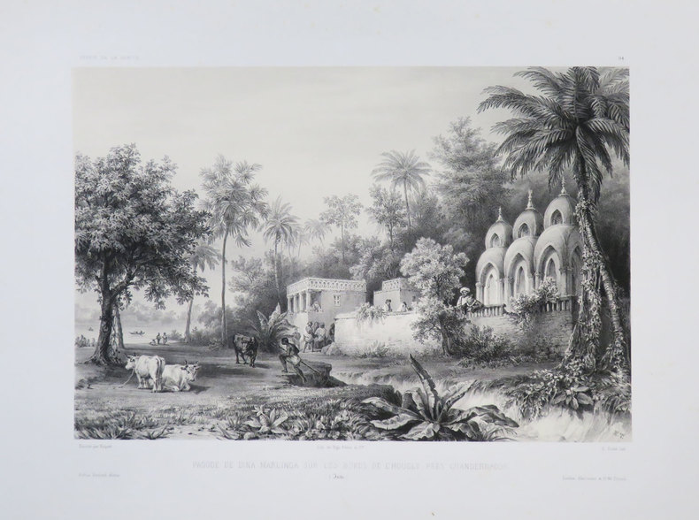
VAILLANT (Auguste-Nicolas).
[BENGALE] Pagode de Dina Marlinga sur les bords de l'Hougly près Chandernagor. (Inde).
[1840]. 223 x 291 mm.
Référence libraire : LBW-3682
|
|
|
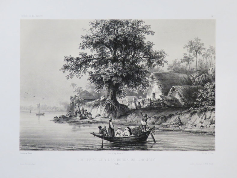
VAILLANT (Auguste-Nicolas).
[BENGALE] Vue prise sur les bords de l'Hougly. (Inde).
[1840]. 212 x 279 mm.
Référence libraire : LBW-3681
|
|
|
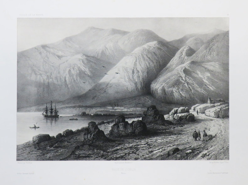
VAILLANT (Auguste-Nicolas).
[BOLIVIE] Rade de Cobija. Bolivie.
[1840]. 233 x 306 mm.
Référence libraire : LBW-3674
|
|
|
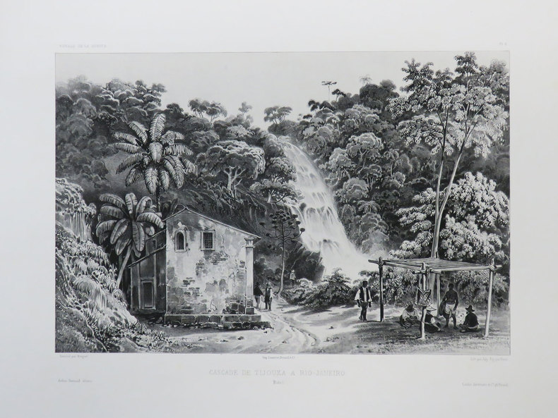
VAILLANT (Auguste-Nicolas).
[BRESIL] Cascade de Tijouka à Rio-Janeiro. Brésil.
[1840]. 227 x 298 mm.
Référence libraire : LBW-3437
|
|
|
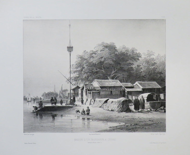
VAILLANT (Auguste-Nicolas).
[CANTON] Maison d'un mandarin à Chinao. (Environs de Canton, Chine).
[1840]. 235 x 263 mm.
Référence libraire : LBW-3679
|
|
|
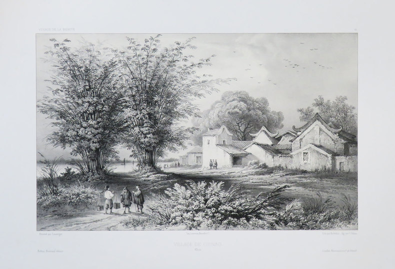
VAILLANT (Auguste-Nicolas).
[CANTON] Village de Chinao. Chine.
[1840]. 219 x 314 mm.
Référence libraire : LBW-3680
|
|
|
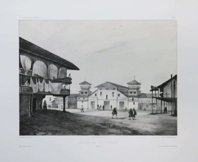
VAILLANT (Auguste-Nicolas).
[EQUATEUR] Cathédrale de Guayaquil. Colombie.
[1840]. 238 x 289 mm.
Référence libraire : LBW-3677
|
|

 Recevoir par e-mail
 Télécharger en PDF
 Flux RSS
 Lien permanent


