|
Töpffer Rodolphe:
Carnet de timbres Rodolphe Töpffer "Les Amours de M. Vieux Bois".
La Poste suisse, 1999. Carnet complet de 10 timbres, valeur faciale 90 centimes, 2 sans valeur servant de titre, publiés par la Poste suisse. Tout beau tout neuf.
Bookseller reference : 15645

|
|
|
U.S. Executive Messages - Maps and Views.
MAPS AND VIEWS TO ACCOMPANY MESSAGES AND DOCUMENTS. 1854-5. Message from the President of the United States to the Two Houses of Congress, at the Commencement of the Second Session of the Thirty-third Congress. Part III, Illustrations Belonging to Reports
(2) pp. [Title-page with list of contents on the verso] + 45 maps and plans, of various sizes (some quite large), most folding. Some damp stain and foxing, but nothing too substantial, except to the endpapers. Original full black cloth binding, stamped in blind, and lettered in gold gilt. Lightly worn. 4to. 300mm. These maps and plans illustrate the Reports of: the Commissioner of the General Land Office (8): Commissioner of Public Buildings (1-4); National Hospital for the Insane (1); Colonel of Topographical Engineers (31); and the Report of the Chief of Ordnance and Hydrography (1) [Officers Quarters at Annapolis]. Significant regions covered include parts of: Kansas; Nebraska; Arkansas; Florida; Michigan; Iowa; California; Minnesota; Wisconsin; Ohio; District of Columbia; New York; as well as a Topographical Map of a portion of the Isthmus of Darien, in site of proposed inter-oceanic navigation (canal). These reports were apparently an adjunct to the MAPS AND CHARTS OF THE UNITED STATES COAST SURVEY. A wonderful addition to any collection of U.S. Maps. . **PRICE JUST REDUCED! W155 CTR
|
|
|
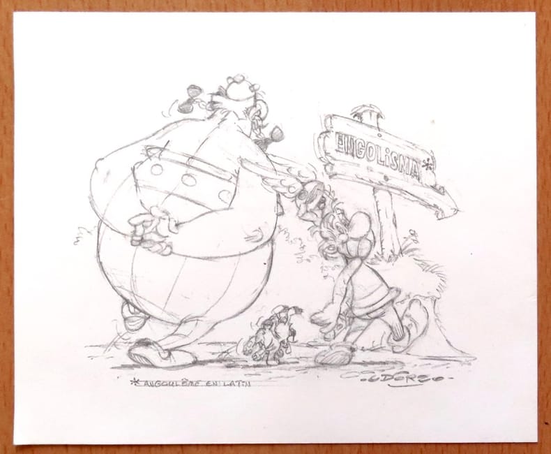
Uderzo:
Carte de voeux pour l'année 1998 - Astérix et Obélix.
Centre National de la Bande Dessinée et de l'Image. Carte de voeux au format 17 x 14.
Bookseller reference : 26562
|
|
|
Ulinger, Johann Caspar (1703?1768)
Prospect des Schlosses Lauenberg zu Hohen Trimms in Pünten.
o.J. Radierung. Plattengrösse: 17 x 25 cm. Papiergrösse: 21,3 x 34,6 cm. + Wichtig: Für unsere Kunden in der EU erfolgt der Versand alle 14 Tage verzollt ab Deutschland / Postbank-Konto in Deutschland vorhanden +, A
Bookseller reference : 1007CG

|
|
|
Ulinger, Johann Caspar (1703?1768)
Prospect von Reichenau in der Pfarr Thamyns in Pünten, bey dem Zusammenfluss des Vorder- und Hinter-Rhyns.
o.J. Radierung. Plattengrösse: 17 x 25 cm. Papiergrösse: 22 x 34,5 cm. + Wichtig: Für unsere Kunden in der EU erfolgt der Versand alle 14 Tage verzollt ab Deutschland / Postbank-Konto in Deutschland vorhanden +, A
Bookseller reference : 1008CG

|
|
|
Ulinger, Johann Caspar (1703?1768)
Situation des zerstörten Schlosses Mannegg und der Passage der Syl zu Leimbach, samt Vorstellung des lustigen Prospects von danen, über die Gegne des Zürich-Sees.
o.J. Radierung. Plattengrösse: 17,3 x 25 cm. Papiergrösse: 22 x 34,3 cm. + Wichtig: Für unsere Kunden in der EU erfolgt der Versand alle 14 Tage verzollt ab Deutschland / Postbank-Konto in Deutschland vorhanden +, A
Bookseller reference : 1006CG

|
|
|
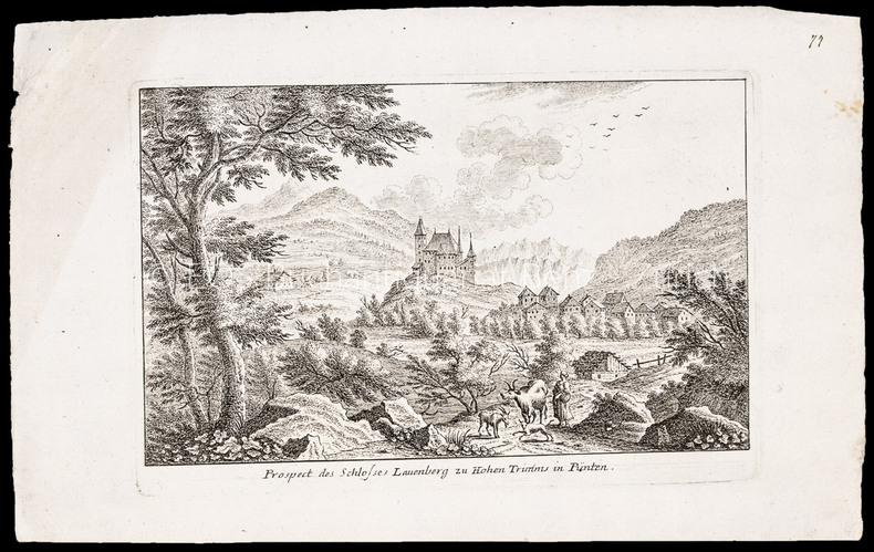
Ulinger, Johann Caspar (1703–1768):
Prospect des Schlosses Lauenberg zu Hohen Trimms in Pünten.
Radierung. Plattengrösse: 17 x 25 cm. Papiergrösse: 21,3 x 34,6 cm.
Bookseller reference : 1007CG
|
|
|
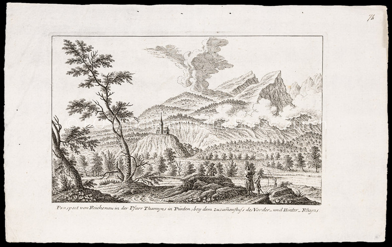
Ulinger, Johann Caspar (1703–1768):
Prospect von Reichenau in der Pfarr Thamyns in Pünten, bey dem Zusammenfluss des Vorder- und Hinter-Rhyns.
Radierung. Plattengrösse: 17 x 25 cm. Papiergrösse: 22 x 34,5 cm.
Bookseller reference : 1008CG
|
|
|
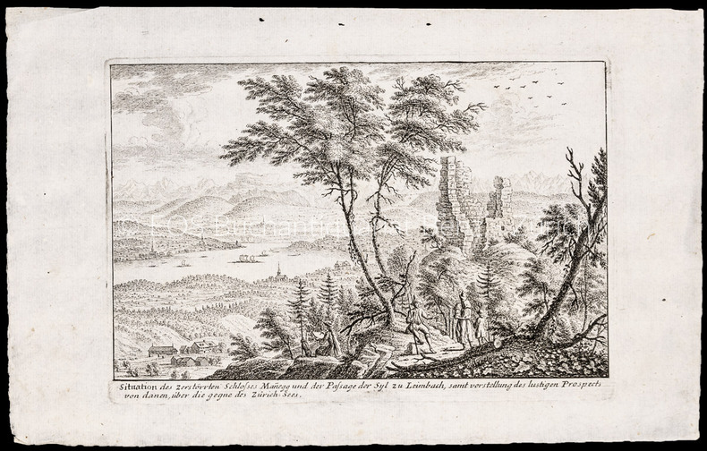
Ulinger, Johann Caspar (1703–1768):
Situation des zerstörten Schlosses Mannegg und der Passage der Syl zu Leimbach, samt Vorstellung des lustigen Prospects von danen, über die Gegne des Zürich-Sees.
Radierung. Plattengrösse: 17,3 x 25 cm. Papiergrösse: 22 x 34,3 cm.
Bookseller reference : 1006CG
|
|
|
Ulrich Bonnell Phillips; Photos & Maps [Illustrator]
Life and Labor in the Old South
Little Brown & Company 1929-01-01. Hardcover. New. In shrink wrap. Looks like an interesting title! Little Brown & Company hardcover
Bookseller reference : Q-0316706078 ISBN : 0316706078 9780316706070
|
|
|
UMA Engineering Ltd.
North Nanaimo Planning Study - City of Nanaimo, March 1991
35 pages plus appendix and numerous maps, some with colour. Occasional markings by former owner. Recent rapid growth has raised concerns about the quality of development, impacts on the environment and the adequacy of support services. This study assesses alternative development scenarios for the large tracts of remaining lands, and develops a more detailed conceptual plan for North Nanaimo than currently provided by the Official Community Plan. Book
|
|
|
Unger, Merrill F.
Unger's Bible Dictionary - Third Edition
1192 pages plus 16 pages of maps. Includes over 500 photos, maps and drawings. No marks noted. A little above average wear to green cloth covered boards. Binding intact. Light soiling. Prior owner's small address label atop preface. Solid working copy of this excellent reference. Book

|
|
|
UNION des CHAMBRES SYNDICALES de l'INDUSTRIE du PÉTROLE.
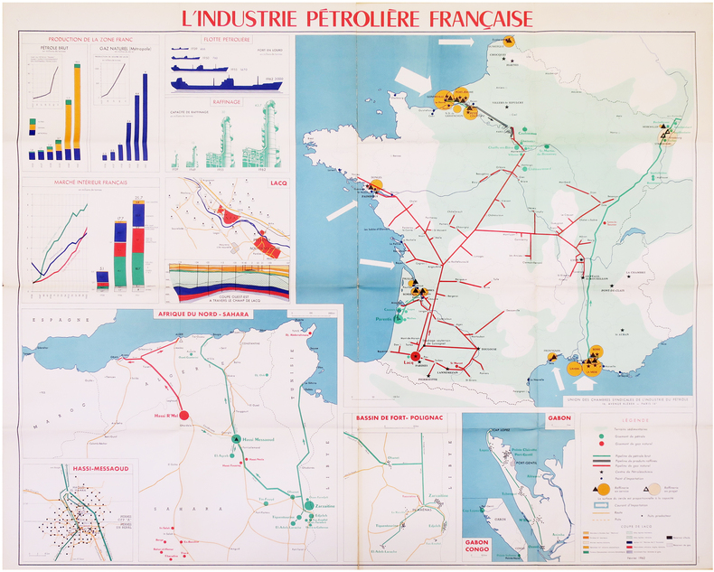
[PÉTROLE] L'Industrie pétrolière française.
Paris, Union des Chambres Syndicales de l'Industrie du Pétrole, Février 1962. 0,97 x 1,14 m.
Bookseller reference : LBW-7972
|
|
|
UNION des CHAMBRES SYNDICALES de l'INDUSTRIE du PÉTROLE.
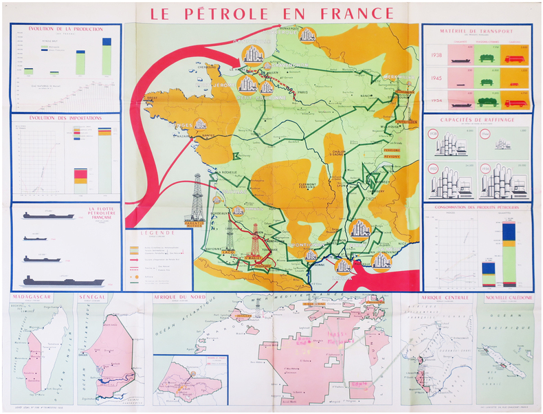
[PÉTROLE] Le pétrole en France.
Paris, Union des Chambres Syndicales de l'Industrie du Pétrole, 1955. 0,97 x 1,22 m.
Bookseller reference : LBW-7973
|
|
|
Unstated
British Columbia Official Centennial Record: 1858-1958 - A Century of Progress
176 pages. Endpapers decorated with colour maps. Designed to tell the story of what British Columbia was and is. Tells stories of romance and adventure; of exploration and settlement; of the search for riches in furs, in gold, in fisheries, farming and forestry. Tells the story of development; of the building of a character and a homogeneous province; of a God-fearing pioneering people dedicated to progress, strengthened by their contest with a great land at first reluctant to yield its full resources. Contents: agriculture; historical background; committees; education; energy and power; fisheries; forestry and logging; government; mining; programme; recreation. Illustrated with a multitude of interesting old black and white photographs as well as some modern colour photos. Attractive colour-illustrated boards. Book
|
|
|
Urban, Sylvanus [Henry, David] [ed]; Gibson, John; Bowen, Thomas [maps]
The Gentleman's Magazine and Historical Chronicle. Volume XLIV 44 January to December 1774
London: David Henry; Elizabeth Newbery. G: in good condition without dust jacket. 20th century binding with new eps. Inner hinge cracking. Sporadic foxing browning marking and off-setting from illustrations. Occasional pencil annotations. Loss to lower edge of prelims slightly impinging on content. 1774. First Edition. Buff hardback cloth cover. 220mm x 140mm 9" x 6". iv 628pp xvi plates. 20 b/w plates 3 fold-out plans 18 fold-out John Gibson and Thomas Bowen road maps. . David Henry; Elizabeth Newbery hardcover
Bookseller reference : gnt774

|
|
|
URTEAGA, Luis.
Vigilia Colonial. Cartógrafos militares españoles en Marruecos (1882-1912).
Barcelona, 2006. Folio; 262 pp. Con 55 reproducciones de planos y mapas en color. Encuadernación original en tela. Sobrecubiertas.

|
|
|
US Executive Messages - Maps and Views U S
MAPS AND VIEWS TO ACCOMPANY MESSAGES AND DOCUMENTS. 1854-5. Message from the President of the United States to the Two Houses of Congress at the Commencement of the Second Session of the Thirty-third Congress. Part III Illustrations Belonging to Reports
A.O.P. Nicholson Printer Washington D.C.: . 1854 2 pp. Title-page with list of contents on the verso 45 maps and plans of various sizes some quite large most folding. Some damp stain and foxing but nothing too substantial except to the endpapers. Original full black cloth binding stamped in blind and lettered in gold gilt. Lightly worn. 4to. 300mm. These maps and plans illustrate the Reports of: the Commissioner of the General Land Office 8: Commissioner of Public Buildings 1-4; National Hospital for the Insane 1; Colonel of Topographical Engineers 31; and the Report of the Chief of Ordnance and Hydrography 1 Officers Quarters at Annapolis. Significant regions covered include parts of: Kansas; Nebraska; Arkansas; Florida; Michigan; Iowa; California; Minnesota; Wisconsin; Ohio; District of Columbia; New York; as well as a Topographical Map of a portion of the Isthmus of Darien in site of proposed inter-oceanic navigation canal. These reports were apparently an adjunct to the MAPS AND CHARTS OF THE UNITED STATES COAST SURVEY. A wonderful addition to any collection of U.S. Maps. . PRICE JUST REDUCED! W155 CTR Language: eng. Full Cloth. Hardcover. Very Good. A.O.P. Nicholson, Printer, Washington [D.C.]: . hardcover
Bookseller reference : 182A61
|
|
|
USSR Soviet Union Communist Era Economics Maps
1959 - 1965 Map of the Soviet Union Giving the Results of Economic Planning Over 7 Years with Map Showing the Economic Districts of the USSR
USSR 1965. The 7 year plan economic map with good lithographic color key gives interpretation and on back various charts show growth over time. The district map in black and white with numbers keyed to the list of districts on the back; text entirely in Cyrillic. Approx. 9 3/4" x 13" size; a little edge-wear one short 1/4" closed edge-tear; in very good condition. First Edition. Not Bound. Very Good. paperback books
Bookseller reference : 25042

|
|
|
Ustinov, Peter
Ustinov in Russia
No marks or inscriptions. A lovely clean crisp tight copy with bright boards and no bumping to corners. Dust jacket not price clipped or torn with a little light creasing to edges. 160pp. A very personal guided tour of the world's largest country by it's most famous 'grandson'. This is an amusing and attractive book which also opens the door to a Russia only a few have been able to see and appreciate. Over 100 original photos, many taken by the author himself.

|
|
|
Vadrot Claude-Marie Gouverne Louisette
TOUS FICHES
FIRST / DOCUMENTS Broché , couverture éditeur représentant un code barres sur un crane , ensemble un peu défraichi mais en bon état , 311 pages .
Bookseller reference : 6492
|
|
|
VAILLANT (Auguste-Nicolas).
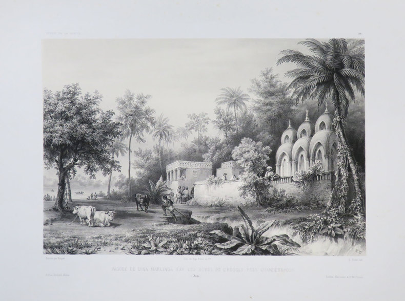
[BENGALE] Pagode de Dina Marlinga sur les bords de l'Hougly près Chandernagor. (Inde).
[1840]. 223 x 291 mm.
Bookseller reference : LBW-3682
|
|
|
VAILLANT (Auguste-Nicolas).
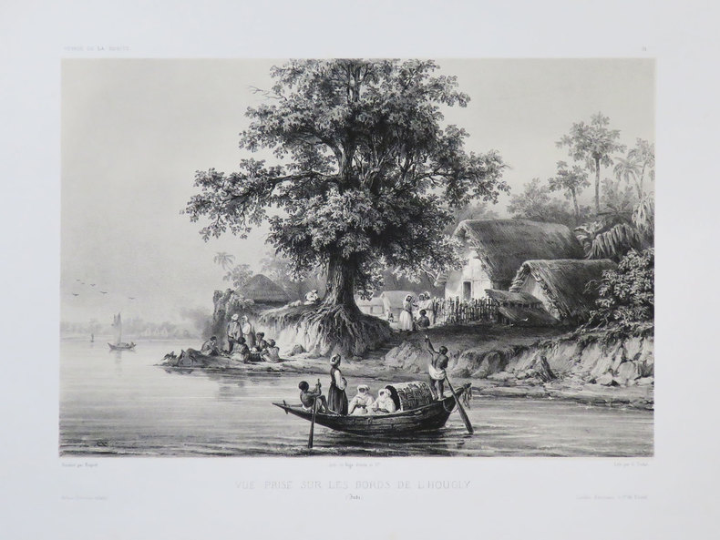
[BENGALE] Vue prise sur les bords de l'Hougly. (Inde).
[1840]. 212 x 279 mm.
Bookseller reference : LBW-3681
|
|
|
VAILLANT (Auguste-Nicolas).
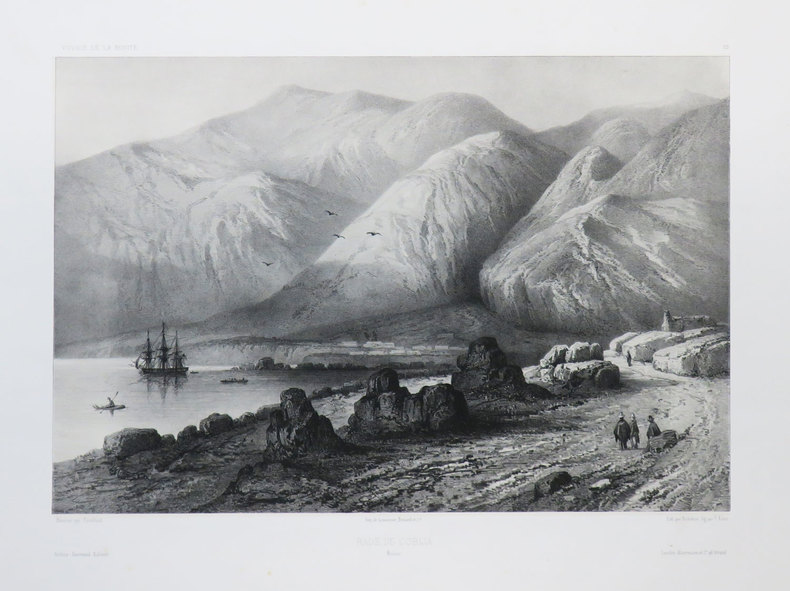
[BOLIVIE] Rade de Cobija. Bolivie.
[1840]. 233 x 306 mm.
Bookseller reference : LBW-3674
|
|
|
VAILLANT (Auguste-Nicolas).
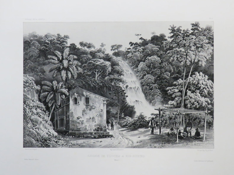
[BRESIL] Cascade de Tijouka à Rio-Janeiro. Brésil.
[1840]. 227 x 298 mm.
Bookseller reference : LBW-3437
|
|
|
VAILLANT (Auguste-Nicolas).
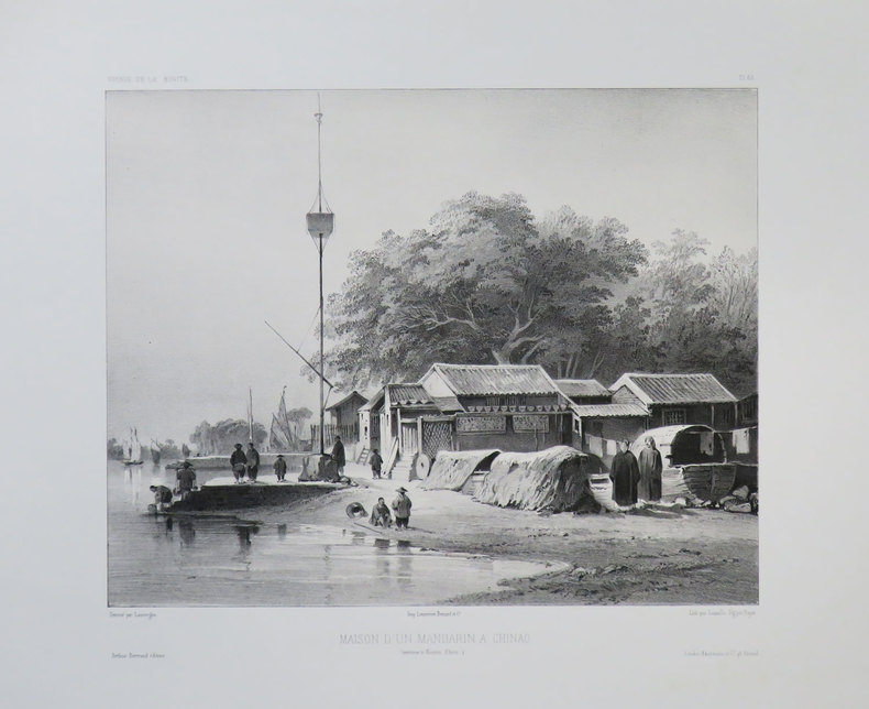
[CANTON] Maison d'un mandarin à Chinao. (Environs de Canton, Chine).
[1840]. 235 x 263 mm.
Bookseller reference : LBW-3679
|
|
|
VAILLANT (Auguste-Nicolas).
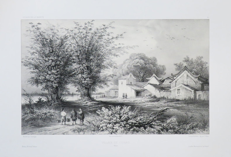
[CANTON] Village de Chinao. Chine.
[1840]. 219 x 314 mm.
Bookseller reference : LBW-3680
|
|
|
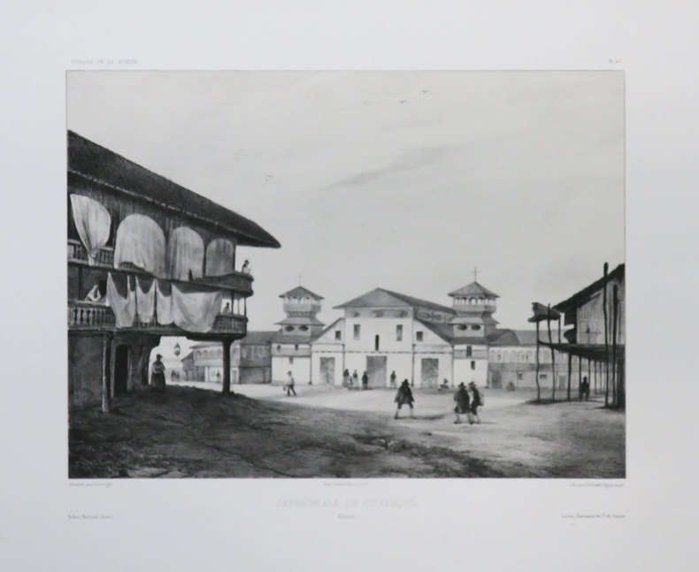
VAILLANT (Auguste-Nicolas).
[EQUATEUR] Cathédrale de Guayaquil. Colombie.
[1840]. 238 x 289 mm.
Bookseller reference : LBW-3677
|
|
|
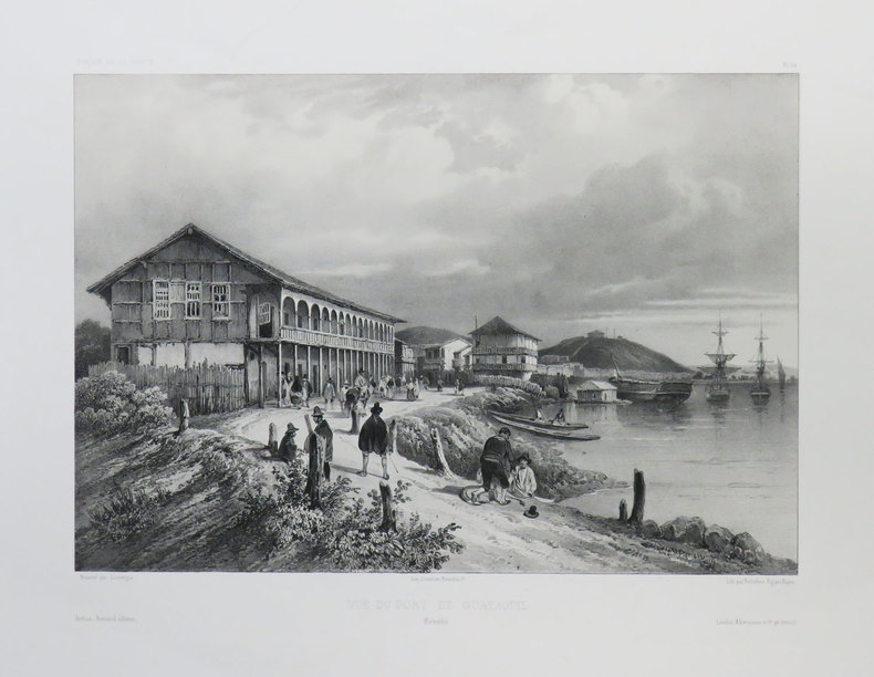
VAILLANT (Auguste-Nicolas).
[EQUATEUR] Vue du port de Guayaquil. Colombie.
[1840]. 222 x 294 mm.
Bookseller reference : LBW-3676
|
|
|
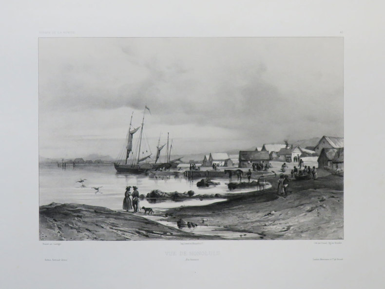
VAILLANT (Auguste-Nicolas).
[HAWAII] Vue de Honolulu. Îles Sandwich.
[1840]. 220 x 291 mm.
Bookseller reference : LBW-3642
|
|
|
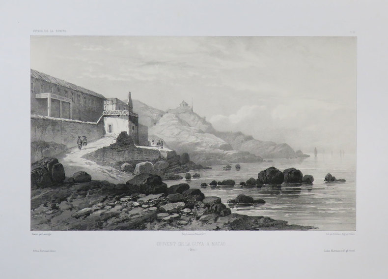
VAILLANT (Auguste-Nicolas).
[MACAO] Couvent de la Guya a Macao. (Chine).
[1840]. 219 x 322 mm.
Bookseller reference : LBW-3678
|
|
|
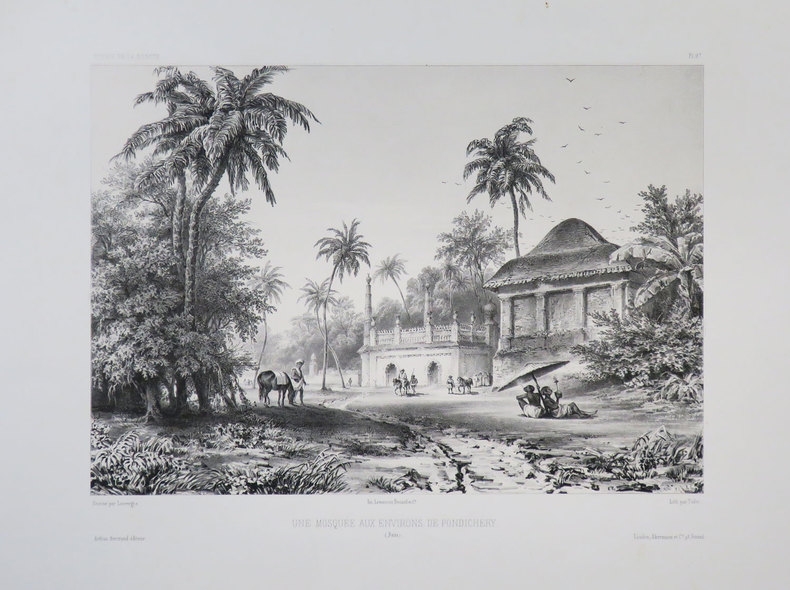
VAILLANT (Auguste-Nicolas).
[PONDICHERY] Une mosquée aux environs de Pondichéry. (Inde).
[1840]. 230 x 287 mm.
Bookseller reference : LBW-3683
|
|
|
Valck, Gerard
Tabula Ducatuum Livoniae et Curlandiae recentior: incisa editaque per Gerardum Valck. Kupferstichkarte von Gerard Valk [Valck] (1650/51-1720) in altem Kolorit.
Amsterdam, [ca. 1680]. Plattenmaß: 59,5 x 48 cm [Blattmaß: 62,5 x 52,5 cm]. Mit kolorierter barocker Titelkartusche (oben links) u. zweifachem Maßstab.
Bookseller reference : 52698

|
|
|
VALENCIENNES. . .
Carte au 1/200 000e. Sans date.
Une feuille 32x50 cm.
|
|
|
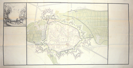
VALENCIENNES. MANUSCRIT.
[Valenciennes].
circa 1760 498 x 1070 mm.
Bookseller reference : LBW00283
|
|
|
VALENTIN-SMITH J.-E.:
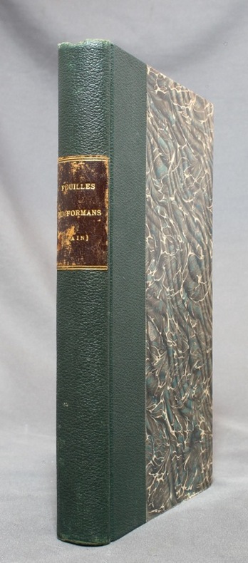
Fouilles dans la vallée du Formans (Ain) en 1862. Documents pour servir à l'histoire de la campagne de Jules César contre les Helvètes [relié avec] Les fouilles dans la vallée du Formans d'après un compte-rendu allemand.
Lyon, Librairie ancienne d'Auguste Brun / Imprimerie Mougin-Rusand, 1888. Grand in-8 de VII-153-[3]; [2]-4-[2] pages, demi-percaline verte, pièce de titre marron au dos, toutes les couvertures conservées.
Bookseller reference : 14664
|
|
|
Valette Maxime Passaglia Guillaume Guedj Didier Missbean
Vie de Merde : les inédits du monde entier tome 1
LGF 2012 96 pages 14x1 8x18 4cm. 2012. pocket_book. 96 pages.
Bookseller reference : 500196306

|
|
|
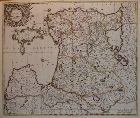
VALK (Gerard).
[LETTONIE/ESTONIE] Tabula ducatuum Livoniae et Curlandiae.
Amsterdam, [circa 1700]. 487 x 578 mm.
Bookseller reference : LBW04172
|
|
|
VALLAUD Pierre
La Seconde Guerre Mondiale. Collection : Témoins de l'histoire.
Paris, France Loisirs, 2002. 18 x 25, 703 pp., très nombreuses illustrations en N/B et en couleurs, cartonnage d'édition + jaquette, état neuf.
Bookseller reference : 30590
|
|
|
VALLET
Carte couleurs au 1/50 000?.
Une feuille 70x60 cm.
|
|
|
VALLOT (Henri) & VALLOT (Joseph).
[HAUTE-SAVOIE/CHAMONIX-MONT-BLANC] Environs de Chamonix extraits de la carte du massif du Mont Blanc (Édition touristique).
Paris, Girard et Barrère, 1934. 481 x 428 mm.
Bookseller reference : LBW-8226

|
|
|
VALLOT Ch.:
Autour du Mont-Blanc. Choix d'excursions.
Paris, Girard, Barrère et Thomas, 1947. In-12 broché de 115-[15] pages, dos de toile bleue avec étiquette de titre (incomplète).
Bookseller reference : 14347

|
|
|
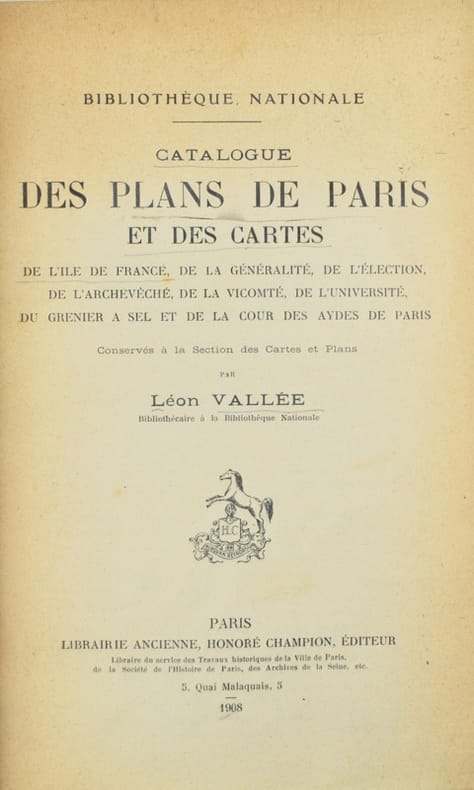
Vallée (Léon).
Catalogue des plans de Paris et des cartes de l'Île-de-France de la généralité, de l'élection, de l'archevêché, de la vicomté, de l'Université, du grenier à sel et de la Cour des aydes de Paris, conservés à la Section des cartes et plans.
Paris, Honoré Champion, 1908. In-8 de II-576 pp., index, demi-maroquin prune, dos à nerfs, tête dorée, couverture et dos conservés (Honnelaître).
Bookseller reference : 42603
|
|
|
VALLÉE, Léon.
Catalogue des Plans de Paris et des Cartes de l'île de France, de la généralité, de l'élection, de l'Archevêché, de la Vicomté, de l'Université, du grenier à sel et de la Cour des Aydes de Paris conservés à la Section des Cartes et Plans.
Paris, Librairie Ancienne, Honoré Champion, éditeur, 1908. In-8 - 25,5 x 17 cm. Reliure en demi-toile noire, dos lisse, pièce de titre en chagrin vert souligné de doubles filets dorés, tête mouchetée, couvertures conservées et montées sur onglets. II, 576 pages paginées, 2 feuillets. Précieux exemplaire avec envoi autographe signé de l'auteur sur la page de titre à Léon Bourgeois : « à Monsieur Léon Bourgeois / Respectueux hommage de son reconnaissant et tout dévoué L. Vallée ». L'ouvrage ayant paru peu avant la mort de Vallée, survenue en 1908, cet envoi compte parmi les derniers témoignages autographes du bibliographe. Le destinataire, Léon Bourgeois (1851–1925), homme d'État républicain, président du Conseil en 1895–1896, président du Sénat de 1920 à 1923 et lauréat du prix Nobel de la paix en 1920, était l'une des figures les plus éminentes de la Troisième République.
Bookseller reference : 2877

|
|
|
VALVERDE Y ÁLVAREZ, Emilio (1848-1894).
Atlas de la Península Ibérica, islas adyacentes y posesiones de ultramar. Provincia de Madrid.
Madrid, Litografía A. Foruny, s.a. (1880). Un mapa de 56 x 39 cm., Escala 1:750000, plegado y contenido en carpeta de cartón.

|
|
|
VAN CHI-BONNARDELLE R?gine
Grand atlas du continent africain, sous la direction de R. Van-Chi-Bonnardelle.
Reliure toile de l'?diteur. 335 pages. 30x40 cm.
|
|
|
VAN DEN HAUTE, Robert.
Woluwe en cartes postales anciennes.- Woluwe in oude prentkaarten.
Petit in-8 oblong, 76 cartes en n&b., reliure cartonnage editeur illustrée.- RARE Tres bon état. [BU-11]
|
|
|
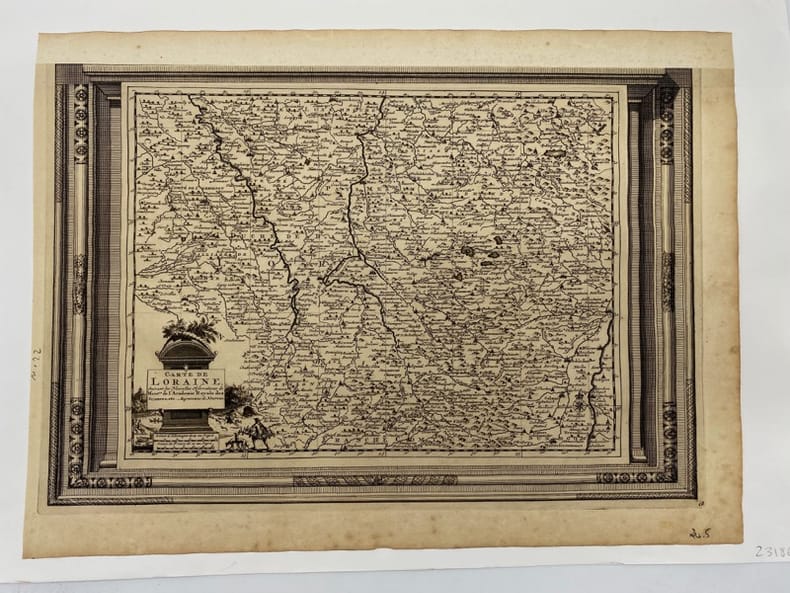
VAN DER AA.
Carte de Lorraine. suivant les Nouvelles Observations de Messieurs de l'Académie Royale des Sciences, etc. Augmentées de Nouveau.
(c.1729), 26.5 x 39.5 cm - feuille : 31 x 42 cm , contrecollée sous passe-partout volant Marge supérieure découpée et restaurée.
Bookseller reference : 231860
|
|
|
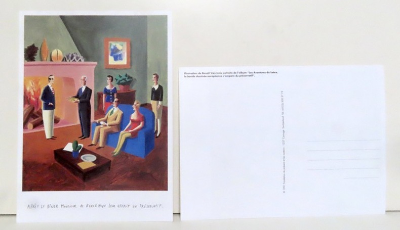
Van Innis Benoît:
Après le dîner Monsieur de Kerckhuve leur offrit un préservatif.
Carouge, Fondation du présent et les auteurs, 1991. Grande carte postale (16x22), représentant une illustration extraite de l'album "Les aventures du latex, la bande dessinée européenne s'empare du préservatif".
Bookseller reference : 14343
|
|
|
VAN TENAC Charles
Traité du jeu de piquet. Lois, règles, conventions et maximes pour le bien jouer
Paris Passard s.d. [1877] in-12 br. couv. impr. jaune
Bookseller reference : 11946
|
|

 Receive by email
 Download as PDF document
 RSS feed
 Permanent link


