|
MAP - GIBRALTAR.
Nueba Vista Gibraltar. 1782.
Wien, L. Hochenleiter, um 1782. (22 x 37 cm.). Engraved map (bird-eye-view) with ships in the sea, fortification and bombardment. Text in Spanish. Mildly brownspotted.
|
|
|
MAP - GIBRALTAR.
Plan der Berühmten Vestung Gibraltar belagert von den Spaniern und Frantzosen seit Anno 1779.
(Frankfurt am M., um 1780). (36 x 26 cm.) Engraved handcoloured map/plan of Gibraltar with text and with insets of Southern Span and North Africa around Ceuta and Tanger. A stamp in upper left corner. I.M. Zell, sculp. (Johann Michael Zell)Some brownspots.
|
|
|
MAP - IRAN und TURAN - STÜLPNAGEL, F. v.
Iran und Turan (Persien, Afghanistan, Beludschistan, Turkestan). Neue Bearbeitung von F. v. Stülpnagel.
(Gotha, Justus Perthes), 1843. Engraved map (35,5 x 44 cm.). Handcoloured in outline.
|
|
|
Map collectors' series
Map collectors' series ; Map Collectors' Circle [10 issues]
Ten issues in offwhite printed wraps; approx. 40-60p per issue, b&w illus., maps ; 25 cm Offerd as a lot only. Includes Number 5 Printed Maps of Tasmania ; No.16 Dictionary of Mapmakers Part I ; No. 32 French Explorer Maps of New Zealand; No. 39 Comparative Cartography ; No. 40 Dictionary of Mapmakers Part III; No. 44 Printed Maps of New South Wales, 1773-1873 ; No. 45 Smith's Virginai and its Derivatives ; No. 68 Printed Maps of America Part 1 by Tooley ; No. 69 Printed Maps of Amerca Part II by Tooley; No. 80 Printed Maps of America Part III by Tooley. || Cartography; Maps. Maps -- Bibliography. Cartes -- Collectionneurs et collections. Maps, Cartas; Bibliography.
|
|
|
MAP OF INDIA
Road Map of India with Road Distances
Carte en couleurs , imprimée sur très bon papier collé sur tissu tramé , se repliant dans une pochette plastifiée . Echelle 1 cm pour 25 kilomètres . Tableau des distances entre les grandes villes . Pour voyager en Inde ou pour afficher au mur . Trés belle carte .- 1 p. , 600 gr.

|
|
|
Map. Florida. Cuba
Shell Map Of Florida And Cuba
Chicago: H. M. Gousha Company. Very Good. Measures approximately 18 x 29.5 inches 7 folds a few small breaks at folds. <br/><br/>With an inset map of Cuba. H. M. Gousha Company unknown
Bookseller reference : 4883
|
|
|
Map. Washington State
Highways State Of Washington
Olympia WA: Department of Highways 1937. Very Good. Measures approximately 19 x 27.5 inches 4 folds lightly edgeworn toned <br/><br/>The Washington State highway maps series began in 1933. Department of Highways unknown
Bookseller reference : 4884
|
|
|
MAPAS
MAPAS 1 Printed Textbook
Difusion 2022. Paperback. Very Good. . Sealed in publisher's shrink wrap. Splitting in shrink wrap so minor shelf wear may be present otherwise VG/NF. Unread clean. 12 month access code present. Difusion paperback
Bookseller reference : mon0002965477
|
|
|
MAPAS
MAPAS 2 Printed Textbook
Difusion 2022. Paperback. Very Good. . Sealed in publisher's shrink wrap never opened. 12 month access code included. Minor shelf wear minor splits in plastic may be present due to storage. Otherwise NF unopened/unread. Difusion paperback
Bookseller reference : mon0002965475
|
|
|
MAPAS
MAPAS 3 Printed Textbook
Klett World Languages 2022. Paperback. Very Good. . Sealed in publisher's shrink wrap never opened. Minor shelf wear may be present due to storage otherwise VG/NF. 12 month access code present. Klett World Languages paperback
Bookseller reference : mon0002965479
|
|
|
MAPAS
MAPAS 4 Printed Textbook
Klett World Languages 2022. Paperback. Very Good. . A nice clean copy unread. Minor shelf wear may be present due to storage. Otherwise VG/NF. Klett World Languages paperback
Bookseller reference : mon0002965531
|
|
|
MAPAS CARRETERA:
España centro. Madrid. Castilla-La Mancha. Extremadura. Ãndice de localidades. 1/400000 - 1 cm:4 km
.- Madrid. s. f. Michelin. 4º menor. Mapa plegado. Rústica editorial . Buen estado. . . ISBN 10: 2067004441. GeografÃa / Mapas CartografÃa paperback
Bookseller reference : *W119677 ISBN : 2067004441 9782067004443

|
|
|
Mapas Naturismo
Costa Rica r/v r naturismo
Mapas Naturismo 2014. Map. New. 2012 edition. 2 pages. 8.82x4.57x0.24 inches. Mapas Naturismo unknown
Bookseller reference : 1-3981126947 ISBN : 3981126947 9783981126945
|
|
|
Mapas Naturismo
Costa Rica Road Map Naturismo 1:500K English & Spainish
map. Good. Access codes and supplements are not guaranteed with used items. May be an ex-library book. unknown
Bookseller reference : 3981126947.G ISBN : 3981126947 9783981126945
|
|
|
Mapas Naturismo
Nicaragua Karte mapa de Tourismo 1:500.000english & espanol / Tourismus- und Straßenkarte""""
paperback. gebraucht sehr gut Originalbroschur Neu Verlagsfrisch. 90x68 cmbeidseitig . Mit Detailkarten von: -Rio San Juan 1:200.000 -Island Ometepe 1:200.000 -Delta RÃo San Juan 1:10.000 -Big and Little Corn Island 1:75.000 -und neu: zusätzlich: Isletas bei Granada 1:75.000 -zahlreiche Aktualisierungen an der Karibik Für Ihre Zufriedenheit versenden wir mit DHL und ausschließlich mit Trackingcode für eine sichere Sendungsverfolgung! Weitere Angebote unter antiquariat-kastanienhof paperback
Bookseller reference : B10625

|
|
|
MAPMEDIA.
Sokak sokak Ankara kent atlasi: 1/10.000.
Fine Turkish Paperback. Roy. 8vo. (24 x 17 cm). In Turkish. 224 p., plan, color ills. Sokak sokak Ankara kent atlasi: 1/10.000. Ankara city atlas (guide) street by street with a huge plan.
|
|
|
MAPS
BIRD'S EYE VIEW OF NARA
1900. MAPS. BIRD'S EYE VIEW OF NARA. Osaka: K. Kawakami c. 1900. Folding panorama c. 22" x 25" colored green and view. Some notes by contemporary tourist added to key. Heavily worn at folds and edges partly separated at folds. unknown books
Bookseller reference : 42458
|
|
|
maps
Etablissement Militaire de St. Bernard. Atlas des batiments
c. early 19th century. Hardcover. Very Good. Half cloth and marbled paper over boards handwritten label on upper board; oblong folio 460 x 360 mm; entirely handwritten and drawn in black ink on the rectos only with "tableau des batiments militaires" and 7 maps. Boards heavily scuffed; binding shaken; some dusty finger-smudges here and there. Sold as is. <br/><br/> hardcover
Bookseller reference : LD7400
|
|
|
maps
Etablissement Militaire de St. Bernard. Atlas des batiments
c. early 19th century. Hardcover. Very Good. Half cloth and marbled paper over boards handwritten label on upper board; oblong folio 460 x 360 mm; entirely handwritten and drawn in black ink on the rectos only with "tableau des batiments militaires" and 7 maps. Boards heavily scuffed; binding shaken; some dusty finger-smudges here and there. <br/><br/> hardcover books
Bookseller reference : LD7400
|
|
|
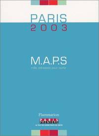
Maps
M.A.P.S. Paris 2003 : Mille adresses pour sortir
FLAMMARION 2003. Paperback. Very Good. Slight signs of wear on the cover. Edition 2003. Ammareal gives back up to 15% of this item's net price to charity organizations. FLAMMARION paperback
Bookseller reference : E-660-482 ISBN : 2080684442 9782080684448
|
|
|
MAPS
MAPS FOR THE JEWISH SCHOOL PORTFOLIO 1
1968. MAPS MAPS FOR THE JEWISH SCHOOL PORTFOLIO 1. New York: Jewish Education Committee Press January 1968. Ten color maps 9 1/2 x 14 inches plus bonus map of the Six Day War. Includes maps of ancient history and contemporary Israel as well as Eastern Europe. Maps fine original envelope has closed tears light soil. unknown books
Bookseller reference : 79979
|
|
|
Maps
Rand McNally Atlas of World History
Paperback. Very Good. paperback
Bookseller reference : GOR005107517 ISBN : 0528832883 9780528832888

|
|
|
Maps
Southern Appalachian Region Maps - VA W VA MD TN
International Geological Congress 1900. no dates but guessing early to mid 1900's - 21 Maps: 1.Route Map Hyattstown to Frederick MD plate 3 2.Route Map Frederick MD to Charles Town W VA plate 4 3. Geologic Map and Sections Area NE of Harpers Ferry W VA plate 5 4. Route Map Hagerstown MD to Cacapon Mountain W VA plate 6 5. Section along Route Hancock to Cumberland MD plate 10 6. Route Map and Sections New Creek W VA to Virginia State Line plate11 7. Route Map and Section W VA state line to Winchester VA plate 12 8. Route Map Winchester to Luray VA and Section across Shenandoah Valley and Massanutten Mountain Plate 13 9. Route Map and Sections Mount Jackson to Staunton VA plate 14 10. Route Map and Sections Staunton to Healing Springs VA plate 15 11. Route Map and Sections Helaing Springs to Lexington VA plate 16 12.Route Map Natural Bridge to Roanoke VA and Section through Read Mountain Fenster plate 18 13. Route Map and Sections Elliston to Glenlyn VA plate 19 14. Route Map Glenlyn to Lebanon VA plate 20 15. Route Map and Section Lebanon to Bristol VA plate 21 16. Route Map Bristol to Pennington Gap VA plate 22 17.Map and Section of Cumberland Overthrust Block plate 23 18. Route Map Cumberland Gap to Morristown TN plate 24 19. Generalized Map and Section of the Cherokee Mountain Klippe TN plate 25 20. Route Map Bristol VA to Mountain City TN and Section from Delaney Mountain to Mountain City plate 26 21. Map of Fenster in Overthrust Block of Rome Formation 3 Miles 4.8 Kilometers East of Wytheville VA Plate 27. Maps. Good. International Geological Congress Paperback
Bookseller reference : FG 2016-26
|
|
|
Maps
Stanford Map Of The Danubian Principalities Prepared From The Vienna Map 2 Maps North and South
Edward Stanford London unknown circa 1857 First Edition thus. Paperback. maps show slight toning a few stains & marks to back of linen otherwise in very good condition case bumped and rubbed with scuffed corners. approximately 54 x 54 inches. dissected linen backed colour map in two parts: North - from Konigr Ungar & Scharzes Meer to Serbia Bulgarien and Schwarzes Meer: South - Vusitrin & Griechenland to Scharzes Meer Meer von Marmara Kleinasien & Archiplagus Weiss. Both 71 X 137 cm legend in English on the North map boundaries carriage trails battlefields harbours in German scale of English miles 69 to one degree boxed set linen backed maps with marbled paper ends cloth covered slipcase Edward Stanford hardcover
Bookseller reference : 32586
|
|
|
MAPS
The Art of the Map-Maker in Essex 1566-1860.
Heron and Co. Ltd. 1947. First Edition 4to coloured frontis. 30 plates cloth. Heron and Co., Ltd., 1947 hardcover
Bookseller reference : 5728
|
|
|
Maps
The Map Book
New York: Harcourt. Good with no dust jacket. 1988. Paperback. 0153729198 . LandmarkEditio; H B J Social Studies Outline Maps and Fact Sheets for States Regions and Countries/Owner Inscription; 0153729198. . Harcourt paperback
Bookseller reference : 79332 ISBN : 0153729198 9780153729195
|
|
|
Maps
The Map Book
Harcourt 1988-01-01. Paperback. Very Good. Paperback. Pages are clean and unmarked. Covers show very minor shelving wear.; 100% Satisfaction Guaranteed! Ships same or next business day! Harcourt paperback
Bookseller reference : 132001210011 ISBN : 0153729198 9780153729195
|
|
|
MAPS
VINLAND MAP AND THE TARTAR RELATION
1965. MAPS. THE VINLAND MAP AND THE TARTAR RELATION. By R.A Skelton et al. New Haven: Yale University Press 1966. Fourth printing. The historian John Muir Whitehill's copy with his notes on the preliminary leaves. 4to. red paper-covered boards; 291pp. A very good copy with a little scuffing to the boards. unknown books
Bookseller reference : 54016
|
|
|
Maps Asia
Large Color WWII Map of Central Asia
Washington D.C.: Army Map Service U.S. Army 1942. Second Edition. Loose sheet. Very Good. Full color map measures 29 x 29 inches. With a list of authorities i.e. other maps consulted in the creation of this map. Glossary. Index to boundaries. Folds as issued and with light soiling. A bright copy. First published 1931 by the War Office this edition is labeled "For Use by War and Navy Department Agencies Only. Not for Sale or Distribution." A vital map published the year 1942 the Japanese invaded Burma and closed off the Allies main supply route the Burma Road. Having already controlled littoral China supplying inland Chinese forces and the Chinese population became increasingly fraught. The region covered extends westward to USSR southward to Northern India and eastward to Mongolia. From the collection of Asian books and maps formed by Albert Ravenholt. On verso Ravenholt has written "Central Asia as far as E. of Tihwa. Army Map Service U.S. Army unknown
Bookseller reference : 5332
|
|
|
Maps British Columbia
Map of Part of British Columbia Showing Main Road System Ashcroft Village
Ashcroft British Columbia: Ashcroft Journal - Board of Trade Ashcroft B.C. 1925. Loose Sheet. Very Good. Map measuring 20 inches x 15 inches printed with black ink on light green paper. Map shows a section of British Columbia from Vancouver north to Quesnell east to Fernie. Map surrounded by ads for Ashcroft businesses. On verso a descriptive narrative offers Ashcroft's history known locally as "Spud City" its regional resources hunting and fishing opportunities and the physical aspects of the landscape. Two rubber stamps one per side for the City Publicity Bureau in Vancouver. Very slight edge-wear to the left margin; a slight stain on the non-map side; old folds now mellowed. A handsome copy of a scarce map suitable for framing. Regarding the publication date: The map refers to Ashcroft as an unincorporated city was formed in 1952 the Main Cariboo Road is described as "a first class dirt and gravel road" and Dr. William Henry Sutherland British Columbia Minister of Public Works is quoted as stating that the scenery in the Marble Canyon Lillooet Lakes and the region of the Fraser River between Lillooet and Lytton "could not be duplicated on the whole of North American Continent and I doubt if it could be surpassed in Europe." Sutherland served in that capacity from 1922-1928 As such we'll posit 1925 as the publication date. Now enclosed in a removable clear archival sleeve. Ashcroft Journal - Board of Trade, Ashcroft, B.C. unknown
Bookseller reference : 5871
|
|
|
Maps Eastern Tibet
Part of Kam or Eastern Tibet
Cambridge: Cambridge University Press 1922. Loose sheet mounted on linen. Good-. Eric Teichman. Map printed in color measuring 26.5 x 25 inches. With a Tibetan glossary. Provides Teichman's routes as well as other routes along with villages monasteries or groups of farms. Edgewear with light stains here and there. In. From Travels of a Consular Officer in Eastern Tibet Together With A History of the Relations between China Tibet and India and mounted on linen. The map was clearly used perhaps in the field as evidence of wear including a split in the paper not the linen on which it's mounted suggests. From the collection of Asian books and maps formed by Albert Ravenholt. On verso Ravenholt has written "Teichman's Kam 28 degrees 25' - 33 degrees 20'. [Cambridge University Press] unknown
Bookseller reference : 5331
|
|
|
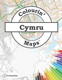
Maps Chasing
Colourin' Maps Cymru: Wales
paperback. Good. Access codes and supplements are not guaranteed with used items. May be an ex-library book. paperback
Bookseller reference : 1738455904.G ISBN : 1738455904 9781738455904
|
|
|
Maps Collins
Short Walks in the Yorkshire Dales Second Edition
HarperCollins Publishers Limited. Used - Good. Ships from the UK. Former library book; may include library markings. Used book that is in clean average condition without any missing pages. HarperCollins Publishers Limited unknown
Bookseller reference : 18973214-20 ISBN : 0007555024 9780007555024

|
|
|
Maps Collins
Short Walks in the Peak District Second Edition
HarperCollins Publishers Limited. Used - Good. Ships from the UK. Former library book; may include library markings. Used book that is in clean average condition without any missing pages. HarperCollins Publishers Limited unknown
Bookseller reference : 15146909-6 ISBN : 0007555032 9780007555031

|
|
|
Maps Coop's
Coop's Roadmap Guide to the Volcanoes
map. Good. Access codes and supplements are not guaranteed with used items. May be an ex-library book. unknown
Bookseller reference : 1884913377.G ISBN : 1884913377 9781884913372

|
|
|
Maps Earthwalk Press
Capitol Reef National Park Hiking Map & Guide
map. Good. Access codes and supplements are not guaranteed with used items. May be an ex-library book. unknown
Bookseller reference : 0915749149.G ISBN : 0915749149 9780915749140
|
|
|
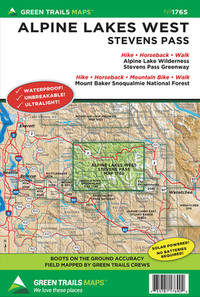
Maps Green Trails
Alpine Lakes West Stevens Pass WA No. 176S Green Trails Maps
map. Good. Access codes and supplements are not guaranteed with used items. May be an ex-library book. unknown
Bookseller reference : 1680513451.G ISBN : 1680513451 9781680513455
|
|
|
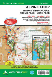
Maps Green Trails
Alpine Loop UT No. 4113SXL Green Trails Maps 4113SX
map. Good. Access codes and supplements are not guaranteed with used items. May be an ex-library book. unknown
Bookseller reference : 1680515160.G ISBN : 1680515160 9781680515169
|
|
|
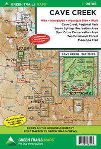
Maps Green Trails
Cave Creek AZ No. 2810S Green Trails Maps
map. Good. Access codes and supplements are not guaranteed with used items. May be an ex-library book. unknown
Bookseller reference : 1680513648.G ISBN : 1680513648 9781680513646
|
|
|
Maps Green Trails
Cougar Mountain WA No. 203S Green Trails Maps
map. Good. Access codes and supplements are not guaranteed with used items. May be an ex-library book. unknown
Bookseller reference : 1680513745.G ISBN : 1680513745 9781680513745

|
|
|
Maps Green Trails
Goat Rocks William O. Douglass Wilderness No.303S Green Trails Maps
map. Good. Access codes and supplements are not guaranteed with used items. May be an ex-library book. unknown
Bookseller reference : 1680513885.G ISBN : 1680513885 9781680513882

|
|
|
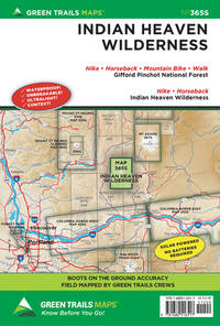
Maps Green Trails
Indian Heaven WA S365S
map. Good. Access codes and supplements are not guaranteed with used items. May be an ex-library book. unknown
Bookseller reference : 1680516515.G ISBN : 1680516515 9781680516517
|
|
|
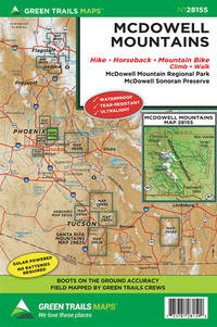
Maps Green Trails
McDowell Mountains AZ No. 2815S Green Trails Maps
map. Good. Access codes and supplements are not guaranteed with used items. May be an ex-library book. unknown
Bookseller reference : 1680514199.G ISBN : 1680514199 9781680514193
|
|
|
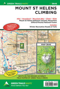
Maps Green Trails
Mount St. Helens Climbing WA No. 364S Green Trails Maps 364S
map. Good. Access codes and supplements are not guaranteed with used items. May be an ex-library book. unknown
Bookseller reference : 1680515993.G ISBN : 1680515993 9781680515992
|
|
|
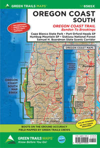
Maps Green Trails
Oregon Coast South OR No. 656SX
map. Good. Access codes and supplements are not guaranteed with used items. May be an ex-library book. unknown
Bookseller reference : 1680515950.G ISBN : 1680515950 9781680515954
|
|
|
Maps Green Trails
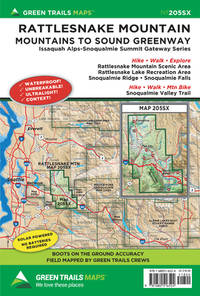
Rattlesnake Mountain WA 205SX Green Trails Maps 205SX
map. Good. Access codes and supplements are not guaranteed with used items. May be an ex-library book. unknown
Bookseller reference : 1680516523.G ISBN : 1680516523 9781680516524
|
|
|
Maps Green Trails
Santa Catalina Mountains AZ No. 2886S Green Trails Maps
map. Good. Access codes and supplements are not guaranteed with used items. May be an ex-library book. unknown
Bookseller reference : 1680514717.G ISBN : 1680514717 9781680514711
|
|
|
Maps Green Trails
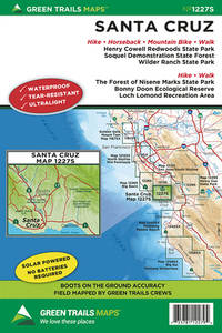
Santa Cruz CA No. 1227S Green Trails Maps
map. Good. Access codes and supplements are not guaranteed with used items. May be an ex-library book. unknown
Bookseller reference : 1680514725.G ISBN : 1680514725 9781680514728
|
|
|
Maps Green Trails
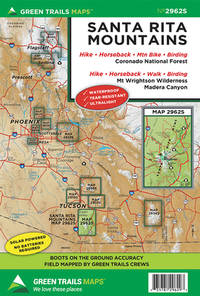
Santa Rita Mountains AZ No. 2962S Green Trails Maps
map. Good. Access codes and supplements are not guaranteed with used items. May be an ex-library book. unknown
Bookseller reference : 1680514733.G ISBN : 1680514733 9781680514735
|
|
|
Maps Green Trails
South Mountain Preserve AZ No. 2836S Green Trails Maps
map. Good. Access codes and supplements are not guaranteed with used items. May be an ex-library book. unknown
Bookseller reference : 1680514830.G ISBN : 1680514830 9781680514834

|
|
 Receive by email
 Download as PDF document
 RSS feed


