|
Münster Sebastian (1488 - 1552)
Roma
Tavola tratta dalla Cosmographiae Universalis, edizione in tedesco, Basilea, seconda metà del XVI secolo.La Cosmographiae Universalis di Sebastian Münster (1488-1552), stampata per la prima volta Basilea nel 1544 dall’editore Heinrich Petri, venne più volte aggiornata e aumentata di nuove carte geografiche e rappresentazioni urbane nelle sue numerose edizioni che arrivano all’inizio del secolo successivo. Münster aveva lavorato a raccogliere informazioni al fine di ottenere un'opera che non deludesse le aspettative e, dopo un'ulteriore pubblicazione in tedesco abbellita da 910 stampe su legno, giunse nel 1550 all'edizione definitiva in latino, illustrata da 970 silografie. Vi furono poi numerose edizioni in diverse lingue, fra cui latino, francese, italiano, inglese e ceco. Dopo la sua morte di Münster (1552), Heinrich Petri prima, e il figlio Sebastian poi, continuarono la pubblicazione dell’opera. La Cosmographia universalis fu uno dei libri più popolari e di successo del XVI secolo, e vide ben 24 edizioni in 100 anni: l'ultima edizione tedesca venne pubblicata nel 1628, molto tempo dopo la morte dell'autore. La Cosmographia conteneva non solo le ultime mappe e vedute di tutte le città più famose, ma anche una serie di notizie enciclopediche di dettagli relative al mondo conosciuto, e sconosciuto. Il particolare successo anche commerciale di quest'opera fu dovuto in parte alle belle incisioni (tra i cui autori si possono citate Hans Holbein il Giovane, Urs Graf, Hans Rudolph Manuel Deutsch, David Kandel). Silografia, bella coloritura a mano, in buone condizioni. Plate taken from the Cosmographiae Universalis, German edition, Basel, second half of the 16th Century. The Cosmographiae Universalis of Sebastian Münster (1488-1552), printed for the first time in Basel in 1544 by the publisher Heinrich Petri, was updated several times and increased with new maps and urban representations in its many editions until the beginning of the next century. Münster had worked to collect information in order to obtain a work that did not disappoint expectations and, after a further publication in German embellished with 910 woodblock prints, arrived in 1550 to the final edition in Latin, illustrated by 970 woodcuts. There were then numerous editions in different languages, including Latin, French, Italian, English and Czech. After his death in Münster (1552), Heinrich Petri first, and then his son Sebastian, continued the publication of the work. The Cosmographia universalis was one of the most popular and successful books of the 16th century, and saw as many as 24 editions in 100 years: the last German edition was published in 1628, long after the author's death. The Cosmographia contained not only the latest maps and views of all the most famous cities, but also a series of encyclopedic details related to the known, and unknown, world. The particular commercial success of this work was due in part to the beautiful engravings (among whose authors can be mentioned Hans Holbein the Younger, Urs Graf, Hans Rudolph Manuel Deutsch, David Kandel). Woodcut, beautiful hand-coloring, in good condition.

|
|
|
N. BAILLEUL et Mr CASSINY DE THURY, de l'Académie Royale des Sciences
CARTE DE LA FRANCE DIVISEE EN XXXI GOUVERNEMENTS MILITAIRES ET EN TOUTES SES PROVINCES, Dressée par N. Bailleul, sur les meilleures Cartes qui ont paruës jusqu'à présent Et sur les Observations Géométriques de la Carte des Triangles, mise au jour par Mr CASSINY DE THURY, de l'Académie Royale des Sciences - 1754 -
Lyon DAUDET 1754 une carte ancienne avec Limites colorée d'époque en vert , rouge et jaune, cartouche non coloré, gravée sur cuivre en noir par N. BAILLEUL, Format total : 100 centimètres de haut par 125,5 centimètres de large, 1754 Lyon DAUDET Editeur,
Bookseller reference : 27639
|
|
|
N/ A and Maps, Text Illustrations etc throuhgout
Lake District The; Britain's Largest National Park
Paperback. Very Good. Very good condition. Same day dispatch Mon-Fri from the UK if ordered by 1pm. paperback
Bookseller reference : EKG-C7E-5G2
|
|
|
n/a
Karte Nr. 35. Ravenstein's Rad- u. Automobil-Karte für den Regierungsbezirk LIEGNITZ Sowie Die Umgend Von Gorlitz Und Zittau. 1: 300 000.
Frankfurt: Ludwig Ravenstein Map. Very Good. Map. No date circa 1910 Cloth backed coloured map - approximately 80 x 60cm. In very good condition some - towns underlined in blue. A very good copy. Ludwig Ravenstein hardcover
Bookseller reference : 007202

|
|
|
n/a
Northeastern Official AAA Tour Book
Washington DC: American Automobile Association 1927. Softcover. Good/no jacket. 400 p maps throughout 24cm tall octavo. One section has brief descriptions of principal northeastern cities towns resorts; another section has detailed logs and maps for principal routes. Also many advertisements for hotels and resorts. Folded northeastern states highway map affixed to inside rear cover. Covers show some soil otherwise a fine copy. American Automobile Association paperback
Bookseller reference : 001379
|
|
|
N/a
Van Mercator tot computerkaart , Een geschiedenis van de cartografie.
, Brepols, 2001 Hardback,approx. 160 p., 30 b/w ill. 54 colour ill., 210 x 285 mm, in Dutch. ISBN 9789056220402.
Bookseller reference : 28741
|
|
|
N/A.
"Libro del Conosçimiento de todos los Regnos et Tierras et Señorios que son por el Mundo, et de las señales et armas que han" Edición facsimilar, transcripción, estudio y notas del Manuscrito Z de la Bayerische Staatsbibliothek, de Munich [Cod. Hisp. 150] procedente de la "Alacena de Zurita", realizada por Maria Jesús Lacarra, Maria del Carmen Lacarra Ducay y Alberto Montaner.
Zaragoza, 1999. Folio; 279 pp., cincuenta y dos de ellas y tres láminas, dos de ellas plegadas, con la reproducción facsímilar del Códice. Cubiertas originales.

|
|
|
N/A.
Paris en Main. La Vrai Guide d'après un plan fractionné par arrondissements et divisé par quartiers.
Paris, A. V. Vallad fils et Cie., 1886. 4to.; 12-45 pp., 20 hojas sin paginar, 20 planos impresos en color y un plano plegado. Encuadernación original en tela estampada.

|
|
|
NAESSENS, HERMAN (VERTALING
Museum van de Kleine Koningin. [Het fietsmuseum van Falmignoul]
Flamignoul, Fietsmuseum, s.d. (ca.1970) Gebonden, kunstleder met titelillustr., 209pp., 16.5x24.5cm., oblong, ills. in z/w., goede staat. Zeldzaam!!
Bookseller reference : 46143
|
|
|
Nagel, Joseph.
Grund-Riß der kay. königl. Residenz-Stadt Wien. Unter glorwürdigster Regierung Beyder May.ten Josephs des II.ten Röm. Kaysers und Mariä Theresiä Röm. Kayserin [...] Unter der Direction dero Hof Mathematici Joseph Nagel aufgenommen von dem N.D. Reg. Ingenieur Franz Gruß und Joseph Neussner im Jahr 1770. Vienna, zu haben auf der Wieden in der Plenkler Gasse No. 316, [1774].
Four-plate engraving by J. E. Mansfeld, mounted on cloth and framed under glass. 131 x 162 cm. Probably the most monumental layout plan of the Vienna inner city ever published, doubling the scale of Nagel's better-known (and more common) plan of Vienna and its suburbs (1781), and self-published as early as 1774. Nagel had begun his surveying task shortly after completion of the re-numbering of houses in 1770. "Probably completed in October 1774" (cf. Dörflinger). - Slight browning to margins, otherwise fine. Extremely rare. Dörflinger, Österreichische Karten des 18. Jhs. I, 71 and note 115. Not in Mayer or Eckl colls.

|
|
|
Nagy, Thomas L.
Ottawa in Maps - A Brief Cartographical History of Ottawa (Canada) 1825-1973 / Ottawa Par Les Cartes - Breve Histoire Cartographique De La Ville D'Ottawa (Catalogue No. SA2-72/1974)
[12], 87 pages. Bilingual English/French. Printed upon glossy stock. Illustrated throughout in blue and brown. "From its very beginning to the present time, the history of the nation's capital unfolds from the cartographical material housed in the National Map Collection. The collection includes over three hundred maps directly relating to the Ottawa area; the selected maps reproduced in this book tell the highlights of the story. A list of Ottawa area maps appears in the appendix. This list should be of great value to historical researchers and all others interested in Canada's capital." - Preface. Moderate external wear. Contents clean and unmarked. A sound copy of this informative reference. Bishop p.36. Book

|
|
|
NANCY
Carte d'Etat-Major au 1/200 000?. Fin XIXe.
1 feuille repli?e. 32x49 cm.
|
|
|
NANSEN Fridtjof:
In Nacht und Eis. Die Norwegische Polarexpedition. 1893-1896. Mit einem Beitrag von Kapitän Sverdrup.
Leipzig, F.A.B. Brockhaus, 1897. 2 vol. in-8 de X-527 + VIII-507 pages, pleine percaline grise d’éditeur (sans doute blanche autrefois), dos lisses, 1ers plats illustrés. Mors fendus sur quelques centimètres au vol. 1.
Bookseller reference : 2105

|
|
|
Nantet, Bernard
Malta
No marks or inscriptions. No creasing to covers or to spine. A very clean very tight copy with bright unmarked boards and no bumping to corners. Dust jacket not price clipped or marked with chips and nicks to upper and lower edges. 195pp. An account of 5000 years of history of Malta, very well illustrated with the culture, architecture, industry and leisure of the island today. Text in English, French and German. Undated ca 1980.

|
|
|
NAPOLEON III]
Jugement de Napoléon III.
Genève et Bruxelles Chez les principaux libraires, s.d. [1870 circa] 1 vol. broché Placard au format 46 x 36 cm imprimé au recto sur 4 colonnes. Compte rendu d'un procès imaginaire où Napoléon III comparaît devant l’Histoire, les témoins cités étant la Paix, la Liberté, la Dette, le Sénat, la Police... Le jugement prononcé par l’Histoire déclare que « le règne de Napoléon III commencé par un coup d’état, terminé par une invasion, prendra place au rang des règnes les plus néfastes et les plus douloureux que la France ait eu à supporter… ». Trace de pli central, excellente condition. Document rare.
Bookseller reference : 121178
|
|
|
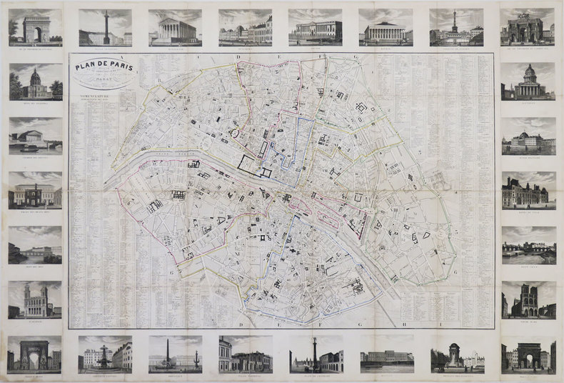
NARAT.
Plan de Paris divisé en 12 arrondissements, indiquant tous les changements.
Paris, Danlos, 1830. En 36 sections jointes et montées sur toile de 590 x 877 mm.
Bookseller reference : LBW-3442
|
|
|
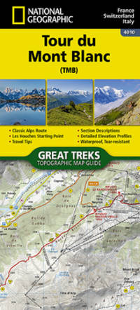
Nat Geo Maps (Author)
Tour de Mont Blanc Great Treks of the World Map Guides
National Geographic Maps 2024. map. New. 48 pages. 9.38x0.20x4.25 inches. National Geographic Maps unknown
Bookseller reference : __1566959543 ISBN : 1566959543 9781566959544
|
|
|
Nat Geo Maps (Author)
Tour de Mont Blanc Great Treks of the World Map Guides
National Geographic Maps 2024. map. New. 48 pages. 9.38x0.20x4.25 inches. National Geographic Maps unknown
Bookseller reference : 1-1566959543 ISBN : 1566959543 9781566959544
|
|
|
National Geographic Maps
A Traveler's Map of Britain & Ireland
National Geographic Society. Folded double sided map. . Very Good. Paperback. First Edition. 2000. National Geographic Society paperback
Bookseller reference : 148743
|
|
|
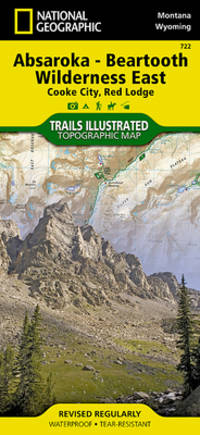
National Geographic Maps
Absaroka-Beartooth Wilderness East Map Cooke City Red Lodge National Geographic Trails Illustrated Map 722
Natl Geographic Society Maps 2019-01-01. 2019. map. New. 4.20x0.40x9.00. Buy with confidence. Excellent Customer Service & Return policy. Natl Geographic Society Maps unknown
Bookseller reference : DADAX1566955823 ISBN : 1566955823 9781566955829
|
|
|
National Geographic Maps - Trails Illustrated
Absaroka-Beartooth Wilderness East Map Cooke City Red Lodge National Geographic Trails Illustrated Map 722
map. Good. Access codes and supplements are not guaranteed with used items. May be an ex-library book. unknown
Bookseller reference : 1566955823.G ISBN : 1566955823 9781566955829
|
|
|
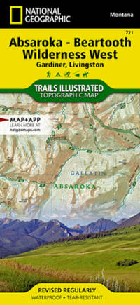
National Geographic Maps
Absaroka-Beartooth Wilderness West Map Gardiner Livingston National Geographic Trails Illustrated Map 721
map. Good. Access codes and supplements are not guaranteed with used items. May be an ex-library book. unknown
Bookseller reference : 1566955815.G ISBN : 1566955815 9781566955812
|
|
|
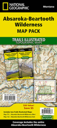
National Geographic Maps - Trails Illustrated
Absorka-Beartooth Wilderness Map Pack Bundle National Geographic Trails Illustrated Map
map. Good. Access codes and supplements are not guaranteed with used items. May be an ex-library book. unknown
Bookseller reference : 156695892X.G ISBN : 156695892X 9781566958929
|
|
|
National Geographic Maps (Corporate Author)
Acadia National Park Day Hikes Map
Natl Geographic Society Maps 2023. Paperback. New. map edition. 48 pages. 9.38x4.25x9.40 inches. Natl Geographic Society Maps paperback
Bookseller reference : 1-1566959101 ISBN : 1566959101 9781566959100
|
|
|
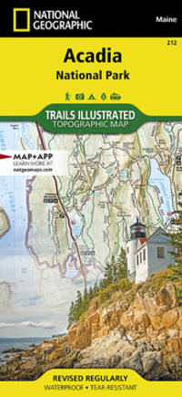
National Geographic Maps - Trails Illustrated
Acadia National Park Map National Geographic Trails Illustrated Map 212
Natl Geographic Society Maps. 2019. Good. It's a preowned item in good condition and includes all the pages. It may have some general signs of wear and tear such as markings highlighting slight damage to the cover minimal wear to the binding etc. but they will not affect the overall reading experience. Natl Geographic Society Maps unknown
Bookseller reference : 1566953529-11-1 ISBN : 1566953529 9781566953528
|
|
|
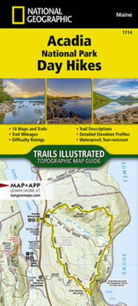
National Geographic Maps - Trails Illustrated
Acadia National Park Day Hikes Map National Geographic Topographic Map Guide 1714
map. Good. Access codes and supplements are not guaranteed with used items. May be an ex-library book. unknown
Bookseller reference : 1566959101.G ISBN : 1566959101 9781566959100
|
|
|
National Geographic Maps - Trails Illustrated
Acadia National Park Map National Geographic Trails Illustrated Map 212
National Geographic 2019-01-01. 2019. map. Used: Good. 6.47x0.17x9.23. Buy with confidence. Excellent Customer Service & Return policy. National Geographic unknown
Bookseller reference : SONG1566953529 ISBN : 1566953529 9781566953528
|
|
|
National Geographic Maps - Trails Illustrated
Acadia National Park Map National Geographic Trails Illustrated Map 212
map. Good. Access codes and supplements are not guaranteed with used items. May be an ex-library book. unknown
Bookseller reference : 1566953529.G ISBN : 1566953529 9781566953528
|
|
|
National Geographic Maps - Trails Illustrated
Acadia National Park National Geographic Trails Illustrated Map
National Geographic Maps. New. BRAND NEW GIFT QUALITY! NOT OVERSTOCKS OR MARKED UP REMAINDERS! DIRECT FROM THE PUBLISHER! National Geographic Maps unknown
Bookseller reference : OTF-S-9781566953528 ISBN : 1566953529 9781566953528
|
|
|
National Geographic Maps - Trails Illust
Acadia National Park National Geographic Trails Illustrated Map 212
National Geographic Maps. New. Special order direct from the distributor National Geographic Maps unknown
Bookseller reference : ING9781566953528 ISBN : 1566953529 9781566953528
|
|
|
National Geographic Maps - Trails Illustrated
Acadia National Park Map National Geographic Trails Illustrated Map 212
National Geographic 2019-01-01. 2019. map. New. 6.47x0.17x9.23. Buy with confidence. Excellent Customer Service & Return policy. National Geographic unknown
Bookseller reference : DADAX1566953529 ISBN : 1566953529 9781566953528
|
|
|
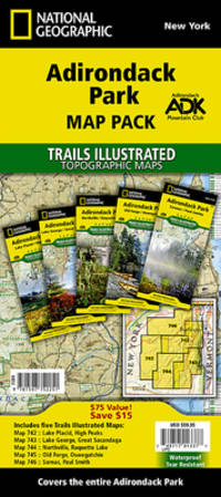
National Geographic Maps - Trails Illustrated
Adirondack Park Map Pack Bundle National Geographic Trails Illustrated Map
map. Good. Access codes and supplements are not guaranteed with used items. May be an ex-library book. unknown
Bookseller reference : 1597752258.G ISBN : 1597752258 9781597752251
|
|
|
National Geographic Maps - Trails Illustrated
Adirondack Park Map Pack Bundle National Geographic Trails Illustrated Map
National Geographic 2023-01-01. 2023. map. New. 4.25x0.50x9.25. Buy with confidence. Excellent Customer Service & Return policy. National Geographic unknown
Bookseller reference : DADAX1597752258 ISBN : 1597752258 9781597752251
|
|
|
National Geographic Maps - Trails Illustrated
Adirondack Park Map Pack Bundle National Geographic Trails Illustrated Map
National Geographic 2023-01-01. 2023. map. Used: Good. 4.25x0.50x9.25. Buy with confidence. Excellent Customer Service & Return policy. National Geographic unknown
Bookseller reference : SONG1597752258 ISBN : 1597752258 9781597752251
|
|
|
National Geographic Maps
Afghanistan Pakistan and the Middle East Wall Map Laminated
Natl Geographic Society Maps 2012. Map. New. lam map edition. 1 pages. 23.50x30.25x2.25 inches. Natl Geographic Society Maps unknown
Bookseller reference : 1-0792250222 ISBN : 0792250222 9780792250227
|
|
|
National Geographic Maps
Africa Political Map Laminated
Natl Geographic Society Maps 2013. Map. New. lam map edition. 1 pages. 23.70x1.70x1.10 inches. Natl Geographic Society Maps unknown
Bookseller reference : 1-0792250109 ISBN : 0792250109 9780792250104
|
|
|
National Geographic Maps
Africa: The Human Footprint/ A Storied Landscape
National Geographic Society. unknown_binding. Good. 1.0000 in x 5.1000 in x 2.0000 in. Folded map that originally accompanied the September 2005 issue of National Geographic. National Geographic Society unknown
Bookseller reference : mon0000949318
|
|
|
National Geographic Maps
Africa: The Human Footprint/ A Storied Landscape
New. Large folded map unknown
Bookseller reference : 53KN1Y0004DE
|
|
|
National Geographic Maps
Alabama Recreation Atlas National Geographic Recreation Atlas
Natl Geographic Society Maps. 2012. Acceptable. The item might be beaten up but readable. May contain markings or highlighting as well as stains bent corners or any other major defect but the text is not obscured in any way. Natl Geographic Society Maps unknown
Bookseller reference : 1597755249-7-1 ISBN : 1597755249 9781597755245
|
|
|
National Geographic Maps
Alabama Recreation Atlas National Geographic Recreation Atlas
Natl Geographic Society Maps 2012-10-01. 2012. paperback. New. 10.60x0.90x15.10. Buy with confidence. Excellent Customer Service & Return policy. Natl Geographic Society Maps paperback
Bookseller reference : DADAX1597755249 ISBN : 1597755249 9781597755245
|
|
|
National Geographic Maps
Alabama Recreation Atlas National Geographic Recreation Atlas
Natl Geographic Society Maps 2012-10-01. 2012. paperback. Used: Good. 10.60x0.90x15.10. Buy with confidence. Excellent Customer Service & Return policy. Natl Geographic Society Maps paperback
Bookseller reference : SONG1597755249 ISBN : 1597755249 9781597755245
|
|
|
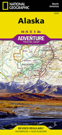
National Geographic Maps - Adventure
Alaska
- Waterproof - Tear-Resistant - Travel Map Alaska is a land so vast that is boggles the imagination. It is so large that it could easily contain the next three largest states: Texas California and Montana and still have room left over. Despite its large size Alaska has very few inhabitants making it the state with the lowest population density. Alaska is known for its dramatic diverse terrain of wide-open spaces mountains and forests with abundant wildlife and many small towns. A majority of Alaska sixty percent is owned and managed by the Federal Government. These lands are open to the public and offer a wide range of activities from sightseeing in Denali National Park to river-running and fishing on one of many wild rivers. Many vistors to Alaska choose to arrive via cruise ship through the famous Inside Passage. The Alaska Adventure Map shows all of these features and more from the temperate rain forest in the Pan Handle to the arctic tundra of the North Slope. This is a state of diverse and wide open spaces that are still truly wild. Alaska's most famous hotspots like Denali Anchorage the Inside Passage Klondike Gold Rush National Historical Park and many others are clearly marked on the map. The boundaries of National Parks National Forests Natural Reserves and Wildlife Refuges are all clearly marked. With such a wealth of content the map is an ideal complement to National Geographic's Inside Passage Destination Map or any other guidebook to the area. Every Adventure Map is printed on durable synthetic paper making them waterproof tear-resistant and tough -- capable of withstanding the rigors of international travel. Map Scale = 1:2250000 Sheet Size = 25.5"" x 37.75"" Folded Size = 4.25"" x 9.25"" unknown
Bookseller reference : BIBUP61025-A39695 ISBN : 1566957052 9781566957052
|
|
|
National Geographic Maps
Alaska Map National Geographic Adventure Travel Map
National Geographic Maps. 2022nd ed. Map. Used; Very Good. Simply Brit welcome to our online used book store where affordability meets great quality. Dive into a world of captivating reads without breaking the bank. We take pride in offering a wide selection of used books from classics to hidden gems ensuring theres something for every literary palate. All orders are shipped within 24 hours and our lightning fast-delivery within 48 hours coupled with our prompt customer service ensures a smooth journey from ordering to delivery. Discover the joy of reading with us your trusted source for affordable books that do not compromise on quality. 01/01/2020 National Geographic Maps unknown
Bookseller reference : 4182251 ISBN : 0749717000599 0749717000
|
|
|
National Geographic Maps - Adventure
Alaska Map National Geographic Adventure Map 3117
National Geographic 2022-01-01. 2022. map. Used: Good. 4.10x0.40x9.10. Buy with confidence. Excellent Customer Service & Return policy. National Geographic unknown
Bookseller reference : SONG1566957052 ISBN : 1566957052 9781566957052
|
|
|
National Geographic Maps - Adventure
Alaska Map National Geographic Adventure Map 3117
map. Good. Access codes and supplements are not guaranteed with used items. May be an ex-library book. unknown
Bookseller reference : 1566957052.G ISBN : 1566957052 9781566957052
|
|
|
National Geographic Maps Adventure
Alaska Map National Geographic Adventure Map 3117
National Geographic 2022-01-01. 2022. map. New. 4.10x0.40x9.10. Buy with confidence. Excellent Customer Service & Return policy. National Geographic unknown
Bookseller reference : DADAX1566957052 ISBN : 1566957052 9781566957052
|
|
|
National Geographic Maps - Adventure
Alaska National Geographic Adventure Map 3117
National Geographic Maps. New. Special order direct from the distributor National Geographic Maps unknown
Bookseller reference : ING9781566957052 ISBN : 1566957052 9781566957052
|
|
|
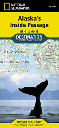
National Geographic Maps
Alaska's Inside Passage National Geographic Destination Map
map. Good. Access codes and supplements are not guaranteed with used items. May be an ex-library book. unknown
Bookseller reference : 159775451X.G ISBN : 159775451X 9781597754514
|
|
|
National Geographic Maps
Alaska's Inside Passage National Geographic Destination Map
National Geographic Maps. New. BRAND NEW GIFT QUALITY! NOT OVERSTOCKS OR MARKED UP REMAINDERS! DIRECT FROM THE PUBLISHER! National Geographic Maps unknown
Bookseller reference : OTF-S-9781597754514 ISBN : 159775451x 9781597754514
|
|
 Receive by email
 Download as PDF document
 RSS feed


