|
PERINT (Charles).
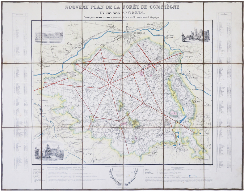
[FORÊT de COMPIÈGNE] Nouveau plan de la forêt de Compiègne et de ses environs.
Compiègne, Dubois, [circa 1845]. En 18 sections montées sur toile et repliées, formant une carte de 532 x 687 mm.
Bookseller reference : LBW-7850
|
|
|
PERREIN (Paul)
Images d'autrefois de Bordeaux et de la Gironde - 506 cartes postales anciennes
Périgueux, Pierre Fanlac, 1984. Grand in-8 broché jaune, ill. sur plats, couv. à rabats, 310 p. Très nombreuses photos en noir. Préface de Jacques Chaban-Delmas. Très bon état. Prix du Livre cartophile 1981.
Bookseller reference : 10048
|
|
|
PERREIN (Paul)
Images d'autrefois de la Gironde, de L'Amélie-sur-Mer à Virelade - Tome II, 552 cartes postales anciennes
Périgueux, Pierre Fanlac, 1982. Grand in-8 broché, couverture ill. "carte postale Pessac" à rabats, 334 p. Préface de Roger Galy. 552 cartes postales anciennes. Très bon état : couverture discrètement roussie.
Bookseller reference : 6942
|
|
|
PERRIN (Maurice).
[ALGER] Plan d'Alger.
Paris, [1890]. 227 x 155 mm.
Bookseller reference : LBW-8653

|
|
|
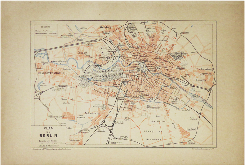
PERRIN (Maurice).
[BERLIN] Plan de Berlin.
Paris, [1890]. 157 x 226 mm.
Bookseller reference : LBW-8600
|
|
|
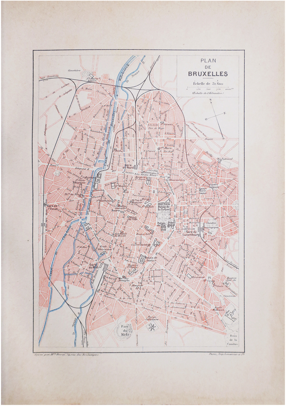
PERRIN (Maurice).
[BRUXELLES] Plan de Bruxelles.
Paris, [1890]. 228 x 156 mm.
Bookseller reference : LBW-8612
|
|
|
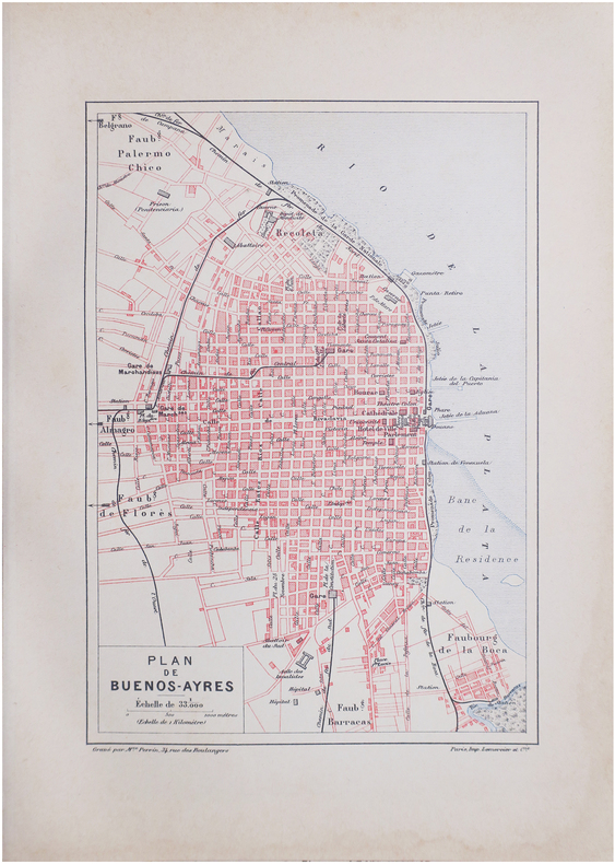
PERRIN (Maurice).
[BUENOS-AIRES] Plan de Buenos-Ayres.
Paris, [1890]. 229 x 156 mm.
Bookseller reference : LBW-8637
|
|
|
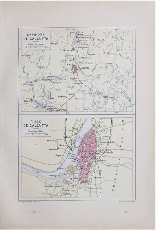
PERRIN (Maurice).
[CALCUTTA] Environs de Calcutta - Ville de Calcutta.
Paris, [1890]. 228 x 158 mm.
Bookseller reference : LBW-8640
|
|
|
PERRIN (Maurice).
[INDOCHINE] Tonkin, Annam, Cochinchine et Cambodge.
[1890]. 239 x 158 mm.
Bookseller reference : LBW-7248

|
|
|
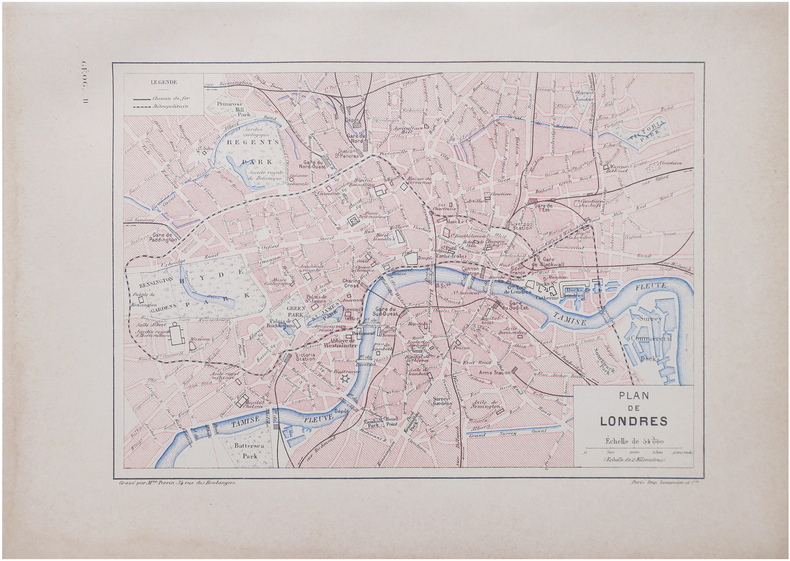
PERRIN (Maurice).
[LONDRES] Plan de Londres.
Paris, [1890]. 160 x 226 mm.
Bookseller reference : LBW-8641
|
|
|
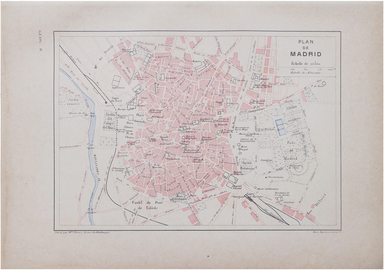
PERRIN (Maurice).
[MADRID] Plan de Madrid.
Paris, [1890]. 160 x 226 mm.
Bookseller reference : LBW-8642
|
|
|
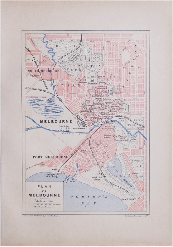
PERRIN (Maurice).
[MELBOURNE] Plan de Melbourne.
Paris, [1890]. 229 x 156 mm.
Bookseller reference : LBW-8601
|
|
|
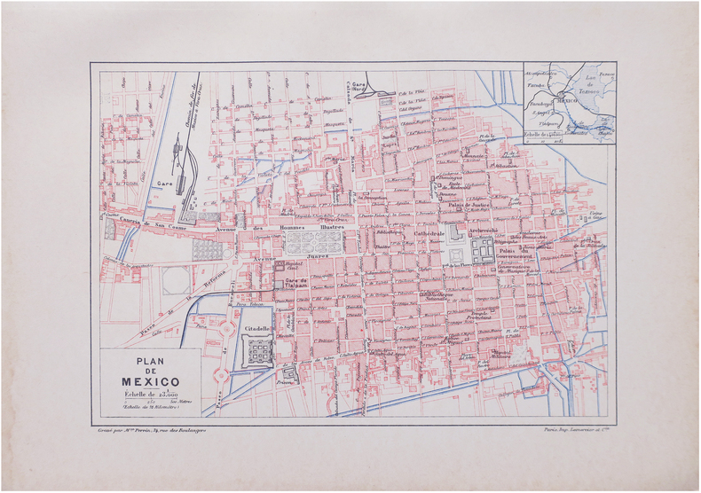
PERRIN (Maurice).
[MEXICO] Plan de Mexico.
Paris, [1890]. 159 x 226 mm.
Bookseller reference : LBW-8625
|
|
|
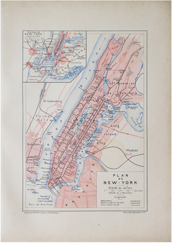
PERRIN (Maurice).
[NEW YORK] Plan de New-York.
Paris, [1890]. 227 x 155 mm.
Bookseller reference : LBW-8610
|
|
|
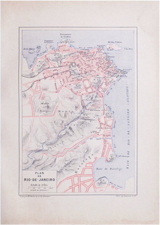
PERRIN (Maurice).
[RIO de JANEIRO] Plan de Rio-de-Janeiro.
Paris, [1890]. 228 x 156 mm.
Bookseller reference : LBW-8639
|
|
|
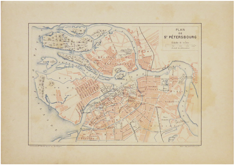
PERRIN (Maurice).
[SAINT-PÉTERSBOURG] Plan de Saint-Pétersbourg.
[1890]. 160 x 224 mm.
Bookseller reference : LBW-7240
|
|
|
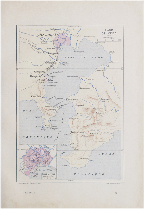
PERRIN (Maurice).
[TOKYO] Rade de Yédo.
Paris, [1890]. 229 x 156 mm.
Bookseller reference : LBW-8644
|
|
|
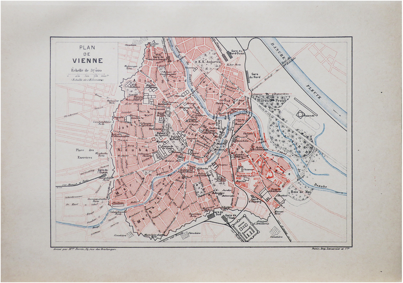
PERRIN (Maurice).
[VIENNE] Plan de Vienne.
Paris, [1890]. 159 x 225 mm.
Bookseller reference : LBW-8618
|
|
|
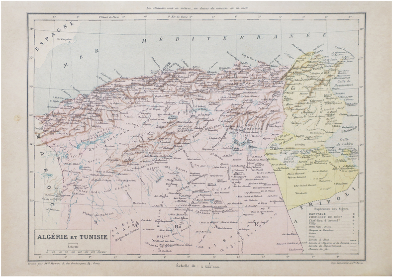
PERRIN (Maurice).
Algérie et Tunisie.
Paris, [1890]. 198 x 258 mm.
Bookseller reference : LBW-8652
|
|
|
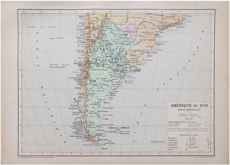
PERRIN (Maurice).
Amérique du Sud (Partie méridionale).
Paris, [1890]. 192 x 258 mm.
Bookseller reference : LBW-8656
|
|
|
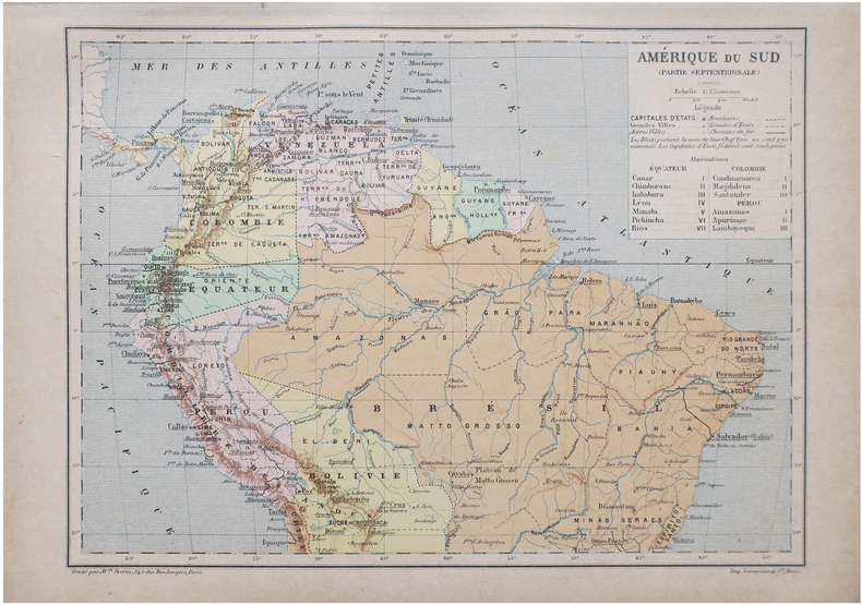
PERRIN (Maurice).
Amérique du Sud (Partie septentrionale).
Paris, [1890]. 192 x 258 mm.
Bookseller reference : LBW-8655
|
|
|
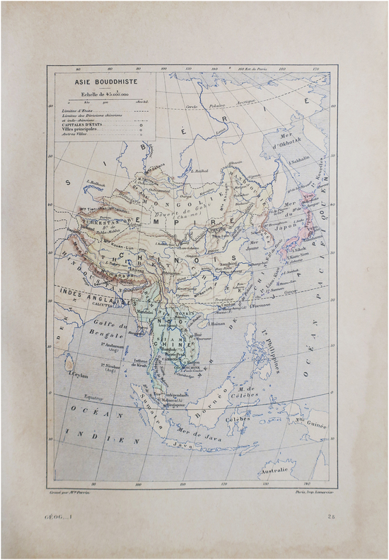
PERRIN (Maurice).
Asie bouddhiste.
Paris, [1890]. 230 x 158 mm.
Bookseller reference : LBW-8646
|
|
|
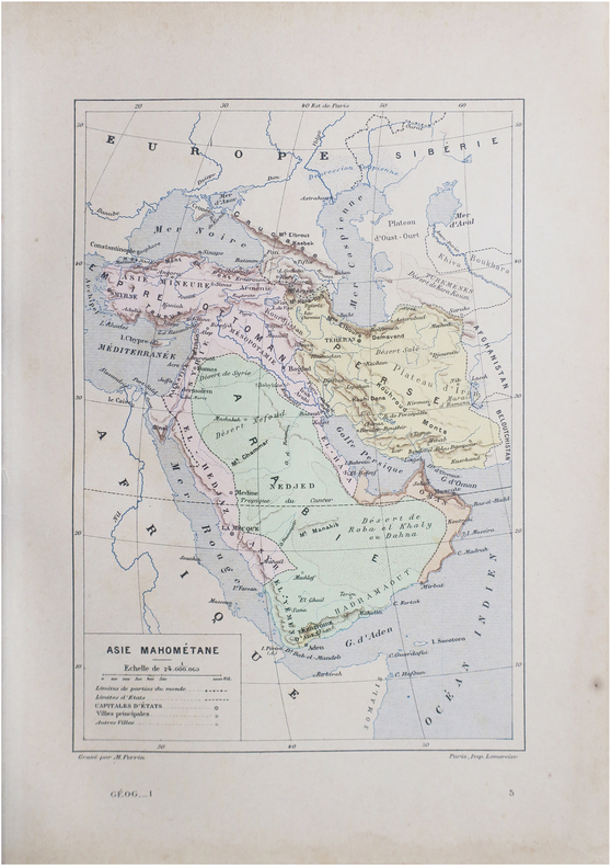
PERRIN (Maurice).
Asie mahométane.
Paris, [1890]. 230 x 157 mm.
Bookseller reference : LBW-8645
|
|
|
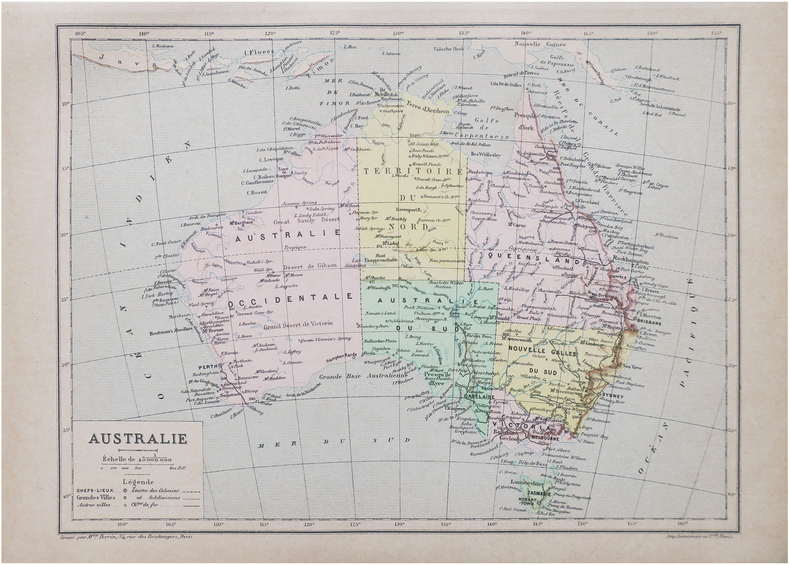
PERRIN (Maurice).
Australie.
Paris, [1890]. 193 x 260 mm.
Bookseller reference : LBW-8647
|
|
|
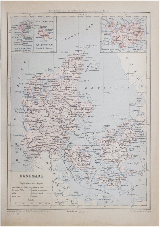
PERRIN (Maurice).
Danemark.
Paris, [1890]. 267 x 190 mm.
Bookseller reference : LBW-8648
|
|
|
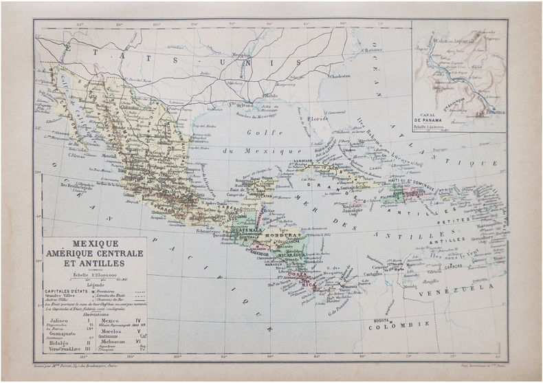
PERRIN (Maurice).
Mexique, Amérique centrale et Antilles.
Paris, [1890]. 192 x 265 mm.
Bookseller reference : LBW-8649
|
|
|
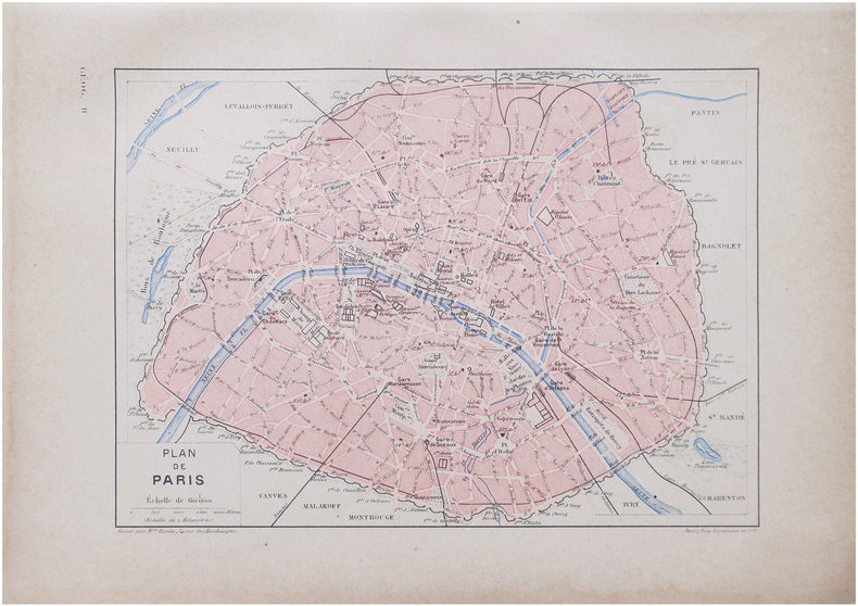
PERRIN (Maurice).
Plan de Paris.
Paris, [1890]. 163 x 225 mm.
Bookseller reference : LBW-8638
|
|
|
PERROT (A.M.).
Carte pittoresque et maritime de la France. Revue et augmentée par A. Vuillemin.
Paris, Bulla Frères et François Delarue, s.d.(1860). Grande carte entoilée de 82 cm x 112 cm) formée de 32 panneaux , gravée et rehaussée en couleurs à l'aquarelle. Rempliée sous percaline brune ornée à froid de l'époque, marque du libraire Auguste Fontaine (Passage des panoramas) et titre doré au premier plat "Carte routière". Très bon état.
Bookseller reference : 16163
|
|
|
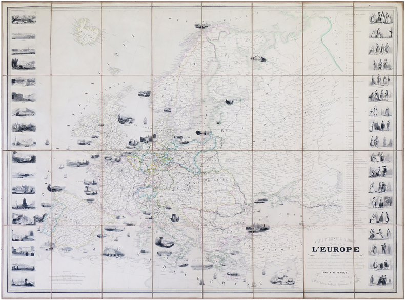
PERROT (Aristide Michel) & VUILLEMIN (Alexandre).
Carte pittoresque & maritime de l'Europe.
Paris, Fatout, 1861. 612 x 842 mm.
Bookseller reference : LBW-7914
|
|
|
PERROT (Aristide Michel).
[MÉTÉOROLOGIE] Tableau de météorologie représentant les divers phénomènes de l'athmosphère, tels que le tonnerre, l'aurore boréale, aréolythes, l'arc-en-ciel, les trombes, le feu S.t Elme, les étoiles filantes et aréolythes, le halo, les parhélies, le mirage, les marées &.a &.a.
Paris, Langlois et Leclercq, Maison Basset, 1856. 491 x 627 mm.
Bookseller reference : LBW-8423

|
|
|
PERROT (Aristide Michel).
[TOPOGRAPHIE] Topographie. Tableau des teintes et signes conventionnels, adoptés par le Ministère de la Guerre. Guide réel des ingénieurs civils et militaires, officiers d'État-major, &c.
Paris, Bouasse-Lebel, Édit. Imp., et Anc.ne M.on Basset réunies, [1863]. 497 x 613 mm.
Bookseller reference : LBW-8426

|
|
|
PERROT (Aristide Michel).
Carte pour servir de tableau d'assemblage aux colonies françaises occidentales.
I. Duprat-Duverger, 1826. 296 x 293 mm.
Bookseller reference : LBW-4800

|
|
|
PERROT (Aristide Michel).
Tableau des animaux et des végétaux existans avant le Déluge, rédigé d'après Cuvier, Buckland, de Humboldt, &.c ; par Perrot, Ingén.r-Géographe. Dessiné d'après les végétaux et les fossiles existants dans les divers cabinets de l'Europe.
Paris, Langlois et Leclercq, Maison Basset, [1842]. 491 x 627 mm.
Bookseller reference : LBW-8431

|
|
|
PERROT (Aristide Michel).
Tableau pittoresque des merveilles de la nature. Encyclopédie Bouasse-Lebel.
Paris, Maison Bouasse Lebel, et ancienne Maison Basset réunies, [1863]. 440 x 585 mm.
Bookseller reference : LBW-8843

|
|
|
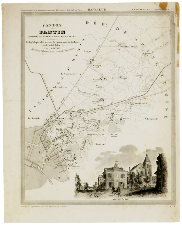
PERROT (Aristide-Michel) & MONIN (Charles V.).
[PANTIN] Canton de Pantin, arrond.t de St Denis, dép.t de la Seine.
[1834]. 305 x 240 mm, sur papier fin.
Bookseller reference : LBW-5373
|
|
|
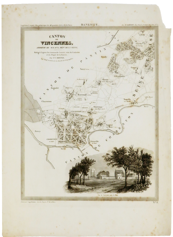
PERROT (Aristide-Michel) & MONIN (Charles V.).
[VINCENNES] Canton de Vincennes, arrond.t de Sceaux, dép.t de la Seine.
[1834]. 305 x 241 mm, sur papier fin.
Bookseller reference : LBW-5374
|
|
|
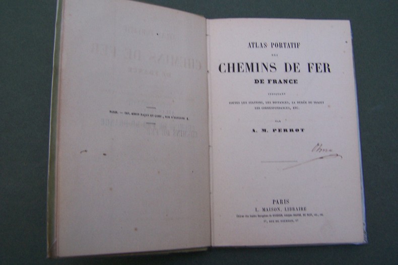
PERROT A.M.
Atlas portatif des Chemins de Fer de France.
P., Maison, s.d. In-12, carte des environs de Paris en frontispice, 37 pages de cartes, cartonnage.
Bookseller reference : CF343
|
|
|
PERROT J-.M.
CARTE PITTORESQUE ET MARITIME DE LA FRANCE
1841 carte entoilée, pliée in-8, qq. coupures aux plis, gravée / acier par bénard, ornée de chaque côtés par des lith. représentant villes et monuments / 1 col., fatout éditeur, 1841,
Bookseller reference : 702
|
|
|
PERROT.
CAEN (Calvados).
Paris, Benard, [circa 1850]. 212 x 285 mm.
Bookseller reference : LBW03d71
|
|
|
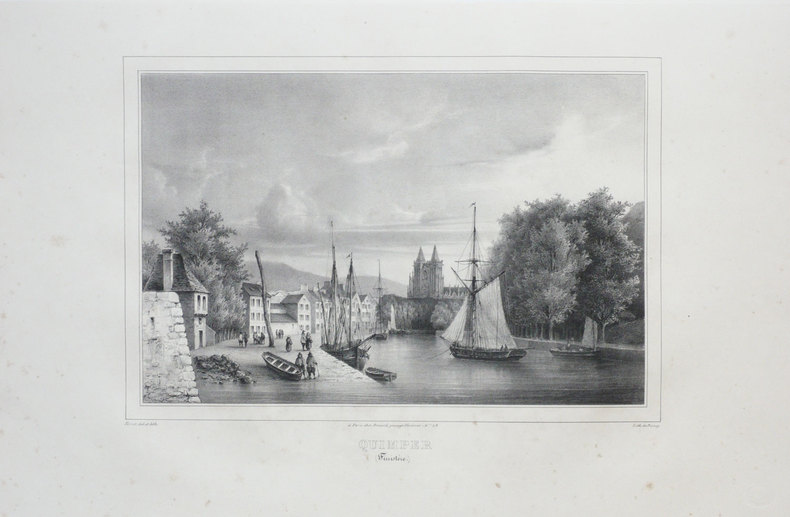
PERROT.
QUIMPER (Finistère).
Paris, Benard, [circa 1850]. 225 x 297 mm.
Bookseller reference : LBW03d69
|
|
|
Pershing, John J.
My Experiences in the World War - Volume I
400 pages including 69 black and white reproductions from photographs and numerous maps. Gilt-edged top. Former owner's rubber stamp upon verso of half title page and upon front side of black and white photographic frontis of General Pershing. Small bookseller's sticker inside back board. "My primary purpose in writing this story of the American Expeditionary Forces in France is to render what I conceive to be an important service to my country. In that adventure there were many lessons useful to the American People, should they ever again be called to arms, and I felt it a duty to record them as I saw them." - from the Foreward. Book
|
|
|
Pestman, P. W
A Guide to the Zenon Archive (P.L. Bat. 21) Compiled by P. W. Pestman. (= Papyrologica Lugduno-Batava, vol. 21a and 21b). Volume 1: Lists and Surveys; Volume 2: Indexes and Maps. 2 volumes complete.
Leiden: E. J. Brill 1981. XX, 466; 467-748 Seiten. With two maps. 4° (28 x 22 cm) Orig.-Broschuren. [Softcover / Paperback].
Bookseller reference : 2140746

|
|
|
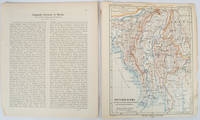
PETERMANN, AUGUST HEINRICH AND SCHMIDT, CARL (CARTOGRAPHER).
Burma map Britisch-Birma nach den neuesten Grenzbestimungen auf Grund amtlicher Quellen. from Petermann's Geographische Mitteilungen
Gotha: Justus Perthes. 1903. Map printed in colour 24.7 x19.4cm and leaf of descriptive text in German 26.5 x 22.5cm slight toning and edges of the map worn with two small tears no loss. Geopolitical map of Burma with railways and railways under construction highlighted. The accompanying text is by the German Tibetologist linguist and orientalist Dr Emil Schlagintweit. . Justus Perthes unknown
Bookseller reference : 173709
|
|
|
PETERMANN, A. (HRSG.).
Mittheilugen aus Justus Perthe's Geographischer Anstalt über wichtige neue Erforschungen auf dem Gebiete der Geographie. 1858 (= Bd. 4 der Reihe).
Gotha, Julius Perthes, 1858. 4to. Contemp, hcalf. Gilt spine. A small stamp to titlepage. VIII,596 pp. and 20, partly folded, lithographed maps and plans. Text as well as maps fine and clean.
Bookseller reference : 46631
|
|
|
PETERMANN, A. (HRSG.).
Mittheilugen aus Justus Perthe's Geographischer Anstalt über wichtige neue Erforschungen auf dem Gebiete der Geographie. 1867 (= Bd. 13 der Reihe).
Gotha, Julius Perthes, 1867. 4to. Contemp, hcalf. Gilt spine. Spine somewhat rubbed. A small stamp to titlepage. VI,470 pp. and 19, partly folded, lithographed maps and plans. Textleaves with some browning and scattered brownspots. Maps clean.
Bookseller reference : 46634
|
|
|
PETERMANN, A. (HRSG.).
Mittheilugen aus Justus Perthe's Geographischer Anstalt über wichtige neue Erforschungen auf dem Gebiete der Geographie. 23. Bd.
Gotha, Julius Perthes, 1877. 4to. Later hcloth. Spine gilt. XII,476 pp. and 23, partly folded, lithographed maps and plans. Internally clean.
Bookseller reference : 46640

|
|
|
PETERMANN, A. (HRSG.).
Mittheilugen aus Justus Perthe's Geographischer Anstalt über wichtige neue Erforschungen auf dem Gebiete der Geographie. 1860 (= Bd. 6 der Reihe). (+) 3 Ergänzungshefte. (1. A. Vibe: Küsten und Meer Norwegens. 24 pp., 1 chromolithographed plate (with ...
Gotha, Julius Perthes, 1860. 4to. Contemp, hcalf. Gilt spine. A small stamp to titlepage. X,490 pp. and 19, partly folded, lithographed maps and plans. Internally clean. + Ergänzungshäfte.
Bookseller reference : 46641
|
|
|
PETERMANN, A. (HRSG.).
Mittheilugen aus Justus Perthe's Geographischer Anstalt über wichtige neue Erforschungen auf dem Gebiete der Geographie. 1861 (= Bd. 7 der Reihe). (+) 3 Ergänzungshefte. (1. G. Lejean: Ethnographie de la Turque D'Europe. Ethnographie der Europäisch...
Gotha, Julius Perthes, 1861. 4to. Contemp, hcalf. Gilt spine. A small stamp to titlepage. VIII,482 pp. and 16, partly folded, lithographed maps and plans. Internally clean. + Ergänzungshäfte.
Bookseller reference : 46642
|
|
|
PETERMANN, A. (HRSG.).
Mittheilugen aus Justus Perthe's Geographischer Anstalt über wichtige neue Erforschungen auf dem Gebiete der Geographie. 1860 (= Bd. 6 der Reihe). (+) 3 Ergänzungshefte. (1. A. Vibe: Küsten und Meer Norwegens. 24 pp., 1 chromolithographed plate (with ...
Gotha, Julius Perthes, 1860. 4to. Contemp, hcalf. Gilt spine. A small stamp to titlepage. X,490 pp. and 19, partly folded, lithographed maps and plans. Internally clean. + Ergänzungshäfte.
|
|
|
PETERMANN, A. (HRSG.).
Mittheilugen aus Justus Perthe's Geographischer Anstalt über wichtige neue Erforschungen auf dem Gebiete der Geographie. 1861 (= Bd. 7 der Reihe). (+) 3 Ergänzungshefte. (1. G. Lejean: Ethnographie de la Turque D'Europe. Ethnographie der Europäisch...
Gotha, Julius Perthes, 1861. 4to. Contemp, hcalf. Gilt spine. A small stamp to titlepage. VIII,482 pp. and 16, partly folded, lithographed maps and plans. Internally clean. + Ergänzungshäfte.
|
|
 Receive by email
 Download as PDF document
 RSS feed


