|
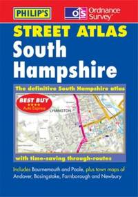
Philip's Maps
South Hampshire Street Atlas
Paperback. Very Good. paperback
Bookseller reference : GOR002254008 ISBN : 0540081078 9780540081073
|
|
|
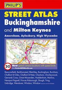
Philip's Maps and Atlases Staff
St at Buckinghamshire 4ed Poc
Octopus Publishing Group. Used - Good. Ships from the UK. Used book that is in clean average condition without any missing pages. Octopus Publishing Group unknown
Bookseller reference : 52916861-20 ISBN : 0540092991 9780540092994
|
|
|
Philip's Maps
St At Greater Manchester 4Ed Poc
Paperback. Very Good. paperback
Bookseller reference : GOR003488734 ISBN : 0540090859 9780540090853

|
|
|
Philip's Maps and Atlases Staff
St at London 4ed Standard Pb 2010
Used - Very Good. Ships from the UK. Former library book; may include library markings. Used book that is in excellent condition. May show signs of wear or have minor defects. unknown
Bookseller reference : 50885271-20 ISBN : 1849070598 9781849070591

|
|
|
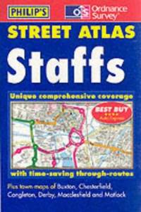
Philip's Maps
Staffordshire Street Atlas
Paperback. Very Good. paperback
Bookseller reference : GOR003821454 ISBN : 0540081183 9780540081189
|
|
|
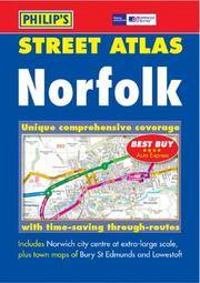
Philip's Maps
Street Atlas Norfolk
Philip's 24/03/2003 00:00:01. paperback. Good. 1.0192 in x 18.7857 in x 12.6904 in. Philip's paperback
Bookseller reference : mon0000485159 ISBN : 054008333x 9780540083336
|
|
|
Philip's Maps
Street Atlas Northamptonshire
paperback. Good. Access codes and supplements are not guaranteed with used items. May be an ex-library book. paperback
Bookseller reference : 0540082880.G ISBN : 0540082880 9780540082889
|
|
|
Philip's Maps
Street Atlas Worcestershire
paperback. Good. Access codes and supplements are not guaranteed with used items. May be an ex-library book. paperback
Bookseller reference : 0540083372.G ISBN : 0540083372 9780540083374
|
|
|
Philip's Maps
Street Atlas West Sussex
paperback. Good. Access codes and supplements are not guaranteed with used items. May be an ex-library book. paperback
Bookseller reference : 0540086479.G ISBN : 0540086479 9780540086474
|
|
|
Philip's Maps
Street Atlas DenbighshireFlintshireand Wrexham
paperback. Good. Access codes and supplements are not guaranteed with used items. May be an ex-library book. paperback
Bookseller reference : 0540085901.G ISBN : 0540085901 9780540085903

|
|
|
Philip's Maps
Street Atlas Lanarkshire
paperback. Good. Access codes and supplements are not guaranteed with used items. May be an ex-library book. paperback
Bookseller reference : 0540088331.G ISBN : 0540088331 9780540088331
|
|
|
Philip's Maps
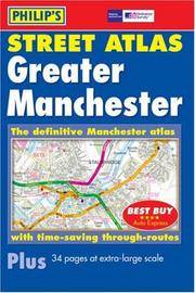
Street Atlas Greater Manchester
paperback. Good. Access codes and supplements are not guaranteed with used items. May be an ex-library book. paperback
Bookseller reference : 0540085235.G ISBN : 0540085235 9780540085231
|
|
|
Philip's Maps
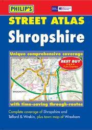
Street Atlas Shropshire
paperback. Good. Access codes and supplements are not guaranteed with used items. May be an ex-library book. paperback
Bookseller reference : 0540083399.G ISBN : 0540083399 9780540083398
|
|
|
Philip's Maps
Street Atlas Bristol and Bath Pocket Edition
paperback. Good. Access codes and supplements are not guaranteed with used items. May be an ex-library book. paperback
Bookseller reference : 0540085251.G ISBN : 0540085251 9780540085255
|
|
|
Philip's Maps
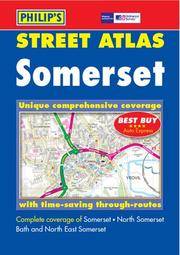
Street Atlas Somerset
paperback. Good. Access codes and supplements are not guaranteed with used items. May be an ex-library book. paperback
Bookseller reference : 054008221X.G ISBN : 054008221X 9780540082216
|
|
|
Philip's Maps
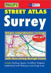
Street Atlas Surrey
paperback. Good. Access codes and supplements are not guaranteed with used items. May be an ex-library book. paperback
Bookseller reference : 0540082910.G ISBN : 0540082910 9780540082919
|
|
|
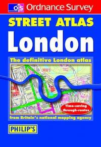
Philip's Maps
Street Atlas London
Hardback. Acceptable. hardcover
Bookseller reference : GOR002602591 ISBN : 0540081582 9780540081585
|
|
|
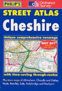
Philip's Maps
Street Atlas Cheshire: The Definitive Cheshire Atlas
Paperback. Very Good. paperback
Bookseller reference : GOR002332489 ISBN : 0540081140 9780540081141
|
|
|
Philip's Maps
Street Atlas Cornwall
Paperback. Acceptable. paperback
Bookseller reference : GOR004164023 ISBN : 0540083291 9780540083299

|
|
|
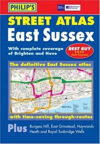
Philip's Maps
Street Atlas East Sussex
Hardback. Very Good. hardcover
Bookseller reference : GOR003033661 ISBN : 0540086487 9780540086481

|
|
|
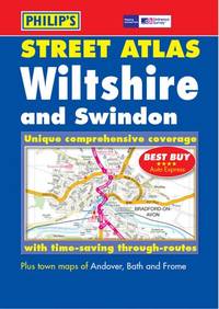
Philip's Maps
Street Atlas Wiltshire: The Definitive Wiltshire Atlas
Paperback. Very Good. paperback
Bookseller reference : GOR001326736 ISBN : 0540081124 9780540081127
|
|
|
Philip's Maps
Street Atlas East Sussex
Hardback. Good. hardcover
Bookseller reference : GOR001982024 ISBN : 0540086487 9780540086481
|
|
|
Philip's Maps
Superscale Atlas Of Great Britain
Hardback. Acceptable. hardcover
Bookseller reference : GOR005487586 ISBN : 1850521107 9781850521105

|
|
|
Philip's Maps
Superscale Atlas Of Great Britain
Hardback. Very Good. hardcover
Bookseller reference : GOR000785942 ISBN : 1850521107 9781850521105
|
|
|
Philip's Maps
Surrey Street Atlas
Paperback. Very Good. paperback
Bookseller reference : GOR003036150 ISBN : 0540059846 9780540059843
|
|
|
Philip's Maps
Treasury Of Bible Quotat
Paperback. Very Good. paperback
Bookseller reference : GOR006638196 ISBN : 086363009X 9780863630095

|
|
|
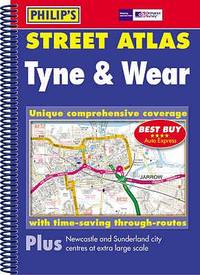
Philip's Maps
Tyne and Wear Philip's Street Atlases
paperback. Good. Access codes and supplements are not guaranteed with used items. May be an ex-library book. paperback
Bookseller reference : 054008753X.G ISBN : 054008753X 9780540087532
|
|
|
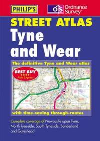
Philip's Maps
Tyne and Wear and Northumberland Street Atlas
Paperback. Very Good. paperback
Bookseller reference : GOR001721066 ISBN : 0540078085 9780540078080
|
|
|
Philip's Maps
Tyrone and Fermanagh
paperback. Good. Access codes and supplements are not guaranteed with used items. May be an ex-library book. paperback
Bookseller reference : 0540089338.G ISBN : 0540089338 9780540089338
|
|
|
Philip's Maps
Warwickshire
paperback. Good. Access codes and supplements are not guaranteed with used items. May be an ex-library book. paperback
Bookseller reference : 0540087599.G ISBN : 0540087599 9780540087594
|
|
|
Philip's Maps
Wiltshire and Swindon
paperback. Good. Access codes and supplements are not guaranteed with used items. May be an ex-library book. paperback
Bookseller reference : 0540087718.G ISBN : 0540087718 9780540087716
|
|
|
Philip's Maps
World Atlas
Ticktock Books Ltd. Hardcover. Very Good. May have limited writing in cover pages. Pages are unmarked. ~ ThriftBooks: Read More Spend Less.Dust jacket quality is not guaranteed. Ticktock Books Ltd hardcover
Bookseller reference : G0753719967I4N00 ISBN : 0753719967 9780753719961
|
|
|
Philip's Maps
World Atlas
Hardback. Good. hardcover
Bookseller reference : GOR002461613 ISBN : 0540092592 9780540092598

|
|
|
Philip's Maps
World Atlas
Hardback. Very Good. hardcover
Bookseller reference : GOR003476180 ISBN : 0540092592 9780540092598

|
|
|
Philip's Series of Travelling Maps
North America
London UK: George Philip & Son Ltd. Good. 0. Hardcover. Dark blue cloth boards with gilt title. Map folds out to 22 x 28 inches. No date circa 1900s. Boards worn on edges corners bumped spine starting to split.; Book; 12mo - over 6¾ - 7¾" tall . George Philip & Son, Ltd. hardcover
Bookseller reference : 006893
|
|
|
Philip's Series of Travelling Maps
North America
London UK: George Philip & Son Ltd. Good. 0. Hardcover. Dark blue cloth boards with gilt title. Map folds out to 22 x 28 inches. No date circa 1900s. Boards worn on edges corners bumped spine starting to split.; Book; 12mo - over 6¾ - 7¾" tall . George Philip & Son, Ltd. hardcover books
Bookseller reference : 006893

|
|
|
PHILIP, George & Son
Philips' Mercantile Map of Europe
4to [29 x 25 cm, 11.5 x 9.7 inches]; large folding colored map measuring 78 x 122 cm or 37.5 x 48 inches that folds to 29 x 25 cm. original cloth covers, title lettering on cover and spine, joint cracked but firm, marbled endpapers, original ribbon ties, map near fine and clean, linen-backed sectional map as originally issued, in very good original cover. A picture of this book is av A very detailed map, showing all of Europe including Western Russia to Iceland, part of north Africa, Lebanon, most of Caspian Sea. It shows cities, railways, mail and other steamers routes, wireless stations, canals, Lloyd's signal states, each country is shown in different color, also shows altitudes, etc. The scale is 72 mile to the inch or 1:4,500,000.
|
|
|
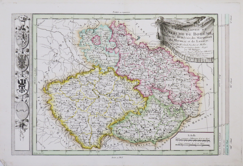
PHILIPPE de PRETOT (Etienne-André).
[BOHÊME] Chorographie du royaume de Bohême, du duché de Silésie, des marquisats de Moravie et de Lusace.
1770. 266 x 400 mm.
Bookseller reference : LBW-4662
|
|
|
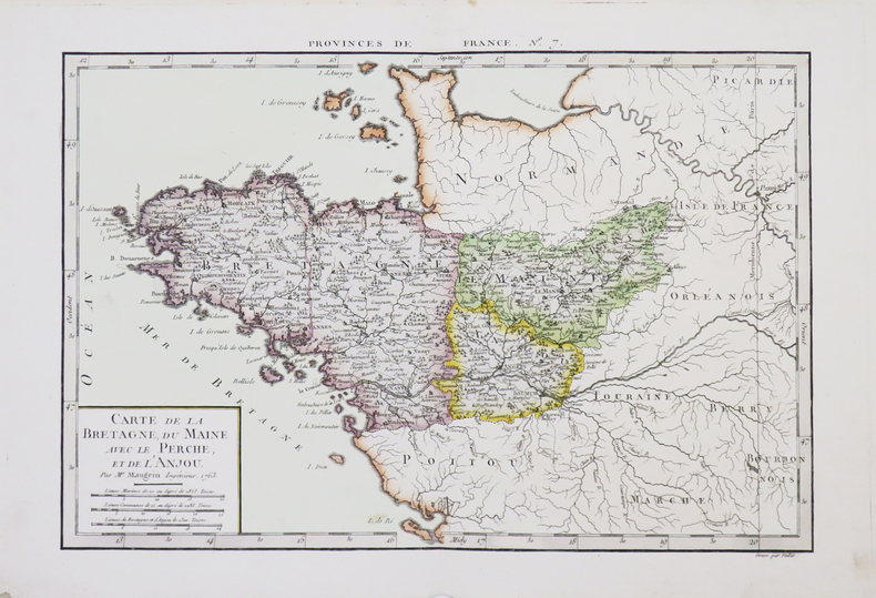
PHILIPPE de PRETOT (Etienne-André).
[BRETAGNE] Carte de la Bretagne, du Maine, avec le Perche, et de l'Anjou.
1763. 255 x 378 mm.
Bookseller reference : LBW-4660
|
|
|
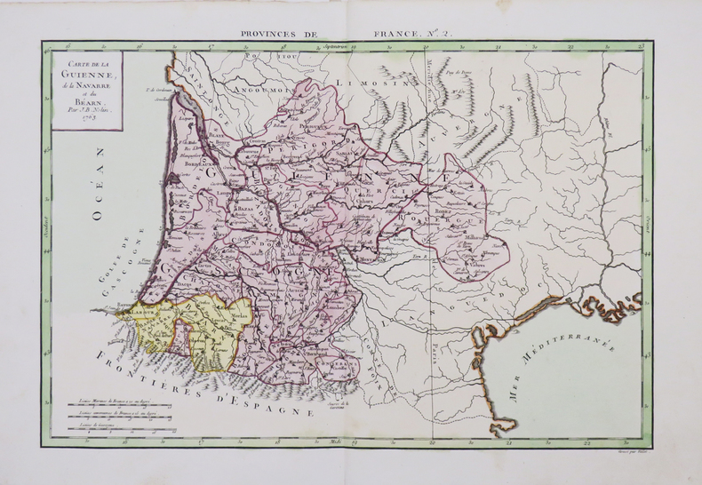
PHILIPPE de PRETOT (Etienne-André).
[GUYENNE/PAYS BASQUE] Carte de la Guienne, de la Navarre et du Béarn.
1763. 258 x 380 mm.
Bookseller reference : LBW-4656
|
|
|
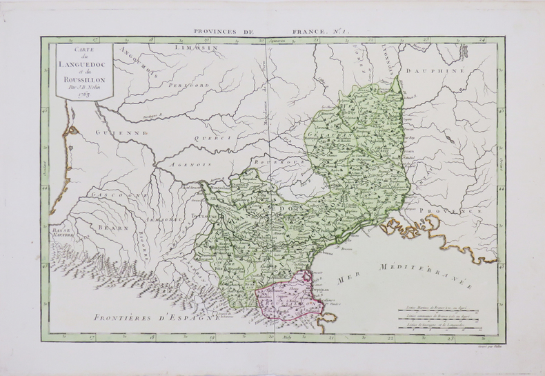
PHILIPPE de PRETOT (Etienne-André).
[LANGUEDOC-ROUSSILLON] Carte du Languedoc et du Roussillon.
1763. 253 x 378 mm.
Bookseller reference : LBW-4655
|
|
|
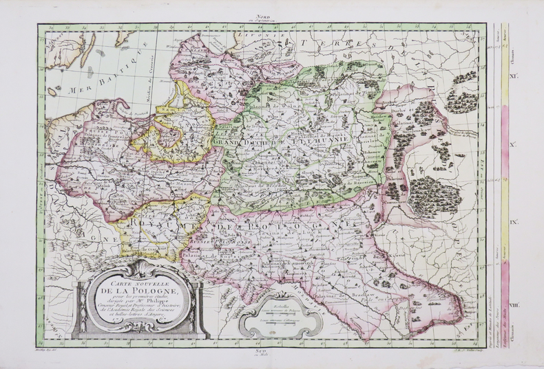
PHILIPPE de PRETOT (Etienne-André).
[POLOGNE] Carte nouvelle de la Pologne.
1767. 281 x 399 mm.
Bookseller reference : LBW-4663
|
|
|
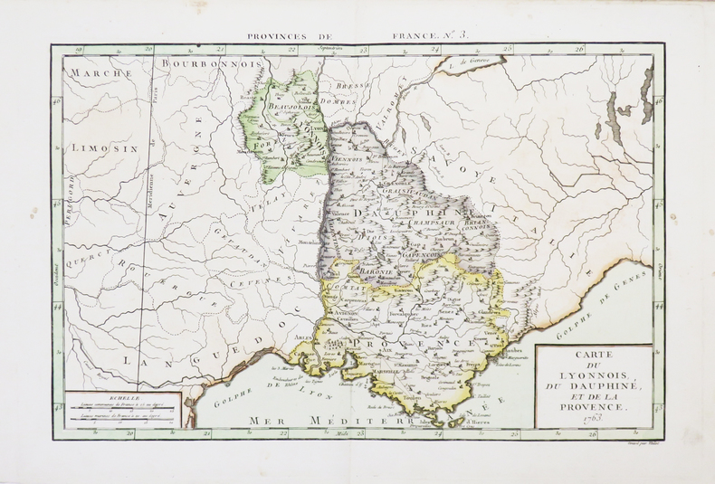
PHILIPPE de PRETOT (Etienne-André).
[PROVENCE] Carte du Lyonnois, du Dauphiné, et de la Provence.
1763. 250 x 375 mm.
Bookseller reference : LBW-4657
|
|
|
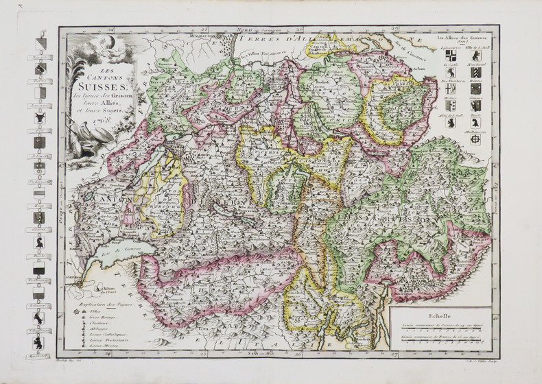
PHILIPPE de PRETOT (Etienne-André).
[SUISSE] Les Cantons suisses, les ligues des Grisons, leurs alliés, et leurs sujets.
1768. 264 x 372 mm.
Bookseller reference : LBW-4661
|
|
|
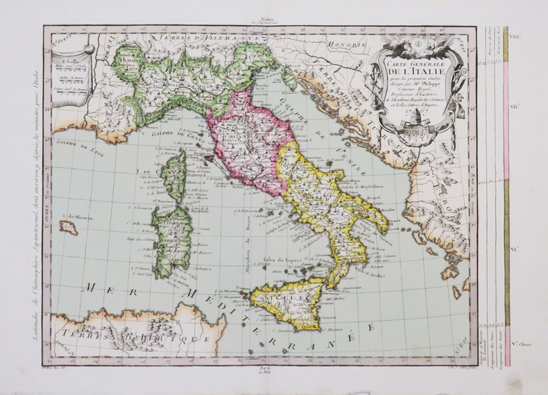
PHILIPPE de PRETOT (Etienne-André).
Carte générale de l'Italie.
1767. 275 x 375 mm.
Bookseller reference : LBW-4665
|
|
|
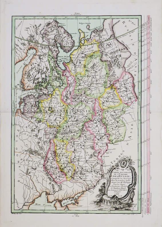
PHILIPPE de PRETOT (Etienne-André).
Carte nouvelle de l'empire de la Russie.
1766. 385 x 264 mm.
Bookseller reference : LBW-4654
|
|
|
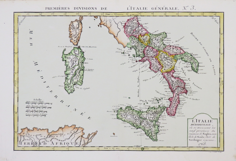
PHILIPPE de PRETOT (Etienne-André).
L'Italie méridionale, où se trouvent les neuf provinces du royaume de Naples, avec l'isle de Sicile, l'isle de Sardaigne royaume.
1768. 251 x 366 mm.
Bookseller reference : LBW-4666
|
|
|
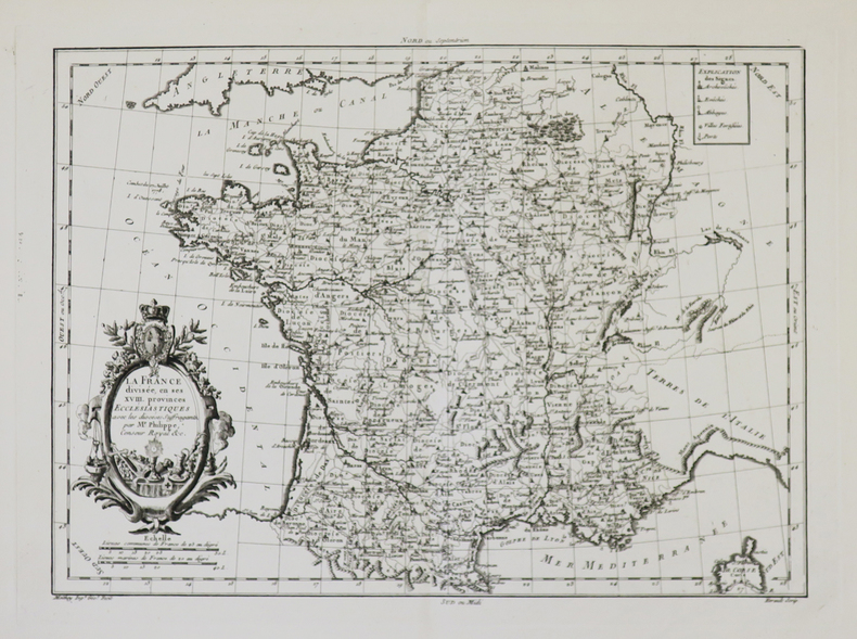
PHILIPPE de PRETOT (Etienne-André).
La France divisée en ses XVIII provinces ecclésiastiques avec les diocèses suffragants.
[circa 1770]. 276 x 372 mm.
Bookseller reference : LBW-4940
|
|
|
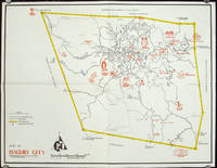
PHILIPPINES 1960S TOURIST MAP
Map of Baguio City Showing Some of Its Major and Minor Tourists Interests.
circa1960. Printed pictorial map 44.8 x 58 cms 46.7 x 60.3 cms sheet original folds a little wear but in very good condition. Attractive 1960s tourist map of Baguio city when it was the "Summer Capital" of the Philippines. Tourist attractions are shown pictorially in red blue triangles denote wood carving shops the city boundaries outlined in yellow sealed and unsealed roads are also shown. . unknown
Bookseller reference : 206510
|
|
|
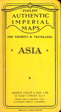
Philips Authentic Imperial Maps
Philips Authentic Imperial Maps For Tourists and Travelers: Asia
Liverpool: George Philip and Son nd. Hardcover. Very good. Boards rubbed and darkened cloth backing slightly tanned else very good. <br/><br/> George Philip and Son hardcover books
Bookseller reference : 43520
|
|
 Receive by email
 Download as PDF document
 RSS feed


