|
Polgar BSc(Hons) MSc, Stephen; Thomas DipPubPol PhD MAPS, Shane A
Introduction to Research in the Health Sciences
Elsevier 2019-11-25. paperback. New. 7x0x9. New Textbook Ships with Tracking Elsevier paperback
Referenz des Buchhändlers : SKU0642178 ISBN : 0702074934 9780702074936

|
|
|
Polgar BSc (Hons) MSc PhD, Stephen; Thomas BA PhD DipPubPol PLD MAPS FCHP, Shane A
Introduction to Research in the Health Sciences
Elsevier 2019-11-25. paperback. New. 7x0x9. New Book Ships with Tracking Elsevier paperback
Referenz des Buchhändlers : SKU1748060 ISBN : 0702074934 9780702074936
|
|
|
Polgar BSc(Hons) MSc, Stephen; Thomas DipPubPol PhD MAPS, Shane A
Introduction to Research in Health Sciences
Churchill Livingstone 2000-08-10. Paperback. New. In shrink wrap. Looks like an interesting title! Churchill Livingstone paperback
Referenz des Buchhändlers : Q-044306265x ISBN : 044306265X 9780443062650

|
|
|
Polgar BSc(Hons) MSc, Stephen; Thomas DipPubPol PhD MAPS, Shane A
Introduction to Research in the Health Sciences
Churchill Livingstone 2007-11-21. Paperback. New. In shrink wrap. Looks like an interesting title! Churchill Livingstone paperback
Referenz des Buchhändlers : Q-0443074291 ISBN : 0443074291 9780443074295

|
|
|
PONSONBY, FREDERICK; THE EARL OF CAVAN (introd); WALKER, EMERY (maps)
The Grenadier Guards in the Great War of 1914-1918
Macmillan and Co. 1920. 3 VOL SET. Super octavo grey card boards label to brown cl spine lettered in gilt; frontis. illus. plates maps; xviii 378 2 advts viii 383 x 352 pp.; VG- moderate to heavy soiling & scuffing to boards moderate to heavy bruising to edges & extrems w moderate chipping; light to moderate soiling tanning & foxing to pg edges; moderate tanning foxing & soiling to eps prelims & terminals; moderate cracking to front vols. 1 2 & 3 & central vol. 2 gutters; wormholes rear boards vols 1 & 2 & sl to spine vols 1 2 & 3; wormholes to rear hinges 1 2 & 3 ; ffep unopened vol. 3; tape to boards. Macmillan and Co. 1920 hardcover
Referenz des Buchhändlers : 360075
|
|
|
POPE, Alexander et al Maps and engravings by Benjamin Cole
The Grand Magazine of Magazines or Universal Register for the Months of January February March April May June July August September October November December MDCCLIX Collected in Two Volumes - II and III.So Containing the Whole of the Year 1759. Illustrated with Many Natural History Plates and Map
1759. T. Kinnersley. London. 1759. In Two Volumes II and III and contains the whole set for the year 1759. Bound in 18th century quarter brown calf gilt very worn and rubbed and lacking portions of leather from heads and tails of spine. Joints tender but holding. Vol. II; ii 372 pages plus 4pages of index. Vignette to general title-page and engraved head-piece for each month. 6 engraved plates of unusual and more ordinary fauna including the dodo the rhinoceros sea hedge-hog the horned didapper flying fish and cassowary. 1 portrait plate of Magliabechi 14 full page engraved maps and plans. Vol. III; ii. 404 pages plus 4 page index. Engr. vignette to general title-page and engraved head-pieces or decorations to each month 4 engraved plates of fauna one portrait plate of Major General Wolfe 1 incredible engraved plate displaying the Torments Inflicted by the Dutch on the English in Amboyna plus the engraved frontis. to Pope's Essay on Man. Three engraved plates - 1 map and 2 plans. A wonderful insight into what interested people in the mid-18th century. Pages browned and occasionally foxed but otherwise a very useful set. hardcover
Referenz des Buchhändlers : 84804
|
|
|
PopOut Maps
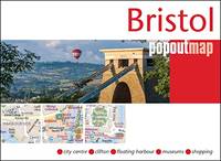
Bristol PopOut Map PopOut Maps
Paperback. Very Good. paperback
Referenz des Buchhändlers : GOR013582795 ISBN : 1910218405 9781910218402
|
|
|
Popout Maps
Bruges PopOut Map PopOut Maps
paperback. Good. Access codes and supplements are not guaranteed with used items. May be an ex-library book. paperback
Referenz des Buchhändlers : 1845878639.G ISBN : 1845878639 9781845878634
|
|
|
Popout Maps
Copenhagen PopOut Map: pop-up city street map of Copenhagen city center - folded pocket size travel map with transit map included
paperback. Good. Access codes and supplements are not guaranteed with used items. May be an ex-library book. paperback
Referenz des Buchhändlers : 1845878795.G ISBN : 1845878795 9781845878795
|
|
|
Popout Maps
Dublin Popout Map
map. Good. Access codes and supplements are not guaranteed with used items. May be an ex-library book. unknown
Referenz des Buchhändlers : 1845878736.G ISBN : 1845878736 9781845878733
|
|
|
Popout Maps
Las Vegas PopOut Map PopOut Maps
paperback. Good. Access codes and supplements are not guaranteed with used items. May be an ex-library book. paperback
Referenz des Buchhändlers : 184587868X.G ISBN : 184587868X 9781845878689
|
|
|
PopOut Maps
Melbourne Popout Map - handy pocket size pop up map of Melbourne PopOut Maps
Paperback. Acceptable. paperback
Referenz des Buchhändlers : GOR011577160 ISBN : 1845879937 9781845879938

|
|
|
PopOut Maps
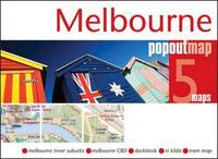
Melbourne Popout Map - handy pocket size pop up map of Melbourne PopOut Maps
Paperback. Very Good. paperback
Referenz des Buchhändlers : GOR008612925 ISBN : 1845879937 9781845879938
|
|
|
Popout Maps
Milan PopOut Map PopOut Maps
map. Good. Access codes and supplements are not guaranteed with used items. May be an ex-library book. unknown
Referenz des Buchhändlers : 1845878833.G ISBN : 1845878833 9781845878832
|
|
|
PopOut Maps
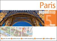
Paris PopOut Map PopOut Maps
Ingramcontent 2017-07-01. Folded Map. map. Used: Good. 3.86x0.20x5.30. Buy with confidence. Excellent Customer Service & Return policy. Ingramcontent unknown
Referenz des Buchhändlers : SONG1910218448 ISBN : 1910218448 9781910218440
|
|
|
PORCACCHI Tommaso (1530 - 1585
Descritione del Mappamondo
Tratta da L'isole più famose del mondo (ed. 1620) in cui il Porcacchi (1530-1585) continua idealmente la tradizione iniziata da Cristoforo Buondelmonti con il primo isolario (manoscritto) risalente al 1420, seguito da quelli di Bartolomeo dalli Sonetti, Bordone e Camocio. In quest'opera vengono descritte tutte le isole conosciute al tempo, con la descrizione geografica e fisica, e con la presentazione degli usi e costumi degli abitanti.L'opera è, per la prima volta, pubblicata nel volume L’isole Piu Famose Del Mondo Descritte Da Thomaso Porcacchi Da Castiglione Aretino E Intagliate Da Girolamo Porro Padovan di Tommaso Porcacchi (ca. 1532-1576), umanista e letterato originario di Castiglion Fiorentino.Gli interessi geografici coltivati sin dal Pomponio Mela del 1557 diedero vita nel 1572 al trattato, pubblicato dalla società tra il libraio Simone Galignani e l’incisore padovano Girolamo Porro, che si servirono della tipografia di Giorgio Angelieri (con privilegio di 10 anni concesso il 16 luglio 1572). Secondo Valerio (cfr. Valerio-Spagnolo, Sicilia 1477-1861, La Collezione Spagnolo-Patermo in quattro secoli di Cartografia, 2014, p. 163) il volume sarebbe stampato nell’officina di Domenico e Giovan Battista Guerra. Il volume, in formato in quarto, con dedica di Galignani a don Giovanni d’Austria, presenta le magnifiche tavole calcografiche di Porro (una seconda edizione, cospicuamente accresciuta di testo e tavole, usci nel 1576, poi ancora, postume, nel 1590, 1604, 1605, 1620 e 1686). Nella lettera dedicatoria Porro narra di essere stato il promotore dell’operazione e di aver incaricato Porcacchi di scrivere un libro sulle isole, riservandosene l’illustrazione. Il modello e quello degli “isolari”, sul quale però Porcacchi innesta lo spirito delle corografie antiche, aggiungendo per ciascuna isola una descrizione fisica, storica e culturale. La concezione e molto ampia (sono comprese penisole, grandi isole come l’Inghilterra o interi continenti: l’America Settentrionale), ma nel “Prohemio” Porcacchi fornisce un glossario di termini geografici che testimonia lo sforzo di impiegare in maniera corretta la terminologia della disciplina (cfr. Franco Pignatti, Porcacchi Tommaso, in "Dizionario Biografico degli Italiani" - Volume 85, 2016). Nel testo vi sono mappe di isole incise su mezza pagina, compreso il planisfero – riduzione della carta murale di Camocio del 1567 e la “carta da navigare con le rotte e i venti, di derivazione gastaldina. Incisione in rame posta nella parte superiore del foglio che contiene anche la parte descrittiva, in ottimo stato di conservazione. Charming miniature map of the world on an oval projection, engraved by Girolamo Porro after a larger world map by Camoccio on the Gastaldi prototype. The huge mythical Terra Incognita dominates the Southern Hemisphere. On a full sheet (8.3 x 11.6") of Italian text with decorative capital letter below map and page 193 above. Italian text continues on the verso. A fine impression minor soiling outside the map.Map taken form L’isole Piu Famose Del Mondo Descritte Da Thomaso Porcacchi Da Castiglione Aretino E Intagliate Da Girolamo Porro Padovan by Tommaso Porcacchi (ca. 1532-1576), humanist and scholar from Castiglion Fiorentino. The geographical interests cultivated since Pomponio Mela in 1557 gave life to the treatise published in 1572 by the company between the bookseller Simone Galignani and the Paduan engraver Girolamo Porro, who used the typography of Giorgio Angelieri (with the privilege of 10 years July 1572). The volume, with a dedication by Galignani to Don Giovanni d'Austria, presents the magnificent calcographic plates by Porro (a second edition, conspicuously augmented with text and tables, came out in 1576, then again, posthumously, in 1590, 1604, 1605, 1620 and 1686). In the dedicatory letter Porro tells of having been the promoter of the operation and of having entrusted Porcacchi with writing a book on the islands, reserving the illustration. The model is that of the "isolari", on which however Porcacchi inserts the spirit of ancient chorographies, adding a physical, historical and cultural description for each island. The concept is very broad (including peninsulas, large islands such as England or entire continents: North America), but in the "Prohemio" Porcacchi provides a glossary of geographical terms that testifies to the effort to correctly use the terminology of the discipline (see Franco Pignatti, Porcacchi Tommaso, in "Dizionario Biografico degli Italiani" - Volume 85, 2016). In the text there are maps of islands engraved on half a page, including the planisphere - reduction of the wall map of Camocio of 1567 and the "carta marina”.Copperplate placed at the top of the sheet also including a descriptive part, in very good condition. R. W. Shirley, "The Mapping of the world", 127

|
|
|
PORRO GUTIERREZ, Jesús María.
Introducción a la Cartografía Histórica Americana. Prólogo de Luisa Martínez de Salinas Alonso.
Valladolid, 1999 4to. alargado; 166 pp Cubiertas originales.

|
|
|
PORTUGAL. Homann, Joh. B
Portugalliae et Algarbiae cum finitimis Hispaniae Regnis: Castiliae, Legionis, Andalusiae, Extrematurae, Galliciae & Granatae Novissima Tabula. Altkolorierte Kupferstichkarte.
Nürnberg, Johann Baptist Homann, [ca. 1730]. 1 grenzkolor. Karte von Portugal mit Teilen Westspaniens sowie NEBENKARTE der Überseebesitzung Brasilien "Regnum Brasiliae in America Australis" (20 x 20 cm), kolor. figürl. Titel- u. Wappenkartusche u. Meilenzeiger. Bildgröße ca. 49 x 57 cm. Mittelbugfalte.
Referenz des Buchhändlers : 89168

|
|
|
postcards, postkaarten, wenskaarten
kaartenmolen voor post / wens kaarten van 15cm x10.5cm.
Hoogte molen: minimale hoogte 143cm maximale hoogte 190cm. ,Doorsnede molen: ? 400mm. Vuldiepte: 25mm. volledig nieuw uit voorraad leverbaar. 30 Pockets 119mm LIGGEND + 21 Pockets 110mm STAAND. grijs gelakt.

|
|
|
Postkarte/ Ansichtskarte / Künstlerkarte / Carte postale
Adolf Reich, Kunst- und Naturfreund. Nr. 148, München, Haus der Kunst.
Um 1940. 15 x 10,5 cm.
Referenz des Buchhändlers : 3843B

|
|
|
Postkarte/ Ansichtskarte / Künstlerkarte / Carte postale
Arno Breker, "Psyche". Nr. 24, München, Haus der Kunst.
Um 1940. 15 x 10,5 cm.
Referenz des Buchhändlers : 3832B

|
|
|
Postkarte/ Ansichtskarte / Künstlerkarte / Carte postale
Arno Breker, Schreitende. Nr. 36, München, Haus der Kunst.
Um 1940. 15 x 10,5 cm.
Referenz des Buchhändlers : 3845B

|
|
|
Postkarte/ Ansichtskarte / Künstlerkarte / Carte postale
Barbara von Kalckreuth, Träumerei. Nr. 352, München, Haus der Kunst.
Um 1940. 15 x 10,5 cm.
Referenz des Buchhändlers : 3841B

|
|
|
Postkarte/ Ansichtskarte / Künstlerkarte / Carte postale
Ernst Liebermann, Naja an der Quelle. Nr. 408, München, Haus der Kunst.
Um 1940. 15 x 10,5 cm.
Referenz des Buchhändlers : 3840B

|
|
|
Postkarte/ Ansichtskarte / Künstlerkarte / Carte postale
Jacob V. Fehrle, Diana. Nr. 327, München, Haus der Kunst.
Um 1940. 15 x 10,5 cm.
Referenz des Buchhändlers : 3842B

|
|
|
Postkarte/ Ansichtskarte / Künstlerkarte / Carte postale
Jak. Wilh. Fehrle, Tänzerin. Nr. 473, München, Haus der Kunst.
Um 1940. 15 x 10,5 cm.
Referenz des Buchhändlers : 3837B

|
|
|
Postkarte/ Ansichtskarte / Künstlerkarte / Carte postale
Joh Schult, Erwartung. Nr. 507, München, Haus der Kunst.
Um 1940. 15 x 10,5 cm.
Referenz des Buchhändlers : 3835B

|
|
|
Postkarte/ Ansichtskarte / Künstlerkarte / Carte postale
Johann Schult, Im Lebensfrühling. Nr. 411, München, Haus der Kunst.
Um 1940. 15 x 10,5 cm.
Referenz des Buchhändlers : 3839B

|
|
|
Postkarte/ Ansichtskarte / Künstlerkarte / Carte postale
Josef Thorak. Leda mit dem Schwan. München, Haus der Kunst.
Um 1940. 15 x 10,5 cm.
Referenz des Buchhändlers : 3833B

|
|
|
Postkarte/ Ansichtskarte / Künstlerkarte / Carte postale
Konstantin Gerhardinger, Modell-Pause. Nr. 448, München, Haus der Kunst.
Um 1940. 15 x 10,5 cm.
Referenz des Buchhändlers : 3838B

|
|
|
Postkarte/ Ansichtskarte / Künstlerkarte / Carte postale
M. Alfred Brumme, Die Belebende. Nr. 497, München, Haus der Kunst.
Um 1940. 15 x 10,5 cm.
Referenz des Buchhändlers : 3836B

|
|
|
Postkarte/ Ansichtskarte / Künstlerkarte / Carte postale
Prof. Richard Scheibe, Der Morgen. Nr. 58, München, Haus der Kunst.
Um 1940. 15 x 10,5 cm.
Referenz des Buchhändlers : 3844B

|
|
|
Postkarte/ Ansichtskarte / Künstlerkarte / Carte postale
Sepp Hilz, Eitelkeit. München, Haus der Kunst.
Um 1940. 15 x 10,5 cm.
Referenz des Buchhändlers : 3834B

|
|
|
Potter, Jonathan
Country Life Book of Antique Maps - An Introduction to the History of Maps and How to Appreciate Them
192 pages including bibliography and index. A thorough introduction to the history of antique maps and how to collect and enjoy them, written by one of the world's leading antique map dealers. Wonderfully illustrated in colour. Text divided into three sections: Looking at Maps; Mapping the World and It's Countries; Globes, Curiosities and Miniatures. Book is clean, bright and unmarked with very light wear to reddish boards. Moderate wear to attractive dust jacket which bears two closed tears, each under a half-inch in length, to top edge of back panel. Nice copy. Book
|
|
|
Powell, J. W
TWELFTH ANNUAL REPORT OF THE UNITED STATES GEOLOGICAL SURVEY TO THE SECRETARY OF THE INTERIOR 1890-'91. Part 1 - GEOLOGY.
Washington, Government Printing Office, 1891. 4°. With many plates, illustrations and maps, 6 folding pocket maps. 675 pp. Original gold stamped cloth. Mit zahlreichen Tafeln, Textabbildungen und Karten, 6 Faltkarten in Anhangtasche. Orig.-Leinen mit Deckelvergoldung, Rückengoldprägung. - Content: The origin and nature of soils; The lafayette formation; The north american continent during cambrian time; The eruptive rocks of electric peak and sepulchre mountain, yellowstone national park etc. Binding scratched. Einband berieben.
Referenz des Buchhändlers : 5664

|
|
|
Precede d'une Analyse Critique des Cartes
Recueil de Cartes Géographiques Plans Vues Et Médailles de l'Ancienne Grèce Relatif au Voyage du Jeune Anacharsis
paperback. Good. Access codes and supplements are not guaranteed with used items. May be an ex-library book. paperback
Referenz des Buchhändlers : 0366336738.G ISBN : 0366336738 9780366336739

|
|
|
Prentice, Robin (editor)
The National Trust for Scotland Guide
No marks or inscriptions. A very clean very tight copy with bright unmarked boards and no bumping to corners. Dust jacket not price clipped or marked or torn with sunned spine and a little creasing to edges. 320pp. A comprehensive reference to the National Trust's houses, castles, gardens, islands, historic sites and the people associated with them.

|
|
|
Prep. by GILBERT R. MARTINEAU.
Les guides Nagel. Finlande. Preface de Jean-Paul Sartre.
Very Good English Paperback. Pbo. 12mo. (16 x 10 cm). In French. [xv], 184 p. Color maps. Les guides Nagel. Finlande. Preface de Jean-Paul Sartre.
|
|
|
Prep. by OSMAN NURI ERGIN, (1883-1961).
[EARLY ISTANBUL CITY GUIDE OF THE REPUBLIC PERIOD] Istanbul sehri rehberi 1934.
Fine Turkish Original grey cloth bdg. Cr. 8vo. (20,5 x 11,5 cm). In Turkish. 240 p., texts and many folding color plans (additionally in end-pockets). First Edition. Maps are complete, scarce. Osman Nuri Ergin was the initiator of the studies regarding modern municipalities' studies and gave so many qualified books related to Ottoman-Turkish urbanism and municipalities' studies scientifically. He was also the first scholar who was one of the architectures of municipalities' studies and the history of urbanism and education. Since he worked as an officer for the government during World War I, the time of Abdulhamid II, and at the time of the young Republic, he was one of the figures who know the cultural and social changes in Turkish society. During this cultural transformation, he played the role of a bridge between Ottoman culture and modern-day Turkey with the help of some enlightened scholars. He had so many attempts to transform the Ottoman Sufi culture into the next generations. To reach this goal, he wrote so many valuable books. OCLC 216699691.
|
|
|
President: H. E. SIR MILES LAMPSON, (1880-1964).
[RARE DESERT MOTOR-ROUTES FOR THE ANGLO-EGYPTIAN MOTORISTS] Egyptian Touring Association handbook 1939-40. Member of Alliance Internationale de Tourisme; federated with the Automobile Association of Great Britain. Preface by Sir Stenson Cooke.
Very Good English Original green cloth. Title gilt in black "Egyptian Touring Association" and "ETA logo" to the front board. Foolscap 8vo. (17,5 x 13 cm). In English. 110 p. with rich separate advertisements, and a fine folded b/w map titled "Desert motor-routes" on a scale of 1:4,000,000. Slightly fading on cloth, otherwise a fine copy. First and only edition of this rare complete and very detailed desert motor-routes' guide for the Anglo-Egyptian motorists, printed by the Egyptian Touring Association in Cairo, including details about hospitals, "what to do in cases of accidents on the roads", free legal defence, hotels, garages as well as itineraries, pedestrian crossings, speed limits in the country, parking regulations of Sharia Kasr el Nil, Adly Pasha, no-lights area, railway bridges, postal rates, exchange rates, rates of freight on motor cars by sea and rail, kilometers into miles, transcontinental road London - Istanbul with other useful information. This guide was explained in the introduction as "This handbook has been compiled for the benefit of members and is issued to them free. Extra copies may be obtained from the Head Office, 3 Sh. Cattawi Bey, Kasr el Nil, Cairo, at the price of P.T. 10. It contains a good deal of useful information regarding touring of all kinds in Egypt and abroad including a list of recommended hotels and garages throughout the country. "The president of the Association which was founded in 1932, was H.E. Sir Miles Lampson (1880-1964). He was a British diplomat who was appointed High Commissioner for Egypt and Sudan in 1934. As a result of the Anglo-Egyptian Treaty in December 1936, to which Lampson was a signatory, Britain loosened its grip on Egypt and the post title was changed to Ambassador to Egypt and High Commissioner for Sudan in 1936. Lampson continued in this office until 1946. Vice presidents were Sir Stenson Cooke and J. A. Crawford. According to the ETA's service page of the guide, the purpose of the association can be determined as "Association was formed to provide a long-felt want in Egypt, that is, a touring club in the true sense of the word, devoted to the interests of all kinds of travelers. It's a non-profit making co-operative organization with the aim of making the path of the motorist, the airman, the camper, and every other kind of traveler pleasanter and smoother. The E.T.A. is officially recognized by the Egyptian Government and already in its short existence has grown enormously, being able to offer the following very real services to its members: Expert and detailed advice on all touring matters. Expert advice on motoring matters and vetting of cars. Free itineraries to all parts of Egypt and abroad. Reminders are sent to all members when a car and driving license is due for renewal. Renewal of car and driving licenses. Free legal defense for motoring offenses. Triptyques, carnets, and all documents for foreign touring, including passport arrangements. Agents at Alexandria, PortSaid, Suez, and the principal ports to look after the incoming and outgoing motorist and relieve him of all worry. A full stock of maps and guide books of Egypt and other countries. Up-to-date information on the state of roads and desert tracks. Welcome and help from the 100 odd touring clubs of the A.I.T. [i.e. the Alliance Internationale de Tourisme], of which the E.T.A. is a member. Recommended hotels and garages throughout Egypt and the Near East. Insurance for members can be effected at the most advantageous rates, and advice is given. Cars can be driven to any part of Egypt, by experienced drivers. Guides are provided. Other benefits, it is hoped, will be given in due of course.". Not located in OCLC. "1938-39 Edition" of the series (not published more than two years) is located in OCLC in no. 862336537.
|
|
|
Pretsch. und Düben:
Pretsch. Düben. "Plan der Action, welche d. 29.Oct. 1759 mit einigen Corps der kayserlich Königl. Ungarischen und Königl. Preussischen Armee zwischen Pretsch und Düben in Sachsen vorgefallen". Schlachtenplan von Pretsch und Düben, links mit Legende. Kupferstich mit farbigen Truppenaufstellungen aus "Neues Kriegs-Theater ...", 2. Supplement.
Format: 18 x 29,5 cm. *Leicht gebräunt, insgesamt gut erhalten. Landkarten de
|
|
|
Pritchard, James B.
THE WATER SYSTEM OF GIBEON. Museum Monographs.
pp. vii, 23 + Plus numerous drawings, maps and photographs of the excavation. 4to. Original printed blue wraps. Very good copy. First excavated by James Pritchard (1956-1962), Gibeon has significant archaeological remains - especially from the days of the early Israelites. First Edition. SCIENCE BOX 3
|
|
|
PRIVAS - ALES
Carte touristique au 1/100 000e.
1 feuille 90x120 cm.
|
|
|
Prividor
Veduta dell' interno della Basilica di S. Marco a Venezia.
Milano, Luigi Zucolisotto il Coperto de Figuri No. 4074, (um 1820). Altkolorierte Aquatina von Citterio. Bildgrösse: 13,8 x 19,4 cm. Blattgrösse: 18,6 x 25 cm. + Wichtig: Für unsere Kunden in der EU erfolgt der Versand alle 14 Tage verzollt ab Deutschland / Postbank-Konto in Deutschland vorhanden +, Bild
Referenz des Buchhändlers : 613DG

|
|
|
PROBST GEORG BALTHASAR.
Pyramides Aegyptiae, miraculum mundi tertium. Les Pyramides de l’Egypte, troisiéme miracle du Monde. I Pyramidi d’Egitto, il terzo miracolo del Mondo. Die Egyptischen Pyramiden, dritte Wunderwerk der Welt.
Augsburg, G.B. Probst, ca. 1780. Engraved and hand coloured vue d'optique. 30 x 40 cm. Mirrored titel with small tear not affecting text. Colours slightly faded, margins a little foxed.
|
|
|
Probyn, John Webb.
ITALY: From The Fall of Napoleon I., In 1815, To The Year 1890.
pp. xvi, 312 + Two color maps and a genealogical table of Charles III and Beatrice of Portugal. Foxed. Marbled endpapers. Top edge gold. 8vo. Original half vellum over marbled boards. Spine decorated in gold, reds, purples, greens and black. Marbled edges rubbed with some loss. Hardbound. Handsome binding. First edition published in 1884. Very good. EUROPE BOX 2
|
|
|
Pronti Domenico (1750 - 1815 circa)
Prima Urbis Inter, Divum Domus Aurea Roma
Pianta a proiezione verticale, orientata con il nord in alto, 1769 circa. Si tratta di una piccola e rara riduzione del Nolli. Scaccia Scarafoni cita un esemplare con sottoscrizione Dom. Pront. F. in R(oma) 1770, mentre il nostro esemplare e quello illustrato su Marigliani sono probabilmente prove ante la firma. “Titolo scritto sul piedistallo di una statua in basso a sinistra. In basso a destra veduta di piazza del Popolo. A destra una legenda di 116 numeri su due colonne. La pianta è incisa con cura grafica e dovizia di dettagli a dispetto del formato ridotto; alcune chiese, come ad esempio San Carlo al Corso e ovviamente San Pietro, vengono persino rappresentate con la pianta interna. I lotti edificati sono campiti in nero” (cfr. Marigliani p. 282). Acquaforte, in ottimo stato di conservazione. Bibliografia Scaccia Scarafoni (1939): p. 116, n. 232; Marigliani (2007): p. 282, n. 202. Vertical projection map, oriented with north at the top, circa 1769. This is a small and rare reduction of the Nolli map of Rome (1748). Scaccia Scarafoni mentions an example with subscription Dom. Pront. F. in R(oma) 1770, while our example and the one illustrated on Marigliani are probably proofs, before the imprint. Title written on the pedestal of a statue in the lower left corner. Bottom right view of Piazza del Popolo. To the right a legend of 116 numbers in two columns. The map is engraved with graphic care and abundance of detail despite the small format, some churches, such as San Carlo al Corso and of course St. Peter, are even represented with the internal plan. The built lots are depicted in black (cf. Marigliani p. 282). Etching, in excellent condition. Literature Scaccia Scarafoni (1939): p. 116, n. 232; Marigliani (2007): p. 282, n. 202.

|
|
|
Published by IMP. HAIRIE et CIE.
[OTTOMAN MAP] [Port of Aden].
Very Good Turkish, Ottoman (1500-1928) Original color map. 21x19,5 cm. In Ottoman script. No scale, no mapmaker info. Slightly dumped on right margin. Little wear on peninsula view. Otherwise a good copy. Folded. [Ottoman map of Aden Bay and Port].
|
|
|
PURDY, JOHN.
The New Sailing Directory for the Coasts of Spain and Portugal, from Cape Finisterre to Cadiz, and Thence to the Eastward of Malaga: Composed to Accompany the Chart.
London, Laurie, 1839. 8vo. In contemporary blank wrappers with part of original printed wrapper pasted on. Stamp to front wrapper and title-page. Internally fine and clean. iv, 38 pp.
|
|
|
Putnam, William C.
Map Interpretation with Military Applications
37 pages including index, selected references and black and white illustrations. Average wear. Binding sound. Former U.S. military copy with usual internal markings. No external markings. Solid working copy in maroon cloth-covered boards Book
|
|

 Per e-mail erhalten
 Als pdf-Dokument herunterladen
 RSS feed
 Permanenter link


