|
CHAMOT
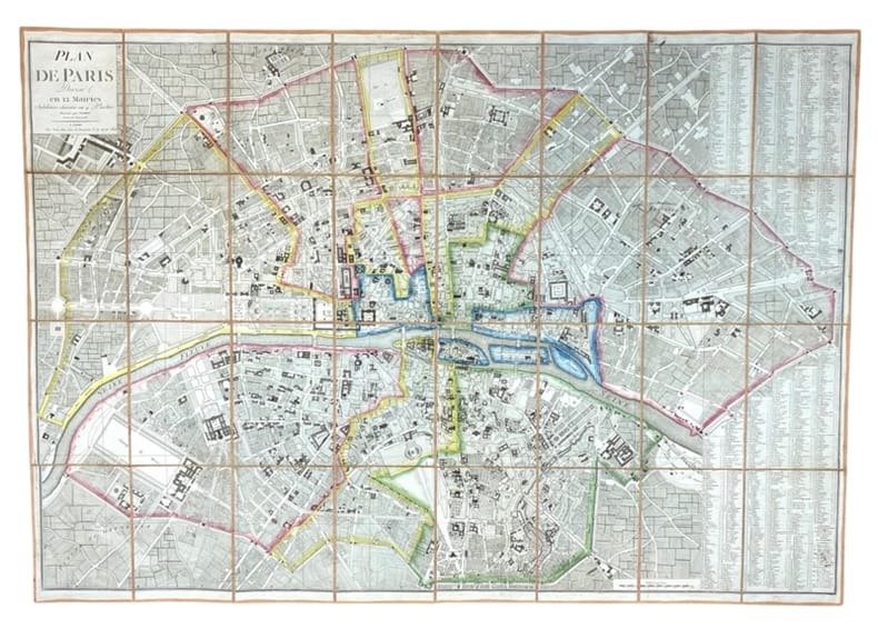
Plan de Paris divisé en 12 Mairies subdivisée chacune en 4 Parties.
1802 Paris, Chez Jean Goujon, 1802.
Referentie van de boekhandelaar : 585
|
|
|
CHATELAIN (Henry Abraham).
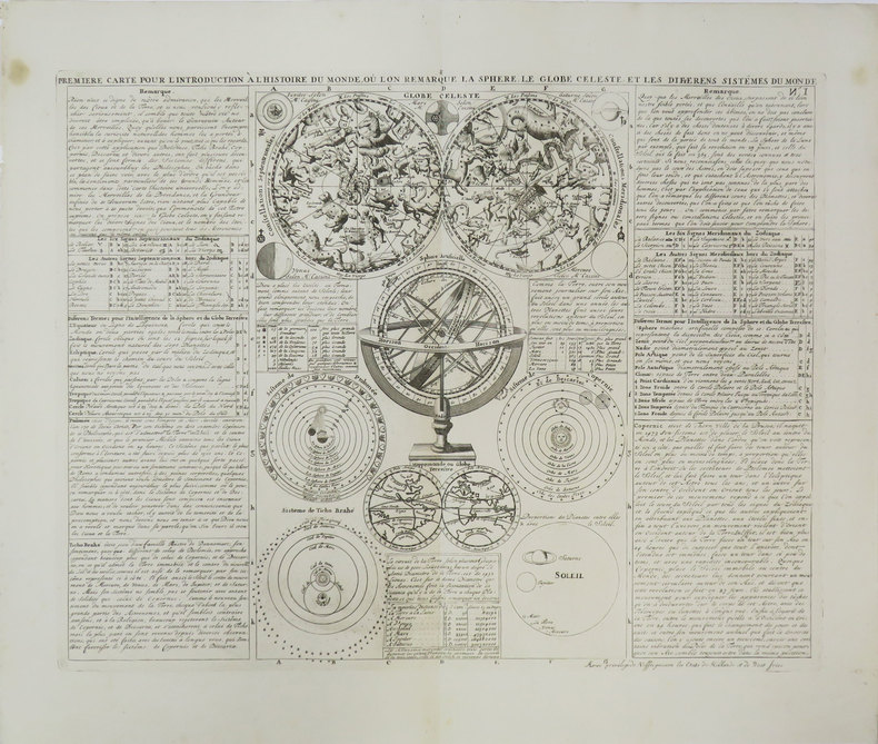
Première carte pour l'introduction à l'histoire du monde, où l'on remarque la sphère, le globe céleste, et les différens sistèmes du monde.
[Amsterdam, 1708]. 343 x 440 mm.
Referentie van de boekhandelaar : LBW-3447
|
|
|
CHAPUIS;
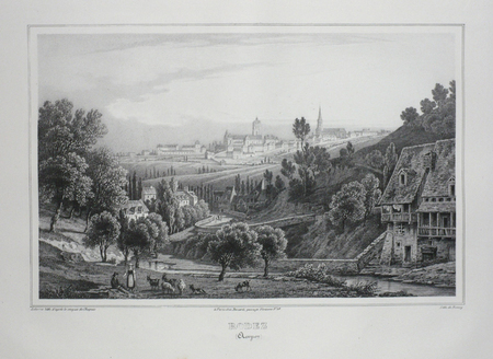
RODEZ (Aveyron).
Paris Benard circa 1850 217 x 298 mm.
Referentie van de boekhandelaar : LBW03d5e
|
|
|
CHAUCHEPRAT, C.H., RIGAULT de GENOUILLY
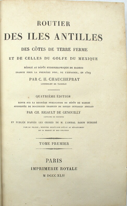
Routier des Iles Antilles des Côtes de Terre Ferme et de celles du Golfe du Mexique. Quatrième Édition revue sur la dernière Publication du Dépôt de Madrid augmentée de Documents traduits de diverse Ouvrages Anglais par CH. Rigault de Genouilly.
Paris, Imprimerie Royale, 1842, 2 volumes in-8 (23x15cm), 1f.-XXII-595pp. & XVI-581pp., demi veau époque, dos lisse avec titre et tomaison, frottements et épidermures, débuts de fentes, accrocs aux coiffes, coins usés, quelques rousseurs.
Referentie van de boekhandelaar : PHO-2031
|
|
|
CHARCHOUNE].
Serge Charchoune.
Paris Galerie Michel Warren 1958 1 vol. broché plaquette in-folio (2 f), marques de pliures. Annonce, avec un texte de présentation de Patrick Waldberg, de l'exposition des oeuvres du peintre et poète d'origine russe Serge Chachourne (1888-1975) à la galerie Warren du 17 décembre 1958 au 17 janvier 1959. Document provenant de la bibliothèque de Georges Bataille avec tampon à l'encre noire "Bibliothèque de Georges Bataille".
Referentie van de boekhandelaar : 104022
|
|
|
CHARCHOUNE].
Serge Charchoune.
Paris Galerie Michel Warren 1958 1 vol. broché plaquette in-folio (2 f), marques de pliures. Annonce, avec un texte de présentation de Patrick Waldberg, de l'exposition des oeuvres du peintre et poète d'origine russe Serge Chachourne (1888-1975) à la galerie Warren du 17 décembre 1958 au 17 janvier 1959. Document provenant de la bibliothèque de Georges Bataille avec tampon à l'encre noire "Bibliothèque de Georges Bataille".
Referentie van de boekhandelaar : 104022
|
|
|
CHACK, Paul - - Avec deux cartes dressées par Paul CHACK.
Sur les bancs de Flandre
PARIS, Ed. de France, 1927- Couverture illustrée - EDITION ORIGINALE. Un des exemplaires sur Alfa, revêtus de la signature manuscrite de l'auteur- vec 2 cartes desinées par l'Auteur - 272 pages
Referentie van de boekhandelaar : 4817
|
|
|
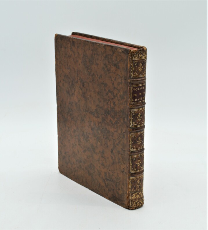
CHABERT, Joseph Bernard , marquis de
Voyage fait par ordre du Roi en 1750 et 1751, dans l'Amérique septentrionale, Pour rectifier les Cartes des Côtes de l'Acadie, de l'Isle Royale & de l'Isle de Terre-Neuve ; Et pour en fixer les principaux points par des Observations Astronomiques.
1753 , à Paris de l'Imprimerie Royale , in-4 (260 x 200 mm) , relié plein veau marbré époque , dos à nerf orné ave pièce de titre rouge , tranches rouge , léger accidents aux coiffes , une charnière fendillée , bel exemplaire illustré d'un bandeau gravé par Gobin d'après le peintre Flotte de Saint-Joseph, et 7 planches dépliantes : 6 cartes gravées par Dheulland, un tableau de calculs astronomiques.
Referentie van de boekhandelaar : PHO-1096
|
|
|
Chagnolleau, Jean ; Dez, Gaston ; Lavaud, Jacques & Crozet, Rene
Visages De Poitou
Name, date & origin on front end paper. Also two of authors names and a few place names underlined. Creasing to oversize parts of covers, none to spine. A very clean very tight copy with sunning to page edges and covers and rubbing to spine ends. 195pp. Very well illustrated guide, culture and history of the French region of Poitou, now part of the new region of Nouvelle-Aquitaine. With a number of fold-out maps all in very good condition. All text in French.

|
|
|
CHALON-SUR-SA?NE
Plan de la ville dress? par C. Perrier instituteur ? Verdun sur le Doubs. Sans date.
1 feuille 52 x 42 cm. 1 pli r?par?.
|
|
|
CHALONS
Carte allemande en couleurs au 1/200 000e.
Une feuille repli?e. 54x75 cm.
|
|
|
CHALONS
Carte au 1/200 000e. Sans date.
Une feuille 32x50 cm.
|
|
|
CHALONS
Carte au 1/80 000e.
Une feuille 64x92 cm.
|
|
|
CHAMBERY
Chamb?ry S. O. Carte au 1/50 000?, type 1889, r?vis?e en 1932.
Une feuille 75x53,5 cm.
|
|
|
Chapman, Bruce K. ; Franklin Raines; A. Ludlow Kramer
Race and Violence in Washinton State: Report of the Commission on the Causes and Prevention of Civil Disorder
Large format staple bound 63 page book with light wear to covers with two small tears at bottom. Binding is solid and square, text/interior is clean and free of marking of any kind. Contents include: The causes of disorders, Importance of attitudes, Ghettoization, Economic deprivation, Social chaos, The inadequate response & sections on White bias, Police conduct, Mass arrest procedure etc. Maps for the "Negro population Washington state" "Negro population Spokane" " Proportion of population classified as negro Seattle, 1960, " occasional photos. Stat tables, charts;

|
|
|
CHARENTE
Carte d?partementale couleurs au 1/200 000e. Sans date.
Une feuille 56x75 cm repli?e sous couverture.
|
|
|
CHARENTE
Carte d?partementale couleurs extraite de la Grande Encyclop?die.
Une feuille 30x42 cm.
|
|
|
Charles H Babbitt,, EX-LIBRARY Usual wear, STAMPS , ETC, Includes a variety of B/W illustrations and maps throughout text BOOKPL
Early Days at Council Bluffs IOWA Contains material on the Mormons Church of Jesus Christ of Latter Day Saints fleeing Persecution & looking for Promised Land Pottawattamie Indians
<p>Press of Byron S. Adams Washingtn D.C. 1916. HARDBACK NOdUSTJAKET 1916 1st edition EX-LIBRARY Usual wear STAMPS ETC VG AS-S NO JACKETMAROON CLOTH SPINE titled in Gold gilt LITE WEAR CVR RUB 8vo INTERIOR LITE WEAR FOX Bound in red cloth on boards with gilt lettering to spine.96 pgs Old Blockhouse of Frontier Days lasted 1837 - 1857 Fort Croghan ETC. April 1847 Brigham Young at head exploring party of 143 men set out from winter quarters in search of promised Land. 1st Edition. Hard Cover. Very Good/No Jacket. Illus. by George Simon Etc. Ex-Library.</p> Press of Byron S. Adams, Washingtn, D.C. hardcover
Referentie van de boekhandelaar : 28350

|
|
|
Charlton, J.R.; Lands and Survey Department
Colony of Fiji Colour (Color) Map, 1939
Handsome colour-illustrated 1939 map of the Colony of Fiji with inset map of the Lau Group/Eastern District Islands. 19.5" x 15". Folds to 9.25" x 6.5". Clean and unmarked with light wear. Map

|
|
|
CharriÚ, Jean-Paul; Delvert, Ray
Conna¯tre le Lot-et-Garonne
Appears unread. No marks or inscriptions. No creasing to covers or to spine. A lovely clean very tight copy with bright unmarked boards and no bumping to corners. 64pp. Coloured guide the the Lot-et-Garonne region of France. All text in French.

|
|
|
Chase, Linda (editor)
Guest Informant : Los Angeles
Tiny mark to front end paper. No other marks or inscriptions. No creasing to covers or to spine. A very clean very tight copy with bright unmarked boards and no bumping to corners. 196pp. The guide to Los Angeles supplied by hotels - 1998/1999 edition. Check out Los Angeles before you travel.

|
|
|
CHATEAU-DU-LOIR
Carte couleurs au 1/100 000?. Feuille XIII-18. Mise ? jour 1913.
Une feuille 57x45 cm.
|
|
|
CHATEAUDUN
Carte au 1/80 000e. Ch?teaudun Nord-Est. Tirage de 1883.
Une feuille 42x60 cm.
|
|
|
CHATEAUDUN
Carte au 1/80 000e. Ch?teaudun Nord-Ouest. Tirage de 1883.
Une feuille 42x60 cm.
|
|
|
CHATEAUDUN
Carte au 1/80 000e. Ch?teaudun Sud-Est. Tirage de 1883.
Une feuille 42x60 cm.
|
|
|
CHATEAUDUN
Carte au 1/80 000e. Ch?teaudun Sud-Ouest. Tirage de 1883.
Une feuille 42x60 cm.
|
|
|
CHATELAIN Henri Abraham (1684 - 1743)
Nouveau Plan de la Ville de Rome tiré par ordre du Pape par Matteo Gregoria de Romans Tres Utille pour les Voiageurs
Pianta a proiezione mista, orientata con il nord a sinistra, 1706 circa. Basata sula pianta di Roma di Lievin Cruyl del 1665 e successiva ristampa del 1696. Per Scaccia Scarafoni prima e Marigliani poi “fu pubblicata ad Amsterdam nel 1706 senza alcun aggiornamento e raffigura pertanto Roma come si presentava alla fine del ‘600. In alto a sinistra è riportata la piantina dei dintorni di Roma” (cfr. Marigliani p. 252). La pianta è inclusa nell'Atlas Historique, pubblicato ad Amsterdam tra il 1705 e il 1720. L'atlante, in 7 volumi, è innovativo per la sua epoca perché combina le mappe geografiche con incisioni e informazioni di carattere geografico, storico, etnografico e araldico. Acquaforte, in ottimo stato di conservazione. Henri Abraham Chatelain (1684 - 1743) era un pastore ugonotto di origini parigine. È meglio conosciuto come cartografo olandese e più specificamente per il suo contributo cartografico nell’Atlas Historique in sette volumi, pubblicato ad Amsterdam tra il 1705 e il 1720. Innovativo per il suo tempo, l'Atlas Historique combinava incisioni e opere d'arte con studi di geografia, storia, etnologia, araldica e cosmografia. Alcuni studiosi suggeriscono che l'Atlas Historique non fu compilato esclusivamente da Henri Chatelain, come si crede comunemente, ma piuttosto fu un'impresa familiare che coinvolse Henri, suo padre Zacharie e suo fratello, sempre Zacharie. Bibliografia Scaccia Scarafoni (1939): p. 113, n. 213; Marigliani (2007): p. 252, n. 158. Mixed projection map of Rome, oriented with north to the left, circa 1706. Based on the map of Rome by Lievin Cruyl (1665) and subsequent reprint of 1696. For Scaccia Scarafoni first and then Marigliani was published in Amsterdam in 1706 without any update and therefore represents Rome as it was at the end of '600. At the top left is the map of the surroundings of Rome (see Marigliani p. 252). The map is included in the Atlas Historique, published in Amsterdam between 1705 and 1720. Henri Abraham Chatelain (1684 - 1743) was a Huguenot pastor of Parisian origins. He is best known as a Dutch cartographer and more specifically for his cartographic contribution in the seminal seven volume Atlas Historique, published in Amsterdam between 1705 and 1720. Innovative for its time, the Atlas Historique combined fine engraving and artwork with scholarly studies of geography, history, ethnology, heraldry, and cosmography. Some scholarship suggests that the Atlas Historique was not exclusively compiled by Henri Chatelain, as is commonly believed, but rather was a family enterprise involving Henri, his father Zacharie and his brother, also Zacharie. Etching, in excellent condition. Literature Scaccia Scarafoni (1939): p. 113, n. 213; Marigliani (2007): p. 252, n. 158.

|
|
|
CHATELAIN Henri Abraham (1684 - 1743)
Rome Ancienne et Moderne
Pianta a proiezione verticale, orientata con il nord a sinistra. "Questa pianta assai schematica deriva come base di rappresentazione dalla pianta grande del Falda e non da quella del De Rossi come sostenuto in passato dall'Huelsen. Raffigura Roma attorno al 1700: manca infatti non solo la scalinata di Trinità dei Monti realizzata tra il 1721 e il 1725 come notato da Scaccia Scarafoni ma anche il porto di Ripetta realizzato nel 1704 e gli interventi dovuti a Innocenzo XII ma la poca definizione del disegno non consente di verificarlo con certezza. I lotti edificati non hanno campitura ma una fitta serie di 320 numeri e varie lettere che rimandano alla legenda disposta ai due lati della pianta. è invece rappresentato con maggiore cura il disegno dei giardini e delle ville" (cfr. Marigliani p. 255). Opera tratta dall'Atlas Historique, pubblicato ad Amsterdam tra il 1705 e il 1720. Incisione in rame, finemente colorata a mano, in perfette condizioni. Henri Abraham Chatelain (1684 - 1743) era un pastore ugonotto di origini parigine. È meglio conosciuto come cartografo olandese e più specificamente per il suo contributo cartografico nell’Atlas Historique in sette volumi, pubblicato ad Amsterdam tra il 1705 e il 1720. Innovativo per il suo tempo, l'Atlas Historique combinava incisioni e opere d'arte con studi di geografia, storia, etnologia, araldica e cosmografia. Alcuni studiosi suggeriscono che l'Atlas Historique non fu compilato esclusivamente da Henri Chatelain, come si crede comunemente, ma piuttosto fu un'impresa familiare che coinvolse Henri, suo padre Zacharie e suo fratello, sempre Zacharie. Bibliografia Huelsen (1915): n. 129b; Scaccia Scarafoni (1939): n. 219; Marigliani (2007): p. 255, n. 162. Vertical projection map of Rome, oriented with the north on the left. This very schematic plan derives as a basis of representation from the large map of Falda and not from that of De Rossi as claimed in the past by Huelsen. It depicts Rome around 1700: in fact, not only the Spanish Steps are missing, made between 1721 and 1725 as noted by Scaccia Scarafoni, but also the port of Ripetta made in 1704 and the interventions due to Innocenzo XII, but the poor definition of the drawing does not allow to verify with certainty. The built lots do not have a field but a dense series of 320 numbers and various letters that refer to the legend placed on the two sides of the plan. It is instead represented with greater care the design of gardens and villas (cf. Marigliani p. 255). Taken from "Atlas Historique" , this sheet includes a small map of the northern hemisphere including all of Europe and Asia and most of Africa, above the horn. Henri Abraham Chatelain (1684 - 1743) was a Huguenot pastor of Parisian origins. He is best known as a Dutch cartographer and more specifically for his cartographic contribution in the seminal seven volume Atlas Historique, published in Amsterdam between 1705 and 1720. Innovative for its time, the Atlas Historique combined fine engraving and artwork with scholarly studies of geography, history, ethnology, heraldry, and cosmography. Some scholarship suggests that the Atlas Historique was not exclusively compiled by Henri Chatelain, as is commonly believed, but rather was a family enterprise involving Henri, his father Zacharie and his brother, also Zacharie. Copper engraving, with fine later hand colour, in excellent condition. Literature Huelsen (1915): n. 129b; Scaccia Scarafoni (1939): n. 219; Marigliani (2007): p. 255, n. 162.

|
|
|
CHATILLON-SUR-SEINE
Carte au 1/200 000?.
1 feuille 32x49 cm.
|
|
|
CHAUMONT
Carte au 1/80 000e.
Une feuille 64x92 cm. Plis r?par?s.
|
|
|
CHERET (Jules)
A partir du 29 novembre, lire dans le Gil Blas "L'Argent", roman inédit par E. Zola. Lithographie en couleurs (244 x 88 cm, en deux parties de 124 x 88 cm chaque).
Imp. Chaix, s.d. [1890] Spectaculaire affiche destinée aux colonnes Morris où la Justice aux yeux bandés déverse une pluie d'argent sur les spéculateurs qui s'affairent devant le Palais Brongniart. Exemplaire plié, en bon état malgré de petites déchirures au centre, sans manques.
Referentie van de boekhandelaar : 64630
|
|
|
CHERET (Jules)
A partir du 29 novembre, lire dans le Gil Blas "L'Argent", roman inédit par E. Zola. Lithographie en couleurs (244 x 88 cm, en deux parties de 124 x 88 cm chaque).
Imp. Chaix, s.d. [1890] Spectaculaire affiche destinée aux colonnes Morris où la Justice aux yeux bandés déverse une pluie d'argent sur les spéculateurs qui s'affairent devant le Palais Brongniart. Exemplaire plié, en bon état malgré de petites déchirures au centre, sans manques.
Referentie van de boekhandelaar : 64630
|
|
|
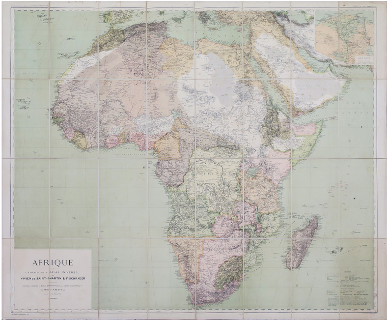
CHESNEAU (Marius).
Afrique extraite de l'Atlas Universel.
Paris, Librairie Hachette & Cie, 1896. En 32 sections montées sur toile et repliées, formant une carte de 0,90 x 1,07 m ; étiquette au dos du graveur-éditeur parisien de cartes géographiques Lanée, successeur de Longuet.
Referentie van de boekhandelaar : LBW-8146
|
|
|
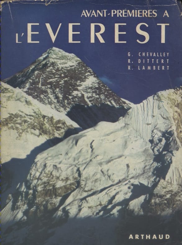
CHEVALLEY Gabriel - DITTERT René - LAMBERT Raymond 36 héliogravures hors texte. Cartes et dessins en 2 couleurs.
Avant-premières à l'Everest.
Couverture souple. Broché. Non coupé. 315 pages. Jaquette.
Referentie van de boekhandelaar : 133394
|
|
|
Chevalier Jean
Balades en nature en Rhône-Alpes - Diois - Baronnies - Vivarais. Avec un guide d'observation des animaux.
Dakota Editions -Coll les plus beaux Sites Naturels, 2000 - In-8, broché, solide vade-mecum couverture souple ill , Carte à pleine page couleurs légendée en manière de frontispice, 128 pages dont index in fine le haut de la pagination est munie donglets de couleurs délimitant les régions, très exhaustive et agréables iconographie en couleurs et en charmantes vignettes dans le texte dessinées par Jean Chevalier et bien rendues sur un papier de haut grammage Bel ensemble, dans un visuel dynamique et agréable.
Referentie van de boekhandelaar : 12894

|
|
|
CHEVALIER Auguste
L'Afrique Centrale Française. Récit du voyage de la mission Chari-Lac Tchad, 1902-1904.
Paris Augustin Challamel 1907 Demi-reliure
Referentie van de boekhandelaar : 010199
|
|
|
CHEVALLIER J.-P. & MARTIN-PREVEL P.
Le tennis à la Belle Epoque
Collection privée J.-P. Chevallier, Imprimerie Lerner, sans date, vers 1980. In-12. Broché, format à l' italienne. Couverture illustrée. 64 pages. Livret consacré à des reproductions de cartes postales anciennes concernant le tennis à la Belle Epoque. Très bon état. Envoi en tarif " lettre "
Referentie van de boekhandelaar : 3301
|
|
|
CHEMINS DE FER DE PARIS A ORLEANS ET DU MIDI Cartes dressées par les établissements De Dion-Bouton.
Le tourisme sur le réseau des chemins de fer de Paris à Orléans. Touraine - Auvergne - Bretagne - Pyrénées.
Couverture souple. Brochure de 24 pages.
Referentie van de boekhandelaar : 26030

|
|
|
CHINE et SZETSCHUAN par Eduard IMHOF.
Die Grossen Kalten Berge von SZETSCHUAN. Richement documenté (aquarelles, planches en couleurs, héliogravures, cartes dont une dépliante en couleurs).
Zürich, Orell Füssli Verlag 1974. Bel exemplaire relié, in-4, 228 pages + planches.
Referentie van de boekhandelaar : AUB-6031
|
|
|
CHINE par René GROUSSET et Vadime ELISSEEF.
Histoire de la Chine avec Vadime ELISSEEF et ses collaborateurs. Richement documenté (34 planches et 2 cartes).
Club des Libraires de France, éd. Fayard 1957. Bon exemplaire relié, reliure pleine toile ornée d'éd., fort in-8 numéroté, 354 pages + planches.
Referentie van de boekhandelaar : AUB-7107
|
|
|
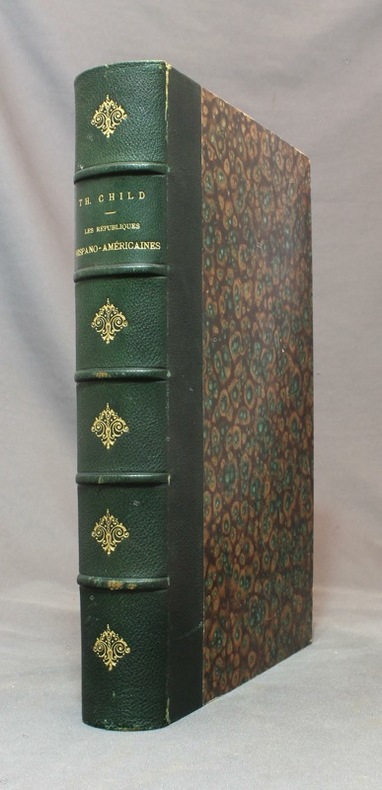
CHILD Théodore:
Les républiques hispano-américaines.
Paris, à la librairie illustrée, sans date [1891]. In-4 de [4]-480 pages, demi-chagrin vert empire, dos à nerfs orné de fleurons dorés, couvertures conservées.
Referentie van de boekhandelaar : 15492
|
|
|
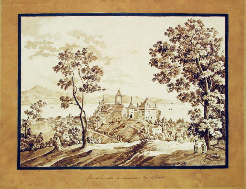
CHISHOLM (C. E.). [Lausanne] MANUSCRIT.
Vue de la ville de Lausanne, Pays de Vaud.
20 juillet 1822. 285 x 385 mm, monté sur carton.
Referentie van de boekhandelaar : LBW-4115
|
|
|
CHIAS Y CARBÓ, Benito.
Mapa de la Provincia de Oviedo. 1903.
Barcelona, Establecimiento Editorial de Alberto Martín, s.a. (1915) [Colección de Cartas Corográficas]. Un mapa de 35 x 45 cms., dibujado por Joaquín Ribera y litografiado en color por Martí Campaña, montado sobre tela, - con soporte exterior de cartoné
|
|
|
Chicago Bureau of Maps and Plats
Report on Proposed Change of House Numbering System for City of Chicago Classic Reprint
hardcover. Good. Access codes and supplements are not guaranteed with used items. May be an ex-library book. hardcover
Referentie van de boekhandelaar : 0484452460.G ISBN : 0484452460 9780484452465
|
|
|
CHIQUET Jacques (1673 - 1721)
Division du Globe Globe Terrestre par Zones Corespondantes ala Sphere Celeste / Correspondance du Globe Terrestre avec la Si
Questa tavola raffigura i due emisferi, che mostrano l'equatore, i tropici e le zone polari del mondo, nelle cuspidi e negli angoli ci sono sei diagrammi più piccoli che mostrano 'Disposition des Parallels' e 'Explication des Zones' ecc. Opera tratta da Le nouveau et curieux Atlas Geographique et historique pubblicato a Parigi nel 1719.All'inizio del XVIII secolo, la cartografia francese ha superato gli olandesi in termini di precisione e design. Il delizioso Nouveau et Curieux Atlas di Chiquet era un prodotto tipico dell'epoca.Acquaforte su rame, finemente colorata a mano, in buone condizioni. This plate shows two hemispheres, showing the equator, tropics and polar zones of the world, in the cusps and corners there are six smaller diagrams showing 'Disposition des Parallels' and 'Explication des Zones' etc. In the early eighteenth century, French cartography overtook the Dutch in terms of accuracy and design. Chiquet's delightful Nouveau et Curieux Atlas was typical product of the time.Work taken from Le nouveau et curieux Atlas Geographique et historique published in Paris in 1719.Copperplate, finely colored by hand, in good condition.

|
|
|
CHIQUET Jacques (1673 - 1721)
Le Globe Terrestre Rappresenté en Deux Plans-Hemispheres…
Mappa del mondo a doppio emisfero che presenta l'isola della California e un passaggio a nord-ovest. Date le picocle dimensioni, dono presenti solo pochi dettagli interni e solo le principali nazioni nominate. Dal punto di vista dell'innovazione cartografica Ter. de Jesso appare al largo della costa orientale dell'Asia, l'Australia è incompleta e ancora attaccata alla Nuova Guinea, appare solo la costa occidentale della Nuova Zelanda, e c'è ancora una costa parziale per Terres Australes. Il cartiglio del titolo decorativo e il testo in francese circondano la mappa.Opera tratta dal Le Nouveau et Curieux Atlas Geographique et Historique... di Jacques Chiquet.Acquaforte su rame, con una bella colorazione a mano, in buone condizioni. This delicately engraved double hemisphere world map features the island of California and a Northwest Passage. There is little interior detail with only major nations named. Ter. de Jesso appears off the east coast of Asia, Australia is incomplete and still attached to New Guinea, only the west coast of New Zealand appears, and there is still a partial coastline for Terres Australes. Decorative title cartouche and French text surrounds the map.From Le Nouveau et Curieux Atlas Geographique et Historique... by Jacques Chiquet.Copperplate, with fine hand colouring, good condition.

|
|
|
CHOCOLAT LOUIT
"Carte Postale du Chocolat Louit "" Le Caviar - Histoire Anecdotique de l'Alimentation """
LIBRAIRIE DU GLORIT. Non daté. In-12. Broché. Bon état, Couv. convenable, Dos satisfaisant, Intérieur frais. Une carte postale, vierge, illustrée en couleurs. 14.5 x 10 cm.. . . . Classification : 220-Cartes Postales Publicitaires
Referentie van de boekhandelaar : RO80093902
|
|
|
CHOCOLAT LOUIT
"Carte Postale du Chocolat Louit "" Les Grives - Histoire Anecdotique de l'Alimentation """
LIBRAIRIE DU GLORIT. Non daté. In-12. Broché. Bon état, Couv. convenable, Dos satisfaisant, Intérieur frais. Une carte postale, vierge, illustrée en couleurs. 14.5 x 10 cm.. . . . Classification : 220-Cartes Postales Publicitaires
Referentie van de boekhandelaar : RO80093903
|
|
|
CHOT (J.-M.).
Carte de voeux illustrée d'une gravure originale signée.
Paris Société des peintres-graveurs français 1997 1 vol. Broché Carte de voeux dépliante sur Arches illustrée d'une eau-forte (11 x 17 cm) signée par J.-M. Chot-Plassot. En parfait état.
Referentie van de boekhandelaar : 109097
|
|
|
CHOT (J.-M.).
Carte de voeux illustrée d'une gravure originale signée.
Paris Société des peintres-graveurs français 1997 1 vol. Broché Carte de voeux dépliante sur Arches illustrée d'une eau-forte (11 x 17 cm) signée par J.-M. Chot-Plassot. En parfait état.
Referentie van de boekhandelaar : 109097
|
|

 De zoekresultaten per email ontvangen
 Zoekresultaten downloaden als PDF
 RSS feed
 Permanente link


