|
Cassini Maps
Cassini HM POP-137: Ludlow & Church Stretton 137 Popular Edition 137
Cassini Maps 2007. Map. New. 1 pages. 5.28x0.32x8.90 inches. Cassini Maps unknown
Bookseller reference : __1847361846 ISBN : 1847361846 9781847361844
|
|
|
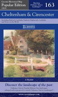
Cassini Maps
Cheltenham and Cirencester Cassini Popular Edition Historical Map
Paperback. Very Good. paperback
Bookseller reference : GOR008931719 ISBN : 1847361382 9781847361387
|
|
|
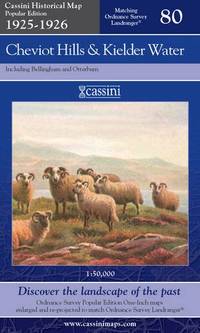
Cassini Maps
Cheviot Hills and Kielder Water: No. 80 Cassini Popular Edition Historical Map
Paperback. Like New. paperback
Bookseller reference : GOR014416051 ISBN : 1847362087 9781847362087
|
|
|
Cassini Maps
Derby and Burton Upon Trent: No. 128 Cassini Popular Edition Historical Map
Paperback. Good. paperback
Bookseller reference : GOR007376122 ISBN : 1847361838 9781847361837

|
|
|
Cassini Maps
Derby and Burton Upon Trent: No. 128 Cassini Popular Edition Historical Map
Paperback. Very Good. paperback
Bookseller reference : GOR002829864 ISBN : 1847361838 9781847361837

|
|
|
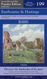
Cassini Maps
Eastbourne and Hastings: Sheet 199 Cassini Popular Edition Historical Map
Paperback. Very Good. paperback
Bookseller reference : GOR007763647 ISBN : 184736120X 9781847361202
|
|
|
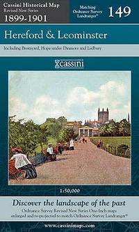
Cassini Maps
Hereford and Leominster Cassini Revised New Series Historical Map
Cassini Publishing Ltd 2007-11-01. Map. Very Good. 22.5828 in x 13.3898 in x 0.7994 in. 3 X large format folded sheet maps in plastic illustrated cover Cassini Publishing Ltd unknown
Bookseller reference : mon0000119409 ISBN : 1847363474 9781847363473
|
|
|
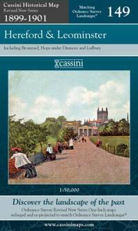
Cassini Maps
Hereford and Leominster: Sheet 149 Cassini Revised New Series Historical Map
Paperback. Very Good. paperback
Bookseller reference : GOR007213108 ISBN : 1847363474 9781847363473
|
|
|
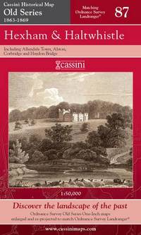
Cassini Maps
Hexham and Haltwhistle: No. 87 Cassini Old Series Historical Map
Paperback. Very Good. paperback
Bookseller reference : GOR006397703 ISBN : 1847360211 9781847360212
|
|
|
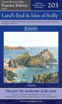
Cassini Maps
Land's End and Isles of Scilly: No. 203 Cassini Popular Edition Historical Map
Paperback. Very Good. paperback
Bookseller reference : GOR012820406 ISBN : 184736151X 9781847361516
|
|
|
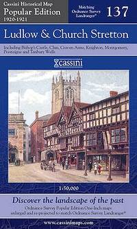
Cassini Maps
Ludlow and Church Stretton: No. 137 Cassini Popular Edition Historical Map
Paperback. Very Good. paperback
Bookseller reference : GOR010794302 ISBN : 1847361846 9781847361844

|
|
|
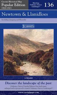
Cassini Maps
Newtown and Llanidloes: No. 136 Cassini Popular Edition Historical Map
Paperback. Very Good. paperback
Bookseller reference : GOR013025670 ISBN : 1847362419 9781847362414
|
|
|
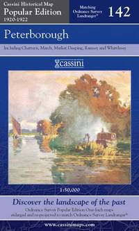
Cassini Maps
Peterborough Cassini Popular Edition Historical Map
Cassini Publishing Ltd. Popular ed. Map. Used; Very Good. Simply Brit welcome to our online used book store where affordability meets great quality. Dive into a world of captivating reads without breaking the bank. We take pride in offering a wide selection of used books from classics to hidden gems ensuring theres something for every literary palate. All orders are shipped within 24 hours and our lightning fast-delivery within 48 hours coupled with our prompt customer service ensures a smooth journey from ordering to delivery. Discover the joy of reading with us your trusted source for affordable books that do not compromise on quality. 04/26/2007 Cassini Publishing Ltd unknown
Bookseller reference : 3717553 ISBN : 1847361668 9781847361660
|
|
|
Cassini Maps
Peterborough Cassini Popular Edition Historical Map
Cassini Publishing Ltd 2007. Paperback. Fine. Fine copy with no previous ownership markings and no creases. Cassini Publishing Ltd paperback
Bookseller reference : 095936 ISBN : 1847361668 9781847361660
|
|
|
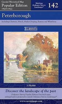
Cassini Maps
Peterborough: No. 142 Cassini Popular Edition Historical Map
Paperback. Very Good. paperback
Bookseller reference : GOR008633834 ISBN : 1847361668 9781847361660
|
|
|
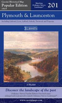
Cassini Maps
Plymouth and Launceston: No. 201 Cassini Popular Edition Historical Map
Paperback. Very Good. paperback
Bookseller reference : GOR011696637 ISBN : 1847361498 9781847361493
|
|
|
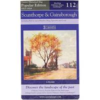
Cassini Maps
Scunthorpe and Gainsborough: No. 112 Cassini Popular Edition Historical Map
Paperback. Very Good. paperback
Bookseller reference : GOR013872953 ISBN : 1847362052 9781847362056
|
|
|
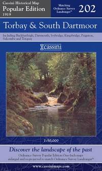
Cassini Maps
Torbay and South Dartmoor: No. 202 Cassini Popular Edition Historical Map
Paperback. Very Good. paperback
Bookseller reference : GOR012993193 ISBN : 1847361501 9781847361509
|
|
|
Cassini Maps
Whitby and Esk Dale: No. 94 Cassini Popular Edition Historical Map
Paperback. Acceptable. paperback
Bookseller reference : GOR014660971 ISBN : 1847362192 9781847362193

|
|
|
CASSINI, CAMUS, MONTIGNY (de)
Carte particulière du Duché de Bourgogne levée géométriquement par ordre de MM. les Elus Généraux de la Province en conséquence du Décret des Etats de 1751, divisée par Diocèses, Baillages et Subdélégations, faisant partie de la Carte Générale de la France levée par ordre du Roy et par les Ingénieurs Géographes de Sa Majesté, sous la direction de Mrs Cassini, Camus & de Montigny, de l'Académie Rle des Sciences. Dressée et executée par le Sr Seguin, ingénieur géographe du roy en 1763. Echelle de dix mil Toises. Les Ornemens d'après les desseins du Sr. Galey, Inspectr. des Batiments du Roy. L'Ecriture par Bourguignon. N° 1 : Confins de la Champagne. Cours de l'Armençon, de l'Yonne...N° 2 : Confins de la Champagne. Cours de la Marne, de l'Aube et de la SeineN° 3 : Confins de la Lauraine et de la Franche-Comté.N° 4 : Confins du Nivernois.N° 5 : Centre de la Bourgogne.N° 6 : Confins de la Franche-Comté. Cours de la Saone, du DoubsN° 7 : Confins du Bourbonois. Cours de la Loire et de l'Arroux.N° 8 : Confins de la Bresse. Cours de la Saone.N° 9 : Confins de la Franche-Comté.
1763 toile, dans un emboitage 35 x 25 x 7 cm (XIXe sur laquelle on a placé l'étiquette XVIIIe). carte composée de 9 feuilles, 290 x 246 cms, 1763
Bookseller reference : 17704

|
|
|
CASSINI.
Bourg en Bresse : Carte N° 117
toilée. Paris
Bookseller reference : 12400
|
|
|
CASSINI.
Carte N° 47 : Auxerre, Joigny
couleurs, carte toilée,
Bookseller reference : 11861
|
|
|
CASSINI.
Carte N° 48 : Vermanton, Cosne, Donzy, Clamecy.
couleurs, carte toilée,
Bookseller reference : 11862
|
|
|
CASSINI.
Carte N°46 : Provins, Sens, Nogent, Montereau
couleurs, carte toilée,
Bookseller reference : 11860
|
|
|
Castela Paul
Jean Giletta 1856 - 1933. Un Photographe à La Recherche de son Temps.Préface de Mme Janine Grisoni-Gilletta.
1981 Gillleta, Nice, 1981. In-4 reliure d'éditeur toile noire sous jaquette illustrée "1er éditeur photographe de la Côte-d'Azur". 456 pages. Ouvrage illustré de 600 photographies en noir. Très bel ouvrage.
Bookseller reference : 24840
|
|
|
Castello, Corina Armella De Fernandez
Acapulco
No marks or inscriptions. A lovely clean very tight copy with bright unmarked boards and no bumping to corners. Oversize dust jacket not price clipped with creasing to oversize upper edge, rubbing to rear surface and a little rubbing to edges and corners. 200pp. Lavish tourist/travel guide to Acapulco in Mexico on superior quality paper. Text in English and Spanish. Colour photographs.

|
|
|
Castelot, Andre; Endpaper Maps [Illustrator]
Paris the Turbulent City 1783-1871
Harper 1962-01-01. First Edition. Unknown Binding. Very Good. 0x0x0. please read no marks on text - dj show wear and a few tears - my shelf location 17-D-13 Harper unknown
Bookseller reference : 180307016
|
|
|
CASTON Alfred (de)
Les tricheurs scènes de jeu
in 12 demi-cuir rouge,dos lisse,titre et filets dorés. photographie de l’auteur en pied par CARJAT avec sa signature d’atelier gaufrée fau-titre,titre 265 pages,1 feuillet d’errata,Dentu éditeur 1863.une tache brun-clair en marge supérieure en début de volume en s’atténuant jusqu’à la page 36 pour être pratiquement invisible jusqu’à la fin.une petite déchirure circulaire avec manque de papier(restauré)à la page de titre sous les initiales ED de l’éditeur rare ouvrage
Bookseller reference : 2511

|
|
|
CATELLA, Francis
Propaganda Postkarten. Tome 2 - Cartes postales & souvenirs philatéliques de l'Allemagne nationale-socialiste 1929-1945
1989 Editions Francis Catella, RZ publication - 1989 - In-8, cartonnage illustré - 232 pages - Très riche iconographie en couleurs et en N&B
Bookseller reference : 124033

|
|
|
Catton Bruce; Illus. with Maps
Never Call Retreat: Volume Three in the American Civil War Trilogy
Fall River Press 2009. Fall River Press 2009 First Edition NL with 1 Near Fine/ Faint spine crease o/w Fine. Includes 12 glossy map photo pages. xvi12555 pages with index. HEAVY ITEM 1.75 Pounds. Size: 9 1/4 x 6 x 1 5/8 inches. First Edition NL with 1. Paperback. Near Fine. No Exp. Fall River Press Paperback
Bookseller reference : 369547
|
|
|
Catton, Bruce; Gallagher, Gary W. [Introduction]; Palacios, Rafael D. [Maps]
Bruce Catton: The Army of the Potomac Trilogy LOA #359: Mr. Lincoln's Army / Glory Road / A Stillness at Appomattox The Library of America; The Army of the Potomac Trilogy 359
Library of America 2022-10-25. First Edition. Hardcover. Near Fine/Very Good Slipcase. 5x1x8. 1st printing of this edition published the the Library of America. Slicpase edition no DJ. With maps by Rafael D. Palacios and introduction by Gary W. Gallagher. Interior appears free of markings. Exterior looks almost like new. Binding is tight sturdy and square. Library of America hardcover
Bookseller reference : 331369 ISBN : 1598537253 9781598537253
|
|
|
Catton, Bruce; Illus. with maps [Illustrator]
The Coming Fury American Civil War Trilogy Vol. 1
Fall River Press 2009-01-01. Paperback. Good. 8x5x0. Fall River Press paperback
Bookseller reference : 1435117174-3-31159181 ISBN : 1435117174 9781435117174
|
|
|
CCC Maps
Atlantic Canada Back Road Atlas: New Brunswick Newfoundland and Labrador Nova Scotia Prince Edward Island and more
Canadian Cartographics Corporation. Used - Acceptable. Acceptable condition. 9781554861002 Canada Road Maps A readable intact copy that may have noticeable tears and wear to the spine. All pages of text are present but they may include extensive notes and highlighting or be heavily stained. Includes reading copy only books. Canadian Cartographics Corporation unknown
Bookseller reference : S14P-00505 ISBN : 1554861004 9781554861002
|
|
|
CEILLIER Patrick - MBOT Jean-Emile
A Libreville, c'était hier...
Libreville Editions du Luto 2002 petite atteinte aux coins inférieurs sans gravité , cartonnage éditeur
Bookseller reference : 32219
|
|
|
CEILLIER, Remi.
Manuel pratique d"Illusionnisme et de Prestidigitation. Généralités - Tours de cartes. Préface de M. Auguste Lumière.
in-8°, 310 pp., figures dans le texte, broche, couverture illustree Etat moyen (fortes mouillures aux 40 premieres pages) [NV-37]
|
|
|
CEILLIER, Rémi
Manuel pratique d'illusionisme et de prestidigitation. Généralités - tours de cartes
Couverture souple Payot 1970 Paris 22,5x14,5 cm
Bookseller reference : 1865
|
|
|
CELLARIUS Christoph 1638-1707
Thracia Antiqua
Carta gegrafica tratta da "Christophori Cellarii Smalcaldensis Geographia antiqua" stampata a Londra da Sumptibus J & T Pote nel 1786.Incisione in rame, firmata da R. W. Scale, finemente colorata a mano, in ottimo stato di conservazione. Carta gegrafica tratta da "Christophori Cellarii Smalcaldensis Geographia antiqua" stampata a Londra da Sumptibus J & T Pote nel 1786.Incisione in rame, firmata da R. W. Scale, finemente colorata a mano, in ottimo stato di conservazione.

|
|
|
CELLARIUS Christoph; PARTICK Samuel:
Christophori Cellarii Smalcaldensis Geographia antiqua recognita denuo, & ad veterum novorumque scriptorum fidem, historicorum maxime, identidem castigata, &. Quinta editione plurimis locis aucta & immutata. Huic demum sextae editioni tot chartas ex majori auctoris Geographia antiqua, quot ad minorem hanc illustrandam requirebantur, duplicemque indicem, quorum priori vetera locorum nomina novis praeponuntur, posteriori nova veteribus, addidit, totam recensuit, & scholarum usui accomodavit, Samuel Patrick.
Londini, sumptibus J. & T.Pote, E.Ballard, C. Bathurst, J. Rivington, S. Crowder, T. Longman, M. Senex, M. Richardson, 1764. In-8 de [10]-180 pages, plein veau moucheté, dos muet à 5 nerfs orné de filets dorés, filet doré encadrant les plats.
Bookseller reference : 15656

|
|
|
CENTRAL AND EAST AFRICA
Contour-coloured world map. With boundaries, roads and railways. Scale 1/4 000 000e.
Carte toil?e repli?e. 91x71 cm.
|
|
|
CEREZO MARTÍNEZ, Ricardo.
La Cartografía Náutica Española en los Siglos XIV, XV y XVI.
Madrid, 1994. Folio; XIV-306 pp. Mapas y láminas fuera de texto. Cubiertas originales.

|
|
|
CESAR Jules; OUDENDORP Francis; CLARKE Samuel; DAVIES John; VOSSIUS Dionysius; HIRTIUS Aulus:
C. Julii Caesaris De bellis Gallico et civili Pompejano, nec non A. Hirtii, aliorumque De bellis Alexandrino, Africano, et Hispaniensi commentarii ad MSStorum fidem expressi, cum integris notis Dionysii Vossii, Joannis Davisii, et Samuelis Clarkii. Cura et studio Francisci Oudendorpii, qui fuas animadversiones, ac varias lectiones adjecit.
Lugd[uni] Bat[avorum] / Rotterodami, apud Samuelem Luchtmans / apud Johannem Danielem Beman, 1737. Fort volume in-4 de [26]-1035-[33] pages, plein veau moucheté, dos à 5 nerfs orné de fleurons, encadrements et titre dorés, étiquette de titre bordeaux, filet à froid sur les plats, double filet doré sur les coupes, tranches marbrées. Quelques petites épidermures, petit manque à la coiffe supérieure rousseurs. Ex-libris Rigaud.
Bookseller reference : 9717

|
|
|
CESAR Nombreuses cartes et illustrations.
La guerre des Gaules. (En 2 volumes). Avec les commentaires de Napoléon. Texte intégral.
Couverture rigide. 2 volumes reliés cuir vert. Au total 470 pages.
Bookseller reference : 145196

|
|
|
CESSART (Louis Alexandre de).
[LE TRÉPORT] Plan du port du Tréport avec le projet d'une retenue pour alimenter l'écluse de chasse construite en 1778.
[1806]. 216 x 298 mm.
Bookseller reference : LBW-6671

|
|
|
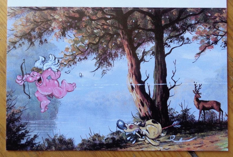
Cestac Florence:
Quel farceur ce Cupidon !
Christian Desbois, 1997. Carte de voeux de l'éditeur pour l'année 1997, illustrée d'un dessin de Florence Cestac (format plié 13 x 8,5 cm.).
Bookseller reference : 9050
|
|
|
CEVAT ÜLKEKUL.
An 8200 year old map: The town plan of Çatalhöyük.= 8200 yillik bir harita: Çatalhöyük sehir plani.
New English Paperback. Pbo. 4to. (31 x 22 cm). In English and Turkish. 80 p., color and b/w ills. An 8200 year old map: The town plan of Çatalhöyük.= 8200 yillik bir harita: Çatalhöyük sehir plani. I was fascinated when I first saw the Catalhoyuk map, a heritage of 'Anatolian Civilizations' which has survived 8,200 years of history, while at the same time I was greatly disappointed that such a unique map was neither known sufficiently enough nor introduced to the cartographic scholars. It was for this reason that about two years ago, I decided to conduct research into the matter. However, as I was already involved in two research projects entitled 'The History of Turkish Mapping in the Republican Era' and 'Historical Relief Maps, ' respectively, it was not possible to find time for the Catalhoyuk map. Once I had completed these studies, I started to carry out my study on 'Piri Reis Kitab-i Bahriye' (Piri Reis and His Book of the Sea) , which has been continiuing for a few years, Thus, my study of the Catalhoyuk map had been delayed once again. When I saw the map once again, in early 1999, I decided that I could not wait any longer. Even though my continuing research would be delayed, I could not avoid giving priority to the study of the Catalhoyuk map. ARCHEOLOGY Anatolian civilizations Hittites Çatalhöyük Excavations Map Geography Guide Reference.
|
|
|
CEVENNES
Parc National des C?vennes. Carte couleurs au 1/100 000e.
Une feuille 88x118 cm.
|
|
|
CGT].
Halte ! à la provocation gouvernementale.
Paris CGT 1968 1 vol. en feuilles Tract imprimé recto-verso daté du 11 juin appelant à un arrêt national du travail le lendemain entre 15 et 16h, pour protester contre les violences policière et notamment la mort de Pierre Baylot, tué par balle le matin même à Sochaux. Pâle mouillure au coin supérieur, sinon en très bonne condition.
Bookseller reference : 93145
|
|
|
Ch. VALLOT et E. de LARMINAT
CARTE GENERALE du MASSIF du MONT-BLANC
Carte Vallot au 1 / 50 000éme, édition de 1956, bon état, Editions Girard Barrère et Thomas (Paris)
Bookseller reference : LFA00251
|
|
|
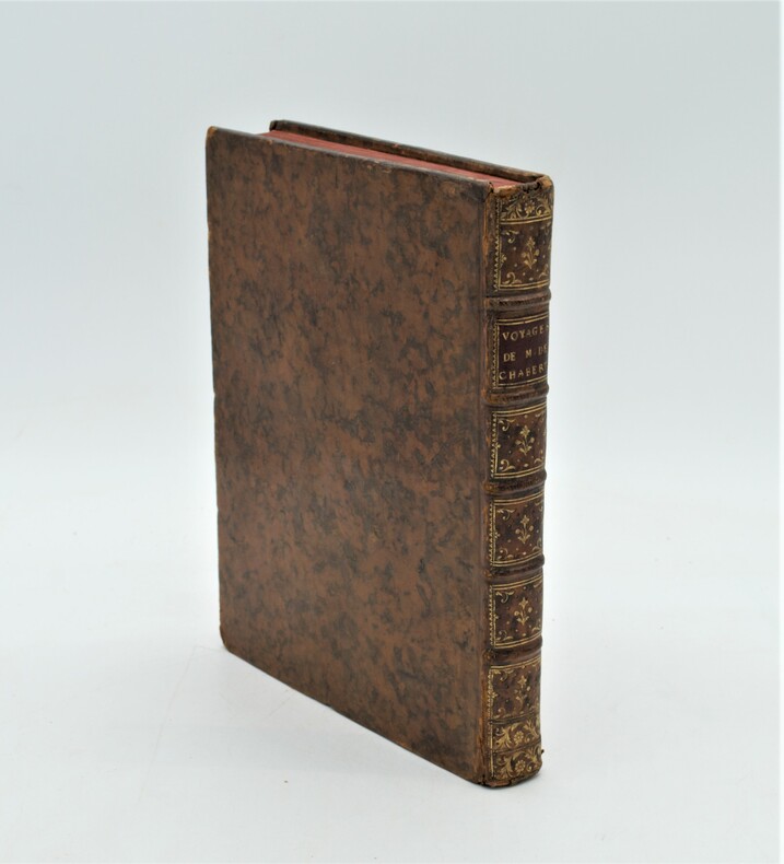
CHABERT, Joseph Bernard , marquis de
Voyage fait par ordre du Roi en 1750 et 1751, dans l'Amérique septentrionale, Pour rectifier les Cartes des Côtes de l'Acadie, de l'Isle Royale & de l'Isle de Terre-Neuve ; Et pour en fixer les principaux points par des Observations Astronomiques.
1753 , à Paris de l'Imprimerie Royale , in-4 (260 x 200 mm) , relié plein veau marbré époque , dos à nerf orné ave pièce de titre rouge , tranches rouge , léger accidents aux coiffes , une charnière fendillée , bel exemplaire illustré d'un bandeau gravé par Gobin d'après le peintre Flotte de Saint-Joseph, et 7 planches dépliantes : 6 cartes gravées par Dheulland, un tableau de calculs astronomiques.
Bookseller reference : PHO-1096
|
|
 Receive by email
 Download as PDF document
 RSS feed


