|
Kepanga Mundiya Dozier Marc
L'étrange tribu des français
PLUME CAROTTE 2021 56 pages 23 5x23 5x1 2cm. 2021. Relié. 56 pages.
Referenz des Buchhändlers : 500092512

|
|
|
KERMAINGANT, Mathurin François.
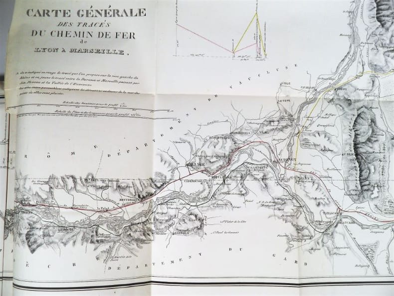
Mémoire sur le Projet d’un Chemin de Fer de Lyon à Marseille. Ministère des Travaux Publics de l’Agriculture et du Commerce. Direction Générale des Ponts et Chaussées et des Mines.
Paris, Imprimerie Royale, 1837. In-4 – 22,5 x 29 cm. Broché. 172 pages, 1 carte dépliante en 2 parties. Edition originale. Ouvrage complet de sa grande « Carte Générale des tracés du Chemin de Fer de Lyon à Marseille » très détaillée (150 x 57cm). On découvre le tracé proposé sur la rive droite du Rhône, rehaussé en vert, et celui sur la rive gauche du Rhône, rehaussé en rouge, les deux se rejoignant à Tarascon puis poursuivant par Arles et les Martigues. Un tracé alternatif de la rive gauche, rehaussé en jaune, entre la Durance et Marseille, envisage une bifurcation à partir d’Avignon en passant par Orgon, Salon, Aix, Fuveau, Aubagne et la vallée de l’Huveaune. Mathurin François Kermaingant (1779-1856) est un ingénieur originaire du Nord de la France. Il intègre l'école des Ponts et Chaussées en 1800. Quatre ans plus tard, il est affecté au service de route de la Drôme. Il quitte ce département pour celui du Rhône en 1810, puis y revient en 1821, pour 3 années. C'est dans la Sarthe qu'il poursuit sa carrière à partir de 1824. A la demande du gouvernement, il pilote la commission d'étude sur un futur chemin de fer dans la vallée du Rhône en 1833. Il suggère de nombreuses variantes de tracés. En 1836, il est nommé ingénieur en chef. Il quitte le sud de la France puis s'occupe du chemin de fer de Paris à Versailles.
Referenz des Buchhändlers : 2321
|
|
|
KEULEN (Johannes van);
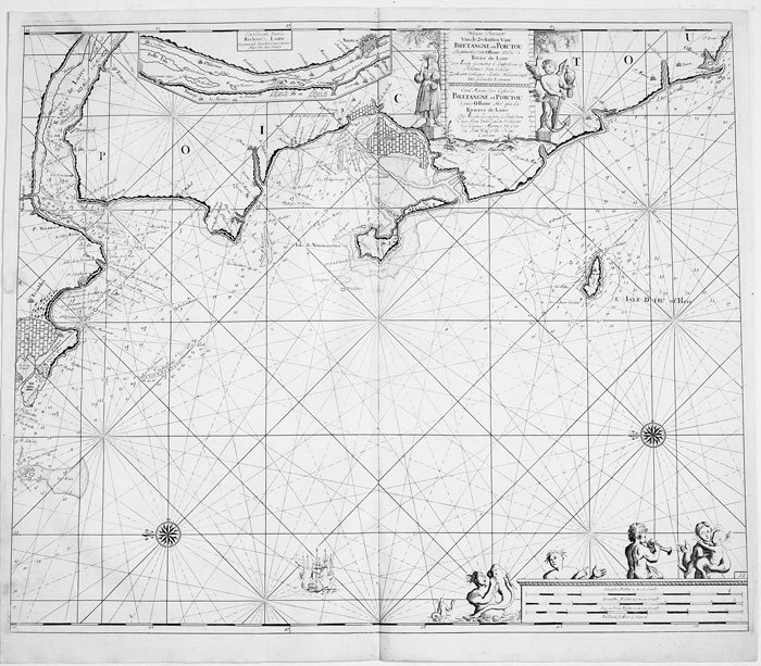
Nieuwe pascaart van de zeekusten van Bretangne en Poictou.
Amsterdam circa 1700 494 x 583 mm.
Referenz des Buchhändlers : LBW-811
|
|
|
KEULEN (Johannes van);
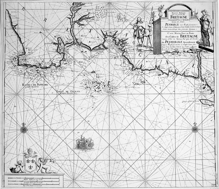
Nieuwe pascaart van een gedeelte van Bretangne.
Amsterdam circa 1700 513 x 592 mm.
Referenz des Buchhändlers : LBW-814
|
|
|
KEULEN (Johannes van);
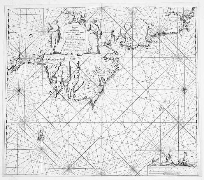
Pascaart van de zeekusten van Galissen.
Amsterdam circa 1700 511 x 588 mm.
Referenz des Buchhändlers : LBW-818
|
|
|
KEULEN (Johannes van).
Paskaart van Gallissien van C. de Finisterre tot aen Zurara.
Amsterdam, [circa 1700]. 505 x 567 mm.
Referenz des Buchhändlers : LBW-950

|
|
|
Khaled Al Ankary
La Péninsule arabique dans les cartes européennes anciennes, fin XVème- début XIXème siècle. Collection Khaled Al Ankary. Exposition du 15 Septembre au 28 Octobre 2001/ The arabian peninsula In old european maps. From the end of 15th century to the beginning of 19th century. Khaled Al Ankary collection. Exhibition from September 15th to October 28th 2001.
Institut du monde arabe, Paris 2001. Hardcover Sehr gut
Referenz des Buchhändlers : 032557

|
|
|
Kiepert, H(einrich)
Karte des russischen Reichs in Europa. Maßstab 1 : 3.000.000.
Berlin, Dietrich Reimer, 1893. Farblithografie, zwei Teile je 122,5 x 67,5 cm (Blattgr. 137,5 x 71 cm) in zus. 88 Segmenten auf Leinen aufgezogen. Zusammen in Leinenschuber d. Zt. mit Titelschild der Londoner Landkartenhandlung Edward Stanford, r1 6. verb. Auflage. (dieser mit geringen Gebrauchsspuren).
Referenz des Buchhändlers : 49033AB

|
|
|
Kiepert, Richard
4 Karten aus Richard Kiepert's Deutschen Kolonial-Atlas für den amtlichen Gebrauch in den Schutzgebieten.
Berlin, Dietrich Reimer, (1893). Ca. 75 x 57 cm. 4 Farblithografien, gefaltet. Zusammen lose in HLn.-Band der Zeit mit aufkaschiertem Deckeltitel, ko (etwas angeschmutzt und fleckig).
Referenz des Buchhändlers : 49113AB

|
|
|
Kiesel, O.E. [Otto Erich] (Bearb.)
Hamburg. Führer durch die Freie und Hansestadt und ihre Umgebung. Offizieller Führer des Fremdenverkehrs-Vereins Hamburg. 3., stark erweiterte Ausgabe.
Hamburg, Broschek & Co. 1924. 184 S. incl. 24 S. Anzeigenanhang. Mit Vignetten u. zahlr., tls. ganzseit. Abb. in Kupfertiefdruck 2 eingeschalt. Verkehrslinien-Plänen, 1 Tafel mit Ohlsdorf-Plan sowie 1 mehrfach gefalteten farbigen Pharus-Straßenplan im Anhang (Maßstab 1 : 14700; 40 x 50,5 cm). Farb. illustr. OBrosch.
Referenz des Buchhändlers : 88292

|
|
|
KILIAN (Georg Christophe);
[NORVEGE] Schloss Bahus in Norwegen.
Augsbourg circa 1740 163 x 177 mm.
Referenz des Buchhändlers : LBW061eb

|
|
|
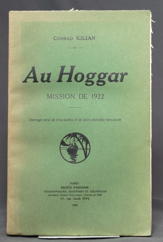
KILIAN Conrad:
Au Hoggar. Mission de 1922.
Paris, Société d'éditions géographiques, maritimes et coloniales, 1925. In-8 broché de [2]-190 pages, couverture verte imprimée en noir, ornée d'une vignette qu'on retrouve au dos (passé). Bords du premier plat insolés, déchirure sans perte au second plat. Intérieur frais, en majeure partie non coupé.
Referenz des Buchhändlers : 10484
|
|
|
Kilmann Ralph H
Social Systems Design: Normative Theory and the Maps Design Technology
Elsevier Science Ltd 1977 344 pages in8. 1977. Cartonné jaquette. 344 pages.
Referenz des Buchhändlers : 100125543 ISBN : 444001980

|
|
|
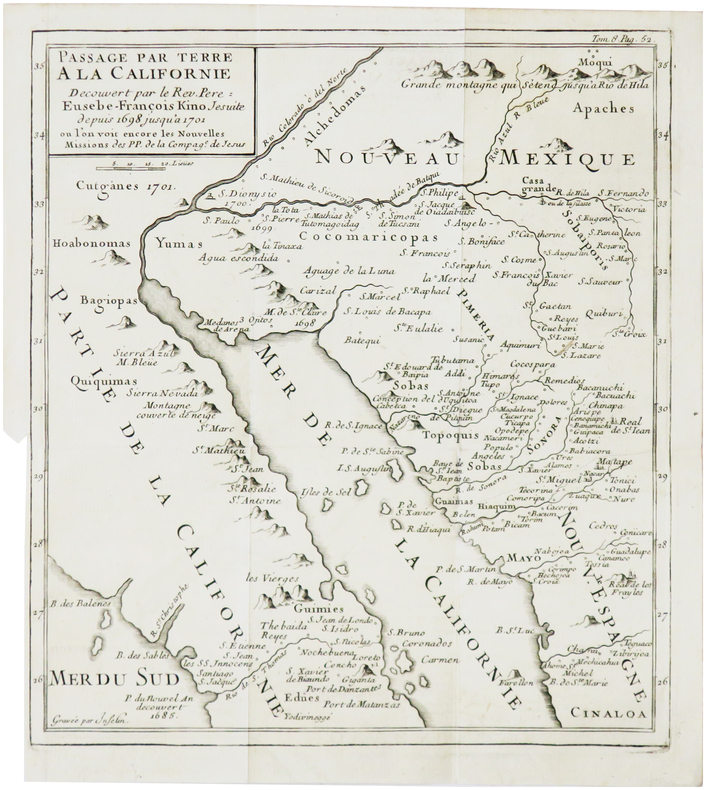
KINO (Eusebio Francisco).
[CALIFORNIE] Passage par terre à la Californie découvert par le Rév. Père Eusebe-François Kino jésuite depuis 1698 jusqu'à 1701, où l'on voit encore les nouvelles missions des PP. de la Compag.e de Jésus.
[1781]. 236 x 211 mm.
Referenz des Buchhändlers : LBW-7867
|
|
|
Kindersley Barnabas Kindersley Anabel
Des enfants comme moi
GALLIMARD JEUNE 80 pages 24 4x1 2x30 4cm. Sans date. Broché. 80 pages.
Referenz des Buchhändlers : 500186562

|
|
|
King, John ; Nebesky, Richard and Wilson, Neil
Lonely Planet : Prague
No inscriptions or marks. No creasing to covers or to spine. A lovely clean crisp very tight copy with bright unmarked boards and no bumping to corners. Appears unused. 240pp. Fourth edition.

|
|
|
KINGSLEY David
Printed Maps of Sussex 1575-1900. With Introduction by Helen Wallis. NEAR FINE COPY IN UNCLIPPED DUSTWRAPPER
4to., First Edition, with frontispiece and 40 plates of facsimiles; original series binding of brown cloth, gilt back, a near fine copy in unclipped dustwrapper. SRS Vol. 72. With the separately printed corrigenda slip.
|
|
|
Kingsolver, Barbara (transby Rebeca Cartes) s b
Another America/Otra America
Seattle WA: Seal Press 1992. Advance Uncorrected Galley Proofs . Paper Back. Very Good/No Jacket. 4to - over 9¾" - 12" tall. 103pp.; SC blk.plastic comb-binding w/clear plastic cover; slight rub w/cleantight pgs. "Poems by Barbara Kingsolver. Spanish translations by Rebeca Cartes. <br/> <br/> Seal Press unknown
Referenz des Buchhändlers : 050926 ISBN : 187806715X 9781878067159

|
|
|
Kingsolver, Barbara; Cartes, Rebeca
Another America/Otra America English Spanish and Spanish Edition
Seal Pr 1992-03-01. Hardcover. New. In shrink wrap. Looks like an interesting title! Seal Pr hardcover
Referenz des Buchhändlers : Q-1878067141 ISBN : 1878067141 9781878067142

|
|
|
Kingsolver, Barbara; Cartes, Rebeca [Translator]
Another America/Otra America English and Spanish Edition
Seal Press 1994-08-01. Paperback. New. In shrink wrap. Looks like an interesting title! Seal Press paperback
Referenz des Buchhändlers : Q-1878067575 ISBN : 1878067575 9781878067579

|
|
|
Kingsolver Barbara; Cartes translator Rebecca
Another America: Otra America Bilingual English / Spanish
Seal Press 1992. Fine. Kingsolver Barbara. Another America: Otra America Bilingual English / Spanish. Cartes translator Rebecca. Seattle: Seal Press 1992. 104pp. 8vo. Black cloth with gilt lettering. Signed by author. Inscribed by author. Book condition: Near fine. Inscribed by author on title page. Dust Jacket Condition: Near fine. Very slight weat along bottom edge. In protective cover. Seal Press hardcover books
Referenz des Buchhändlers : RKINANO00JKN
|
|
|
Kingsolver Barbara; Cartes translator Rebeca
Another America Otra America with Spanish Translations
Seal Press 1992. Very Good. Kingsolver Barbara. Another America Otra America with Spanish Translations. Cartes translator Rebeca. Seattle: Seal Press 1992. 103pp. 12mo. Paperback. Book condition: Very good with lightly rubbed and bumped edges. Seal Press paperback books
Referenz des Buchhändlers : UKINANO00CCW
|
|
|
Kinsei Seinen Publishing Co, Ltd Editorial Department of Literary Maps
student literary dictionary
Not Available 1982. Soft Cover. Fine. Number of books: 1 Not Available paperback
Referenz des Buchhändlers : 2091502135401251
|
|
|
KIRCHER Athanasius (1601 circa - 1680)
Tabula Geographico-Hydrographica Motus Oceani, Currentes, Abyssos, Montes Igniuomos In Universo Orbe Indicans
Straordinaria mappa fisica ed idrografica del mondo, raffigurante le correnti oceaniche, profondità marine ed i vulcani. La carta è tratta dal Mundus Subterraneus del Kircher, studioso gesuita, uno dei primi scrittori sui fenomeni fisici della terra. Il Kircher teorizzava che tutti gli oceani della Terra erano connessi tra loro tramite dei tunnel sotterranei che univano oceani e mari. Tra il Mar Mediterraneo, il Mar Nero, il Mar Caspio e il Golfo Persico, Kircher ha teorizzato enormi gallerie e un complesso interscambio di flussi d'acqua. Questi tunnel sono particolarmente noti tra il Mar Nero e il Mar Caspio e tra il Mediterraneo e il Golfo Persico. L'Antartide è rappresentata lungo la parte meridionale della mappa. A nord è raffigurato un grande passaggio aperto a nord-ovest che corre lungo tutta la mappa. Mostra la Nuova Guinea e una suggestione dell'Australia collegata alla terraferma Australsis Incognita. L'Africa è mostrata con una precisione notevolmente maggiore rispetto a molte mappe disegnate centinaia di anni dopo - in particolare per quanto riguarda il Niger e i sistemi fluviali del Nilo. Il Nord America e il Sud America sono entrambi maldestramente raffigurati, il che indica una conoscenza relativamente sommaria del continente. La Corea viene mostrata come un'isola e il Giappone appare come un'unica isola. Incisione in rame, in eccellente stato di conservazione. Extraordinary map, both form the physical and hydrographic point of view, depicting ocean currents, volcanoes and deep-sea chasms. The map is taken from Kircher’s Mundus Subterraneus . The Jesuit scholar, Athanasius Kircher, was one of the first compilers of semi-scientific knowledge about the physical features of the world. This map expounds on Kircher's theories by noting the abysses and the currents they create as well as the locations of the world's known volcanoes. Between the Mediterranean Sea, the Black Sea, the Caspian Sea, and the Persian Gulf, Kircher theorized massive tunnels and a complex interchange of water flows. These tunnels are noted most particularly between the Black and Caspian Sea and between the Mediterranean and the Persian Gulf. Antarctica is shown along the southern part of the map. In the North a great open northwest passage is depicted running all the way across the map. Shows New Guinea and a suggestion of Australia attached to the 'Australsis Incognita' mainland. Africa is shown with considerably greater accuracy than many maps drawn hundreds of years later – particularly with regard to Niger and Nile River Systems. North America and South America are both wildly malformed, indicating a relatively sketchy knowledge of the continent. Korea is shown as an Island and Japan appears as only a single island.Published in a Dutch edition of Kircher's famous Subterranean World by Johann Waesberger.Copperplate, in excellent condition. Shirley, The Mapping of the World, 459.

|
|
|
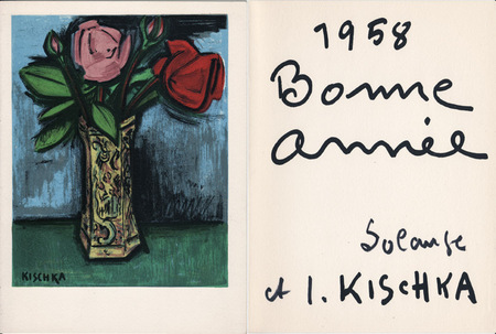
Kischka, Isis
Isis Kischka : carte de voeux pour 1958 et lithographie originale
1958 Carte de voeux de lsis et Solange Kischka pour l'année 1958. 20 x 15 cm, 2 ff., avec au premier plat une lithographie originale signée dans la planche et en page 3 un envoi sérigraphié.
Referenz des Buchhändlers : 1064
|
|
|
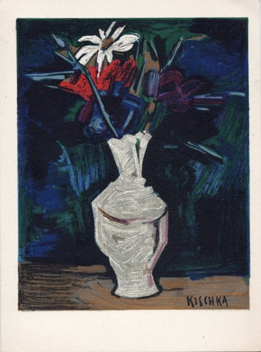
Kischka, Isis
Isis Kischka : carte de voeux pour 1959 et lithographie originale
1959 Carte de voeux de lsis et Solange Kischka pour l'année 1959. 20 x 15 cm, 2 ff., avec au premier plat une lithographie originale signée dans la planche et en page 3 un envoi sérigraphié.
Referenz des Buchhändlers : 1472
|
|
|
Kiwi Maps
New Zealand Travellers Road Atlas
Kiwi Maps 2021-10-01. 18. map. New. 8.00x1.00x10.25. Buy with confidence. Excellent Customer Service & Return policy. Kiwi Maps unknown
Referenz des Buchhändlers : DADAXB00008OOZ6
|
|
|
Kizer, Benjamin H.
The U.S.-Canadian Northwest: A Demonstration Area for International Postwar Planning and Development
71 pages including index. A guide-book to the future of a vast region awaiting development after the war. A study of the past, present and future of international co-operation in this region. Presents a high challenge to the people of Canada and the US, and their governments. Author was regional chairman of the National Resources Planning Board. Light soiling. Unmarked. Some yellowing. Includes three fold-out maps. Moderate wear to illustrated boards. Nice copy. Book
|
|
|
KLEIN (Johann Adam).
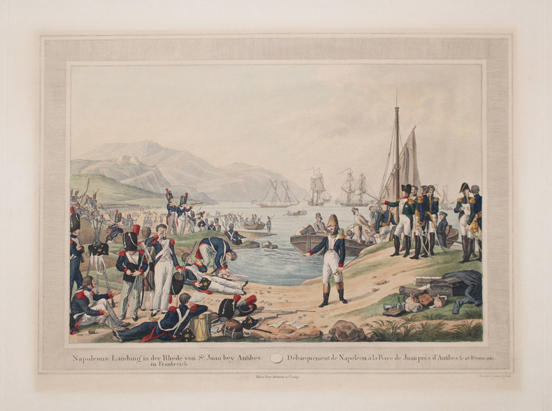
[NAPOLEON] Napoleons Landung in der Rhede von St Juan bey Antibes in Frankreich - Débarquement de Napoléon à la baye de Juan près d'Antibes le 28 février 1815.
Vienne, Artaria et Comp., [circa 1815]. 335 x 458 mm.
Referenz des Buchhändlers : LBW-3289
|
|
|
KLINGER (Johann Georg).
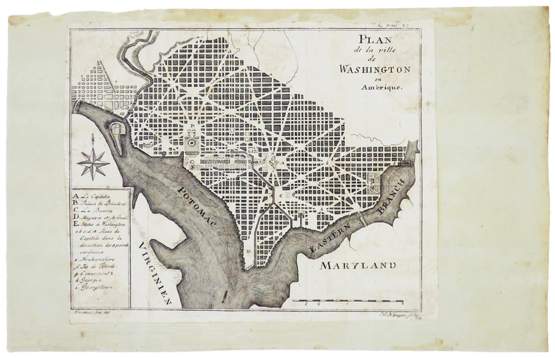
[WASHINGTON] Plan de la ville de Washington en Amérique.
[Gotha], 1794. 158 x 197 mm.
Referenz des Buchhändlers : LBW-4981
|
|
|
Klinger, D. M
Die Frühzeit der erotischen Fotografie und Postkarten.
Nürnberg, DMK, 1984. 4°. 111 S. mit 603 Abb. Orig.-KLeder mit goldgepr. Front- u. RTitel. (= Erotische Kunst Bd. 5.) 1
Referenz des Buchhändlers : 682A

|
|
|
Klopfer, W.:
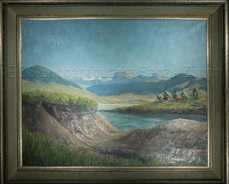
Frühling am Sihlsee.
Oel auf Leinwand. Bildausschnitt: 43 x 54 cm.
Referenz des Buchhändlers : 661DG
|
|
|
Klopfer, W
Frühling am Sihlsee.
o.J. Oel auf Leinwand. Bildausschnitt: 43 x 54 cm. + Wichtig: Für unsere Kunden in der EU erfolgt der Versand alle 14 Tage verzollt ab Deutschland / Postbank-Konto in Deutschland vorhanden +, Abb.
Referenz des Buchhändlers : 661DG

|
|
|
Klose, Olaf / Lilli Martius
Ortsansichten und Stadtpläne der Herzogtümer Schleswig, Holstein und Lauenburg. 2 Bde. (Textband und Tafelband. = komplett).
Neumünster, Karl Wachholtz, 1962. 320 S. (Textband) u. 419 S. (Bildband). Mit 18 Taf. (davon 2 farb.) u. 2 gefalt. Karten im Textband sowie sehr zahlr. Abb. a. Taf. im Bildband. (= Studien zur schleswig-holsteinischen Kunstgeschichte, Bde. 7 u. 8). 4to. OLn. in OPp.-Schuber.
Referenz des Buchhändlers : 14813
|
|
|
KOCH (Christophe-Guillaume).
Tableau des Révolutions de l'Europe dans le Moyen Age. Enrichi de Tablettes chronologiques et généalogiques.
, Strasbourg, Treuttel , Paris, Onfroy, 1790; 2 vol.- Tableau des Révolutions de l'Europe, depuis le bouleversement de l'Empire Romain en Occident, jusqu'à nos jours. Paris, Schoell, 1807; 3 vol.- Abrégé de l'histoire des traités de paix entre les puissances de l'Europe depuis la paix de Westphalie. Bâle, Decker; Paris, Pougens; Strasbourg, König et Levrault, 1796-97; 4 vol.- Ensemble 9 vol. in-8, cart. bradel papier vert, dos ornés de fil. dor., pièces de mar. rouge et vert, tranches jaspées. (Cartonnages début XIX e siècle). "Nombreux tableaux hors-texte et 5 belles cartes sur doubles pages, soigneusement enluminées. Christophe-Guillaume Koch est une célébrité protestante alsacienne. Né à Bouxviller en 1737, d'une famille originaire de Strasbourg qui remplissait les fonctions de Conseiller à la Chambre des finances des Comtes de Hesse-Hanau, il fit ses études à Strasbourg sous la direction du célèbre professeur Schoepflin avec lequel il se lia d'amitié et dont il deviendra le collaborateur pour l'Alsatia diplomatica. Député à Paris en 1789 il soutint les droits civils et religieux des protestants d'Alsace. En 1791 il siégea à l'Assemblée législative. Arrêté comme concervateur il passa près d'un an dans diverses prisons jusqu'à la chue de Robespiere. Il mourut à Strasbourg en 1813. Voir Sitzmann pp. 52-54-Haag VI, 124-128. """" Le tableau des Révolutions d'Europe est le meilleur abrégé d'une histoire moderne depuis le V e siècle, qui existe en aucune langue"""" Schoell. Un des volumes porte l'ex-libris manuscrit du Comte Auguste de Belisle, un écrivain qui en 1824 publia des Contes en vers."
Referenz des Buchhändlers : 46400522
|
|
|
KOELTZ Commandant
D’Esternay aux Marais de Sant-Gond (6-9 septembre 1914)
in 8 broché,faux-titre,titre,219 pages complet des 2 cartes dépliantes,des 20 croquis perspectifs,des 9 photos l’ensemble dans unepochette cartonnée séparée.Charles Lavauzelle & Cie éditeur 1930.légères rousseurs sur la couverture.Très Rare complet
Referenz des Buchhändlers : 2450
|
|
|
koffie beker bibliotheek
Drinkbeker met bibliotheek motief, mok voor koffie of thee. Becher Bitte nicht storen
, erik tonen books, 2015 Hohe: 10,3 cm - Durchmesser: 8 cm - Inhalt: 300 ml Material: Bone China Porzellan. ISBN 4335915013873.
Referenz des Buchhändlers : 48014
|
|
|
koffie beker bibliotheek
Drinkbeker met bibliotheek motief, mok voor koffie of thee. Becher Bitte nicht storen
Hohe: 10,3 cm - Durchmesser: 8 cm - Inhalt: 300 ml Material: Bone China Porzellan. ISBN 4335915013873. Begin je dag met een warme drank in je eigen biblio mok !

|
|
|
Koichi Yamazaki / Written and edited Science and engineering maps
Revised Edition Building Certification Application Guidebook
Not Available 1984. Soft Cover. Fine. The book is in fine condition. Not Available paperback
Referenz des Buchhändlers : 2090502113705843
|
|
|
Kokoschka Oskar:
5 cartes postales.
Fondation Kokoschka. 5 cartes postales, détachables.
Referenz des Buchhändlers : 22842

|
|
|
KOLBE (Pierre).
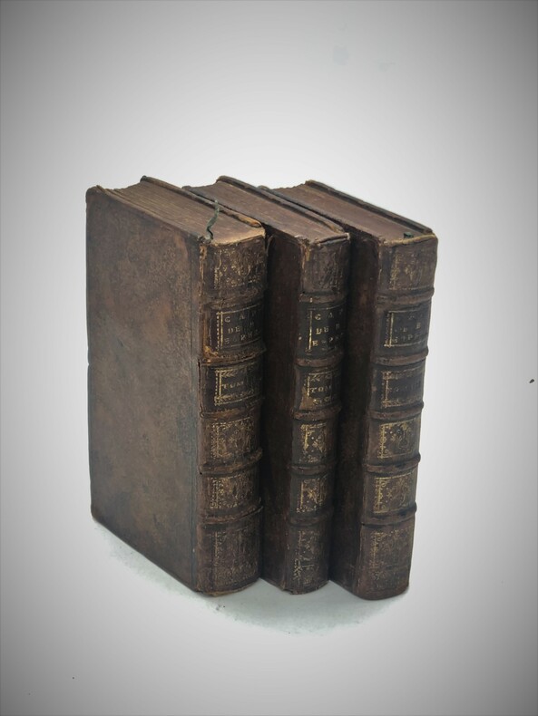
Description du Cap de Bonne-Espérance ; Ou l'on trouve tout ce qui concerne l'Histoire-Naturelle du Pays ; La Religion, les Moeurs & les Usages des Hottentots ; et l'Establissement des Hollandois. Tirées des Memoires de monsieur Pierre Kolet
Amsterdam,chez Jean Catuffe, 1742 , 3 vol. in-12(170x100mm), 2ffnch , xiii-5ffnch(table) 428pp -1ffnch ,8ffnch – 262pp, 10ffnch-320pp , relié plein veau époque, dos à nerfs ornés avec pièce de titre et tomaison,tranches rouges , défauts d’usages .Seconde édition de la traduction française illustrée de 29 cartes et planches hors-texte
Referenz des Buchhändlers : PHO-693
|
|
|
KOLBE (Pierre).
Description du Cap de Bonne-Espérance ; Ou l'on trouve tout ce qui concerne l'Histoire Naturelle du Pays ; La Religion, les Mœurs & les Usages des Hottentots ; et l'Establissement des Hollandois. Tirées des Mémoires de monsieur Pierre Kolbe
Amsterdam, chez Jean Catuffe, 1741-43, 3 vol. in-12(170x100mm), 2ffnch., xiii-5ffnch(table) 428pp -1ffnch ,8ffnch – 262pp, 10ffnch-320pp., relié plein veau époque, dos à nerfs ornés avec pièce de titre et tomaison, tome 1 reliure différente. Coins usés, coiffes arasées avec petit manque au dos tome 2, mouillure claire en marge (T1), en coin (T2), page de titre presque détachée (T2), ex-libris manuscrit au tome 1 « Duplat de Monticourt »
Referenz des Buchhändlers : PHO-2241

|
|
|
Koncnik, Damjan; Kato, Kevin
Greenland - The End of the World (Includes 2 DVDs)
No marks or inscriptions. No creasing to covers or to spine. A very clean very tight copy with bright unmarked boards and no bumping to corners. 222pp. History, culture, nature, travel in Greenland. Two DVDs tucked in with trip details and travel relevant to Greenland.
|
|
|
Konstam, Angus
Historical Atlas of the Napoleonic Era
No marks or inscriptions. A lovely clean very tight copy with bright unmarked boards and no bumping to corners. Dust jacket not price clipped or marked or torn or creased. 192pp. A detailed study of Napoleon Bonaparte's military activities, very well illustrated in particular with maps showing battle plans, conquests, losses and areas covered in the Europe of the early 19th century.

|
|
|
Koshi Mizunoru/Ed Meiji Maps
New Course of Study Detailed Draft Series Japanese Writing Guidance Detailed Draft 3 Elementary School 56th Grade
Not Available N.A. Soft Cover. Fine. The book is in fine condition. Not Available paperback
Referenz des Buchhändlers : 2090502113702155
|
|
|
Kossak, Egbert / Markovic, Mirjana
Hamburg | Stadt im Fluß. Hrsg. von der Freien und Hansestadt Hamburg, Baubehörde. (4. Aufl.).
(Hamburg), Ellert & Richter, (© 1989). 352 S. Mit zahlr., meist farb. Abb. 4to. 28,5 cm. OPp. m. SU.
Referenz des Buchhändlers : 89478

|
|
|
Kovalevsky (sous la direction de M. W. de) :
La Russie à la fin du 19e siècle. Commission Impériale de Russie à l'Exposition Universelle de Paris.
Paris, Paul Dupont ; Guillaumin, 1900 ; fort in-8, broché ; 989 pp., [1]f. d'Errata, 22 planches hors-texte lithographiées en couleurs (cartes, tableau et graphiques, dont une grande carte dépliante de Russie).
Referenz des Buchhändlers : 20199

|
|
|
KOYAMA, KICHIZŌ] 小山吉三.
蘭領東印度諸島詳圖 附泰國・佛印・マレー半島. Ranryo Higashi Indo shoto shozu : Fu Taikoku Futsuin Mare hanto. Malay Archipelago.
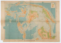
Tokyo.: 日本名所圖繪社.Nihon Meisho Zuesha. 昭和 17 1942. Folding Japanese coloured map of the Malay Archipelago and Thailand during World War II scale 1:8500000. Legend in lower corner indicates altitudes. Ink annotation in Japanese left edge. Pin holes at three corners upper right corner torn with loss evenly browned otherwise very good. Text in Japanese and English. 52.8 x 75.6cm. This map shows most of Thailand former Indochina Hainan Province and South China Sea Sumatra and Java Sea Borneo the Philippine Islands Celebes Timor New Guinea and parts of Micronesia. Natural resources such as tobacco spices wood sugar metal mines tin iron and etc. rice and other resources are indicated on the map. . 日本名所圖繪社.[Nihon Meisho Zuesha]. unknown
Referenz des Buchhändlers : 160533
|
|
|
KRAMER Augustin:
Die Samoa-Inseln. Entwurf einer Monographie mit besonderer Berücksichtigung Deutsch-Samoa von Dr. Augustin Grämer Kaiserlicher Marinestabsartz. Herausgegeben mit Unterstützung des Kolonialabteilung des Auswärtigen Amts. I. Band: Verfassung, Stammäume und Überlieferungen. II. Band: Ethnographie. Anhang zu Band II: Die Wichtigsten Hautkrankheiten der Südsee.
Stuttgart, E. Schweizerbartsche Verlagsbuchhandlung, 1902-1903. 2 volumes in-4 de XII-509p. + X, 445-[6]-26 pages. Pleine toile écrue de l’éditeur.
Referenz des Buchhändlers : 4544
|
|
|
KRACKENBERGER (Helmut).
Photo en couleurs.Aubenas/Ardèche. Le marché des producteurs ardéchois, sur la place du Château.
Aubenas, Krackenberger, s.d. (années 70), 1 photo en couleurs de 11 x 16 cm ;
Referenz des Buchhändlers : 18666
|
|

 Per e-mail erhalten
 Als pdf-Dokument herunterladen
 RSS feed
 Permanenter link


