|
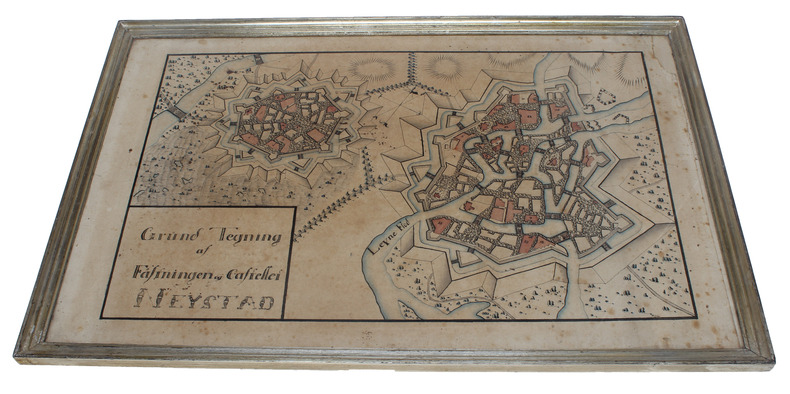
FESTUNG NEUSTADT (NEUSTADT AM RÜBENBERGE) - MANUSCRIPT PLAN.
Grund Tegning af Fästningen og Castellet Neÿstad. (Plan of the Fortification and the Citadel in Neustadt).
Around 1800. 26,5x43 cm. (Paper size 32x48,5 cm.). Detailled manuscript plan on the fortifications and surroundings of Neustadt. Ink and handcoloured. Upper right corner of paper gone but not affecting image. Light browning and marginal brownspots. Framed and under glass.
|
|
|
FESTUNG NEUSTADT (NEUSTADT AM RÜBENBERGE) - MANUSCRIPT PLAN.
Grund Tegning af Fästningen og Castellet Neÿstad. (Plan of the Fortification and the Citadel in Neustadt).
Around 1800. 26,5x43 cm. (Paper size 32x48,5 cm.). Detailled manuscript plan on the fortifications and surroundings of Neustadt. Ink and handcoloured. Upper right corner of paper gone but not affecting image. Light browning and marginal brownspots. Framed and under glass.
Referentie van de boekhandelaar : 52282
|
|
|
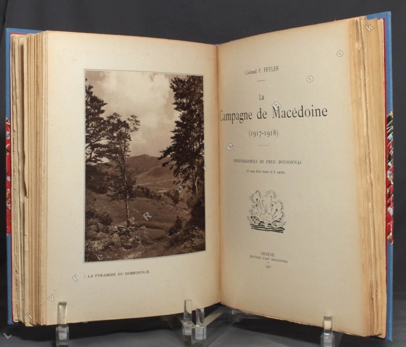
FEYLER colonel [Fernand]; BOISSONNAS Fred:
Les campagnes de Serbie (1914 et 1915) [relié avec] La campagne de Macédoine (1916-1917) [relié avec] La campagne de Macédoine (1917-1918).
Genève et Paris, Editions d'Art Fred Boissonnas et Librairie Jean Budry, 1920-1921. 3 ouvrages en un volume in-4 de [6]-133-[10]; [8]-118-[4]; [8]-122-[4] pages, demi-toile bleue à coins, titre doré au dos, chacun des trois volumes comportant les couvertures rempliées, illustrées en 2 tons, conservées.
Referentie van de boekhandelaar : 9490
|
|
|
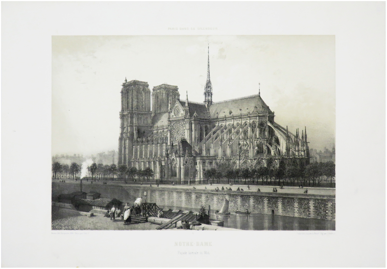
FICHOT (Charles).
[NOTRE-DAME] Notre-Dame. Façade latérale du Midi.
Paris, Henri Charpentier, 1861. 287 x 361 mm.
Referentie van de boekhandelaar : LBW-7211
|
|
|
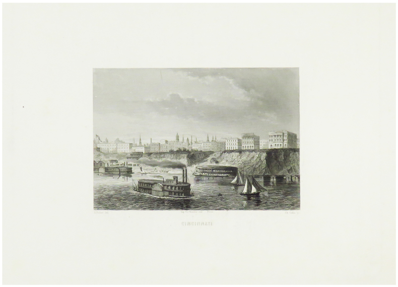
FICHOT (Karl).
Cincinnati.
Paris, [circa 1860]. 123 x 163 mm.
Referentie van de boekhandelaar : LBW-1250
|
|
|
Field Marshal Viscount French of Yprres KP. OM. etc. with a Preface by Marshal Foch and with Portrait and Maps K. P. O. M.
1914
Houghton Mifflin Company 1919. Hardcover. Acceptable. First ed. with some unopened pages. Although this volume is in excellent condition it is merely "acceptable" because there is only one map in back pocket; the pref. by Marechal Foch is in French but there is a translation in the appendix. 385 p. clean and unmarked anywhere on strong paper only mildly age-toned--no foxing; TEG; tissue guard on frontis. photo-portrait of Viscount French is creased but not torn; holograph of signature on assumes beneath frontis. portrait; binding tight; crimson boards with still bright gilt lettering have light bumping at corners and slight rubbing at some edges. Fascinating primary source. Houghton Mifflin Company hardcover
Referentie van de boekhandelaar : 102091
|
|
|
Fife, Donald L. & Brown, Arthur R. (editors), Photographs & Maps
Geology and Mineral Wealth of the California Desert: Dibblee Volume
South Coast Geological Society 1980. Price HAS BEEN REDUCED by 10% until Monday Dec. 22 weekend SALE ITEM 555 pp. paperback ex library else text clean and binding tight. - If you are reading this this item is actually physically in our stock and ready for shipment once ordered. We are not bookjackers. Buyer is responsible for any additional duties taxes or fees required by recipient's country. South Coast Geological Society paperback
Referentie van de boekhandelaar : ZB1333066
|
|
|
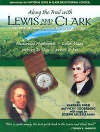
Fifer, Barbara; Soderberg, Vicky; Maps By Mussulman, Joseph
Along The Trail With Lewis And Clark - Second Edition Includes East Of The Mississippi
Helena MT.: Farcountry Press. VG In Wraps. Light Wear & Edgewear. Pages Clean & Tight. Pages: 216. 2001. Trade Paperback. Farcountry Press paperback
Referentie van de boekhandelaar : MASTER384324I ISBN : 1560371889 9781560371885
|
|
|
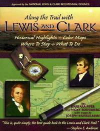
Fifer, Barbara; Soderberg, Vicky; With Maps By Mussulman, Joseph
Along The Trail With Lewis And Clark: Historical Highlights Color Maps Where To Stay What To Do
Montana Magazine. Vg In Wraps. Pages Clean & Tight. Pages: 208. 1998. Trade Paperback. Montana Magazine paperback
Referentie van de boekhandelaar : MASTER274963I ISBN : 156037117X 9781560371175
|
|
|
FIGUIER Louis
La terre et les mers
ou description physique du globe.In 8 demi-chagrin foncé à nerfs, titre et caissons dorés,plats percaline chagrinée, filets à froid en encadrement.Reliure signée VIGNEAU & PASQUIER.Faux-titre,frontispice en couleurs sous serpente (éruption du Vésuve)titre,635 pages,tranches dorées,195 vignettes dessinées par Karl GIRARDET,LEBRETON etc.19 cartes géographiques physiques en couleurs, hors-texte. Hachette & Cie 1872 mention de quatrième édition, rousseurs,plus concentrées à certaines pages,ainsi qu’en début et fin de volume.Un cahier légèrement décalé.
Referentie van de boekhandelaar : 7806

|
|
|
FIGUIER Louis
La terre et les mers.
Ou description physique du globe.2ème édition corrigée et augmentée.In 8 demi chagrin vert à nerfs, titre et caissons dorés.plats percaline verte chagrinée, quadruple filet à froid en encadrement.faux-titre, frontispice lithographié, en couleur:éruption du Vésuve.Titre VIII,562 pages,181 vignette dans et hors-texte par Karl GIRARDET,LEBRETON… 20 cartes en couleurs géographie physique hors-texte.L Hachette & Cie 1864 pâle mouillure angle supérieur droit avec une légère
Referentie van de boekhandelaar : 8150
|
|
|
FIGUIER Louis:
La Terre avant le déluge.
Paris, Lib. L. Hachette et Cie, 1866. 1 vol. in-8 de 504 pages. Demi-basane marron, dos à nerfs orné. Dos passé avec une petite tache, rares rousseurs.
Referentie van de boekhandelaar : 2783

|
|
|
FIGUIER Louis:
Le savant du foyer, ou Notions scientifiques sur les objets usuels de la vie.
Paris, Lib. de L. Hachette et Cie, 1862. 1 vol. in-8 de IV-438 pages. Demi-chagrin vert, dos à nerfs orné de caissons dorés, plats de percaline verte encadrés à froid, tracnhes dorées. Coiffe sup. frottée, mors du 1er plat fendu en son extrémité sup.
Referentie van de boekhandelaar : 2542

|
|
|
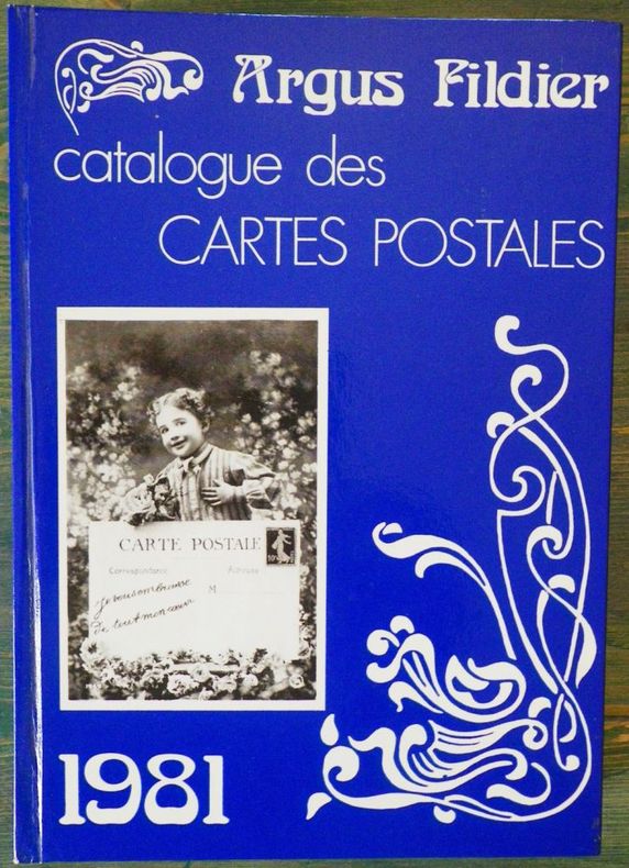
FILDIER (André).
Argus Fildier - Catalogue des cartes postales.1981 - 6e année.
P., Fildier cartophilie, 1981, 1 vol. in-8 cartonné. sous couv. ill., de 424 pp.
Referentie van de boekhandelaar : 2079
|
|
|
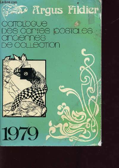
Fildier André
5e édition du catalogue des cartes postales anciennes de collection 1979 - 4ème année - Reflet du marché de la carte postale, évolution des prix, incunables et post incunables, la cote générale des oblitérations postales sur cartes postales etc...
Fildier Cartophile. 1979. In-8. Broché. Etat d'usage, Couv. convenable, Dos satisfaisant, Intérieur acceptable. 288 pages - quelques photos en noir et blanc dans le texte. . . . Classification Dewey : 741.68-Illustrations des cartes postales
Referentie van de boekhandelaar : R160211578
|
|
|
FILDIER André
ARGUS FILDIER - CATALOGUE DE CARTES POSTALES -
1981 cartonné in-octavo, dos bleu, premier plat illustré, illustrations : principalement reproduction de cartes postales, 424 pages, 1981 Paris Fildier Cartophile,
Referentie van de boekhandelaar : 682
|
|
|
Fildier André
Catalogue des cartes postales anciennes de collection 1977 - Argus Fildier.
Librairie cartophilique. 1976. In-8. Broché. Etat d'usage, Coins frottés, Dos satisfaisant, Intérieur acceptable. 180 pages - nombreuses reproductions de cartes postales en noir et blanc hors texte.. . . . Classification Dewey : 741.68-Illustrations des cartes postales
Referentie van de boekhandelaar : R320138187
|
|
|
Filey, Mike
Look At Us Now
79 pages. Black and white archival photographs of Toronto throughout. Gift greetings upon front flyleaf. Bookplate inside front board. Book clean and bright with light wear. Moderate wear to and some smallish chips from dust jacket which is now preserved in a glossy new archival-grade Brodart cover. Book

|
|
|
Filip CREMERS
*Cartiers en Wallonie. Kaartenmakers in Wallonië
160 p., 139 fig. n/b. Catalogue d'exposition, Turnhout , Museum van de Speelkaart et Malmedy, Musée National du Papier. Inv. 41375
|
|
|
FILLON, Angélique.
Atlas portatif. Composé de cartes géographiques et orné de précis historiques.
Sans lieu, sans éditeur, pièce unique, 1830. In-4 oblong – 33,5 x 24 cm. Reliure de l’époque en demi-maroquin rouge à grain long avec coins sertis d’un filet doré, dos à 5 faux-nerfs orné de doubles filets, dentelle et petits fers dorés, supra-libris doré au premier plat, toutes tranches dorées. 29 ff. Bel atlas entièrement manuscrit composé en 1830 par une jeune fille dénommée Angélique Fillon.Il renferme un titre calligraphié et 14 cartes détaillées et rehaussées en couleurs : Europe, Suède et Norvège, Iles britanniques, France, Allemagne, Pologne, Espagne, Italie, Asie, Turquie d'Asie, Chine, Afrique, Amérique du Nord et Amérique du Sud. Un feuillet de texte donne parfois des informations sur le pays ou le continent représenté.
Referentie van de boekhandelaar : 2322

|
|
|
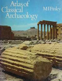
Finley M. I. Ed. & John Flower Maps and Plans
ATLAS OF CLASSICAL ARCHAEOLOGY
McGraw-Hill. Very Good in Very Good dust jacket. 1977. Hardcover. 007021025X . Minor shelfwear. DJ has minor creasing ; Folio 13" - 23" tall; 256 pages . McGraw-Hill hardcover
Referentie van de boekhandelaar : 40644 ISBN : 007021025X 9780070210257
|
|
|
Finley M.I. (Moses I)
Atlas of Classical Archaeology
Major classical sites illustrated with detailed maps, diagrams and descriptions. 256p. illus.maps.glossary,index Book
|
|
|
Finley MI. (Moses I) M. I.
Atlas of Classical Archaeology
London: Chatto & Windus 1977 Book. As New. Hardcover. 1st UK Edition. Major classical sites illustrated with detailed maps diagrams and descriptions. 256p. illus.maps.glossaryindex . Chatto & Windus hardcover
Referentie van de boekhandelaar : 039270 ISBN : 0701121998 9780701121990
|
|
|
Finley, M. I. (Ed. ) & (John Flower, Maps and Plans)
ATLAS OF CLASSICAL ARCHAEOLOGY
McGraw-Hill. Good in Very Good- dust jacket. 1977. Hardcover. 007021025X . Foxing to textblock and endpapers. DJ has minor creasing and sunning to spine. Obverse of DJ is foxed. ; Folio 13" - 23" tall; 256 pages . McGraw-Hill hardcover
Referentie van de boekhandelaar : 27517 ISBN : 007021025X 9780070210257
|
|
|
Fischer S.J., Joseph; Soulsby, Basil H. (Translator)
The Discoveries of The Norsemen in North America - with Special Relation to Their Early Cartographical Representation
130 pages. Index. Bibliography. Frontispiece. Ten plates at back. Sixteen informative pages of advertisements. Text in English, translated from the German. Seeks, in part, to to address errors of Carl Christian Rafn in his 1837 work "Antiquitates Americanae". Forest green cloth exterior adorned with attractive gilt lettering and decorations. Top edge gilt. Usual library markings. Binding intact. Average wear. A sound copy of this informative work. Book

|
|
|
FISCHER, Alexander
A journal of a voyage of discovery to the Arcric regions in his majesty' ship Hecla and Griper in the Years 1819 & 1820
London: Longman, Hurst. 1821. in-8 ,XI + 320 pp. ,illustré avec 2 cartes (1 facsimilé)et 5 gravures in texte , relié pleine percale , dos lisse avec pièce de titre et auteur et date ,rousseurs sur le titre
Referentie van de boekhandelaar : PHO-1025

|
|
|
Fisher, Martyn
Leominster & District Tourist Guide
No marks or inscriptions. Tiny crease to lower corner of front cover, none to rear or to spine. A very clean very tight copy with bright unmarked boards and no bumping to corners. 96pp.

|
|
|
Fisher, Martyn
Leominster & District Toutist Guide
No marks or inscriptions. No creasing to covers or to spine. A very clean very tight copy with bright unmarked boards, minor foxing to page edges and no bumping to corners. 96pp. Local history gazetteer to the towns and villages around Leominster in Herefordshire. Illustrated.

|
|
|
Fisher, Robin
Vancouver's Voyage ; Charting the Northwest Coast, 1791-1795
131 pages. Index. Recommended Reading List. Footnotes. Thirty colour photos. "Reveals much of Captain Vancouver's personality, life abourd his ships, the techniques of mapping, and his views of the native peoples he encountered. Historical engravings and maps richly illustrate the land and events." - from dust jacket. Moderate wear. Binding intact. Usual library markings. A sound working copy of this fascinating and informative work. Book

|
|
|
FISQUET (Honoré).
Grand Atlas départemental de la France, de l'Algérie et des colonies.
Paris, Librairie Albert Pilon / A. Le Vasseur, s.d. [circa 1875]. Un vol. au format in-folio à l'italienne (453 x 377 mm) de 1 f. bl., 2 ff. n.fol., 12, 40, 13, 1 f. n.fol., 130, 18 pp. et 1 f. bl. Reliure d'édition de plein cartonnage émeraude à l'imitation de chagrin, filets gras et maigres en noir encadrant les plats, le premier s'orne en outre d'un jeu de petits filets verticaux en noir, filets d'encadrement stylisés dorés, importante composition allégorique dorée, entrelacs de filets maigres dorés, titre doré, dos à nerfs orné de filets gras à froid, quintuples caissons d'encadrement gras et maigres dorés et en noir, titre doré, filet doré en tête et queue, tranches mouchetées. (Charles Magnier et Auguste Souze).
Referentie van de boekhandelaar : 23710
|
|
|
Fitzgerald, Walter.
AFRICA. A Social, Economic and Political Geography of Its Major Regions. With 101 Maps.
pp. xv, 499. Numerous text maps. 8vo. Original full purple cloth binding, slightly spotted. Gilt lettered spine. Fourth edition. AFRICA/3
|
|
|
Five Star Maps
Abilene/Sweetwater TX
Five Star Maps 2007. Map. New. 1 pages. 8.70x3.80x0.10 inches. Five Star Maps unknown
Referentie van de boekhandelaar : 1-1592140645 ISBN : 1592140645 9781592140640
|
|
|
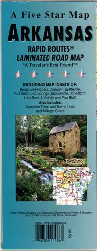
Five Star Maps; Five Star Maps [Editor]; Five Star Maps [Illustrator]; Five Star Maps [Illustrator];
Arkansas Rapid Routes
Five Star Maps 2011. Map. Very Good. 11x4x0. 2011. Laminated. Ships next day. Map is in very good shape; no tears scribbles highlighting or underlining; a little general wear; from a smoke-free environment. Five Star Maps unknown
Referentie van de boekhandelaar : sku1110215 ISBN : 1592141110 9781592141111
|
|
|
Five Star Maps
Bryan/College Station TX
Five Star Maps 2006. Map. New. 1 pages. 8.90x3.70x0.30 inches. Five Star Maps unknown
Referentie van de boekhandelaar : 1-1592140734 ISBN : 1592140734 9781592140732
|
|
|
Five Star Maps
Denton TX
Five Star Maps 2010. Map. New. 1 pages. 8.60x3.90x0.20 inches. Five Star Maps unknown
Referentie van de boekhandelaar : 1-1592141072 ISBN : 1592141072 9781592141074
|
|
|
Five Star Maps
Georgia : road map
NEW. unknown
Referentie van de boekhandelaar : BIB-NOV-15-2025-466675 ISBN : 1592140580 9781592140589
|
|
|
Five Star Maps
Houston TX
map. Good. Access codes and supplements are not guaranteed with used items. May be an ex-library book. unknown
Referentie van de boekhandelaar : 1592141390.G ISBN : 1592141390 9781592141395
|
|
|
Five Star Maps
Killeen TX
NEW. unknown
Referentie van de boekhandelaar : BIB-NOV-15-2025-46294 ISBN : 1592141285 9781592141289
|
|
|
Five Star Maps
Louisiana
Five Star Maps 2009. Map. New. 9.02x3.82x0.39 inches. Five Star Maps unknown
Referentie van de boekhandelaar : 1-1592140432 ISBN : 1592140432 9781592140435
|
|
|
Five Star Maps
Lufkin/Nacogdoches TX
Five Star Maps 2008. Map. New. 1 pages. 8.90x3.70x0.30 inches. Five Star Maps unknown
Referentie van de boekhandelaar : 1-1592141234 ISBN : 1592141234 9781592141234
|
|
|
Five Star Maps
New Mexico : road map
Five Star Maps 2011. Map. New. 1 pages. 9.00x4.00x0.30 inches. Five Star Maps unknown
Referentie van de boekhandelaar : 1-1592141552 ISBN : 1592141552 9781592141555
|
|
|
Five Star Maps
San Angelo/Big Spring TX
Five Star Maps 2007. Map. New. 1 pages. 8.80x3.60x0.20 inches. Five Star Maps unknown
Referentie van de boekhandelaar : 1-1592141676 ISBN : 1592141676 9781592141678
|
|
|
Five Star Maps
Tyler TX
Five Star Maps 2011. Map. New. 1 pages. 8.80x3.90x0.30 inches. Five Star Maps unknown
Referentie van de boekhandelaar : 1-1592141218 ISBN : 1592141218 9781592141210
|
|
|
Five Star Maps
Tyler TX Street Map
map. Good. Access codes and supplements are not guaranteed with used items. May be an ex-library book. unknown
Referentie van de boekhandelaar : 1592141218.G ISBN : 1592141218 9781592141210
|
|
|
Five Star Maps
Victoria and Port Lavaca Texas Street Map
NEW. unknown
Referentie van de boekhandelaar : BIB-NOV-14-2025-252763 ISBN : 0768306114036 0768306114
|
|
|
FIÉVET-BARRÉ (L.).
Succession de Mr et Mme Colombier-Batteur. Atlas des biens ruraux échus à Mme Sénart-Colombier.
1850. Grand in-folio ; demi-veau havane à coins, pièce de titre de maroquin rouge sur le premier plat (reliure de l'époque).
Referentie van de boekhandelaar : LBW-6638
|
|
|
FLACHAT Eugène et Jules PETIET
tracé du canal de Paris à Strasbourg entre la Marne et la Meuse
In 4 broché,faux-titre,titre,XXXIV,68 pages,1 page de table des matières,plan détaillé, dépliant 70x37 cm,du nouveau tracé du canal de la Marne au Rhin entre Saint- Dizier et Void,1 plan général dépliant,44 x48cm canal de la Marne à la Meuse.Profils longitudinaux de divers tracés 47 x 69 cm.Librairie scientifique et industrielle de L. Mathias 1838.Petites rousseurs habituelles,quelques pâles mouillures,sans gravité en fin de volume.
Referentie van de boekhandelaar : 5690

|
|
|
Flash Maps
Instant Guide to Washington
Random House 1987. Trade paperback. Very good. Prompt shipment with tracking. we ship in CLEAN SECURE NEW boxes Very good trade paperback clean Random House paperback
Referentie van de boekhandelaar : GrayTPB2KW104
|
|
|
Fleming, Kevin (photographs) & Jane Vessels (text) & Marley Amstutz (maps)
Delaware Small Wonder
New York Harry N. Abrams 1986. 2. Hardcover. Good. New York, Harry N. Abrams hardcover
Referentie van de boekhandelaar : 00222380 ISBN : 0810908263 9780810908260

|
|
|
FLEURY.
[YVELINES] Plan figure, arpentage & bornage de la Forest de Cruyë, & du bois des Alluais, deppendans de la maistrise de Sainct Germain en Layë.
Octobre 1673. 55 x 67,5 cm, sur peau de vélin.
Referentie van de boekhandelaar : LBW-7442

|
|
 De zoekresultaten per email ontvangen
 Zoekresultaten downloaden als PDF
 RSS feed


