|
NUSRET.
[ATLAS OF ROUTES OF VESSELS / NAVIGATION] Martin'in manevra levhasiyla Batenberg'in rota müs'irinin sûret-i istimaline mahsûs talimat. [i.e. Martin's maneuvering plate and Batenberg's instruction for the use of the route master].
Fine Turkish, Ottoman (1500-1928) Modern light brown cloth bdg. gilt lettering on the front board. [1], 99 p., 36 numbered maps printed in black and red ink, 5 numbered folded plates. A fine copy. First and only edition of this extremely rare atlas in user guide form including the instructions and descriptions of the routes of vessels by an advisor of the British naval officer and German prince related to the British royal family, Prince Louis Alexander of Battenberg (1854-1921), who was the first Marquess of Milford Haven, commanded the Atlantic Fleet from 1908 to 1910 and became first sea lord in 1912. This book was translated by Nusret, who was a lieutenant in the Ottoman Naval Forces in its period and prepared only for use of Turkish naval officers. The plates include the maneuver plate of an officer named "Martin", who is not able to be recognized. Every map and plate depending on the current position of the ship has its own descriptive text. Özege 12270.; Not in OCLC and Library Hub.
|
|
|
NUSSBAUM, Fritz.
Les Pyrénées dans l'ancien cartographie selon la Collection de Cartes de la Bibliothèque de la Ville de Berne, Suisse.
Zaragoza, 1952 [Separata de "Actas del Primer Congreso Internacional del Pirineo"]. 4to. mayor; 26 pp., con 14 reproducciones entre el texto y 8 láminas fotográficas aparte. Edición limitada de 500 ejemplares. Cubiertas originales.

|
|
|
O. Akbulatova (ed.) N. Vernova
Peterhof (Treasures of Russia)
No marks or inscriptions. Crease to lower corner of rear cover. A very clean very tight copy with bright unmarked boards and no bumping to corners. 82pp. A guide to the sumptuous Palace and gardens of Peterhof in St. Petersburg, Russia. Very scarce in the UK.

|
|
|
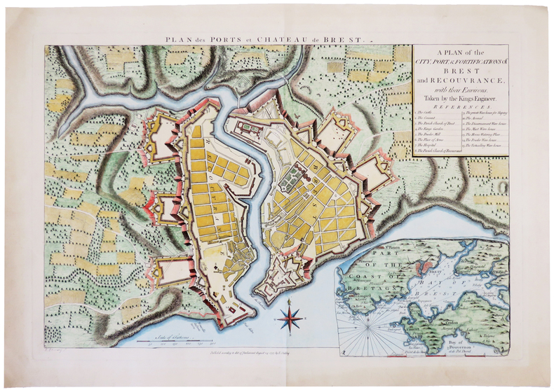
OAKLEY (Edward).
[BREST] Plan des ports et château de Brest. A plan of the city, port, & fortifications of Brest and Recouvrance, with their environs, taken by the Kings engineer.
1757. 345 x 506 mm.
Riferimento per il libraio : LBW-4984
|
|
|
OCCIDENT ROMAIN par Louis HARMAND.
L'occident romain. Gaule ; Espagne ; Bretagne ; Afrique du Nord (31 av. J.-C. à 235 ap. J.-C.). Racines celtiques et structures romaines d'une communauté ... Contient 15 cartes de l'auteur.
Ed. Payot 1960. Bel exemplaire broché, fort in-8, 494 pages avec tables.
Riferimento per il libraio : AUB-6182
|
|
|
OCEAN PACIFIQUE
Oc?an pacifique et ses principaux archipels. Carte couleur.
1 feuille 80 x 67 cm.
|
|
|
Odile LOZACHMEUR
QUIZZ DES FRANCAIS(ES) CELEBRES: De Cro-Magnon à nos jours
OUEST-FRANCE 2014 200 pages 10 8x2 2x17 6cm. 2014. Broché. 200 pages.
Riferimento per il libraio : 500034956

|
|
|
Of British Geographers, Institute (Author)/ Philip's Maps (Author)/ Chabluk, Stefan (Illustrator)/ Donohoe, William (Illustrator
Philip's RGS Atlas of the World: 2024 edition Philip's World Atlas
Philip's 2024. Hardcover. New. 448 pages. 11.26x1.50x14.49 inches. Philip's hardcover
Riferimento per il libraio : __1849077002 ISBN : 1849077002 9781849077002

|
|
|
ohne Autor
(Ekuador) Guia general del Ecuador.
Guayaquil, Publicistas, 1959. Mehrfach gefaltete Farbkarte.
Riferimento per il libraio : 4624
|
|
|
ohne Autor
(Mexiko) Las Carreteras de Mexico. Road Map of/Carta de Caminos Mexico.
ohne Ort, Rand McNally (ohne Jahr). Mehrfach gefaltete Straßenkarte.
Riferimento per il libraio : 4647
|
|
|
Olami, Ya'aqov ; Sender, Shlomo ; Oren, Eldad
Archaeological Survey of Israel: Map of Yagur (27)
Contains a map. 24x17 cm. 102+72 pages. Softcover. In good condition.
|
|
|
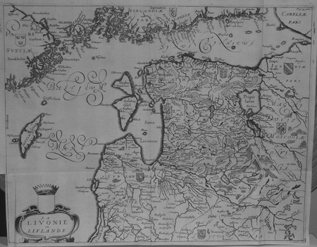
OLEARIUS (Adam).
[LETTONIE] La Livonie ou Liflande.
[1659]. 279 x 361 mm.
Riferimento per il libraio : LBW02521
|
|
|
OLEARIUS (Adam) , MANDELSO (J.A. de) , WICQUEFORT (A. de , traducteur)
Relation du voyage d'Adam Olearius en Moscovie, Tartarie et Perse , augmentée en cette nouvelle édition... d'une seconde partie contenant le voyage de Jean Albert de Mandelslo aux Indes Orientales, traduit de l'allemand par A. de Wicquefort
Paris, Dezallier, 1679, 2 volumes in-4 ,28ff.-686pp., 22ff-648pp , relié plein cuir époque, dos à nerfs orné avec pièce de titre et tomaison, tranches mouchetées rouge, réparations aux dos, pièces de titre et tomaison récentes au tome, illustré de 6 cartes dépliantes (7), ex-libris manuscrit en page de garde et au titre, traces de réparation aux cartes.
Riferimento per il libraio : PHO-1772

|
|
|
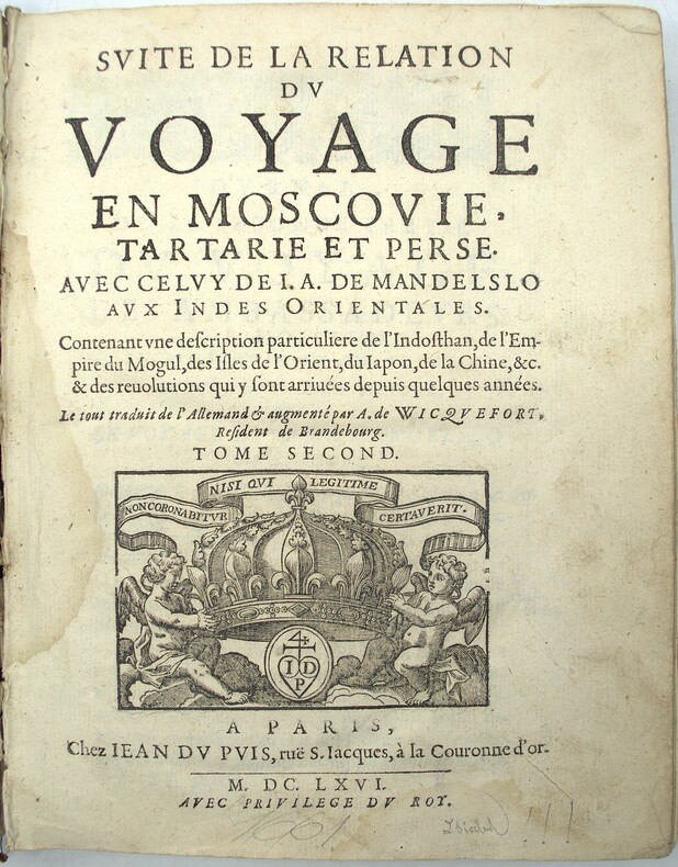
OLEARIUS (Adam), MANDELSO (J.A. de), WICQUEFORT (A. de, traducteur)
Suitte du voyage en Moscovie. Tartarie et Perse, avec celuy de J. A. de Mandelslo aux Indes orientales, contenant une description... de l'Indosthan, de l'empire du Mogul, des isles de l'Orient, du Japon, de la Chine….
Paris, Jean du Puis, 1666, 1 volume (2) in-4 (24x18cm), 23ff.-648pp., veau époque, dos à nerfs, manque important au dos, frottements, coiffes arasées, fentes, mouillure, manque les cartes.
Riferimento per il libraio : PHO-2151
|
|
|
Olearius, Adam
La Livonie ou Liflande. Original-Kupferstichkarte, unkoloriert.
[Paris, A. Dezailler, 1679]. 28,5 x 36,5. Unter Passepartout.
Riferimento per il libraio : 78821

|
|
|
Olearius, Adam (1599-1671)
Vera delineatio provinciae fertilissimae Kilan olim Hyrcaniae ad mare Caspium sitae. [Kaspisches Meer]. Per Ad. Olearium.
O. O. (Paris), (Jean Dupuis), ( 1659). Kupferstich. Darstellung ca. 28 x 33 cm, Blattmaß 31 x 42 cm. Feinkartonpassepartout.
Riferimento per il libraio : 78800

|
|
|
OLIVIERI Bernardino (Roma, 1770 - ?)
Circoli per formare La Sfera Armillare
Foglio contenente delle sezioni di globo - in dodici segmenti - e altri elementi atti a costruire una sfera armillare. Il globo terrestre centrale è in 12 segmenti e avrebbe un diametro di circa 5,5 cm se costruito. La sfera armillare complessiva avrebbe un diametro di 28 cm. I vari anelli della sfera armillare comprendono l'equatore, il Tropico del Cancro, il Tropico del Capricorno, le zone e i cerchi polari e antartici. Tavola edita dalla Calcografia Camerale, Roma 1795 e tratta dal Nuovo Atlante Geografico Universale delineato sulle ultime osservazioni, edito a Roma dal 1792 fino al 1801, opera che la Calcografia Camerale commissionò al Cassini al fine di sostituire l’ormai obsoleto Mercurio Geografico della tipografia De Rossi. Bernardino Olivieri fu cartografo incisore presso la Calcografia Camerale di Roma sitauta nel Collegio di Propaganda Fide Incisione in rame, finemente colorata a mano, in ottime condizioni. Rara. This matching set of sheets contain the pieces to construct an armillary sphere. The central terrestrial globe is in 12 segments and would have a diameter of approximately 5.5 cm if constructed. The overall armillary sphere would have a diameter of 28 cm. The various rings of the armillary sphere include the equator, the Tropic of Cancer, the Tropic of Capricorn, the zones, and the Polar and Antarctic circles. Uncommon maps, published in the Nuovo Atlante Geografico Universale, that was commissioned to Cassini by the Calcografia Camerale, in order to replace the obsolete De Rossi's Mercurio Geografico. Bernardino Olivieri was a cartographer and engraver at the Calcografia Camerale di Roma located in the Collegio di Propaganda Fide. Copper engraving, finely hand colored, in very good condition. Rare.

|
|
|
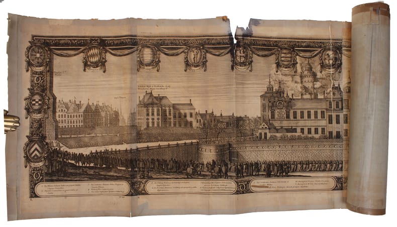
ONE OF THE LARGEST ENGRAVED FUNERAL PROCESSIONS - ERIK DAHLBERG.
Exequiae Serenissimi ac Potentiss: Principis ac Dni. Domini Caroli Gustavi Suecorum Gothorum et Wandalorum Regis d. 3. Nouemb. 1660 Holmiæ Celebratæ. Accuraté delineauit E.I. Dahlbergh. (The funeral procession of King Carl X Gustav of Sweden).
(Nürnberg, 1696). The large engraving of the procession through Stockholm being composed of 13 engraved plates joined together, measuring 30x450 cm. (Plates numb. 1-13). Some mostly marginal dampstains, some marginal tears, some brownspots mainly marginal. Upper margin of plate 3 partly gone. Margins strenghtened at verso with brown paper. Some variation to paperquality, but in general in good strong impressions.
Riferimento per il libraio : 32611
|
|
|
ONE OF THE LARGEST ENGRAVED FUNERAL PROCESSIONS - ERIK DAHLBERG.
Exequiae Serenissimi ac Potentiss: Principis ac Dni. Domini Caroli Gustavi Suecorum Gothorum et Wandalorum Regis d. 3. Nouemb. 1660 Holmiæ Celebratæ. Accuraté delineauit E.I. Dahlbergh. (The funeral procession of King Carl X Gustav of Sweden).
(Nürnberg, 1696). The large engraving of the procession through Stockholm being composed of 13 engraved plates joined together, measuring 30x450 cm. (Plates numb. 1-13). Some mostly marginal dampstains, some marginal tears, some brownspots mainly marginal. Upper margin of plate 3 partly gone. Margins strenghtened at verso with brown paper. Some variation to paperquality, but in general in good strong impressions.
|
|
|
ORANGE [Jacques de CHIÈZE]
Carte : La Principauté d'Orange et Comtat de Venaissin, Amstelodami, 1627.
1 62,7 x 53,3 cm encadrée ; 59 x 49,5 à vue, larges marges piqûées.
Riferimento per il libraio : 10222
|
|
|
Orchard, Imbert
Floodland and Forest - Memories of the Chilliwack Valley - Sound Heritage Series Number 37
92 pages. Based upon 15 tape recorded interviews with people of the Chilliwack area conducted in the early 1960s. Replete with historical photos and maps. Book
|
|
|
ORDNANCE SURVEY 1916
Carte De France Entoilée , ST OMER . Section Sheet 27° S.E., de La 1° Guerre Mondiale ( Map of France of Sheet 27° S.E. For the First War )
Ordnance Survey 1916 68 Cm X 88 Cm Carte entoilée illustrée . Plan de St Omer , Wisques , Quelmes , Acquin , forêt national de Tournehem , Norbécourt , Houlle , St Momelin au 1/20 000° en couleurs . L'entoilage ensanglanté par la blessure du soldat est imprimé d'un glossaire ( glossary ) français-anglais . Quelques défauts d'usages que l'on pardonnera vues les conditions dans lesquelles cette guerre de tranchées s'est déroulée . Histoire 1° Guerre Mondiale . - 1 p. , 250 gr.
Riferimento per il libraio : 007289
|
|
|
ORDENER Paul.-
Les Sports. Jeu des Familles.-
Paris. Nathan. s.d. Jeu complet de 48 cartes illustrées en couleurs par Paul ORDENER, dans un coffret (160 x 118mm) de carton rouge orné d'une grande vignette couleurs. Tout petits défauts mais bon exemplaire bien complet de la règle du jeu (enfants de 7 à 12 ans).
Riferimento per il libraio : ORD-7929
|
|
|
ORDANCE SURVEY
Ordnance Survey [Tourist] Map of Dorking & Leith Hill. One Inch to One Mile. ['Official Royal Arms' cover].
Folding coloured map on paper measuring 24 x 33 ins (approx. 61.0 x 84.0 cms) folding in 32 panels to 7.5 x 4.25 ins (approx. 19.0 x 11.0 cms), neat contemporary signature on front cover, one or two neat repairs at folds; original pictorial card wrappers, yapped edges, wrappers lightly age-soiled else a very good, bright, clean copy. The One Inch Tourist Map series was first published in 1924 with 'Official Royal Arms' artwork. The present copy is the 1929 revision; the cover is single red lineation on buff with black arms, red sheet name and location map. Browne, 8.1.a.1.

|
|
|
Ordnance Survey Maps:
Victorian Ordnance Survey Maps: London
Great Britain: David & Charles 2004. Victorian Ordnance Survey Maps: London Originally engraved in the early 1820s these four maps cover the Victorian city of London and the surrounding area including Windsor Watford Brentwood Southend Maidstone Guildford and Bracknell. in very good slipcase We carry a wide selection of titles in The Arts Theology History Politics Social and Physical Sciences. Academic and Scholarly books and Modern First Editions and all types of Educational Reference Literature. . First Thus. Very Good. Maps . David & Charles unknown
Riferimento per il libraio : 100177 ISBN : 0715318640 9780715318645

|
|
|
Ordnance Survey
Buxton & Matlock: Sheet 111
The folded map is in very good condtion, the covers are dusty, (One Inch Map of Great Britain Seventh Series). eng
|
|
|
Ordnance Survey
Hereford: Sheet 142
covers repaired. eng
|
|
|
Ordnance Survey
Killarney & Dingle Bay : Survey of Ireland Sheet 20 : Quarter Inch
No marks or inscriptions. A clean bright slightly sunned unmarked folded map opens up to 21 x 30 inches. Tears (2 and 3 inches) along two folds and small opening up at two corners 1pp. Ordnance Survey of Ireland quarter inch to 1 mile map of Killarney & Dingle Bay. Scarce.
|
|
|
Ordnance Survey
Landranger Maps: Blairgowrie Sheet 53
Light creasing to the covers, map itself very good used condition, (Landranger Series of Great Britain). eng
|
|
|
ORDNANCE SURVEY
Map of Southern Britain in the Iron Age. Scale 1: 625,000. About Ten Miles to One Inch. [Second Edition.] NEAR FINE COPY
8vo., Second Edition, with large folding coloured map and classified gazetteer; pictorial wrappers, yapped edges, a near fine copy. Updated version of the first edition of 1962.
|
|
|
ORDNANCE SURVEY
Ordnance Survey Contoured Road Map of Barnstaple and Exmoor. Popular Edition. One Inch, Sheet 118. [Ellis Martin cover].
Folding coloured map on cloth measuring 21.x 28.5 ins (approx. 53.0 x 72.0 cms) folding in 24 panels to 7.0 x 3.5 ins (approx. 18.0 x 9.0 cms); original pictorial card wrappers a very good bright clean copy. The famous Popular Edition One Inch series was first published in 1919 with striking 'cyclist' artwork by Ellis Martin. The present copy is the 1932 reissue; the covers are black with red sheet name and location map. Browne, 11.1.a

|
|
|
ORDNANCE SURVEY
Ordnance Survey Contoured Road Map of Bicester. Popular Edition. One Inch, Sheet 94. [Ellis Martin cover]. BRIGHT, CLEAN COPY
Folding coloured map on cloth measuring 22 x 30 ins (approx. 56.0 x 76.0 cms) folding in 21 panels to 7.5 x 4.5 ins (approx. 19.0 x 11.5 cms); original pictorial card wrappers, neat contemporary signature on upper wrapper, wrappers lightly age-soiled else a very good, bright, clean copy. The famous Popular Edition One Inch series was first published in 1919 with striking 'hiker' artwork by Ellis Martin. The present copy is the 1930 revision (roads revised to June 1926); the covers are the dark red and black variant with location map. Browne, 11.2.a

|
|
|
ORDNANCE SURVEY
Ordnance Survey Contoured Road Map of Bridgwater and District. Popular Edition. One Inch. Sheet 120. [Ellis Martin cover].
Folding coloured map on cloth measuring 21 x 30 ins (approx. 53.0 x 76.0 cms) folding in 24 panels to 7.0 x 3.75 ins (approx. 18.0 x 9.5 cms); original pictorial card wrappers, wrappers lightly age-soiled else a very good, bright, clean copy. The famous Popular Edition One Inch series was first published in 1919 with striking 'hiker' artwork by Ellis Martin. The present copy is the 1926 revision; the covers are the dark red and black variant with location map. Browne, 11.2.a

|
|
|
Ordnance Survey
Ordnance Survey Contoured Road Map of Carmarthen : Sheet 89 : One-inch Popular Edition (cloth)
Previous owner's initials to front cover. No creasing to covers. A very clean unmarked map with creasing to some corners and a little rubbing to some of the map's folded corners and edges. Cloth backed edition. 1pp.

|
|
|
ORDNANCE SURVEY
Ordnance Survey Contoured Road Map of Carmarthen. Popular Edition. One Inch. Sheet 89. [Ellis Martin cover].
Folding coloured map on cloth measuring 22.0 x 28.5 ins (approx. 56.0 x 72.0 cms) folding in 21 panels to 7.5 x 4.25 ins (approx. 19.0 x 11.0 cms), small neat contemporary signature on front wrapper else a very good, bright, clean copy. The famous Popular Edition One Inch series was first published in 1919 with striking 'hiker' artwork by Ellis Martin. The present copy is the 1923; the covers are the dark red and black variant with location map. Browne, 11.2.a

|
|
|
ORDNANCE SURVEY
Ordnance Survey Contoured Road Map of Clacton-on-Sea and Harwich. Popular Edition. One Inch, Sheet 98. [Ellis Martin cover].
Folding coloured map on cloth measuring 21.x 28.5 ins (approx. 53.0 x 72.0 cms) folding in 24 panels to 7.0 x 3.5 ins (approx. 18.0 x 9.0 cms); original pictorial card wrappers a very good clean copy. The famous Popular Edition One Inch series was first published in 1919 with striking 'cyclist' artwork by Ellis Martin. The present copy is the 1932 [third] reissue; the covers are black with red sheet name and location map. Browne, 11.1.a

|
|
|
ORDNANCE SURVEY
Ordnance Survey Contoured Road Map of Hastings. Popular Edition. One Inch. Sheet 135. [Ellis Martin cover].
Folding coloured map on cloth measuring 22.0 x 28.5 ins (approx. 56.0 x 72.0 cms) folding in 21 panels to 7.5 x 4.25 ins (approx. 19.0 x 11.0 cms), small neat contemporary signature on front wrapper else a very good, bright, clean copy. The famous Popular Edition One Inch series was first published in 1919 with striking 'hiker' artwork by Ellis Martin. The present copy is the 1933 revision (roads and railways) of the 1921 impression; the covers are the dark red and black variant with location map. Browne, 11.2.a

|
|
|
Ordnance Survey
Ordnance Survey Contoured Road Map of Lampeter : Sheet 78 : One-inch Popular Edition (cloth)
Previous owner's name to front cover. Light creasing to covers. A very clean unmarked map with minor creasing to some corners. Cloth backed edition. 1pp. Undated. 'First published --- 1923 with periodical corrected reprints', probably 1930s.

|
|
|
ORDNANCE SURVEY
Ordnance Survey Contoured Road Map of Land's End and Lizard. Popular Edition. One Inch. Sheet 146. [Ellis Martin cover].
Folding coloured map on cloth measuring 22.0 x 28.5 ins (approx. 56.0 x 72.0 cms) folding in 21 panels to 7.5 x 4.25 ins (approx. 19.0 x 11.0 cms), covers lightly dust-soiled else a very good, bright, clean copy. The famous Popular Edition One Inch series was first published in 1919 with striking 'hiker' artwork by Ellis Martin. The present copy is the 1925 revision; the covers are the dark red and black variant with location map. Browne, 11.2.a

|
|
|
ORDNANCE SURVEY
Ordnance Survey Contoured Road Map of Newquay. Popular Edition. One Inch, Sheet 143. [Ellis Martin cover].
Folding coloured map on cloth measuring 21.x 28.5 ins (approx. 53.0 x 72.0 cms) folding in 24 panels to 7.0 x 3.5 ins (approx. 18.0 x 9.0 cms); original pictorial card wrappers a very good bright clean copy. The famous Popular Edition One Inch series was first published in 1919 with striking 'cyclist' artwork by Ellis Martin. The present copy is the 1931 reissue; the covers are black with red sheet name and location map. Browne, 11.1.a

|
|
|
ORDNANCE SURVEY
Ordnance Survey Contoured Road Map of Norwich and Great Yarmouth. Popular Edition. One Inch. Sheet 67. [Ellis Martin cover].
Folding coloured map on cloth measuring 22.0 x 28.5 ins (approx. 56.0 x 72.0 cms) folding in 21 panels to 7.5 x 4.25 ins (approx. 19.0 x 11.0 cms), some light pencilled annotation in margins; original pictorial card wrappers, wrappers lightly age-soiled else a very good, bright, clean copy. The famous Popular Edition One Inch series was first published in 1919 with striking 'hiker' artwork by Ellis Martin. The present copy is the 1931 revision; the covers are the dark red and black variant with location map. Browne, 11.2.a

|
|
|
ORDNANCE SURVEY
Ordnance Survey Contoured Road Map of Portsmouth and Southampton. Popular Edition. One Inch. Sheet 132. [Ellis Martin cover].
Folding coloured map on cloth measuring 22.0 x 28.5 ins (approx. 56.0 x 72.0 cms) folding in 21 panels to 7.5 x 4.25 ins (approx. 19.0 x 11.0 cms), small neat contemporary signature on front wrapper else a very good, bright, clean copy. The famous Popular Edition One Inch series was first published in 1919 with striking 'hiker' artwork by Ellis Martin. The present copy is the 1932 revision; the covers are the dark red and black variant with location map. Browne, 11.2.a

|
|
|
Ordnance Survey
Ordnance Survey Contoured Road Map of Salisbury and Bulford :Linen-backed Sheet 122
No added marks or inscriptions. Linen-backed map in excellent bright condition, not torn. Covers lightly marked and creased. 1pp. One-inch to one mile Ordnance Survey map of Wiltshire around Salisbury, Bulford and surrounding district published in 1919. Opens up to 22 x 30 inches. Extremely scarce.

|
|
|
ORDNANCE SURVEY
Ordnance Survey Contoured Road Map of Stow-on-the-Wold and District. Popular Edition. One Inch, Sheet 93. [Ellis Martin cover].
Folding coloured map on cloth measuring 22 x 30 ins (approx.56.0 x 76.0 cms) folding in 21 panels to 7.5 x 4.5 ins (approx. 19.0 x 11.5 cms); original pictorial card wrappers, wrappers lightly frayed at edges else a very good, clean copy.

|
|
|
ORDNANCE SURVEY
Ordnance Survey Contoured Road Map of Torquay and Dartmouth. Popular Edition. One Inch. Sheet 145. [Ellis Martin cover].
Folding coloured map on cloth measuring 22.0 x 28.5 ins (approx. 56.0 x 72.0 cms) folding in 21 panels to 7.5 x 4.25 ins (approx. 19.0 x 11.0 cms), covers lightly dust-soiled else a very good, bright, clean copy. The famous Popular Edition One Inch series was first published in 1919 with striking 'hiker' artwork by Ellis Martin. The present copy is the 1925 revision; the covers are the dark red and black variant with location map. Browne, 11.2.a

|
|
|
ORDNANCE SURVEY
Ordnance Survey Contoured Road Map of Truro and St. Austell. One Inch, Sheet 143. [Ellis Martin cover].
Folding coloured map on cloth measuring 21.x 28.5 ins (approx. 53.0 x 72.0 cms) folding in 24 panels to 7.0 x 3.5 ins (approx. 18.0 x 9.0 cms); original pictorial card wrappers a very good bright clean copy. The famous Popular Edition One Inch series was first published in 1919 with striking 'cyclist' artwork by Ellis Martin. The present copy is the 1930 reissue; the covers are black with red sheet name and location map. Browne, 11.1.a

|
|
|
ORDNANCE SURVEY
Ordnance Survey Map of Colchester and District. Coloured Edition. One Inch, Sheet 99. [Ellis Martin cover].
Folding coloured map on cloth measuring 21.x 28.5 ins (approx. 53.0 x 72.0 cms) folding in 24 panels to 7.0 x 3.5 ins (approx. 18.0 x 9.0 cms); original pictorial card wrappers covers lightly browned else a very good bright clean copy. The One Inch Coloured Edition dates from 1904. The present copy is the 1914 reissue; the covers are Ellis Martin's Royal Arms with mantling, dark red and brown variant. Browne, 10.2. SCARCE.

|
|
|
ORDNANCE SURVEY
Ordnance Survey One-Inch Map. Fifth Edition. SE London and Dartford. Mounted on Linen. Sheet 15. [Ellis Martin cover].
Folding coloured map on linen measuring 22.0 x 28.5 ins (approx. 56.0 x 72.0 cms) folding in 21 panels to 7.5 x 4.25 ins (approx. 19.0 x 11.0 cms); a very good, bright, clean copy. The famous One Inch Fifth Edition series was first published in 1934 with striking 'younger sitting hiker' artwork by Ellis Martin. The present copy is the 1935 revision; the covers are the blue and black variant with location map. Browne, 11.2.unrecorded.

|
|
|
Ordnance Survey
Ordnance Survey Road Map of Brighton :Linen-backed Sheet 39
Well used lightly tanned map with damp effect to rear only, no corresponding marks to actual map. No added marks or inscriptions. Not torn but well rubbed at all fold corners. 1pp. Hill-shaded half-inch to one mile Ordnance Survey map of Brighton and surrounding district published in 1914. Opens up to 21 x 30 inches. Extremely scarce.

|
|
|
ORDNANCE SURVEY
Ordnance Survey Road Map of Oxford and Swindon. Sheet 28. Layers. alf Inch to One Mile. [Ellis Martin cover]. BRIGHT, CLEAN COPY
Folding coloured map on paper measuring 22 x 30 ins (approx. 56.0 x 76.0 cms) folding in 21 panels to 7.5 x 4.25 ins (approx. 19.0 x 11.0 cms); original pictorial card wrappers, wrappers lightly age-soiled else a very good, bright, clean copy. The Half Inch series was first issued in 1919 with striking 'motorist' artwork by Ellis Martin. The present copy is the 1935 revision; the covers are the green and brown variant with green sheet name. Browne, 12.2.a

|
|

 Ricevere i risultati per e-mail
 Scaricare i risultati in PDF
 RSS feed
 Link
Link


