|
HAFFNER Johann Christoph
Roma. Rom
Il modello iconografico a cui questa veduta si ispira è la veduta edita da Georg Baltazar Probst nel 1730 su disegno di Bernard Werner. Si tratta di una veduta che presenta la consueta scarsa affidabilità architettonica, esprimendosi in chiaro stile nordico, nella quale la selva di cupole, campanili e altissime antenne si conclude con coperture a profilo concavo, come le tipiche coperture delle città mitteleuropee. Johann C. Haffner (1668 - 1754) è incisore ed editore attivo a Vienna ed Augsburg; alcune sue opere sono datate tra il 1720 ed il 1730, mentre questa veduta è tratta da una serie databile al periodo 1745 - 50. Tooley 275: “The iconographic model of this view is the engraving printed by Georg Baltazar Probst in 1730, after Bernard Werner’s drawing. As usual, the view is not reliable on an architectonical point of view, for it refers to the classical nordic style, in which the multitude of domes, bell towers and high poles ends in hollow covers, typical of Mitteleuropean cities”.. Incisione in rame, due lastre stampate su due fogli di carta originariamente uniti, in eccellente stato di conservazione. Molto rara. The iconographic model of this view is the engraving printed by Georg Baltazar Probst in 1730, after Bernard Werner’s drawing. As usual, the view is not reliable on an architectonical point of view, for it refers to the classical nordic style, in which the multitude of domes, bell towers and high poles ends in hollow covers, typical of Mitteleuropean cities. Johann C. Hafner (1668-1754) was engraver and printer, he worked in Vienna; some of his works have been realized between 1720 and 1730, while the series from which the present work has been taken has been realized between 1745 and 1750. Johann C. Haffner (1668 - 1754) is an engraver and publisher active in Vienna and Augsburg; some of his works are dated between 1720 and 1730, while this view is taken from a series datable to the period 1745 - 50. Tooley 275: "The iconographic model of this view is the engraving printed by Georg Baltazar Probst in 1730, after Bernard Werner's drawing. As usual, the view is not reliable on an architectonical point of view, for it refers to the classical nordic style, in which the multitude of domes, bell towers and high poles ends in hollow covers, typical of Mitteleuropean cities.". Copperplate, two plates printed on two sheets, joined together in the past, in excellent condition. Very rare. cfr. C. Marigliani, "Le Piante di Roma delle collezioni private", tav. 183 (edizione del 1730 circa di formato ridotto).

|
|
|
Hagedorn, Hermann; Frank Godwin (Illust) & Edwin Eirich (Maps)
The Book of Courage
Philadelphia: The John C. Winston Company. Very Good. 1929. First Edition; First Printing. Hardcover. Color Plates; B&W drawings and pictorial maps; Small 4to 9" - 11" tall; 408 pages; 1929 The John C. Winston Company. Larger stout HC in original blue cloth with decorative pictorial borders in red and gold and a color pictorial panel on paper mounted to the cover inside a double gilt border. Illustrated with color and b&w plates and drawings by Frank Godwin and with pictorial maps by Eirich. Bright solid and neat. No marks. Mild crimping to cloth at spine ends and superficial shelf tapping to corner tips. Light silverfish tracing/patches to top edge of the page block; a few pages with straightened corner creases. VG or better. . Oversize book may require additional charges for expedited or international shipping. . The John C. Winston Company hardcover
Bookseller reference : 47781
|
|
|
HAGUENAU
Zone nord de guerre : Haguenau. Carte couleurs d'Etat-Major au 1/50 000?.
Feuille 53x68 cm.
|
|
|
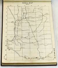
Hale's Motor Maps
Motor Maps of W.A. : comprising Index Map and 65 Sectional Maps of the South-West division of the State Western Australia 1923
Perth: Hale's Motor Maps Ltd. 1923. Octavo cloth boards with block printed title laid on upper boards b&w plates b&w illus pp 244. Rebound with new endpapers in custom-made slipcase. First page creased otherwise contents clean. Very good condition. Road maps of Western Australia from Moora Kondut and Becubbin in the north to Albany in the south and stretching iinward through the wheatbelt. Scale: 4 miles to the inch. With many illustrated advertisements for WA companies decriptions of Perth and Western Australia with photographs lists of garages and hotels and information for travellers. Boards in slip-case. Hale's Motor Maps Ltd. hardcover
Bookseller reference : 101984
|
|
|
Hale, EE. And Susan; Maps and Profuse Woodcuts [Illustrator] E. E.
A Family Flight Through Mexico
D. Lothrop 1893-01-01. Hardcover. VERY GOOD/NONE. Cover alone is worth the purchase. Very lightly bumped corners. Cover is a piece of art. D. Lothrop hardcover
Bookseller reference : 039254
|
|
|
Halecki, Oscar; B/w Maps [Illustrator]
Borderlands of Western Civilization: History of East Central Europe
Ronald Press Co. Hardcover. New. New. In shrink wrap. Looks like an interesting title! Ronald Press Co hardcover
Bookseller reference : Q-0826037402 ISBN : 0826037402 9780826037404
|
|
|
Halifax Estate Agencies (Retford Salerooms)
Oil Paintings, Watercolour Drawings, Maps, Prints & Books : Monday 18th May 1992
VG paperback . Auction catalogue. 10090 eng
|
|
|
Halit Ziya [Türkkan].
Arap Yarimadasi ve Irak. [Istanbul, ca. 1929].
Ca. 280 x 200 mm. Manuscript map of the Arabian Peninsula and Iraq in original hand colour. Captioned in Turkish (in Latin letters). Unique hand-drawn map of the Arabian Peninsula and Iraq by the Turkish cartographer, scientist and cadastre specialist Halid Ziya Türkkan, who was appointed Head of the Science Committee of Istanbul's new cadastre office in 1925. The map distinguishes Nejd, Yemen, Hadramaut, Oman, Kuwait, and Iraq by different colours, also showing the Bay of Aden, the Umman Sea, and the Red Sea. Featured cities include Aden, Makkah, Medina, Sana'a, and Mascat. - Signed in ink by the cartographer. Very well preserved.
|
|
|
Hall, Sidney.
A Travelling County Atlas With all the Coach and Rail Roads Accurately Laid Down and Coloured and Carefully Corrected to the Present Time. London, Chapman & Hall, 1845.
(4) SS., 46 gest. Karten mit originalem Grenzkolorit. Originaler dunkelgrüner kopertartiger Ganzlederband mit goldgeprägtem Deckeltitel. 8vo. Hübscher Taschenatlas der englischen Grafschaften (mit Isle of Wight und Kanalinseln; Irland, Wales und Schottland als Übersichtskarten) unter Angabe der Straßen und Eisenbahnverbindungen. Durchgehend mit der Angabe "Engraved by Sid.y Hall".

|
|
|
Halliday FE. editor and introduction; maps by John Norden F. E.
Richard Carew of Antony: The Survey of Cornwall &c
London: Andrew Melrose 1953. Hardcover. 334p. cloth-covered boards 6x9.25 inches frontispiece portrait of Carew corners bumped boards have a stained/mottled appearance offsetting to endpapers from dj old price stamped on front paste-down endpaper else good condition in a worn dj with a small splash stain on the spine panel. Andrew Melrose hardcover books
Bookseller reference : 264337

|
|
|
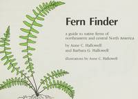
Hallowell, A. & B.; Drawings & Maps [Illustrator]
Fern Finder
Nature Study Guild 1981-01-01. Paperback. Very Good. Very nice book. Minor wear to cover edges and corners. Nature Study Guild paperback
Bookseller reference : 123021010 ISBN : 0912550112 9780912550114
|
|
|
HALMA Franciscus (1653 - 1722)
Romani Imperii Occidentalis et Orientalis Decriptio Geographica Auct.
Carta storica della penisola di derivazione da quella di Nicola Sanson, edita per la prima volta a Leida da Pieter Vander Aa nel 1700.Esemplare tratto dall'opera "Beschryving van oud en nieuw Rome", di François Jacques Deseine edita ad Amsterdam nel 1704 da Franz Halm.Incisione in rame, bella coloritura a mano, in ottimo stato di conservazione. Antique map of the Mediterranean Sea, showing the Roman Empire. After N. Sanson, published by Francois Halma.Published in "Beschryving van oud en nieuw Rome", by François Jacques Deseine.Copperplate with fine later hand colour, very good condition. Zacharakis 2104

|
|
|
Halpine, Charles Greham.
A PILOT'S METEOROLOGY.
pp. ix, 220 + Plus three large pocket folding airport weather maps. Illustrated with numerous photographs, charts, diagrams and maps. Endpapers beginning to brown. XLib stamp on front pastedown. 8vo. Original full cloth binding. Original dust jacket, torn with slight loss. Nice copy. WWII 2
|
|
|
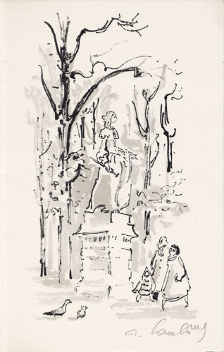
Hambourg, André
André Hambourg : carte de voeux pour 1958 et lithographie originale
1958 Carte de voeux de André Hambourg pour 1958. 22,5 x 14 cm, 2 ff., en page 3 une lithographie originale en noir et gris, signée à la mine de plomb, voeux imprimés en regard.
Bookseller reference : 1473
|
|
|
Hamel, Sonja van
Groeten van het rode autootje - een reis in ansichtkaarten
, Harmonie, Uitgeverij De, 2017 Oorspronkelijk uitgevers omslag, 23.5 x 17 cm. ISBN 9789463360357.
Bookseller reference : 66184
|
|
|
HAMMER-PURGSTALL (Joseph von), HELLERT , J.J.
Histoire de l'Empire ottoman depuis son origine jusqu'à nos jours. Traduit de l'Allemand sur les notes et sous la direction de l'Auteur et par J. J. Hellert.
Paris, Bellizard, Barthes, Dufour et Lowell ; Londres, Bossange, Barthes et Lowell ; Saint-Petersbourg, Fd. Bellizard et Cie, 1835-1841. 18 volumes de texte in-8 et un atlas in-folio TEXTE : 18 volumes in-8, relié plein cuir tacheté époque, dos lisse orné avec pièce de titre rouge et auteur et tomaison vertes, filet sur les plats, adhésif, frottements, défauts d'usage .., rousseurs dans le texte. ATLAS : Paris. Bellizard, Dufour etc. 1844. Imprimé chez Thierry Frères. Reliure époque, dos lisse. Grand in-folio (555x375mm) il est composé d'un titre, d'une listes des cartes, d'une carte générale de l'Empire Ottoman avec les contours aquarellés (690x550mm), de 21 cartes particulières (dont une sur 2 feuilles et 2 à double page dépliantes représentant les états de l'empire ottoman et les états limitrophes (845x590mm et 845x545), de 13 plans de batailles ou de siège, et de 3 plans de villes dont un grand plan dépliant de Constantinople (690x670mm) par G. Heck et Lon. Plée et gravée par U. Muschani. Reliure avec défauts, réparation au dos, fente intérieure, petite mouillure angulaire, une carte et un feuillet détaché
Bookseller reference : PHO-1099

|
|
|
HAMMER-PURGSTALL (Joseph von), HELLERT (J.J., Trad.)
Histoire de l'Empire ottoman depuis son origine jusqu'à nos jours. Traduit de l'allemand sur les notes et sous la direction de l'auteur et par J. J. Hellert. & Nouvel atlas physique, politique, et historique de l'Empire Ottoman et des etats limitrophes en Europe, en Asie et en Afrique : en quarante feuilles, avec un beau plan topographique de la ville actuelle de Constantinople, plusieurs plans des villes les plus importantes de l'Empire, et ceux des sieges et batailles memorables soutenus par les Ottomans...
Paris, Bellizard, Barthes, Dufour et Lowell ; Londres, Bossange, Barthes et Lowell ; Saint-Petersbourg, Fd. Bellizard et Cie, 1835-1844. 18 volumes de texte in-8 et un atlas in-folio. TEXTE : 18 volumes in-8, relié demi basane et coins moderne, dos lisse orné avec pièces d’auteur, titre et tomaison noires, frottements et épidermures, défauts d’usage, rousseurs dans le texte, tampon et étiquette du relieur. ATLAS : Paris. Bellizard, Dufour etc. 1844. Imprimé chez Thierry Frères. Demi basane et coins à long grain grenat, dos à nerfs avec titre et auteur, In-folio (520x345mm), IV-82pp.-40 planches, il est composé du Commentaire sur l’Atlas de l’Empire Ottoman, d'une liste des cartes, d'une carte générale de l'Empire Ottoman (690x550mm), de 22 cartes particulières (dont une sur 2 feuilles) (815x850), de 13 plans de batailles ou de siège, et de 4 plans de villes dont un grand plan dépliant de Constantinople (690x670mm), le plan de Vienne est en 2 états, par G. Heck et Plée et gravé par U. Muschani, roussurs éparses, 2 cartes uniformément brunies avec réparations, mouillure claire en marge, tache sur les 16 premiers feuillets en tête et en fin d’ouvrage en pied. Provenance : collection de S.A.R. le Prince Osman Ibrahim d'Égypte (1951-2025), fils de S.A.R. le Prince Amr Ibrahim d'Égypte et de S.A.I. la Princesse Nejla Hibetullah Sultan (Necla Osmanoğlu) de Turquie, petite-fille du dernier calife Abdulmejid II et du sultan Mehmed VI, avec sa marque au tampon.
Bookseller reference : PHO-1982

|
|
|
HAMILTON, J. TAYLOR & HAMILTON, KENNETH G. & BEES, FRED (Maps)
History of the Moravian Church: The Renewed Unitas Fratrum 1722-1957
Interprovincial Board of Christian Education Moravian Church in America 1983. Super octavo hardcover VG in d/w VG; all our specials have minimal description to keep listing them viable. They are at least reading copies complete and in reasonable condition but usually secondhand; frequently they are superior examples. Ordering more than one book may reduce your overall postage costs Interprovincial Board of Christian Education Moravian Church in America 1983 hardcover
Bookseller reference : 288601
|
|
|
Hammerton, J. A. (editor)
Countries of the World : Volume 1 : Abyssinia to Bengall
No marks or inscriptions. No creasing to covers or to spine. Contents excellent. A very clean very tight copy with bright unmarked slightly irregularly sunned boards, rubbing to ends of and small scratch to spine and no bumping to corners. 724pp. With a ten page introduction by Joseph Conrad, this very well-researched and well-wrtten account of the countries and cities across the world tells us what our world was like 100 years ago with nearly 700 photographic illustrations including about 200 in full colour or photogravure. Undated ca 1923. A heavy book.

|
|
|
Hammerton, J. A. (editor)
Countries of the World : Volume 3 : Constantinople to Iceland
No marks or inscriptions. No creasing to covers or to spine. Contents excellent. A very clean very tight copy with bright unmarked slightly irregularly sunned boards, minor rubbing to ends of spine and no bumping to corners. 1453-2180pp. A very well-researched and well-wrtten account of the countries and cities across the world which tell us what our world was like 100 years ago with nearly 700 photographic illustrations including about 200 in full colour or photogravure. Undated ca 1923. A heavy book.

|
|
|
Hammerton, J. A. (editor)
Countries of the World : Volume 4 : India to New Orleans
No marks or inscriptions to contents. No creasing to covers or to spine. Contents excellent. A very clean very tight copy with bright slightly marked slightly irregularly sunned boards, minor rubbing to ends of spine and no bumping to corners. 2181-2908pp. A very well-researched and well-wrtten account of the countries and cities across the world which tell us what our world was like 100 years ago with nearly 700 photographic illustrations including about 200 in full colour or photogravure. Undated ca 1923. A heavy book.

|
|
|
Hammerton, J. A. (editor)
Countries of the World : Volume 5 : New York to Siam
No marks or inscriptions. No creasing to covers or to spine. Contents excellent. A very clean very tight copy with bright unmarked slightly irregularly sunned boards, minor rubbing to ends of spine and no bumping to corners. Fold-out coloured maps of New York and Paris in the 1920s in excellent condition. 2909-3628pp. A very well-researched and well-wrtten account of the countries and cities across the world which tell us what our world was like 100 years ago with nearly 700 photographic illustrations including about 200 in full colour or photogravure. Undated ca 1923. A heavy book.

|
|
|
Hammerton, J. A. (editor)
Countries of the World : Volume 6 : Siberia to Zanzibar
No marks or inscriptions. No creasing to covers or to spine. Contents excellent. A very clean very tight copy with bright unmarked slightly irregularly sunned boards, minor rubbing to ends of spine and no bumping to corners. Fold-out coloured maps of the World in the 1920s in excellent condition. 3629-4348pp. A very well-researched and well-wrtten account of the countries and cities across the world which tell us what our world was like 100 years ago with nearly 700 photographic illustrations including about 200 in full colour or photogravure. Undated ca 1923. A heavy book.

|
|
|
Hammond Maps
HAMMOND'S ILLUSTRATED ATLAS FOR YOUNG AMERICA
Maplewood NJ: C.S. Hammond and Company 1956. Yellow hardcover binding soiled square and tight. Bumped corners. Bit of paper missing along spine. Endpapers with index and facts hinges good. 92 pages with a few small closed tears. Part of the Weekly Reader Children's Book Club - full color maps and up-to-date well through 1956! facts with new concepts about our physical and political world. Size: 8vo - over 7¾" - 9¾" tall. Illus. by Illustrated. Hardcover. Good/No Jacket. C.S. Hammond and Company Hardcover
Bookseller reference : 08337
|
|
|
Hammond, Reginald J W
The Isle of Wight : Red Guide
No marks or inscriptions. No creasing to covers or to spine. Very clean very tight pages with bright unmarked boards, a little foxing to page edges and end papers and no bumping to corners. Front map slighlty torn, others in excellent condition. 160pp. Red Guide to the Isle of Wight. We do not use stock photos, the picture displayed is of the actual book for sale. Every one of our books is in stock in the UK ready for immediate delivery.

|
|
|
Hammond, Reginald J W (editor)
Colwyn Bay and North Wales : Red Guide
No marks or inscriptions. A very clean very tight copy with unmarked red cloth boards, a trace of foxing to top of page edges and no bumping to corners. Dust jacket not price clipped or marked or torn or creased. Fold-out maps in excellent condition. 192pp. Red Guide to North Wales covering Anglesey, Llandudno, Colwyn Bay, Conway, Bangor, Caernarvon, Rhyl and Betws-Y-Coed. Third Edition. We do not use stock photos, the picture displayed is of the actual book for sale. Every one of our books is in stock in the UK ready for immediate delivery.

|
|
|
Hammond, Reginald J W (editor)
The Isle of Man (Red Guide)
No marks or inscriptions. No creasing to covers or to spine. A very clean very tight copy with bright unmarked boards, very slightly tanned pages, very minor bump to spine foot and no bumping to corners. Dust jacket clipped but not price clipped and not marked or torn with a little rubbing to upper edge. Fold-out map in excellent condition. 128pp. Red Guide to the Isle of Man. Twelfth edition.

|
|
|
Hammond, Reginald James William
The Highlands of Scotland : Following Road, Rail and Steamer Routes with Tours from Each Centre
No marks or inscriptions. A very clean very tight copy with bright unmarked boards and tiny bump to lower front corner. Dust jacket not price clipped or marked with light creasing and some rubbing/nicks to edges. 160pp.

|
|
|
Hampe, I. & H. Kolb & Maps B & W Photos
A PRELIMINARY LIST of BIRDS of MARYLAND and the DISTRICT of COLUMBIA.
Natural History Society of Maryland. Very Good- with no dust jacket; Yellow Pictorial cardstock cover with . staple binding; owners name on front; ink mark on back cover; No marks or . writing clean tight binding;. 1947. First Edition. Softcover. 76 pages . Natural History Society of Maryland paperback
Bookseller reference : 11726
|
|
|
Hannon - Revue libanaise de géographie
Hannon - Recueil des travaux du département de géographie Volume VII - 1972 - Sommaire : Etudes libanaises : "Les précipitations exceptionnelles de Décembre 1968 et janvier 1969 au Liban" (G. BLANCHET) - "Sur la nature de l'horizon B dans les sols rouges méditerranéens du Liban-Sud" (W. VERHEYE) - "Rivages marins du Günz-Mindel dans la région d'Enfé (Liban-Nord)" (R. DALONGEVILLE et P. SANLAVILLE) - "Tableaux et Préhistoire libanaise (1ere partie)" (J. BESANÇON, L. COPELAND et F. HOURS) - Etudes Moyen-Orientales : "Une spéculation originale : l'astrakhan en Afghanistan" (D. BALLAND) - "Contribution à l'étude des bioclimats et de la végétation naturelle en Turquie" (I. NAHAL) - Documentation Géographique : "Exploration de la résurgence de nabaa el Labane" ( A. MAROUN, M. MAJDALANI, A. COMATY) - "Documents de cartographie antique (II) : l'époque romaine" (O. AURENCHE) - "La cartographie arabe jusqu'au Xème siècle" (KAHWAJI) - Notes : "Chroniques cartographique" (N. KANAAN-ATALLAH) - "Traduction en langue arabe des résumés" (Mme I. MAKKI)
1972 Université Libanaise Faculté des Lettres 1972 - In-8 broché - 184 pages
Bookseller reference : 82010
|
|
|
Handtke, F
General-Karte von Deutschland. - entworfen und gezeichnet von F. Handtke. Verhältniss 1:1791000
Glogau, C. Flemming Verlag, 1849. in 20 lithogr. Segmenten mit Grenzkolorit auf Leinwand. Original-Faltkarte, gefaltet 8°
Bookseller reference : 12988

|
|
|
Handtke, F
Reise-Karte von Deutschland.und den Nachbar-staaten bis Kopenhagen, Dover, Paris, Lyon, Turin, Ferrara, Budapest, Debreczin, Lublin, Grodno, Tauroggen. - entworfen und gezeichnet von F. Handtke. Verhältniss 1: 500.000
Glogau, C. Flemming Verlag o.J., circa, 1890. Neueste revidierte Ausgabe. in 52 lithogr. Segmenten mit Grenzkolorit auf Leinwand. (ziegelroter) OLwd.-Einband, Original-Faltkarte, gefaltet 8°
Bookseller reference : 15148

|
|
|
Handtke, F. (Bearb.)
Provinz Pommern. 1 : 520.000.
Berlin u. Glogau, Flemming, o. J. (um 1890?). Farblithogr., 75 x 50 cm mit kl. Nebenkarte von Stettin unten links. In Segmenten auf Leinen aufgezogen. Gefaltet. In OLn., h (Carl Flemmings Generalkarte No. 6).
Bookseller reference : 45552AB

|
|
|
Handy Maps Inc.
Handy Map a Quick Reference Street Atlas of Metropolitan Nashville Tenn. 1987 Edition
Memphis Tennessee: Handy Maps Inc. Very Good. 1987. Spiral bound. Very Good spiral bound softcover no names or marks. Cover has some light shelf wear. ; 8vo 8" - 9" tall . Handy Maps, Inc. unknown
Bookseller reference : 40451
|
|
|
Hanigan, Des
Cornwall and the Isles of Scilly
No marks or inscriptions. No creasing to covers or to spine. A lovely clean very tight copy with bright unmarked boards and no bumping to corners. 128pp.

|
|
|
Hansa Rundfahrt GmbH
Rundfahrt-Führer durch Hamburg - Circular-Drives through Hamburg
Hamburg, Norddeutsche Buchdruckerei ca 1922. 36 S., Faltkarte, 22cm Karton 0
Bookseller reference : 77553

|
|
|
HARTMANN (Hippolyte) & CICÉRI (Eugène).
[MARTINIQUE] Vue de la grande rue du Mouillage, prise du balcon Vivé. S.t Pierre, Martinique.
Paris, Lemercier, [1860]. 283 x 192 mm.
Bookseller reference : LBW-8873

|
|
|
HARTMANN (Hippolyte) & CICÉRI (Eugène).
[MARTINIQUE] Statue de l'impératrice Joséphine. Fort-de-France, Martinique.
Paris, Lemercier, [1860]. 215 x 260 mm.
Bookseller reference : LBW-8874

|
|
|
HARTMANN (Hippolyte) & CICÉRI (Eugène).
[MARTINIQUE] Palais de Justice. Fort-de-France, Martinique.
Paris, Lemercier, [1860]. 215 x 261 mm.
Bookseller reference : LBW-8875

|
|
|
HARTMANN (Hippolyte) & CICÉRI (Eugène).
[MARTINIQUE] Rivière Madame, vue prise du bac Bellevue. Fort-de-France, Martinique.
Paris, Lemercier, [1860]. 215 x 258 mm.
Bookseller reference : LBW-8876

|
|
|
HARTMANN (Hippolyte) & CICÉRI (Eugène).
[MARTINIQUE] Vue de la rivière du Fort, prise du pont de pierre. S.t Pierre, Martinique.
Paris, Lemercier, [1860]. 216 x 260 mm.
Bookseller reference : LBW-8877

|
|
|
HARTMANN (Hippolyte) & CICÉRI (Eugène).
[MARTINIQUE] Vue de la place Bertin prise du quai Larougerie. S.t Pierre, Martinique.
Paris, Lemercier, [1860]. 215 x 262 mm.
Bookseller reference : LBW-8878

|
|
|
HARTMANN (Hippolyte) & CICÉRI (Eugène).
[MARTINIQUE] Vue de la ville de S.t Pierre, prise de la batterie S.te Marthe. Martinique.
Paris, Lemercier, [1860]. 223 x 303 mm.
Bookseller reference : LBW-8879

|
|
|
HARTMANN (Hippolyte) & CICÉRI (Eugène).
[MARTINIQUE] Vue de la Maison de Santé et Habitation Pécoul, prise du boulevard de la Comédie. S.t Pierre, Martinique.
Paris, Lemercier, [1860]. 216 x 266 mm.
Bookseller reference : LBW-8880

|
|
|
HARTMANN (Hippolyte) & CICÉRI (Eugène).
[MARTINIQUE] Vue du château d'eau ou canal de Gueydon. Fort-de-France, Martinique.
Paris, Lemercier, [1860]. 215 x 262 mm.
Bookseller reference : LBW-8881

|
|
|
HARTMANN (Hippolyte) & CICÉRI (Eugène).
[MARTINIQUE] Vue de la cascade du Jardin des Plantes. S.t Pierre, Martinique.
Paris, Lemercier, [1860]. 287 x 197 mm.
Bookseller reference : LBW-8882

|
|
|
Harper D
Aa mini guide chine
NATIONAL GEOGRA 2026 2026. unknown_binding. Ce guide de voyage National Geographic sur la Chine écrit par Damian Harper avec des photographies d'Alison Wright propose une exploration complète du pays à travers ses régions son histoire sa culture et sa cuisine. Il contient des cartes détaillées des conseils pratiques pour les voyageurs des informations sur l'hébergement et la restauration ainsi que des itinéraires et excursions
Bookseller reference : 500336956
|
|
|
Harding, William.
WAR IN SOUTH AFRICA AND THE DARK CONTINENT. From Savagery To Civilization. Including the War With the Boers. And a Detailed History of the Causes and Events of the British-Boer War. Superbly Illustrated With Half-Tone Engravings Made From Photographs
554p. + Plus frontis and color folding map. Full page text half-tone engravings from photographs. Title page printed in red and black. Paper beginning to brown but not brittle. 4to. Original full cloth binding with pictorial design of British soldier, Boer soldier and an African tribesman. Binding slightly soiled. Nice copy. AFRICA/2
|
|
|
Hardwick, Walter G.
Vancouver - Canadian Cities
214 pages including index. A provocative study of Canada's third-largest city which challenges all readers interested in the problems facing urban centres today. Includes 13 maps and 25 photographs. Book
|
|
|
Hargreaves, John D and Maps
West Africa: The Former French States Softcover
Paperback. Fair. Prentice-Hall 1967 hardcover. EX-LIB COPY with usual markings. Text and cover clean binding tight. paperback
Bookseller reference : 0917J210936
|
|
 Receive by email
 Download as PDF document
 RSS feed


