|
SPRUNER, KARL AND MENKE,THEODOR.
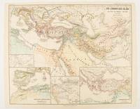
Die Länder des Islâm zur Zeit der Bûjiden 945-1055.
Gotha: Justus Perthes. 1877. Map with original colour and outline hand-colour 32.7 x 40.7 cm four inset maps text in German central fold slight marginal edge wear and spotting to the verso but in very good condition. A handsome map detailing the lands of Islam at the time of the Bujids 945-1055. The inset maps depict a western extension to the main map southern Arabia the lands of the Ghaznavid sultanate in Central Asia and lands of the Eastern Roman/Byzantine Empire issued for the "Hand-Atlas für die Geschichte des Mittelatters und die Neueren Zeit". . Justus Perthes unknown
Bookseller reference : 174917
|
|
|
[BYZANTINE EMPIRE - MAP]. SPRUNER, KARL AND MENKE,THEODOR.
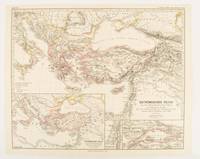
Oströmisches Reich von der Einwanderung der Ungarn in Ponnonien um 895 bis zur Unterwerfung des Bulgarenreichs durch Kaiser Basilius im J. 1019.
Gotha: Justus Perthes. 1874. Map with original colour and outline hand-colour 32.2 x 40 cm three inset maps text in German central fold slight marginal toning in very good condition. A most handsome map detailing the Eastern Roman Empire from the immigration of Hungarians in Ponnonia around 895 to the subjugation of the Bulgarian Empire by Emperor Basilius in 1019. The inset maps depict Divisions of the Empire Palestine and the Themata around Propontis present day Sea of Marmara issued for the "Hand-Atlas für die Geschichte des Mittelatters und die Neueren Zeit". . Justus Perthes unknown
Bookseller reference : 174914
|
|
|
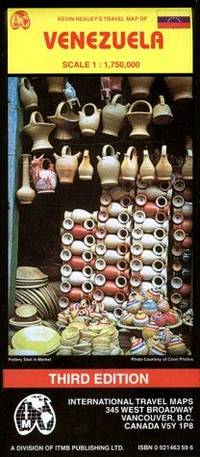
International Travel maps
Venezuela
map. Good. Access codes and supplements are not guaranteed with used items. May be an ex-library book. unknown
Bookseller reference : 0921463596.G ISBN : 0921463596 9780921463597
|
|
|
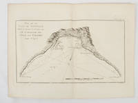
BENARD, ROBERT (ENGRAVER), AFTER PHILIP CARTERET (MAPMAKER).
Vue de la Baye de Bonthain située à environ 30. lieues au S.E. de Macassar dans l'Isle des Celebes latit. 5d. 34" S.
Paris.: Chez Saillant et Nyon rue Saint-Jean-de-Beauvais Chez Panckoucke Hotel de Thou rue des Poitevins. 1774. Engraved map on laid paper 18.5 x 31cm 25.6 x 34.4cm sheet size central fold slight marginal toning but a very good dark impression. Map of Bonthain Bay situated southeast of Macassar on the island of Celebes finely re-engraved for the French edition of Captain James Cook's First Voyage 1768-1771 "Relation des voyages.pour faire des decouvertes dans l'hemisphere meridional et successivement executes par le commodore Byron le capitaine Carteret le capitaine Wallis & le capitaine Cook.". . Chez Saillant et Nyon, rue Saint-Jean-de-Beauvais, [Chez] Panckoucke, Hotel de Thou, rue des Poitevins. unknown
Bookseller reference : 174257
|
|
|
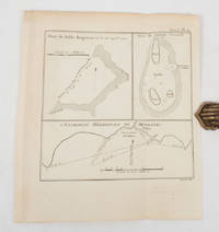
BENARD, ROBERT (ENGRAVER), AFTER PHILIP CARTERET (MAPMAKER).
Banc de Sable Dangereux. on sheet with Isles de Joseph Freewill and L'Extremité Méridionale de Mindanao.
A Paris.: Chez Saillant et Nyon rue Saint-Jean-de-Beauvais Chez Panckoucke Hotel de Thou rue des Poitevins. 1774. Engraved map on laid paper 27.2 x 19.9cm 26.5 x 22.2cm sheet size edge fold slight marginal toning but in very good condition. Map of the treacherous coastal waters sandbars submerged rocks and reefs surrounding Mindanao and the Joseph Freewill Islands Mapia Atoll in the Philippines finely re-engraved for the French edition of Captain James Cook's First Voyage 1768-1771 "Relation des voyages.pour faire des decouvertes dans l'hemisphere meridional et successivement executes par le commodore Byron le capitaine Carteret le capitaine Wallis & le capitaine Cook.". . Chez Saillant et Nyon, rue Saint-Jean-de-Beauvais, [Chez] Panckoucke, Hotel de Thou, rue des Poitevins. unknown
Bookseller reference : 174260
|
|
|
[GENERAL DRAFTING COMPANY]. ネラル・ドラーフティング株式会社.
アメリカ合衆國.主要地方資源産物及び風景絵入り地図. Amerika Gasshūkoku. Shuyō chihō shigen sanbutsu oyobi fūkei eiri chizu. Pictorial Map of the United States of America Showing Principal Regional Resources Products and Natural Features.
Washington D.C.: 国務省. Kokumishō. No date. circa1955. Large folding Japanese coloured map of the United States with 3 inset maps at foot of map showing main railways air and highway routes and hemispheres at the top right. Some browning mainly visible on reverse still a good copy. 66 x 81cm. An intricate and detailed pictorial map of the United States published in Japanese by the US State Department. The same type of map had been published since 1945 in English and subsequently in other languages. The Japanese language map is hard to find. The map is undated but was probably produced in the 1950's. The images include depictions of women board riders in two piece swimsuits of the sort popular in the 1950s but the inset text lists Alaska and Hawaii as external territories of the US indicating that the map was produced before they attained statehood in 1959. <br> <br>An inset panel provides information on the area and population of the US the population of major American cities mineral and other resources climate and topography. A note at the bottom right hand corner of the map states that copies of the map can be obtained free of charge from your nearest US Information Office. <br> <br>Every region of the country is decorated with an illustration of the natural resources industries or cultural or historical resources associated with that particular place. These include images of early colonial settlers the birthplaces of Mark Twain and Woodrow Wilson Booker T. Washington's house and Abraham Lincoln's grave; images of major dams oil fields coal mines cotton plantations etc. various animals and crops and images of ships cars and public buildings including the Statue of Liberty located rather oddly far out at sea. . 国務省. [Kokumishō]. unknown
Bookseller reference : 172003

|
|
|
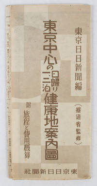
[TōKYō NICHINICHI SHINBUN]. 東京日日新聞.
東亰中心の日歸り一、二泊健康地案内圖. Tōkyō chūshin no higaeri ichi ni-haku kenkōchi annaizu. Healthy Places - Birds-eye View Map around Tokyo
東京日日新聞社. Showa 14 19391939. Title on map :東京中心の健康地案内鳥瞰圖. Tōkyō chūshin no kenkōchi annai chōkanzu. <br>Colour map of region around Tokyo with inset map in lower right corner. Few closed tears along central fold larger tear repaired small holes at folds a little light browning. Measures 19.5 cm x 9.5 cm when folded and 38.7 cm x 54 cm when open. Bird's eye view map of the region around Tokyo showing places where the residents of the city can go for healthy one two or three day trips. The map published by the Tokyo Nichi Nichi Newspaper in 1939 highlights hot springs golf courses beaches parks fishing areas mountains shrines and ski areas. The mark ハ indicates hiking courses. On the reverse side the distance to each resort area the way to get there and the costs are detailed. Users of the map area are warned that the areas circled in red around the mouth of Tokyo Bay is a military area where photos cannot be taken without permission. Even with the rising tides of war in 1939 city people were clearly still looking for ways to escape the noise and dust of the city for health-giving recreation. . 東京日日新聞社. unknown
Bookseller reference : 163423
|
|
|
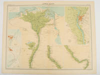
JOHN BARTHOLOMEW & CO.
Lower Egypt.
London.: The Times. 1920. Map printed in colour 47 x 59.5 cm sheet showing cultivated land in green and desert in cream five insets: Port Said Suez Environs of Cairo and two showing continuations of the Nile; original fold two small edge tears but in very good condition. Attractive large map prepared as plate 79 from "The Times Survey Atlas and Gazeteer of the World". . The Times. unknown
Bookseller reference : 47836
|
|
|
Kiwi Maps
New Zealand Travellers Road Atlas: 4th edition
C.A. Boot. Used - Good. Good condition. 4th edition. new zealand maps A copy that has been read but remains intact. May contain markings such as bookplates stamps limited notes and highlighting or a few light stains. C.A. Boot unknown
Bookseller reference : D15OS-00379
|
|
|
National Geographic Maps
National Geographic Road Atlas 2026: Scenic Drives Edition United States Canada Mexico National Geographic Recreation Atlas
National Geographic Maps 2025 Soft cover. New. National Geographic Maps paperback
Bookseller reference : ABE-1748188323721 ISBN : 1566957060 9781566957069
|
|
|
Compass Maps
Marin County
Compass Maps. Trade paperback. Very good. Prompt shipment with tracking. we ship in CLEAN SECURE NEW boxes Very good trade paperback map clean Compass Maps paperback
Bookseller reference : GrayTPB2KW100
|
|
|
Trakker Maps
Orlando Area
Trakker Maps Inc. Trade paperback. Good. Prompt shipment with tracking. we ship in CLEAN SECURE NEW boxes Good trade paperback map some stains Trakker Maps, Inc paperback
Bookseller reference : GrayTPB2KW087
|
|
|
Flash Maps
Instant Guide to Washington
Random House 1987. Trade paperback. Very good. Prompt shipment with tracking. we ship in CLEAN SECURE NEW boxes Very good trade paperback clean Random House paperback
Bookseller reference : GrayTPB2KW104
|
|
|
Harvey Maps
Wales Coast Path 3 Map - Cardigan to Llanelli XT40
Harvey Maps 2023. Map. New. 1st ed april 2023 edition. 2 pages. 9.49x8.31x0.39 inches. Harvey Maps unknown
Bookseller reference : __1851376623 ISBN : 1851376623 9781851376629
|
|
|
International Travel Maps
Southern Africa Map
map. Good. Access codes and supplements are not guaranteed with used items. May be an ex-library book. unknown
Bookseller reference : 1553410270.G ISBN : 1553410270 9781553410270
|
|
|
Thomas Brothers Maps
Thomas Guide 2002 San Diego County Including Portions of Imperial County: Street Guide and Directory
spiral_bound. Good. Access codes and supplements are not guaranteed with used items. May be an ex-library book. unknown
Bookseller reference : 1581743505.G ISBN : 1581743505 9781581743500

|
|
|
Maps, Surf
Baja Norte & Baja Sur: Surf Maps Atlas by Surfmaps.com
paperback. Good. Access codes and supplements are not guaranteed with used items. May be an ex-library book. paperback
Bookseller reference : 1607468719.G ISBN : 1607468719 9781607468714

|
|
|
Common English Bible; National Geographic Maps [Illustrator]
CEB Common English Bible New Testament Softcover
Common English Bible 2010-10-01. Paperback. Very Good. Prompt shipment with tracking. we ship in CLEAN SECURE NEW boxes Very good paperback with clean pages. Minor creasing. Common English Bible paperback
Bookseller reference : ware509mm106 ISBN : 1609260066 9781609260064

|
|
|
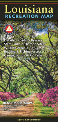
Benchmark Maps
LOUISIANA RECREATION MAP
Sheet map folded. New. Louisiana is truly a Sportsman's Paradise. From the northern Piney Hills to the brackish swamps of the Atchafalaya Basin the state is rich with water and woodlands recreation. unknown
Bookseller reference : A9780783499260 ISBN : 0783499264 9780783499260
|
|
|
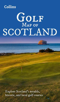
Collins Maps
Collins Golf Map of Scotland
Sheet map folded. New. unknown
Bookseller reference : A9780008720278 ISBN : 0008720274 9780008720278
|
|
|
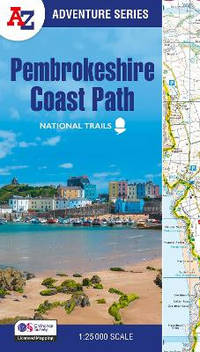
A-Z Maps
Pembrokeshire Coast Path: with Ordnance Survey mapping A-Z Adventure Series
Paperback / softback. New. paperback
Bookseller reference : A9780008727765 ISBN : 0008727767 9780008727765
|
|
|
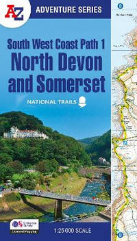
A–Z maps
South West Coast Path – North Devon & Somerset: with Ordnance Survey mapping A-Z Adventure Series
Paperback / softback. New. paperback
Bookseller reference : A9780008707651 ISBN : 0008707650 9780008707651
|
|
|
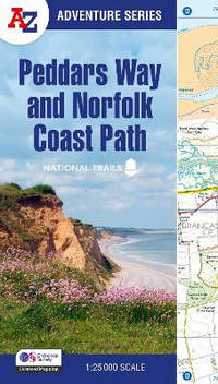
A-Z Maps
Peddars Way and Norfolk Coast Path: with Ordnance Survey mapping A-Z Adventure Series
Paperback / softback. New. paperback
Bookseller reference : A9780008727734 ISBN : 0008727732 9780008727734
|
|
|
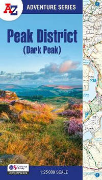
A Z Maps
Peak District Dark Peak: with Ordnance Survey mapping A-Z Adventure Atlas
Paperback / softback. New. <p>The <strong>A-Z Adventure Series</strong> uses Ordnance Survey mapping and is the perfect companion for walkers off-road cyclists and anyone wishing to explore the great outdoors.</p> paperback
Bookseller reference : A9780008744205 ISBN : 0008744203 9780008744205
|
|
|
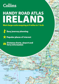
Collins Maps
Collins Handy Road Atlas Ireland
Paperback / softback. New. paperback
Bookseller reference : A9780008716523 ISBN : 0008716528 9780008716523
|
|
|
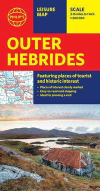
Philip's Maps
Philip's Outer Hebrides: Leisure and Tourist Map: Leisure and Tourist Map
Sheet map. New. Brand new edition of this easy-to-use Philip's sheet map of the Outer Hebrides giving detailed coverage of the area's road network and featuring all the major places of tourist and historic interest. unknown
Bookseller reference : A9781849077071 ISBN : 184907707x 9781849077071
|
|
|
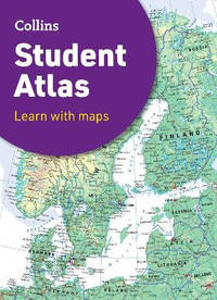
Collins Maps
Collins Student Atlas Collins School Atlases
Paperback / softback. New. The perfect GCSE Atlas to get ready to go back to school. paperback
Bookseller reference : A9780008652852 ISBN : 0008652856 9780008652852
|
|
|
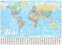
Collins Maps
Collins World Wall Paper Map
Sheet map folded. New. Explore the world with a Collins wall map unknown
Bookseller reference : A9780008712570 ISBN : 0008712573 9780008712570
|
|
|
Med Maps Inc
New England Lighthouses
Med Maps Inc. Trade. Very Good. Prompt shipment with tracking. we ship in CLEAN SECURE NEW boxes Very Good trade; 4 to; Small nick on bottom edge; prompt shipping with tracking Med Maps Inc unknown
Bookseller reference : BING593KSB012
|
|
|
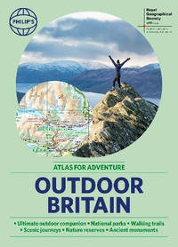
Philip's Maps
Philip's RGS Outdoor Britain: An Atlas for Adventure: A4 Paperback with handy flaps
Paperback / softback. New. Ever wanted to explore Britain's finest National Parks go surfing on the best beaches or follow the Pilgrims' Trail <i>Philip's RGS Outdoor Britain</i> maps it all from the majestic heights of the Scottish Highlands to the lush valleys of Wales and all the heritage and activities in between. paperback
Bookseller reference : A9781849076777 ISBN : 1849076774 9781849076777
|
|
|
Atkeson, Ray; maps by Dee Molenaar
Northwest Heritage The Cascade Range
Charles H. Belding 1969. with dustjacket hardcover. acceptable; used. Prompt shipment with tracking. we ship in CLEAN SECURE NEW boxes folio; 182 pages; acceptable hardcover with dustjacket; dustjacket stain scuff crease nicks to edges; spine starting; spine slanting; foxing to eges; some tanning; few faint stains; otherwise clean pages; prompt shipping with tracking Charles H. Belding hardcover
Bookseller reference : bing77np001
|
|
|
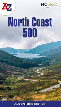
A-Z Maps
North Coast 500: Plan your next adventure with A-Z A-Z Adventure Series
Paperback / softback. New. <p>The <strong>A-Z Adventure Series</strong> of maps is the perfect companion for walkers off-road cyclists and anyone wishing to explore the great outdoors.</p> paperback
Bookseller reference : A9780008660635 ISBN : 0008660638 9780008660635
|
|
|
Cooley, John K.; with maps by McDonnell, Charles
Baal Christ and Mohammed: Religion and Revolution in North Africa
Holt; Rinehart and Winston. hardcover with dustjacket. good; used. Prompt shipment with tracking. we ship in CLEAN SECURE NEW boxes 8vo; 367 pages; good hardcover with dustjacket; bookclub ediiton; first edtiion; slight chips to bottom edge; dustjacket scuffs slight tears taped to boards by a previous powner tips bumped with slight fray or tear; board tips bumped; spine starting to slant; some foxing; deckling starting; tanning to edges; clean pages; prompt shipping with tracking Holt; Rinehart and Winston hardcover
Bookseller reference : BING835NP087
|
|
|
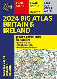
Philip's Maps
2024 Philip's Big Road Atlas Britain and Ireland: A3 Paperback
Paperback / softback. New. <b>No. 1 in the UK for clear maps </b>Philip's bring you the latest large format Big Road Atlas Britain and Ireland 2024 with fully updated maps from the Philip's digital database. The maps are super-clear and have been voted Britain's clearest and most detailed in an independent consumer survey. paperback
Bookseller reference : A9781849076210 ISBN : 1849076219 9781849076210
|
|
|
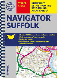
Philip's Maps
Philip's Navigator Street Atlas Suffolk
Spiral bound. New. The only county Street Atlas with all the named streets of Suffolk and perfect back-up for emergency services delivery drivers visitors and locals. unknown
Bookseller reference : A9781849076357 ISBN : 1849076359 9781849076357
|
|
|
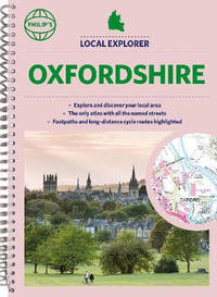
Philip's Maps
Philip's Local Explorer Street Atlas Oxfordshire
Spiral bound. New. <b>Philip's created this new series for walkers cyclists and local explorers at a scale that provides greener options to uncover all the nature and hidden gems in your local area. From </b><b>Abingdon-on-Thames</b><b> to Wootton we cover Oxfordshire in enticing detail.</b> unknown
Bookseller reference : A9781849076326 ISBN : 1849076324 9781849076326
|
|
|
A?Z Maps
A A-Z EDINBURGH HIDDEN WALKS: Discover 20 routes in and around the city: Discover 20 routes in and around the city
paperback. Good. Access codes and supplements are not guaranteed with used items. May be an ex-library book. paperback
Bookseller reference : 0008496315.G ISBN : 0008496315 9780008496319

|
|
|
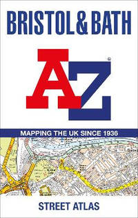
A-Z Maps
Bristol and Bath A-Z Street Atlas
Paperback / softback. New. Navigate your way around Bristol and Bath with this detailed and easy-to-use A-Z Street Atlas. <p>Printed in full-colour paperback format this atlas contains 104 pages of continuous street mapping. More than 12800 streets indexed. Large scale 6.25 inches to 1 mile map.</p> paperback
Bookseller reference : A9780008560447 ISBN : 0008560447 9780008560447
|
|
|
Maps International
Snowdonia Rock Climbs Collect & Scratch Print
Other cartographic. New. Set your sights on a new climbing challenge with the Scratch Off Snowdonian Climbs Print! unknown
Bookseller reference : A9781913834906 ISBN : 1913834905 9781913834906
|
|
|
Philips Maps
Philips Modern School Atlas 99th Edition Philips World Atlas
Philips. Hardcover. Used; Good. Simply Brit welcome to our online used book store where affordability meets great quality. Dive into a world of captivating reads without breaking the bank. We take pride in offering a wide selection of used books from classics to hidden gems ensuring theres something for every literary palate. All orders are shipped within 24 hours and our lightning fast-delivery within 48 hours coupled with our prompt customer service ensures a smooth journey from ordering to delivery. Discover the joy of reading with us your trusted source for affordable books that do not compromise on quality. 04/04/2019 Philips hardcover
Bookseller reference : 3366020 ISBN : 1849074925 9781849074926
|
|
|
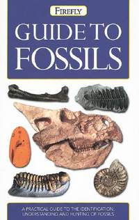
Maps, Philip's
Philip's Guide to Fossils
Firefly Books Ltd 2004. Trade Paperbac. Very good trade paperback. Prompt shipment with tracking. we ship in CLEAN SECURE NEW boxes Earth Sciences: VERY GOOD TRADE PAPERBACK SOME MINOR NICKS AND CREASES POSSIBLE TIPS BUMPED OTHERWISE CLEAN PAGES PROMPT SHIPPING WITH TRACKING. Firefly Books Ltd paperback
Bookseller reference : Bing732KG094 ISBN : 1552978125 9781552978122
|
|
|
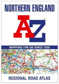
A-Z maps
Northern England Regional A-Z Road Atlas
Paperback / softback. New. paperback
Bookseller reference : A9780008532192 ISBN : 0008532192 9780008532192
|
|
|
Action Marketing Maps Corporation
San Francisco and the Bay Area
Action Marketing Maps Corporation. Map foldout. Good. Prompt shipment with tracking. we ship in CLEAN SECURE NEW boxes Good Map. Normal marks and softening at creases. 8vo. unknown
Bookseller reference : Bing774AL010
|
|
|
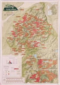
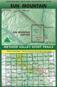
Maps, Green Trails
Sun Mountain Methow Valley WA No. 83S Green Trails Maps
map. Good. Access codes and supplements are not guaranteed with used items. May be an ex-library book. unknown
Bookseller reference : 168051489X.G ISBN : 168051489X 9781680514896
|
|
|
Collins Maps
Collins School Atlas for Trinidad and Tobago: Workbook Collins School Atlas
Paperback / softback. New. An introductory atlas for secondary schools perfectly designed to support and motivate Key Stage 3 students in geographical and mapping skills. paperback
Bookseller reference : A9780008403560 ISBN : 0008403562 9780008403560

|
|
|
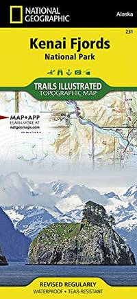
National Geographic Maps
Kenai Fjords National Park: Trails Illustrated National Parks
Sheet map folded. New. unknown
Bookseller reference : A9781566953856 ISBN : 1566953855 9781566953856
|
|
|
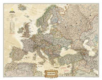
National Geographic Maps
Europe Executive Laminated: Wall Maps Continents
Sheet map. New. unknown
Bookseller reference : A9780792289845 ISBN : 0792289846 9780792289845
|
|
|
National Geographic Maps
The Balkans Classic Tubed: Wall Maps Countries & Regions
Sheet map rolled. New. unknown
Bookseller reference : A9781597754040 ISBN : 1597754048 9781597754040

|
|
|
National Geographic Maps
Yellowstone Se/yellowstone Lake: Trails Illustrated National Parks
Sheet map folded. New. unknown
Bookseller reference : A9781566954365 ISBN : 1566954363 9781566954365

|
|
|
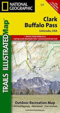
National Geographic Maps
Clark/buffalo Pass: Trails Illustrated
Sheet map folded. New. unknown
Bookseller reference : A9781566952859 ISBN : 1566952859 9781566952859
|
|
 Receive by email
 Download as PDF document
 RSS feed


