|
No Author
Handy Map & Guide to London with index to Streets Cruchley's Handy Map of London
<p>Gall & Inglis' 1870's-1880's. Paperback. Very good. VGC.Gall & Inglis'.No date given but probably 1870's to 1880's prior to London Tower Bridge build which is not included on the map.Green hardbacksmall dentsnicks and light shelf wear on the cover with folded map in VGC.The map is in VGC but with small stain marks and foxing marks on the edgessmall tear on the edge of the map.The map is hand coloured and includes:RailwaysRailway StationsSteamer RoutesOmnibus and Tramway RoutesParks.The size of the map is: 30x20 inch.The scale of the map is: 3 3/4 to 1 mile.The map covers: From Hyde Parkincluding parts of Kensington Palace to Blackwall and from Mildmay Park to South Lambeth.The map is in VGC for its age. A collectable and scarce map.</p> Gall & Inglis' paperback
Bookseller reference : 5388

|
|
|
Streetmaster Street Maps
Shrewsbury Oswestry Market Drayton Whitchurch Bishops Castle Ellesmere Wem Streetmaster Street Maps
Atlas Publishing 1990. Paperback. Very Good. 0x0x0. Undated circa 1990's. A Fine clean map with no tears. No previous ownership markings. Atlas Publishing paperback
Bookseller reference : 104439 ISBN : 1859826245 9781859826249
|
|
|
Philip's Maps
Philip's Street Atlas Isle of Wight: Pocket Edition
Paperback. Acceptable. paperback
Bookseller reference : GOR007805775 ISBN : 054008638X 9780540086382

|
|
|
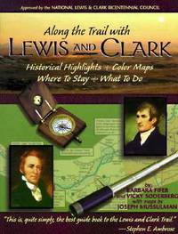
Fifer, Barbara; Soderberg, Vicky; With Maps By Mussulman, Joseph
Along The Trail With Lewis And Clark: Historical Highlights Color Maps Where To Stay What To Do
Montana Magazine. Vg In Wraps. Pages Clean & Tight. Pages: 208. 1998. Trade Paperback. Montana Magazine paperback
Bookseller reference : MASTER274963I ISBN : 156037117X 9781560371175
|
|
|
Peterson, Roger Tory - Text And Illustrations. Maps By Peterson, Virginia Marie
A Field Guide To Western Birds - Peterson Field Guide Third Edition Completely Revised and Enlarged
Boston: Houghton Mifflin Company. Vg In Wraps. Lightly Worn. A Completely New Guide To Field Marks Of All Speices Found In North America West Of The 100th Meridian & North Of Mexico. Pages: 432. 1990. Trade Paperback. Houghton Mifflin Company paperback
Bookseller reference : MASTER259778I ISBN : 039551424X 9780395514245

|
|
|
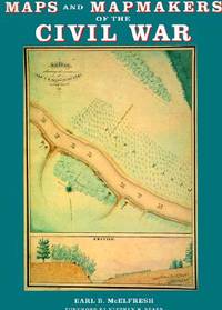
McElfresh, Earl B
Maps and Mapmakers of the Civil War
Boston Massachusetts U.S.A.: Harry N Abrams Inc 1999. 272pp/180 illustrations including 150 plates in full color. The largest most comprehensive & most beautifully illustrated collection of Civil War maps ever published. Still shrink wrapped. First Edition. Hard Cover. New/New. 4to - over 9¾" - 12" tall. Harry N Abrams Inc hardcover
Bookseller reference : 007290 ISBN : 0810934302 9780810934306
|
|
|
Stanford's Library & Commercial Maps
A Map of the Countries Between Constantinople and Calcutta Including Turkey in Asia Persia Afghanistan and Turkestan
Edward Stanford. Good. . This is a large folding coloured linen backed map. Map is clean with minimal wear. No copyright date is given. Edward Stanford unknown
Bookseller reference : mon0003321896
|
|
|
Tucker, Glenn [author]; Tucker, WT. [maps] W. T.
POLTROONS AND PATRIOTS : A POPULAR ACCOUNT OF THE WAR OF 1812 Two volumes
Indianapolis: Teh Bobbs-Merrill Company 1954. First edition. Hardcover. Octavo Two volumes continuous paging: xiii 812 pages. In Good plus condition. Spine is blue with gold print on red banner. Boards in blue cloth with gold print. Light wear to spine caps and corners toning to spine. Illustrated with b&w frontispieces plates and maps. 1371593. FP New Rockville Stock. Teh Bobbs-Merrill Company hardcover
Bookseller reference : 1371593
|
|
|
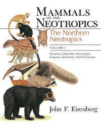
Eisenberg John Frederick; Redford Kent Hubbard authors; Reid Fiona illustrator; Bonner Sigrid James maps
MAMMALS OF THE NEOTROPICS Three volumes
Chicago: The University of Chicago Press 1989-1999. Softcover. Octavo Three volumes. In Good condition. Spines are white with black print. Covers has slight edge wear light shelf wear light creasing on first volume.Text blocks have embossed owner stamp on front flyleaf. Illustrated with b&w drawings and color plates. <br /> <br /> CONTENTS: Vol. 1. The Northern Neotropics : Panama Colombia Venezuela Guyana Suriname French Guiana 1989; ISBN 0226195406; x 449 pages - Vol. 2. The Southern Cone : Chile Argentina Uruguay Paraguay 1992; ISBN 0226706826; 430 pages - Vol. 3. The Central Neotropics : Ecuador Peru Bolivia Brazil hardcover in dust jacket; 1999; ISBN 0226195414; x 609 pages. <br /> <br /> Oversized books. Additional postage necessary for expedited/international orders. Economy International shipping unavailable due to size/weight restrictions. For international/expedited customers please inquire for rates.<br /> <br /> <p>NOTE: Shelved in Room X Case #3. 1370310. FP New Rockville Stock. The University of Chicago Press unknown
Bookseller reference : 1370310 ISBN : 0226195406 9780226195407
|
|
|
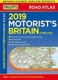
Philip's Maps
Philip's 2019 Motorist's Road Atlas Britain and Ireland A3: Large-format paperback Philips Road Atlas
Paperback. Very Good. paperback
Bookseller reference : GOR011329163 ISBN : 1849074739 9781849074735
|
|
|
Philip's Maps
Philip's Astronomy Dictionary
Paperback. Very Good. paperback
Bookseller reference : GOR010020650 ISBN : 0540060151 9780540060153

|
|
|
Stackpole, Edouard J & Wilbur S. Nye (Maps by)
From Cedar Mountain to Antietam August-September 1862
Harrisburg PA: Stackpole Company. Very Good in Very Good dust jacket. 1959. 1st Edition; 1st Printing. Hardcover. Hardcover with dustjacket "Cedar Mountain - Second Manassus - Chantilly - Harper's Ferry - South Mountain - Antietam" book has a small number of tan spots on the fore-edge and is in great shape otherwise the binding is tight and the contents are fine the jacket has mild edge-wear at the spine-ends and corners and is also in excellent overall condition the original price 5.95 is present and a professional removable mylar cover is included also includes illustrations and maps; 466 pages . Stackpole Company hardcover
Bookseller reference : 054229
|
|
|
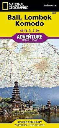
National Geographic Maps
BaliLombok and Komodo Map: Travel Maps International Adventure Map National Geographic Adventure Map
Paperback. Very Good. paperback
Bookseller reference : GOR009007062 ISBN : 1566955254 9781566955256
|
|
|
Ward, Bob; maps by Ann Ward
Mountain Biking in tthe Northern Sierra - Volume Two: Grouse Ridge and the Excelsior District
Sacramento CA: Bobo Ptroductions 1990. Not stated presumed 1st edition. PB in b/w-photo wraps saddle-stapled. Fine unmarked no spine creases. More great mountain bike getaways mapped and described b/w photos. Bright tight clean unused PB copy. <br/><br/>5-1/2 x 8-1/2 86 pp b/w maps & photos. Bobo Ptroductions paperback
Bookseller reference : 42329
|
|
|
Collins Maps
Collins Student Atlas
Collins UK. paperback. Good. 8x0x10. Book Leaves in 1 Business Day or Less! Leaves Same Day if Received by 2 pm EST! Cover has some wear mostly corners and binding. Good. Collins UK paperback
Bookseller reference : 087-05-00214 ISBN : 0007591381 9780007591381

|
|
|
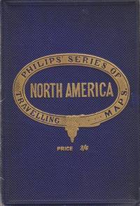
EDITED ERNEST RHYS ,DECORATED ENDPAPERS FORMER OWNER NAME, INCLUDES NUMEROUS MAPS IN COLOR WITH INDEX, GAZETTEER, ETC
A LITERARY & HISTORICAL ATLAS OF ASIA EVERYMAN’S LIBRAry #633 STATED 1ST PUBLISHED THIS EDITION 1912 in Purple dj with design in b/w on Front INCLUDES NUMEROUS MAPS IN COLOR WITH INDEX GAZETTEER OF TOWN & PLACES ETC REFERENCE 4TH IN SERIES OF SPECIAL ATLASES DESIGNED FOR EL
<p>HBDJ STATED 1ST PUBLISHED THIS EDITION 1912 SMALL PURPLE EMBOSSED CLOTH CVRLITE RUB WEAR VG/VG AS-IS BACK OF DJ MENTIONS OVER 960 VOLUMES ENDS WITH ZOLA 226 PGS INDEX LIST OF TITLES OUTER SPINE CVR HAS SMALL NICK DEALS WITH COUNTRIES OF ASIA WHOSE HISTORY & GEOGRAPHY ARE ALIKE RELECTED IN MAPS. & CHARTS THAT FOLLOW Philipine Islands JAVA EAST INDIES AUSTRALIA MADRAS CEYLON SIBERIA KOREA MANCHURIA JAPAN SINGAPORE FAR EAST ETC</p> J. M.DENT EVERYMAN’S LIBRARY LONDON hardcover
Bookseller reference : 30210
|
|
|
Odgers, Sally Farrell; Hinch, Jennifer (maps).
Tasmania - A Guide.
Sydney Kenthurst: Kangaroo Press 1991. Reprint ed. Paperback trade very good condition black & white text-photos maps minor edgewear. 224 pp. This comprehensive book looks at places of historic and scenic interest and includes a number of tourist attractions specifically designed for young travellers. Sally Farrell Odgers a Tasmanian herself has travelled most of the routes and explored many of the places she writes about here. Kangaroo Press paperback
Bookseller reference : 28527 ISBN : 0864172362 9780864172365
|
|
|
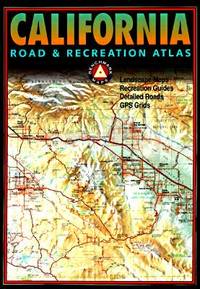
Benchmark Maps
California Road & Receation Atlas
Benchmark Maps 1998. Oversize PB in colr maps wraps saddle-stapled. Fair unmarked taped spine worn wraps. Oversize Landscape Maps Recreation Guides Detailed Roads GPS Grids. The best color maps; beat-up but intact used PB copy. <br/><br/>10-1/2 x 15-1/4 127 pp color maps indexes recreation guide. Benchmark Maps paperback
Bookseller reference : 42201 ISBN : 0929591437 9780929591438
|
|
|
Thorp, Willard L., Editor; Maps,
The United States and the Far East. Second Edition
Prentice-Hall Spectrum. Very Good in Very Good dust jacket. 1962. Paperback. 1.5 x 8.4 x 5.9 Inches. . Prentice-Hall Spectrum paperback
Bookseller reference : 63057
|
|
|
Combined Maps
Combined Maps of Greater London and Central London
London: Combined Maps Inc. Good with no dust jacket. No pub date. Paperback. New & revised . Combined Maps, Inc. paperback
Bookseller reference : 83448
|
|
|
Maps
The Map Book
New York: Harcourt. Good with no dust jacket. 1988. Paperback. 0153729198 . LandmarkEditio; H B J Social Studies Outline Maps and Fact Sheets for States Regions and Countries/Owner Inscription; 0153729198. . Harcourt paperback
Bookseller reference : 79332 ISBN : 0153729198 9780153729195
|
|
|
Thomas Brothers Maps
La Orange 1994-Map
Thomas Brothers Maps 1993-09-01. Unbound. Good. 1.1700 11.7800 8.5000. Thomas Brothers Maps unknown
Bookseller reference : mon0003257953 ISBN : 0881306355 9780881306354
|
|
|
Thomas Brothers Maps
La Orange 1994-Map
Thomas Brothers Maps 1993-09-01. Unbound. Acceptable. 1.1700 11.7800 8.5000. Evidence of previous water damage. Thomas Brothers Maps unknown
Bookseller reference : mon0002600890 ISBN : 0881306355 9780881306354
|
|
|
Maps, Butler Motorcycle
Butler Maps G1 State Maps : Colorado
Butler Maps Inc 2010-01-01. Good. 2010. Map. 0984559000 . Map has a bit of improper folding from previous owner. . Butler Maps Inc 2010-01-01 unknown
Bookseller reference : 06GW23-602-213f ISBN : 0984559000 9780984559008
|
|
|
Philip's Maps
Street Atlas Cornwall
Paperback. Acceptable. paperback
Bookseller reference : GOR004164023 ISBN : 0540083291 9780540083299

|
|
|
Wavell Gen Sir Archibald; 15 maps/plans 14 Pp Photos Illustrator
Allenby: A Study in Greatness
Oxford Univ Press 1941-01-01. Hardcover. Good. No dust jacket. Cloth boards have fading of color to the top edge and spine. Clean has a good binding no marks or notations. Oxford Univ Press hardcover
Bookseller reference : 197431
|
|
|
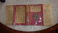
Philip's Series of Travelling Maps
North America
London UK: George Philip & Son Ltd. Good. 0. Hardcover. Dark blue cloth boards with gilt title. Map folds out to 22 x 28 inches. No date circa 1900s. Boards worn on edges corners bumped spine starting to split.; Book; 12mo - over 6¾ - 7¾" tall . George Philip & Son, Ltd. hardcover
Bookseller reference : 006893
|
|
|
Trevelyan Raleigh & B/W Illus; Maps & Cartoons
Rome '44 the Battle for the Eternal City
Easton Press. Very Good with no dust jacket. 1990. Hardcover. Leather-bound hard cover published by Easton Press in 1990. No dust jacket. Black leather covers with gilt decorations and lettering. Corners are slightly bumped. Spine has three raised bands. Page edges are gilt-covered. Silk moire endpapers. Gray satin bookmark ribbon is attached to headband. Included are an unused and unattached bookplate from Easton Press and the Collector's Notes from Easton Press. Book is in very good plus condition. Large 8vo 366 pages 2.2 lb. ; Large 8vo 9" - 10" tall; 366 pages . Easton Press hardcover
Bookseller reference : MST13651
|
|
|
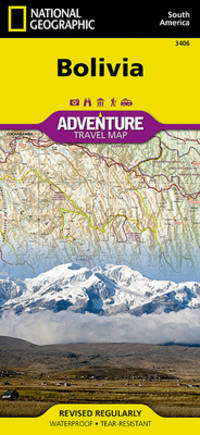
National Geographic Maps
Bolivia National Geographic Adventure Map 3406
Natl Geographic Society Maps 2019-01-01. 2019. Map. New. Distributor bookstore overstock. Unused. Light shelfware. Natl Geographic Society Maps unknown
Bookseller reference : 21-09-12-gw-3873-jm ISBN : 1566956501 9781566956505
|
|
|
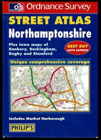
Philip's Maps
Ordnance Survey Northamptonshire Street Atlas
London: Philip's. Minor rubbed board corners else minimal wear. . Very Good. Hardcover. 1999. Philip's hardcover
Bookseller reference : 074059 ISBN : 0540077453 9780540077458
|
|
|
(Minnesota Rivers, Maps)
Snake Upper Red and Minnesota Rivers Minnesota; Reservoirs at Sources of rock River Wisconsin and Illinois
Washington DC: U. S. Congress. Very Good. 1881. Pamphlet. Snake Upper Red and Minnesota Rivers Minnesota; Reservoirs at sources of Rock River Wisconsin and Illinois. Letter from the Secretary of War transmitting surveys .United States. War Department. 1881. 16 pages maps 2 folded ; 23 cm. Washington Govt. Print. Off. 1881. Disbound Pamphlet. The contents are nice and the 2 folding maps are bright and clean. . U. S. Congress unknown
Bookseller reference : 74181
|
|
|
[Caribbean Maps]: Norie, J. W.
THE ISLAND OF ANTIGUA. Revised by J.W. Norie 1827
Antigua but actually Philadelphia: R.B. Eldridge & Co 1860. Lithographic sheet map 20 1/2 x 26 1/2 inches. Backed with contemporary blue paper. Light foxing and toning. A few small tears in margins. Very good. An unusual lithographic edition of Norie's 1827 revision of this handsome chart lithographed by Wagner & McGuigan in Philadelphia. A statement in the cartouche reads: "Presented by R.B. Eldridge Antigua to Captain Andrew Tyler." The captain's name is accomplished in manuscript. R.B. Eldridge is not listed in Tooley's DICTIONARY OF MAPMAKERS and appears to be unrelated to publisher of charts George Eldridge. It seems most likely that he was rather an Antigua merchant who commissioned a reprint of the chart for complimentary distribution to sea captains. A handsome piece. R.B. Eldridge & Co unknown
Bookseller reference : WRCAM48522

|
|
|
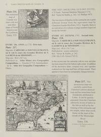
Early Printed Maps of Canada Vol. III 1703-1799
Early Printed Maps of Canada
Kershaw Pub 1997. First Edition. Hardcover. very Good/Very Good. 0x0x0. this copy has a solid tight binding with clean u unmarked pages light bit of edge wear to the dj from the shelf.Maps of Eastern Canada & Newfoundland The Maritimes Nova Scotia Halifax Prince Edward Island Sable Island Cape Breton Louisbourg & The Great Lakes. Kershaw Pub hardcover
Bookseller reference : js5667 ISBN : 096971842X 9780969718420
|
|
|
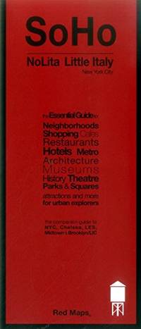
Red Maps
Red Map Soho-Nolita & Little Italy NYC - City Travel Guide
Paperback. Very Good. paperback
Bookseller reference : GOR011034021 ISBN : 1892238845 9781892238849
|
|
|
Collins Maps
Collins First Atlas
New. Never used book Harpercollins Uk
Bookseller reference : 0008101019 ISBN : 0008101019 9780008101015

|
|
|
ELISABETH HUBBARD LANSING , INNER DJ FLAP $2 , Numerous B/W Pictures & Maps by Syd Browne, B/W Illustrated Endpapers Tourist Ch
SEEING NEW YORK in Color Dustjacket A walking guide to Manhattan in the late 1930's with many Historical Anecdotes & charming sketches inside. Old Houses & Park Benches
New York: Thomas Y. Crowell. 1938. HBDJ 1938 1ST EDITION VG/GOOD 6 1/2 X 9 In. BEAUTIFUL RED CLOTH CVR With Printed Title & Illustration LABE on Front & Spine CvrL Hardcover. Book Condition: Very Good with Mild TONING PGS . Dust Jacket Condition: Good. First Edition; First Printing. DJ has some soiling EDGE chipping and wear with chips missing on DJ Spine Ends LIGHT Small CORNER FADE CVR 233 pgs INDEX Old Houses & Park Benches & Index NY IS A BIG EXCITING CITY. The Aquarium Statue of Liberty Empire State Building Syrian Candy Kitchen ETC Each chapter covers a Days Outing. . 1st Edition. Hardcover. Very Good/Good. Illus. by Syd Browne . New York: Thomas Y. Crowell. Hardcover
Bookseller reference : 28569

|
|
|
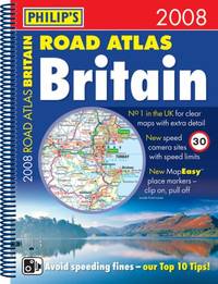
Philip's Maps
Philip's Road Atlas Britain 2008: Spiral A4
Paperback. Very Good. paperback
Bookseller reference : GOR001142712 ISBN : 0540090891 9780540090891
|
|
|
Lee, Weston & Jeanne, Color Photography & Text by. Endpapers & Maps by Don Perceval
Torrent in the Desert
Flagstaff: Northland Press 1962. First edition. Cloth. Very Good. 4to. 186 pp. Photographs of the Colorado River. Head and heel of spine and corners of boards lightly bumped minor dustsoiling to covers page edges tanned a few pages bumped at fore-edges book plate on front pastedown. Northland Press hardcover
Bookseller reference : 18008
|
|
|
Denson John editor in chief; Bacheller Martin A. editor in chief for maps
The Five Worlds of Our Lives: Ingredients and Results of War and Revolution
U.S.A. And Canada simultaneously: Newsweek Inc. and C.S. Hammond & Co. Inc. 1961 319 numbered pp; HB. Pages: clean bright tight speckled edgestain; a.e. lt tanned mildly cocked. Cover: brown padded leatherette gilt ornamentation front gilt titles spine; v lt shelfwear extrems slightly worn back b.e. bumped. An evaluation of "the deadly-sometimes hopeful-shape of things man hath wrought." Newsweek, Inc. and C.S. Hammond & Co., Inc. hardcover
Bookseller reference : 032779
|
|
|
Thomas Brothers Maps
Map-Orange/La Co
Thomas Brothers Maps 1985-10T. paperback. Good. . Thomas Brothers Maps paperback
Bookseller reference : mon0003148712 ISBN : 0881301639 9780881301632
|
|
|
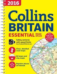
Collins Maps
2016 Collins Essential Road Atlas Britain
Paperback. Like New. paperback
Bookseller reference : GOR012436295 ISBN : 0008102309 9780008102302
|
|
|
Slesser, Malcolm & Photographs and Maps
Red Peak
Coward-McCann Inc. Near Fine in Very Good dust jacket. 1964. Hardcover. A book that is used but still very attractive with dustjacket. . ; 8.80 X 5.80 X 1.20 inches; 256 pages . Coward-McCann, Inc. hardcover
Bookseller reference : 112198

|
|
|
Hildebrand, JR., maps drawn by AHBumstead J. R. A. H.
Greatest Voyage in the Annals of the Sea- Magellans Voyage
National Geographic Magazine. Very Good with no dust jacket. 1932. magazine. very good condition SCARCE ORIGINAL VINTAGE ARTICLE These pages unbound are neatly trimmed & in mylar with a stiff backing board.; These pages unbound are neatly trimmed & in mylar with a stiff backing board.; NOVI005610; pages 6x9-1/2; 41 pages; Gold Lettering and design is still bright with introductions and notes . National Geographic Magazine unknown
Bookseller reference : 79933
|
|
|
ZURCHER, E. and JM. Pluvier (maps) J. M.
Buddhism: Its Origin and Spread in Words Maps and Pictures
Routledge 1962. Hbk 96pp an unnumbered section of full-color maps at the rear lacks dj near fine mustard boards with silver-gilt spine titles now in custom acetate jacket prev ownerÕs inscription on front endpaper otherwise a very good clean tight and unmarked copy Routledge, 1962 hardcover
Bookseller reference : BC401
|
|
|
Waters, Frank; Fechin, Nicolai (illus.); Annand, George (maps)
The Colorado
New York / Toronto: Rinehart & Company 1946. First Edition. Hardcover. Fine/Very Good. Part of "The Rivers of America" series edited by Hervey Allen and Carl Carmer. Cloth; illustrated dust jacket. With b/w and color illustrations and maps. Spine tips very lightly rubbed otherwise book is fine. Dust jacket very lightly rubbed a little scuffed along the edges; spine a bit sunned; VG not price-clipped presents nicely in mylar. <br/><br/> Rinehart & Company hardcover
Bookseller reference : GK2103
|
|
|
GA. Henty; WH. Overend (illustrations & maps) G. A. W. H.
Through Russian Snows-- A story of Napoleon's retreat from Moscow
New York N.Y.: Charles Scribner's Sons 1902. Reprint. Cloth . Good/No Jacket As Issued. Early reprint of classic historical novel. Red cloth with black lettering and black & silver decorative illustrations. Black tinted textblock edges. Front free end page is torn at gutter about two inches starting at bottom edge. 8 illustrated plates including frontispiece. And 3 illustrated map plates. Bright clean well preserved. A few tick marks within Scribner's list at end of book. Else appears without internal markin 339 pages plus 22 pages of Scribner books for sale. Charles Scribner's Sons hardcover
Bookseller reference : 251090
|
|
|
Bigelow, E. Victor; Photos maps fold-outs (Illustrator)
A Narrative History of the Town of Cohasset Massachusetts
The Committee on Town Histor 1981. Hardcover. Very Good/No Jacket as issued. 8.5 x 5.8 x 1.9. Hardcover. Book Condition: Very Good. Jacket Condition: No Jacket as issued. The Committee on Town Histor 1981. 561 pages. 3 great maps. Nice Firm Clean copy ! Light general wear. Size: 8.5 x 5.8 x 1.9. Originally published under The Committee on Town History 1898. History::Localities New England::History Maps 6304 6304 The Committee on Town Histor hardcover
Bookseller reference : 126450
|
|
|
Parkman, Francis; Maps (Illustrator)
Half-Century of Conflict in Two Volumes France and England in North America Part VI
Little Brown and Company 1892. Hardcover. Good/No Jacket. L 8vo 7.75 - 9.75'' tall. Hardcover. Book Condition: Good. Jacket Condition: No Jacket. Little Brown and Company 1892. A Series of Historical Narratives. Ex-Library Usual Markings. 333 395 pages. 2 volumes complete. Light general wear. Volume 2 spine top cloth frayed. Size: L 8vo 7.75 - 9.75'' tall. History::U.S.A.::Colonial History::Canada New England::History 7371 7371 Little, Brown and Company hardcover
Bookseller reference : 83511
|
|
|
Sherman James E. & Barbara H. Maps by Jim Cooper
Ghost Towns and Mining Camps on New Mexico
Norman: University of Oklahoma 1975. First edition. Wraps. Very Good. 4to 270 pp. illus. Spine slightly creased wrappers sunned and a bit edgeworn with small spot on front date in ink on halftitle. University of Oklahoma paperback
Bookseller reference : 8036 ISBN : 0806111062 9780806111063

|
|
|
Philip's Maps
Philip's Street Atlas of Edinburgh: De Luxe Edition Leopardskin Pattern
Hardback. Very Good. hardcover
Bookseller reference : GOR004629653 ISBN : 0540092185 9780540092185

|
|
 Receive by email
 Download as PDF document
 RSS feed


