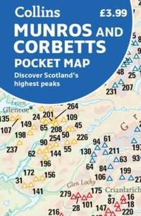
Sheet map folded. New. New Book; Fast Shipping from UK; Not signed; Not First Edition; Handy little full colour map of Scotland’s Munros and Corbetts. unknown
Bookseller reference : ria9780008520625_inp ISBN : 0008520623 9780008520625
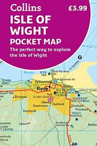
Sheet map folded. New. New Book; Fast Shipping from UK; Not signed; Not First Edition; Explore new places with handy pocket maps from Collins. Handy little full-colour map of the Isle of Wight. Detailed mapping and tourist information of the whole island. unknown
Bookseller reference : ria9780008579999_inp ISBN : 0008579997 9780008579999
Sheet map folded. New. New Book; Fast Shipping from UK; Not signed; Not First Edition; Full-colour handy guide to more than 60 of the most popular film and TV locations in Scotland. Striking images and detailed descriptions allow for a comprehensive guide to Scotland’s most recognisable filming sites in a con unknown
Bookseller reference : ria9780008602918_inp ISBN : 0008602913 9780008602918
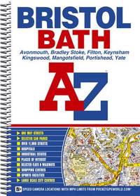
Spiral bound. New. New Book; Fast Shipping from UK; Not signed; Not First Edition; Navigate your way around Great Britain with this detailed and easy-to-use A-Z Road Atlas unknown
Bookseller reference : ria9780008652951_inp ISBN : 0008652953 9780008652951
Paperback / softback. New. New Book; Fast Shipping from UK; Not signed; Not First Edition; Navigate your way around Nottingham with this detailed and easy-to-use A-Z Street Atlas. Printed in full-colour paperback format this atlas contains 74 pages of continuous street mapping. paperback
Bookseller reference : ria9780008445188_inp ISBN : 0008445184 9780008445188
Sheet map folded. New. New Book; Fast Shipping from UK; Not signed; Not First Edition; This map is the perfect companion to take for exploring the Shetland Islands. It is packed with lots of information on where to find the best that this group of islands has to offer visitors. unknown
Bookseller reference : ria9781871149913_inp ISBN : 1871149916 9781871149913
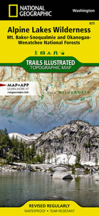
Natl Geographic Society Maps June 2017. Novelty . Very Good. Very Good Map. Pictures available upon request. A locally owned independent book shop since 1984. Natl Geographic Society Maps unknown
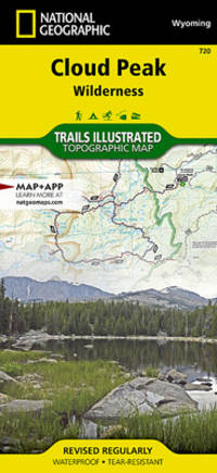
Natl Geographic Society Maps July 2017. Novelty . Very Good. Very Good Map. Pictures available upon request. A locally owned independent book shop since 1984. Natl Geographic Society Maps unknown
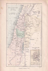
Cambridge University Press. circa1880. Engraved colour map 14.1x 8.2 cm map small inset map of Jerusalem inner edge a trifle ragged and two small marginal spots but in good condition. . Cambridge University Press. unknown
London: McCorquodale 1903. First edition of this atlas map folio 16 1/4 x 27 1/2 inches. 5 sheets of British Commission maps and index map; 13 sheets of United States Commission maps Alaska boundary atlas and index map. Total of 20 maps 19 folding and 5 in color Maps are 53 x 32 inches. All but the British index map folded and backed in linen. Quarter red morocco over red cloth. Gilt Royal Seal to front board and spine. Maps mounted on linen and sectioned as issued. Portfolio case with moderate rubbing chipping to leather. Does not include the 10 cards to accompany the U.S. Commission maps seems to be common that these smaller ones are missing. Old staining to cloth. Toning and edge wear to British Index map. Slight toning and offsetting to maps. Overall a very good copy; quite scarce. [McCorquodale] hardcover
HarperCollins Publishers Limited. Used - Good. Ships from the UK. Former library book; may include library markings. Used book that is in clean average condition without any missing pages. HarperCollins Publishers Limited unknown
Bookseller reference : 18773157-20 ISBN : 0008101566 9780008101565
Ottowa: Departement de L'Agriculture 1880. First edition. Octavo. Folding color map as frontispiece short tear 26 1 table of contents 9 ads two full page woodcuts of Manitoba farms and single page governments announcements pp. Publisher's pink printed wrappers. Split at spine but holding strong. A very good copy. Departement de L'Agriculture unknown
Los Angeles: Automobile Club of Southern California ca. 1940. A fine grouping of 14 pre-freeway California maps from the Automobile Club of Southern California. Housed in the original box given to the subscriber when he received them at his local office one end missing but attractive nonetheless. A few slight separation fold splits but overall in very good condition with the majority appearing to have never been opened.Maps are; Eastern Section of Los Angeles; Central Section of Los Angeles; Southern Section of Los Angeles; San Fernando Valley Section of Los Angeles; Orange County; Metropolitan Los Angeles; Imperial County; San Diego County; Kern County; San Luis Obispo County; Tulare County; Ventura County; Riverside County; California. Automobile Club of Southern California unknown
 Receive by email
 Download as PDF document
 RSS feed