4438 resultados
Map (117 x 102 cm). Not in Al Ankary; Al-Qasimi.
Hand-coloured engraved map (260 x 243 mm). Scale ca. 1:13,000,000. The Dutch edition of Jacques-Nicolas Bellin’s map, from Prévost's "Histoire générale des voyages (Paris, 1746). "This map is perhaps the original of the maps appearing in Prévost" (Tibbetts). Map of Arabia and the Red Sea emphasizes the coastlines and the interior is primarily left blank. The shoals and navigational hazards in the Red Sea and the pearl banks off the coast of Bahrain are also noted. Decorated with a title cartouche. - Well preserved. Tibbetts 267. Al Ankary 173. Not in Al-Qasimi. Cf. OCLC 164354184.
1954Folio (256 x 318 mm). VIII, (2), 96 pp. With 15 leaves of plates and several illustrations in the text. Original cloth with giltstamped spine title. Only edition. - Systematic account of fossilized foraminifera discovered in the desert of the Qatar Peninsula. OCLC 8202535. Not in Macro.
8vo. XIII, (3), 341, (1 blank) pp. With a double-page map on green paper, 40 double-sided plates, a green ornament on the title-page and some decorations in the text. Green cloth with gold lettering on front cover and spine. With dust jacket designed by F. Quilter. First edition of the second part of Freya Stark's autobiography, detailing her first extensive travels through the Middle East. Stark (1893-1993) was one of the first European travellers in certain parts of the Middle East, for example Southern Arabia. Apart from a four-volume autobiography, she has 21 other works to her name. Her autobiography and other works are illustrated with images of her own photographs she took of family and of the landscape and peoples during her travels. Her writing style was unusual for her time, since she wrote multifaceted works in a highly personal style, not only about her own life and travels but also about the geography, history, politics, and anthropology of the places she visited. In the present work Stark describes her experiences during the years 1928-1933. - Dust jacket is very slightly damaged with a small tear at the foot of the spine, restored with tape, edges are untrimmed, very slight browning throughout. Overall in very good condition. Bergé, Vente Collection Lazard L'Orient et la Terre Sainte (2008), 404. Blackmer 1470. Howgego IV, S 61. Shapero, The Islamic World (2003), 457. Cf. Canton, From Cairo to Baghdad British travellers in Arabia, pp. 118-121; cf. article "Freya Stark" in Encyclopaedia Britannica.
ref. 136955aafParis, Yves Meyer & Cie Imprimeurs, s.d., vers 1966). 27 x 36 cm, série complèt comme publiée (malgré le fait que qqs “Rules” ne son pas inclus (par ex. Rule 5 &19, pour Rule 12 ily a 2 diff. planches), chaque planche avec le cachet à froid de Perrier, portfolio / enveloppe avec titre & impression à froid: “offert par la source PERRIER”.
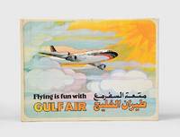
1974ref. 168084Bahrain: Gulf Public Relations 1974. First edition first printing of this pop-up book published by Gulf Air Public Relations in around 1970 with dual Arabic-English text by Ib Penick and illustrations by Gloria Nixon. The narrative revolves around Ahmed a boy who is flying from Manama to London with his parents. Quarto. 8 double-page full-colour illustrations by Gloria Nixon each one with a pop up all except the last with moving parts. Original coloured pictorial boards spine lettered in gold covers illustrated in colour and lettered in black and gold. Boards lightly toned spine lettering faded covers slightly soiled contents bright all moving parts in working order. A very good copy. hardcover
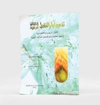
1995ref. 182920Kuwait: Markaz al-buhuth wa-al-dirasat al-Kuwaytiyah 1995. First edition of this well-illustrated study on the environmental impact of the destruction of oil wells in Kuwait based on government documents issued by the Iraqi government during the Gulf War. The work presents this damage substantiated by copious data as a main goal of the Iraqi war strategy of delayed sabotage. An appendix lists names of Iraqi officers accused of being "environmental criminals" as they took part in the identification of targets and methods and the execution of the plan - phases which are carefully described in the first part. The second part discusses subsequent damages to the economy public health and the environment including air and water pollution and their impact on living organisms. The third part describes the strategies employed to limit the damage such as the efforts of firefighters in extinguishing burning oil wells. Quarto. With facsimiles of documents colour illustrations and maps. Text in Arabic. Original pictorial wrappers wire-stitched as issued. Pencilled Arabic word at head of last verso. Extremities a trifle rubbed or creased contents clean: a very good copy. unknown
1896ref. 24979Berlin, Pitcairn-Knowles, Simon & Co. Januar-Juni 1896. Halbledereinband der Zeit mit goldgepr. Deckeltitel (Rücken an den Gelenken angebrochen und mit Brandspur. 3 Bl., 418 S. Mit zahlreichen photographischen Abbildungen. 2°. Papierbedingt gebräunt. Bis auf die Einbandbeschädigung gut erhaltenes Exemplar.
1929ref. 136431929 P., Etablissements Loubok, 1929, 1 vol. in-folio (395 x 290 mm), cartonné sous jaquette illustrée en bleu, jaune et palladium, de (28) pp.Petite rayure sans gravité sur le plat supérieur de la jaquette, transfert des encadrements de photos sur les pages en regard, très bel exemplaire, très rare dans cet état (l'ouvrage est généralement couvert de rousseurs).
1852Folio. 2 vols. 503, (1) pp. 460 pp. Dark brown calf bindings with fore-edge flap; oxydized giltstamped cover decorations); wants upper cover of vol. 1.
Small 4to. Together 15 pp. In stapled wrappers with handdrawn cover designs showing two angels, a shepherd with a lamb, and Bethlehem's star. Programmes of the Ras Tanura Protestant Fellowship, an organisation frequented by Aramco employees. The set includes schedules of the Sunday School, Vacation Bible School, and Christmas service. - Occasional small marginal flaws to wrappers.
Folio. (2), 6 pp. Loosely sewn as issued. On legal and social problems of the progress of the abolition of slavery and the new "free" status of former Zanzibar and Pemba slaves after their emancipation. - Hull University Library stamp on title-page. A very good copy. Bennett 2244.
Folio. IV, 69, (1) pp. Sewn, with remains of former spine. Rare British parliamentary papers and correspondence with local agents and officers on the slave trade, especially in Madagascar and off the south coast of Arabia. One item discusses the reported landing in Arabia of slaves from a French dhow, noting that "few French dhows go to Arabia without a few slaves who are sold" (p. 69). Comprises the sections "Zanzibar" (pp. 1-43); "Reports from Naval Officers - East Coast of Africa Station" (pp. 45-59); and "Appendix [Zanzibar]" (pp. 61-69). - A good copy. Bennett 495.
Folio. (2), 24 pp. Rare British parliamentary papers and correspondence on the early months of the rule of Sultan Barghash bin Said Al-Busaid of Zanzibar, anxious to re-establish the slave trade. With a reference to "probably the first [photographic views] taken of Muscat and its harbour". - Binding loosened; disbound from a volume of parliamentary papers.
Folio. (2), 19, (1) pp. Top edge gilt. Disbound. Rare British parliamentary papers and correspondence with local agents and officers on the slave trade, including an account of the murder, by slave traders, of the young schoolmaster and missionary student Benjamin Hartley on 28 January 1874. - Disbound from a volume of parliamentary papers but otherwise as issued, a very good clean copy. Bennett 497. Wilson p. 210.
890 x 620 mm. Scale: 1:1,000,000. First edition. Map of the western part of Yemen, including parts of Oman. - Stamped "Sales copy".
580 x 420 mm. Colour lithograph, signed "Ibrahim K." Mounted on styrofoam board. Bilingual safety poster in Arabic and English. - Traces of folds, some brownstaining to lower right corner.
565 x 425 mm. Colour lithograph, signed "A. Jawa". Mounted on styrofoam board. Bilingual safety poster in Arabic and English. - Traces of folds. Numbered "B61-2" in blue pen below the horizonat fold on the right.
965 x 710 mm. Scale 1:500,000. In excellent condition.
1020:710 mm. Scale 1:500,000. "For use by War and Navy Department Agencies only. Not for Sale or distribution". - In good condition.
Colour lithographed postcard, 130 x 90 mm. A very rare Ottoman postcard depicting a map of Yemen, including the Ottoman-dominated northern and western parts of the country (Sana'a, Taiz, and Al Hodeidah), as well as the British-dominated southern regions (Aden). The card was part of a series made by Ibrahim Hilmi, one of the premier Istanbul cartographers of the era. - Ibrahim Hilmi Cigiracan (1876-1963) was one of the most important publishers and cartographers of the late Ottoman Empire. Born in Tulcea (now in Romania), he founded his first printing shop in Istanbul in 1896, under the name "Kitaphane-i Islami" (Islamic Library), largely producing religious books. Subsequently, Hilmi became interested in military affairs, geography and history, and changed the name of his press to "Kitaphane-i Islam ve Askeri" (Islamic and Military Library). He published about 200 military books, and his atlases (especially his "Pocket Atlas") were among the most popular cartographic items throughout the empire. During WWI, Hilmi gained the affection of the public for his charitable programme of sending free books to poor children in Anatolia. - Hilmi's enterprise thrived until Atatürk's Republican regime nationalized the publishing of law and school books in the 1920s, undercutting the most lucrative part of his business. However, Hilmi left an enduring legacy, having published over a thousand books on a wide variety of topics over three decades. - Very good, overall clean and crisp, just some very light even toning and slight stains to verso.
Engraved map, outline coloured. 580 x 260 mm. An antique map showing the East African coastline, extending from the mouth of the Red Sea to the Island of Zanzibar. The work was originally included in Karl Müller's "Geographi Graeci minores", along with many other maps of the region. - The map is highly detailed, showing many settlements, mountains, wadis, and more. The map is composed of four insets, with the largest focusing on the Somali coast. Most interestingly, Müller models one inset after a Greco-Roman periplus describing the western Indian Ocean. On this inset, Müller notes the travel times between adjacent ports, ostensibly following the notes in the periplus. - Fold toning.
915:625 mm. Scale: 1:1,000,000. Second edition. Map of the coast of Oman from Salala in the West to Duqm in the North. - In excellent condition.
33 x 44 cm (neat line). Pencil on paper. Charming dressage scene between an Arab in back view and two bridled Arabian horses with luxurious saddles and a backdrop of tents. The stallion on the left is carrying a round shield and a bow. The signing artist Charles Paris was probably an amateur and is not otherwise known. - Professionally restored. The upper and right margins show traces of tears and brittleness, probably due to old water damage. Browning and minor foxing overall. Some light spotting to the lower margin. The drawing is little affected by the paper flaws.
ref. 19792Paris Imprimerie Royale 1838 in 8 (22x14) 1 volume reliure à la bradel demi percaline bleue, dos lisse, pièce de titre de cuir marron, XXIII et 296 pages, avec 1 planche gravée hors-texte, quelques rousseurs sur les premières et les dernières pages. Reliure fin XIXème. Ouvrage posthume publié sous les auspices du Ministère de l'Instruction Publique. Saint-Martin Antoine-Jean, membre de l'Académie royales des Inscriptions. Rare. Bel exemplaire ( Photographies sur demande / We can send pictures of this book on simple request )