Zambaur, Eduard von.MareMagnum

4 493 résultats
Folio. (1), 286 pp. With 26 folding plates. Original cloth. First edition, based on the unpublished 1942 proofs. The noted numismatist Eduard von Zambaur (1866-1947) was a specialist for the coinage of the Muslim peoples; in 1927 he published his "Manuel de Généalogie et de Chronolgie pour l'Histoire de l'Islam" (1927). - A perfect copy. OCLC 6321389.
8vo. (6), 437, (1 blank) pp. With a cut-out picture of a Bedouin woman on the verso of the half-title-page, a picture of "a typical Arab of Yemen" as the frontispiece, 15 plates, a floor plan of a mosque, 2 maps and numerous small illustrations in the text. Yellow cloth. An account of the history, geography, religion, and political and social situation of the Middle East, and especially of the Arabian Peninsula, from a Christian missionary point of view. This information is presented alongside accounts of the author's experiences, and it is illustrated with images of local peoples, landscapes and examples of Arabic script and music. According to the preface, this second edition of Zwemer's first work, first published in 1899/1900, was published in order to correct some minor errors that had made their way into the first edition because of the physical distance between the author and the publishers. At the time of publication, Zwemer was doing missionary work in Arabia, while his work was being published in the U.S. The present copy was published in Edinburgh and London, but apparently (according to the verso of the title-page) printed by the Caxton Press in New York. - Reverend Samuel Marinus Zwemer (1867-1952), sometimes nicknamed "the Apostle to Islam", was an American missionary, traveller and scholar. He was a part of the Reformed Church of America, meaning that his beliefs and later missionary work were rooted in Calvinistic traditions, and he was ordained within that church in 1890. Together with James Cantine and John G. Lansing, Zwemer founded the Arabian Mission, which was active from 1889 until 1913. During that time, Zwemer was active in Iraq, Bahrein, and several locations in Arabia. He also worked in Egypt and travelled extensively throughout Asia Minor. From 1929 until his retirement at the age of 70 in 1937 he taught at the Princeton Theological Seminary, as a professor of missions and as a professor of the history of religion. - Binding rubbed, soiled and slightly damaged around the corners, edges foxed, water stain in the top margin of the first leaves (until p. 14), hinges weak. With an inscription in German on the first flyleaf dated 17 January 1904; cut-out picture of a Bedouin woman pasted on the verso of the half-title. List of works in the NYPL relating to Arabia and the Arabs (1911), p. 174. Cf. Macro 2371; Shapero, The Islamic World (2003), 511.
réf. DADAX0831740353New unknown
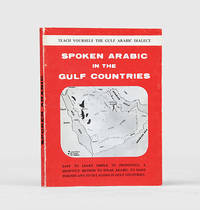
1971réf. 171721al-Khobar: The International Publications Industries 1971. Keep the following in mind and everything will be easy Fourth printing of this institutionally rare phrasebook which adopts "a short cut method simple and easy enough for a businessman to teach himself the spoken Arabic while relaxing in the Aircraft or in his Hotel room. Many of the oil industry people in Arabia owe their local friendship to this book". Arranged by topic the book has sections on greetings shopping food and drink and other practicalities such as taking one's car to a mechanic. The unnamed author places a premium on language as a key to understanding local culture: "you will find the Gulf Arabs intensely loyal to their friends as well as to their families. Most of them are blessed with a keen sense of humor. For these and other reasons such as their hospitality and courtesy you will enjoy getting acquainted with them". Further sections discuss the etiquette of being a guest at a traditional wedding and how to behave if invited to a private house as a guest. WorldCat lists only four copies in institutions Oxford National Library of Wales National Library of Israel Bilkent University. Small octavo 115 x 117 mm. Wire stitched in the original printed wrappers spine lettered in black. Minor wear to wrappers contents lightly toned not affecting text. A very good copy. unknown
réf. 686284to. 265 pp. 23-24 & 173-174 missing 11 pages unused page 71 repeated i.e. 251 of 300 numbered pages employed for the manuscript minutes of board meetings and for occasional other purposes; several typed pages or notes laid in or affixed to a page. Minutes in pen and pencil in the hands of recording secretaries Harry Hartmeir Frank Piaget John Connolly and others. Founded in 1895 as the Paterson Golf Club and incorporated as the North Jersey Country Club in 1897 this minute book covers an important period in club history as plans to build roads through the Paterson location occasioned a move to Wayne in 1917 the purchase of the 327 acre Greenbrook Farm in 1921 and the building of a new club house there in 1922; the construction of its new golf course designed by Walter Travis began the same year opening in 1923. The club and course continue today. Contemporary notebook half-leather and black pebbled cloth very worn leather spine gone leather corners mostly gone edges bumped and worn; interior very good and quite legible. unknown
réf. 686284to. 265 pp. 23-24 & 173-174 missing 11 pages unused page 71 repeated i.e. 251 of 300 numbered pages employed for the manuscript minutes of board meetings and for occasional other purposes; several typed pages or notes laid in or affixed to a page. Minutes in pen and pencil in the hands of recording secretaries Harry Hartmeir Frank Piaget John Connolly and others. Founded in 1895 as the Paterson Golf Club and incorporated as the North Jersey Country Club in 1897 this minute book covers an important period in club history as plans to build roads through the Paterson location occasioned a move to Wayne in 1917 the purchase of the 327 acre Greenbrook Farm in 1921 and the building of a new club house there in 1922; the construction of its new golf course designed by Walter Travis began the same year opening in 1923. The club and course continue today. Contemporary notebook half-leather and black pebbled cloth very worn leather spine gone leather corners mostly gone edges bumped and worn; interior very good and quite legible. unknown books
1807réf. 145581807. Waring Edward Scott. A Tour to Sheeraz 1807 travel narrative describing Persia during the early nineteenth century written by an officer of the British East India Company who journeyed to Shiraz in 1802 by way of the Persian Gulf. The work documents British encounters with Persian society at a moment when commercial diplomatic and strategic interests increasingly connected the Persian Gulf with British imperial networks centered in India. Waring records observations of Persian customs language literature and law while also describing economic activity and regional cultures encountered along the Gulf coast. His account places particular attention on the intellectual traditions of Persian literature and the social practices of Persian society providing commentary on classical Persian poetry as well as everyday cultural life. Waring Edward Scott. A Tour to Sheeraz by the Route of Kazroon and Feerozabad; with various remarks on the manners customs laws language and literature of the Persians. London: W. Bulmer for T. Cadell & W. Davies 1807. Second edition revised. Waring recounts his expedition to Shiraz and provides descriptions of landscapes towns and cultural practices encountered along the journey. The narrative includes discussions of hawk hunting Arabian horses and pearl fishing in the Persian Gulf with references to coastal communities stretching from Ras al Khaimah and Qatar to Bahrain and Kuwait. Waring also records an early European account of Muhammad ibn Abd al Wahhab and the religious movement associated with Wahhabi Islam. Throughout the text he comments on Persian language and literary traditions including references to major poets such as Hafiz and Saadi as well as the intellectual influence of Sufi thought. Travel literature concerning Persia and the Persian Gulf formed an important component of European knowledge about the region during the late eighteenth and early nineteenth centuries. British officials and merchants traveling between India and the Middle East produced accounts that combined geographic description with commentary on local society trade networks and political developments. Waring's narrative reflects this tradition presenting observations on Persian history and social customs alongside discussions of the literary heritage that shaped Persian intellectual culture. The author himself noted that the earlier 1804 edition printed in Bombay contained numerous errors that required correction leading to the publication of this revised edition. Folio volume containing 329 pages bound in quarter leather over original boards. The two plates called for are absent. Front board detached but present text block solid with staining and water damage visible throughout and writing on both front and rear pastedowns. Overall good condition. unknown
1807réf. 145581807. Waring Edward Scott. A Tour to Sheeraz 1807 travel narrative describing Persia during the early nineteenth century written by an officer of the British East India Company who journeyed to Shiraz in 1802 by way of the Persian Gulf. The work documents British encounters with Persian society at a moment when commercial diplomatic and strategic interests increasingly connected the Persian Gulf with British imperial networks centered in India. Waring records observations of Persian customs language literature and law while also describing economic activity and regional cultures encountered along the Gulf coast. His account places particular attention on the intellectual traditions of Persian literature and the social practices of Persian society providing commentary on classical Persian poetry as well as everyday cultural life. Waring Edward Scott. A Tour to Sheeraz by the Route of Kazroon and Feerozabad; with various remarks on the manners customs laws language and literature of the Persians. London: W. Bulmer for T. Cadell & W. Davies 1807. Second edition revised. Waring recounts his expedition to Shiraz and provides descriptions of landscapes towns and cultural practices encountered along the journey. The narrative includes discussions of hawk hunting Arabian horses and pearl fishing in the Persian Gulf with references to coastal communities stretching from Ras al Khaimah and Qatar to Bahrain and Kuwait. Waring also records an early European account of Muhammad ibn Abd al Wahhab and the religious movement associated with Wahhabi Islam. Throughout the text he comments on Persian language and literary traditions including references to major poets such as Hafiz and Saadi as well as the intellectual influence of Sufi thought. Travel literature concerning Persia and the Persian Gulf formed an important component of European knowledge about the region during the late eighteenth and early nineteenth centuries. British officials and merchants traveling between India and the Middle East produced accounts that combined geographic description with commentary on local society trade networks and political developments. Waring's narrative reflects this tradition presenting observations on Persian history and social customs alongside discussions of the literary heritage that shaped Persian intellectual culture. The author himself noted that the earlier 1804 edition printed in Bombay contained numerous errors that required correction leading to the publication of this revised edition. Folio volume containing 329 pages bound in quarter leather over original boards. The two plates called for are absent. Front board detached but present text block solid with staining and water damage visible throughout and writing on both front and rear pastedowns. Overall good condition. unknown books
Photolithographed map in 3 colours (705:600 mm). Scale 1:1,000,000. Rare RAF map of central Arabia, showing Jebal Tuwaiq, the desert west, and Wadi ad-Dawasir south. The first edition was published in 1925. - In good condition. OCLC 634949403. Not in Al Ankary; Al-Qasimi.
8vo. XII, (2), 286 pp. Contemporary calf. All edges sprinkled in red. 6th edition of this "often reprinted" (DNB) treatise, first published in 1697. Its scholarship depended in particular on Pococke. "Prideaux's literary reputation rests on his ‘Life of Mahomet’ (1697) [... of which] the story has been told that the bookseller to whom he offered the manuscript said he ‘could wish there were a little more humour in it.’ No sign of humour was ever shown by Prideaux, except in his proposal (26 Nov. 1715) for a hospital in each university, to be called ‘Drone Hall,’ for useless fellows and students. The ‘Life of Mahomet’ was in fact pointed as a polemical tract against the deists. [...] Some of its errors were noted by Sale in the discourse and notes to his translation of the ‘Koran,’ 1734" (ibid.). From the library of the British philosopher of religion, David Arthur Pailin (b. 1936), with his bookplate and notes laid in. Chauvin XI, 658. Cf. DNB 46, 353. Gay 3623 (1st. ed.).
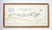
réf. 258j2741Glasgow Scotland: McCorquodale Ltd. Fine. Reprint. Framed Print. Beautiful framed colour print illustrating the famed St. Andrews golf course. Includes the name and length of each hole. Recent reprint of the original created by Golf Course Architect A. Mackenzie in 1924. 27" x 14". The beige wooden frame is attractively colour-co-ordinated with gilt and green trim. In excellent condition. 2kg.; Artist; Folio . McCorquodale Ltd. unknown
réf. DADAX1570280886New unknown
1896réf. r3847aEdinburgh: T & A Constable. G : in good condition. Modern rebind with new eps. 1896. First Edition. Marbled hardback boards with blue cloth spine. 300mm x 220mm 12" x 9". xix 516pp xxxiv plates. 9 b/w & sepia plates. 270 b/w vignettes. Heavy book extra shipping needed for overseas. . T & A Constable hardcover
8vo. 102, 2 blank, (8) pp. With 9 photographic prints, included in pagination. Original printed wrappers with a coloured illustration of the Kaaba on the lower cover. An explanatory pamphlet aiming to "enlighten and guide every Muslim pilgrim about the sacred message of Islam and the rules of Hajj". The five pillars are laid out in 14 chapters, including instructions for pilgrimage, prayer, almsgiving and fasting. With a portrait of Sheikh Abdullah Khayyat. The other illustrations show Al Tan'eem near the Mosque of A'isha, a pilgrims' camp at the Al Rahma Mountain of Arafat, a view of the Taraf around the Kaaba, as well as the Al Khaif Mosque in Mona, the ritual "stoning the devil" at Al Aqaba, the Al Safa Palace before its enlargement, a view of the mosque, water and electrical stations at Muzdlifa, and the Mosque of the Prophet in Medina before the beginning of the Saudi rule in 1925. - Slightly duststained. A good copy of this compact introduction to Islamic faith, traceable in a mere 5 libraries worldwide, only one of which in Europe (Leiden University Library). OCLC 80175743.
Folio (212 x 333 mm). (2), XIII, 91 pp. With 26 full-page plates (of 29), including dozens of coloured maps, as well as a very large folding "Map of the world showing existing and proposed air transport routes" housed in a custom pocket on the inside rear board, as issued. Original printed grey boards with blue cloth spine. Sole edition of this large-format, pivotal early document in the development of international air travel, including the often-lacking loose map. The principal concern of the British during this period was accelerating air transport between the vast reaches of their empire - and chief among these was the lengthy journey to India, via the Middle East. As noted on p. 5, the maximum range of commercial aircraft in 1926 was a mere 400 miles; perhaps partly for this reason, the existing and proposed air routes include numerous stops for refueling in the oil-rich regions of Syria, Iraq, and Iran. - The stated aim of the Air Ministry was in fact to reduce the journey to India to just 5 days (p. VI), and although bold proposals are put forward and illustrated for giant "airships" with a range of 4,000 miles, the then-current technology limited aircraft to a designated route along the northern coast of the Arabian Gulf. Facing the challenge of "the extreme heat and the height of the Arabian Plateau, both of which tend to reduce the load with which an aeroplane can rise from the ground" (p. 9), the route is amply illustrated on numerous folding maps, from Cairo via Gaza, Rutbah Wells (Iraq), Baghdad, Basra, Bushire, Bandar Abbas, Chahbari, Pasni, Karachi, Hyderabad, etc. - Other chapters cover fascinating proposals for "major air routes" between Ottawa, London, and Kingston, Jamaica; "the use of wireless in air traffic communications" (p. 62); early air routes in Australia and the United States; and so on. The plates include designs for proposed experimental "airships"; photographs of early airports, and maps of meterological phenomena. Particularly interesting is the "Map Showing Areas in Which Main Imperial Airship Routes Will Probably Develop" (facing p. 74), which indicates that alongside the Transatlantic route, the coasts of the Arabian Gulf (but not the interior) as well as the coasts of Africa will be the next targets of development. - Lacks three plates, otherwise fine.
Small 8vo. 6 vols., uniformly bound in contemporary brown half cloth with giltstamped spine titles. Still early printing of this revised edition of Habicht's German translation, based on a complete French translation prepared by Antoine Galland (1646-1715) and expanded by Gauttier. The manuscript which Galland had bought in 1701 is the oldest Arabic text extant (dating from 1450 or later). The German editor Maximilian Habicht (1775-1839) lived in Paris for a decade as a member of the Prussian delegation. He knew vernacular Arabic well and separately published an edition of the Arabic text of the "Nights" (cf. Fück). - Slight browning. Volumes 1 and 2 have old colour vignettes applied to the half-titles; pencil ownership of Marianne Alschech to second volume, otherwise fine. Hayn/Gotendorf V, 276. Chauvin IV, 249 (note). Cf. Fück 157.
Oblong 4to. Pop-up book containing 8 pop-ups with moveable parts. (8) pp. Text in English and Arabic. Printed boards. Colourful pop-up book for travelling children, published in the 1970s by Gulf Air's Public Relations department in Bahrain and illustrated by Gloria Nixon. - One moveable part missing, some creasing, otherwise in good condition.
1147 x 850 mm. Scale 1:921,207. Engraved chart, including tidal information, compass roses, soundings, seabed notations. First published in 1898 from British Surveys to 1863. - Folded.
Standard issue, 710 x 875 mm. Scale 1:36,370. Nautical chart of the Gulf of Suez from Suez southward to Ras el Ghubah on the African coast and Kad-el Towila on the Arabian coast, prepared by the British Admiralty. With small views of the light beacons on Kal ah Kebireh Shoal and Newport Rock lighthouse. - The chart shows the city of Suez, labelling hospitals, railway stations, cemeteries, the water works, and a mosque, as well as the maritime canal, Port Ibrahim and Port Thewfik. Other details include the plain of Atakah and the fresh water conduit from Atakah to Suez, the plains of Mohaggiara, and Oyun Musa, marked "the traditionary well of Moses". - The British Admiralty has produced nautical charts since 1795 under the auspices of the United Kingdom Hydrographic Office (HO). Its main task was to provide the Royal Navy with navigational products and service, but since 1821 it has also sold charts to the public. The present chart was composed after Admiralty surveys of 1870, and saw corrections following a 1927 survey carried out by the Suez Canal Company; it was first published in 1871 and saw several corrections up to 1931. - With a single fold. A few manuscript notes. With a stamp "Increase 50%" near lower right corner. Captioned in print and in a former collector's hand on verso. Small marginal tears in the centrefold; not touching image.
16mo (60 x 88 mm). 448 pp. Text printed within red double rules. Contemporary green full morocco, covers and spine prettily giltstamped. Floral endpapers. All edges red, goffered with gilt stars. An anthology of prayers issued by the Jesuit Fathers of the Lebanon, translated into Arabic from Latin (or possibly Spanish), issued in support of the Jesuits' missionary work in the Muslim Middle East. The index contains references to various notable personalities of the Jesuit Order, such as the founder, St Ignatius Loyola, Luigi Gonzaga, Francesco Saverio, Stanislaus Kostka, and others. - Lower hinge professionally repaired. A rare, prettily bound volume.
8vo. 84 pp. 5 folding maps. Contemporary loose cardstock wrapper, stapled. Slightly altered version published in 1947 as "Historical Memoranda" or "Historical Survey". A rare Zionist booklet issued in Hebrew by the General Council of the Jewish Community of Palestine to the Anglo-American Committee of Inquiry. This publication was part of a series of three such pamphlets issued in 1946-47, each presenting a history of Jewish populations in Palestine and diasporic movement. Of the three, this pamphlet deals the most with the history of ancient Palestine. The folding maps illustrate waves of Jewish immigration from 640-1882 CE and identify sites of Jewish settlements in Roman, early Muslim, Crusade, Mamluk, and Ottoman periods. - Somewhat toned; maps are bright and clear. OCLC 244129609.
20,5 x 31,5 cm. Original hand-coloured map. In Ottoman script. Western paper with watermark (posthorn in crowned shield). Rare manuscript map of Kosovo Vilayet, an Ottoman first-level administrative division, showing the borders of the sanjaks in red and marking cities including Üsküp, as well as rivers and railway lines. It includes the Novi Pazar Sanjak, which was set up in 1865 as a result of the abolition of the Bosnian state and the establishment of the Ottoman Empire's Bosnia Province. With the Treaty of Berlin in 1878, the Novi Pazar Sanjak was separated from the Bosnian Province in 1879 and connected to the Province of Kosovo. The Taslica Sanjak was established in 1880 and consisted of Taslica and Prepol Kazas, with Austrian-Hungarian garrisons in the Priboy district. Following the defeat of the Ottoman Empire in the First Balkan War of 1912-13, this sanjak was shared between Serbia and Montenegro with the London Agreement in 1913. - With the personal seal of the cartographer Dervish Mustafa on verso. Somewhat brownstained and creased.
4to. (4) pp. With woodcut printer's device to t. p. Folded broadsheet. Rare contemporary news report about the victory of the Polish and Lithuanian army against the Ottoman troops at Kamianets and the fall of the Turkish-occupied fortress of Gyula to the Imperial troops in late 1694. Also published in German as "Umständliche Relation von dem herrlichen Sieg, welchen die polnische neben der litauischen Armee gegen die Türken und Tataren bei Kamieniec den 6. Oktober 1694 erhalten hat". In the Great Turkish War of 1683-99, the Holy League (Austria, Poland, Venice, and Russia) successfully defended Vienna, then re-conquered Hungary; the war ended with the 1699 Treaty of Karlowitz. Not in Italian libraries; not in OCLC.
Hand-coloured engraved map (531 x 480 mm).
Seven photos and a mimeo letter mounted on four pages of a tied homemade album with paper covers. Photos approximately 160 x 110 mm. Inked caption beneath each photo. The rest of the album pages are blank. Oblong folio. A mimeo letter from Headquarters, 169 (Lon) Inf Bde states that members of their brigade scaled Mount Camino and routed the Germans from an old Benedictine monastery located on the summit in November 1943. When the Moroccan Goums arrived in the area in the Spring of 1944 they were so impressed with the mountain warfare of the British troops that they subscribed for a plaque to be placed on top of the mountain honouring the British soldiers. These seven professional quality photos which the mimeo letters says are "enclosed" were taken at the dedication of the plaque. The photos show Moroccan troops, the 8th Army commander, and the plaque.