4 589 résultats
Colour-printed map. Ca. 65 x 52 cm. Scale 1:800,000. German military map of eastern Anatolia in the Ottoman Empire, produced by the Prussian Ordnance Survey near the end of the First World War and marked as "for operational use only". - Folded. Formerly in the collections of the Geographical Institute of the University of Berlin with 1940s stamp and shelfmark. OCLC 246429024.
(2), 11, (1) SS., l. w. Bl. Marmorbroschur der Zeit. 8vo. Aufsätze: "Das Auslaut- und Betonungsgesetz des Neupersischen"; "Über das Lautgesetz: altbaktr. sh = alteran. rt."; "dahân". "Aus dem Decemberhefte des Jahrganges 1870 der Sitzungsberichte der phil.-histor. Cl. der kais. Akademie der Wissenschaften [LXVI. Bd., S. 361] besonders abgedruckt." Im Rand etwas angestaubt. Mit Bibliotheksstempel des Indogermanischen Instituts der Karl-Marx-Universität Leipzig am Titelblatt sowie Ausscheidestempel.
1986réf. 129921München : Mosaik-Verlag, 1986. 159 Seiten mit Abb. Gr.-8°, Leinen mit OU
1991réf. 13475Paris, Esprit / Les Cahiers de l'Orient, 1991 1 volume 15 x 24cm Broché. 354p., 3 feuillets. Très bon état.
1991N° spécial, issu de l'exceptionnelle association des 2 revues, présentant un important dossier sur les "Paysages apres la bataille", celle de la Guerre du golfe Persique (1990-1991), pour "déminer autant que possible" le thème de "la guerre des cultures", s'interroger sur la politique arabe de la France, la politique étrangère des Etats-Unis, l'avenir politique du Proche-Orient, sur l'Islam, etc; introduit par "La Guerre", poème de Mohammed KHAÏR-EDDINE. Français
1949réf. 001622New York: Esquire Inc David A Smart 1949. A superb item for the golf collector 12 page guide plus numerous adverts covering the whole golfing scene incs at double page size a pullout colored print of " The Golfers " playing at St Andrews by Charles Lees Wonderful condition you won't be disappointed! 167pp. Not Inscribed or Signed. This is the First Edition. Paper Magazine . Fine/No Jacket Issued. Illus. by Various Including a Coloured Print of the Famous Golfer Picture " the Golfers " By Charles Lees in Superb Condition . Folio - over 12" - 15" tall. Magazine . Esquire Inc David A Smart unknown
1942réf. b24975New York 1942. First Edition . Soft cover. Near Fine. Near fine in original wrappers. paperback
4to. (4), VI, 7-100 pp. With lithographed frontispiece and 3 lithographed plates. Original printed wrappers. Third edition. Rare treatise on equine appearance by a prominent figure of the French cavalry. Unlike the first edition, which included only two illustrations, the present third edition features 4 lithographed plates, including an Arabian horse and the horse's skeleton. Frequently cited by later works on hippology, Morris's essay discusses all aspects of the horse's physique, including proportions and the angular structure of the skeleton, which "can rather be applied to the Arabian horse than to European breeds" (de la Lance). - Wrappers slightly browned near margins. A fine, uncut copy of an equestrian classic. Mennessier de La Lance II, 227. Not in Boyd/P.
Tables only: 11 genealogical tables on 15 folding sheets. Contemporary red half morocco; marbled covers and endpapers. Slightly foxed throughout. From the library of Richard C. Hodges (his etched bookplate on front flyleaf); later in the library of Sidney Edward Bouverie-Pusey (1839-1911), only son of the agriculturist Philip Pusey (cf. DNB XLVII, 64), with his bookplate on front pastedown.
8vo. X, 485 pp. Harting 79.
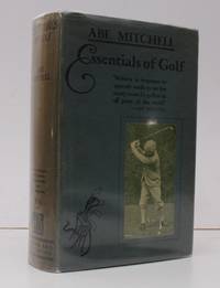
1936réf. 38688Hodder & Stoughton 1936. 8vo. Fifteenth Edition with portrait frontispiece and plates some very light and scattered spotting; olive cloth upper board and backstrip framed and lettered in green uncut a very good bright clean copy in unclipped dustwrapper. Mitchell's golfing classic was first published in 1927. SCARCE IN THIS CONDITION. Hodder & Stoughton, hardcover
19368vo., Fifteenth Edition, with portrait frontispiece and plates, some very light and scattered spotting; olive cloth, upper board and backstrip framed and lettered in green, uncut, a very good, bright, clean copy in unclipped dustwrapper. Mitchell's golfing classic was first published in 1927. SCARCE IN THIS CONDITION.
4to. XII, 127, (8) pp., final blank page. Front flyleaf included in the pagination. Original printed wrappers. With dust jacket. Only edition, very scarce. - Noted essay on the physique of the Anglo-Arabian horse, challenging the theory of its over-lightness and insufficiency - the "gravest and most unjust" criticism levelled against the breed. Prepared by the vice-president of the prominent Toulouse stables "Écurie coopérative du Midi", Claude Marty. Of the utmost rarity: a single library copy traceable internationally (French National Library). - The main part of this work is made up of highly informative tables, displaying the distribution of the various breeds in the French, Algerian, Spanish, and Prussian cavalry forces, specifying their origins, as well as weights and body measures, and occasionally even stating their given names. Several other tables show the use of the Anglo-Arabian for public transportation in Toulouse. The work concludes with remarks on the Anglo-Arabian's high bone density and their physical ability to set vehicles in motion. - Ownership stamp of the Bibliothèque de Trélissac to half-title. Dust jacket somewhat worn, minor tears. A few pages loosened. A good copy of this important work rarely seen in the trade. OCLC 457358123.
Engraved map (42 x 56 cm), coloured in outline. Map of the Turkish Empire, showing Ottoman possessions in the Balkans, Eastern Mediterranean, Egypt and Arabia and marking topography and settlements. Al Ankary 59. Al-Qasimi 60. Tibbetts 99.
1997réf. BN623935Nathan 1997. 1997. Softcover. Etapes numéro 54 : électronique de puissance Etapes numéro 54 : électronique de puissance R. Le Golf Nathan paperback
4 vols. (24), 484, (28) pp. (4), 470, (18) pp. (4), 599, (1), 89 (1) pp. (40), 411, (5) pp. With a total of 2 engr. frontispieces (in vols. 1 and 4). Original French calf with giltstamped spine. Encompassing study of the Ottoman Empire in the late 17th century, at a time when its power in Europe was waning, but it remained a force to be reckoned with. Rare, especially when including the 4th volume ("Suite de l'Etat general de l'Empire otoman [...] Quatrieme tome") which contains accounts of the state of the Greek, Armenian and Maronite churches in the Ottoman Empire. "According to the Gennadius Library, this was translated by Petis de la Croix and edited by La Croix. In fact the privilege is ceded to La Croix, former secretary of the French embassy at Constantinople. It seems likely that there must be a family connection between the two, although the original family of Petis de la Croix was Petis, not La Croix" (Atabey). - Binding slightly rubbed, but on the whole in good condition. The Atabey copy (3 volumes only) commanded £15,000 at Sotheby's in 2002 (lot 646). Atabey 651. OCLC 470426837. Not in Blackmer or Cobham-Jeffrey.
Hand-coloured engraved map (560 x 490 mm). Matted. Robert de Vaugondy’s spectacular 1753 map of the Ottoman Empire. Vaugondy maps the empire at its height, with territory spanning from the Black Sea to the southernmost extension of Arabia and west, inclusive of Persia, as far as the Mogol Empire of India. Includes the modern day nations of Turkey, Egypt, Saudi Arabia, Oman, Yemen, the United Arab Emirates, Iran, Iraq, Kuwait, Israel, Palestine, Jordan, Syria, Lebanon, Armenia, Azerbaijan, Georgia, and parts of Afghanistan, Pakistan, India, Uzbekistan, and Greece. Vaugondy employs all of the latest geographical information of the time incorporating both French and transliterations Arabic place names. This map offers splendid detail throughout inclusive of undersea shoals and reefs in the Red Sea and Persian Gulf, mountain ranges, lakes, rivers, and historical sites. A highly decorative title cartouche showing an Ottoman prince appears in the lower left quadrant. Five distance scales are in the lower right. Drawn by Robert de Vaugondy in 1753 and published in the 1757 issue of his Atlas Universal. Al-Qasimi 168. Al Ankary 353. McMinn 49. Not in Tibbetts.
réf. ABE-103881406068,5 CM X 11 CM-BLEU-JAUNE-BLANC-DECOR RAQUETTE DE TENNIS, SAC GOLF 4 CLUBS, BLASON 2 HIPPOCAMPES (CPP1)
1873réf. 10561Paris, J.B. Baillière, 1873 (Nice, Imprimerie Caisson et Mignon) ; in-8, broché ; 130 pp., (1) f. blanc, 7 planches dépliantes, 1 grande carte dépliante en couleurs, couverture bleue imprimée.
1786Engraved map (plate size: 53 x 44.5 cm), with coloured borders. Engraved map showing the Near East, especially the areas of today’s Syria and Iraq. From Schalbacher’s and Schrämbl’s “Großer Allgemeiner Atlas”. A good, clean impression. Dörflinger/Hühnel I, 136, 97.
1985réf. 36142München : Mosaik-Verl., 1985. 230 S. : überw. Ill., Kt. 4°. 2., aktualis. Ausg. OPpbd. mit SU im ill. OSchuber.
1984réf. 47146ABMünchen Mosaik Verlag 1984. 4° 230 S., reich ill. OK. 1 Aufkleber-Abdr. a. unt. Kapit., leicht berieb., innen sauber u. gut erhalten. 1 Biblioth.-Stempel a. Vors.
2006312 pages, illustrated, statistics. eng