4 432 résultats
Oblong 4to (240 x 168 mm). Photo album with 9 original black-and-white silver gelatin prints, mostly 125 x 180 mm. With English captions mounted on verso of the photographs as well as on the opposite pages. 8 blank ff. Contemporary half cloth over cardboard with title label mounted to front cover. Notable collection of historic images of the Mahd Al Thahab gold mine in the province of Al-Madinah, in the Hejaz region of Saudi Arabia. Photographs show the mining complex including the crushing plants, mills and storage tanks, as well as the camp with warehouses, shops, schools, hospital buildings, a mosque, and the living quarters of the Emir of Mahad. The last picture depicts the staff and office buildings at Jeddah. - Mining activities in the area date back to 961 BC, and the Mahd adh Dhahab deposit was rediscovered in 1932 by K. S. Twitchell. The Saudi Arabian Mining Syndicate (SAMS), a joint venture between the Government of Saudi Arabia and the American Smelting and Refining Company, started production in 1939, treating at first mainly the ancient tailings. SAMS produced 22 tonnes of gold and 28 tonnes of silver up to 1954. - Extremities slightly rubbed.
Lithographic portrait (555 x 380 mm), matted (618 x 499 mm). Portrait of Mahmud II (1785-1839), the 30th Sultan of the Ottoman Empire from 1808 until his death in 1839. A fine likeness by the celebrated Viennese portraitist Joseph Kriehuber. - Some foxing.
4to. VI, 32 pp. With 2 lithogr. plates and 28 ff. of Arabic letterpress with lithogr. borders, toned in various colours. Modern boards with the original wrappers bound within. First edition. - Without any doubt Hammer’s finest work in imitation of an oriental manuscript: the Persian text of the famous Sufi manual ‘Golshan-e Râz’ is printed in seven four-leaf quires of varying colours, each framed by a lithographed sequence of interlaced flowers and animals (pheasants, deer, antilopes, panthers, jackals). The German translation, the unsophisticated typography of which provides a striking contrast to the luxurious Persian text, is illustrated by two plates of topographical interest. The binding preserves the original blue paper wrappers with a large emblematic lithograph of a shell hidden among a bouquet of roses, drawn by Pauline von Koudelka-Schmerling. - Occasional slight foxing. Untrimmed. Goedeke VII, 767, 100. Rabenlechner I, 122. Cf. Brunet III, 34 (Vienna, 1838 ed.).
Collection of 48 stereoscopic views (double prints on cardboard) (ca. 86 x 178 mm each). Includes original contemporary stereo viewer with collapsible handle, sliding focus tray, and padded viewing chamber with lenses. An American-manufactured mahogany stereoscope (Perfecscope, Underwood & Underwood, New York) with 48 photographs showing scenes of town and country, architecture, figures, and war. Well preserved, rare with the turn-of-the-century stereoscope in perfect working order.
Engraving (230 x 160 mm), matted (360 x 280 mm). Portrait of Sultan Mehmet IV (1642-93), the second longest reigning sultan in Ottoman history, pictured on horseback. From Peeters's series "Korte Beschryvinghe, Ende Aen-Wysinghe der Plaetsen in dessn Boeck, met hunnen teghenwoordigen Standt, pertinentelijck uytghebeldt, in Oostenryck" (1686).
4to (162 x 202 mm). (12), 128 pp. Modern marbled boards. Posthumous edition, under a new title (and with the author's name misspelt "Enustinus" for "Cnustinus"), of Knaust's 1542 pamphlet "Von geringem Herkommen, schentlichem Leben, schmehlichem Ende des Turckischen Abgots Mahomets". The jurist and poet Knaust (ca. 1521-77) published on a wide range of topics; "his popular-scientific works, written mainly for young readers and interested laymen, proved especially successful" (cf. NDB XII, 167). From p. 33 onwards the book contains an updated German version of the oft-reprinted and anthologized "Cronica und Beschreibung der Türckey" (1530) by the former slave Bartolomej Georgijevic from Transsylvania (Georgius de Hungaria). - Variously browned throughout with a few insignificant waterstains in the margins; occasional 18th century pencil annotations. Rare. VD 16, K 1434. Chauvin XI, 502. Göllner 2200. BM-STC German 473. Boecler 169. Draudius 531. Hammer 1305. Kertbeny 1190. Szabó III, 873. Veress 128.
8vo. (10), 547, (1) pp. With additional engraved title page and 6 engraved plates. Contemporary vellum with handwritten spine title. Uncommon Dutch edition of du Ryer's version, in a translation by J. H. Glasemaker (previously published in 1658), with a Life of the Prophet and numerous engravings by Caspar Luyken (1672-1708). Du Ryer's 1647 French version served as the basis for further translations of the Qur'an (including English, German, and Russian), and was instrumental in introducing Europeans to the tenets of the Muslim faith. - Block somewhat loosened, but still a good copy. Chauvin X, p. 129 (phi). Cf. Schnurrer 428.
8vo. 2 vols. 88, 47 ff. Original Japanese fukuro-toji bindings. First Japanese edition: the first Japanese book on the life of the prophet Muhammad, drawn from Prideaux's "The True Nature of Imposture Fully Display'd in the Life of Mahomet" (1697) and translated into Japanese by Hayashi Tadasu, later to become Japan's Minister for Foreign Affairs. Rare as a complete two-volume set. - Bindings very slightly stained, otherwise fine. Cf. Chauvin XI, 185f., 656ff. (other editions).
réf. 5h3029Gulf Craft United Arab Emirates 2017. 143 S. mit zahlreichen Abbildungen Pappband quart. - gutes Exemplar / good condition / Text englisch - unknown
Folio (422 x 528 cm). Lithogr. t. p. and 60 lithogr. plates, all in original hand colour, captions often raised in gilt. With 10 leaves of letterpress text. 10 instalments in the original printed wrappers as issued. Stored in contemporary green half calf with giltstamped spine and cover label. Ties. - (Includes): Die Uebergangsländer von Asien und Afrika, begreifend: Arabien nebst Mesopotamien und Syrien und das Nilgebiet. Munich, C. Wenng, 1845. Engraved map with contemporary border colour. 640 x 544 mm. Scale 1:7,000,000. Only edition of the rare variant with all the plates and in their splendid original colour: the personal copy of Duke Maximilian in Bavaria. "Published in ten parts. The plates show costume of the period and also that of earlier times, taken from paintings" (Hiler). The picturesque views, which include Cairo, Alexandria, Jerusalem, La Valletta, Luxor, and Thebes, genre scenes and landscapes, are all framed within a decorative border and arranged as a small painting. The Nuremberg artist Mayr, especially well-known for his depictions of battles scenes and horses, was personal painter to Duke Maximilian, whom he accompanied on his 1838 journey of the Orient. The group had departed from Munich on January 20 with a small entourage, travelling via Venice, Korfu, Patras, Athens, Alexandria, and Cairo to the Holy Land. They returned to Munich after eight months on 17 September 1838; the following year, Maximilian was made honorary member of the Bavarian Academy of Sciences. - Some foxing to letterpress explanatory text, plates beautifully preserved with only the backing paper showing occasional duststaining. From the library of Duke Maximilian at Tegernsee Castle, retaining the original shelfmark label on the spine. - Includes the extremely rare map of the Arabian Peninsula and the Middle East which was published only in 1845, at the instigation of the naturalist Gotthilf Heinrich von Schubert (1780-1860) and the geologist Joseph von Russegger (1802-63), to satisfy this frequently noted lack in Mayr's production (some foxing, but also finely preserved). Ibrahim-Hilmy II, 26. Gay 90 (only 36 plates). Lipperheide Ma 22 (= 1589). Hiler 578. Tobler 161. Graesse IV, 457. Engelmann 124. Kainbacher 265 ("a rarity"). Thieme/Becker XXIV, 477. Nagler VIII, 498f. ("highly memorable drawings"). ADB XXI, 139ff. Not in Blackmer or Abbey (Travel). Not in Colas.
Folio (422 x 528 cm). Lithographed title-page and 60 lithographed plates, all in original hand colour, captions often raised in gilt. With 10 leaves of letterpress text. Half calf with giltstamped spine. (Includes): Die Uebergangsländer von Asien und Afrika, begreifend: Arabien nebst Mesopotamien und Syrien und das Nilgebiet. Munich, C. Wenng, 1845. Engraved map with contemporary border colour. 640 x 544 mm. Scale 1:7,000,000. Only edition of the rare variant with all the plates and in their splendid original colour: "Published in ten parts. The plates show costume of the period and also that of earlier times, taken from paintings" (Hiler). The picturesque views, which include Cairo, Alexandria, Jerusalem, La Valletta, Luxor, and Thebes, genre scenes and landscapes, are all framed within a decorative border and arranged as a small painting. The Nuremberg artist Mayr, known especially for his depictions of battle scenes and horses, was personal painter to Duke Maximilian, whom he accompanied on his 1838 journey of the Orient. The group had departed from Munich on January 20 with a small entourage, travelling via Venice, Korfu, Patras, Athens, Alexandria, and Cairo to the Holy Land. They returned to Munich after eight months on 17 September 1838; the following year, Maximilian was made honorary member of the Bavarian Academy of Sciences. - Some foxing, otherwise splendidly preserved. Includes the extremely rare map of the Arabian Peninsula and the Middle East which was published only in 1845, at the instigation of the naturalist Gotthilf Heinrich von Schubert (1780-1860) and the geologist Joseph von Russegger (1802-63), to satisfy this frequently noted lack in Mayr's production (some foxing, but also finely preserved). Ibrahim-Hilmy II, 26. Gay 90 (only 36 plates). Lipperheide Ma 22 (= 1589). Hiler 578. Tobler 161. Graesse IV, 457. Engelmann 124. Kainbacher 265 ("a rarity"). Thieme/Becker XXIV, 477. Nagler VIII, 498f. ("highly memorable drawings"). ADB XXI, 139ff. Not in Blackmer or Abbey (Travel). Not in Colas.
815 x 1140 mm (on 2 separate sheets). The first distance-time route map of the Ottoman Empire, one of the great masterpieces of Ottoman thematic cartography. Devised by the General Staff of the Ottoman Army and depicting the entire realm of the Sublime Porte from Albania to Yemen, it gives travel times between hundreds of locations, including various routes of the Hajj. - The map captures the scene during the middle of the rule of Sultan Abdul Hamid II (reigned 1876-1909), during which the empire still controlled vast territories in Europe, Asia and Africa, extending from the Balkans to the Arabian Peninsula. It is centred upon Anatolia but includes all the core regions of the Empire, extending from Bosnia in the northwest to the head of the Arabian Gulf in the southwest, and from Crimea and Baku in the north and east to Lower Egypt in the southwest. In the lower right corner is an inset capturing the western Gulf, including Kuwait, Bahrain, and Qatar; an inset above details the Red Sea, including Hejaz, Asir and Yemen; a larger inset in the lower left depicts Ottoman Libya as well as parts of French Tunisia and Algeria. Annotated in Ottoman Turkish throughout, the map is traversed by hundreds of lines that connect every city and town of importance, representing the main land travel routes between these centres; each segment states the estimated travel times between the points. The map also features a chart comparing distances between the principal centres: on average, the chart shows, it took 18 hours to travel from the Red Sea port of Jeddah to the holy city of Mecca. - This is the first map ever to display the distances between all significant travel points in the Ottoman Empire and would have been vitally useful to soldiers, merchants, and government bureaucrats planning their itineraries. It was also one of the only maps to give an approximately accurate notion of the times and distance along several of the most important Hajj routes, including the famous Syrian Hajj Road from Damascus to Mecca, now considered by UNESCO for World Heritage Status. - Transportation had always been one of the great challenges confronting the Ottoman Empire, an astoundingly vast realm spanning three continents and traversing some of the world's most rugged terrain. Yet the Hamidian Era marked a period of rapid modernization, including the creation of macadamized highways, railways and modern ports, and saw the rise of sophisticated cartography. The General Staff was able to draw on exhaustive highway surveys and recent itinerary records. The present map also depicts the rapidly expanding Ottoman railway system, after a wave of development had revolutionized travel in the empire's European domains, but just before an unprecedented boom in railway construction would do the same for Ottoman Asia. The Balkans are traversed by several railways: most notably as of 1888 the great port of Salonika was connected to the rest of Europe by rail, while Istanbul was linked to the European system for the first time that same year, providing the direct route for the famed Orient Express, which commenced in 1889. One will also notice the first great leg of the Anatolian Railway that connected Istanbul to Ankara on 31 December 1892, completed only a matter of weeks before the present map was issued. - Although Ottoman cartographers were producing topographic and thematic maps of the highest sophistication and diversity, every bit as impressive as those of the best German and French and British mapmakers, these works tend to be very rare today and are not nearly as well known as they deserve to be: they were almost invariably issued in small print runs, and maps intended for practical use in the field, such as the present work, tended to perish easily. Also, Turkey's switch to the Latin alphabet, in 1928, ensured that many of the surviving earlier maps were discarded, making this specimen a rare survival of an historic cartographical achievement. - Brownstains and waterstains.
8vo. 3 parts in one volume. (72), 184, (4), 71, (1), (14), 278 pp. With 12 engravings in the text, 3 folding plates and several woodcuts. 19th century mottled boards, spine ruled in gilt, titled in gilt on black leather spine label. All edges speckled. First edition of this important work dedicated to oriental games from Arabia and Persia as well as from India and China, including backgammon, draughts and dice. Includes the first scholarly account devoted to the history of chess, as well as Asian board games from Arabia, Persia, India, and China, including backgammon, draughts, and dice. Two folding plates illustrate chessboards; further in-text illustrations show the various types of game pieces in Caxton-era England, Turkey, and India. The second and third parts explain the history of dice and many other Chinese games. - Contains numerous texts in Hebrew, Chinese, Arabic, Greek, and other languages. "Ouvrage curieux. Les exemplaires n'en sont pas communs" (Brunet). Hyde was an orientalist and later became Bodleian Librarian. - Binding lightly rubbed at extremities, outer front hinge splitting, small paper library label on lower spine. Paper repair to top right edge of front free endpaper and to reverse of largest folding plate. Interior gently toned, edges of folding plates lightly rubbed, a few inked and penciled notes on front endpapers. Graesse III, 403. Von der Linde I, 88-90. Cordier (Sinica) 3142. Wing H3875 & H3877. ESTC R1348.
8vo. 3 parts in one volume. (72), (4), 184, 71, (1), (16), 278 pp. With 12 engravings in the text, 3 folding plates and several woodcuts. Contemporary English calf with red label to gilt spine. All edges red. First edition. Important work dedicated to oriental games from Arabia and Persia as well as from India and China, including backgammon, draughts and dice. Also contains the first scholarly account devoted to the history of chess (pp. 53-137), with two folding plates showing chessboards, engravings of a giraffe, and examples of various types of chessmen (English from the time of Caxton; Turkish; and several kins of Indian specimens). The second part explains, inter alia, the "Promotiones Mandarinorum", the history of dice, and many other Chinese games. Contains numerous texts in Hebrew, Chinese, Arabic, Greek and other languages. Hyde was an orientalist and later became Bodleian Librarian. "Ouvrage curieux. Les exemplaires n'en sont pas communs" (Brunet). - Upper spine-end professionally repaired; inner hinges reinforced. Light browning throughout due to paper. From the library of the chess-player and collector James Wilson Rimington Wilson (1822-77) of Broomhead Hall near Sheffield, with his autograph ownership in ink ("J W Rimington Wilson / Chess Library") to pastedown. Graesse III, 403. Von der Linde I, 88-90. Cordier (Sinica) 3142. Wing H3875 & H3877. ESTC R1348.
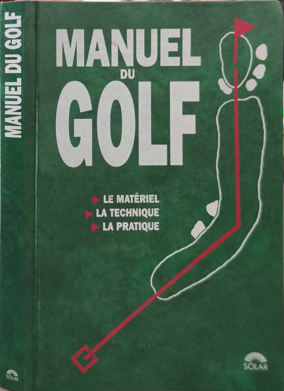
1992réf. 17936Solar 1992 223 pages in8. 1992. Broché. 223 pages. LE MATÉRIEL LA TECHNIQUE LA PRATIQUE
réf. 6465SOLAR Broché au format 13x19cm , couverture illustrée souple de l'éditeur , 223 pages nombreux croquis explicitant les positions , quelques photographies en couleurs ,très bon état , 224 pages .
1999réf. LFA-126743730Un ouvrage de 224 pages, format 140 x 210 mm, illustré, broché couverture couleurs, publié en 1999, Editions Solar, bon état
1992réf. 8165Solar 1992 223 pages in8. 1992. Reliure editeur cartonnée. 223 pages. Ce manuel pratique de Vivien Saunders est un guide complet pour apprendre et progresser au golf. Il couvre tous les aspects du jeu : le choix et l'utilisation du matériel (des drivers aux putters) la maîtrise des techniques de base (stance grip swing) l'entraînement la stratégie en compétition et l'interprétation des règles. L'approche est adaptée au niveau du joueur plutôt qu'à la performance des champions
8vo (135 x 90 mm). 11 pp. Ink on paper, written space 110 x 65 text area approx. Text in black with "points" in gold within the framework of various colours. Pages mounted within coloured rules. Title page in red, purple and gold (worn with some losses). Contemporary leporello binding. Devotional manuscript, bound as a leporello. Begins with "bi-hawli llah wa-quwwatihi" ("with God's power and strength"); text has been separated and continues on a previous page. Elaborately decorated title and chapter heading within ornamental borders, gilt and coloured. The name of the scribe, Muhammad Ja'far al-Lahijani (from Lâhîjân in northern Iran on the Caspian Sea), as well as the date 1246, are stated on the final page. - Partially worn and damaged; front cover shows a floral design on cloth (rubbed and chafed); the back cover is missing. Some brownstaining and chipping; a few leaves show old repairs and marginal defects.
Large 4to (274 x 210 mm). 6 pp. on 4 leaves (final leaf blank), sewn. Latin chancery manuscript, ink on paper. Variously revised draft for a Papal decree, asking the cardinals and others to raise monies for the Church to fight the Turks as well as other heretics: "Sixtus V, in order to better govern the Church and safely protect it from all dangers, judges that the Church needs a larger amount of money. The first year the pontificate had 100,000 gold coins, as did the second, to make 1,000,000 gold coins to be guarded in the safe of the Castel Sant'Angelo. In order that they be safely guarded, two constitutions have been issued and an enormous fleet is to be prepared, as the Tyrant of the Turks as well as heretics and schismatics are a threat to the bark of Saint Peter, and large numbers of people are eager in both France and Germany to defend against the enemy. Sixtus V orders his dear brothers, the Cardinals of the Catholic Church, to bring the Holy See another 1,000,000 golden coins, and advises them how to collect the money and the divisions to be made among them for doing so, how often to pay, etc. [...]". As comparison with the final version shows, the present text underwent further editing, and not all changes here drafted made it into the final text. - Occasional slight browning and ink-bleeding, but very well preserved altogether. Cf. Bullarum diplomatum et privilegiorum Sanctorum Romanorum Pontificum. Taurinensis editio, vol. IX (1865), p. 1-4.
Ca. 235 x 190 mm. Original hand-coloured map on tissue paper. In Ottoman script and Arabic. Two hand-drawn maps on a single sheet, made in the Ottoman Empire, likely in Istanbul, near the beginning of the 20th century. The map to the left depicts the Baghdad Vilayet, embracing Central Iraq. The map on the right features the Basra Vilayet, extending from Southern Iraq down the southern coast of the Arabian Gulf to include Kuwait, what is now the Dhahran area of Saudi Arabia, Bahrain, and Qatar. By the late 19th century the Gulf States had become de-facto British protectorates and were no longer practically subject to Ottoman rule; still, the Sublime Porte never relinquished its sovereignty. - Maps such as this, executed on thin tracing paper, were commonly made as educational tools at elite Ottoman schools and universities during the early 20th century, although few such specimens survive. - Clean and bright, with light creasing and traces of an old vertical centrefold.
210 x 170 mm. Pencil and ink on paper, the map ruled in red. Small plan of the city and the adjacent terrain, obviously drawn around the time of Snouck Hurgronje's visit, during the last decades of Ottoman rule.
Folio (244 x 345 mm). Arabic manuscript, Bihari script on paper. 287 (instead of 292) ff., foliated 364-655 (lacking 550-551 and 622-624). Surah headings in gilt and colours, verse divisions marked by gold and black ink rosettes, numerous circular and tear-shaped markers in the margins, elaborately ornamented in gold and colours. Bound in modern oriental-style full leather with fore-edge flap and recessed cover decorations. Part four of a pre-Mughal Qur'an commentary, treating the text from Surah XXI, Al-Anbya (The Prophets) to Surah LXXV, Al-Qiyamah (The Resurrection). - Lacks five leaves according to the foliation; some dampstaining; several edge flaws (more severe near the end of the volume), often remargined. Traces of dust in the gutter throughout. In all a fine example of an early Qur'anic manuscript. - Provenance: 1950s private ownership stamp of the "Mohd. Halim Salimi Library", Kandahar, Afghanistan, on fol. 490v. Mohammed Halim Salimi of Kandahar worked in an administrative capacity for the USA's International Cooperation Administration (ICA) Mission to Afghanistan in 1959. In 1960 Salimi applied to the ICA for reimbursement of a lost sum of $123.88; the application was refused on the grounds that Salimi was not in fact an ICA employee but was sub-contracted by the agent Herman Klee (see report B-144148-O.M., 1 Nov 1960). Acquired from Hampel Auctions, Munich. Cf. S. A. Blair, Islamic Calligraphy (Edinburgh 2006), pp. 386-390; Qur‘an, exhibition catalogue (Istanbul 2010), pp. 350f., no. 92.
Folding map of Arabia (180 x 135 cm), coloured in outline, dissected and mounted on cloth (24 sections). The exceptionally rare first independently issued edition of this famous, meticulously prepared map of Arabia and the Gulf. The "Hunter map" is an enormous, wall-size chart showing an astounding degree of detail. The "Gulf portion being largely based on actual surveys can be considered fairly accurate. [...] Kuwait (except that portion based upon actual surveys) Hasa, Jabal Shammar, Qasim, 'Aridh, Oman, Hadhramaut are the result of exhaustive use of detail supplied by travellers supplemented by months and months of enquiry by local Political Officers. The map of these portions can certainly claim superiority over any previous work of the kind" (Notes on the Map of Arabia and the Persian Gulf [...] compiled by Capt. F. Fraser-Hunter 1905-1908 [Calcutta, 1910], p. 1). - The Canadian-born Hunter later became a major figure in British India's Intelligence Service. As the author recalled in his 1919 "Reminiscences", "a great deal of the information on the map was from sources considered secret at the time" (p. 357). Special surveys of the country's interior areas were carried out to achieve a hitherto unprecedented degree of accuracy: "The map was a distinct advance on anything which existed, as in 1908 no general map of Arabia on such a large scale existed" (p. 360). - Hunter's map was first issued in a very limited press-run to accompany John G. Lorimer's "Gazetteer of the Gulf" (1908); at that time it still bore the title, "Map of the Persian Gulf, 'Oman, and Central Arabia". It was subsequently used (and praised) by St John Philby during his journey across Arabia. Indeed, reliable topographical information was an invaluable asset not least to the local Sheikhdoms in their territorial disputes during this politically volatile age: Hunter recounts that on one occasion, the Sheikh of Umm-al-Qaiwan went so far as to torture his relative, the Sheikh of Abu Dhabi, into signing away his right to strategically important islands in the Arabian Gulf, a stratagem foiled only by the happy intervention of the British Political Resident. - Stamp of the University Library of Nijmegen on the cloth backing. A very few minute traces of worming, otherwise in fine, spotless condition. Never seen in the trade: the only two copies of this map in auction records were both of the 1914 issue (Christie's, 2012, and Sotheby's, 2013). Not in Al Ankary or Al-Qasimi.
794 x 628 mm. Scale 1:4,000,000. Mounted on cloth. Folded. Rare, large-scale map of western Arabia including all but the easternmost part of the Peninsula (ending about 100 miles east of Qatar). "This map has been compiled almost entirely from published sources, of which the principal are (1) Hunter's Arabia 1:2,000,000; (2) War Office quarter inch of S.W. Arabia; (3) War Office 1:250,000 of the rest of the Turkish Empire; R.G.S. materials have also been used" (editor's note). Some slight brownstaining in places, otherwise well-preserved. Not in OCLC.