4 432 résultats
Engraved map with original outline colour and manuscript calligraphy in red ink. With a fine inset plan of the city of Kamianets-Podilskyi in the upper right corner, as well as an ovoid title cartouche, both bordered by Neo-Classical Ottoman-inspired designs. On thick laid, watermarked paper. 60 x 140 cm. Exceedingly rare engraved wall map comissioned by the Sublime Porte, brilliantly labelled and hand-coloured in Istanbul by court calligraphers. A masterpiece of cartography and Islamic calligraphy, the map presents the theatre of the Russo-Turkish War of 1768-74 in its earliest stages. Focussed on the southern Ukraine, it extends from the Mouths of the Danube, in the west, to the Caspian Sea, in the east, rendering the region as it was common before the Russian surveys of the 1770s. The Russo-Ottoman boundary, as it existed between 1739 and 1774, is clearly delineated, with the Ottoman lands outlined in green and Russian territories in yellow, whilst the Polish territories, in the northwest, are outlined in pink. Until the war, the Ottomans controlled Crimea and the southern Ukraine in their entirety, along with most of the Caucasus. - As the Ottoman Empire lacked publishing capabilities, the Porte often relied upon their ancient ally, France, to supply them with custom-printed material, conveyed to the Topkapi Palace via the French Embassy in Istanbul's Pera neighbourhood. The skeleton of the map, engraved in Paris, depicts topographic features and the locations of key cities and fortifications, but omits all text: all names of regions and major settlements were added in Turkey in luxurious red ink. The masterly penmanship would have been executed by a specialized imperial calligrapher: the rich, expensive red ink was reserved for sacred and high-level legal documents under the Sultan's patronage and was only very seldom applied to cartography, indicating that the present map would have been held in particular esteem by the Imperial Court. - A single other example of the map with the Topkapi calligrapher's manuscript work, executed in a similar fashion, survives in the Biblioteca Nacional de España (MR/42/415), very likely once a high-level diplomatic gift to Madrid from Sultan Mustafa III, anxious to improve his diplomatic and trading links with the Bourbons. In addition, a single blank example of the engraved map template is held by the Bibliothèque nationale de France (CPL GE DD-2987, 3089 B), formerly in the collection of the famous cartographer Jean-Baptiste Bourguignon d'Anville, who is known to have had privileged access to maps created for the French diplomatic corps. - Resplendent original calligraphy, several old tears professionally repaired without loss. An extremely rare survival in fine condition. Biblioteca Nacional de España, MR/42/415. Elena Santiago Páez, La Historia en los mapas manuscritos de la Biblioteca Nacional (Madrid: Biblioteca Nacional, 1984), no. 336 (p. 266). Not in Özdemir, Ottoman Cartography (2008).
500 x 420 mm. Oval manuscript map in ink and watercolour (blue, brown, green and red; map image including water 295 x 380 mm, the land alone 220 x 305 mm) on a half sheet of extremely large Dutch laid paper (watermark: D&C Blauw IV), with dozens of features labelled in Persian (written in black ink in the nastaliq script) and with animals (including elephants and a dragon), people and 4 European ships. Framed and matted. An 18th century manuscript copy, in colour, of a lost map in the Islamic tradition, with dozens of inscriptions in Persian and extensive pictorial imagery showing numerous mosques, elephants in southern Africa, eastern India and what may be northern Bengal or part of Southeast Asia, snakes and a dragon (with four feet and two pair of wings) in East Asia, birds north of the Caucasus and people in Europe north of the Alps. The regions with people and animals (excluding the dragon and snakes) are also the only regions shown wooded. The oval land is surrounded by oceans with a European ship at each of the four cardinal compass directions: three 3-masted ships flying flags with St George's cross (used by the crusaders, Knights Templar and English and French troops from the 12th century and by the Genoese and others from the 13th century: while it is not St George come to slay the dragon, these European ships in an Islamic map remain a puzzle), and at the south a 2-masted ship with no rectangular flag, all four ships accompanied by rowboats. Inlets can be identified as the Arabian Gulf, the Gulf of Oman, the Red Sea, the Mediterranean, the Black Sea (?) and another in the Far East. A wide straight band of mountains runs west to east from coast to coast, apparently representing the Alps, the Caucasus and the Himalayas, with a few additional mountains in southern India and elsewhere. One can clearly see the Tigris and Euphrates rivers as well as the rivers of the Indus and Ganges valleys. After one passes beyond Bengal it becomes more difficult to identify the topographic features that ought to represent Southeast and East Asia: there is no island to represent Japan, and the peninsula that faintly resembles Korea seems more likely to be China. While some pictorial elements and lettering are designed to be viewed from various sides as one turns the map, there is a distinct bias in the lettering and some of the pictures for west at the head, which is quite unusual (most Islamic maps have south at the head). - We have found no record of any closely similar map, but the topography certainly owes something to the traditional Islamic world maps, perhaps by the 10th-century Abu al-Hasan al-Harrani or his followers such as the 15th-century Ibn al-Wardi. Like most maps in the Islamic tradition (including those of al-Bakri and al-Istakhri), these follow the Greek tradition of Anaximander (6th century BC) in depicting the world as an almost perfectly geometric circle surrounded by the great river or sea Oceanus, and also representing other features with abstract forms. They show the Nile running into the Mediterranean and (almost as its continuation north of the Mediterranean) a channel leading to the Black Sea, which continues via the river Phasis to the northern coast, forming a boundary between Europe and Asia. The present map is much more naturalistic, with an oval form and irregular coastlines. The inlets and rivers also have more naturalistic forms, and the map shows much more detail than do the traditional Greek and Islamic maps (one can recognize Qatar and Ceylon/Sri Lanka, and one of the two islands in the Mediterranean probably represents Crete (is the other Ceylon, Sicily, an oversized Malta, or something else?). Yet in spite of its greater detail and naturalism, its geography is in some ways less accurate than that of its more abstract ancestors. Like the al-Harrani and al-Wardi maps, the Nile has an L shape (though not rigidly geometric like theirs), but the southern end connects to the Red Sea and the northern end passes east of the Mediterranean, continuing directly into the channel leading to the northern coast (with no graphic distinction between the Black Sea and the channel to Oceanus). The Nile also appears to contain an enormous island, but the tower at its northern end might possibly represent the 13th-century minaret at Luxor. The Mediterranean appears as a triangular inlet without even a bulge to suggest Greece or Italy, which many Islamic and Greek maps show clearly. Africa and India extend no farther south than the Arabian Peninsula, with only the Red Sea and the Gulfs separating them. Some Mughal maps, such as that of Sadiq Isfahani (ca. 1647), share the more naturalistic depiction, and Isfahani also depicts Ceylon similarly, but his map shows few geographic or topographic similarities. - Perhaps the most remarkable feature of the present map is the depiction of mosques and minarets, which are so detailed that many can be identified even without recourse to the Persian inscriptions. The rectangular wall of the Great Mosque at Mecca appears clearly with the Ka'bah in the centre and four minarets, one at each corner. This also suggests a latest possible date for the lost original, for three more minarets were added in quick succession, apparently between 1603 and 1629. A recent study suggests that the Ka'bah began to appear in Islamic maps only ca. 1450 (Karen Pinto, "Medieval Islamic maps", 2016, not seen, but cf. Arnoud Vrolijk in Mols & Buitelaar, eds., "Hajj: global interactions through pilgrimage", 2015, p. 216), suggesting that the lost model for the present map with many mosques, some shown in detail, was at least several decades later. This evidence for a date, combined with the naturalistic depiction, suggests the lost model for the present map might have originated in the Islamic realms of 16th-century India. The Great Mosque at Medina is also clearly depicted. Pending more information about the Persian inscriptions (which apparently name regions, cities, mosques, topographic features and curiosities), we can only guess at the other mosques or minarets. We noted one perhaps at Luxor. Two on the eastern side of the Euphrates might be at Basra and Aleppo (with some pyramids in between), while one in North Africa looks like the Great Mosque at Taza and the other might be at Fez. There may some buildings in East Asia, by the mountains near the dragon, but they may merely be smoke or flames from what appear to be burning rocks. A couple of other sites show fortress-like walls (in red in the northern parts of the Arabian Peninsula and India) without a mosque or minaret. - The map is stunning as a work of art, a fusion of age-old tradition with modern techniques of illustration and figural representation, executed in pastel colours with the mountains and ships in several shades of brown, Oceanus and the inlets light blue, the rivers grey, the forests and dragon green and occasional small details in red or pink. In spite of its large size, the map is drawn on a half sheet, so that the whole sheet would measure at least 84 x 50 cm, considerably larger than Imperial and one of the largest sheet sizes produced in the 18th century. The chainlines are about 28.5 mm apart. The watermark or countermark would fall in the middle of the map image, so that it is not identifiable in the framed map. One can make out only some diagonal lines that might belong to a letter W. The map is numbered "No 95" in an 18th-century hand at the upper left, so it may have once been part of a manuscript atlas. - Formerly folded once horizontally and vertically. In very good condition. An 18th century copy of a lost 16th century (?) Islamic map of the world, showing seven mosques or minarets, unlike any other map known to us.
121 x 92 cm. Colour-printed map (folded). Scale 1:20,000,000. A large wall map of the Middle East shortly before the Yom Kippur War, showing the Arabian Peninsula, north-eastern Africa with Libya, Egypt and Sudan as well as Turkey and Iraq pictured in their entirety. A separate inset shows Israel, others show statistics such as population and trade, oil production, etc. - A few large tears to folds, some adhesive tape reinforcements to reverse, but well preserved.
494 x 324 mm. Chromolithographic map. Scale 1:5,900,000. A medium-sized wall map showing the Middle East between the Suez Crisis and the Six-Day War, covering the area from the Eastern Mediterranean to Iran including most of Turkey as well as Israel, Lebanon, Syria, Jordan, Iraq, Northern Saudi Arabia and the Gulf as far south as Qatar. Oil production capacities are shown in barrels, with oilfields, refineries, pipelines, and associated infrastructure indicated on the map. The massive 'tapline' is seen crossing the northern Saudi desert from the Gulf coast to Sidon, while double pipelines run from Kirkuk to Tripoli and to Haifa. From the atlas of Yediot Achronot. - After the Suez Crisis and its associated geopolitical shifts, Britain and France were forced by the USA to abandon their post-imperial plans, and Israel now counted in both U.S. and Soviet plans for their control of Middle Eastern politics. Britain was forced to anchor its Middle Eastern influence in Cyprus, Aden and Iraq, while the increased American influence is evident in the vast Aramco oilfields at Ras Tanura. - Well preserved.
Folio (215 x 344 mm). (4), 34 pp. With a photographic frontispiece showing the Arch of Ctesiphon and 9 folding maps. Original red cloth, lettered in gilt. Revised and enlarged edition: an excellent guide to the roads of Iraq, with notes compiled by government departments and members of commercial firms. The text contains chapters on the "Development of Oil Resources", "The Great Tribes of Iraq", and "The Iraq Police", and offers advice on roads and railways, the Iraq Automobile Association, "Government Regulations for Ladies Travelling in Iraq", and other information on history, culture and political organization of the country. The front pastedown bears a binder's ticket advising the owner that "the solution used in binding this book has been specially prepared in order to render the work impervious to the ravages of insects". - Ink ownership, dated Baghdad, 1934, to pastedown. Extremities slightly rubbed, otherwise very good.
290 x 210 mm. Hand-coloured lithograph. Matted. Plate from "Recuel [!] de divers portraits des principales dames de la Porte du Grand Turc. Tirée au naturel sur les lieux". "Pour bien vendre sa marchandise / Il est adroit il est rusé / Fait argent de vielle chemise / Et rend neuf un habit usé".
Folio (209 x 318 mm). 459, (2), 14 (but: 13) ff. of index, numerous errors in Arabic pagination, but complete according to catchwords, numbered throughout by a later owner in pencil from left to right, 1-474 ff. Ottoman Turkish manuscript on thin, polished, cream-coloured laid paper. Text is in fine naskh script with black and red ink within a red double-lined border, 31 lines of text within a written area of 232 x 112 mm. Occasional red underlining, sections usually demarcated by a single word of red text on a line with a red border on either side. With 11 full-page colour illustrations of scientific diagrams, 2 full-page coloured world maps, 8 full-page coloured tables, 2 full-page illustrations of Mekka and Jerusalem, 4 coloured half-page diagrams and 1 coloured half-page table, as well as a round, black and red ink diagram on leaf 448v. Contemporary full calf, expertly rebacked with six compartments of raised bands and gilt motifs, gilt red title label, all edges speckled red. A fine 18th century manuscript copy of the famous scholarly encyclopedia, not printed until 1835 (in Bulaq). The "Marifetname", or "Book of Gnosis" is a compilation of astronomical, astrological, mathematical, anatomical, psychological, philosophical as well as mystical religious texts. It is famous for containing the first treatment of post-Copernican astronomy by a Muslim scholar. - Ibrahim Haqqi Erzurumi (1703-80) is considered an outstanding figure of 18th century Ottoman Turkey. Based on an immense knowledge of the Sufi branch of Islam as well as his studies in Western science, he devoted himself to the domains of both religion and science, considering both a means of approaching God. - Occasional smudging of ink; minor offsetting on pages facing illustrations, leaves 7-11 with minor waterstains in the upper corner margins, leaves 12-18 expertly reinforced in the upper margin, with rather severe loss to text in upper half of leaves 14v and 15. Text appears to be lost on 378r (faint traces of text still remain). Leaves 343v-350v have dark pink stain in centre of text toward gutter (no loss), likewise on 443v-463v. Leaves 448-454 have had their margins reinforced. Leaves numbered 449 and 450 must be switched, as well as 453 and 454. Altogether a very appealing copy with the numerous illustrations showing fine detail. Cf. Zenker I, 1709. F. Gülen, "Key Concepts in the Practice of Sufism," p. 106, n. 69. Z. Virk, "Science and Technology in Ottoman Sultanate".
4to (ca. 175 x 230 mm). Ottoman Turkish manuscript on paper. 11-277 numbered leaves (lacking the first 10 ff. from the front of the volume, all likely from the Fihrist), per extensum, 16 lines in black Naskh, words and headings in red throughout, over ten leaves with full-page illustrations and diagrams, some of these in colour, including the double-page illustration of the globe as spheres, many tables and diagrams also appearing throughout the text. Contemporary leather-backed cloth boards, cloth with stamped tughra of sultan to covers (head-over-heels). A fine early 19th century manuscript copy of the famous scholarly encyclopedia, not printed until 1835 (in Bulaq). The "Marifetname", or "Book of Gnosis" is a compilation of astronomical, astrological, mathematical, anatomical, psychological, philosophical as well as mystical religious texts. It is famous for containing the first treatment of post-Copernican astronomy by a Muslim scholar, placing the sun at the center of the universe. - Ibrahim Haqqi Erzurumi (1703-80) is considered an outstanding figure of 18th century Ottoman Turkey. Based on an immense knowledge of the Sufi branch of Islam as well as his studies in Western science, he devoted himself to the domains of both religion and science, considering both a means of approaching God. - Although Ibrahim Haqqi completed his work in 1756, very few surviving manuscripts predate the first quarter of the nineteenth century. The British Library holds a copy (MS.Or.12964) compiled in 1235 H (1820 CE), and the earliest known manuscript copy was long thought to be that in the Khalili collection, dated 1226 H / 1811 CE (J. M. Rogers, Empire of the Sultans, 1995, no. 74, pp. 121 & 123), but a copy predating this by seven years was sold by Bloomsbury in 2014 (7 December sale, lot 123), and a manuscript dated to ca. 1760 was offered by Inlibris. - While this copy of the text is in a relatively informal hand, the diagrams have been executed to an excellent standard. The text and drawings were likely executed in different workshops, as the scribe allocated far more space than necessary for the illustrator, resulting in numerous blank pages throughout the text. - Leather spine worn with slight loss to leather at extremities, cloth also worn with loss. Contemporary foliation throughout, a few scuffs and smudges. Spine cracked with a few individual gatherings becoming loose. Overall a clean copy.
1992réf. 86148Addim, coll. « Les Armes et les Hommes » 1992 In-4 cartonnage éditeur sous jaquette 30 cm sur 24. 141 pages. Publ. par le Service d'information et de relations publiques de la Marine.. Jaquette comme neuve. Très bon état d’occasion.
200148 pages. Features include: Dockwalk - Victoria and Sydney; Pushing in the Gulf - Seaspan Challenger and Coastal Express; From the Design Table - Paul Gartside Ltd. 16'6" Inboard Workboat; Noise Suppression - Lowering On-Board Decibel Levels; Gorge-ous... and quiet; Nautical Beginnings; Mariner's Photos. Average wear. Usual library markings. Book
4to. (14), 591, (23) pp, final blank. With additional engr. title page (frontispiece), 4 full-page text woodcuts (2 folding) and several smaller woodcuts in the text, as well as 1 folding woodcut plate, latterly backed with cloth. Sumptuous mid-19th-century three quarter morocco binding with gilt spine. Extremely rare and early edition of this great English hippiatric manual, first published in 1615, by one of the earliest Western owners of and dealers in Arabian horses. A distinctly modern touch is provided by the small woodcut pointing hands scattered about the margins, denoting new cures and "medicines that are most certaine and approved; and heretofore never published". Gervase (Gervais, Jarvis) Markham, as well as his father Robert, a Nottinghamshire MP and Sheriff, was the owner of valuable horses, and "is said to have imported the first Arab. In a list of Sir Henry Sidney's horses in 1589 'Pied Markham' is entered as having been sold to the French ambassador [and it, or a horse of the same name, may have been given to Markham by Sir Francis Walsingham], and Gervase sold an Arabian horse to James I for £500" (DNB). - Variously browned; occasional corner faults (no loss to text). From the library of Sir Robert Throckmorton, Bt. (1800-62), member of an eminent Anglo-Catholic noble family who sat in the House of Commons from 1831 to 1835 (his bookplate on front pastedown; a later bookplate is opposite on the flyleaf). Wing M659. Poynter 20.7. Wellcome IV, 56 (incomplete). Cf. Mennessier de la Lance II, 156. Huth p. 17 (other editions).
Large 4to (210 x 267 mm). (2), 168, (2) ff. Publisher's original printed and illustrated boards with an oriental design in three colours and Persian letterpress on both covers. First and only edition of the "Meditations" of Emperor Marcus Aurelius both in the original Greek and in Persian, edited and translated by Joseph Hammer-Purgstall and printed in parallel on opposite pages throughout. "A meticulous typographical production" (Durstmüller). "The 1831 publication of Marcus Aurelius' Meditations in Persian comprises one of the 19th century's most intriguing cross-cultural and inter-religious texts. Produced by the Austrian Orientalist Joseph von Hammer-Purgstall, and addressed to the reigning Shah of Persia, this translation negotiates a wide diversity of concerns, including political diplomacy, literary aesthetics and religious difference" (J. Einboden, Stoicism or Sufism? Hammer-Purgstall's Persian Meditations, Middle Eastern Literatures 13.1 (2010), pp. 49-68. - Corners bumped, edges a little rubbed. Clean and uncut as issued in the publisher's charming original printed boards, a rare and early example of such a binding. Hoffmann I, 187. Engelmann/Preuss I, 148. Goedeke VII, 766, 80. Durstmüller I, 263. Graesse I, 329. OCLC 257616436.
Royal folio. 2 vols. V, 76 pp. III, 148 pp. Arabic text printed in red and black. With 2 chromolithogr. frontispieces, 2 chromolithogr. title pages, 243 phototype plates (27 in colour), 2 folding maps, folding table, and numerous text illustrations. Original blind- and giltstamped green cloth. First, original Arabic edition; much rarer than the English edition, which appeared a year later. "The finest piece of book production achieved in Egypt" (Creswell). A history of Islamic architecture in Egypt, containing several beautiful views of the principal mosques, with plans and notes. Both volumes include the double page with the preface by the Minister for Religious Foundations as well as Creswell's introduction (dated 1954), which supplanted the original pages 1-2 (probably a dedication to King Farouk). An unusually good, clean copy from the library of Tarek Wahby (his bookplate on the flyleaf).
8vo. 32 pp. in paper cover, illustrated title page. Numerous illustrations in the text Shortened Italian version of this account of a journey made from Port Said, down the Red Sea to Mascate, and then along the Arabian Gulf ending in Baghdad (Obock, Mascate, Bouchire, Bassorah. Paris 1883). No. 61 of the famous "Biblioteca illustrata dei viaggi intorno al mondo per terra e per mare" series, published 1899-1904. - Some wear, but altogether well preserved. OCLC 799578383.
Folio (212 x 324 mm). Persian manuscript on faintly ruled paper. 1 blank leaf, 336 pp. (168 ff.), 1 blank leaf. Text is complete, but last leaf is missing. 1 illuminated headpiece and 49 illustrations in ink and bright watercolour wash. Text in black, ruled in black, with important words and phrases picked out in purple. 19th century leather ruled and stamped in blind. Lavishly illuminated Persian manuscript depicting the romance which came to define the love story in Western literature. Composed by Abu al-Qasim Hasan Unsuri (ca. 961-1039), the original Persian was in fact lost, and preserved in a Turkish translation. Unsuri's version was itself based on what was already an ancient love story in his own time, the Ancient Greek novel "Metiochus and Parthenope", which also survives only in fragments. Though certainly derived from the Greek, like many Persian romances with Greek origins, "the nature of the relationship is not [...] the simple one of the earlier (Greek) material influencing the later (Persian) material, as the Greek novels contain a number of motifs and topoi which are identified within the narratives themselves as Persian in origin. The relationship between the love narratives of the two cultures appear, therefore, to have been one of mutual reciprocity over a considerable stretch of time" (Davis). - Some fragments of the original Persian do survive: Sa'id Nafisi collected 141 verses of "Wameq o 'Adra" that were used as evidence in Persian dictionaries, and 372 more verses were discovered by Mohammad Šafi' in the binding of an old manuscript in 1950 (Blois, 201). Unsuri's version was translated in the 16th century into Turkish by Shaikh Mahmud Lame'i, though in comparison with the earlier fragments, this is considered a loose translation of the original. However, it provides the source of most subsequent translations and most of what we know of "Vamiq va 'Azra", as a romance which underpins the genre. In literature both medieval and modern, the narratives of the original persist: lovers separated by a kidnapping, a virgin who must use a range of tricks to elude unworthy attempts on her chastity, an interrupted wedding, and a seemingly final separation with the (supposed) death of one of the lovers. In this way, "Vamiq va 'Azra" echoes down the literary ages. - Covers somewhat worn but professionally repaired; still tightly bound. Light soiling, otherwise a beautifully illustrated and uncommon manuscript. Richard Davis, "Greece IX. Greek and Persian Romances", in: Encyclopaedia Iranica XI, 339-342. Francois de Blois, Persian Literature: A Bio-Bibliographical Survey. Vol. V: Poetry of the Pre-Mongol Period (London: Royal Asiatic Society, 2004), pp. 201-204.
1998133 pages. eng
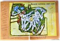
1978réf. 76031aozThe Augusta National Golf Club 1978. imitation_leather. Good/Missing. 0x0x0. Signed by Other. Signed and isncribed by golf course designer Fred Sparks. Oversized green hardbound without dust jacket. Apart from the inscription no text markings noted. The Augusta National Golf Club hardcover
1931réf. ABE-5174254313FORMAT 32 CM X 45 CM-EN COUVERTURE "TOULON EST CHAMPION DE FRANCE DE RUGBY"/SCENE DE LA FINALE DU CHAMPIONNAT DE FRANCE A BORDEAUX ENTRE LE R.C.TOULONNAIS ET LYON O.U. "UNE DANGEREUSE OFFENSIVE LYONNAISE ECHOUE SUR LA LIGNE DE BUT TOULONNAISE"-LA COURSE PARIS LILLE REVIENT AU BELGE DERVAES/1P/2 PHOTOS-LE CHAMPIONNAT DE FRANCE DE GOLF/"AVEC LES JOUEURS SUR LE PARCOURS DE CHANTILLY"/1P/4 PHOTOS-LA FINALE DU CHAMPIONNAT DE FRANCE DE RUGBY/2P/6 PHOTOS-AUX ARENES DE LUTECE LE FOYER DE MULHOUSE EST CHAMPION DE FRANCE DE BASKET POUR LA 7 E FOIS/PHOTO PLEINE PAGE-LES PRECIEUX CONSEILS DE JOHNNY WEISSMULLER/COMMENT ON DOIT POUVOIR AMELIORER LE CRAWL/2 PHOTOS-PETITES DECHIRURES PERIPHERIQUES
4to. (2), 132, VIII, 132, 55, (1) pp. Contemporary vellum. First edition of the annals of Egypt written by Jamaleddin Abul Mehassen. Original Arabic text followed by the Latin translation and Latin notes, each with separate pagination. - Occasional browning to text. An errata leaf follows the title page. Old library stamps of the Congregation of the Redemptorists, New York, and the Bibliotheca Mt. St. Alphonsus, Esopus, N.Y. - Rare. Schnurrer 184. Ibrahim-Hilmy II, 25. Gay 2073. OCLC 165551800.
1984152 pages. Index. Footnotes. Reproductions of archival black and white photos. Includes two voters lists from over one-hundred years ago. Moderate wear. Unmarked. Binding intact. A sound copy of this informative history. Book
4to. 3-36, (2) pp. With 1 folding map of the Sinai Peninsula (450 x 692 mm) in rear pocket. Original printed wrappers. Rare contemporary account of the 1956 Israeli "Operation Kadesh" in Sinai during the Suez Crisis, under the chief of staff of the IDF, Moshe Dayan, in Hebrew. Israeli military planning for this operation hinged on control of four main military objectives: Sharm el-Sheikh, Arish, Abu Uwayulah (Abu Ageila), and the Gaza Strip. Moshe Dayan's plan put an emphasis on air power combined with mobile battles of encirclement. Israeli forces would in a series of swift operations encircle and then take the main Egyptian strong points in the Sinai. Reflecting this emphasis on encirclement was the "outside-in" approach of "Kadesh", which called for Israeli paratroopers to seize distant points first, with those closer to Israel to be seized later. Thus, the 202nd Paratroop Brigade commanded by Colonel Ariel Sharon was to land in the far-western part of the Sinai to take the Mitla Pass and thereby cut off the Egyptian forces in the eastern Sinai from their supply lines. The map shows the main troop movements on the peninsula, highlighting military objectives such as Sharm-el-Sheikh as well as the landing points of the Paratroop Brigade. - Only 6 copies worldwide, 4 of which in the United States, and one in the Jewish National Library in Jerusalem. - A little worn at the edges, otherwise very well preserved. OCLC 763138388.
1951Pages 1025-1124 (99 pages in total). Includes index and prices. Profusely illustrated in black and white. Intended to be read by shop owners. Presents a wonderful cross-section of "the most complete stocks in Western Canada" - from page 1024. Extensive listings of firearms and related products. Also included are products for dogs, traps, thermos and related products, flashlights and batteries, lighters, harmonicas, cards, baseball, tennis, badminton, golf, football, hockey, soccer, volleyball, basketball, boxing, lawn bowling, croquet, roller skating, snow shoes, bicycles and ski equipment. Above-average but not excessive wear. Front cover taped in place. Back cover missing. A very enjoyable and nostalgic item. Young readers will be amazed to see how far today's gear has advanced in the past 50+ years, particularly ski equipment. Book
8vo. IX, (5), 333, (1) pp. With 8 plates. Yellow cloth with title information in blue on front cover and spine, with a dust jacket designed by Paul Wenck, map of Ethiopia and Arabia on the endpapers. First edition of Coon's account of his experiences in Ethiopia and Arabia. From 1933 to 1934 Coon travelled through Ethiopia to conduct physical anthropological research, but after conflicts with the authorities he had to escape to Arabia. He states in his foreword that the purpose of the present work is a memoir, since it was not meant to "impress the public with our scientific findings, for, interesting as these results may or may not be, they are reserved for more formal publication", but simply to tell what he and two others did during the expedition. C. S. Coon (1904-81) was an American anthropologist and professor of anthropology at Harvard University and the University of Pennsylvania. He spoke ten languages and made notable contributions to the fields of cultural and physical anthropology and archaeology. He was the author of multiple works, including highly controversial works on race, such as "The Origin of Races" (1962), which were widely disputed during his lifetime and are considered pseudoscientific by modern anthropology. - Dust jacket somewhat damaged, covered with clear protective plastic, edges foxed. Otherwise in very good condition. Macro 747. Shapero, The Islamic World (2003), 178. Sotheby's, Burrell sale, lot 889.
808:640 mm. Scale: 1:1,000,000. Folded. First edition. Map of the western coast of Saudi Arabia from Abu Shaibana in the north to Rakah in the south, and from Rabigh and Jeddah in the west to Turbah in the interior. Including parts of Anglo-Egyptian Sudan and Egypt. Compiled by W. O. 1939, drawn and heliographed by O. S. 1940. With 2 printed straight lines giving degrees of longitude dated December 1943. - Inscribed "Mecca 5" by a former collector near lower margin. - A few small tears and creases.
808:640 mm. Scale: 1:1,000,000. First edition. Map of the western coast of Saudi Arabia from Abu Shaibana in the north to Rakah in the south, and from Rabigh and Jeddah in the west to Turbah in the interior. Including parts of Anglo-Egyptian Sudan and Egypt. Compiled by W.O. 1939, drawn and heliographed by O.S. 1940. With 2 printed straight lines giving degrees of longitude dated December 1943. - In excellent condition.