[Blisset, Captain].MareMagnum

4 438 résultats
12mo. 180 pp. Rebound in green buckram. Title page with engraved vignette of a Kangaroo and three full page engraved plates. First edition. - A third hand account of the travels of one Captain Blisset, "an Englishman of birth and large fortune", in company with William Walsh, from Bombay, to the Arabian Gulf, having toured which they pass on to Muscat and Mecca, thence to the Holy Land. Nothing seems to be known of Blisset. Possibly a fictitious account, but the detail seems firmly based on fact, save for the incongruous Kangaroo on the title page.
Large 4to (282 x 230 mm). (4), XXIII, (3), 668 pp. With lithographed portrait frontispiece, 3 engraved maps (2 folding), and 3 engraved plans. Contemporary full calf with gilt spine, two labels, and cover borders. Gilt inner dentelle, marbled endpapers. First edition. Posthumously edited by William Leake, these journals describe Burckhardt's various journeys between 1810 and 1816. It was at Aleppo that he studied Arabic in preparation for his later travels (clandestinely, in Arab guise under the cognomen Sheikh Ibrahim) and he toured Syria, the Lebanon and Palestine. Burckhardt had been recruited by Sir Joseph Banks on behalf of the African Association to carry out these explorations, but unfortunately he died in 1819 before he was able to complete the entire project. - Binding somewhat rubbed along extremeties; hinges and upper spine-end repaired. A little browning and foxing near the beginning, otherwise internally fine. The portrait shows Burckhardt "in his Arab Bernous, sketched at Cairo Feb. 1817 by H. Salt, Esq.". Macro 628. Blackmer 237. Atabey 166. Aboussouan 174. Tobler 141. Röhricht 1627. Weber I, 107. Howgego II, p. 82, B76. Henze I, 406. Brunet I, 1401. Graesse I, 575. Ibrahim-Hilmy I, 106.
8vo. 3 vols. XXIV, (2), 328 pp. XII, 304 pp. XII, 384 pp. With 8 plates, 4 of which are folding, and one folding map. 19th century cloth-backed brown boards, paper spine labels. Second edition. "Acclaimed by critics as one of the most valuable books on travel that had ever appeared, it was the first comprehensive account of the whole of Central Asia" (Howgego, p. 83). - The best-known work of Alexander Burnes (1805-41), a Scottish diplomat, military officer, spy, and explorer who was once nicknamed "Bukhara Burnes" for his role in establishing contact with and exploring Bukhara, a historical stop along the Silk Road and today the seventh-largest city in Uzbekistan. Burnes began his career serving in the army of the East India Company and swiftly became enmeshed in what the British called The Great Game: a series of disputes between the British and Russian empires as each sought to acquire Afghanistan and surrounding areas under imperial rule. This had large ramifications in West Asia and the subcontinent, and Burnes was familiar with many of the local political actors who rose to become major players in the Game, such as Ranjit Singh (1780-1839) and especially Mohan Lal Zutshi (1812-77), an Indian fellow explorer and diplomat who guided Burnes on his trip to Bukhara. Zutshi and Burnes remain at the heart of Burnes's narrative. The folding map at the rear of vol. 1 illustrates the path Mohan Lal Zutshi and Burnes took through West Asia. - Light exterior wear, front cover of vol. 3 detached, otherwise in good condition. OCLC 3813162. Cf. Wilson 35 (1835 ed.). Howgego, 1800-1850, B77.
8vo. XVI, 336 pp. Original blind-stamped cloth. Highly uncommon: the first English edition, translated and abridged by St. John Bayle from Perron's French translation of the author's "Tashhidh al-adhhan bi-sirat al-`Arab wa-al-Sudan". The book is divided into two sections - Dafur and the Wadai - and is an informative anecdotal account of the regions, including detailed accounts of the lineage and customs of the respective royal families and inhabitants. Also mentions the pilgrimage to Mekka undertaken by the author's grandfather and his subsequent life in Jeddah. - Slightly rubbed. Only two copies in institutional possession: OCLC lists records for Oxford and Cambridge only. OCLC 265431715.
12mo. 2 vols. XX, 339, (1) pp. XII, 359, (1) pp. With 8 engraved plates and one engraved folding map of the Arabian Gulf. Contemporary half calf over marbled boards with giltstamped spine and spine-title. All edges sprinkled red. Second edition in English of Niebuhr's excellent account of his travels in the Middle East, Egypt, Persia, India and Arabia, the first scientific expedition to this area, subsidised by the Danish king. Of the five scientists, Carsten Niebuhr (1733-1815) was the sole survivor, and his work represents an important contribution to the study of the Middle East. The maps Niebuhr drew in the course of the expedition were remarkably detailed and accurate. Indeed, his map of Yemen was the first exact map of the area ever, remaining the standard for the next 200 years. The volumes include authentic descriptions of life and customs in Yemen, Oman and elsewhere, with detailed descriptions of Mecca and Medina, Sana'a and Mocha as well as several references to coffee and coffeehouses. The first volume was adapted from Niebuhr's "Reisebeschreibung nach Arabien" (1774) and the second from his "Beschreibung von Arabien" (1772). Previously published in Edinburgh in 1792. - Corners and hinges professionally repaired. With near-contemporary manuscript presentation note to flyleaves: "presented to the Glenbervie Sunday School Library by G. M". Later pencil ownership of the Scottish dentist and naturalist E. G. H. Lightfoot, dated Aberdeen 1953. Some additional pencil notes to pastedown and flyleaf of volume I, including brief biographical notes on Niebuhr in Lightfoot's handwriting. ESTC T176314. Howgego, to 1800, N24. Hünersdorff, p. 1081. OCLC 5416838. Cf. Weber II, 550. Macro 1700. Atabey 873-874 (other eds).
Large 8vo. 2 vols. XIII, (3), 405, (1) pp. VIII, 347, (1) pp. With 2 lithogr. frontispieces and a folding map of the Arabian Peninsula. Contemp. blindstamped cloth with gilt title to spine. Only edition. One of the best English 19th-c. accounts of Arabia and the Gulf. Wellsted's short career was almost entirely devoted to the surveying of the Red Sea, Arabia and Oman, undertaken on a number of expeditions between 1830 and 1837. On board the surveying ship Palinurus he was the first European to set foot in the interior of Oman. Starting late in 1835 from the easternmost point of Oman, Wellsted made his way westward through the Ja`alan region to the Wahibah Sands and then struck north up the Wadi Batha to Samad. There he was joined by Lieutenant F. Whitelock, also of the Indian Navy, who had set out from Muscat later. Together they reached Nazwa, the ancient capital of Oman, and climbed the lower slopes of the Jabal al-Akhdhar, in central Oman. In January 1836 they arrived on the Al-Batinah coast and then turned west, recrossing the Hajar mountains and emerging on the edge of the Dhaharah, the rocky steppe that stretches west toward the Rub` al-Khali. - Bindings rubbed; spines rebacked. Interior somewhat foxed as common. Removed from the Worcester Public Library. Rare; the Peter Hopkirk copy fetched £3,500 at Sotheby's (Oct 14, 1998, lot 1192). Macro, Bibliography of the Arabian Peninsula, 2283. Howgego III, 635. Weber I, 67. Wilson 242. Henze IV, 476. Not in Gay, Blackmer, or Ghani.
8vo. (16), 249, (3) pp., 1 final blank leaf. With a full-page woodcut in the text (illustration of hawking instruments), woodcut initials and ornaments, printer's device on title page and different, larger device at the end. Contemporary vellum (spine professionally repaired). First edition - the edition of 1547 mentioned by Harting and Souhart does not seem to exist, propably confused with Federico Giorgi's work - of the best-known and most authoritative of 16th century Italian books on falconry, the breeding and training of falcons, their ailments, etc. "Carcano states in his Preface that this treatise is the result of forty years' experience as a falconer, and the perusal of all the Italian and French books he could find relating to Falconry [...] The author's reputation as a falconer caused this book to become very popular, and it not only passed through several editions [...], but was extensively copied by subsequent writers, as, for example, Raimondi and Turberville" (Harting, p. 142f.). "An interesting treatise on falcons and sporting dogs, with remedies for their diseases" (Schwerdt). The full-page woodcuts shows a set of veterinary instruments for use by the falconer. - Occasional slight brownstaining; a minute paper flaw to margin of fol. P3 (barely touching text). Lacks 2 leaves of dedication in the preliminaries, not bound with all copies, and the second of the two final blanks, otherwise a fine copy. Harting 267 (p. 141). Adams C 644. BM-STC Italian 148. IA 132.009. Bongi II, 271. Souhart 86. Ceresoli 132. Schwerdt I, 94.
2 pp. 8vo. Modern binder. Parliamentary minutes regarding the sale of a vacant site of some 4/5ths of an acre in the Manama district of Bahrain, originally acquired in 1903 for the erection of the Victoria Memorial Hospital which was demolished in 1953, to the Ruler of Bahrain, H.H. Sheikh Salman ibn Hamad Al Khalifa, who wished to found a Museum and Public Library on the site. The value of the site was estimated at about 70,000 pounds sterling. - With stamp of "The Law Society, London" (29 March 1957).
1960pp. vi, 218. Illustrated with cartoon drawings. 8vo. Original full cloth binding. Hardbound. First edition. Nice condition. **PRICE JUST REDUCED! GAMES BOX 2
8vo. 7, (1) pp. Original wrapperless covers. Trade agreement regulating the trade of goods destined for or exported from ports in Saudi Arabia, and carried in ships calling at Bahrain. In English and Arabic. - Some rust-staining in gutter.
8vo. 11 pp. Original wrapperless covers. Agreement between the UK and the Government of the United Arab Emirates regarding the operation of airlines between the two countries. Such an agreement had become necessary following the Emirates' independence in 1971, when the British-Trucial Sheikhdoms treaty expired.
Folio (210 x 330 mm). (2), 65, (1) pp. Original printed boards, spine reinforced with cloth. Annotated tables of the tribes making up "Al-Muntafiq", a large Arab tribal league in southern and central Iraq then in struggle against British occupation. Edited from the Basrah Arab Bureau's confidential British government handbook "The Muntafik" published that same year. - Corners chipped; erased stamps; stamp and handwritten ownership of "Harry J. Almond, Arabian Mission" (American Mission School). Extremely rare; no copies in OCLC or the British Library.
101 x 71 cm. Constant ratio linear horizontal scale, ca. 1:150,000. Signed by Collingwood. Impressive, early, large-scale map of central Iraq, showing the area between Al Hillah (100 km south of Baghdad) to the ruins of the ancient Sumerian city of Nippur. Indicates sand hills, canals, old river beds, tracks, cultivated areas. Includes inset plans and views of Tel Ibrahim, Zibbleyeh, Nejmi, Niffer, and the Niffer Mounds. - Some paper defects and edge damage restored. Rare; copies are known in no more than two public collections (Bodleian; British Library). Personal copy of the cartographer William Collingwood, signed by himself as well as by Cdr. W. B. Selby, R.I.N. - Selby began his distinguished surveying career in 1837 when, as a midshipman, he embarked on the expedition first to lay navigation buoys in the mouths of the Indus River and then to chart some coastal areas in the Horn of Africa. By 1846 he was back working off the mouth of the Indus, having made his reputation in Mesopotamia (in 1840-41), and thereafter achieved considerable acclaim for his numerous other surveys, including those during the military expedition to Persia in 1856, before returning to England at the end of 1862. He was succeeded as Surveyor of Mesopotamia by his protégé, Lt. William Collingwood (a distant cousin of the Admiral), who had already done much valuable work in the region, including the large-scale, though surreptitious, mapping of Baghdad in 1855, described by him as follows: "The survey of the city of Baghdad was completed entirely by myself and under very unpleasant restrictions [...] The Turkish Government were not to know anything about it [...] and I was left to survey the town as best I could, and under such difficulties that at times I had to note bearings and paces all over my white shirt, where best I could get the pencil at the time [...]". During this same expedition, Collingwood also surveyed the Shatt-ul-Arab, the city of Bussorah (also by stealth) and much of the country between the Tigris and Euphrates Rivers, and he was undoubtedly one of the most gifted and productive R.I.N. surveyors of his day. OCLC 863254646.
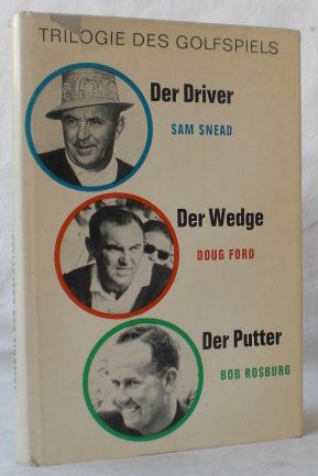
1965réf. 16573Wiesbaden: Golf- und Sport-Verlag H.E. Gaertner. (1965). 292 S. Gr.8°. Mit zahlr. Abbildungen. Deutsche EA. OLeinen, OU.
Folio (305 x 190 mm). (2), 61, (1) pp. Title page printed in red and black. With 11 (instead of 18?) plates containing 22 copper engravings. Modern boards. Fascinating, little-received geographical study focusing on the Eastern Mediterranean and Asia Minor, then under Ottoman rule. The anonymous late 17th-century German author hides behind the name of "Philo Cosmographus" and is evidently identical with the "Philo Chronographus" who produced the similarly themed chronographical work, "Arca Temporum", which was often issued together with this, though produced by a different publisher and catalogued separately. The present work features an overview of the geography of the Ottoman Empire, including the Aegean, the Sea of Marmara, and the Black Sea region - the "three seas" to which the title refers. Numerous pages of plates (each page containing two copper engravings) depict maps and views as well as animals (a hyena and sheep, Iraklion and Chania, Nauplia, Koroni, Rhodes, Thessaloniki, Belgrade, Izmir, etc.). - The number of plates, and indeed even the arrangement of engravings on a single page, varies from copy to copy, but this wants 8 plates as compared to the table of plates provided in "Arca Temporum". Occasional inkstains, but well-preserved. VD 17, 7:688727L; 3:605737C. Weller, Pseud. 439.
1992477 p. Hardcover Very good condition good
1996réf. 08201Hamburg, Jahr Golf Magazin, 1996. PP, OU, 172S, gutes Exemplar
1972126 pages. Features: Seven IRA men escape from prison ship The Maidstone; Leo Durocher; Noah Dietrich recalls the day they jailed Howard Hughes; Alan Gibbs - Hollywood stuntman; Handsome Marlborough centerfold loose but present; Eva Cropp - she swims with dangerous fish; The Uncensored adventures of Lewis and Clark; The Mad Marlin (fish) of Punta Carnero; Golf fashion photos; Five on a Raft - and then there were Three - Juan Puga, Richard Antonio and Tom Rash were rescued from Elliott Key, Florida. Above-average but not excessive wear. Unmarked. Address label on front cover. Book
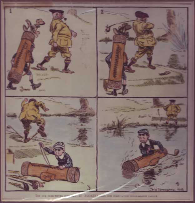
1909réf. 308638ABLondon, Donovan, 1909. 18,5 x 17,5 cm. (guter Zustand).
8vo. (8), 384 pp. Cloth-backed red boards with title inked on spine, likely privately bound. Very rare privately published botanical text on the famous expedition of the Jewish agronomist Aaron Aaronsohn (1876-1919) through the Anti-Lebanon mountain range and his subsequent discovery of what was claimed to be the oldest wild wheat, ancestor of all farmed wheat today. - While the exact line of descent of modern wheat is contested and complex, Aaronsohn's wheat - wild emmer - was indeed ancient, and its discovery remains a landmark moment in historical botany and the study of the history of human civilization. Like much of Aaronsohn's work, his detailed notes on the wild wheat distribution and other botanical notes on the landscapes he surveyed were published posthumously by Aaronsohn's family. The text includes numerous scientific names and an index, plus 13 botanical designs and 38 photoplates documenting the expedition. A folding map at the rear is titled "Aaronsohn's travels in Jordan and the distribution of wild wheat in the land of Israel". Largely in Hebrew, supplemented with scientific Latin, this Hebrew version is very uncommon, as Aaronsohn's work was originally published in French as "Florula transiordanica: révision critique des plantes récoltées et partiellement determinées", also by his family, in 1931. - Binding bumped at extremeties; a few library stamps to title-page, along with some minor paper repairs. Altogether in good condition. OCLC 42945306.
Small folio (185 x 246 mm). (7), 75, (2) ff. With 2 (instead of 4) double-page-sized engraved maps and a double-page-sized compass rose plate, all in contemporary hand colour. Early 20th century half calf over marbled covers with title gilt to spine. The first illustrated printed Turkish book and the second work from the press of Ibrahim Müteferrika. Composed in 1656, this is a compilation containing in its main section a history of the Ottoman navy and naval wars, from the conquest of Constantinople down to the author's own lifetime. It includes an introductory geographical summary of the conditions around the Balkans and the Black Sea, a chronological list of all Ottoman admirals, a description of the administrative organisation of the navy and dockyards, regulations on sea battles, ships in the Ottoman navy, their equipment and maintenance, together with suggestions for improvement. - The maps show the Mediterranean and the Adriatic Sea (some edge flaws; rebacked; lacks the map of the Black Sea and the world map). Some browning and waterstaining throughout; ff. 17-18 transposed between ff. 4 and 5, ff. 25-28 between ff. 22 and 23. Watson 2. Atabey 898. Özege 21273. Babinger 12. Blackmer 1176. De Sacy III, 5017. Toderini III, p. 25, no. II.
4to. (16), 458, (2) pp. With the title in a woodcut architectural frame. Contemporary vellum. "First printing of the Pentateuch in Arabic characters" (Smitskamp). Edited by Thomas Erpenius and printed with his influential nashk Arabic types, cut under his direction by Arent Corsz. Hogenacker in Leiden. It gives the text of a 13th-century translation of the Pentateuch in the Maghreb dialect (spoken in Mauritania). Erpenius was one of the most distinguished orientalists and by far the best Arabist of his day. He published an influential Arabic grammar and several excellent critical editions. His own private printing office, equipped with Hebrew, Arabic, Syriac, Ethiopic and Turkish type, produced its first works as early as 1615. - With bookplate, owner's inscription and library stamp of Verplanck Colvin (1847-1920). Occasional spots, some leaves with a minor waterstain in the upper or lower margin, nor affecting the text. A good copy, with generous margins. Binding slightly soiled and with a restoration to the front inner hinge, but otherwise good. Breugelmans 1622-2. Darlow/Moule 1645. Smitskamp, PO 86.
Engraved map (49 x 37 cm). Contemporary hand-coloured. Matted. Map of the Arabian Peninsula, Turkey, North Africa, Syria, Israel, the Balkans, etc. From the "Theatrum Orbis Terrarum" by Abraham Ortelius. - Slightly age-toned and brownstained. Green faded to brown; repaired tear with tiny holes in the middle. Generally in a good condition. Van den Broecke, 169. Al Ankary 15. Tibetts 42.
Engraved map, outline colour (560 x 450 mm). Decorative map of the Turkish Empire, showing the Ottoman territories in the Balkans, Anatolia, Levant, Arabia and North Africa, published by Henricus Hondius in Atlas sive Cosmographicae Meditationes de Fabrica Mundi et Fabricati figura. The map has a decorative cartouche with the portrait of Ottoman Sultan Mahomet Turcorum Imperat 2. The English translation of the text (1636 edition) includes observations such as "The Countrie is for the most part fruitfull in graine, as wheate, barlie, oats, winter wheate, beanes, pease, and all manner of pulse. It aboundeth in rice, flaxe and cottons. They have vines, whose fruit they make use of after divers manners. The Christians make wine of them, & the Turcks prepare a kind of sweete meate, by mingling honey and grapes together, which seemeth allwayes fresh, both to the sight & tast, this they call Vsum Turssi (sic)." Tibbetts 63. Al Ankary 178. Al-Qasimi 50.
8vo. First edition. XV, (1), 328 pp. With lithographic map bound as frontispiece. First edition; flyleaf inscribed by the author to "Mr A. Regnaudin". Important overview of Turkish trade, resources, infrastructure and municipal organisation by the diplomat David Urquhart (1805-77). After two and a half years fighting in the Greek war of independence, Urquhart was invited to accompany Sir Stratford Canning to Constantinople in November 1831 as an advisor during negotiations to settle the Greek boundary. In 1832 Urquhart was sent to Albania to cultivate the support of Rechid Pasha, leading advisor to the Turkish sultan. Urquhart became a great supporter of Turkey, spending most of 1834 in the country, and encouraged the British government to ally itself with Turkey against Egypt. This substantial book was written to inform the British political class of the possible commercial benefits of an Anglo-Turkish alliance. - Some negligible toning to first few leaves. Very good, uncut in original grey paper-covered boards, spine with original printed label, light wear to extremities. Scarce, particularly in original condition as here. Goldsmiths’ 27883. OCLC 65261681.