4 114 résultats
290 x 210 mm. Hand-coloured lithograph. Matted. Plate from "Recuel [!] de divers portraits des principales dames de la Porte du Grand Turc. Tirée au naturel sur les lieux". "Pour bien vendre sa marchandise / Il est adroit il est rusé / Fait argent de vielle chemise / Et rend neuf un habit usé".
Folio (215 x 344 mm). (4), 34 pp. With a photographic frontispiece showing the Arch of Ctesiphon and 9 folding maps. Original red cloth, lettered in gilt. Revised and enlarged edition: an excellent guide to the roads of Iraq, with notes compiled by government departments and members of commercial firms. The text contains chapters on the "Development of Oil Resources", "The Great Tribes of Iraq", and "The Iraq Police", and offers advice on roads and railways, the Iraq Automobile Association, "Government Regulations for Ladies Travelling in Iraq", and other information on history, culture and political organization of the country. The front pastedown bears a binder's ticket advising the owner that "the solution used in binding this book has been specially prepared in order to render the work impervious to the ravages of insects". - Ink ownership, dated Baghdad, 1934, to pastedown. Extremities slightly rubbed, otherwise very good.
494 x 324 mm. Chromolithographic map. Scale 1:5,900,000. A medium-sized wall map showing the Middle East between the Suez Crisis and the Six-Day War, covering the area from the Eastern Mediterranean to Iran including most of Turkey as well as Israel, Lebanon, Syria, Jordan, Iraq, Northern Saudi Arabia and the Gulf as far south as Qatar. Oil production capacities are shown in barrels, with oilfields, refineries, pipelines, and associated infrastructure indicated on the map. The massive 'tapline' is seen crossing the northern Saudi desert from the Gulf coast to Sidon, while double pipelines run from Kirkuk to Tripoli and to Haifa. From the atlas of Yediot Achronot. - After the Suez Crisis and its associated geopolitical shifts, Britain and France were forced by the USA to abandon their post-imperial plans, and Israel now counted in both U.S. and Soviet plans for their control of Middle Eastern politics. Britain was forced to anchor its Middle Eastern influence in Cyprus, Aden and Iraq, while the increased American influence is evident in the vast Aramco oilfields at Ras Tanura. - Well preserved.
121 x 92 cm. Colour-printed map (folded). Scale 1:20,000,000. A large wall map of the Middle East shortly before the Yom Kippur War, showing the Arabian Peninsula, north-eastern Africa with Libya, Egypt and Sudan as well as Turkey and Iraq pictured in their entirety. A separate inset shows Israel, others show statistics such as population and trade, oil production, etc. - A few large tears to folds, some adhesive tape reinforcements to reverse, but well preserved.
500 x 420 mm. Oval manuscript map in ink and watercolour (blue, brown, green and red; map image including water 295 x 380 mm, the land alone 220 x 305 mm) on a half sheet of extremely large Dutch laid paper (watermark: D&C Blauw IV), with dozens of features labelled in Persian (written in black ink in the nastaliq script) and with animals (including elephants and a dragon), people and 4 European ships. Framed and matted. An 18th century manuscript copy, in colour, of a lost map in the Islamic tradition, with dozens of inscriptions in Persian and extensive pictorial imagery showing numerous mosques, elephants in southern Africa, eastern India and what may be northern Bengal or part of Southeast Asia, snakes and a dragon (with four feet and two pair of wings) in East Asia, birds north of the Caucasus and people in Europe north of the Alps. The regions with people and animals (excluding the dragon and snakes) are also the only regions shown wooded. The oval land is surrounded by oceans with a European ship at each of the four cardinal compass directions: three 3-masted ships flying flags with St George's cross (used by the crusaders, Knights Templar and English and French troops from the 12th century and by the Genoese and others from the 13th century: while it is not St George come to slay the dragon, these European ships in an Islamic map remain a puzzle), and at the south a 2-masted ship with no rectangular flag, all four ships accompanied by rowboats. Inlets can be identified as the Arabian Gulf, the Gulf of Oman, the Red Sea, the Mediterranean, the Black Sea (?) and another in the Far East. A wide straight band of mountains runs west to east from coast to coast, apparently representing the Alps, the Caucasus and the Himalayas, with a few additional mountains in southern India and elsewhere. One can clearly see the Tigris and Euphrates rivers as well as the rivers of the Indus and Ganges valleys. After one passes beyond Bengal it becomes more difficult to identify the topographic features that ought to represent Southeast and East Asia: there is no island to represent Japan, and the peninsula that faintly resembles Korea seems more likely to be China. While some pictorial elements and lettering are designed to be viewed from various sides as one turns the map, there is a distinct bias in the lettering and some of the pictures for west at the head, which is quite unusual (most Islamic maps have south at the head). - We have found no record of any closely similar map, but the topography certainly owes something to the traditional Islamic world maps, perhaps by the 10th-century Abu al-Hasan al-Harrani or his followers such as the 15th-century Ibn al-Wardi. Like most maps in the Islamic tradition (including those of al-Bakri and al-Istakhri), these follow the Greek tradition of Anaximander (6th century BC) in depicting the world as an almost perfectly geometric circle surrounded by the great river or sea Oceanus, and also representing other features with abstract forms. They show the Nile running into the Mediterranean and (almost as its continuation north of the Mediterranean) a channel leading to the Black Sea, which continues via the river Phasis to the northern coast, forming a boundary between Europe and Asia. The present map is much more naturalistic, with an oval form and irregular coastlines. The inlets and rivers also have more naturalistic forms, and the map shows much more detail than do the traditional Greek and Islamic maps (one can recognize Qatar and Ceylon/Sri Lanka, and one of the two islands in the Mediterranean probably represents Crete (is the other Ceylon, Sicily, an oversized Malta, or something else?). Yet in spite of its greater detail and naturalism, its geography is in some ways less accurate than that of its more abstract ancestors. Like the al-Harrani and al-Wardi maps, the Nile has an L shape (though not rigidly geometric like theirs), but the southern end connects to the Red Sea and the northern end passes east of the Mediterranean, continuing directly into the channel leading to the northern coast (with no graphic distinction between the Black Sea and the channel to Oceanus). The Nile also appears to contain an enormous island, but the tower at its northern end might possibly represent the 13th-century minaret at Luxor. The Mediterranean appears as a triangular inlet without even a bulge to suggest Greece or Italy, which many Islamic and Greek maps show clearly. Africa and India extend no farther south than the Arabian Peninsula, with only the Red Sea and the Gulfs separating them. Some Mughal maps, such as that of Sadiq Isfahani (ca. 1647), share the more naturalistic depiction, and Isfahani also depicts Ceylon similarly, but his map shows few geographic or topographic similarities. - Perhaps the most remarkable feature of the present map is the depiction of mosques and minarets, which are so detailed that many can be identified even without recourse to the Persian inscriptions. The rectangular wall of the Great Mosque at Mecca appears clearly with the Ka'bah in the centre and four minarets, one at each corner. This also suggests a latest possible date for the lost original, for three more minarets were added in quick succession, apparently between 1603 and 1629. A recent study suggests that the Ka'bah began to appear in Islamic maps only ca. 1450 (Karen Pinto, "Medieval Islamic maps", 2016, not seen, but cf. Arnoud Vrolijk in Mols & Buitelaar, eds., "Hajj: global interactions through pilgrimage", 2015, p. 216), suggesting that the lost model for the present map with many mosques, some shown in detail, was at least several decades later. This evidence for a date, combined with the naturalistic depiction, suggests the lost model for the present map might have originated in the Islamic realms of 16th-century India. The Great Mosque at Medina is also clearly depicted. Pending more information about the Persian inscriptions (which apparently name regions, cities, mosques, topographic features and curiosities), we can only guess at the other mosques or minarets. We noted one perhaps at Luxor. Two on the eastern side of the Euphrates might be at Basra and Aleppo (with some pyramids in between), while one in North Africa looks like the Great Mosque at Taza and the other might be at Fez. There may some buildings in East Asia, by the mountains near the dragon, but they may merely be smoke or flames from what appear to be burning rocks. A couple of other sites show fortress-like walls (in red in the northern parts of the Arabian Peninsula and India) without a mosque or minaret. - The map is stunning as a work of art, a fusion of age-old tradition with modern techniques of illustration and figural representation, executed in pastel colours with the mountains and ships in several shades of brown, Oceanus and the inlets light blue, the rivers grey, the forests and dragon green and occasional small details in red or pink. In spite of its large size, the map is drawn on a half sheet, so that the whole sheet would measure at least 84 x 50 cm, considerably larger than Imperial and one of the largest sheet sizes produced in the 18th century. The chainlines are about 28.5 mm apart. The watermark or countermark would fall in the middle of the map image, so that it is not identifiable in the framed map. One can make out only some diagonal lines that might belong to a letter W. The map is numbered "No 95" in an 18th-century hand at the upper left, so it may have once been part of a manuscript atlas. - Formerly folded once horizontally and vertically. In very good condition. An 18th century copy of a lost 16th century (?) Islamic map of the world, showing seven mosques or minarets, unlike any other map known to us.
Engraved map with original outline colour and manuscript calligraphy in red ink. With a fine inset plan of the city of Kamianets-Podilskyi in the upper right corner, as well as an ovoid title cartouche, both bordered by Neo-Classical Ottoman-inspired designs. On thick laid, watermarked paper. 60 x 140 cm. Exceedingly rare engraved wall map comissioned by the Sublime Porte, brilliantly labelled and hand-coloured in Istanbul by court calligraphers. A masterpiece of cartography and Islamic calligraphy, the map presents the theatre of the Russo-Turkish War of 1768-74 in its earliest stages. Focussed on the southern Ukraine, it extends from the Mouths of the Danube, in the west, to the Caspian Sea, in the east, rendering the region as it was common before the Russian surveys of the 1770s. The Russo-Ottoman boundary, as it existed between 1739 and 1774, is clearly delineated, with the Ottoman lands outlined in green and Russian territories in yellow, whilst the Polish territories, in the northwest, are outlined in pink. Until the war, the Ottomans controlled Crimea and the southern Ukraine in their entirety, along with most of the Caucasus. - As the Ottoman Empire lacked publishing capabilities, the Porte often relied upon their ancient ally, France, to supply them with custom-printed material, conveyed to the Topkapi Palace via the French Embassy in Istanbul's Pera neighbourhood. The skeleton of the map, engraved in Paris, depicts topographic features and the locations of key cities and fortifications, but omits all text: all names of regions and major settlements were added in Turkey in luxurious red ink. The masterly penmanship would have been executed by a specialized imperial calligrapher: the rich, expensive red ink was reserved for sacred and high-level legal documents under the Sultan's patronage and was only very seldom applied to cartography, indicating that the present map would have been held in particular esteem by the Imperial Court. - A single other example of the map with the Topkapi calligrapher's manuscript work, executed in a similar fashion, survives in the Biblioteca Nacional de España (MR/42/415), very likely once a high-level diplomatic gift to Madrid from Sultan Mustafa III, anxious to improve his diplomatic and trading links with the Bourbons. In addition, a single blank example of the engraved map template is held by the Bibliothèque nationale de France (CPL GE DD-2987, 3089 B), formerly in the collection of the famous cartographer Jean-Baptiste Bourguignon d'Anville, who is known to have had privileged access to maps created for the French diplomatic corps. - Resplendent original calligraphy, several old tears professionally repaired without loss. An extremely rare survival in fine condition. Biblioteca Nacional de España, MR/42/415. Elena Santiago Páez, La Historia en los mapas manuscritos de la Biblioteca Nacional (Madrid: Biblioteca Nacional, 1984), no. 336 (p. 266). Not in Özdemir, Ottoman Cartography (2008).
794 x 628 mm. Scale 1:4,000,000. Mounted on cloth. Folded. Rare, large-scale map of western Arabia including all but the easternmost part of the Peninsula (ending about 100 miles east of Qatar). "This map has been compiled almost entirely from published sources, of which the principal are (1) Hunter's Arabia 1:2,000,000; (2) War Office quarter inch of S.W. Arabia; (3) War Office 1:250,000 of the rest of the Turkish Empire; R.G.S. materials have also been used" (editor's note). Some slight brownstaining in places, otherwise well-preserved. Not in OCLC.
Folding map of Arabia (180 x 135 cm), coloured in outline, dissected and mounted on cloth (24 sections). The exceptionally rare first independently issued edition of this famous, meticulously prepared map of Arabia and the Gulf. The "Hunter map" is an enormous, wall-size chart showing an astounding degree of detail. The "Gulf portion being largely based on actual surveys can be considered fairly accurate. [...] Kuwait (except that portion based upon actual surveys) Hasa, Jabal Shammar, Qasim, 'Aridh, Oman, Hadhramaut are the result of exhaustive use of detail supplied by travellers supplemented by months and months of enquiry by local Political Officers. The map of these portions can certainly claim superiority over any previous work of the kind" (Notes on the Map of Arabia and the Persian Gulf [...] compiled by Capt. F. Fraser-Hunter 1905-1908 [Calcutta, 1910], p. 1). - The Canadian-born Hunter later became a major figure in British India's Intelligence Service. As the author recalled in his 1919 "Reminiscences", "a great deal of the information on the map was from sources considered secret at the time" (p. 357). Special surveys of the country's interior areas were carried out to achieve a hitherto unprecedented degree of accuracy: "The map was a distinct advance on anything which existed, as in 1908 no general map of Arabia on such a large scale existed" (p. 360). - Hunter's map was first issued in a very limited press-run to accompany John G. Lorimer's "Gazetteer of the Gulf" (1908); at that time it still bore the title, "Map of the Persian Gulf, 'Oman, and Central Arabia". It was subsequently used (and praised) by St John Philby during his journey across Arabia. Indeed, reliable topographical information was an invaluable asset not least to the local Sheikhdoms in their territorial disputes during this politically volatile age: Hunter recounts that on one occasion, the Sheikh of Umm-al-Qaiwan went so far as to torture his relative, the Sheikh of Abu Dhabi, into signing away his right to strategically important islands in the Arabian Gulf, a stratagem foiled only by the happy intervention of the British Political Resident. - Stamp of the University Library of Nijmegen on the cloth backing. A very few minute traces of worming, otherwise in fine, spotless condition. Never seen in the trade: the only two copies of this map in auction records were both of the 1914 issue (Christie's, 2012, and Sotheby's, 2013). Not in Al Ankary or Al-Qasimi.
Folio (244 x 345 mm). Arabic manuscript, Bihari script on paper. 287 (instead of 292) ff., foliated 364-655 (lacking 550-551 and 622-624). Surah headings in gilt and colours, verse divisions marked by gold and black ink rosettes, numerous circular and tear-shaped markers in the margins, elaborately ornamented in gold and colours. Bound in modern oriental-style full leather with fore-edge flap and recessed cover decorations. Part four of a pre-Mughal Qur'an commentary, treating the text from Surah XXI, Al-Anbya (The Prophets) to Surah LXXV, Al-Qiyamah (The Resurrection). - Lacks five leaves according to the foliation; some dampstaining; several edge flaws (more severe near the end of the volume), often remargined. Traces of dust in the gutter throughout. In all a fine example of an early Qur'anic manuscript. - Provenance: 1950s private ownership stamp of the "Mohd. Halim Salimi Library", Kandahar, Afghanistan, on fol. 490v. Mohammed Halim Salimi of Kandahar worked in an administrative capacity for the USA's International Cooperation Administration (ICA) Mission to Afghanistan in 1959. In 1960 Salimi applied to the ICA for reimbursement of a lost sum of $123.88; the application was refused on the grounds that Salimi was not in fact an ICA employee but was sub-contracted by the agent Herman Klee (see report B-144148-O.M., 1 Nov 1960). Acquired from Hampel Auctions, Munich. Cf. S. A. Blair, Islamic Calligraphy (Edinburgh 2006), pp. 386-390; Qur‘an, exhibition catalogue (Istanbul 2010), pp. 350f., no. 92.
210 x 170 mm. Pencil and ink on paper, the map ruled in red. Small plan of the city and the adjacent terrain, obviously drawn around the time of Snouck Hurgronje's visit, during the last decades of Ottoman rule.
Ca. 235 x 190 mm. Original hand-coloured map on tissue paper. In Ottoman script and Arabic. Two hand-drawn maps on a single sheet, made in the Ottoman Empire, likely in Istanbul, near the beginning of the 20th century. The map to the left depicts the Baghdad Vilayet, embracing Central Iraq. The map on the right features the Basra Vilayet, extending from Southern Iraq down the southern coast of the Arabian Gulf to include Kuwait, what is now the Dhahran area of Saudi Arabia, Bahrain, and Qatar. By the late 19th century the Gulf States had become de-facto British protectorates and were no longer practically subject to Ottoman rule; still, the Sublime Porte never relinquished its sovereignty. - Maps such as this, executed on thin tracing paper, were commonly made as educational tools at elite Ottoman schools and universities during the early 20th century, although few such specimens survive. - Clean and bright, with light creasing and traces of an old vertical centrefold.
Large 4to (274 x 210 mm). 6 pp. on 4 leaves (final leaf blank), sewn. Latin chancery manuscript, ink on paper. Variously revised draft for a Papal decree, asking the cardinals and others to raise monies for the Church to fight the Turks as well as other heretics: "Sixtus V, in order to better govern the Church and safely protect it from all dangers, judges that the Church needs a larger amount of money. The first year the pontificate had 100,000 gold coins, as did the second, to make 1,000,000 gold coins to be guarded in the safe of the Castel Sant'Angelo. In order that they be safely guarded, two constitutions have been issued and an enormous fleet is to be prepared, as the Tyrant of the Turks as well as heretics and schismatics are a threat to the bark of Saint Peter, and large numbers of people are eager in both France and Germany to defend against the enemy. Sixtus V orders his dear brothers, the Cardinals of the Catholic Church, to bring the Holy See another 1,000,000 golden coins, and advises them how to collect the money and the divisions to be made among them for doing so, how often to pay, etc. [...]". As comparison with the final version shows, the present text underwent further editing, and not all changes here drafted made it into the final text. - Occasional slight browning and ink-bleeding, but very well preserved altogether. Cf. Bullarum diplomatum et privilegiorum Sanctorum Romanorum Pontificum. Taurinensis editio, vol. IX (1865), p. 1-4.
8vo (135 x 90 mm). 11 pp. Ink on paper, written space 110 x 65 text area approx. Text in black with "points" in gold within the framework of various colours. Pages mounted within coloured rules. Title page in red, purple and gold (worn with some losses). Contemporary leporello binding. Devotional manuscript, bound as a leporello. Begins with "bi-hawli llah wa-quwwatihi" ("with God's power and strength"); text has been separated and continues on a previous page. Elaborately decorated title and chapter heading within ornamental borders, gilt and coloured. The name of the scribe, Muhammad Ja'far al-Lahijani (from Lâhîjân in northern Iran on the Caspian Sea), as well as the date 1246, are stated on the final page. - Partially worn and damaged; front cover shows a floral design on cloth (rubbed and chafed); the back cover is missing. Some brownstaining and chipping; a few leaves show old repairs and marginal defects.
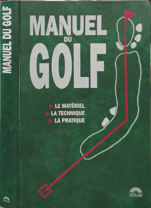
1992réf. 17936Solar 1992 223 pages in8. 1992. Broché. 223 pages. LE MATÉRIEL LA TECHNIQUE LA PRATIQUE
réf. 6465SOLAR Broché au format 13x19cm , couverture illustrée souple de l'éditeur , 223 pages nombreux croquis explicitant les positions , quelques photographies en couleurs ,très bon état , 224 pages .
1999réf. LFA-126743730Un ouvrage de 224 pages, format 140 x 210 mm, illustré, broché couverture couleurs, publié en 1999, Editions Solar, bon état
1992réf. 8165Solar 1992 223 pages in8. 1992. Reliure editeur cartonnée. 223 pages. Ce manuel pratique de Vivien Saunders est un guide complet pour apprendre et progresser au golf. Il couvre tous les aspects du jeu : le choix et l'utilisation du matériel (des drivers aux putters) la maîtrise des techniques de base (stance grip swing) l'entraînement la stratégie en compétition et l'interprétation des règles. L'approche est adaptée au niveau du joueur plutôt qu'à la performance des champions
8vo. 3 parts in one volume. (72), (4), 184, 71, (1), (16), 278 pp. With 12 engravings in the text, 3 folding plates and several woodcuts. Contemporary English calf with red label to gilt spine. All edges red. First edition. Important work dedicated to oriental games from Arabia and Persia as well as from India and China, including backgammon, draughts and dice. Also contains the first scholarly account devoted to the history of chess (pp. 53-137), with two folding plates showing chessboards, engravings of a giraffe, and examples of various types of chessmen (English from the time of Caxton; Turkish; and several kins of Indian specimens). The second part explains, inter alia, the "Promotiones Mandarinorum", the history of dice, and many other Chinese games. Contains numerous texts in Hebrew, Chinese, Arabic, Greek and other languages. Hyde was an orientalist and later became Bodleian Librarian. "Ouvrage curieux. Les exemplaires n'en sont pas communs" (Brunet). - Upper spine-end professionally repaired; inner hinges reinforced. Light browning throughout due to paper. From the library of the chess-player and collector James Wilson Rimington Wilson (1822-77) of Broomhead Hall near Sheffield, with his autograph ownership in ink ("J W Rimington Wilson / Chess Library") to pastedown. Graesse III, 403. Von der Linde I, 88-90. Cordier (Sinica) 3142. Wing H3875 & H3877. ESTC R1348.
8vo. 3 parts in one volume. (72), 184, (4), 71, (1), (14), 278 pp. With 12 engravings in the text, 3 folding plates and several woodcuts. 19th century mottled boards, spine ruled in gilt, titled in gilt on black leather spine label. All edges speckled. First edition of this important work dedicated to oriental games from Arabia and Persia as well as from India and China, including backgammon, draughts and dice. Includes the first scholarly account devoted to the history of chess, as well as Asian board games from Arabia, Persia, India, and China, including backgammon, draughts, and dice. Two folding plates illustrate chessboards; further in-text illustrations show the various types of game pieces in Caxton-era England, Turkey, and India. The second and third parts explain the history of dice and many other Chinese games. - Contains numerous texts in Hebrew, Chinese, Arabic, Greek, and other languages. "Ouvrage curieux. Les exemplaires n'en sont pas communs" (Brunet). Hyde was an orientalist and later became Bodleian Librarian. - Binding lightly rubbed at extremities, outer front hinge splitting, small paper library label on lower spine. Paper repair to top right edge of front free endpaper and to reverse of largest folding plate. Interior gently toned, edges of folding plates lightly rubbed, a few inked and penciled notes on front endpapers. Graesse III, 403. Von der Linde I, 88-90. Cordier (Sinica) 3142. Wing H3875 & H3877. ESTC R1348.
815 x 1140 mm (on 2 separate sheets). The first distance-time route map of the Ottoman Empire, one of the great masterpieces of Ottoman thematic cartography. Devised by the General Staff of the Ottoman Army and depicting the entire realm of the Sublime Porte from Albania to Yemen, it gives travel times between hundreds of locations, including various routes of the Hajj. - The map captures the scene during the middle of the rule of Sultan Abdul Hamid II (reigned 1876-1909), during which the empire still controlled vast territories in Europe, Asia and Africa, extending from the Balkans to the Arabian Peninsula. It is centred upon Anatolia but includes all the core regions of the Empire, extending from Bosnia in the northwest to the head of the Arabian Gulf in the southwest, and from Crimea and Baku in the north and east to Lower Egypt in the southwest. In the lower right corner is an inset capturing the western Gulf, including Kuwait, Bahrain, and Qatar; an inset above details the Red Sea, including Hejaz, Asir and Yemen; a larger inset in the lower left depicts Ottoman Libya as well as parts of French Tunisia and Algeria. Annotated in Ottoman Turkish throughout, the map is traversed by hundreds of lines that connect every city and town of importance, representing the main land travel routes between these centres; each segment states the estimated travel times between the points. The map also features a chart comparing distances between the principal centres: on average, the chart shows, it took 18 hours to travel from the Red Sea port of Jeddah to the holy city of Mecca. - This is the first map ever to display the distances between all significant travel points in the Ottoman Empire and would have been vitally useful to soldiers, merchants, and government bureaucrats planning their itineraries. It was also one of the only maps to give an approximately accurate notion of the times and distance along several of the most important Hajj routes, including the famous Syrian Hajj Road from Damascus to Mecca, now considered by UNESCO for World Heritage Status. - Transportation had always been one of the great challenges confronting the Ottoman Empire, an astoundingly vast realm spanning three continents and traversing some of the world's most rugged terrain. Yet the Hamidian Era marked a period of rapid modernization, including the creation of macadamized highways, railways and modern ports, and saw the rise of sophisticated cartography. The General Staff was able to draw on exhaustive highway surveys and recent itinerary records. The present map also depicts the rapidly expanding Ottoman railway system, after a wave of development had revolutionized travel in the empire's European domains, but just before an unprecedented boom in railway construction would do the same for Ottoman Asia. The Balkans are traversed by several railways: most notably as of 1888 the great port of Salonika was connected to the rest of Europe by rail, while Istanbul was linked to the European system for the first time that same year, providing the direct route for the famed Orient Express, which commenced in 1889. One will also notice the first great leg of the Anatolian Railway that connected Istanbul to Ankara on 31 December 1892, completed only a matter of weeks before the present map was issued. - Although Ottoman cartographers were producing topographic and thematic maps of the highest sophistication and diversity, every bit as impressive as those of the best German and French and British mapmakers, these works tend to be very rare today and are not nearly as well known as they deserve to be: they were almost invariably issued in small print runs, and maps intended for practical use in the field, such as the present work, tended to perish easily. Also, Turkey's switch to the Latin alphabet, in 1928, ensured that many of the surviving earlier maps were discarded, making this specimen a rare survival of an historic cartographical achievement. - Brownstains and waterstains.
Folio (422 x 528 cm). Lithogr. t. p. and 60 lithogr. plates, all in original hand colour, captions often raised in gilt. With 10 leaves of letterpress text. 10 instalments in the original printed wrappers as issued. Stored in contemporary green half calf with giltstamped spine and cover label. Ties. - (Includes): Die Uebergangsländer von Asien und Afrika, begreifend: Arabien nebst Mesopotamien und Syrien und das Nilgebiet. Munich, C. Wenng, 1845. Engraved map with contemporary border colour. 640 x 544 mm. Scale 1:7,000,000. Only edition of the rare variant with all the plates and in their splendid original colour: the personal copy of Duke Maximilian in Bavaria. "Published in ten parts. The plates show costume of the period and also that of earlier times, taken from paintings" (Hiler). The picturesque views, which include Cairo, Alexandria, Jerusalem, La Valletta, Luxor, and Thebes, genre scenes and landscapes, are all framed within a decorative border and arranged as a small painting. The Nuremberg artist Mayr, especially well-known for his depictions of battles scenes and horses, was personal painter to Duke Maximilian, whom he accompanied on his 1838 journey of the Orient. The group had departed from Munich on January 20 with a small entourage, travelling via Venice, Korfu, Patras, Athens, Alexandria, and Cairo to the Holy Land. They returned to Munich after eight months on 17 September 1838; the following year, Maximilian was made honorary member of the Bavarian Academy of Sciences. - Some foxing to letterpress explanatory text, plates beautifully preserved with only the backing paper showing occasional duststaining. From the library of Duke Maximilian at Tegernsee Castle, retaining the original shelfmark label on the spine. - Includes the extremely rare map of the Arabian Peninsula and the Middle East which was published only in 1845, at the instigation of the naturalist Gotthilf Heinrich von Schubert (1780-1860) and the geologist Joseph von Russegger (1802-63), to satisfy this frequently noted lack in Mayr's production (some foxing, but also finely preserved). Ibrahim-Hilmy II, 26. Gay 90 (only 36 plates). Lipperheide Ma 22 (= 1589). Hiler 578. Tobler 161. Graesse IV, 457. Engelmann 124. Kainbacher 265 ("a rarity"). Thieme/Becker XXIV, 477. Nagler VIII, 498f. ("highly memorable drawings"). ADB XXI, 139ff. Not in Blackmer or Abbey (Travel). Not in Colas.
Folio (422 x 528 cm). Lithographed title-page and 60 lithographed plates, all in original hand colour, captions often raised in gilt. With 10 leaves of letterpress text. Half calf with giltstamped spine. (Includes): Die Uebergangsländer von Asien und Afrika, begreifend: Arabien nebst Mesopotamien und Syrien und das Nilgebiet. Munich, C. Wenng, 1845. Engraved map with contemporary border colour. 640 x 544 mm. Scale 1:7,000,000. Only edition of the rare variant with all the plates and in their splendid original colour: "Published in ten parts. The plates show costume of the period and also that of earlier times, taken from paintings" (Hiler). The picturesque views, which include Cairo, Alexandria, Jerusalem, La Valletta, Luxor, and Thebes, genre scenes and landscapes, are all framed within a decorative border and arranged as a small painting. The Nuremberg artist Mayr, known especially for his depictions of battle scenes and horses, was personal painter to Duke Maximilian, whom he accompanied on his 1838 journey of the Orient. The group had departed from Munich on January 20 with a small entourage, travelling via Venice, Korfu, Patras, Athens, Alexandria, and Cairo to the Holy Land. They returned to Munich after eight months on 17 September 1838; the following year, Maximilian was made honorary member of the Bavarian Academy of Sciences. - Some foxing, otherwise splendidly preserved. Includes the extremely rare map of the Arabian Peninsula and the Middle East which was published only in 1845, at the instigation of the naturalist Gotthilf Heinrich von Schubert (1780-1860) and the geologist Joseph von Russegger (1802-63), to satisfy this frequently noted lack in Mayr's production (some foxing, but also finely preserved). Ibrahim-Hilmy II, 26. Gay 90 (only 36 plates). Lipperheide Ma 22 (= 1589). Hiler 578. Tobler 161. Graesse IV, 457. Engelmann 124. Kainbacher 265 ("a rarity"). Thieme/Becker XXIV, 477. Nagler VIII, 498f. ("highly memorable drawings"). ADB XXI, 139ff. Not in Blackmer or Abbey (Travel). Not in Colas.
réf. 5h3029Gulf Craft United Arab Emirates 2017. 143 S. mit zahlreichen Abbildungen Pappband quart. - gutes Exemplar / good condition / Text englisch - unknown
8vo. 2 vols. 88, 47 ff. Original Japanese fukuro-toji bindings. First Japanese edition: the first Japanese book on the life of the prophet Muhammad, drawn from Prideaux's "The True Nature of Imposture Fully Display'd in the Life of Mahomet" (1697) and translated into Japanese by Hayashi Tadasu, later to become Japan's Minister for Foreign Affairs. Rare as a complete two-volume set. - Bindings very slightly stained, otherwise fine. Cf. Chauvin XI, 185f., 656ff. (other editions).
8vo. (10), 547, (1) pp. With additional engraved title page and 6 engraved plates. Contemporary vellum with handwritten spine title. Uncommon Dutch edition of du Ryer's version, in a translation by J. H. Glasemaker (previously published in 1658), with a Life of the Prophet and numerous engravings by Caspar Luyken (1672-1708). Du Ryer's 1647 French version served as the basis for further translations of the Qur'an (including English, German, and Russian), and was instrumental in introducing Europeans to the tenets of the Muslim faith. - Block somewhat loosened, but still a good copy. Chauvin X, p. 129 (phi). Cf. Schnurrer 428.