ARABIAN GULF - WYATT, SBiblio.com
4.432 resultados
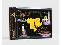
1955ref. 188201On board HMS Loch Alvie: South Asia and Arabian Gulf 1955-56. Striking visual record of the Gulf at the dawn of the oil boom An attractive photograph album compiled by a Royal Navy rating during service in the Gulf in 1955-56 notable for its early views of Abu Dhabi and other sites in the present-day UAE on the eve of the oil transformation. Drawn to the stark coastline and improvised shore installations he recorded places that within a decade would be reshaped by petroleum infrastructure and urban expansion. Several images relate to Abu Dhabi. A view of Das Island dated 11 April 1956 shows a bare shoreline with oil drums and rudimentary structures in the first phase of development linked to the Umm Shaif field. At Khawr al Bazm 19 April 1956 he photographed the coast from the ship and the firing of a 21-gun salute for the Queen's birthday juxtaposing imperial ceremony with an undeveloped littoral. Four deckle-edged photographs depict Dalma Island - then a remote outpost - including a grave the remains of a wrecked dhow and the stretch of coast where the vessel was driven ashore in bad weather. Today Dalma is recognised as a major archaeological site within Abu Dhabi emirate. Dubai appears in a 22 April 1956 view of water taxis and the souq along Dubai Creek still a modest mercantile settlement. The following day Lord and Lady Mountbatten paused there during their return from Asia and Australasia an event marked by guards of honour and captured in the album. A coastal view of Dibba on the Musandam Peninsula - now divided between Oman and the UAE - records the rugged shoreline before modern development. Although centred on the Gulf the album also includes related regional material - Bahrain including Juffair naval base Qatar's early oil installations at Umm Said and Halul Island and shipboard scenes - placing the UAE images within the wider strategic network of Britain's post-war naval presence east of Suez. The volume concludes with an official photograph of HMS Loch Alvie and a track chart of her cruise under Captain C. J. Matthews sailing from Chatham in July 1955 and returning in July 1956. Landscape folio 270 × 390 mm. 88 mounted silver gelatine photographs the majority personal rather than purchase and 24 of which relate to the Gulf various formats mostly 105 x 80 mm the great majority captioned in white ink leaves additionally decorated with small sketches and various ephemera. Asian black lacquer album silk ties at the spine typical of those available at the Liberty Stores Aden lettered "Souvenir of Aden" on the front cover with a hand-painted map of the Arabian Peninsula and Red Sea surrounded by images of a mosque camel dhow and local inhabitants HMS Loch Alvie cap tally pasted to spine edges gilt decorative gold and silver leaf spackled endpapers; black card mounting leaves. Corners a little bumped and worn a couple of cracks to the lacquer to the back cover; some tissue guards a little creased contents otherwise clean sound and complete; very good. unknown
2006ref. 1-0810955423Harry N Abrams Inc 2006. Paperback. New. 303 pages. 10.50x8.00x1.25 inches. Harry N Abrams Inc paperback
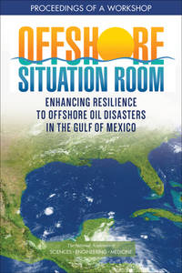
2022ref. x-030926913XNational Academies Press 2022. Paperback. New. 86 pages. 9.02x5.98x0.79 inches. National Academies Press paperback
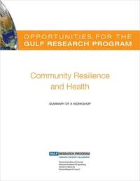
2015ref. x-0309368529Natl Academy Pr 2015. Paperback. New. 1st edition. 75 pages. 10.75x8.25x0.25 inches. Natl Academy Pr paperback
ref. DADAX0367193086New unknown
ref. DADAX0415656664New unknown
ref. DADAX0367152673New unknown
ref. DADAX0367450305New unknown
ref. DADAX0367866986New unknown
ref. DADAX0415542715New unknown
ref. DADAX0415522226New unknown
ref. DADAX1138183318New unknown
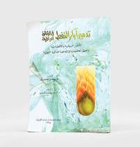
1995ref. 182920Kuwait: Markaz al-buhuth wa-al-dirasat al-Kuwaytiyah 1995. First edition of this well-illustrated study on the environmental impact of the destruction of oil wells in Kuwait based on government documents issued by the Iraqi government during the Gulf War. The work presents this damage substantiated by copious data as a main goal of the Iraqi war strategy of delayed sabotage. An appendix lists names of Iraqi officers accused of being "environmental criminals" as they took part in the identification of targets and methods and the execution of the plan - phases which are carefully described in the first part. The second part discusses subsequent damages to the economy public health and the environment including air and water pollution and their impact on living organisms. The third part describes the strategies employed to limit the damage such as the efforts of firefighters in extinguishing burning oil wells. Quarto. With facsimiles of documents colour illustrations and maps. Text in Arabic. Original pictorial wrappers wire-stitched as issued. Pencilled Arabic word at head of last verso. Extremities a trifle rubbed or creased contents clean: a very good copy. unknown
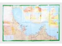
ref. 181557Saudi Arabia: Kruger for I.P.A. International Bookshops Dharan Airport 1977. Road construction faster than map production A folding road map of the Gulf and an interesting snapshot of its natural and human geography in the 1970s with 25 attractive photographs of Dubai. The map extends from Kuwait to Oman's Jabal al-Akhdar showing primary metalled roads roads under construction secondary roads towns wadis oil wells and pipelines oilfields and the morphology of the terrain. It also features 7 inset maps of the city centres of Manama Doha Abu Dhabi Kuwait Dubai Mutrah and Muscat. The small print in the reference section explains that "all roads under construction are being completed as the progress was faster than our production". The photos of Dubai include views of Dubai Creek dhows dromedaries and camels local inhabitants and the main heritage sites. Colour printed map folded 295 x 157 mm; unfolded 585 x 910 mm. Text in Arabic and English. Seven inset maps of Gulf capital cities verso with 25 colour photograph views of Dubai by Said Salah. Original colour self-wrappers printed in yellow black and white on a red and green ground. A few tiny chips or light wear to some folds couple of minor creases to outer corners: a very good exemplar. unknown
2011ref. 1-1603203990Time Home Entertainment Inc 2011. Hardcover. New. hardback/dvd edition. 556 pages. 10.00x10.25x2.50 inches. Time Home Entertainment Inc hardcover
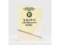
1985ref. 177401Bahrain: Printed by the Arab Printing and Publishing Establishment 1985. Second edition of this booklet produced to showcase the Arab Thought Forum held in Riyadh in April 1985. The first part comprises "Arab Unity: A General Outlook" a speech delivered by Prince Saud al-Faisal Foreign Minister of the Kingdom of Saudi Arabia. It is concerned with the difference between the "failed" concepts of Arab unity and Arab nationalism and their relationship with Islamic doctrines. The second part is devoted to a research paper by the GCC Secretary General concerning the role of the GCC in the achievement of Arab unity. It analyzes regional changes in the decade 1971-1981 and the "Arab degeneration and decline and the downfall of the unity of Arab security" before the establishment of the GCC. Octavo 240 x 165 mm. Text in English and Arabic. Original yellow printed wrappers wire-stitched as issued. Extremities and covers a bit rubbed sunned and foxed first recto and last verso toned: a very good copy. unknown
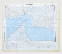
1957ref. 182684London: War Office; Printed for D. Survey WO and AM by Balding and Mansell Ltd 1957. A bright example of this detailed Gulf map Classified "restricted" and issued for military use at the time of the Jebel Akhdar War this double-sided sheet shows much of the modern-day UAE extending northwards from the latitude of Abu Dhabi and the Buraimi Oasis as well as the eastern Arabian Peninsula from the Trucial Coast to Jubail. As with other contemporary GSGS maps the sheet covers six degrees of longitude and highlights towns of significance and other standout features for example oil pipelines and wells water systems and roads and railways. Rayon sheet 630 x 710 mm printed both sides in colour folded as issued. A fine example. unknown
1948ref. 65334London 1948 . 8to. Originalbind med smussomslag. 251 s. Rikt illustrert i svart/hvitt. Engelsk. Smussomslaget slitt og frynsete. unknown
1901ref. 60388London. 1901. 8vo. Rikt dekorert originalbind. Topp gullsnitt. Ubeskåret. 252 s. Illustrert i svart hvitt og farver. J. M. Dent Engelsk. unknown
ref. DADAX1409443140New unknown
ref. DADAX1138023272New unknown
ref. DADAX0415752175New unknown
2008ref. 1-1602393265Skyhorse Pub Co Inc 2008. Hardcover. New. 225 pages. 11.30x9.00x1.20 inches. Skyhorse Pub Co Inc hardcover
2012ref. 1-1618930214Time Home Entertainment Inc 2012. Hardcover. New. expanded edition. 224 pages. 10.00x10.25x1.00 inches. Time Home Entertainment Inc hardcover
ref. 5d5818Albrecht Golf Verlag München 2001. 783 S. in getrennter Zählung mit zahlreichen Abbildungen Pappband quart. - gutes Exemplar / Landkarten Beschreibungen Reisetipps und Länderinformationen - unknown