Montana, JoeBiblio.com

7,851 results
1991ref. 1506381991. Original Sports Illustrated from 1991 inscribed by Hall of Famer Joe Montana. In very good condition. Joe Montana b. 1956 is a Pro Football Hall of Fame quarterback widely regarded as one of the most accomplished players in National Football League history. As leader of the San Francisco 49ers during the 1980s Montana guided the team to four Super Bowl championships XVI XIX XXIII and XXIV and was named Super Bowl Most Valuable Player three times. Known for his composure under pressure and precision passing he became emblematic of late-game performance earning the nickname “Joe Cool.” He is a two-time NFL Most Valuable Player and eight-time Pro Bowl selection. unknown
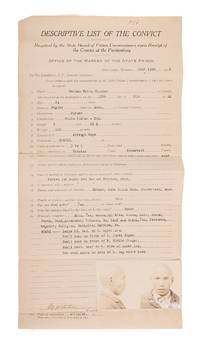
1922ref. 832611922. Deer Lodge Montana 1922. 16-1/4" x 8-1/2. Deer Lodge Montana 1922. 16-1/4" x 8-1/2". Penitentiary Admission Form for a "Souix Indian" Convicted of Attempted Rape Montana. Criminals. White Thunder Herman b. 1900 or 1901. Penitentiary Admission Form for Herman White Thunder. Deer Lodge Montana July 13 1922. 16-1/4" x 8-1/2" 41.5 x 21.3 cm part-printed form "Descriptive List of the Convict" completed with typewriter. Autograph signature of warden M.W. Potter i.e. Milton W. Potter at foot 2-1/2" x 4-1/4" 6.3 x 11 cm black-and-white composite mug shot photograph of Herman White Thunder tipped onto sheet. Moderate toning horizontal fold lines with some creasing along them some fading to photograph "936" in ink to top margin. Good. $450. This form records the admission of Herman White Thunder described as a "Souix Indian - Drk." sic to the Montana State Prison. He was likely a member of the Lakota or Assiniboine/Nakota tribes part of the Oceti Sakowin Oyate also known as the Great Sioux Nation. He had pled guilty to the attempted rape of a 16-year-old girl in Brockton on the Fort Peck Indian Reservation in July 1922. 21 years old at the time of his admission he was sentenced to three to six years in prison and may have been released around 1926. The form notes his physical characteristics former employment and health status and gives the name of his mother Anna Black Hawk. The "warden's remarks" record that he was Catholic could read and write did not smoke and would be allowed to receive mail. unknown
1922ref. 832611922. Deer Lodge Montana 1922. 16-1/4" x 8-1/2. Deer Lodge Montana 1922. 16-1/4" x 8-1/2". Penitentiary Admission Form for a "Souix Indian" Convicted of Attempted Rape Montana. Criminals. White Thunder Herman b. 1900 or 1901. Penitentiary Admission Form for Herman White Thunder. Deer Lodge Montana July 13 1922. 16-1/4" x 8-1/2" 41.5 x 21.3 cm part-printed form "Descriptive List of the Convict" completed with typewriter. Autograph signature of warden M.W. Potter i.e. Milton W. Potter at foot 2-1/2" x 4-1/4" 6.3 x 11 cm black-and-white composite mug shot photograph of Herman White Thunder tipped onto sheet. Moderate toning horizontal fold lines with some creasing along them some fading to photograph "936" in ink to top margin. Good. $450. This form records the admission of Herman White Thunder described as a "Souix Indian - Drk." sic to the Montana State Prison. He was likely a member of the Lakota or Assiniboine/Nakota tribes part of the Oceti Sakowin Oyate also known as the Great Sioux Nation. He had pled guilty to the attempted rape of a 16-year-old girl in Brockton on the Fort Peck Indian Reservation in July 1922. 21 years old at the time of his admission he was sentenced to three to six years in prison and may have been released around 1926. The form notes his physical characteristics former employment and health status and gives the name of his mother Anna Black Hawk. The "warden's remarks" record that he was Catholic could read and write did not smoke and would be allowed to receive mail. unknown books
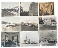
1923ref. 239071923. Southern California community mausoleum photo archive c. 1923 to 1935 documenting when burial was recast as a modern architectural commercial and consumer enterprise. Centered on Cecil E. Bryan Clarence L. Jay Sunnyside Mausoleum in Long Beach and Mountain View Mausoleum in Altadena the photographs show how architecture landscaping publicity and office administration turned the communal mausoleum into a purchasable alternative to the traditional cemetery. Bryan entered the community mausoleum business in 1912 and became one of its principal national advocates ultimately designing more than eighty mausoleums while promoting aboveground entombment as sanitary permanent economical and modern. This archive documents the transition of American burial conventions showing the architecture real estate administration and salesmanship behind the development of California community mausoleums. Photo archive of 31 silver gelatin photographs mostly 7.5 x 9.5 inches though some measure approximately 7.5 x 8.5 inches Southern California c. 1923 to 1935. The photographs show Bryan at his desk; administrative offices lined with card files; architectural perspectives and site plans; a scale model labeled "Sunnyside Memorial Park"; landscaped courts arcades galleries entrances reception rooms and richly furnished interiors. One rendering identifies "Cecil E. Bryan executive vice president" and "Clarence L. Jay architect." Versos carry stamps for Hiller Studio W. Albert Martin Padilla Company Photography and the Mountain View Mausoleum Association as well as "file copy" notations crop marks print numbers and reproduction instructions. The rapid development of community mausoleums was in part due to advent of reinforced concrete construction and an aggressive new business model for death. Builders across the country solicited crypt buyers before construction sometimes tying installment payments directly to completion of the foundation walls roof and finished building; a 1920 Detroit project had sold $160900 in crypt contracts by the end of the following year. In Long Beach Pacific Builders Company operating as the Sunnyside Mausoleum Association commissioned Bryan in 1922 for a $300000 Spanish style complex planned for 1000 crypts and 1000 niches while Architectural Digest later presented Sunnyside in 1929 with Jay as architect Bryan as engineer and Padilla photography. Long Beach Historic Cemeteries The enterprise belonged squarely to 1920s Southern California where speculative development planned landscapes Spanish revival architecture professional advertising and rapid metropolitan growth were reshaping ordinary life; here the same machinery was applied to death packaging permanence beauty sanitation and status as something a family could purchase. Light surface wear handling marks occasional curling and contemporary working annotations. Overall in very good condition. unknown
1923ref. 239071923. Southern California community mausoleum photo archive c. 1923 to 1935 documenting when burial was recast as a modern architectural commercial and consumer enterprise. Centered on Cecil E. Bryan Clarence L. Jay Sunnyside Mausoleum in Long Beach and Mountain View Mausoleum in Altadena the photographs show how architecture landscaping publicity and office administration turned the communal mausoleum into a purchasable alternative to the traditional cemetery. Bryan entered the community mausoleum business in 1912 and became one of its principal national advocates ultimately designing more than eighty mausoleums while promoting aboveground entombment as sanitary permanent economical and modern. This archive documents the transition of American burial conventions showing the architecture real estate administration and salesmanship behind the development of California community mausoleums. Photo archive of 31 silver gelatin photographs mostly 7.5 x 9.5 inches though some measure approximately 7.5 x 8.5 inches Southern California c. 1923 to 1935. The photographs show Bryan at his desk; administrative offices lined with card files; architectural perspectives and site plans; a scale model labeled "Sunnyside Memorial Park"; landscaped courts arcades galleries entrances reception rooms and richly furnished interiors. One rendering identifies "Cecil E. Bryan executive vice president" and "Clarence L. Jay architect." Versos carry stamps for Hiller Studio W. Albert Martin Padilla Company Photography and the Mountain View Mausoleum Association as well as "file copy" notations crop marks print numbers and reproduction instructions. The rapid development of community mausoleums was in part due to advent of reinforced concrete construction and an aggressive new business model for death. Builders across the country solicited crypt buyers before construction sometimes tying installment payments directly to completion of the foundation walls roof and finished building; a 1920 Detroit project had sold $160900 in crypt contracts by the end of the following year. In Long Beach Pacific Builders Company operating as the Sunnyside Mausoleum Association commissioned Bryan in 1922 for a $300000 Spanish style complex planned for 1000 crypts and 1000 niches while Architectural Digest later presented Sunnyside in 1929 with Jay as architect Bryan as engineer and Padilla photography. Long Beach Historic Cemeteries The enterprise belonged squarely to 1920s Southern California where speculative development planned landscapes Spanish revival architecture professional advertising and rapid metropolitan growth were reshaping ordinary life; here the same machinery was applied to death packaging permanence beauty sanitation and status as something a family could purchase. Light surface wear handling marks occasional curling and contemporary working annotations. Overall in very good condition. unknown books
1945ref. 199841945. Official U.S. Army map documenting the military geography of the Obersalzberg Adolf Hitler's Bavarian headquarters and one of the principal leadership centers of the Third Reich during the final weeks of World War II. The map identifies the Berghof SS barracks the residences of Martin Bormann and Hermann Göring roads toward Mount Kehlstein and the Kehlsteinhaus and other features within the restricted Nazi compound. It provides a contemporary record of how American forces mapped and navigated this highly fortified and symbolically important enemy landscape at the moment of its destruction and occupation. Official U.S. Army Map of the Obersalzberg Nazi Compound. U.S. Army 1945. Single-sheet map measuring 8 x 11¾ inches. By the war's end the Obersalzberg had developed into a cordoned-off Nazi leadership enclave centered on Hitler's Berghof with residences barracks administrative facilities and security installations serving senior members of the regime and SS personnel. The map's schematic and somewhat imperfect geography suggests a practical military purpose rather than a postwar survey providing U.S. personnel with navigational guidance through terrain that had not yet been fully documented on the ground. Its 1945 date places the map directly within the destruction and Allied occupation of the Obersalzberg. RAF Bomber Command attacked the compound on April 25 1945 and American forces entered the area in early May discovering and occupying the remains of one of Nazi Germany's most politically charged command centers. Typical fold creases from field handling; upper corners clipped possibly from mounting or pinning; light stain at lower left; edge wear; tear at lower right not affecting the map image. Overall very good. A scarce contemporary U.S. military document recording the physical organization of Hitler's Obersalzberg headquarters and the practical geography confronting American forces as they entered and occupied the Nazi leadership complex in the final days of the war. unknown
1945ref. 199841945. Official U.S. Army map documenting the military geography of the Obersalzberg Adolf Hitler's Bavarian headquarters and one of the principal leadership centers of the Third Reich during the final weeks of World War II. The map identifies the Berghof SS barracks the residences of Martin Bormann and Hermann Göring roads toward Mount Kehlstein and the Kehlsteinhaus and other features within the restricted Nazi compound. It provides a contemporary record of how American forces mapped and navigated this highly fortified and symbolically important enemy landscape at the moment of its destruction and occupation. Official U.S. Army Map of the Obersalzberg Nazi Compound. U.S. Army 1945. Single-sheet map measuring 8 x 11¾ inches. By the war's end the Obersalzberg had developed into a cordoned-off Nazi leadership enclave centered on Hitler's Berghof with residences barracks administrative facilities and security installations serving senior members of the regime and SS personnel. The map's schematic and somewhat imperfect geography suggests a practical military purpose rather than a postwar survey providing U.S. personnel with navigational guidance through terrain that had not yet been fully documented on the ground. Its 1945 date places the map directly within the destruction and Allied occupation of the Obersalzberg. RAF Bomber Command attacked the compound on April 25 1945 and American forces entered the area in early May discovering and occupying the remains of one of Nazi Germany's most politically charged command centers. Typical fold creases from field handling; upper corners clipped possibly from mounting or pinning; light stain at lower left; edge wear; tear at lower right not affecting the map image. Overall very good. A scarce contemporary U.S. military document recording the physical organization of Hitler's Obersalzberg headquarters and the practical geography confronting American forces as they entered and occupied the Nazi leadership complex in the final days of the war. unknown books
ref. DADAX0415102243New unknown
ref. DADAX0934252912New unknown
1911ref. 14521Lausanne, Georges Bridel, 1911. 2 tomes en 1 volume grand in-4 de VI-216 pages, demi-toile bleue à coins, titre et fleuron dorés au dos, tête mouchetée, le premier plat de chacune des deux livraisons est conservé, ainsi que le second du deuxième volume.
ref. 50698602-nnew. unknown
ref. DADAX0870813013New unknown
ref. DADAX0879519886New unknown
1921ref. 62358Seattle WA & Cooke City MT: Western Smelting & Power Company 1921. Oblong 4to. 10 x 7 in. 47 1 pp. With photo plates text illustrations 1 large folding map. Textured beige softcovers raised embossed copper decorative lettering front cover yapp fore-edges slight toning minor shelfwear still a VG bright copy. First edition of this exceedingly rare mining investment prospectus issued following World War I by The Western Smelting & Power Company to raise money to build their two-part aerial tramway system to connect the Homestake and Gold Dust mines to the Company’s copper smelter just completed in 1921. The WS&P Co. had already built a 350 kilowatt hydro-electric power plant near the 53 foot “Big Fall” waterfall on the Clark’s Fork River which featured a quarter mile wooden flume to carry water to the plant and in fact the flume required so much lumber they had also constructed a sawmill producing 800000 board feet of timber. When completed the tram operated at a speed of 12 mph and was capable of delivering 250 tons of ore to their smelter every six hours. Although the tram was completed four years later there is no evidence either the smelter or tram was in operation by 1926 and the company never reached commercial production. By late 1926 the Gold Dust Adit had reached 2100 and had not tapped the Homestake’s ore body and in 1929 the WS&P Co. had failed to stockpile any ore. Eventually the smelter was converted to 1000-ton flotation plant and destroyed by fire in 1988. The Map depicts “Claims surveyed for patent and principal locations New World unor Mining District Park County MT. Tanzer 1863-1927 had originally organized the New World Mining & Development Co. in Cooke City MT in 1904 and after beginning initial construction and with additional investors it became the Western Smelting & Power Co. He was an inveterate developer and promoter of Cooke City MT mining interests. No copies in Worldcat; See: Chapter 4. The Western Power and Smelting Aerial Tram System 24PA879 US Forest Service 2024 pp. 4-1 thru 4-32 with photos; Historical Note - Week of March 8th Cooke City Mining Man Dies in Germany Cooke City Montana Museum 2023. Western Smelting & Power Company, paperback
1984ref. 221113015Smoky Mountain Historical Society 1984-01-01. hardcover. Good. 11x8x2. Please Read 1993 PRINTING -dogeared pages - marks on text - My shelf location 38-G-3 Smoky Mountain Historical Society hardcover
ref. Z1-S-012-01976ELLIEVE Organics. Used - Acceptable. Used - Acceptable. Wear and tear to cover and spine. Sticker on cover. Ships from UK in 48 hours or less usually same day. Your purchase helps support Sri Lankan Children's Charity 'The Rainbow Centre'. Ex-library with wear and barcode page may have been removed. 100% money back guarantee. We are a world class secondhand bookstore based in Hertfordshire United Kingdom and specialize in high quality textbooks across an enormous variety of subjects. We aim to provide a vast range of textbooks rare and collectible books at a great price. Our donations to The Rainbow Centre have helped provide an education and a safe haven to hundreds of children who live in appalling conditions. We provide a 100% money back guarantee and are dedicated to providing our customers with the highest standards of service in the bookselling industry. ELLIEVE Organics unknown
ref. Z1-R-014-01329Nabu Press. Used - Like New. Used - Like New. Book is new and unread but may have minor shelf wear. Ships from UK in 48 hours or less usually same day. Your purchase helps support Sri Lankan Children's Charity 'The Rainbow Centre'. 100% money back guarantee. We are a world class secondhand bookstore based in Hertfordshire United Kingdom and specialize in high quality textbooks across an enormous variety of subjects. We aim to provide a vast range of textbooks rare and collectible books at a great price. Our donations to The Rainbow Centre have helped provide an education and a safe haven to hundreds of children who live in appalling conditions. We provide a 100% money back guarantee and are dedicated to providing our customers with the highest standards of service in the bookselling industry. Nabu Press unknown
ref. Z1-C-083-03092NTC/Contemporary Publishing Company. Used - Good. Ships from UK in 48 hours or less usually same day. Your purchase helps support Sri Lankan Children's Charity 'The Rainbow Centre'. Ex-library so some stamps and wear but in good overall condition. 100% money back guarantee. We are a world class secondhand bookstore based in Hertfordshire United Kingdom and specialize in high quality textbooks across an enormous variety of subjects. We aim to provide a vast range of textbooks rare and collectible books at a great price. Our donations to The Rainbow Centre have helped provide an education and a safe haven to hundreds of children who live in appalling conditions. We provide a 100% money back guarantee and are dedicated to providing our customers with the highest standards of service in the bookselling industry. NTC/Contemporary Publishing Company unknown
1838ref. 12707Londres / Paris, George Virtue / Ferrier, 1838. Fort volume in-4 de VI-[2]-216 pages, pleine percaline marron, larges décors dorés au dos et au premier plat, vignette dorée au centre du second, titre doré au dos, tranches dorées.
1960ref. 8122Société nationale des chemins de fer français, 1960. Offset 62 x 100. Imprimée par Draeger.
1930ref. 45307162London: The Covenant Publishing Co. Ltd. Fair with no dust jacket. 1930. First Edition. Hardcover. Claims to completely vindicate British-Israel teaching. Claims the Anglo-Saxon race are lineal descendants of the Ten Tribes of Israel who were taken away as captives to Assyria about the years 770-721 B.C. by Tiglath Pileser Ahalmaneser and Sargon. Claims the Almighty is today fulfilling in Anglo-Saxons in their British Empire the national promises he made between three and four thousand years ago to Abraham Isaac Jacob Moses Israel and David and that in fact they are British Israelites - literal descendants of the Lost Ten Tribes; the continuation of the Israel nation; the inheritors of her Charters; the possessors of her guarantees and immunities from destruction; and the executors of her commissions. A fascinating exposition. Average wear and soiling. Former owner's inkstamp upon front endpaper. Few library markings. Yellowed tape ghosts to endpapers. A worthy reading copy. ; 12mo - over 6¾" - 7¾" tall; The Triumph of British-Israel - a Reply to Rev. D. Lee Pitcairn Mr. George Goodman Mr. Avary H. Forbes and Others 336 pages plus index and advertisements. Frontis is black and white plate of author. Completely vindicates British-Israel teaching. Cla . The Covenant Publishing Co. Ltd. hardcover
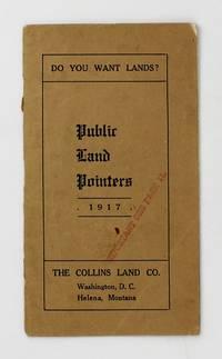
1917ref. 6104Washington DC; Helena Mt: The Collins Land Co 1917. About very good. 20pp. Narrow 12mo. Original tan printed wrappers stapled. Light wear inner spine reinforced with tape. Contemporary ink stamp to cover and p.11. "The aim will be to set out in this little booklet the methods by which public land may be acquired and the services we can render in that connection." Herein Jeremiah Collins offers advice on how to acquire public land and move your claims through bureaucracy offering his services as a land attorney if needed. The Collins Land Company maintained offices in both Helena and D.C. indicating much of his work centered on Montana. We locate a single copy in OCLC at the Wisconsin Historical Society. The Collins Land Co unknown
1917ref. 6104Washington DC; Helena Mt: The Collins Land Co 1917. About very good. 20pp. Narrow 12mo. Original tan printed wrappers stapled. Light wear inner spine reinforced with tape. Contemporary ink stamp to cover and p.11. "The aim will be to set out in this little booklet the methods by which public land may be acquired and the services we can render in that connection." Herein Jeremiah Collins offers advice on how to acquire public land and move your claims through bureaucracy offering his services as a land attorney if needed. The Collins Land Company maintained offices in both Helena and D.C. indicating much of his work centered on Montana. We locate a single copy in OCLC at the Wisconsin Historical Society. The Collins Land Co unknown books
1909ref. 76811Chicago: The North-Western Line 1909. Pamphlet. Very good. President William Howard Taft's August 19 1909 presidential proclamation directed that certain lands in the Cheyenne River and Standing Rock Reservations be opened to the public for settlement between October 4 and 23 1909. This brochure outlines the opportunity for any United States citizen over the age of 21 who does not already own 160 acres of U.S. land to apply and secure a homestead. Married women were not eligible to apply "unless she has been deserted or abandoned by her husband or unless her husband is incapacitated by disease or otherwise earning support for his family and she is the head and main support of the family." The brochure also provides a description of the lands open to settlement and detailed instructions on the process for registering and selecting the allotted 160-acre tracts. The North-Western Line a subsidiary of the Chicago and North Western Railway was a major economic force in South Dakota beginning in 1878. Federal Indian policy during the period from 1870 to 1910 marked a departure from earlier policies that were dominated by removal treaties reservations and war. The new policy known as the General Allotment Act of 1887 or Dawes Act focused specifically on breaking up reservations and tribal lands by granting land allotments to individual Native Americans. Amendments to the General Allotment Act also made it easier for Indian land to pass into non-Indian hands. The Burke Act 1906 contributed to the ongoing fractionation of lands within reservation boundaries by requiring the government to assess whether individuals were "competent and capable" to manage their land. Printed on both sides of a 32" x 9" sheet that folds to 4" x 9 ¼" 16 panels including a map on one panel by Poole Bros. Chicago. Light soiling; otherwise very good. The North-Western Line unknown
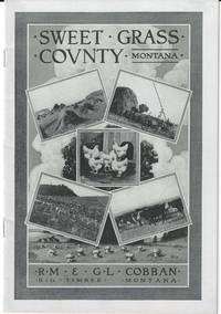
1911ref. 76801Missoula Montana: Missoulian Publishing Company 1911. Pamphlet. Near fine. Promotional pamphlet by the real estate firm of R.M. & G.L. Cobban with agricultural facts and statistics for Sweet Grass County in southern Montana and advertisements by the firm for locating a homestead. Although a portion of Montana was acquired as part of the Louisiana Purchase in 1803 it was not admitted into the union until 1889 and grew slowly in the succeeding years. This brochure encourages Easterners to give up paying rents and move to Montana: "If not gifted with a fat purse he still has the opportunity of securing a piece of land from Uncle Sam - his birth right - and like thousands of others in Montana today make good while earning his title thereto living upon it." Pamphlet 28 p. printed in black and white. Includes photographic illustrations charts of comparative crop yields in various regions and a map of the state on the verso of the front panel. Original pictorial paper wrappers 6 1/2" x 9" bound with two staples. Near fine. Scarce no copies in the marketplace. OCLC locates five holdings: Columbia Montana Historical Society Washington State Yale and Southern Methodist. Missoulian Publishing Company unknown