Rousseau, Jean JacquesAntiquariat.de

8,055 results
1793ref. 23296(Paris), (Poincot), 1793. In-8°. Avec 2 gravure frontispiece. 463 p., 515 p. (= Oeuvres completes. Nouvelle édition, classée par ordre de matieres, et ornée de 90 gravures. Tome 29 et 30). Reliure plein chemin bibliophile, pièces dorées et bicolores de titre. - Contient: Rousseau, juge de Jean-Jacques, Dialogues. Histoire du précédent écrit. Déclaration de J. J. Rousseau, relative a M. le Pasteur Vernes. Vision de Pierre de la Montagne, dit le voyant. Errata de l'essai sur la musique ancienne et modrne ou lettre a l'auteur de cet essai. Reliure un peu abimée aux margins. Des gardes tachées par la moisissure. Vermoulure faible dans le margin blanc des dernières pages. En tout en tres bon état.
2006ref. 85343Berlin : Berliner Taschenbuch Verl., 2006. 188 S. 19 cm. kart., Broschiert.
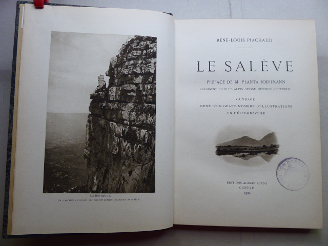
1924ref. 141634Genf, Editions Albert Ciana 1924. 186, (3) Seiten und ein Werbeanhang. Mit zahlreichen teils ganzseitigen Abbildungen (Heliogravuren). Schöner Halbleder-Einband mit reicher Rückentitelvergoldung und marmorierten Deckeln. (Einband gering berieben. Titelblatt gestempel). 25x18 cm
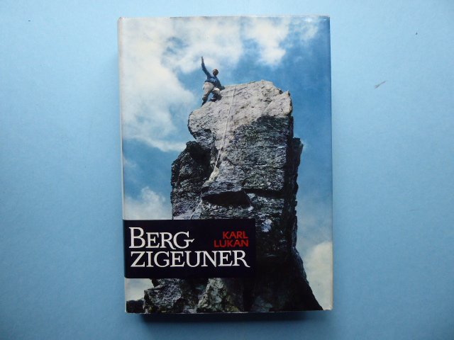
1967ref. 141984Verlag "Das Bergland-Buch" Salzburg u. Stuttgart 1967. 298, (1) Seiten. Mit teils farbigen Abbildungen auf Tafeln. Geprägter Original-Leinwand-Einband und farbig illustrierter Original-Schutzumschlag. (Geringe Gebrauchsspuren). 21x15 cm
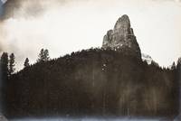
ref. 648-Eo.J. Aquarell, über Bleistift, auf festem Velin, links unten bezeichnet ?Bodensee II?, rechts unten signiert ?K. Schott?, oben von links nach rechts ortsbezeichnet ?Hohe Kugel - Bran... (?) Sesa Plana (d.i. Schesaplana) Panuela (d.i. Panüelerkopf) - 3 Schwestern?. 17,3:24,5 cm. Verso: Skizze mit einem Strandab-schnitt und Bootssteg mit Schiffen. Aquarell über Bleistift, links oben bezeichnet ?10 ? Aus-tria 10 ??, rechts oben ?10 ? Austria?, rechts unten datiert ?1890?. Mit leichten Gebrauchsspuren.
1968ref. 65036Reinbek bei Hamburg, Rowohlt Verlag GmbH, 1968, Auflage: 1., 1.-25. Tausend. Leinen, gebunden; hellgelbgrauer Einband, rotes, gelb/schwarz bedrucktes Rückenschild, mit farbig bedrucktem Schutzumschlag / Anz. Seiten: 877 / 13 x 21 cm / Umschlag- und Einbandentwurf: Manfred Waller / Zustand: gut, leichte Gebrauchsspuren; Rückenschild leicht berieben, Schnitt etwas gebräunt und gering fleckig, Schutzumschlag leicht berieben, etwas gebräunt und leicht randlädiert
1988ref. 24428BBOsnabrück, Biblio-Verl., 1988. 25 cm. XIII, 266 S. Ill., Kt. Pappband, Deckelillustr. Aufkl. u. Besitzereintr. a. Vorsatz, ans. guter Zustand. Soldatenschicksale des 20. Jahrhunderts als Geschichtsquelle, 9.
1996ref. 58831ABMünchen, Bucher, 1996. ungek. Buch-Gemeinschafts-Lizenzausg. 30 cm, 95 S., überw. Ill., graph. Darst., Kt. Gewebe, OU., sauber u. gut erhalten. Edition USA Traumziel Amerika.
1850ref. 4824AGHildburghausen, BI, 1850 (ca.). Stahlstich von Rottmann (nach Lami), Darst. 15,9 x 10 (excl. Text und Umrandung), Bll. 18,7 x 26 Auf Wunsch Digitalaufnahme in jpg-Format erhältlich- photo in jpg-format available. Je nach Versandart können die Portokosten bis zu 2 ? weniger als angegeben betragen.+
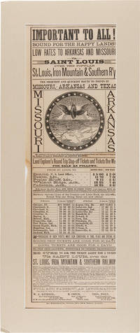
1880ref. 55682St. Louis: Jno. McKittrick & Co. ca.1880. The Shortest and Quickest Route to Points in Missouri Arkansas and Texas An attractive broadside promotional for the St. Louis Iron Mountain & Southern Railway with a large engraving in the center depicting the route from St. Louis through Arkansas and into Texas beneath a train wheel bearing wings about which the motto "Bound for the happy lands" appears all in the center of a circle of stars. A schedule of ticket costs for various routes is included as well as a pitch directed at homesteaders regarding the purchase of government lands. The names of three land agents are listed at bottom - one in Missouri one in Illinois and one in Arkansas. The railway touts their "large grant of lands from the United States Government embracing all varieties of soil and timber adapted to Farming Fruit Growing and Grazing purposes.Immigrants can locate on railroad land in well improved neighborhoods having Roads Mills Churches and Schools and peopled by honest and industrious citizens who will give a cordial welcome to all good people coming among them." Only six copies in OCLC spread over four records located at Yale SMU Michigan the University of Texas at Arlington Truman State and the University of Missouri at St. Louis. Old center horizontal fold small chip to left edge slight wrinkling. Very good. Matted and shrinkwrapped. OCLC 22160865 166641127 702349761 761878887. unknown books
1922ref. 126253Culver City CA: Selznick Pictures 1922. Vintage hand-tinted half sheet poster for the lost 1922 silent film. Conway Tearle starrs as Russell Carrington a man who accepts a murder charge to protect Rita the woman he loves played by Florence Billings and flees to a fishing village where he falls in love with the town belle Dorothy played by Winifred Westover. Shot on location in Fort Lee New Jersey. 26.25 x 20 inches margins slightly trimmed down from 28 x 22 inches see image. Very Good with moderate edgewear including loss to the top and bottom right corners several closed tears to the margins and one 2.25 inch closed tear to the top center. Selznick Pictures unknown books
1921ref. 162834New York: Kadel and Herbert 1921. Vintage press photograph of Jack Dempsey training in the ring with his friend Luigi "Bull" Montana in Atlantic City New Jersey in 1921. Annotations in manuscript ink and pencil on the verso along with a small newspaper clipping and the stamp of Kadel and Herbert News Service. From the archive of the PIX Agency an American photo house that acted as an intermediary between emigre photographers as well as those still living in Europe and the American magazine and newspaper market between 1935-1969. 9 x 7.5 inches. Very Good with touchups for print on the recto trimmed irregularly with a chip on the bottom left corner. Kadel and Herbert unknown books
1964ref. 160812Universal City: Universal Pictures 1964. Vintage banner poster for the 1964 film. Based on popular 1962-1966 ABC television sitcom made during the series second season and followed by the 1965 sequel "McHale's Navy Joins the Air Force" also directed by series producer Edward Montagne. Remade in 1997 directed by Bryan Spicer and starring Tom Arnold and David Alan Grier. In order to save a struggling orphanage McHale and his crew recreate the Australian Derby on a South Pacific Island and end up in even more debt to a group of Marines. 81 x 24 inches. Very Good plus with light soiling and faint rubbing and creasing. Universal Pictures unknown books
1983ref. 153253Port Townsend WA: Copper Canyon Press 1983. First Edition. First Edition. The first translation of the Tang Dynasty poet's complete works in English with the original Chinese presented en face. Fine and unread in a Near Fine dust jacket with a touch of rubbing to the extremities. Copper Canyon Press unknown books
1923ref. 239071923. Southern California community mausoleum photo archive c. 1923 to 1935 documenting when burial was recast as a modern architectural commercial and consumer enterprise. Centered on Cecil E. Bryan Clarence L. Jay Sunnyside Mausoleum in Long Beach and Mountain View Mausoleum in Altadena the photographs show how architecture landscaping publicity and office administration turned the communal mausoleum into a purchasable alternative to the traditional cemetery. Bryan entered the community mausoleum business in 1912 and became one of its principal national advocates ultimately designing more than eighty mausoleums while promoting aboveground entombment as sanitary permanent economical and modern. This archive documents the transition of American burial conventions showing the architecture real estate administration and salesmanship behind the development of California community mausoleums. Photo archive of 31 silver gelatin photographs mostly 7.5 x 9.5 inches though some measure approximately 7.5 x 8.5 inches Southern California c. 1923 to 1935. The photographs show Bryan at his desk; administrative offices lined with card files; architectural perspectives and site plans; a scale model labeled "Sunnyside Memorial Park"; landscaped courts arcades galleries entrances reception rooms and richly furnished interiors. One rendering identifies "Cecil E. Bryan executive vice president" and "Clarence L. Jay architect." Versos carry stamps for Hiller Studio W. Albert Martin Padilla Company Photography and the Mountain View Mausoleum Association as well as "file copy" notations crop marks print numbers and reproduction instructions. The rapid development of community mausoleums was in part due to advent of reinforced concrete construction and an aggressive new business model for death. Builders across the country solicited crypt buyers before construction sometimes tying installment payments directly to completion of the foundation walls roof and finished building; a 1920 Detroit project had sold $160900 in crypt contracts by the end of the following year. In Long Beach Pacific Builders Company operating as the Sunnyside Mausoleum Association commissioned Bryan in 1922 for a $300000 Spanish style complex planned for 1000 crypts and 1000 niches while Architectural Digest later presented Sunnyside in 1929 with Jay as architect Bryan as engineer and Padilla photography. Long Beach Historic Cemeteries The enterprise belonged squarely to 1920s Southern California where speculative development planned landscapes Spanish revival architecture professional advertising and rapid metropolitan growth were reshaping ordinary life; here the same machinery was applied to death packaging permanence beauty sanitation and status as something a family could purchase. Light surface wear handling marks occasional curling and contemporary working annotations. Overall in very good condition. unknown books
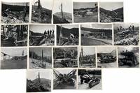
1960ref. 231891960. Labor Industrial rock drilling photograph archive documenting Gardner Denver and drill carrier machinery in factory yard and field settings circa 1960s recording how specialized drilling equipment was designed serviced and operated in steep-cut and tunnel construction environments. The group centers on crawler-mounted drills compressor-fed hose systems and rail-mounted heavy equipment photographed both as machines and in use by work crews. Gardner Denver is identified directly by company stamps and visible signage while the field views place the machinery within active excavation and blasting work rather than isolated product display. Photo archive of 19 Large silver gelatin photographs all 8 x 10 inches Quincy Illinois and unidentified mountain construction sites circa 1960s. Views include operators seated or standing at tracked drill carriers on exposed rock faces; close mechanical studies of valves feed assemblies hoses and fittings; factory-yard portraits of articulated drill rigs parked on pavement; and a large rail-mounted drilling platform photographed on tracks with crew members standing above it. Several photographs show men in work clothes and caps monitoring or operating the machines on steep slopes with forested ridgelines behind them. One image records a tunnel portal marked BLUE MOUNTAIN with adjacent heavy construction equipment and rails leading into the opening. Blue Mountain Tunnel belonged to the original Pennsylvania Turnpike system opened in 1940 and by the 1960s it stood within a corridor undergoing major modernization as rising traffic as Americans in the postwar years increasingly relied on automobile ownership suburban commuting and highway expansion ultimately reshaping infrastructure construction and everyday mobility from the late 1940s through the 1960s. Advances in carrier-mounted rock drilling concentrated labor on machine operation positioning maintenance and coordinated blasting making work at Blue Mountain Tunnel faster more systematized and less dependent on earlier hand-held drilling methods. After World War II postwar conditions produced the demand capital and public-works agenda that made this machinery necessary: rising automobile traffic highway expansion tunnel widening and large earthmoving projects pushed contractors toward faster more powerful and more standardized drilling systems. Drilling was one of the mechanical developments that transformed rock excavation in the 1950s and 1960s and moved from more limited portable systems toward carrier-mounted equipment able to work faster more consistently and on more difficult terrain for highway cuts tunnel approaches and other large infrastructure projects. Because the group includes stamped manufacturer views shop and yard photographs working machine close-ups and field operation scenes it shows the full operating system of industrial drilling technology rather than a single machine in isolation. Light handling wear and minor curling at edges; one print with blueprint attached to verso; all images otherwise clean and in good condition. Depicting the industrial postwar boom and infrastructure investments carried out by mid-century American excavation technology manufacturer documentation and construction labor in practice. unknown books
1935ref. 233251935. Clarkston Valley earthquake photo archive documenting structural damage in southwestern Montana after the June 27 1925 earthquake one of the strongest recorded earthquakes in Montana before the 1959 Hebgen Lake disaster. The main shock struck near the Clarkston Valley north of Three Forks and northwest of Bozeman caused severe damage across roughly 600 square miles and was felt across an estimated 310000 square miles. Brick buildings suffered heavily in Manhattan Three Forks Logan and nearby communities while cliffs shed rock ground cracks opened chimneys fell and aftershocks continued through the following days. The absence of fatalities was widely noted as fortunate since schools churches public buildings and roads took the brunt of the damage rather than crowded urban districts. Photo archive of 7 silver gelatin photos approximately 3" x 5" Gallatin County and surrounding Montana communities 1925. A dirt road is split by a long open fissure running down the track recording visible ground rupture or surface cracking after the quake. Several brick school buildings show collapsed rooflines broken cornices damaged upper walls and debris piled along foundations. Handwritten verso captions identify "public school Manhattan 23 mi from Bozeman" "High school Manhattan 23 mi from Bozeman" "Logan school 19 mi from Bozeman" "Consolidated school Three Forks 40 mi from Bozeman" and "Church Three Forks 40 mi from Bozeman." One captioned view reads "Logan School Mont. Earthquake" with damage visible along the roof and upper brickwork. The accompanying clipping summarizes the earthquake as measuring M6.6 notes damage in Manhattan Three Forks and Lombard and describes later seismological interpretation of the Clarkston Valley fault. The archive preserves a local record of disaster damage in rural Montana where public schools and churches often stood as the largest masonry structures in small towns and therefore made earthquake destruction immediately visible. The 1925 Clarkston Valley event became a major reference point in Montana seismic history later studied by J. T. Pardee for the U.S. Geological Survey and still cited in state earthquake preparedness materials. Light toning minor handling wear and faint soiling to versos; manuscript captions remain legible and image detail is strong. Overall in good condition. unknown books
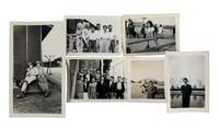
1944ref. 211521944. Japanese American incarceration photographs dating from World War II document civilian life and military presence at several internment and assembly centers established after the forced removal of Japanese Americans from the West Coast. Following Executive Order 9066 in 1942 more than 120000 people of Japanese ancestry were confined in temporary assembly centers and longer term relocation camps administered by the War Relocation Authority. The photographs record daily activities of men women and children within these camps and illustrate the physical environment of the barracks settlements created to house incarcerated civilians during the war. Archive contains six original silver gelatin photographs measuring approximately 2.5 × 2.75 inches to 3.5 × 5.75 inches. The images depict Japanese American families and individuals at Heart Mountain Relocation Center in Wyoming Camp Amache in Granada Colorado and Pomona Assembly Center in California. Several photographs show families gathered in front of barracks style housing units typical of the camps. One image from Amache shows a family of six standing on the steps of their assigned unit with the wooden barracks structure visible behind them. Another photograph from Pomona shows two United States soldiers seated on a storage trunk outside a camp building likely serving as patrol or security personnel. One image from Heart Mountain shows a military medic standing beside an ambulance truck while gesturing toward camp structures in the distance. Other photographs include a group portrait of Japanese American young men standing in front of a brick building possibly a school building within the camp and a separate image of the same individual standing beside a lake. Another photograph shows a young Japanese American girl playing on a see saw while families watch a sports game in the background with camp buildings visible beyond the field. Pomona Assembly Center served as one of the temporary detention facilities established in 1942 before incarcerated families were transferred to permanent camps such as Heart Mountain. Heart Mountain became the fourth largest relocation center eventually housing nearly fourteen thousand people while Amache in Colorado confined more than seven thousand internees the majority of whom were American citizens by birth. Living quarters in these camps consisted of small rooms within hastily constructed wooden barracks assigned to individual families. The photographs preserve small moments of social life and recreation within these confined communities illustrating how families attempted to maintain routines despite the conditions of incarceration. Photographs remain clear and well preserved with light age wear consistent with vernacular prints. Very good condition overall and a revealing visual record of Japanese American life within wartime relocation centers. unknown books
1943ref. 211901943. WWII Japanese American Japanese American incarceration archive circa 1940s documenting the personal lives of Japanese American detainees at Poston War Relocation Center in Arizona and Heart Mountain Relocation Center in Wyoming during World War II. Executive Order 9066 authorized the forced removal and incarceration of more than 120000 persons of Japanese ancestry two thirds of them United States citizens. This archive provides direct material evidence of communication and daily life in the War Relocation Authority camp system. An addressed envelope postmarked February 20 1943 connects two of the ten major incarceration sites indicating a maintained interpersonal network across camps. Photographs in this archive depict a young Japanese American woman in Western dress posed outdoors with barracks visible in several backgrounds and include an image of a young girl on a see-saw before rows of camp housing illustrating the family and youth experience in the camps. Archive of 8 pieces including 7 photographs mostly black and white with one color and 1 post stamped envelope addressed to "Mrs. Asako Kudari" sic at Block 15 21 F Heart Mountain Center Wyoming. Circa 1940s. The envelope bears a purple United States stamp depicting an eagle above the slogan "Win the War" and is postmarked February 20 1943 from Block 44 3A Poston Relocation Center Arizona. Photographs measure approximately 6.5 x 3.5 inches to 2.25 x 3.25 inches. Several images show detainees with camp barracks in the background; others portray a young woman with a Japanese American man wearing glasses suggesting prewar memories though no inscription confirms dating. Poston located in Yuma County Arizona was the largest of the War Relocation Authority camps while Heart Mountain in Park County Wyoming confined nearly 14000 people at its peak. Heart Mountain became a focal point of organized resistance to the military draft of Nisei men in 1944 when 85 young men and seven leaders of the Fair Play Committee were prosecuted under the Selective Service Act after challenging the legality of conscripting citizens while their civil rights were suspended. The present archive predates that confrontation but documents the correspondence networks and ordinary domestic life of the immigrants and citizens detained. Minor edge wear and light surface handling to photographs; envelope with expected postal folds and moderate age toning; overall very good condition. An archive linking two major incarceration sites. unknown books
1899ref. 365579Montana 1899. 21 silver print photographs. Captioned in pencil on verso. Approx. 4-3/4x7 inches each. Uniformly matted. 21 silver print photographs. Captioned in pencil on verso. Approx. 4-3/4x7 inches each. Although the photographer is unidentified the captions on the verso are in the same hand and the image quality suggests a pictorialist such as Dan Dutro or an extremely talented amateur. The group if noted for its images on the Blackfeet reservation including several of the Grass Dance dated 1899. The captions comprise: Grass Dance 1899 Grass Dance 1899 Inside Medicine Lodge Camp on Cut Bank on Reserve Cut Bank Cut Bank Creek Cut Bank in winter Cut Bank in winter Camp in Cut Bank in winter View in the large park on Cut Bank Peak up Two Medicine Upper St. Mary's Lake Upper St. Mary's Up Birch River Birch Creek south line of reserve Birch Creek Birch Creek Fish Lake south of reserve Fish Lake Grinnell Mt and Swift Current Fall On the trail to Bull's Head Mine in the Swift Current country back of Grinnell Mt. Mt Wilbur in distance. unknown books
1945ref. 199841945. Official U.S. Army map documenting the military geography of the Obersalzberg Adolf Hitler's Bavarian headquarters and one of the principal leadership centers of the Third Reich during the final weeks of World War II. The map identifies the Berghof SS barracks the residences of Martin Bormann and Hermann Göring roads toward Mount Kehlstein and the Kehlsteinhaus and other features within the restricted Nazi compound. It provides a contemporary record of how American forces mapped and navigated this highly fortified and symbolically important enemy landscape at the moment of its destruction and occupation. Official U.S. Army Map of the Obersalzberg Nazi Compound. U.S. Army 1945. Single-sheet map measuring 8 x 11¾ inches. By the war's end the Obersalzberg had developed into a cordoned-off Nazi leadership enclave centered on Hitler's Berghof with residences barracks administrative facilities and security installations serving senior members of the regime and SS personnel. The map's schematic and somewhat imperfect geography suggests a practical military purpose rather than a postwar survey providing U.S. personnel with navigational guidance through terrain that had not yet been fully documented on the ground. Its 1945 date places the map directly within the destruction and Allied occupation of the Obersalzberg. RAF Bomber Command attacked the compound on April 25 1945 and American forces entered the area in early May discovering and occupying the remains of one of Nazi Germany's most politically charged command centers. Typical fold creases from field handling; upper corners clipped possibly from mounting or pinning; light stain at lower left; edge wear; tear at lower right not affecting the map image. Overall very good. A scarce contemporary U.S. military document recording the physical organization of Hitler's Obersalzberg headquarters and the practical geography confronting American forces as they entered and occupied the Nazi leadership complex in the final days of the war. unknown books
2002ref. 49289New York: Orion 2002. Fine in fine dust jacket. Signed first printing of Mountain's second book a murder mystery centered around intrepid genealogist / sleuth Natasha Blake who has uncovered an unexpected link behind the disappearance of a young girl and the death of Pre-Raphaelite icon Lizzie Siddal. 9.25'' x 6''. Original green boards. Original unclipped £17.99 color pictorial dust jacket. 278 pages. Signed by Mountain to title page. Jacket with Poisoned Pen "Signed by the Author" sticker to front and price sticker to rear. Sharp. Orion unknown books
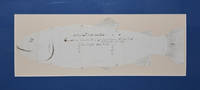
1877ref. 321671Montana Territory 1877. Pen-and-ink drawing on ruled paper cut out to size and captioned as above. Approx. 20-1/2 x 7 inches. Old folds. Matted. Pen-and-ink drawing on ruled paper cut out to size and captioned as above. Approx. 20-1/2 x 7 inches. From the first reports of the Yellowstone region such as Gen. Wm. E. Strong's A Trip to the Yellowstone National Park in July August and September 1875 the word began to spread: "There is probably no river in the world the equal of the Yellowstone for big trout." Though tourist parties began to travel to the Yellowstone it was still uncertain territory. In the late summer of 1877 it was the seat of war. In early September 1877 Civil War veteran General Oliver O. Howard who a decade earlier had founded Howard University and served as its president was leading his troops on the trail of the Nez Perce who had just left the Yellowstone Park. Howard's forces more than 500 strong reached the northeast corner of the Park on Clark's Fork on 7 September. The Nez Perce under the leadership of Chief Joseph moved through incredibly rugged terrain and ultimately evaded both Howard and another military cohort under Col. Samuel D. Sturgis. This contemporary record of a Yellowstone river trout was made on a large sheet of ruled ledger paper. The anonymous artist is believed to be Lieut. Cyrus A. Earnest of the 8th U.S. Infantry as the item was found among his papers with a cyanotype of Fort Bridger California where he was posted following his Yellowstone expedition service as well as several related printed documents of the Military Order of the Loyal Legion California Commandery. These items accompany the drawing. Earnest 1840-1893 was a lieutenant in the Eighth Infantry and served with Custer in the 1873 Yellowstone Expedition to survey a route for the Northern Pacific Railroad along the Yellowstone River. While serving under Howard in the Nez Perce expedition Earnest received special commendation for a heroic 2-day over 100 mile ride over rough terrain to resupply the army at Baker's battlefield. Ernest who was born in Ohio used the conventional name for the brook trout Salmo fontanalis but that describes a non-native eastern species. Yellowstone cutthroat trout or black spotted are the most widespread native trout with "highly variable coloration but generally yellow-brown or brassy/bronze" They were first described as a distinct species Oncorhynchus clarkii bouvieri by Jordan and Gilbert in 1883. A remarkable artifact from the earliest years of the U.S. presence in the Yellowstone valley and a reminder that at the edges of battle people attend to customary tasks and pursuits: fishing and making a record of daily activities. Provenance: Cyrus A. Earnest 8th U.S. Infantry see below unknown books
1930ref. 84029Paris: Felix Alcan 1930. 1st ed. Paperback. Very Good. folding maps xvi 426p. Softcover in original wrapper. 26 cm. Some cover soiling and browning. Former owner's name. Foxing on several leaves at both ends of text. French text. Felix Alcan paperback books
1930ref. 84031Paris: Felix Alcan 1930. 1st ed. Paperback. Very Good. folding map and 80 photos printed on one side with occasional text ix 22p. Softcover in original wrapper. 26 cm. Head of backstrip chipped. Minor foxing. Former owner's name. French text. Felix Alcan paperback books