5.825 Ergebnisse
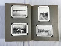
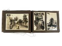
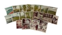
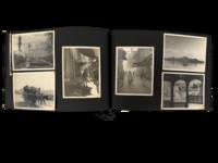
1960Best.-Nr. 232021960. Pakistan travel album recordingstreet life mountain excursions landscapes military ceremony and local custom in the 1960s with particular strength in its photographs depicting everyday culture and public life of Pakistany rural people. Photographer identified in an inscription as "Pech." The album focuses on a Life in Pakistan showing men in regional dress military regiments animal handling agricultural labor roadside and market activity mountain travel and formal as well as informal gathering. References to Rawalakot Many scenes of upland terrain and military units place part of the album in northern Pakistan. Photo album of over 120 corner mounted and loose silver gelatin photographs arranged across black paper leaves with many loose prints inscribed in French. Photos measure primarily between 2.5" x 3.5" to 3.5" x 5". Album measures 7.5" x 11". Visible scenes include men in celebratory flower garlands gathered in mountain settings groups posed in rugged terrain and photographs of men standing beside lakes rivers and highland roads suggesting travel or climbing excursions that were socially marked as memorable events rather than casual tourism. One photo of a man's portrait is inscribed to "Pech" en verso and mentions Rawalakot and their participation in climbing "6000 feet" he signs off as "M. MacDonald / Rockhampton Queensland." Other photographs turn to daily life and custom showing men in turbans and traditional dress rural figures with cattle agricultural work village architecture street scenes and portraits of children and families. Several images show snake charmers one seated with cobras raised before him others posed with baskets and spectators nearby preserving a form of public performance long circulated in South Asian spectacle. Urban views include crowded market lanes mixed traffic and building fronts while architectural photographs show mosques domed structures gardens and formal compounds placing devotional civic and residential space within the traveler's route. A handful of photos show military images of uniformed men in camp and review settings one caption identifying a brigade parade ground and another a general showing the compiler's access to official environments alongside civilian ones. Multiple photos depict dinner settings with the compiler seated with friends family and his "amour" also seen throughout the album. Most images from Pakistan with a small handful in Egypt and Lebanon circa 1960s. One dinner scene shows him and three other individuals with the en verso inscribed "Beruit - 1962." In the 1960s Pakistan was a young post-Partition state shaped by military visibility frontier administration and conflict especially in Kashmir where UN observers operated. Foreign travelers and officials moved through the country alongside local communities recording mountain travel public ceremony village life and everyday custom with Rawalakot being part of a borderland where military oversight diplomacy and travel intersected. Chipping to album covers photos exhibit some corner and edge wear overall very good condition. A mid-century photo album of a traveler's view of Pakistan through a distinctly outsider lens shaped by transnational movement official access and cultural encounter. unknown books
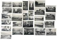
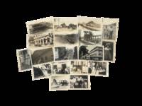
1951Best.-Nr. 233771951. 1950s Clearwater Florida photographed by George L. Fulmer documenting real estate expansion and early housing and rental marketing showing how ranch houses apartment courts furnished efficiencies and street addressed properties were presented during the postwar Sunbelt expansion of Pinellas County. After World War II Florida's housing market was pushed by returning veterans retirees northern migrants automobile commuting and seasonal tourism while federal mortgage programs and private development made small houses garden apartments and furnished rentals central to the state's growth. Fulmer's commercial assignments connect that boom to named local properties: each job envelope ties the house or rental unit to a studio number client or property name address and in several cases a 1951 date. The archive reveals how Clearwater real estate moved through a practical commercial process with repeated exterior records interior room studies duplicate proofs and labeled job packets created for owners brokers and rental promotion. Photo archive of 47 items including 25 silver gelatin photographs and 22 large scale negatives. Many photographs have correlating negatives while some negatives contain unique images. Contained in 6 original photo studio envelopes. Photographs measure approximately 3 x 5 inches and negatives 4 x 5 inches Clearwater Florida circa 1951. Exteriors include one story ranch houses with low hip and gable roofs picture windows shutters carports mowed lawns curbside plantings palm trees shell or gravel yards television antennas and street frontage arranged for automobile approach. Apartment material includes a roadside sign reading "Bright Water Apts" with "Vacancy" a two story rental building set behind trees and a long low apartment row with a fenced yard and children's play equipment. Interiors include living rooms staged with patterned sofas lounge chairs framed floral and figural prints table lamps venetian blinds wall rugs and coffee tables; bedrooms with paired beds dressers and striped coverlets; small dining alcoves set with tables and chairs; and compact kitchens built around metal cabinets white sinks refrigerators cooktops wall ovens and built in storage. Fulmer photographs the houses apartments furnishings appliances and rental readiness as the product. Studio envelopes preserve job numbers and partly legible entries including Bright Water Apts Nokomis 1021 235 Bayshore Dr. 315 Venetian St. 420 Brightwater Mary Ann Apts Beach and dated jobs from July August September and October 1951. These photographs were taken in the decade when Clearwater shifted from a compact Gulf Coast resort city toward a year round Sunbelt housing market shaped by suburban lots furnished rentals small apartment complexes and real estate photography meant to make properties legible to buyers and tenants before arrival. The interior shots record what was being sold inside the walls from tropical curtains tile floors small dining rooms compact kitchenettes wall ovens living rooms sized for seasonal use and domestic decoration calibrated for a middle class Florida market. The address level job records support comparison with city directories tax records property files architectural surveys and later redevelopment histories making the archive usable for reconstructing specific Clearwater buildings rather than only identifying broad mid century style. Negatives show handling wear and envelopes show toning and some small tears. Overall in very good condition. unknown books
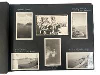
1925Best.-Nr. 227841925. SS Resolute photo archive approximately 86 photographs dating to 1925 documenting a passenger voyage through the Hawaiian Islands and broader Pacific region during a period of expanding U.S. tourism and colonial presence. The material captures volcanic landscapes urban development agricultural activity and Native Hawaiian individuals providing visual evidence of both environmental features and social life. These images record the intersection of natural geography and emerging tourist infrastructure in Hawaii during the interwar period when the islands were increasingly integrated into trans-Pacific travel networks. Approximately 86 black-and-white and color photographs each measuring about 3.5 x 5 inches mounted on black album leaves with white ink captions identifying locations such as Honolulu Hilo Waimea Bay Kilauea Crater and the Royal Hawaiian Hotel. The archive includes multiple views of volcanic activity including lava flows associated with eruptions from 1868 1901 and 1924 as well as craters at Halemaumau and Kilauea steam vents and descending lava formations. Coastal landscapes and inland terrain of Oahu and the Big Island are represented alongside urban scenes in Honolulu including hotels streetscapes and institutional buildings such as the Moana Hotel and the Mormon Temple at Laie. Agricultural images show sugarcane cultivation and rural labor environments while market scenes and portraits depict local residents in daily settings. A group of photographs includes Duke Kahanamoku posed with a surfboard marked "DUKE" alongside additional images referencing Pacific locations such as Tutuila and Upolu indicating the voyage extended beyond Hawaii. Produced during the 1920s expansion of Pacific tourism these photographs document how Hawaii and surrounding islands were visually framed for travelers within a colonial and commercial context. The combination of landscape infrastructure and human subjects reflects both the promotion of the islands as a destination and the presence of established local communities and industries. The archive supports research into tourism history Pacific colonial networks environmental documentation and Native Hawaiian cultural representation. Mild toning and occasional rippling to prints with minimal edge wear; captions remain clear; overall very good condition. A comprehensive visual record of a trans-Pacific यातà¥à¤°à¤¾ and its documentation of Hawaii and neighboring islands in the early twentieth century. unknown books
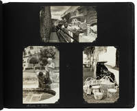
1940Best.-Nr. 229521940. Photographic album of an American family's travels in 1940 and 1941 documents cross regional movement through Mexico Nova Scotia and the United States with a sustained visual record of Mexican landscapes labor and public life at the beginning of the 1940s. The album titled in manuscript "MEXICO 1941" includes detailed captions identifying locations agricultural practices and infrastructure situating the images within a period of expanding road networks and tourism in North America. The photographs support research into travel history visual documentation of rural and urban environments and cross cultural observation during the early twentieth century. Oblong photograph album containing approximately 180 original black and white silver gelatin photographs each measuring about 3 x 4 inches mounted on grey cardstock pages within a black pebbled faux leather album measuring approximately 9 x 7 inches. Over 80 photographs document travel in Mexico in 1941 with images of central Mexican landscapes including agave fields identified as sources of pulque and mezcal rural roads near Montemorelos the Tampoan River near Valles village scenes and market activity with vendors and goods displayed in open air settings. Urban views show streets with carts wagons and commercial signage. A recurring identified figure "Mary Kay" appears throughout including a photograph with a Spanish interpreter and references to a guide named Miquel "Mike" Soto. Additional photographs depict local residents including agricultural workers and market vendors. The remaining images include approximately 90 photographs from a 1940 trip to Nova Scotia and other North American locations including waterfront and forest scenes Washington D.C. civic architecture and monuments Texas small town environments and Gettysburg battlefield landscapes. The album was produced during a period when automobile travel and tourism expanded access to regional and international destinations allowing American travelers to document landscapes and communities through personal photography. The juxtaposition of Mexican rural and urban scenes with locations in Canada and the United States reflects differing regional environments while also demonstrating the continuity of travel practices and visual documentation. The inclusion of detailed captions indicates an effort to record geographic and cultural information alongside personal experience. Photographs remain clean and well preserved with secure corner mounts and a tight binding; overall very good condition. This album provides an extensive visual record of early 1940s travel across North America with particular emphasis on Mexico and Canada. unknown books
1930Best.-Nr. 221561930. This Photo Album captures a series of trips across California Mexico Dominican Republic Cuba Panama and other U.S. and North American travel documents the coastal and cross-border tourist experience of an American social group during the 1930s through the early 1950s.The album records a continuous itinerary of domestic and international travel with dated captions such as "July 19 1938 / On Board S/S Dixie from New Orleans La" situating the group within organized steamship routes linking the United States to Caribbean destinations. Oblong photograph album measuring approximately 11.5 x 15.25 inches containing 218 silver gelatin photographs mounted on black pages with images ranging from approximately 2.25 x 2.75 inches to 4.5 x 5.5 inches. Photographs are captioned on album pages and occasionally on versos identifying locations and dates. California scenes include Los Angeles Hollywood Olvera Street Pasadena gardens San Diego Balboa Park Mission Beach La Jolla Catalina Island and the Hotel del Coronado with recurring images of beaches coastal views small boats and leisure activities such as bathing and sightseeing. Additional images depict San Francisco landmarks including Alcatraz Island and Muir Woods. Travel beyond the United States includes Tijuana Mexico; Havana Cuba; Santo Domingo Dominican Republic; and Panama City with scenes of street activity ruins courtyards and waterfronts. A sequence from Catalina Island emphasizes seaside recreation while Caribbean and Central American images show plazas tropical vegetation and urban environments including Afro-Caribbean individuals in public spaces. Additional photographs document travel to New Orleans Utah Salt Lake City Nova Scotia and a location labeled "Indian Island." This album documents patterns of American tourism during the mid-twentieth century when organized travel by rail and steamship enabled access to domestic resorts and international destinations across the Americas. The combination of coastal California imagery with Caribbean and Latin American scenes reflects a broader گردش of leisure travel that emphasized climate landscape and cultural difference within reachable distance of the United States. The presence of consistent captions and chronological markers provides a structured record of travel routes and destinations contributing to research on tourism history visual culture and cross-border movement in the pre-jet era. Light wear to album and photographs with minor handling marks; overall very good condition. A substantial visual record of American travel practices and geographic mobility across the Americas in the mid-twentieth century. unknown books
1900Best.-Nr. 223161900. Early twentieth century Mexico documented in photographs and real photo postcards depicting rural life Indigenous labor archaeological sites and urban landscapes during the decades surrounding the Mexican Revolution. The images record scenes of everyday activity alongside monumental remains of ancient Mesoamerican civilizations illustrating the cultural landscape of Mexico during a period when tourism archaeology and national identity formation increasingly emphasized the country's Indigenous heritage. Photographs of markets domestic work agricultural labor and village life provide visual evidence of social conditions and cultural practices within rural communities during the early twentieth century. Archive of thirty nine black and white real photo postcards and photographs dating from approximately the 1900s through the 1920s. Many images contain captions printed in the negative in English or Spanish identifying locations and subjects. Several photographs depict well known archaeological sites including views of the Pyramid of the Sun at Teotihuacan and detailed images of the carved serpent heads of the Temple of Quetzalcoatl. Other photographs document rural environments and community life including images labeled "Xochimilco Mex." showing canal traffic and canoe riders navigating the waterways near Mexico City. One real photo postcard captioned "Haciendo tortillas" depicts Indigenous women preparing tortillas over open fires surrounded by cooking vessels and firewood. Additional photographs show thatched roof dwellings agricultural labor including men harvesting agave plants and scenes of local marketplaces. A group portrait depicting Mexican soldiers alongside women and children suggests the presence of military or political activity during the revolutionary era. The photographs reflect a period when Mexico's archaeological monuments and Indigenous communities were increasingly photographed by travelers ethnographers and publishers producing visual material for both domestic and international audiences. After the Mexican Revolution of 1910-1920 intellectual and political movements promoting indigenismo emphasized Indigenous heritage as a central component of Mexican national culture while archaeological research at sites such as Teotihuacan gained international attention. Real photo postcards circulated widely during this period and served both as souvenirs and as documentary images of landscapes monuments and local communities. Photographs and postcards generally measure approximately 3 x 5 inches and remain preserved as loose prints. Minor edge wear and surface toning visible with occasional curling at the corners; most images retain strong contrast and clarity. Overall very good condition. The archive provides a varied photographic record of Mexican cultural life Indigenous communities and archaeological sites in the early twentieth century. unknown books
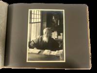
1930Best.-Nr. 223021930. Japan travel photograph album. 1930s. This album documents Western travel through Japan during a period of expanding imperial influence and managed international tourism recording temple architecture theatrical performance and curated cultural sites alongside limited family portraiture. The photographs provide primary visual evidence of how foreign visitors encountered Japan through established travel circuits that emphasized religious monuments scenic landscapes and staged cultural forms while also including a labeled image from Korea that situates the journey within the geography of Japanese colonial rule. Photo Album containing 22 silver gelatin photographs each mounted one per page with white ink captions identifying locations including "Nikko" "Kyoto" "Shochiku-za" "Koya San" "Akashi" "Takao" and "Korea." Three photographs depict members of a Western family posed in studio and outdoor settings including portraits in front of temple gates and residential entrances. The remaining images focus on architectural and cultural sites including temple facades with detailed ornamentation mountain and waterfall landscapes and a staged theatrical performance at the Shochiku-za theatre in Osaka showing performers in elaborate costume and makeup. One photograph labeled "Korea" depicts seated women wearing hanbok indicating travel beyond the Japanese home islands. The photographs are consistently sized at approximately 5 x 7 inches and mounted in an album measuring approximately 8.5 x 12 inches bound in cloth boards with decorative striping and cord binding. The album was produced during a decade when Japan promoted domestic and imperial sites as destinations for foreign travelers integrating religious landmarks urban infrastructure and colonial territories into a coherent tourist experience. Sites such as Nikko and Koya San were presented as emblematic of national heritage while theatrical venues and scenic locations formed part of structured itineraries. The inclusion of Korea reflects the extension of these travel routes into occupied regions where colonial subjects and landscapes were incorporated into representations of the empire. Photographs remain clear with strong contrast; minor wear to album consistent with handling; overall very good. A focused visual record of Western travel in 1930s Japan documenting how cultural sites and imperial geography were presented to foreign visitors. unknown books
1930Best.-Nr. 224461930. Caribbean and Panama travel photograph album. circa early 1930s. This album documents interwar travel through the Panama Canal Zone and Jamaica recording maritime transit canal infrastructure and rural Caribbean life as observed by Western travelers. The photographs provide primary visual evidence of the Panama Canal as a site of industrial activity and international movement alongside scenes of Jamaican village life and landscape establishing a contrast between engineered environments and colonial rural settings. The material is particularly strong in its depiction of canal operations and the presence of local populations within these spaces. Album containing 29 silver gelatin photographs mounted on black leaves with individual prints measuring approximately 3.5 x 4.5 to 5 x 7 inches housed in a string-bound album measuring approximately 7 x 9.5 inches. The opening sequence shows passengers aboard a steamship with men and women posed along deck rails and views of ships navigating canal locks and docking areas. Additional images depict cranes drawbridges canal cuts and small boats in the water along with dock workers and uniformed personnel visible among travelers. Architectural and infrastructural views include colonial-style buildings and mechanical equipment associated with canal operation concluding with a monument identified as that of Vasco Núñez de Balboa in Panama City. The Jamaica sequence includes landscape views of hillsides and gardens along with images of Black Jamaican residents posed in village settings. One photograph bears the caption "Kingston Jamaica 10 -- S.S. 'Reliance' West Indies Cruise" showing children and adults gathered along a dirt road lined with wooden and metal-roofed structures. Other images show groups assembled beneath trees and within rural surroundings. Produced during a period when the Panama Canal served as a major conduit for global shipping under U.S. administration and Caribbean travel formed part of organized cruise itineraries the album reflects established routes of interwar tourism. The juxtaposition of canal engineering and Jamaican village scenes situates the photographs within broader patterns of travel that linked industrial infrastructure with colonial landscapes. Minor water rippling to pages and photographs; images remain clear; overall very good. A coherent travel album documenting canal operations and Caribbean life in the early twentieth century. unknown books
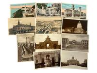
1920Best.-Nr. 224751920. Cuba Havana landmarks and urban development real photo post card archive ca. 1920s-1940s. 11 color and sepia real photo postcards of iconic civic and cultural architecture in Havana Cuba. Each measure 4" x 6". Many with captions identifying the locations in the negative or en verso with some printed in English and others in Spanish signaling their intended audience of both locals and foreign tourists. A compelling photo archive documenting early 20th-century Havana's architectural and political aspirations this collection showcases prominent landmarks that symbolized Cuba's nationalist identity international cosmopolitanism and American-influenced modernization in the decades between independence from Spain and the Cuban Revolution. The archive includes silver gelatin and printed color views of the National Theatre Cuba's Capitol Building Central Railway Station Gran Casino Nacional National University and the grand gateway of Havana's Colón Cemetery. Other views depict Paseo de Martí one of Havana's most iconic boulevards lined with vintage American cars and flanked by ornate colonial facades and new Art Deco-style hotels evidence of the influx of U.S. capital and tourism during the Batista era. Havana in this period was rapidly transforming into a showcase city of the Caribbean its urban core reflecting both Spanish colonial heritage and American urban planning models. The presence of monumental buildings like El Capitolio constructed between 1926 and 1929 and modeled after the U.S. Capitol in Washington D.C. points to Cuba's alignment with American political aesthetics and aspirations toward modern statehood. Similarly the University and Gran Casino Nacional represent both the intellectual elite and leisure-class investment that typified pre-revolutionary Cuban society. The mixture of European and U.S. architectural influences ranging from Beaux-Arts to Art Deco speaks to the layered colonial legacy and new economic dependency forged during the Platt Amendment era. Some mild edge wear. One card with a small corner crease others clean. Overall very good condition. This archive captures Havana in the midst of dramatic urban renewal and internationalization before the massive ruptures brought on by the 1959 revolution. unknown books
1969Best.-Nr. 225621969. Mexico Travels throughout Mexico in 1969 by Western tourists two older women identified as "Joan" and "Eve". Archive of 23 original color photographs documenting various rural and city locations within Mexico. These images capture a cross-section of urban cultural and historic sites at the cusp of Mexico's late 1960s modernization and tourism boom. The photographs are annotated in period handwriting with dates and locations situating the journey across Mexico City Guadalajara Pátzcuaro Toluca San Miguel de Allende and Teotihuacan. Measurements range from 2.5" x 3.5" to 3.5" x 3.5". The imagery ranges widely: Alameda Park in Mexico City a leafy civic space where tourists strolled among fountains and colonial arcades; the cathedral and central plazas of Guadalajara; and the Hotel Posada de Don Vasco at Pátzcuaro a resort-style colonial inn that catered to international travelers in Michoacán. Several views record the pyramids of Teotihuacan including the Pyramid of the Sun rising over the plateau. Particularly notable is a series from Toluca depicting a traditional Aztec sun dance performed by local costumed dancers in feathered headdresses and decorated attire-images that reflect mid-20th century staged folkloric revivals of pre-Hispanic ritual for both community expression and tourist consumption. Other photographs show the streets of San Miguel de Allende a town that by the late 1960s had become a magnet for expatriate artists and serene scenes of fishermen in dugout canoes on Lake Pátzcuaro. Photographs retain strong color saturation with some natural tonal fading common to late 1960s prints. Light handling wear and minor curling at edges but overall surfaces remain clean with legible handwritten captions. Overall very good condition. A vibrant and personal travel archive these photographs provide a valuable record of how Mexico's cultural heritage urban life and indigenous traditions were framed through the lens of travelers in the late 1960s intersecting with themes of tourism identity and heritage preservation. unknown books
1900Best.-Nr. 225611900. Panama City and Canal Zone postcard archive early twentieth century documents Panama during the period of canal construction U.S. administration and rapid urban change. The group supports research into Latin American urban history U.S.-Panama relations imperial infrastructure tourism imagery and the visual presentation of Panama as both a modern canal corridor and a city layered with Spanish colonial remains. Its value rests in the combination of engineering views civic streetscapes religious architecture harbor scenes and public entertainment sites. Fifteen sepia-toned real photo postcards each approximately 3.5 x 5.5 inches with many captions printed in the negative. Canal and infrastructure subjects include "Opening Gates Pedro Miguel Locks" "Miraflores Locks Panama Canal" and a Pacific-side vista of the canal works. Urban views include the "American Cabaret" façade with pedestrians the Panama City railway station with carriages at the entrance Cathedral Plaza from street-level and elevated perspectives panoramic views of the city grid ships moored at Balboa harbor and a bullfighting ring. Colonial and religious subjects include the Golden Altar of San José and ruins identified as the Old Spanish Fort tower. The archive captures a specific visual record of Panama at the intersection of Latin American civic life Spanish colonial memory and U.S.-directed global infrastructure. Minor handling wear and faint edge toning to some postcards; images crisp and clean; overall very good condition. A compact and varied photographic record of Panama City and the Canal Zone during a decisive period in the history of urban modernization and interoceanic commerce. unknown books
1997Best.-Nr. 213231997. Archive of LGBTQ travel guides documenting the expanding infrastructure of gay and lesbian tourism during the late 1990s and early 2000s. The material consists of specialized guidebooks produced for queer travelers documenting LGBTQ travel coordination hospitality identification and community information-sharing through listings for hotels nightlife venues restaurants and vacation destinations. The guides show how gay and lesbian travelers located affirming businesses and avoided hostile or uncertain environments during a period when mainstream travel industries frequently ignored LGBTQ concerns or failed to identify safe accommodations for openly queer visitors. Compiled through community networks and commercial LGBTQ publishing the guides document the use of dedicated directories and travel resources for navigating unfamiliar cities and international destinations. The archive provides evidence for the study of LGBTQ tourism queer consumer culture and the commercialization of gay and lesbian travel markets at the turn of the twenty-first century. Archive consists of four LGBTQ travel guides published between 1997 and 2001 measuring between approximately 5 x 8 inches and 7 x 9 inches. 1 Kolber-Stuart Billy and David Alport. Out & About Gay Travel Guides: USA Cities. New York: Out & About 1997. Regional travel guide covering more than forty American cities and selected Canadian destinations with listings for LGBTQ-friendly nightlife restaurants hotels and cultural attractions emphasizing businesses and districts with established gay and lesbian communities. 2 Kolber-Stuart Billy and David Alport. Out & About Gay Travel Guides: USA Resorts & Warm-Weather Vacations. New York: Out & About 1997. Destination-focused guide highlighting resort regions and vacation centers including Key West Fire Island Palm Springs Mexico Costa Rica and the Caribbean. The guide concentrates on locations with visible queer tourism economies and established reputations as welcoming spaces for LGBTQ travelers. 3 Ferrari Marianne. Gay Travel A to Z. Phoenix: Ferrari International Publishing 2001. Twentieth edition of the annually updated international LGBTQ travel guide issued in association with the International Gay & Lesbian Travel Association containing worldwide listings for hotels nightlife venues organized travel opportunities and tourism services catering to gay and lesbian travelers. 4 Access Gay USA. New York: HarperCollins 2000. City-organized travel guide providing recommendations for accommodations restaurants entertainment venues and attractions associated with LGBTQ social and cultural life across the United States. The guides document the rapid expansion of LGBTQ tourism infrastructure during a period marked by increasing public visibility growing commercial recognition of queer consumers and the emergence of dedicated gay and lesbian travel industries. The archive preserves printed systems of geographic and social navigation used before digital review platforms and online travel resources transformed tourism practices. Throughout the guides emphasis is placed on identifying explicitly affirming spaces rather than general tourist destinations reflecting uneven LGBTQ acceptance within public accommodations and hospitality industries during this period. Minor handling wear and light rubbing consistent with use; overall very good condition. Documentary archive of late twentieth-century LGBTQ travel culture and queer hospitality networks. unknown books
1994Best.-Nr. 210521994. Laermer Richard; Collins Andrew; Link Matthew; Damron Guides; Fodor's Editors; Guaracino Jeff. Gay and lesbian travel guide collection 1994-2007 documenting the development of LGBTQ travel culture and the identification of queer social spaces in the late twentieth and early twenty-first centuries. These guides situate travel as a structured means of accessing community particularly in the aftermath of the AIDS crisis when information about safe spaces health resources and social networks was critical. The collection provides evidence of how printed directories functioned as both navigational tools and cultural records of LGBTQ presence across cities regions and international destinations. Collection comprises 7 travel guides ranging in size from approximately 4" x 7" to 5" x 8.5". 1 Richard Laermer's Gay and Lesbian Handbook to New York City 1994. This book contains 244 pages of hundreds of listings in New York City broken up by subjects including gay neighborhoods entertainment the arts politics spirituality and most importantly health services and support groups for those suffering from AIDS in the midst of the crisis. 2 Betty & Pansy's Severe Queer Review of San Francisco 1995. A queer travel guide of San Francisco that contains many illustrations and sketches representing the underground of queer culture. 130 pages that includes listings of bars performance spaces night clubs hotels restaurants and more. This copy also includes an original postcard which features a picture of both authors and has an inscription signed by Betty. 3 Fodor's Gay Guide to San Francisco and the Bay Area by Andrew Collins. First Edition 1997. Includes 166 pages on Gay Life Culture Establishments and more in the bay area. 4 Matthew Link's Rainbow Handbook: Hawaii the Island's Ultimate Travel Guide 1999. Contains 225 pages dedicated to gay travel in Hawai'i written by gay travel writer Matthew Link. Includes a breakdown of locations on each individual island. 5 Fodor's Gay Guide to the USA Second Edition 1998. 600 Pages. Measures 5" x 9". Includes a city by city breakdown with 67 road maps. 6 Damron Men's Travel Guide 1999. 900 pages. Measures 3.5" x 6.5". Includes USA Mexico Canada Caribbean and European Cities along with a 1999 party calendar. About 800 pages on USA locations 7 Guaracino Jeff. Gay and Lesbian Tourism: the Essential Guide to Marketing. 183 pages. This is a 2007 book focusing on marketing towards the LGBT community. The author focuses on various aspects of LGBT tourism such as the case for its economic value finding the right stakeholders and the best practices in marketing towards that audience. Produced during a period of expanding LGBTQ visibility and mobility these guides illustrate how travel infrastructure supported the formation and maintenance of queer social networks. The inclusion of health resources nightlife and community organizations reflects the practical needs of travelers as well as the broader cultural landscape of LGBTQ life. Many listed establishments no longer operate making these guides a record of spaces that have since disappeared. Light wear consistent with use; bindings intact and pages clean; overall very good condition. This collection offers a substantial printed record of LGBTQ spatial and cultural networks at the turn of the twenty-first century. unknown books
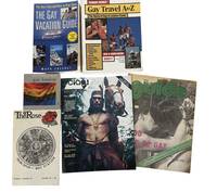
1978Best.-Nr. 211511978. Gay travel guides published between 1978 and 2002 document the development of LGBTQ social spaces and travel networks during the late twentieth century. Printed guides of this kind served as practical tools for gay and lesbian travelers seeking safe environments and community venues in cities and tourist destinations. At a time when many establishments serving LGBTQ patrons were not openly advertised in mainstream publications specialized travel guides compiled addresses telephone numbers and descriptions of bars restaurants hotels gyms clubs and other gathering places. Today these publications provide valuable documentation of LGBTQ cultural geography preserving records of venues and community spaces that often operated informally and have since disappeared. Archive contains six travel guides and magazines published between 1978 and 2002 documenting LGBTQ travel destinations and social venues in North America and Europe. The publications include directories of establishments travel advice and descriptions of cities known for active LGBTQ communities. Many listings include addresses telephone numbers and brief descriptions of businesses catering to gay and lesbian travelers. 1 Ciao! The World of Gay Travel. New York: QQ Publications 1978. 54 pages. Early international gay travel magazine featuring destinations including Canada Malaysia El Salvador and Morocco with numerous listings for cafes bars restaurants and other venues. 2 The Rose. Vol. 1 No. 15. 1980. 43 pages. Travel and lifestyle guide focused on Southern California with listings for gay and gay friendly bars restaurants clubs gyms and entertainment venues. 3 The Guide to Gay New England. Boston: The Haymarket 1987. 70 pages. Travel guide covering New England destinations including cities such as Providence and Manchester as well as established resort communities including Provincetown. 4 Gay London: A Guide. London: Ellipsis 1999. Guide to LGBTQ nightlife and community spaces in London including bars clubs bookstores and cafes. 5 Ferrari Guides: Gay Travel A to Z. Phoenix: Ferrari International Publications 2001. 160 pages. Directory style guide listing United States destinations with entries for bars tour operators bathhouses and related venues. 6 Chesnut Mark. The Gay Vacation Guide: The Best Trips and How to Plan Them Revised and Updated. New York: Kensington Books 2002. 212 pages. Travel planning guide featuring information on resorts cruises tours and seasonal destinations popular among LGBTQ travelers. Together these publications illustrate the growth of LGBTQ tourism and the increasing visibility of queer social networks during the late twentieth century. Travel directories such as these helped connect travelers with welcoming venues and contributed to the development of identifiable LGBTQ neighborhoods and resort destinations. The guides also preserve historical records of establishments that have since closed making them useful sources for studying the geography of LGBTQ culture and nightlife. Volumes remain clean and well preserved with light handling wear. Very good condition overall and a representative group of late twentieth century LGBTQ travel publications. unknown books
1930Best.-Nr. 205481930. Early twentieth century travel photo album compiled by "Jake"documents the working life and global mobility of a merchant ship crewman during the 1930s and 1940s with sustained visual attention to port cities across Africa the Americas and the United States. The album supports research into maritime labor informal American commercial presence abroad and everyday interactions between traveling workers and local populations under late colonial conditions. Photographs taken in Beira and Dondo in Mozambique and Angola Durban and Cape Town in South Africa and Accra in the Gold Coast record encounters shaped by European colonial infrastructures and tourist economies including images captioned "Typical Ricksha Boy" depicting South African rickshaw pullers in elaborate headdress and dress and scenes of women in Accra balancing baskets and trays of food. Additional captions such as "Sam and his 'girls'" showing uniformed workers marked "Sea View Hotel" and "me and my gals" portraying informal social contact provide direct evidence of how American maritime workers framed and recorded relationships with local communities. The album further situates this mobility within a broader circuit including the Panama Canal Mexico City and Vera Cruz and U.S. port cities such as Galveston New York and Boston. Travel photo album compiled circa 1930s to 1940s likely by an American merchant marine crewman identified as Jake. String-bound black cloth album containing 44 leaves with 218 silver gelatin photographs and postcards mounted or cornered in along with one original sketch of an African man. Images span multiple global locations including Beira Dondo Durban Cape Town Accra Vera Cruz Mexico City the Panama Canal Powell River Vancouver Galveston New York and Boston. Several photographs depict shipboard life and crew activity aboard the S.S. Nemiskam Park with additional images of small craft landings including African men canoeing crew members ashore. A sequence of photographs taken in Boston shows the compiler in maritime work gear wearing thigh-high boot wraps rubber gloves and an oxygen mask captioned "At last -- working for a change." Nineteen photographs document Mexico including rancheros and rancheras in embroidered dress scenes of bullfighting and crew members wearing sombreros and sarapes. This album provides a concentrated record of interwar and wartime-era maritime circulation linking North American labor to colonial and postcolonial port environments offering primary visual evidence of how working-class American travelers documented race labor and leisure across imperial geographies. The inclusion of commercial signage hotel uniforms and transport labor such as rickshaw pulling situates the photographs within local economies shaped by tourism and global trade while the Panama Canal images anchor the album within a critical artery of twentieth-century shipping and U.S. strategic infrastructure. The juxtaposition of African Mexican and U.S. scenes underscores the continuity of maritime networks that connected these regions and the album's captions provide insight into informal language humor and perception among traveling crewmen. Minor edge wear to album corners with some mounts loosening; leaves and photographs remain clean and stable. Overall very good condition. unknown books
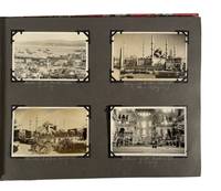
1927Best.-Nr. 208311927. Photo album documenting a multi country group यातà¥à¤°à¤¾ in 1927 records interwar travel across southern Europe and the eastern Mediterranean including regions under colonial administration and recent political transition. The album follows a group of travelers moving from France through Italy Greece Turkey British administered Palestine and Egypt capturing urban landmarks archaeological sites and local populations encountered along the route. The sequence provides visual evidence of tourism infrastructure mobility and cross cultural observation during a period when former imperial territories such as Constantinople were undergoing redefinition following the dissolution of the Ottoman Empire and the establishment of modern nation states. Album contains 93 black and white silver gelatin photographs and four real photo postcards with images ranging approximately from 2.5 x 4 inches to 3.5 x 5.5 inches and one larger group photograph measuring about 9 x 7 inches. Photographs are mounted on black paper boards with handwritten captions in white pencil and interleaved tissue guards; string bound in patterned cloth boards. The album opens in Avignon with views of St. Pierre's Church and the Palais des Papes then continues through Italy with scenes of Naples and Pompeii as well as shipboard images captioned S.S. Adriatic. Subsequent sections include Athens with views of the Parthenon followed by Constantinople where four postcards depict the harbor the Sultan Ahmed Mosque and the Hagia Sophia shortly after the end of the Ottoman Empire. In British Mandate Palestine images show street scenes in Nazareth and Jerusalem including sites along the River Jordan the Western Wall and the Garden of Gethsemane alongside a captioned portrait labeled "A Jewish Maiden." The album concludes in Egypt with extensive views of archaeological and urban sites at Thebes Memphis Cairo and Luxor including the Obelisk of Hatshepsut Edfu Temple the tomb of Amenhotep II the Colossi of Memnon and the pyramids and Great Sphinx at Giza where the final group portrait shows the travelers posed on camels. Produced during the interwar period the album reflects expanding international tourism networks alongside ongoing European influence in the eastern Mediterranean and Middle East. The juxtaposition of ancient sites modern transport and local populations situates the material within broader histories of archaeology empire and travel culture in the early twentieth century. Light general wear to album and mounts; images well preserved with clear captions; overall very good condition. unknown books
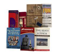
1987Best.-Nr. 209821987. Damron Bob Lindsy Van Gelder Pamela Robin Brandt Hanns Ebensten and others archive of seven travel publications and related materials dating from 1987 to 2003 documents the development of queer travel infrastructure and the circulation of information necessary for LGBTQ individuals to navigate public space safely in the late twentieth century. Produced during and after the AIDS crisis these guides provided listings of bars hotels medical resources and social organizations at a time when visibility and safety varied widely by region. The publications extend a tradition of minority travel guides comparable in function to The Negro Motorist Green Book offering practical tools for identifying supportive environments and avoiding hostile ones. Early editions of the Damron guides compiled through firsthand travel by Bob Damron established a model for cataloging queer friendly spaces across North America and beyond while later publications expanded coverage to Europe and incorporated broader cultural and political resources. Archive of seven items comprising five travel guides one fold out map and one volume of travel writing published between 1987 and 2003. Items include: 1 Damron Bob. Damron Address Book. San Francisco 1987. Approximately 3 x 6 inches. Contains over 6000 listings across the United States Canada and Mexico with extensive coverage of U.S. locations. 2 Van Gelder Lindsy and Pamela Robin Brandt. Are You Two.Together A Gay and Lesbian Travel Guide to Europe. 1991. Approximately 345 pages. Covers accommodations dining and travel sites across multiple European countries. Signed by both authors. 3 The Gay and Lesbian Handbook to New York City. 1994. Approximately 277 pages. Includes listings for cultural venues social organizations and medical resources including AIDS related services. 4 Columbia Fun Maps: Mapping the Gay and Lesbian World. San Francisco 1995. Fold out map with directory of businesses and resources in San Francisco. 5 Damron Bob. Damron Address Book. 1998. Expanded edition with hundreds of pages of listings across North America the Caribbean and Europe. 6 Ebensten Hanns. The Seals on the Icepack and More Gay Travel Adventures. 1999. Signed and inscribed. Travel narratives documenting experiences in multiple global locations. 7 Frommer's Gay and Lesbian Europe. 2003. Comprehensive guide to travel across the United Kingdom and continental Europe. These materials document how LGBTQ travelers relied on print networks to construct routes of movement community and safety prior to the widespread availability of digital resources. The guides reveal the geographic distribution of queer spaces the integration of medical and social support listings during the AIDS crisis and the expansion of international travel opportunities in the late twentieth century. Ebensten's travel writing provides a narrative counterpart to directory based guides offering firsthand accounts that complement the logistical frameworks of the other publications. Together the archive provides evidence of how queer communities mapped social belonging across cities and nations contributing to the study of LGBTQ history tourism and spatial politics. Light handling wear across volumes with typical age toning; overall clean and stable. Overall very good condition. unknown books
Best.-Nr. 6890Unidentified photographer. Stereoview of El Capitan and an angler in Yosemite Valley a nineteenth-century visual record of the landscape imagery through which Yosemite became known to audiences beyond California. The photograph combines the monumental granite formation with a solitary man fishing in the foreground documenting both the physical character of Yosemite Valley and the recreational experience promoted through early tourism. Such stereoscopic views circulated Yosemite scenery as immersive domestic entertainment during the period encompassing the Yosemite Grant of 1864 and the establishment of Yosemite National Park in 1890 supporting research into Western landscape photography conservation history tourism and nineteenth-century visual culture. Stereoscopic photograph nineteenth century. Approximately 3 x 7 inches. The paired images show El Capitan rising in the background beyond a riverbank scene while a man stands or sits near the water fishing in the foreground. The contrast between the small human figure and the immense rock face emphasizes the scale of the valley while the fishing activity places Yosemite within an emerging culture of scenic travel and outdoor recreation. Intended for viewing through a stereoscope the format created an illusion of depth; surviving mounts commonly carried captions photographer or publisher identifications and series information although no such markings are reported for this example. Light signs of age and handling consistent with nineteenth-century photographic ephemera; image remains clear and the mount intact very good. A visually engaging Yosemite stereoview linking early landscape photography with the development of tourism and recreational culture in the American West. unknown books
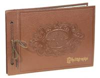
1938Best.-Nr. 190871938. Photograph album documenting a multi-location journey through Mexico City and surrounding regions in the late 1930s presenting a sustained visual record of urban life Indigenous communities and regional landscapes during a period of post-revolutionary modernization. Comprising 52 original black-and-white photographs the album captures both monumental architecture and everyday social environments offering a layered view of Mexico as experienced by foreign travelers. Album with 52 original black-and-white photographs approximately 3.5" x 2.5" mounted on black paper across 10 photographic leaves 21 leaves total. Album measures approximately 10" x 7". Brown faux-leather binding with blind-stamped design and gilt lettering to front cover; bound with brown tie. Handwritten captions in white ink beneath several images. Includes maps of Mexico City on final leaf and rear pastedown. The photographs emphasize the coexistence of historic colonial structures and emerging modern infrastructure. Prominent architectural views include Chapultepec Castle major ecclesiastical buildings in Puebla and formal civic spaces alongside street scenes featuring automobiles commercial signage and pedestrian activity. These images situate Mexico City within a rapidly modernizing urban framework while retaining strong visual continuity with its colonial past. Equally significant are the album's documentary images of Indigenous and rural life. Several photographs depict Indigenous individuals and families in roadside and village settings including a family group with a child and laborers transporting agricultural materials. These images foreground systems of manual labor and traditional dress contrasting sharply with the urban environments elsewhere in the album. Additional scenes of burro transport rural roads and subsistence activity reinforce this juxtaposition between modernization and longstanding economic practices. Market scenes form another core component of the album's documentary value. Photographs labeled as flower and farmer's markets show dense arrangements of goods vendors and informal commercial structures illustrating local economies and patterns of exchange. These are complemented by images of Xochimilco waterways paddle boats and cultivated landscapes extending the album's coverage to agricultural and peri-urban environments. The album also reflects the perspective of its creators. Handwritten captions in white ink identify locations such as Puebla "pottery tiles" "Indian family" "Indian boys" and "Burros" revealing a period-specific outsider vocabulary and framing of Indigenous subjects. The presence of the traveling party-largely older individuals-along with images of hotels and an English school in Mexico City situates the album within the context of organized or leisure travel likely by English-speaking visitors. Final leaves include printed maps of Mexico City and surrounding areas reinforcing the album's function as both a visual and geographic record of the यातà¥à¤°à¤¾. The structure and sequencing of the photographs suggest a deliberate effort to document both major cultural landmarks and vernacular life across multiple environments. This album holds strong research value for Latin American urban history Indigenous studies visual anthropology tourism history and the study of foreign representations of Mexico in the early 20th century. It provides primary visual evidence of how Mexico City and its environs were experienced interpreted and recorded during a formative period of national development. Condition: Very good; photographs clean and well-preserved. unknown books
Best.-Nr. 0848714210-11-1Oxmoor House. Very Good. It's a well-cared-for item that has seen limited use. The item may show minor signs of wear. All the text is legible with all pages included. It may have slight markings and/or highlighting. Oxmoor House unknown
2008Best.-Nr. 1-1601408404Leisure Arts 2008. Paperback. New. mira edition. 48 pages. 10.75x8.50x0.25 inches. Leisure Arts paperback
2001Best.-Nr. 1-1574862162Leisure Arts 2001. Perfect Paperback. New. 144 pages. 10.50x8.50x0.25 inches. Leisure Arts paperback
2009Best.-Nr. 1-1601409974Leisure Arts Inc. 2009. Paperback. New. 80 pages. 10.60x8.40x0.60 inches. Leisure Arts, Inc. paperback
2003Best.-Nr. 1-1574862979Leisure Arts 2003. Paperback. New. 160 pages. 10.50x8.25x0.25 inches. Leisure Arts paperback
2009Best.-Nr. 1-1601408749Leisure Arts Inc. 2009. Paperback. New. paperback/cd-rom edition. 68 pages. 10.75x8.50x0.50 inches. Leisure Arts, Inc. paperback